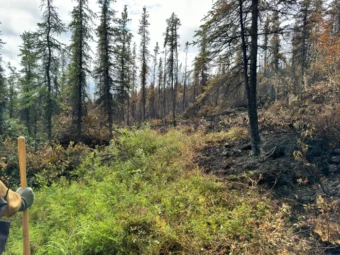
A fast-moving wildfire near the Elliott Highway prompted officials to ask residents to evacuate Wednesday night between Mile 41 and Mile 43 of the highway.
Alaska Fire Service spokeswoman Beth Ipsen said a state Department of Transportation work camp and a few homes are in the path of the Globe Fire, which was initially reported to be about one acre Tuesday.
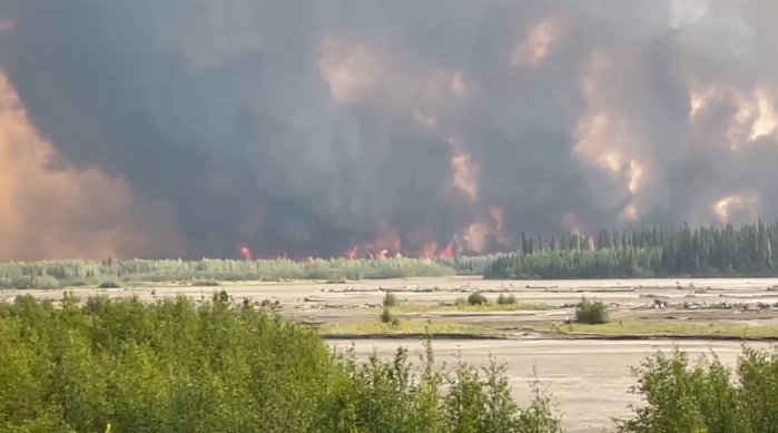
“And then on Wednesday afternoon, we got reports that fire activity had significantly picked up and was moving towards the highway,” Ipsen said.
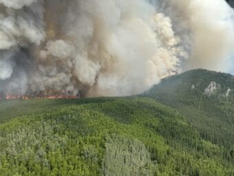
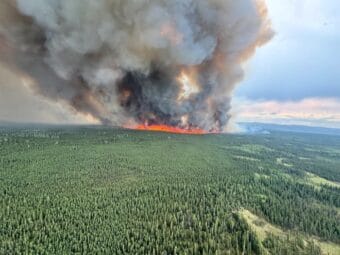
An overflight confirmed the fire’s rapid growth.
“It was estimated at more than a thousand acres and about a mile from the closest structure, and since it’s moving through black spruce, its moving rather quickly,” Ipsen said.
Ipsen said communications are difficult in the area, and Alaska State Troopers are helping.
“(We’re) getting the word out that this fire could impact the road between mile markers 37 and 52, but the residents between miles 41 and 43 are what we’re most concerned about.”
Ipsen said smokejumpers, water and retardant drops have been deployed on the Globe Fire.
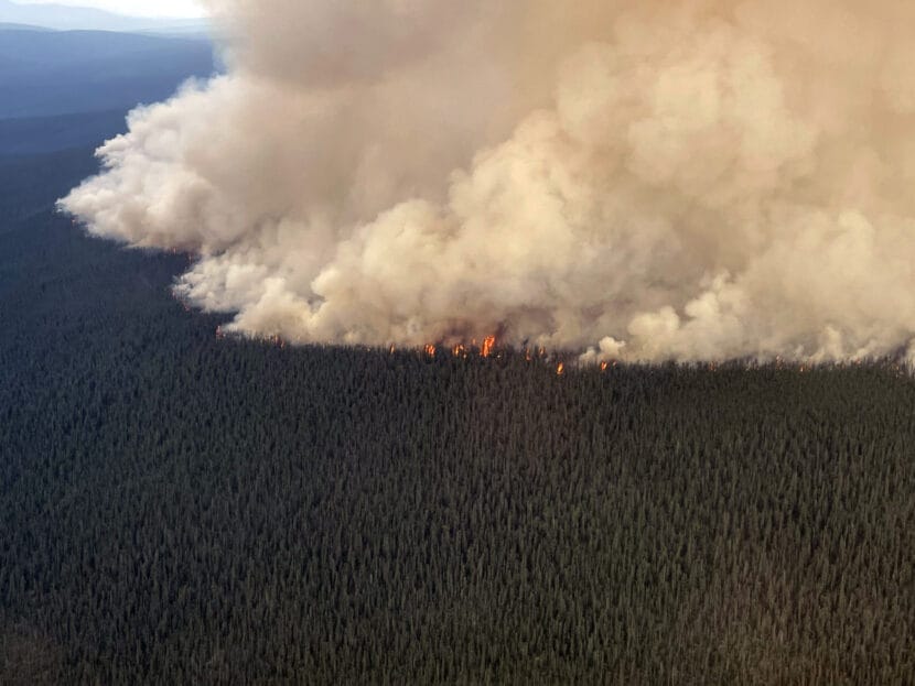
Meanwhile, work continues on two other Interior wildfires off the Steese Highway. The Deception Pup Fire near Central and the Flasco Fire near Circle were hit aggressively with water and retardant late Tuesday, and Ipsen said additional resources are being sent in to aid with further suppression.
“More crews, specifically hotshot crews, two hotshot crews out of California that will drive out and help with those fires,” she said. “We’re also getting a Type 3 incident management team from Idaho that’s going to be taking over the effort on a group of fires, including these two fires, in that general vicinity of the Steese Highway.”
Red Flag conditions are forecast for much of the Interior, and wildfire activity has spurred an increase in statewide preparedness to Level 4, just shy of the highest level: 5.
The state’s two largest wildfires, the lightning-caused McDonald and Clear Fires south of Fairbanks, continue to put up heavy smoke as they burn across military training grounds west of the Tanana River. Fire information officer Terry Solomon said the blazes remain in largely undeveloped areas.
“There’s some different military infrastructure, some survival cabins and things like that,” Solomon said.
A lot of work has gone into protecting private cabins on the southern edge of the McDonald Fire. Solomon said managers are keeping a close eye on the fire’s eastern perimeter along the Tanana River and Richardson Highway.
“We do have engines and some crews that are assigned to monitor the east side of the river, just in case something were to jump the river,” he said.
As of Wednesday, the McDonald Fire was sized at over 62,000 acres, and the Clear Fire was estimated to have burned more than 23,000 acres.