
The Juneau Assembly has adopted a new land use ordinance that maintains restrictions on development in downtown avalanche zones while rolling back restrictions for landslide zones.
It passed unanimously during Monday night’s meeting after a round of public testimony that was mostly in favor of the policy change.
“This is not a perfect document in any way, shape, or form,” said Mayor Beth Weldon before the vote. “But this is the best that we could probably come up with.”
For avalanche zones, restrictions on development will stay about the same as the ones in the previous hazard ordinance, from 1987. But there is one major change — landslide regulations will be eliminated from Juneau’s city land use code.
Many who testified at the meeting, including Juneau condo owner Mary Ellen Duffy, praised that change.
“Not adopting the landslide maps and new landslide ordinance could avoid huge economic impact to many of your fellow Juneauites,” Duffy said.
Until now, restrictions were similar for both avalanche and landslide zones. That’s because the land use code was based on low-resolution hazard maps developed in the 1970s, which lumped the two hazards together.
But in 2020, the city commissioned new maps — made with more precise science — using a $205,000 grant from the federal emergency management agency. Those maps doubled the number of Juneau properties with high or severe hazard designations.
While the avalanche zones didn’t change much, the new maps placed some neighborhoods in landslide zones for the first time, or upgraded their hazard designation to severe. That drew widespread public opposition from homeowners, who raised concerns about their ability to get mortgages or insurance policies.
The new ordinance also calls for property owners to be notified by the city of their avalanche risk. And even though the new landslide maps were not adopted, the Assembly favored keeping them available on the city website.
Many members of the public, including downtown homeowner Shawn Eisele, opposed those measures, too, fearing that any information about the risks could threaten their ability to sell their homes in the future.
“We don’t want a situation where the Assembly hasn’t adopted a zone, but the city is nonetheless sending postcards each year telling residents about the danger zone they’re in,” Eisele said. “How will their mortgage broker interpret that?”
But some Assembly members, including Christine Woll — who said the maps represent the best available information about the risks — pushed back. Woll said her first home in Juneau was in a landslide zone, but she didn’t know it at the time.
“Shortly after I moved out of that house, five trees went through the house,” Woll said. “I, as a person who lived up there, would have loved to have known that the city has information about how serious it is to live there.”
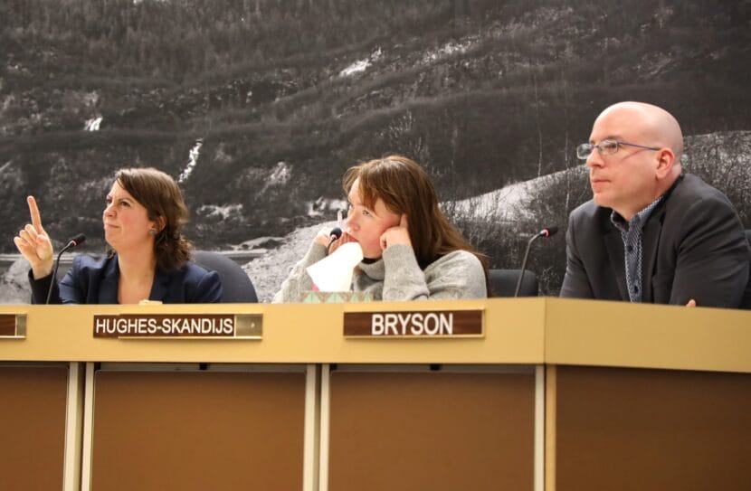
Just before the vote, member Alicia Hughes-Skandijis brought up the recent November landslide in Wrangell, which left five dead and one missing, and the 2020 landslide in Haines, which killed two.
“I, of course, like all of you hope that that doesn’t come to pass in Juneau. But as climate change continues, and it does get warmer and wetter, that is a real danger,” Hughes-Skandijs said. “As we’ve gone through this process, but we’ve maybe not spoken to that piece enough.”
Juneau does have a history of deadly and destructive landslides, including three that came down from Mt. Roberts in the first half of the 20th century. A massive 1936 landslide on South Franklin St. killed 15 people.
Under the new ordinance, construction in moderate or severe avalanche zones will be limited to single family homes. Building apartment buildings and adding mother-in-law apartments will be prohibited, though property owners can apply for exceptions.
The Assembly will discuss the hazard notification system in future meetings. The unadopted landslide maps will remain on the website, but with a disclaimer saying they should not be used to evaluate landslide risk on specific properties.
City attorney Robert Palmer, who helped to draft the new ordinance, said there’s no guarantee that financial institutions will disregard landslide hazards just because the city chose not to adopt the maps.
“It’s almost a chicken in the egg concept as to, did the landslide hazard come first? Or did the maps come first,” Palmer said.
Even if the city chooses not to regulate landslides, he said, lending institutions, assessors and insurance companies will make their own decisions.
Correction: A previous version of this story misspelled Beth Weldon’s name.
