
Listen to this story:
The low growl of machinery has been resounding through Juneau’s Mendenhall Valley for about two weeks, where dump trucks filled with sand rumble through backyards and the air smells of diesel.
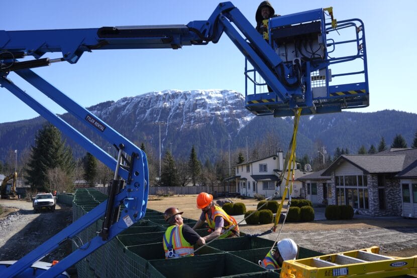
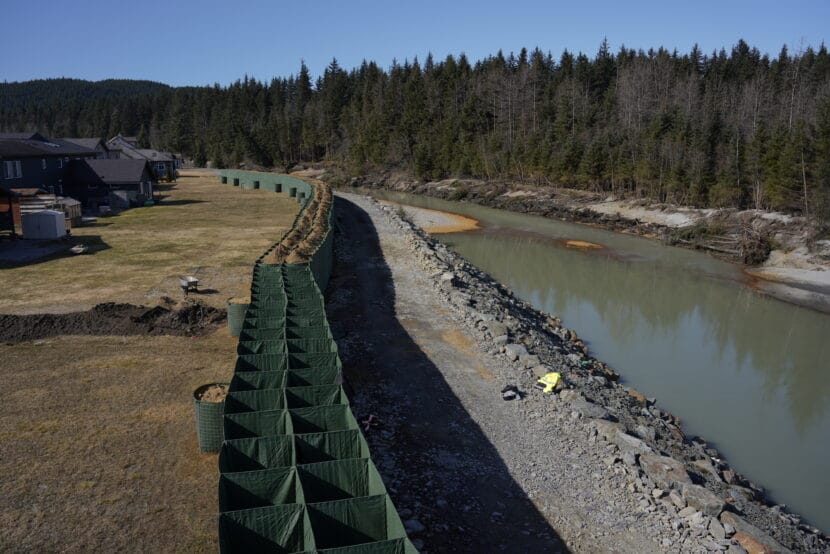
Robert Moore works for Admiralty Construction and spent his morning Wednesday inside HESCO barriers threading steel rods and coils through the metal cages that make up the growing flood wall. He said he’s grateful to be working on this project to protect Juneau neighborhoods from the annual glacial outburst flood.
“I’m a carpenter by trade, so I want to protect those beautiful homes,” Moore said.
So far, crews have installed barriers on part of Riverside Drive across from Melvin Park, and have stacked them eight feet high along the river behind houses on Killewich Drive. The city plans for the levee to be done by mid-June — before a torrent of glacial meltwater is expected to release from Suicide Basin.
But plans might change. The U.S. Geological Survey just released revised estimates of the volume and speed of the water that raged through Mendenhall River during the 2023 and 2024 floods.
The preliminary estimate was that 34,400 cubic feet per second (cfs) were released into the river last year. Now, the USGS estimates it was actually 42,700 cfs.
Jeff Conaway, associate director for water, ice and landscape dynamics at the USGS Alaska Science Center, said it’s typical for the agency to publish preliminary results right after a flood and then update them later.
“The reason we have a new rating is because there’s higher flows and the channel is changing,” he said.
Scientists physically measure those changes in the months after a flood to recalibrate their estimates, then go through a peer review process to verify the numbers.
“We’re out there with meters measuring the velocity and the depth and the width of the channel” which have shifted with erosion, altering the “relationship of how the lake drains and how much flow is coming down the river,” Conaway said.
Nate Rumsey, Juneau’s Engineering & Public Works deputy director, said that the inundation maps that were scheduled to be released at the end of March had been based on the preliminary results since the revision wasn’t available at the time.
When the new numbers came out, “it was a large enough shift that we needed to go back and rerun our models,” he said.
Critically, the maps will model how well the flood wall will perform. Rumsey said that while the city is prepared to adjust its plans depending on new information, “we do feel extremely confident that even though we’re deciding to go back and recalibrate the models, that the HESCO barrier will work as it is intended to work.”
The maps will include inundation scenarios for a flood height up to 20 feet. Last year, the river set a record of 16 feet. A litany of changing factors influence how high glacial outburst floods could get, and USGS researchers say they don’t know yet what the maximum could be.
Rumsey said that modeling for a 20-foot flood seems practical for the next several years.
“It doesn’t seem like there’s knowledge that an event higher than 20 feet is foreseeable based on what we know right now,” he said.
The city plans to publish the new inundation maps by the end of April.
