Ned Rozell, University of Alaska

Ned Rozell is a science writer with the Geophysical Institute at the University of Alaska Fairbanks.

At open house, scientists explain what HAARP can — and can’t — do

Three people walk two huskies down a gravel road flanked by
During a recent open house, visitors walk their dogs beneath an antenna field used to heat the upper atmosphere during space physics experiments at a facility known as HAARP between Glennallen and Tok. (Photo by Ned Rozell.)

In this wild place where dump truck drivers once tipped load after load of gravel onto the moss to make roads and building pads, scientists rolled open an iron gate one recent Saturday afternoon.

They invited in conspiracy theorists, reality-TV hosts and salmon fishermen from Chistochina to the grounds of a mysterious antenna field. It’s a facility that some claim has caused caribou to walk backward. It has been rumored to activate earthquakes and to hold human souls in a sort of northern purgatory.

Scientists were a bit to blame for all the allegations of weirdness out here between the Copper and Gakona rivers. First off, they used an acronym to name it — HAARP, which stands for High-frequency Active Auroral Research Program.

That acronym added to the mystery of the field of antennas, which can heat a region of space far above our heads with radio waves powered by five powerful diesel generators, each the size of a fuel truck.

The science of studying a region we can’t see by perturbing it with enough electricity to power a small city — located in a place where wolves and bears pad along silently across its few gravel roads — is hard to wrap your head around.

A few people really do understand HAARP, though. They were standing on those smoothed piles of gravel that Saturday, when the foreboding metal gate clicked open.

My former boss, Sue Mitchell (now retired), initiated this “open house” a few years ago. She was there again in 2022, greeting people at the first table of the first building visitors walked into. I asked her why.

“So we could be as transparent and open as possible,” she said. “Throw open the gate, and show people what’s here.”

When she worked at the Geophysical Institute, Mitchell took the considerable hit of answering phone calls about the HAARP facility. She had no answers for people who were sure the antenna field was somehow controlling their minds.

“My hope has been, by showing people what really goes on, the facts will speak for themselves,” she said. “That doesn’t always work. People sometimes make decisions emotionally, not always based on the facts.”

It doesn’t help when the facts are so hard to understand. Here’s a try:

The antenna field at this 5,408-acre site, far from any Alaska town, was first a chunk of black-spruce forest and wetlands that U.S Air Force officials purchased from the Native corporation Ahtna in 1989. The idea was to use the location to build an over-the-horizon radar that would allow technicians to observe bombers or missiles that might be headed for America over the pole.

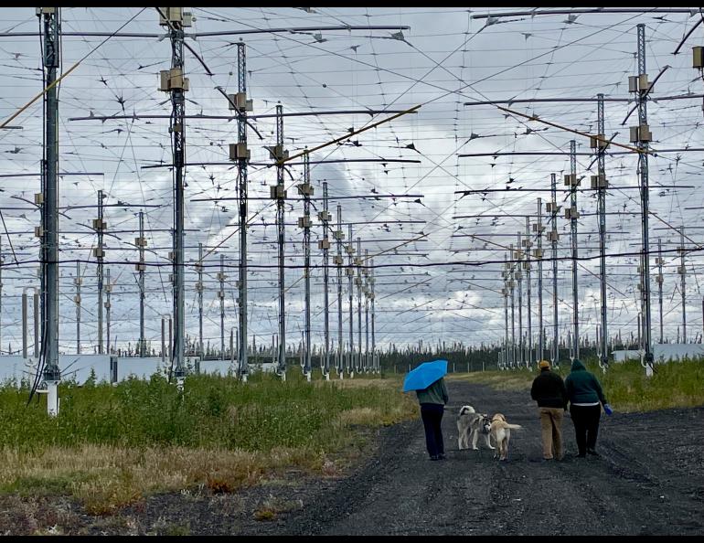
Due to the end of the Cold War, that radar was never built. Instead, Air Force workers installed a field of 18 antennas that broadcast high-frequency waves up to the ionosphere, the region of space that is home to the aurora.

The antenna field over the years grew to 180, each powered by two transmitters. A researcher has called it the world’s largest ham radio.

A University of Alaska banner on a pole in a the HAARP antenna field
The upper atmosphere-heating facility named HAARP is located on about 5,000 acres between the small Alaska towns of Glennallen and Tok. (Photo by Ned Rozell.)

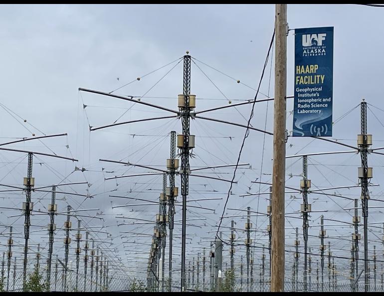
HAARP is a group of high-frequency radio transmitters (in the ham-radio band) powered by five diesel generators — four from tugboats and one from a locomotive. When activated, the transmitters send a focused beam of radio-wave energy into the ionosphere, 50-600 miles overhead.

Since it opened in 2003 with funding the late Sen. Ted Stevens helped secure, HAARP has hosted many scientists doing basic science on the auroral zone.

Others used it to do applied research for the military. In one study, researchers used the antenna array to heat a part of the ionosphere that in turn acted as a low frequency antenna that could send an ocean-penetrating signal to a submarine. That ping could tell a submarine captain to surface in order to receive conventional radio communications.

This place almost fell to bulldozers in 2012, when the Department of Defense wanted to get out from under the cost of running the facility — which includes about $250,000 each year just to heat the dozens of transmitter buildings in the winter.

About then, Bob McCoy, the director of the Geophysical Institute and a space physicist himself, lobbied for the institute to take over the site. Scientists rallied around him, as did the university president at the time.

At the same time, leaders of the National Research Council held a workshop about HAARP. They wrote a 70-page report on science that could be accomplished with the facility.

“Even though it’s esoteric and hard to understand, it’s the best,” McCoy said in 2015.

The university administration gave McCoy a loan to keep HAARP running. He gambled that he could pay it back by drumming up business from scientists. They would use the transmitters and pay for it with grants from funding agencies. That gamble is paying off, with a new 5-year grant from the National Science Foundation.

McCoy was there at the entrance to HAARP, too, answering questions from people like Michael Lewis of Anchorage.

A man in a suit stands next to a man wearing a tinfoil hat
Geophysical Institute Director Bob McCoy poses with visitor Michael Lewis from Anchorage during a recent open house of the ionosphere-heating facility known as HAARP between Glennallen and Tok. (Photo by Ned Rozell.)

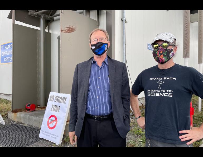
Lewis, who wore a baseball hat he had covered with tin foil (apparently for fun), said he had always wanted to see the facility. McCoy posed for a photo with him.

Visitors were allowed all over the grounds of the facility during the open house. Swampy ground limited them to driving and walking the few miles of road and gravel pad, including the dormant transmitter array.

Scientists and engineers were stationed at strategic points to explain what the complicated equipment did when it was on. A few guests were ham-radio enthusiasts, but most seemed to be just curious people.

After the five-hour open house ended, the black gate shut behind the final car. Then, HAARP reverted to what it is most of the year: a silent pile of gravel sprouting with antennae. There, songbirds on their way south flitted through the spruce and on the ground beneath the antenna masts.

Harry Potter Lake, once too big to see across, vanished in a day

A helicopter sitting by a mostly dry lakebed
Harry Potter Lake, at the top of this drone photo, after most of its water drained into a nearby creek on Alaska’s North Slope in early July 2022. (Photo by Allen Bondurant)

“Lakes seem, on the scale of years or of human life spans, permanent features of landscapes, but they are geologically transitory, usually born of catastrophes, to mature and die quietly.” — George Evelyn Hutchinson, “A Treatise on Limnology,” 1957.

Harry Potter Lake did not die quietly. Water in the basin on Alaska’s North Slope cut through a 30-foot strip of tundra in early July 2022. The lake then roared into a creek. The creek swelled like a python for a day, robbing Harry Potter Lake of the majority of its water.

Scientists know this because they were watching the lake with game cameras and satellite images.

Chris Arp of the University of Alaska Fairbanks Water and Environmental Research Center named Harry Potter Lake because his daughter was enjoying the book series when he first encountered the lake. It also somewhat resembled a wizard’s hat when seen from above.

Arp and other scientists were monitoring the lake because it’s in an area oil companies are considering for development. The lake was large enough that while standing on one side of the water-filled oval in that flat, buggy landscape, you could not see the far shore.

A creeks meander cutting very close to the shore of a lake
Harry Potter Lake, at the top of this photo, as it looked four years ago, perched 10 feet above and 30 feet away from the creek that in 2022 received most of its water. (Photo by Chris Arp)

During field work four years ago, Arp noticed that the lake basin was perched 10 feet above the creek level. If gravity had its way, lake water would some day make it into the creek.

Arp noticed a trickle of water between the lake and the river in summer 2021. When he returned this summer, the water was doing its thing.

“By late June that water had begun to cut a major niche, which increased the flow and caused it to erode even faster,” Arp said from Deadhorse after returning from the lake basin in mid-August. “We realized then it was going to go soon.”

Judy Kayaak Creek — the nearby stream that received all that water — flows into larger drainages that empty into the Arctic Ocean northwest of the village of Nuiqsut.

On July 7, 2022, the erosive power of the water cut a new channel, sending a torrent of lake water flooding into the creek.

Judy Kayaak Creek pirated almost the entire volume of Harry Potter Lake in about 24 hours. The creek raged with 100 times its normal volume during the peak flow.

“It was probably strong north winds in early July that ultimately pushed enough water over that outlet to trigger the failure,” Arp said.

Alaska’s treeless North Slope is peppered with lakes that have formed because of surface water that thaws frozen ground. Those lakes have emptied themselves for at least 10,000 years or so, leaving behind scars on the landscape and fertile places for new plants.

Drained lake basins make up more than half of the Arctic coastal plain, the part of the Alaska map that most resembles Swiss cheese.

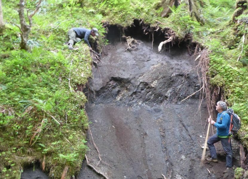
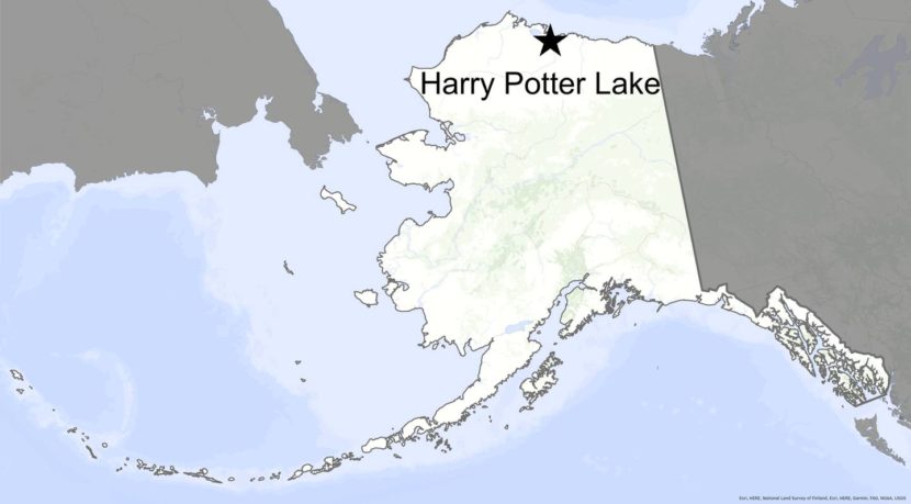
The disappearance of Harry Potter Lake is “kind of a tree falling in the forest type of thing,” according to Arp. Rarely do people get to see it.

And no one saw the breach this time — except for the cameras standing on posts near the new outlet of the lake and satellites orbiting 500 miles overhead.

Meteorologists at the National Weather Service warned the residents of the village of Nuiqsut, who might have fish camps along the creek, to be watchful for the sudden pulse of water (which did no reported damage).

Other living things have noticed the absence of Harry Potter Lake. Arp flew over the basin one last time on Aug. 15. He noticed it was full of ducks, shorebirds and other waterbirds attracted for some reason to the ponded, muddy lake bed.

“It was kind of amazing how fast they moved in,” he said.

A difficult, dynamic place: Lessons from nearly 50 years studying Glacier Bay’s outer coast

A tent in a forest of short, spindly trees with snow-covered mountains in the background
Dan Mann’s tent site on a plateau north of Lituya Bay that has risen 1,500 feet from the sea in the last 40,000 years. (Photo by Ned Rozell)

A CLIFF NORTH OF LITUYA BAY — Dan Mann hands me a clump of orange dirt the size of an almond. He instructs me to put it in my mouth.

“What’s it taste like? Does it crunch? Ash crunches because there’s glass fragments in it.”

“It crunches.”

“It’s from Mount Edgecumbe,” he says, referring to a volcano 100 miles away, near Sitka. “From an eruption 13,000 years ago.”

As I spit out the grit, I realize that date doesn’t mean much to me. But it means a lot to Mann, a University of Alaska Fairbanks researcher who looks at landscapes and sees what they were thousands of years ago.

I have admired Dan for years, especially when he is off trading Alaska’s winter for New Zealand’s summer or when I have sat in on a class he teaches. I’m glad to finally be out in the field with him. Especially here, in his place, one of the most dynamic areas of an ever-changing state.

Mann, a few years older than me, moves through the woods like a bear and knows this rugged part of the outer coast of Glacier Bay National Park better than anyone.

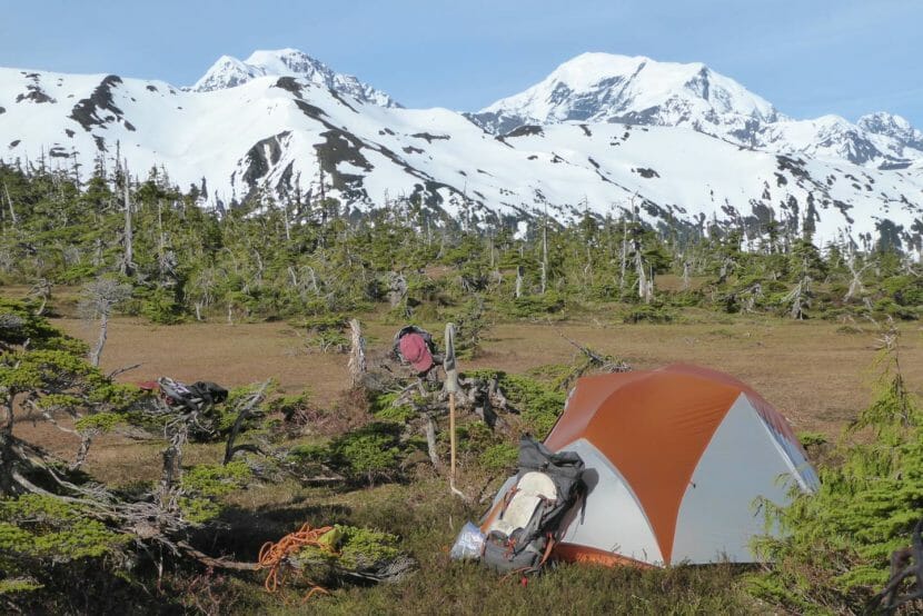
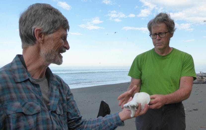
He is a Quaternary Period geologist, and also a forester and entomologist and someone who can answer pretty much any ecological question you would ask of this wild place. He is tall as a grizzly standing up, has long legs that propel him across the beach faster than I can walk, and makes decisions fast.

The Outer Coast isn’t Mann’s only gig. Each summer, he travels to a favorite river on the North Slope where he and UAF’s Pam Groves have found thousands of bones of mammoth, steppe bison and Pleistocene horses. He teaches UAF classes on climate change and the history of Alaska’s landscapes and animals. He studies landslides, like Pretty Rocks in Denali National Park, and an ancient glacial-outburst flood at Black Rapids Glacier south of Delta Junction.

But this place of tall young mountains, giant earthquakes, green rainforests and large bears has kept him coming back for nearly half a century.

His first trip was in 1977. As a 24-year-old, he camped on Cenotaph Island within Lituya Bay, dug soil pits, and almost got fired for scheming to get his climbing buddies to join him for an ascent of nearby Mount Crillon.

A bit later, a retired scientist named Richard Goldthwait of Ohio State University looked to this broad-shouldered young man who was intrigued with the same wild country.

“Have you solved the mystery of the terraces?” he asked Mann.

The “marine terraces” on the outer coast of Glacier Bay National Park are green plateaus a few difficult miles inland from the Gulf of Alaska.

The terraces were once underwater. In the last 40,000 years, tectonic movements along the nearby Fairweather Fault have raised the squishy ground upon which we pitch our tents 1,500 feet above the Gulf of Alaska. The Earth’s crust around this fault experiences some of the most rapid movement on the planet. Evidence of this is the ever-rising 15,300-foot Mount Fairweather, just a dozen miles from where we are camped.

Though they are hell to get to, the terraces are pleasant enough once you reach them. They are spongy benches so wet that big trees don’t grow on them. They feel like something out of Lord of the Rings, with mist in the air, gurgling creeks, small friendly pines and mountain hemlocks twisted by winter storms. You wouldn’t be surprised to bump into a bunch of elves picnicking in a glade.

On a beach, one man hands another man a bone
Lewis Sharman, a scientist who was hiking with Dan Mann, hands Mann a bone found on a Gulf of Alaska beach to see if he can guess the animal it came from. (Photo by Ned Rozell)

The puzzle of the terraces to which Goldthwait referred is whether or not they were part of the migration route by which the first Americans traveled southward from Bering Strait shortly after the last ice age. At that time, blue ice a mile thick smothered most of the continent’s land. But the Gulf of Alaska coastline might have been ice-free.

“Somehow you’ve got to get Siberians to South America,” Mann says. “This is the bottleneck — the skinniest part of the continental shelf is right offshore here.”

Finding a wooden kayak paddle in terrace peat would answer that human-migration question cleanly. But there are no quick answers up here.

Mann has not found any prehistoric boats or paddles in the last 45 years, but he keeps coming out here with his Vietnam-era folding Army shovel with the polished wooden handle. With it, he chops steps in the dark walls of soil and smooths it to read what has happened over the millennia. Each small insight dabs more color on the big picture.

About a dozen people have accompanied Mann here since the late 1970s. A repeat visitor is UAF ecologist Ben Gaglioti, who invited me along on this trip. Gaglioti shares Mann’s interests and has the brainpower and physical endurance to hang with him.

With all his experience here, Mann is the natural leader of me, Gaglioti and two other scientists out on this trip. I take note of him suspending a tarp over his tent even though his rainfly looks fine. He tells of a biblical rainfall out here once, when he and a partner endured 16 inches of rain in two days.

He also once needed to sneak around a half-dozen grizzly bears that were feasting on a whale carcass on the beach. While leading us through the jungle in the heat of the day, he yells “Wake up!” to assure bears hear us before they see us.

Two people study a section of rainforest cliff that's been cleared of vegetation to expose the soil beneath
From left, Ben Gaglioti and Dan Mann check an exposed section of ground for clues to past landscapes on the outer coast of Glacier Bay National Park. (Photo by Ned Rozell)

I would be terrified to walk the bear footprints pressed into the moss without him. He seems to have a quiet agreement with the bears. When he stops at a tree scratched up high and bitten by passing bears, he takes his red baseball cap off, reaches it five feet above his head with his walking stick and rubs it high on the tree. He leaves a mysterious, extra-tall scent for the bears to ponder.

Though he lets you know out loud that you should rinse your dehydrated-dinner bag in the creek before you put it in the waterproof sack to hang in a tree, his boyish smile appears often. He speaks with a relaxed tone. He asks sincere questions and waits for answers.

Here on the almost-never-visited outer coast of Glacier Bay, Mann is unearthing a big, long-developing story, doing old-fashioned shovel-and-backpack science while welcoming help from satellite and lidar images.

I ask him about his science and his adventures here when he agrees to speak into my recorder on our last day out. At the end of an interview under a tarp he has strung over our eating area, he becomes almost apologetic as he explains one of the reasons he keeps coming back to this exhausting, magnificent place.

“I just like being out here.”

Site notifications
Update notification options
Subscribe to notifications