Anna Canny

Local News Reporter

Juneau’s Eaglecrest Ski Area will remain open at limited capacity this weekend

The Porcupine Chairlift runs on Opening Day at Eaglecrest Ski Area. (Photo by Adelyn Baxter/KTOO)
The Porcupine Chairlift runs on Opening Day 2017 at Eaglecrest Ski Area in Juneau. (Photo by Adelyn Baxter/KTOO)

Juneau’s Eaglecrest Ski Area will be open at a limited capacity again this weekend, with only the Porcupine chair running. That lift services the mountain’s easiest trails. 

Staff members were hoping to open more of the mountain going into this weekend, but the ski report this morning confirmed that Hooter, Ptarmigan and Blackbear lifts will remain closed. That means no access to the upper mountain. 

“It was 35 degrees at the base Wednesday morning. And it was raining all the way to the top of Hooter,” said Marketing and Events manager Kristen Strom. “That kind of set us back for a bigger opening this weekend.”

Temperatures this week were warmer than expected, with several days above freezing.

Eaglecrest hosted a soft opening last weekend. Strom said a steady flow of visitors came out to enjoy the easier trails.

“It was kind of a nice, slower opening for us. And then this week, we were predicted to have a lot of snow,” she said.

Strom said safety considerations guided the decision to keep some trails closed. 
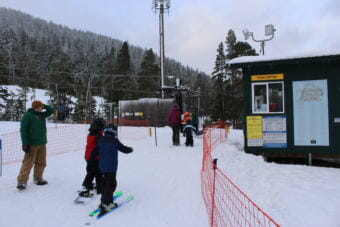
The base of the mountain has a relatively thin snowpack, which exposes skiers to early-season hazards. 

The other consideration is snowmaking. Eaglecrest relies on a durable snow base that can last throughout the season. In recent seasons, they’ve relied more and more on man-made snow. This year, temperatures have not stayed cold enough for snowmakers to cover the base of the mountain.

Strom said that a slow rollout is not uncommon for Eaglecrest, and they’re hopeful that the whole mountain will be accessible by Thursday, Dec. 15. 

The National Weather Service forecasts clear skies with below-normal temperatures this weekend.

2022 is Juneau’s wettest year on record

Flooding near Jordan Creek after record-breaking rain on Sept. 26 in Juneau. (Paige Sparks/KTOO)

A mix of rain and snow this week has officially made 2022 the wettest year in Juneau’s history, breaking the record set in 1991. With three weeks left in the year, 2022 could surpass that record by several inches. 

According to the National Weather Service, Juneau has seen 85.31 inches of precipitation since Jan. 1. That’s a combined measure of melted snowfall and rain. It’s 24 inches more than Juneau gets in a normal year.

National Weather Service meteorologist Edward Liske says the first quarter of 2022 set the pace for a record-breaking year, with record rainfall in January and February across the panhandle.

“We had a very, very wet late winter and early spring period,” Liske said. “So that was the main thing that caused us to be really high this year.” 

Juneau’s airport got double the normal amount of rainfall in January. A wet February surpassed the rainfall record set back in 1984. 

A graphic showing the top ten years for precipitation at Juneau's airport.
The ten years with the most annual precipitation at Juneau’s airport. The graphic was created before 2022’s total precipitation reached 85.31″ this morning. (Alaska Center for Climate Assessment and Policy)

Liske said this was caused by weather systems coming up from the South Pacific.

“The precipitation was starting to come out of a southerly direction,” he said. “So we had more wet systems, more warm systems, and most of that precipitation started falling as rain instead of snow.”

Precipitation for the rest of the year was pretty normal, though there were a few periods of heavy rain during late summer and early fall. In late September, intense rain contributed to a landslide that damaged several homes downtown. 

Over the past century, annual rainfall in Juneau has increased by about 20 inches. And each of the past three years, 2020, 2021, and now 2022, have broken into the top ten wettest years on record. The Alaska Coastal Rainforest Center listed higher levels of precipitation as one of nine climate impacts in a report this past summer.

That pattern can be difficult to perceive on a year-by-year or even decade-by-decade basis. Even as precipitation trends higher, there will be some years that are especially wet and others that are especially dry.

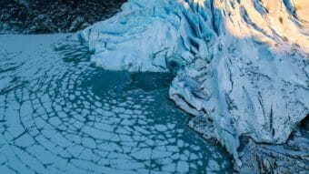
Advice to Mendenhall Lake visitors: Ice is never 100% safe

The face of the Mendenhall Glacier pictured from a drone on Dec. 4, 2022. (Photo courtesy of Paul Jose Rodriguez)

With colder, drier air spilling in from Canada, a thick sheet of ice quickly formed over Mendenhall Lake over the last week.

After an unseasonably warm and wet winter last year, Nordic skiers, climbers and hikers were especially eager to get out and see the glacier up close.

Ahead of the sunny weekend in Juneau, many were turning to Brian Weed.

“People ask me like, have you drilled it? Are you gonna go out and drill it?” he said.

Weed, a Juneau local and administrator of the popular Facebook page Juneau’s Hidden History, measures ice thickness at the lake each year to help people make safe decisions. After a busy weekend, Weed ventured out on Monday for the first time this winter along the lake’s eastern shoreline.

Weed saw several people venturing out beyond where he was comfortable. He said he often observes people breaking the most important rule.

“I can’t tell you how many people I’ve seen walk right up to the face of the glacier to touch it. And they’re probably standing on two inches or less of rotten ice,” he said.

People cross the frozen Mendenhall Lake to reach a small iceberg on Dec. 4, 2022, in Juneau. (Photo by Jennifer Pemberton/KTOO)

The National Weather Service’s guidelines recommend that people keep a distance of at least 300 yards when approaching the glacier. Ice thins out considerably around the terminus, and frequent, unpredictable calving creates an additional risk. 

“All it’ll take is one small chunk of the glacier coming off to turn that whole area in front of the glacier back to water,” Weed said.

NWS put out a reminder about ice thickness standards via Twitter and Facebook going into the weekend. They say 4 inches is good for ice fishing and walking, 5 inches supports small groups of ice skaters and 6 inches supports snowmachines.

NOAA ice safety guidance. (Image courtesy of the National Weather Service Juneau)

The NWS does not monitor ice conditions. Meteorologist Greg Spann said ice thickness varies across the lake, which makes it especially hard to make solid judgments.

“It’s very possible to have some patches that have thin ice, some patches that don’t have thin ice,” Spann said. “And you very much do not want to be the individual who discovers the thin patch of ice.”

Spann said that normal freeze-thaw cycles are another added challenge when it comes to ice safety. Though the ice on Mendenhall Lake is new, meteorologists expect it will freeze and thaw several times this winter. That will cause additional cracks and weak spots across the lake.

If you do go out on the ice, there are a few extremely dangerous areas to avoid. Areas of flowing water around river and creek mouths cause ice to thin, especially around Nugget Falls.

Icebergs should also be avoided. They are generally surrounded by open water, and because they are constantly moving, they can further break up the ice at any moment.

Above all, Spann emphasized that venturing out onto the ice always poses a risk.

“The first rule of ice safety is that it’s very difficult to actually be 100% safe on the ice,” he said.

Site notifications
Update notification options
Subscribe to notifications