“I write stories that shine a light on environmental problems and solutions. In the words of Rachel Carson, ‘The public must decide whether it wishes to continue on the present road, and it can do so only when in full possession of the facts.’”
When Alix isn’t asking questions, you can find her hiking, climbing or buried in a good book.
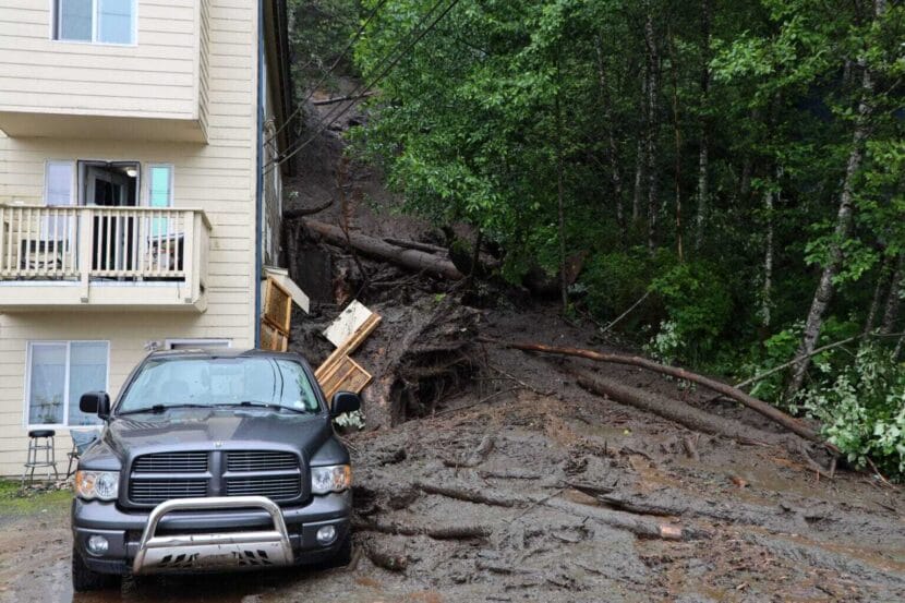
A landslide on Gastineau Avenue in Juneau on July 14, 2024. (Photo by Clarise Larson/KTOO)
The U.S. Geological Survey is expanding its landslide monitoring efforts in Southeast Alaska. The goal is to eventually develop an emergency alert system.
Data from Juneau’s Mount Roberts went online last month.
Dennis Staley leads the Alaska Landslide Hazards Project at USGS. He said that even though people in Southeast die from landslides, there aren’t forecasts for them yet. At least a dozen people have died in landslides in the region over the past decade.
“We’re trying to understand the hydrometeorological conditions that make landslides,” he said.
In Juneau, Staley said his team chose research sites on the northwest and southwest slopes of Mount Roberts partly due to the danger posed to the downtown area. Numerous recentand historic landslides have struck the town, including one in 1936 that killed 15 people.
The agency’s end goal is to build a model that can use weather forecasts to reliably predict when slopes are likely to be unstable, then warn those who live beneath them. But Staley said it will take years to amass a large enough data set to create such a model.
The team deployed several sensors on Mount Roberts to gather the data. The first is a heated rain gauge that measures rain and snow. The others are buried in the ground to measure three main factors in the soil: saturation, cohesion and the water pressure between soil particles. The data will help the USGS measure how strong the slope is and how that changes in response to the weather.
Even after scientists make the model, Staley said that they won’t be able to anticipate precisely wherethe land will give way.
“Locally, there can be tremendous variability in the way soil responds to the introduction of water, even at very short distances,” he said.
So far, the USGS has established research sites in Juneau and Sitka. The agency plan to add another Southeast community this fall, but Stale said they are not prepared to announce where yet.
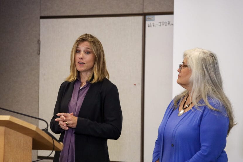
Juneau City Manager Katie Koester, left, and the Central Council of the Tlingit and Haida Indian Tribes of Alaska’s first Vice President Kus.een Jacqueline Pata, right, answer questions during a press briefing at the Juneau Police Department on Friday, Aug. 8, 2025. (Photo by Clarise Larson/KTOO)
Juneau city and tribal officials announced a preemptive disaster declaration Friday in anticipation of the glacial outburst flood expected to hit the Mendenhall Valley soon.
Ku.seen Jacqueline Pata is the Central Council of the Tlingit and Haida Indian Tribes of Alaska’s first Vice President. At a press briefing, she said declaring a disaster before the flood could expedite recovery efforts, such as financial aid applications with the state.
“Being ahead of the curve really makes a big difference,” she said.
The tribe has already ratified the declaration and the Juneau Assembly will hold a special meeting next Friday at noon to do the same.
The city and tribe have ramped up their communication with the public ahead of this year’s flood, compared to previous years. Ashley Heimbigner, the city’s communications and engagement director, said that’s a response to feedback from the public.
“For better or worse, we’ve had folks that lived through this last year, and they knew what information our residents were looking for, where we were lacking in terms of quick response with that information, and so it gave us sort of a workbook of how to do better this year,” she said.
Nicole Ferrin is the warning coordination meteorologist at the National Weather Service in Juneau. She says that Suicide Basin — the glacial lake that will soon release the flood — is nearly full.
“Based on recent mapping by [University of Alaska Southeast] that were up there just a couple days ago, it has about 15 feet before it will be actually overtopping the ice dam,” Ferrin said at the briefing.
She says that in the past, it has taken between one and six days for the flood to release out of Suicide Basin after water flows out over the top of Mendenhall Glacier.
All agencies are on high alert because the basin can release at any time, no matter how full it is.
Mendenhall Valley residents dry out their belongings following Juneau’s annual glacial outburst flood on Tuesday, August 6, 2024. (Clarise Larson/KTOO)
Hundreds of people in Juneau’s Mendenhall Valley are living on the front line of a climate change disaster they didn’t see coming. This is Outburst, the story of how glacial outburst flooding has escalated faster than human imagination – and public policies to protect people.
The KTOO newsroom and reporter Alix Soliman take you from the floodwaters to the glacier’s edge to uncover why the annual floods happen, how they got out of control and what can be done to keep Juneau safe.
On Aug. 6, 2024, many residents of Juneau’s Mendenhall Valley woke to freezing water rushing into their homes. Glacial outburst floods aren’t new to Juneau, but they’ve escalated dramatically in the last few years.
The first episode of Outburst unravels why so many people were surprised by the sudden severity of recent glacial outburst floods – and why Alaska’s capital city wasn’t prepared.
We’ll examine the science behind glacial outburst floods and how human psychology plays into policy.
KTOO’s Alix Soliman is our guide from flooded basements to assembly chambers and Juneau schoolrooms to understand how a disaster that’s been ramping up for years could shock people. KTOO reporter Clarise Larson cowrote this episode.
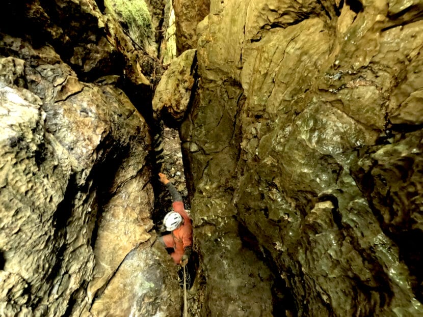
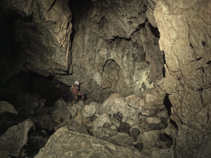
Paul Wilcox descends into Devil’s Canopy Cave on Prince of Wales Island. (Photo courtesy of Jessica Honkonen)
Listen to this story:
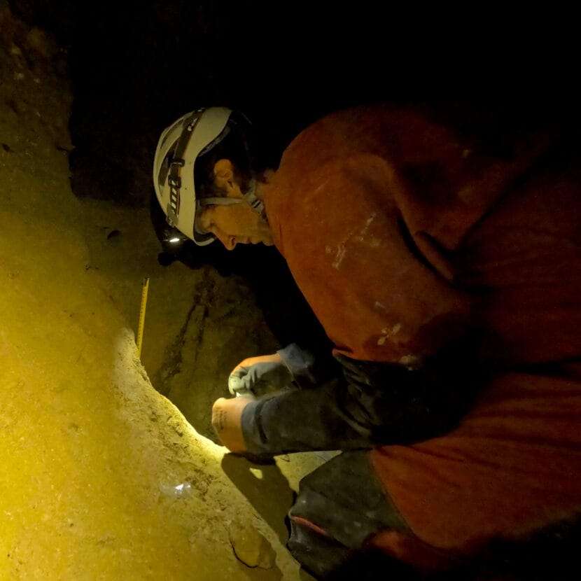
An unlikely discovery in a cave on Prince of Wales Island could help scientists understand Earth’s climate history. A small pile of sand and stones tells the story of formidable glacial meltwater floods that washed through Southeast Alaska during the last Ice Age.
Paul Wilcox is a paleoclimate researcher at the University of Lapland in Finland. While looking for stalactites and stalagmites on Prince of Wales Island in 2022, he stumbled across something odd in Devil’s Canopy Cave.
“I found this very impressive pile of sediment in one of the cave rooms,” he said.
The pile is made of rounded cobbles and pebbles on top of sand, which is unlike what he usually finds in most caves.
“It often is either like a goopy mud or the rocks are very sharp-edged,” Wilcox said.
The rounded and weathered rocks looked like they traveled a vast distance over land, and the layers gave Wilcox a clue that the sediments could have been transported by multiple floods.
He and his colleagues dated them using a method called optically stimulated luminescence that traces when quartz crystals were last exposed to sunlight. They found that the sediments were preserved in the cave like a time capsule between 17,000 and 20,000 years ago.
The researchers say the pile is evidence of enormous glacial meltwater floods coming from the Cordilleran Ice Sheet that covered much of British Columbia and parts of Alaska, including Southeast, South Central and the Aleutian Islands, during the last Ice Age.
“These meltwater events were a common occurrence during the height of the last Ice Age,” Wilcox said.
The finding could help researchers unravel the mystery of how Earth’s climate rapidly fluctuated thousands of years ago.
Maureen Walczak, a researcher at the University of Washington, named these prehistoric floods Siku events, an Iñupiaq word for ice.
She said this pile is significant because Siku sediments are a rare find on land. The glacial ice usually destroys everything in its path when it advances forward.
Paul Wilcox samples Siku sediments inside Devil’s Canopy Cave. (Photo courtesy of Jessica Honkonen)
Walczak didn’t work on this cave study, but she and her team discovered evidence for Siku events in the Gulf of Alaska in 2020.
“The ice basically picks up the rock, and it gets mixed up with the ice, and then the icebergs float out to the middle of the ocean and drop it,” she said.
Along with boulders at the bottom of the ocean, she found glacial silt fanned far out from the coast of Alaska. Radiocarbon dating revealed these floods started around 40,000 years ago.
Walczak said that the timing is key. It could shift how scientists understand the chain reaction that led to prehistoric climate swings.
The same sort of glacial calving and flooding events happened on the other side of the globe, in the North Atlantic Ocean. They’re named Heinrich events after the scientist who discovered them in the late 1980s.
The tremendous influx of cold freshwater into the North Atlantic is thought to have changed the ocean’s circulation. Ocean circulation affects climate, so many climate scientists think that Heinrich events could have played a big role in abrupt climate fluctuations during the last Ice Age.
But Heinrich events started after the more recently discovered Siku events.
Paul Wilcox explores another cave on Prince of Wales Island. (Photo courtesy of Jessica Honkonen)
Walczak suggests that Siku events may have even triggered Heinrich events, or they just responded to the same trigger earlier. What could have set them off is still a mystery. But once they were in motion, researchers say they could have created a feedback loop that further destabilized Earth’s climate.
“We’re talking about shifting a paradigm here,” Walczak said. “This is right in the beginning of changing how we’re thinking about the role of the Cordilleran [Ice Sheet] in the global climate system.”
Historically, the Pacific Ocean was seen as a relatively passive entity in climate systems. When it came to driving global climate, the North Atlantic got the most research attention.
“Probably because it’s the easiest thing to study, and it’s ringed by a bunch of big, illustrious academic institutions,” Walczak said.
But she said that’s changing, especially since scientists understand the Pacific and Southern Oceans play important roles in shifting global patterns now.
Walczak said that understanding climate changes in Earth’s history can help us prepare for the effects of future warming now.
“We don’t have in historic times any kind of analog. So we have to go back, you know, over 10,000 years ago to understand what this might look like,” she said.
Sometimes, to understand Earth’s history, digging around in Alaska’s caves can help.
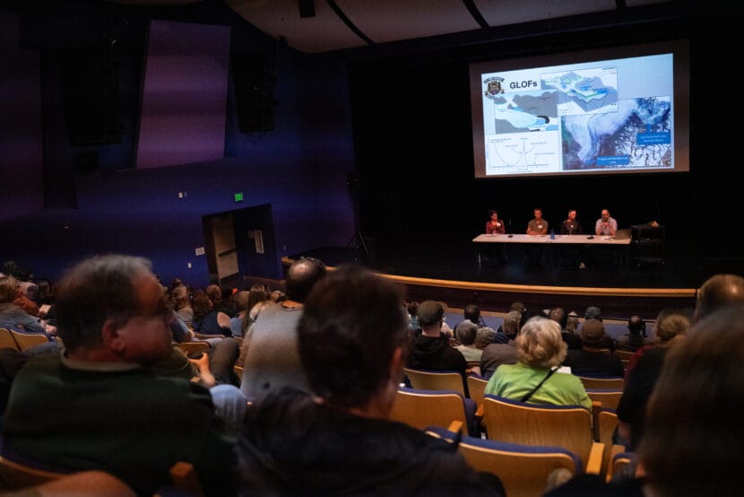
Erin Stockdale, Curtis Lee, Mike Records and Leif Hammes from the U.S. Army Corps of Engineers present the federal process to come up with a long-term flood protection solution for Mendenhall Valley on July 30, 2025. (Photo by Alix Soliman/KTOO)
Listen to this story:
As the next glacial outburst flood looms over Juneau’s Mendenhall Valley, around 200 residents filed into the Thunder Mountain Middle School auditorium last night to talk about a permanent solution. Officials from the U.S. Army Corps of Engineers said it’s years away. But residents in the flood zone said they need a solution sooner to feel safe in their neighborhoods.
Dominic Walsh’s home on Northland Street flooded last year. The temporary levee the city put up this year is meant to protect his home until there’s a permanent fix, but he doesn’t feel confident in that.
“I don’t feel any safer with the HESCO barriers, maybe a little bit, but not really,” he said.
This is the first time the levee will be put to the test. Although city officials said they are confident the levee should work properly, they are urging residents in the flood zone to evacuate when the flood warning is issued.
Walsh said he’s spent all year recovering from the last flood and preparing for the next one, and it’s challenging to imagine that he’ll be living with that anxiety for several more years while the federal process unfolds.
Craig Loken lives on Emily Way, a street that got hit hard by the flood last August. He said the Army Corps’ slow approach is painful to watch.
“If it takes 10 years, there won’t be anybody left in the Valley to benefit from all these studies,” he said.
His family has lived in the Valley for three generations. Loken said they are thinking about moving away, depending on how this long-term solution pans out.
The Mendenhall Glacier and Lake are on federal land, so anything built there is under federal jurisdiction. The Army Corps is starting with a technical study to gather all of the physical data about the baseline conditions in the Valley. Congress allocated $4.75 million to the study and Army Corps officials said it will take a few years to finish.
That study will inform another report called a feasibility study. That’s where the Army Corps weighs each option and picks one. It could take another couple of years and millions of dollars more.
After that, engineers have to design the solution they pick, which can take another couple of years. Then the Army Corps has to build it.
Leif Hammes is chief project manager in the civil works branch of the Army Corps in Alaska. During Wednesday’s meeting at Thunder Mountain Middle School, he explained that the building timeline depends on how big the project is, but that this is a top priority in his office.
“We do look for ways to go faster, save time, get us there quicker, but from sort of where we are today to physical construction is multiple years — you know, six, seven, ten-ish years is not an unreasonable timeline,” Hammes said.
Added together, Mendenhall Valley residents can expect a decade or more before there’s a permanent fix.
Hammes said that Army Corps staff can’t change the agency’s process because it’s grounded in federal laws.
But Erin Stockdale, chief of the planning section at the Army Corps, told residents to speak up and tell their stories since Congress has the power to make things move quicker.
“The ‘just build it’ avenue is not common, but I will say the squeaky wheel gets the grease,” she said.
Lots of ideas were floated, including a tunnel through the ice, a lake tap at the bottom of Suicide Basin and a permanent levee. At this stage in the process, Hammes said the Army Corps isn’t ruling anything out yet.
But one idea got more attention at the meeting than any other: a dam on Mendenhall Lake.
Dave Hanna has lived in Juneau his whole life. Although his place on Auke Lake isn’t in the flood zone, he said glacial outburst floods are the most devastating issue Juneau is facing. And he thinks a dam is a simple fix. He went up to the microphone and told the Army Corps as much.
“If you put a dry dam across the outlet of the lake, it would serve as a pedestrian bridge,” he suggested. “Find out what you’ve got to build on, and then figure out how to build it, because we can’t wait seven years.”
The crowd erupted into applause. Many residents agree with him.
Scientists are beginning to research other lakes farther up Mendenhall Glacier that might release outburst floods in the future. No one knows how big the risk is yet, but it could narrow down the options for a permanent solution.
That’s a major reason Hanna is pushing for a dam.
“Anything we do at Suicide Basin is probably not the correct thing to do, because it doesn’t address future basins,” Hanna said.
Bob Deering lives along the Mendenhall River and is a retired engineer who once worked at the Army Corps. He thinks a dam is the only viable solution, and said that the process the agency laid out is too slow.
“Frankly, it’s unacceptable,” he said. “I mean, everybody’s going through all this stress right now, with the flood, you know, looming above us, and we’re going to go through that for another 10 years?”
Suicide Basin is expected to be full around mid-August, but National Weather Service forecasters don’t yet know exactly when it will unleash the next flood.
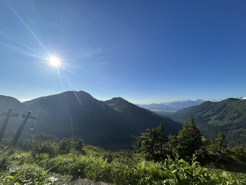
The sun shines on Eaglecrest Ski Area in Juneau. (Photo by Clarise Larson/KTOO)
The sunshine that Southeast Alaskans felt yesterday will go down in history. Multiple towns in the region reached record high temperatures.
The highest record breaking temperatures were in Yakutat and Juneau, which both reached 81 degrees. That broke Yakutat’s 1996 daily record by nearly 10 degrees and tied Juneau’s 1982 record.
Temperatures also broke or matched records in Haines, Gustavus and Klawock.
National Weather Service Meteorologist Grant Smith said it’s important to track record-breaking days.
“So when we see these extremes, yes, it’s impressive,” he said. “If we see more of them in a short amount of time, then yeah, it could mean something.”
Over decades, he says, that data can help tell the story of how the local climate is changing. But just a single day of record heat can’t alone tell that story.
This year, Alaska updated its heat advisory levels to match how temperatures feel in northern latitudes.
In Southeast, a forecast of 80 degrees now triggers a heat advisory. Juneau just had its first one.
The new advisories reflect that hot weather often feels hotter here.
“The sun angle is so much higher, so all that light energy is much more direct on us, on the concrete, on our skin,” Smith said.
Smith describes it as a flashlight shining down on a table. When it’s shining directly down, the light is concentrated in a small circle, so it’s more intense — that’s what Alaska is like in the summer. When the flashlight is angled, it shines as a large cone at a much lower intensity — that’s what we experience in the winter.
Monday’s heat gave way to clouds and rain across much of Southeast on Tuesday. Aside from a few days of warmth here and there, cool weather has dominated this summer so far.
Correction: This article has been updated to specify that Yakutat and Juneau saw the highest record breaking temperatures in the region, but not the highest temperatures overall.
Close
Update notification options
Subscribe to notifications
Subscribe
Get notifications about news related to the topics you care about. You can unsubscribe anytime.