
The letters encourage British Columbia to pause mining developments in the headwaters of the Stikine, Unuk and Taku Rivers that drain into Southeast Alaska.
KSTK - Wrangell
KSTK is our partner station in Wrangell. KTOO collaborates with partners across the state to cover important news and to share stories with our audiences.
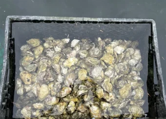
Alaska oyster farmers refine growing techniques to meet high demand
Pacific oysters are not native to Alaska, but farmers say they’re up for the challenge. One Southeast farmer has been experimenting through trial and error to meet that need.
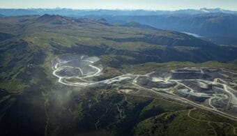
Mine near Wrangell prompts tribal concerns about Canadian mining regulations
The new owners of the Red Chris Mine in British Columbia hope to expand the copper and gold project, which is already bigger than Wrangell Island.
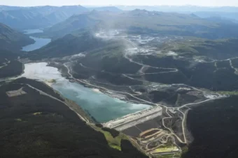
Conservationists say Canadian mine is contaminating Wrangell-area watershed
The Red Chris Mine in British Columbia border is already 89 square miles, bigger than Wrangell Island. And the mine — just 25 miles from the border — could get bigger.
Landslide researchers have more clues about what caused Wrangell’s devastating 2023 slide
It’s been over a year since a landslide devastated the Wrangell community, killing six people. Last month, geologists presented their work from a visit to the slide over the summer.
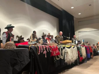
The U.S. Army apologized to Wrangell clans for the 1869 bombardment of a village. Not all of them accepted the apology.
The village of Ḵaachx̱aana.áakʼw lost at least five people, a totem pole and multiple houses in the U.S. Army’s 1869 bombardment. And for the past 155 years, the tribe has been waiting for this apology.