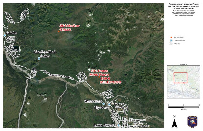
A map of new, lightning-caused fires the Alaska Division of Forestry & Fire Protection actively responded to on Monday, July 24 near Delta and Salcha. (From Alaska Wildland Fire Information)
Thousands of lightning strikes around the eastern Interior sparked new wildfires Monday.
Two of the fires ignited by lightning Monday are burning in areas off the Pogo gold mine access road north of Delta Junction. State Division of Forestry & Fire Protection spokesperson Lily Coyle says the biggest is the 150-acre Pogo Mine Road Fire, which was started by several strikes.
“That was actually a cluster of ignitions, so there’s multiple different starts,” Coyle said. “And they’re very close to each other, so we’re just considering it one fire.”
Coyle says the other area fire start, the 6-Mile Pogo Road Fire, had burned about 6 acres as of Monday night.
“There are no structures threatened on the Pogo Mine Road Fire or the 6-Mile Pogo Fire,” she said. “We did have air resources responding and are continuing to monitor.”
Further north, the McCoy Creek Fire near Salcha had burned about 50 acres as of Monday night. Beth Ipsen, a spokeswoman for the federal Bureau of Land Management’s Alaska Fire Service, was also busy with new lightning starts.
“We got a lot of reports coming in through the dispatch centers, so we sent some AFS personnel up in a plane to check them out,” Ipsen said. “And as we were sending people out, they were finding new fires.”
?7/24/2023 4:50 PM Radar Update ? We are seeing thunderstorms developing north and east of Fairbanks. We are currently watching for further development of storms around area. pic.twitter.com/m8bwLrU4Ii
Ipsen says the agency recorded 7,000 lightning strikes around the Interior. But as of Monday night, the only high-priority fire in the federal agency’s area of responsibility was the 5-acre Moose Fire, burning near Mile 100 of the Elliott Highway.
“It’s not immediately threatening anything, but we’d like to keep it from impacting the highway,” she said.
Ipsen says rainfall and the damp subsurface soil around the region should slow the fire’s growth.
“Those deeper ground layers haven’t dried out like they would in a typical year, so most of what we’re going to see right now is more surface-burning,” she said. “So they will be a little bit more manageable if we get on them right away.”
Meanwhile, National Weather Service meteorologist Bobby Bianco says rain showers are helping clear the air of smoke that’s been drifting into the Interior from large wildfires in the Yukon and Northwest Territories.
“Definitely rain can help alleviate some of the smoke,” he said.
Bianco says that’s what happened Monday afternoon in Fairbanks.
“It did reduce some of the smoke here just a little bit,” he said. “The wind kind of pushed it south of the area, and we see a little bit bluer skies.”
The new fires come as Interior and Southcentral Alaska skies see smoke from wildfires burning in Canada’s Yukon Territory. Forecasts call for the smoke to dissipate later this week.
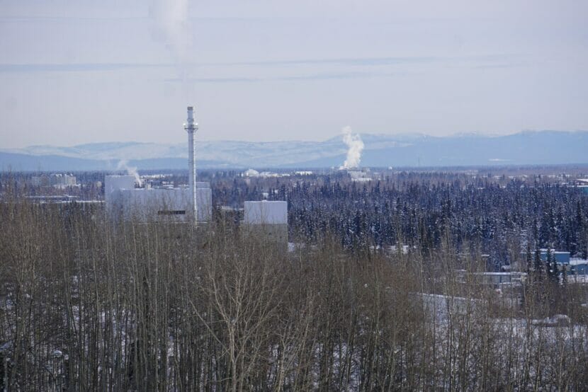
Smokestack emissions are seen along the Fairbanks skyline on March 1. At left is the coal-fired heat and power plant on the University of Alaska Fairbanks campus. Alaska and nine other states have filed a notice of intent to sue the Environmental Protection Agency over its certification process for wood-fired stoves, which are factors in Fairbanks air pollution. (Photo by Yereth Rosen/Alaska Beacon)
Alaska and nine other states have notified the Environmental Protection Agency they intend to sue if new standards for certification of wood-burning stoves are not issued soon.
The EPA last issued standards for wood-burning stoves in 2015, and new standards are due at least every eight years, said the notice of intent to sue, which was issued on June 29.
The chief problem, the notice said, is that the EPA’s 2015 standards are flawed, inadequately administered and are allowing substandard devices to be certified, thus creating more pollution and deceiving consumers.
The notice of intent to sue gives the agency 60 days to produce revised wood-stove standards and a better process for testing and certifying the units.
Along with Alaska, the states filing the notice of intent to sue are New York, Illinois, Maryland, Massachusetts, Minnesota, New Jersey, Oregon, Vermont and Washington, along with the Puget Sound Clean Air Agency.
For Alaska, the key issue is fine-particulate pollution in the Fairbanks area, which can be a serious problem and health hazard in winter.
The air-pollution problems stem from wintertime weather conditions known as inversions that are set up by surrounding mountains that trap cold air over the city and outlying areas. Particulate pollution from wood-burning stoves and other sources can get tapped in that stagnant air, resulting in violations of Clean Air Act standards. Despite several years of improvements, the Fairbanks North Star Borough is still considered to be falling short of federal standards for particulate pollution, labeled as a “nonattainment area.” The borough is the subject of an improvement plan from the Alaska Department of Environmental Conservation that requires EPA approval.
The latest state improvement plan, referred to as a SIP, remains under review by the EPA, with a final decision expected by the end of the year.
The EPA on Dec. 30 gave mixed reviews to the plan, proposing approval of some elements and rejection of others. The provisions concerning wood-burning stoves, for example, were seen as meriting approval, but other provisions, largely concerning commercial sources, were deemed insufficient. The agency said the state erred in failing to justify its decision to not require the best-available technology to be used in coal- and oil-burning power plants and in failing to justify its decision against requiring ultra-low-sulfur fuel for residential and commercial uses, among other deficiencies.
State officials argue that wood-burning stoves are responsible for most of the borough’s air pollution and that any new requirements concerning power plants, commercial operations and diesel fuel would be onerous.
“We must defend the Greater Fairbanks area from potentially expensive, restrictive federal controls on businesses that are not the source of the problem like coffee roasters, restaurants, and utilities,” Alaska Attorney General Treg Taylor said in a statement released last week by the Department of Law.
Alaska Department of Environmental Conservation Commissioner Jason Brune said wood smoke is responsible for 80% to 90% of the borough’s air-quality problems. “Unfortunately, EPA regulators in Seattle and Washington, D.C. are centrally focused on elements of the SIP that will have little to no environmental benefit, or at worst are overly punitive to utility ratepayers,” he said in the Department of Law statement.
But data from the EPA – which has praised Fairbanks’ improvements in wood-burning practices – indicates that those stoves are less of a problem than they were in the past and that validity of certification is now a relatively minor issue in the borough.
Since 2010, there have been thousands of stoves replaced, repaired or converted to non-wood units, according to EPA data. The 1,596 new wood-burning stoves installed between 2010 and 2022 showed significant improvements, according to the data. By 2022, the average emissions per wood-burning stove was less than a fourth of the 2010 average, according to the data.
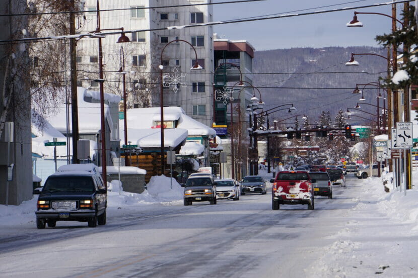
Afternoon traffic is seen in downtown Fairbanks on March 1. Significant air-quality improvements have been achieved since 2010, according to data from the Environmental Protection Agency. (Photo by Yereth Rosen/Alaska Beacon)
Since 2016 – when standards set in 2015 were effective — 158 EPA-certified wood-burning stoves have been installed in the borough, according to the EPA’s data. Since that year, much of the changeover involved conversions to other types of heating.
The Alaska Legislature this spring passed a resolution urging a solution for the state-EPA dispute. The measure, House Joint Resolution 11, called on the EPA to update its wood-stove standards so they are more useful and credible and called on the Department of Environmental Conservation to “develop an economically and legally defensible state implementation plan for the Fairbanks North Star Borough nonattainment area.”
Aside from Alaska’s concerns about the Fairbanks North Star Borough, the states’ notice cited concerns that low-income and minority neighborhoods are suffering more from wood smoke that is being emitted by improperly certified heaters. “Many of these devices will be installed in communities that are overburdened by environmental harms and other inequities, further exacerbating environmental justice issues,” the notice said.
The states’ notice cited documented deficiencies in the EPA’s wood-stove certification program.
Those citations include an EPA Inspector General’s report issued in February that found the 2015 standards were flawed and that inaccurate tests and oversight likely meant that consumers were getting substandard products marketed as “certified.”
The notice also cited a 2021 study by a coalition of eight Northeast states that evaluated over 250 EPA-certified wood heaters and found “a systemic failure of the entire certification process” and a lack of oversight creating a “dysfunctional” system. In many cases, manufacturers and testing laboratories distorted measurements, resulting in consumers getting subpar products, the report said.
Bill Dunbar, a spokesperson for EPA’s Region 10 office, said on Wednesday that the agency would not comment on pending litigation.
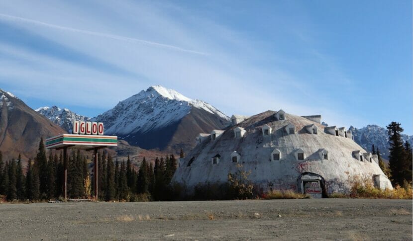
The Parks Highway igloo, midway between Anchorage and Fairbanks, in 2021. (Emily Schwing/Alaska Public Media)
A famously dilapidated, unfinished architectural curiosity near Cantwell is the planned location for a new distillery.
Local resident Shirley Schmidt says she and her uncle are leasing the famous igloo, a three-story, foam-coated dome by the Parks Highway. The plan involves rebuilding an old convenience store next to the igloo and starting the distillery there.
“Throughout the winter, while the booze is being made and aging, we’re gonna do work on the inside of the igloo,” she said.
According to the Anchorage Daily News, Leon Smith started building the igloo as a hotel in 1970’s. He never completed the interior and eventually sold the igloo to Brad Fisher. Fisher ran a gas station on the property until 2010 and decided to sell it a few years ago.
“It’s not for sale anymore,” Schmidt said. “We don’t own it, but we are leasing it from the Fisher family, with plans to own it.”
Unoccupied for more than decade, Schmidt says the igloo property has suffered. Right now they’re focused on cleaning it up “from all the destruction over the years and vandalism.”
But Schmidt says the structure is intact, and the circular framing is impressive.
“You’re actually blown away when you walk in because, just the way that it looks outside right now, you think: ‘what a dump hole,’” she said. “But when you walk inside, it’s a masterpiece.”
Circular framing inside the igloo. (Courtesy of Shirley Schmidt)
Schmidt says they have no near-term plans for the top two stories of the igloo, due to fire code issues.
“Probably just keep it lit up so when you walk in the middle, you can look up and see up all the floors,” she said. “See the genius behind the framework.”
As far as the distilling goes, Schmidt says her uncle, who recently relocated to Alaska from Outside, has a lot of experience.
“My uncle is head distiller, and he’s using a recipe that was a family recipe since the prohibition era: bourbons, whiskeys, brandies,” she said.
Schmidt says they’re calling the business Wolf Dog Distillery and trying to get the word out about their plan for the igloo. They want to dissuade any additional trespassing, theft and vandalism while they rehabilitate the property.
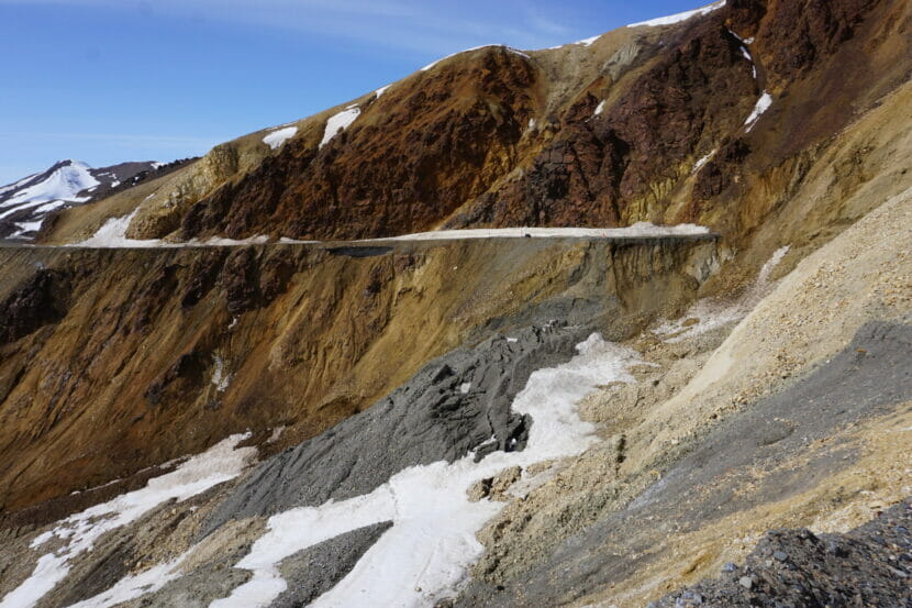
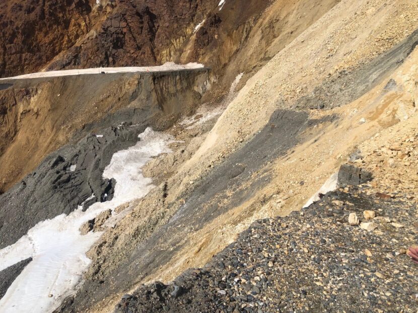
The landslide at Pretty Rocks, at about the halfway point of the Denali National Park road, is seen on May 5. The project to install a new bridge that will allow the road to reopen is challenging because of geologic and logistical complexities, which include ice-rich permafrost, a band of difficult clay and overall remoteness, The expected completion is now midsummer of 2026, pushed back from an earlier esimate of 2025. (Photo by Yereth Rosen/Alaska Beacon)
By midsummer in 2026, visitors will likely be traveling over a sophisticated new bridge that clears a geologic hazard that has become a poster child of climate change in Alaska.
Until then, the National Park Service and the tourism industry will be coping with three more years of shutdowns at about the halfway point of the sole park road to avoid ongoing landslides at a steep and perilous site called Pretty Rocks.
Where there used to be a curve at about mile 45 of the 92-mile road, a site known for its spectacular views of a valley called the Plains of Murie, a section of road is now gone, leaving a nearly sheer drop-off in its place. When the sun hits the rock face on the north side, as it did on the first Friday in May, clumps of dirt and rock tumble almost incessantly down the slope.
In August of 2021, the road was closed there; that section was still intact but deemed too dangerous for public travel. By then, the perils were obvious, said Dave Schirokauer, Denali’s science and resources team leader. He pointed to a site on the now-collapsed road section.“Right over there in the corner, we could see ice. Very, very ice-rich permafrost was at the surface and was very visible,” he said during a May 5 tour.
Pretty Rocks got this way in Hemingway-like fashion: gradually, and then suddenly.
The slope was moving slightly in the 1960s and likely for decades earlier, according to the park service. But prior to 2014, it was causing little trouble beyond some occasional small cracks in the road surface, according to park officials. As the climate continued to warm, slope movement that was measured in inches per year before 2014 increased to inches per month in 2017, inches per week the following year, inches per day in 2019 and, in 2021, 0.65 inches per hour, according to park officials. A collapse in August of 2021 forced the abrupt road closure and an early end to some Denali trips.
The project to reopen the road at Pretty Rocks, expected to cost about $100 million, is challenging. The site is remote and steep. The bridge has to be suitable for permafrost terrain, strong and secure enough to carry tour buses and withstand earthquakes, subtle enough in appearance to blend in with surroundings and constructed in a way that minimizes impacts to park visitors and wildlife.
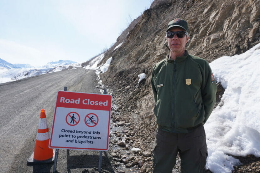
Dave Schirokauer, Denali National Park’s science and resources team leader, stands on May 5 at the East Fork turnaround site on the park’s road, at about mile 43 of the 92-mile route. Tour buses can go no further on the road because of the closure a couple of miles to the west at the dangerous Pretty Rocks landslide site. (Photo by Yereth Rosen/Alaska Beacon)
The design includes anchors to lodge vertically and at angles. It also includes 23 thermosyphons — devices that pull heat out of the ground — to preserve a pocket of ice-rich permafrost discovered 85 feet below the surface at the east end, said Steve Mandt, the park engineer coordinating the project.
Site geology pushes back road opening
The site’s geology makes any fix complex. There is permafrost overlain with a rock glacier, which is a frozen but thawing conglomeration of rock and ice. There is clay, which thaws at a lower temperature than that needed to melt ice. There is rainwater that infiltrates all that and, depending on the season, expands the ice or hastens the melt. “So you’ve got rock, you’ve got rain that freezes and you’ve got this major ice layer that’s moving,” Schirokauer said.
The clay has proved particularly problematic. A recent discovery that workers will have to remove 80,000 cubic yards of clay on the west side of the planned bridge site rather than the 30,000 previously estimated means a one-year delay in the project’s expected completion, said Denali spokesperson Sharon Stiteler.
The change from a 2025 road opening is a setback to the tourism industry.
“With the additional delay, obviously, that is disappointing,” said Jillian Simpson, president and chief executive officer of the Alaska Travel Industry Association. But the road is “a critical piece of infrastructure” and the industry understands “how important it is to get it right,” she said.
“Denali is the linchpin of tourism when it comes to exploring Alaska on land,” Simpson said.
As the bridge becomes reality, Denali will be busy with more than the usual tourist crowds.
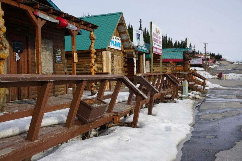
Tourist businesses lining the Parks Highway outside of the Denali National Park entrance, at a strip nicknamed “Glitter Gulch,” are seen on May 5. The shops, restaurants and tour companies, not yet open that day, depend on Denali crowds. Last year, with the second half of the road closed, there were more opportunities for some companies but challenges for others, like restaurants, which did not have the staffing to manage crowds. (Photo by Yereth Rosen/Alaska Beacon)
A camp at the park’s gravel site operated over the next summer seasons will serve 50 or more workers who will shuttle back and forth, their vehicles in some places alternating with the tour buses.
The approach to the Pretty Rocks site is so narrow that work trucks are to be backed in because there is not enough space for large vehicles to turn around. There will be some noise, like from pile driving, though the plan is to keep that to a minimum.
For tourists, this will be another year of stopping at the site called East Fork at the road’s 43-mile point, where there is a temporary ranger station in a yurt and enough space for buses to turn around.
“This is the new Eielson,” Schirokauer said, referring to the temporarily closed Eielson Visitors Center at the road’s 66-mile point, normally a popular stopping and turnaround site.
Last year, the first full year of the closure at Pretty Rocks, visitation bounded back from extreme lows resulting from the COVID-19 pandemic, though it was still only 88% of typical pre-2020 levels, according to an analysis by the Alaska Department of Labor and Workforce Development. Those who came to Denali were curious about the landslide, park staffers said. Many who rode the bus as far as they could, to the East Fork turnaround, walked the extra distance to see the site for themselves, Stiteler said.
This year, with Alaska on track for a record 1.6 million cruise passengers, the crowds are expected to be bigger. But Denali should be able to handle the increased traffic, even with half the road closed, said Brooke Merrell, the park’s superintendent.
“We feel like we got a good practice year last year to make sure we have it right,” she said. “We believe we’ll be able to accommodate it with the part of the road we have this year.”
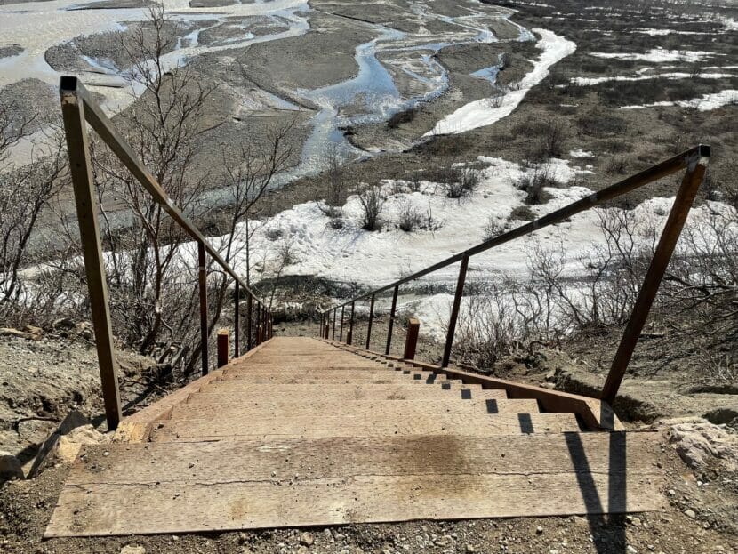
A temporary staircase at the East Fork turnaround area on the Denali National Park road, seen here in May of 2022, gives visitors access to the river plain below the roadbed and a route for exploring park territory beyond the Pretty Rocks closure area. (Photo provided by National Park Service)
It remains possible to travel around Pretty Rocks to the western half of the park.
There is temporary access provided by a steep stairway from the East Fork bus terminus to the river valley below. About 15% of the visitors who rode the shuttle bus that far last year chose to make that descent for brief walks or even more extensive hikes, according to park staff.
Backcountry users with the appropriate permits can keep going from there to explore the territory that is currently beyond park road access. Well-heeled travelers can, moreover, fly into Kantishna, the patch of private land at the end of the road, and stay at deluxe lodges where daily rates are well above $1,000.
How the construction affects Alaska tourism
The tourism industry has been adjusting to the new reality.
For local companies, last year was a “mixed bag,” with some operators able to take advantage of increased traffic resulting from the shorter bus trips but others struggling, said Vanessa Jusczak of the Denali Chamber of Commerce, based in Healy. Excursion companies had more business, but short-staffed restaurants were burdened by crowds appearing at what were normally low-volume times, she said by email.
In Anchorage this summer, Denali-bound tourists appear to be well aware of the road closure, said Jack Bonney, vice president of the Anchorage Convention and Visitors Bureau.
“It doesn’t seem to be affecting their choice about whether they go to Denali or not,” he said. While “the closure is in the back of people’s minds,” the park continues to be seen as an attractive destination, he said.
More than people are affected by the road closure. The park service is embarking on a study of bears to see how the lack of road traffic might be affecting them, Schirokauer said. The plan is to collar 18 to 20 animals, with half on the east of Pretty Rocks and the other half on the west side where the road is closed, he said.
Landslides increasing across the north
While Pretty Rocks is a dramatic and visible case because of its location and the inconvenience it is causing, thaw-induced landslides are increasing all over the north.
Cruise passengers stroll the waterfront in Juneau on May 9. Cruise visitation in Alaska is expected to hit a new record this year, and that in turn is expected to send more visitors to Denali, where half the road remains closed because of landslide dangers. (Photo by Yereth Rosen/Alaska Beacon)
Along other roads in Alaska, there are dangers in other national parks and sites outside of parks. Those include Slate Creek along the Parks Highway just outside Denali’s entrance, where permafrost thaw appears to be combining with extreme rainfall to create potential maintenance headaches and threats to a recently installed fiber-optic cable and other infrastructure, and the Dalton Highway, the sole land route to the North Slope oil fields, where thawing “frozen debris lobes” of ice, dirt, rock and vegetation are creeping downslope and forcing diversions and adjustments. East of Alaska, in Canada’s Northwest Territories, thaw-triggered landslides and slumps are eating away at the Dempster Highway.
Away from roads, big hazards come from thawing mountainsides, especially of coastal mountains, where dumped debris can cause localized tsunamis. One landslide hotspot is northern Southeast Alaska, where tall peaks rise dramatically from glacial fjords. There, and in neighboring parts of Canada; the pace of landslides is accelerated through combined glacial retreat and mountain permafrost thaw that destabilizes slopes. In 2015 in Taan Fjord, a coastal area of Wrangell-St. Elias National Park, the side of a mountain collapsed, sending rocks and debris into the water and triggering a local tsunami that reached over 630 feet, making it the fourth highest ever recorded. No people were affected by that, but the story was different in Greenland in 2017, when a massive landslide in a glaciated area caused a tsunami that killed four people.
In Denali, the Pretty Rocks bridge will not be the end of the work. The federal funding secured for the bridge is also intended to cover a second project phase to address another unstable site less than a mile to the east called Bear Cave.
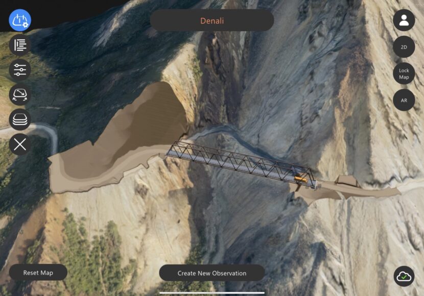
Computer generated image of the bridge to be built over the landslide at mile 45 of the Denali National Park Road. (National Park Service)
The expected completion of a bridge on the Denali Park Road has been pushed back from 2025 to 2026. The 90-mile road into Denali National Park remains closed at about the halfway point, where it crosses a melt-driven landslide that has obliterated the road.
Denali National Park public affairs officer Sharon Stiteler says the new timeline is primarily the result of a geotechnical issue.
“The discovery of more clay than was anticipated on the west side of the project,” she said. “Originally it looked like it was going to be 30,000 cubic yards of clay that was going to be excavated, and now it looks like it’s going to be 80,000 cubic yards, and that’s a significant change.”
The 475-foot bridge — expected to cost $100,000,000 — will span a melting rock glacier in Polychrome Pass that crosses the gravel road at mile 45. The road closed in 2021, after the landslide began moving too fast for maintenance crews to keep up.
“It got to the point of calculating how far they had to go to pick up the gravel, how much it was going to take to get out here to be able to maintain the road and make it safe enough for drivers to go across,” Stiteler said.
Looking west across the Pretty Rocks landslide on May 5th, 2023 (Dan Bross/KUAC)
Park science and resources team leader Dave Schirokauer underscores the challenging alpine terrain the section of the Park Road traverses, and how it’s changed since the road was built.
“They probably had no idea they were building a road across a rock glacier. It was completely inactive back then and it wasn’t really a problem until 2016, and so 1930 until 2016, it was a great road and just a little bit of climate warming that’s occurred in that era, along with the disturbance of creating a cut through here, really woke up this rock glacier.”
Park engineer and bridge project manager Steve Mandt underscored the scope of the bridge project.
“Just a massive amount of engineering and detail and thought goes into this,” he said.
Mandt says the plan that calls for incrementally building the truss-style bridge across the slide without any underlying support.
“Starting at both the east and the west and then progressively work toward the center, so they will at some point be assembling bridge kind of out in space kind of hanging over the valley below,” he said.
Heat dissipating thermosiphons will protect ice beneath the rock where the bridge’s abutments will be stand on either side of the slide.
Work on the bridge across was supposed to start in May, but that’s been pushed to July. Bridge contractor Granite Construction began mobilizing in the park this spring and is in the process of building a 50-worker camp in a gravel pit at mile 27 of the Park Road.
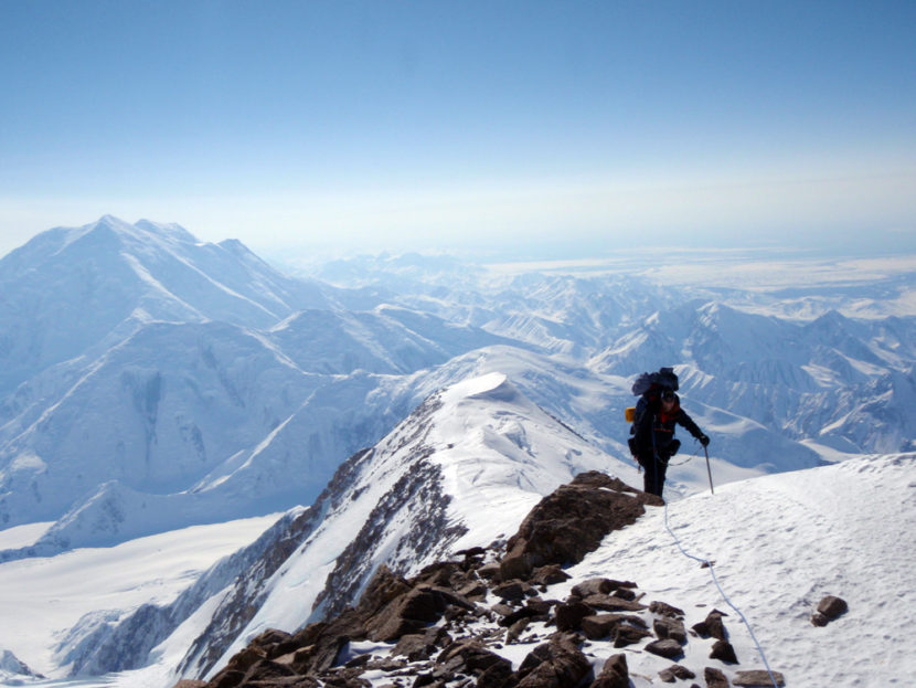
A climber on Denali’s West Buttress route. (Photo courtesy of the Alaska Air National Guard)
Mountaineering rangers rescued a climber on Saturday who had fallen from a 16,000-foot ridge on Denali late Friday night.
According to a Denali National Park and Preserve release, 24-year-old Tatsuto Hatanaka of Japan fell more than 1,000 feet from the mountain’s West Buttress to the Peters Glacier. Hatanaka’s climbing partner witnessed the fall but could not see or get to the place where he came to rest.
The Park Service sent its high altitude helicopter to look for Hatanaka, and the Alaska Rescue Coordination Center dispatched a C-130 plane. Hatanaka was spotted, but clouds prevented the helicopter from getting to him.
Park mountaineering rangers worked the rescue on the ground, and a ranger evacuated Hatanaka from around 15,000 feet early on Saturday.
Hatanaka suffered only minor injuries.
Close
Update notification options
Subscribe to notifications
Subscribe
Get notifications about news related to the topics you care about. You can unsubscribe anytime.