Louie's has eight rotating beers on draft. (Photo by Lisa Phu/KTOO)
Abby Trucano, 32, runs Louie's Douglas Inn. (Photo by Lisa Phu/KTOO)
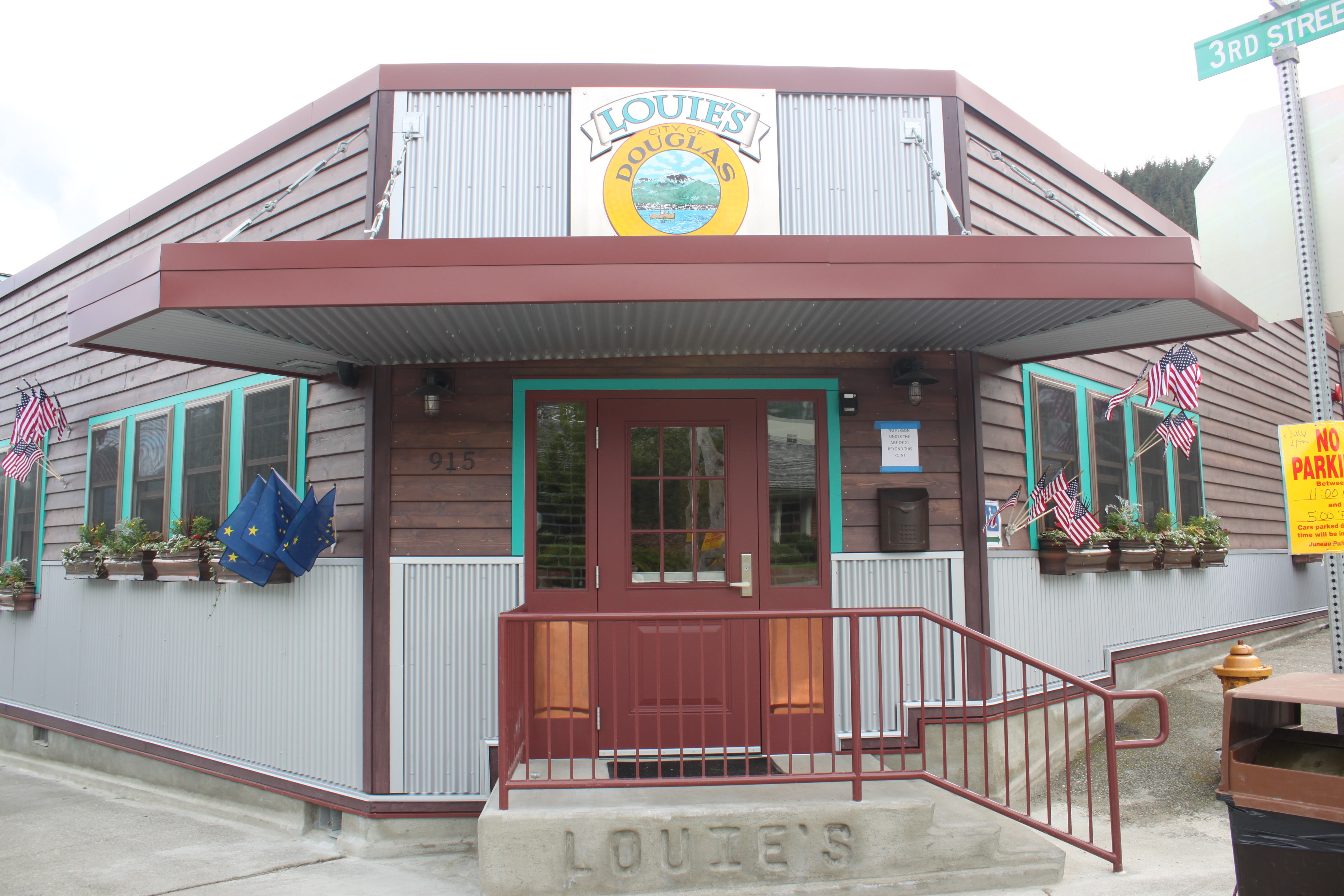
The new Louie's Douglas Inn opened its doors July 1. (Photo by Lisa Phu/KTOO)
For the interior look of Louie’s, Trucano sought inspiration from Douglas’s mining history. This table, like the bar, has a copper top. (Photo by Lisa Phu/KTOO)
Louie’s Douglas Inn opened on July 1 and co-owner Abby Trucano says it was a busy night.
“Our first night we rang up just a little over 500 tickets,” she says.
The bar, formerly called PP’s Douglas Inn, was seized by the Internal Revenue Service a year ago. The previous owner, Patrick Peterson, failed to pay almost a million dollars in taxes since 1999.
Trucano and her parents, North Pacific Erectors, Inc. owners James and Arbe Williams, successfully bid on the bar for about $145,000 during a public auction last August.
“We just kind of started with drawings on bar napkins and went from there. I’m partners with my folks Jim and Arbe and we each played a pretty big part in designing this place. I kind of took the lead on all the bar equipment, my dad took the lead on all the building and my mom’s amazing with designing stuff and picking out colors, so that was her job,” Trucano says.
The new Louie’s has brick walls, a copper-topped bar, an outdoor patio and everything is accessible by wheelchair.
“The whole place is ADA compliant, which is why you see so much space behind the bar, which actually works great for busy nights where you have multiple bartenders,” Trucano says. “But same with the bathrooms, the bathrooms are a lot bigger than what people were used to. We’ve got an access ramp. Before there wasn’t a way for people in wheelchairs to get here, so now they can.”
The bar has eight rotating beers on tap and if you’re hungry, hot dogs are available.
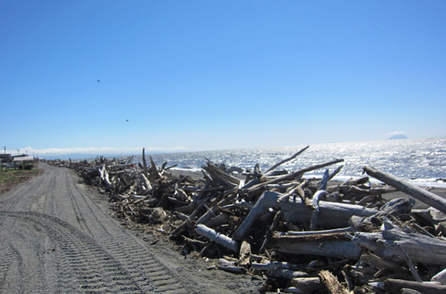
The beginning of the Shaktoolik coastal berm. (Photo by Anna Rose MacArthur/KNOM)
For years agency reports have listed Shaktoolik as eroding with immediate need for relocation. But without government funding, little action has been taken and erosion has progressed. Now the people of Shaktoolik are taking matters into their own hands and building a coastal berm to protect their community.
A four-foot high pile of driftwood lines the coast of Shaktoolik. It stretches one mile from the first house to the dump. The barrier is the city’s first step in building a coastal berm, and it is the community’s first defense for fall storm surges.
Harvey Sookikyak is one of the crew members constructing the berm. “If we try and wait for any kind of federal money, then it’s going to take more than a while to get this thing started,” he said, explaining the reason for the project. “So we decided it’s time for us to do something on our own.”
Coordinating the project is Eugene Asicksik. He’s the Mayor of Shaktoolik and the Vice Chair of the Shaktoolik Native Corporation. “There has been a number of agencies that have come up with plans but there’s been no money to actually start,” Asickik said. Those plans include evacuation roads, evacuation centers, and even relocation.
Over the years, Asicksik said a parade of government and private agencies have landed in the community to assess the erosion. He says they investigate, write a report, and leave.
“But again there is no money,” Asickik repeated. “That’s where we’ve taken initiative upon ourselves.”
That initiative is building a coastal berm. Over the past two years the community has saved and raised money to build it: $120,000 from the Norton Sound Economic Development Corporation in community development funds and $500,000 from NSEDC in an outside entity grant.
Asicksik said they are going to work until the money runs out— about three months. The funds will pay for labor, equipment, and fuel. It will not pay for an engineer.
Instead, Shaktoolik is basing the berm’s design off a blueprint from the Department of Transportation. The DOT had intended to construct a vegetated berm in Shaktoolik as an experiment for other eroding communities. Shaktoolik lifted that design, just without the vegetation.
“The money doesn’t allow it,” Asicksik said.
DOT coastal engineers Harvey Smith and Ruth Carter drafted the design and support the community’s efforts.
“They’re kind of taking our idea and making it happen in a bigger way than what we could do with our little grant,” Ruth Carter said when asked about the community’s self-engineering.
The berm will consist of a driftwood pile, embedded with gravel, backed by a gravel mound. The materials come from the Shaktoolik coast.
Though the community is paying to construct the berm, if the barrier gets damaged, the state or FEMA—the Federal Emergency Management Agency—might be responsible for repairing it.
Jeremy Zidek is the Public Information Officer for the Alaska Division of Homeland Security and Emergency Management and explained, “This berm, if it was owned by the city, it was properly engineered and maintained as a protective measure for the community, it can be eligible under public assistance program.”
The berm’s construction is in its second week. To date, the workers have piled the driftwood and finished cutting a road to begin hauling the gravel.
Gesturing to the berm’s beginning, Asicksik said, “Yes, we could just sit here and see what happens. But I can’t. I personally can’t. So in a way we are taking our own fate.”
Asicksik said he does not know how long the berm will last. At best, he says the barrier will prevent a surge from cresting into the community. If anything, he said, it will buy the community time— time to remain in Shaktoolik or just time to escape the storm.
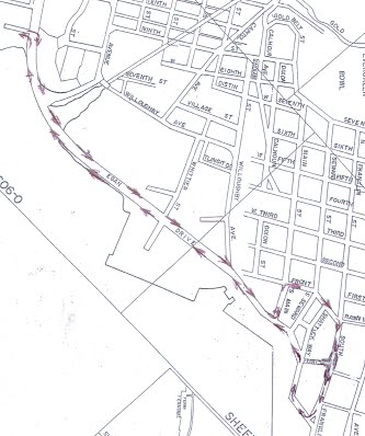
2014 Parade route map. Courtesy Juneau Fourth of July Committee.
Juneau’s Independence Day parade starts at 11 a.m. Friday.
The staging area is the Alaska Labor Department building parking lot at the corner of Egan Drive and the Juneau-Douglas Bridge.
The parade will start up the mountain side of Egan Drive, turn left on Main Street, right on Front, down South Franklin Street to Admiral and Marine Way and back on the waterside of Egan Drive.
This year’s theme is “I love a parade.” Grand Marshal is Dick Garrison, usually seen playing his trombone in the Fourth of July marching band.
After the Juneau parade, a number of floats will cross the bridge for the Douglas parade, followed by activities at Savikko Park.
Juneau police will be out in full force for the entire holiday weekend, says Lt. David Campbell.
We have one guy that’s on family medical leave, but pretty much every sworn police officer, from the chief of police to the newest rookie, is scheduled to work this weekend.”
Campbell reminds parade-goers and partiers that the open-container law is still enforced, even on the Fourth of July.
The sale was announced in November and the $170 million purchase closed on Tuesday.
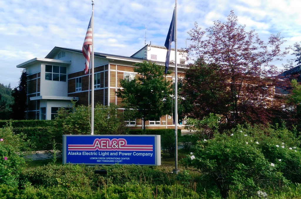
At closing, Avista Corp. issued about 4.5 million shares of common stock to Alaska Energy and Resources Company shareholders at just under $32.46 a share. AERC is AELP’s parent company.
Avista is a mid-size utility that sells electricity and natural gas to nearly 700,000 customers in eastern Washington, northern Idaho and parts of Oregon. With the purchase of AELP, Avista Utilities acquires an additional 16,000 electric customers.
AELP Consumer Affairs Director Debbie Driscoll says they will not see any changes in day-to-day operations in the short term.
Part of the contractual agreement was that when the deal closes everything remains as is or better for the next two years,” Driscoll says.
That includes retaining AELP’s Juneau headquarters and its more than 70 employees.
Avista Communications Manager Jessie Wuerst says Juneau may not be the company’s only entry into Southeast Alaska.
We’re an investor-owned utility, so we’re always looking for opportunities to bring value to our shareholders and Southeast Alaska is certainly an area that has opportunities in it,” Wuerst says. “So we’re looking.”
She says 51 percent of Avista power generation comes from renewable sources, including hydroelectric, wind and biomass. Avista also owns part of a coal-based generation plant in Montana.
Avista started as Washington Water Power on the banks of the Spokane River in 1889.
AELP was founded in 1894. The Corbus family bought into the utility in 1896 and has been majority owner since.
When former president Bill Corbus announced the Avista agreement in November, he said the company provided the best cultural fit.
Driscoll describes her fellow employees as excited about the merger, especially for the financial resources the bigger company brings.
“We’ve just expanded our resources significantly. There are changes in the industry, innovative improvements in the industry, smart grids, things that we can possibly now afford and maybe before it would have been too much of an impact to our customers from a rate standpoint,” she says.
AELP operates Snettisham and Lake Dorothy hydroelectric facilities as well as several smaller hydro projects and back-up diesel generation.
Note: Story updated at 9:40 a.m. to clarify that the no-change clause in the Avista agreement applies to daily operations.
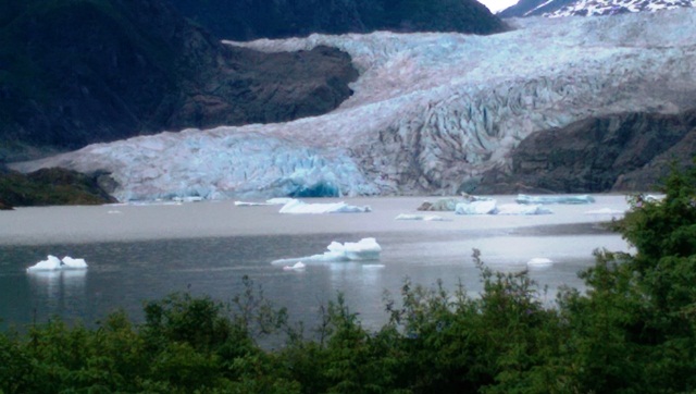
The Mendenhall Hall Glacier can calve and ice bergs can roll at any time, posing a danger to people on the lake. (Photo by Rosemarie Alexander/KTOO).
Water is still rising in Suicide Basin on the Mendenhall Glacier, but if or when it will release isn’t predictable.
Suicide Basin is a natural collector of rainfall and snowmelt, and is dammed by the glacier. The dam has broken the last three summers, causing various levels of flooding on Mendenhall Lake and Mendenhall River.
The National Weather Service said on Friday that a visual check of the basin indicates the amount of water already exceeds 2012 levels when the dam released, and a jökulhlaup could happen at any time.
Jökulhlaup is the Icelandic name for a glacial outburst flood. According to the weather service, it takes one to two days for water from Suicide Basin to affect levels in Mendenhall Lake.
A pressure sensor in the basin shows when it starts draining, but can’t predict the volume of water that may be released, or whether it will come as an outburst or slow release.
The U.S. Forest Service is warning kayakers, rafters and hikers to be smart on and around the lake, due to potential flooding.
Mendenhall Glacier Visitors Center naturalist Laurie Lamm says the glacier poses a danger at any time.
The face of the glacier is never a safe spot to be, because the glacier calves without warning. And if you’re close to the face of the glacier there are a couple different potential dangers. There’s the actual piece of ice falling on you, the ice popping up from underneath, or the wave that’s created by the ice. It’s not a safe spot to be,” Lamm says.
Commercial operators must file an annual operating and safety plan with the Forest Service that includes the distance their boats will stay from the glacier.
“There isn’t a Forest Service standard in our management plan that says you shall stay back X-amount of feet, so it’s recommendations,” says Natural Resource Specialist Jessica Schalkowski.
Four commercial companies are operating on the lake this year. Depending on the tour, Schalkowski says, the plans range from 300 feet to 600 feet from the face of the glacier, and 150 feet from ice bergs.
Alaska Travel Adventures offers a Mendenhall Lake trip from Skater’s Cabin beach to Nugget Falls. Adventures Tours Manager Niles Hansen says the operating plan recommends the 15-passenger canoes stay 300 feet from the face of the glacier, but they remain about a thousand feet back.
“We’re allowed to go closer, but with our canoes we just don’t feel like it’s safe,” Hansen says.
Schalkowski says it’s the inexperienced, unguided boaters that cause concern.
“Be it somebody that has a kayak personally or has rented a kayak,” she says. “They’re not with a guide that can kind of direct them to stay back from some of those dangers or recognize some of those hazards.”
The general rule of thumb: The farther away you are from the face of the glacier or ice bergs, the safer you are.
Close
Update notification options
Subscribe to notifications
Subscribe
Get notifications about news related to the topics you care about. You can unsubscribe anytime.