Weather

It’s ‘all hands on deck’ as second snowstorm buries Juneau

A plow drives down a street on Douglas on Monday, Jan. 22, 2024. (Clarise Larson/KTOO)

Update: Jan. 22, 6:45 p.m.

Juneau schools are closed Tuesday. Students will have a remote learning day. City facilities will also close.

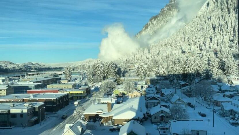
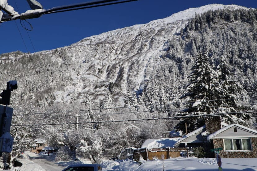
Thane Road will close at 8 p.m. due to avalanche risk. Officials will reevaluate road conditions Tuesday morning.

Original story

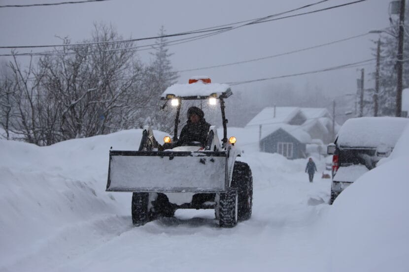
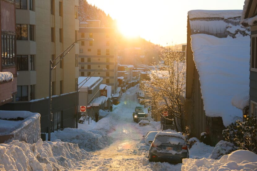
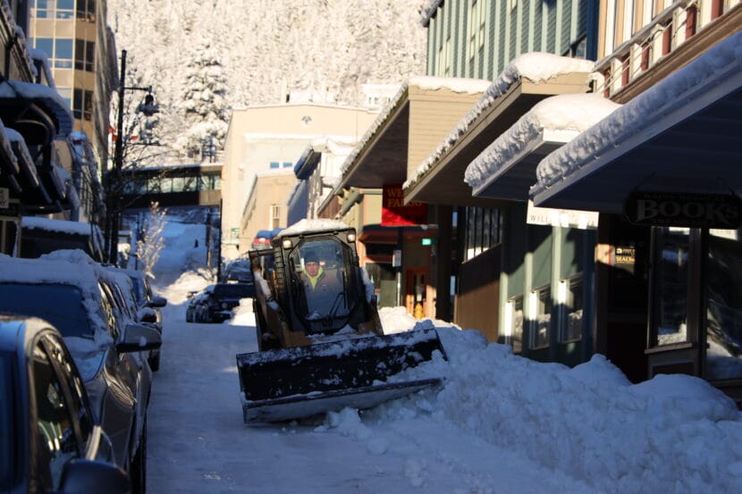
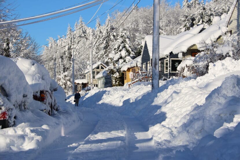
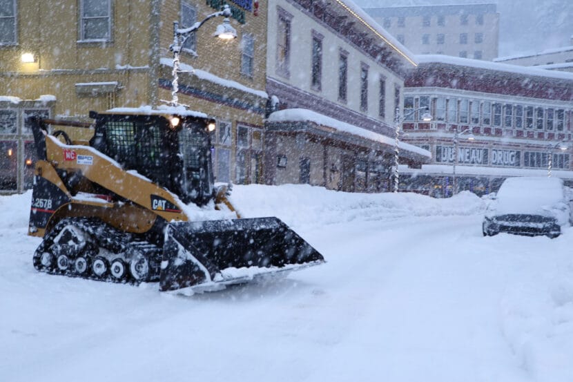
Less than a week after Juneau got buried under nearly 30 inches of snow, a second storm is triggering school closures, clogging roads and running plow drivers ragged. 

As the snow kept piling up in Juneau on Monday — 16 inches since Saturday night — Denise Koch, the city’s director of Engineering and Public Works, said keeping up is an all-hands-on-deck situation.

“CBJ streets crews are out doing everything they can. Our water utility is out doing everything they can to do things like try and keep fire hydrants clear,” she said. 

The Juneau School District shifted to remote learning on Monday and Tuesday and City and Borough of Juneau offices were closed due to the snow. 

Koch said the city is fully staffed with plow drivers and contracted help, and drivers have been working night and day. She said two city loaders are out of commission, but that’s been the only equipment hiccup so far. 

Independent plow drivers have also been working long hours to clear private driveways and roads. Brian Clasmeyer said he’s been plowing his routes in the Valley twice a day. 

With constant snow and fluctuating temperatures, he said it’s hard to keep up.

“When it’s been snowing for several hours and then the temperature changes, and now it’s 30 degrees and it’s starting to get wet. Then it’s really difficult to remove,” he said. “And then if it freezes the next night, especially if you have a berm, it’s almost impossible – you can break your plow.”

Debbie Driscoll with Alaska Electric Light and Power or AEL&P, said there had been no reported power outages as of Monday afternoon. 

“We’re — knock on wood — not really seeing anything right now. It’s cold, so trees tend to stay in place when the ground is frozen,” she said. 

Driscoll said that warming weather in the coming days could bring some outages.

Capital City Fire/Rescue Assistant Chief Sam Russell said the department had not had any reports of roof cave-ins as of Monday morning. Koch said how much weight a roof can handle depends on factors like pitch, age and location.

“People ask us questions about, you know, whether or not they should shovel their roofs. And it’s not, unfortunately, it’s not one-size-fits-all sort of answer,” she said. 

The city does offer guidance on its website to help residents assess the potential for roofs to collapse.

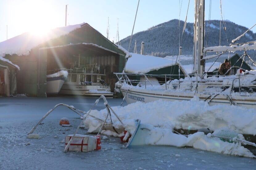
Meanwhile, Juneau Harbormaster Matt Creswell said there have been no reports of boats sinking yet — but he strongly encouraged boat owners to go shovel their boats if they can get to the harbors safely. 

“At this rate, the snow is going to keep coming, and it’s getting heavier and heavier,” he said. “And we’re starting to get really concerned.”

Last week at Aurora Harbor, three boats sank under the weight of the snow. Three more were saved just in time.

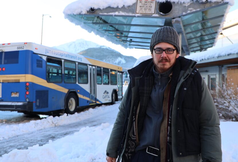
Capital Transit will run winter route detours until midnight. There is no service up Cordova Street to Cedar Park on Douglas Island, or on Franklin and Fourth streets downtown. 

Anna Canny contributed reporting to this article.

This story has been updated. 

Juneau’s avalanche danger is rising as Weather Service extends winter storm warning

Snow covers a swing set outside Harborview Elementary School on Tuesday, Jan. 16, 2024. (Clarise Larson/KTOO)

Update — Jan. 23, 9:15 a.m.

A winter storm warning for Juneau has been extended until 3 a.m. Wednesday.

In a Tuesday morning update, the National Weather Service said that even more snow is expected to fall through Tuesday and into early Wednesday morning.

There will be a mix of wet, heavy snow and freezing rain as temperatures start to rise, with the potential for 9 to 16 inches of additional snow accumulation before the storm ends. The heaviest snowfall is expected on Tuesday morning. 

Juneau’s urban avalanche advisory was set to high again Tuesday, with the likelihood of avalanches increasing.

More than 19 inches of snow has fallen at the National Weather Service office since the storm began over the weekend. That much snow could create avalanches that are “very large to nearing historic,” the advisory said. 

“It’s hard to predict how large these events could be,” wrote city avalanche forecaster Tom Mattice. “I don’t think we have enough snow to hit Egan Drive yet although we are nearing volumes that could begin to endanger homes.”

The avalanche advisory recommends that people avoid avalanche terrain, even in the city.

“Today is one of those days as an individual you need to make your own decisions and stay safe by simply not spending time in avalanche zones,” Mattice wrote.

Maps of Juneau’s urban avalanche zones can be found on the city’s website.

Original story

Heavy snowfall in Juneau is expected to continue through Monday night and into Tuesday afternoon.

The storm has already dumped around 16 inches of snow since it began on Saturday evening. Now, the National Weather Service has issued a winter storm warning saying that another 10 to 14 inches could fall before the storm subsides.

Meteorologist Nathan Compton said the rate of snowfall hasn’t been unusual — but the duration is.

“That’s due to a front basically sitting over Juneau all the way to Pelican,” he said. “It’s not moving. If it were to move north, we would get rain. If it were to move south, we would really limit the amount of snowfall we get. But it’s really just parked over us.”

As the snowfall continues, temperatures will warm across the Panhandle. Freezing rain has already started to fall between Wrangell and Kake and up to Yakutat. 

Temperatures in nearby communities like Gustavas, Hoonah, Pelican Island and Elfin Cove are expected to warm up first, ushering in a blend of snow and rain. That wintry mix will reach Juneau later this week, and the rain could bring slick conditions and even more challenges for snow removal. 

“We’re going to be sitting right at that 32, 33 [degree] mark. And so as soon as it hits the snow, it’s probably going to refreeze, you’ll get that crust,” Compton said. “That’s going to be on top of anything that’s already fallen.  So things are going to be pretty difficult to move out there.”

That mixture of rain and snow, paired with rising temperatures, can also elevate avalanche risk. 

Monday’s urban avalanche advisory is high. There is the potential for large avalanches, but no calls for evacuations at this time. Avalanche danger will likely remain high for the next several days as the snow settles and temperatures continue to warm up. 

People living in avalanche zones should continue to monitor the advisory at https://juneau.org/emergency/current-advisory.

How wind causes avalanches, even after the snow stops falling

Still from a video of an avalanche in Juneau, Alaska on Jan. 16, 2024. (Courtesy of Tempest Smith-Marshall)

A winter storm over the holiday weekend dropped more than 30 inches of snow on the mountains that surround Juneau. A fresh dump of snow like that can set the stage for avalanches.

“The snow piles up, and it can’t quite stick to the sides of the slopes. So it can avalanche during a storm,” said Wendy Wagner, director of the Chugach National Forest Avalanche Information Center.

But Juneau’s recent avalanches came down well after the snow had stopped falling. On Tuesday morning, people captured dramatic videos of an avalanche on the Behrends Path on Mt. Juneau coming down under bright, clear skies. Wednesday night, another Behrends slide left cars and houses dusted in up to two inches of snow. 

Wagner said these kinds of sunny-day snow slides happen often — because snowfall isn’t the only ingredient in an avalanche. 

“The winds can actually create their own avalanche cycle,” she said. 

When wind blows across a ridge, it moves snow around, picking it up from the windward side and dropping it on the leeward side, where it forms thicker, heavier drifts. 

And it doesn’t take a strong wind to start moving the snow. 

“If you have, say, a foot or two feet of nice, loose powder, it’ll only take maybe 20 mile an hour or less winds to pick up that snow and put it somewhere else and pile it up,” Wagner said. “The wind can basically create its own snowstorm on a slope.”

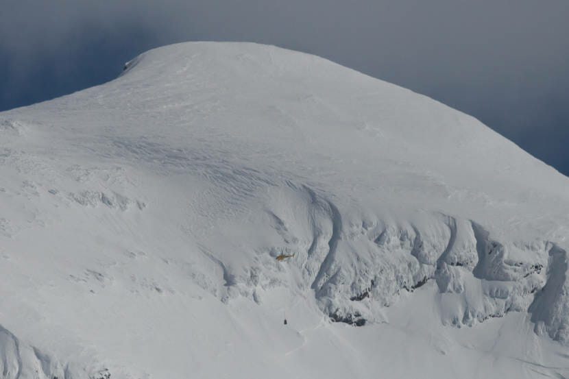
And the right kind of wind storm can actually deposit snow faster — up to 10 times faster — than a real snow storm, where snow falls from the sky. 

“So you can have winds for a few hours,” Wagner said. “And if they’re just right, they can make an avalanche problem pretty quickly.”

Juneau’s recent storm left a lot of cold, dry powder that was easy to blow around. And after the storm subsided, strong winds followed. 

Moderate winds on Tuesday loaded up the avalanche paths on Mt. Juneau. Then, on Wednesday and Thursday, the winds got even stronger. The National Weather Service issued a high wind warning, predicting winds between 40 and 55 mph and gusts up to 70 mph.

Winds that fast move a lot of snow around. And strong winds change the quality of the snowflakes, too. 

“Snow grains often get broken up, just because they’re colliding with each other,” Wagner said. “They’re a little bit smaller, and so they can pack tighter.”

All those tiny particles bond closely together and form a dense layer of snow known as a wind slab, which puts pressure on the existing snowpack, 

“All of the sudden, you have this kind of more dense layer of wind drifting off snow that’s sitting on a less dense, more un-cohesive layer,” Wagner said.  “And that’s the perfect recipe for an avalanche.”

But Juneau residents know that an avalanche doesn’t happen every time a strong wind blows. Mike Janes, an avalanche forecaster with Alaska Electric Light and Power, said this week’s avalanches were also caused by problems deep in the snowpack.

“The main reason is that we have kind of a series of these weak layers, with crusts and sugary snow between them,” he said.

Mike Janes and Jossline Aranda-Jackson head out to perform avalanche tests near the top of Mount Roberts in April 2023. (Anna Canny/KTOO)

In the middle of this weekend’s snowstorm, a spell of freezing rain formed a crust of ice on the snowpack, Janes said. And even deeper down, Juneau’s snowpack has layers of sugar snow,  a type of large, angular snow grain that doesn’t stick well with the grains around it. That led to weaker bonds in the snowpack.

So when the wind built a heavy slab in the Behrends path, it tested those bonds. And it broke them, triggering an avalanche.

Wind is a major factor shaping avalanche risk, but Janes said it’s extremely hard to monitor. In Juneau, though, avalanche forecasters can use the National Weather Service’s Juneau Airport Wind System to get wind speed measurements for the ridges of Mt. Roberts, Eaglecrest and Sheep Mountain to refine their forecasts. 

Avalanche control above Thane Road on March 18, 2021 in Juneau, Alaska. (Photo by Rashah McChesney/KTOO)
A helicopter used for avalanche control above Thane Road on March 18, 2021 in Juneau, Alaska. (Photo by Rashah McChesney/KTOO)

Janes says that’s critical because wind’s role in avalanche’s really depends on its speed, which varies widely across Juneau’s microclimates. Winds between 40 and 60 mph are ideal for building wind slabs, but stronger winds, like the 80 to 100 mph Taku winds that happen along Gastineau Channel, can actually push snow off the ridge. Sometimes, the snow even sublimates back into the atmosphere. 

“So like sometimes Thane Road’s more of a wind tunnel,” Janes said. “And a lot of times that will reduce avalanche activity, in some ways, because it’s doing so much stripping.”

Farther up the channel, Mt. Juneau is more sheltered. The winds are more likely to stay in a 40 to 60 mph range, which moves the snow around without blowing it off the mountain.

And that puts Mt. Juneau in the sweet spot for wind-driven avalanches.

Juneau digs out from massive winter storm

Downtown Juneau on Tuesday, Jan. 16, 2024. (Clarise Larson/KTOO)

A winter storm dumped nearly 30 inches of snow over the holiday weekend in Juneau. On Tuesday morning, residents and city officials were just beginning to dig out. 

For some, the aftermath meant spending Tuesday morning shoveling their driveways, or figuring out what to do with their kids on their snow day.

Jerry Eldemar makes heart-shaped snow sculptures in downtown Juneau on Tuesday, Jan. 16, 2024. (Clarise Larson/KTOO)

Others, like Robert Jared Lewis, spent the morning outside, waiting for the downtown library to open. He said he’d been waiting since about 7 a.m. after spending the night at the city’s warming shelter.

“For two months I just slept outside because I didn’t want to go over there to the warming shelter,” he said. “But it just started getting too cold.”

Robert Jared Lewis stands outside near the downtown Capital Transit center on Tuesday, Jan. 16, 2024. (Clarise Larson/KTOO)

Lena Gilbertson was walking her dog, Diya, along the seawalk on a thin path dug through the deep snow. Both wore coats against the wind from the channel. Gilberston says the storm was much larger than she expected. 

“I don’t remember one like this in quite a while,” she said. “I’m on day two of work being canceled.”

Diya, a 1-year-old Dalmatian, wears a coat outside while on a walk with her owner, Lena Gilbertson, downtown on Tuesday, Jan. 16, 2024. (Clarise Larson/KTOO)

A scattering of people were walking downtown Tuesday morning surrounded by the high banks of snow piled along the streets. Many were walking to the Alaska State Capital. Tuesday marked the start of the legislative session. Juneau Sen. Jesse Kiehl said he spent his weekend doing what most people were doing. 

“It was a lot of shoveling — a lot of shoveling,” he said. “ I shoveled off my walks, the neighbors, opened up the alley. You know, push people’s cars up hills and around corners when they got stuck downtown – it happens.”

A bobcat plows snow downtown on Tuesday, Jan. 16, 2024. (Clarise Larson/KTOO)

Down at the harbor, three boats had sunk completely under the weight of the snow. Harbormaster Matt Creswell said three more were saved just in time. No pollution has been detected so far. 

“In my time in Juneau this is the worst I’ve seen it,” he said. 

A boat that sunk at Aurora Harbor sits under frozen water on Tuesday, Jan. 16, 2024. (Clarise Larson/KTOO)

Creswell said the Douglas harbor was having problems too, and Docks and Harbors staff was working overtime to make sure no more vessels sink.

“We are expending resources that could be used right now to clear parking lots and docks,” he said. “We’re expanding those resources for boats that could have not sunk if people would have shoveled them off in time.”

Capital Transit will run winter route detours until midnight Tuesday, according to its website. There is no service up Cordova Street to Cedar Park on Douglas Island, and on Franklin or 4th Street in Downtown Juneau. Normal service will resume Wednesday. 

School will also resume on Wednesday, according to the Juneau School District. Buses will use snow routes in Douglas, downtown Juneau and Lena Loop. There will be no service to Thane.

Avalanche danger remains high in Juneau as slide dusts downtown neighborhood

A snow cloud over the Behrends neighborhood during an avalanche on Tuesday, Jan. 16, 2024 (Photo courtesy of Jennifer Whitcomb)

After more than 30 inches of snow fell over the holiday weekend, avalanche activity in Juneau is high. A Monday evening avalanche has blocked Thane Road, and a Tuesday morning avalanche dusted homes in the Behrends neighborhood. But no damage has been reported.

Emily Osborn was in her house on Glacier Highway when the Behrends slide came down.

“I think it was more dramatic since it was so sunny and a bluebird day outside,” she said. “All of the sudden, the lighting in my living room just kind of changed — it all the sudden went from bright sunshine to more of a dark golden color. And I looked out the window, and all I could see was snow.”

Osborn, who has lived in the house since 2019, said this is the first time she’s witnessed an avalanche come down. 

“It probably lasted for about 30 seconds. And it was just like a blizzard outside,” she said. 

The Behrends Path above Glacier Highway, where a small snow slide came down on Tuesday, Jan. 16, 2024 (Clarise Larson/KTOO)

The storm gave way to clear skies and cold temperatures Tuesday that are expected to persist until the weekend.

Juneau’s emergency programs manager Tom Mattice said it will take a few days for the weekend’s snow to bond with the existing snowpack. In the meantime, strong winds over the ridges could trigger more avalanches. 

“The area that slid on Behrends this morning was a very small piece of a much bigger avalanche path,” Mattice said. “So there is still danger up there. But I don’t believe that the depth [of snow] is enough to hit houses.”

It’s possible the neighborhood will get dusted again. Mattice said those smaller snow slides reduce the overall avalanche danger.

“The bottom line is the more snow there is, the farther it travels and the more destructive power it has,” Mattice said. “So it’s good to see some of that snow come off the hill, it reduces some of the concern.”

There was little visible evidence on Behrends Avenue of Tuesday morning’s avalanche, which came down after 30 inches of snow over the holiday weekend buried Juneau and pushed the urban avalanche advisory to “high.” (Clarise Larson/KTOO)

Juneau’s urban avalanche advisory was “high” as of Tuesday morning. The “extreme” level is typically reserved for scenarios that could damage houses. 

But Mattice said avalanche country should be avoided, especially the Flume Trail and the entirety of Gold Creek Basin and Perseverance Basin. 

And Thane Road reopened Tuesday afternoon after two natural avalanches on Monday evening brought down trees and at least two feet of snow that blocked the road. The Alaska Department of Transportation cautions drivers not to stop while passing through the avalanche zone.

This post has been updated to reflect that Thane Road has reopened.

Juneau schools are closed Tuesday after weekend snowstorm

A bobcat removes snow from a parking lot downtown on Monday, Jan. 15, 2024. (Clarise Larson/KTOO)

Juneau schools will be closed Tuesday after more than 20 inches of snow fell over the holiday weekend.

RALLY and after-school activities are also canceled, and there will be no remote learning.

A school board meeting on the district’s budget will be held by Zoom only, at 6 p.m.

Most city offices and facilities, including City Hall, will open at 10 a.m. Tuesday. Dimond Park Aquatic Center will open at 11 a.m., and Treadwell Arena will open at 12:15 p.m.

The Parks and Recreation Department’s youth basketball practice is canceled.

Capital Transit buses are running on winter routes until 12 a.m. Wednesday morning. The city expects to return to normal service on Wednesday.

This story has been updated to reflect Wednesday’s update from Capital Transit.

Site notifications
Update notification options
Subscribe to notifications