Weather

Southcentral Alaska cold snap and surging natural gas demand put supply in question

This oil and gas infrastructure is located in Cook Inlet. (Photo by Nathaniel Herz/Northern Journal)

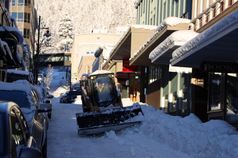
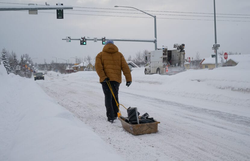
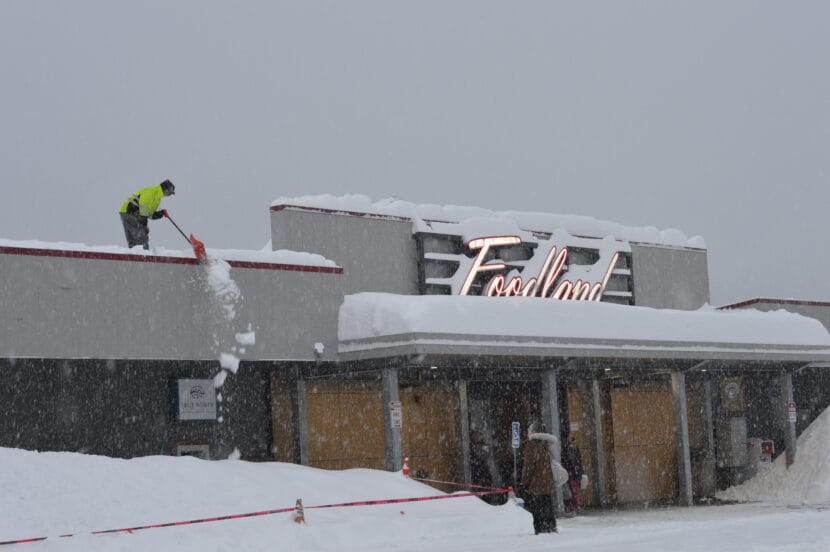
Cold weather has caused surging demand for natural gas in Southcentral recently and problems for the region’s gas utility, Enstar.

The Northern Journal reports that, as the cold in mid-January prompted gas-burning furnaces across the region to run more frequently, Enstar experienced an equipment failure that caused it to reduce output from a gas storage reservoir. And that created questions around whether Enstar would have to take special measures to meet the increased demand, including the possibility that customers would be asked to turn down their thermostats.

Temperatures in the region have dipped again, down to 15 below Thursday in parts of Anchorage and the Matanuska-Susitna Borough, and are expected to drop further.

Northern Journal reporter Nat Herz has been following the issue and explains that the focus continues to be on the availability of gas from a storage reservoir.

Listen:

This interview has been lightly edited for length and clarity.

Nat Herz: So right now, to keep ourselves warm and to generate our electricity in Southcentral Alaska, we are relying on gas coming directly out of wells in Cook Inlet. And we are also significantly relying on gas coming out of this natural gas storage facility operated by Enstar. I think about roughly half of the gas that we’re using right now is supposed to be coming out of this storage facility. However, as this cold snap got underway and they started pumping the bejesus out of this reservoir, all of a sudden, they started experiencing some problems. And in fact, I think at least one, if not two, of the wells started producing, not just gas, but sand. And your boiler does not run on sand. So because of these technical problems, it’s making it hard to flow out all the gas from Cook Inlet that we need to heat our homes and our businesses and run our power plants.

Casey Grove: And I think you noted in the story that you had at Northern Journal that this is connected to that larger looming shortfall that we’ve been hearing about, that people are talking about importing liquefied natural gas to meet demand in the future.

But this is happening right now. And, you know, I think we heard in those discussions that the average homeowner doesn’t need to worry about their house running out of gas. But maybe we do now? I mean, is that something I should be concerned about, as an Anchorage resident or, you know, a resident of Southcentral, that my house is just gonna be cold one day?

Nat Herz: I think it’s pretty clear that no one is going to, like, have their gas all of a sudden abruptly shut off. And I don’t think that’s what anyone has to worry about. I think there’s the potential… like this Cook Inlet gas storage facility right now is only able to produce about two-thirds of the gas that it is supposed to be able to produce at one time, because of the problems with these wells.

If that gets worse, or if the demand increases, because of the really intense cold snap, that’s where you might start, I think, to hear from both policymakers and from electricity producers and from gas providers, “OK, now we need to start talking about demand, and can people please turn their thermostats down to 60 degrees from 65?” And, you know, who knows how far that might have to go. But I think like those are the next sort of steps and things you might be hearing about.

Casey Grove: And I guess, with electricity generation in particular, toO, there’s like this patchwork of different interties that either, we don’t feed as much electricity somewhere else, or we could potentially bring, you know, power generation from other places to us, right?

Nat Herz: Yeah, so, for example, in Southcentral Alaska we have a number of different utilities that have a number of different types of power plants. And the most efficient that we have, on a sort of fossil fuel basis is, is these natural gas plants. But in Fairbanks, they do have the option to, instead of buying cheaper power that’s produced at Southcentral natural gas plants, they can actually stop using that natural gas power and burn, I think it’s like naphtha, or they also even have the option to go to diesel in the Mat-Su Borough with their electric utility. So there are ways that we can adapt.

Casey Grove: Do they also burn coal up in Fairbanks, too, though?

Nat Herz: Yeah.

Casey Grove: You mentioned the conversation around renewables. And it sounds like some folks in the utilities don’t think that that is a viable option for dealing with potential shortages, right?

Nat Herz: It’s a tricky conversation. I mean, this conversation started because the president of Enstar, John Sims, went to a public meeting last week and, unsolicited, made this comment about how we’re, you know, struggling to meet demand. “And you know what, wind and solar aren’t coming to the rescue,” (he said). And it was a little bit of a head scratcher. Like, this actually isn’t really relevant. It’s not like we have that stuff and it’s not working. And in fact, you look out and you see it the wind turbines spinning at Fire Island. Like that helps the cause.

I talked to Sims about this afterwards, and what he was saying is basically like, “You can’t count on that stuff on a day like this, like you can on a, you know, fuel like natural gas or oil.” His argument is, “Maybe we need to be thinking about that sort of base load reliable power that we can layer these other forms of renewables on top of.

I ran these comments past some of the advocates that we’ve been hearing from about the need to transition to renewable power, and they really are basically saying, “Enstar is kind of trying to rally the troops here, because their business model — Enstar is a privately owned company — their business model depends on people continuing to buy natural gas.” There’s going to have to almost certainly be liquefied natural gas imported, because we’re not going to be able to meet demand with Cook Inlet gas. And when that happens, it’s going to cost a lot of money to build the infrastructure that we need and to bring the cargoes in.

And in fact, there was recently a study that came out — a major, like, $1 million study from the University of (Alaska) Fairbanks that actually said the cost of putting in all of these renewables and all the battery storage that you’d need to make the grid resilient enough, is pretty much on par with what it would cost us to continue buying fuel for these natural gas plants. And I think there is a pretty compelling argument that if the costs are the same, why wouldn’t we want to set ourselves up to kind of generate our power locally rather than be sort of subject to the whims of these like global markets for petroleum products?


Update: Schools closed again as third big January storm dumps snow on Juneau

A bobcat plows snow downtown on Tuesday, Jan. 16, 2024. (Clarise Larson/KTOO)

Update — Feb. 1, 6:00 a.m.

Juneau schools are shifting to remote learning and city offices and facilities are opening late as yet another winter storm dumps heavy snow on Juneau.

The Juneau School District announced Thursday morning that in-person classes, after-school programs and RALLY had been called off “due to heavy snow and icy conditions on streets and sidewalks.”

University of Alaska Southeast also announced that it will be operating remotely on Thursday, and that all campus buildings are closed.

City offices and facilities will be opening late, at 11:00 a.m.

Just after 6:00 a.m., the National Weather Service office in Juneau tweeted that more than ten inches of snow had fallen there overnight, with light snow still falling.

Original story

A third and final January storm will pass over Juneau starting on Wednesday afternoon. It’s expected to dump 9 to 14 inches of snow overnight and into Thursday. 

The snow will also come with strong winds, with gusts up to 40 mph, which could create hazardous road conditions on Wednesday evening and Thursday morning.

The National Weather Service has issued a winter storm warning for Juneau, Haines, Skagway and Klukwan, effective at 3 p.m. on Wednesday. The heaviest snow should start in the late afternoon and continue through midnight.

Between 6 and 11 inches of snow is expected for Haines and Skagway. To the south, from Gustavus down to Sitka and Angoon, between 1 and 6 inches of snow is possible. NWS has issued a winter weather advisory for those communities. 

 A mix of snow and rain is possible as the storm picks up. Snow will likely start out heavy and wet before transitioning to drier, fluffier snow. 

Meteorologist Lance Chambers says the snowfall totals could vary based on the strength of cold winds coming in from the north, which will determine how much precipitation comes down as snow versus rain or freezing rain. 

“The cooler it is, the higher the snowfall ratio is going to be,” Chambers said. “And if it’s warmer you’re going to have lower snow ratios. So therefore it’s the same amount of water but less depth of snow.

Meteorologists will update their predictions for snow accumulations as the storm gets closer on Wednesday afternoon. 

Heavy snowfall and wind could damage boats, and boat owners should take care to secure their vessels and shovel off snow. According to Juneau Docks and Harbors, at least 8 boats have sunk under the weight of snow this month.

Alaskans see bitter cold, record-breaking snow and a winter defying El Niño predictions

A man pulls a sled full of shovels down Muldoon in Anchorage on Monday, Jan. 29, 2024. (Matt Faubion/Alaska Public Media)

Alaska has had quite a wintry start to 2024. The Interior’s seen temperatures nearing 60 degrees below zero. Parts of Southeast have gotten record-breaking snowfall. And Anchorage — often a microcosm of the state as a whole — has had a taste of all of it.

Simply put, Alaska’s winter is defying predictions that an El Niño climate pattern would produce a warmer, less-snowy season.

National Weather Service climate researcher Brian Brettschneider, from our Ask a Climatologist segments, says that while the snow is
notable — and yes, temperatures have been cold recently — we’re still living in an Alaska that’s warmer than it used to be.

Take Fairbanks, for example:

Listen:

This interview has been lightly edited for length and clarity.

Brian Brettschneider: The cold that they (Fairbanks) had the other day, which got down to minus 43, you know, now that happens about, on average, once or so per year. And historically it happened 10 or 12 times a year. So it can still happen, it can still get that cold, but much less frequency. And the deep cold, the 50s below (zero) used to happen every year, and now it may happen once a decade.

And this is probably going to be a little bit unpopular to state this, but in Fairbanks, the UAF outdoor thermometer and the Fred Meyer West outdoor thermometer tend to run a couple of degrees too cold. So when people are standing out there (taking pictures), and it says minus 40, it’s probably not quite minus 40. Still cold, but those have a little bit of temperature, inflation or, I guess, deflation.

Casey Grove: And even colder if you take off all your clothes except for a bathing suit, right?

Brian Brettschneider: Oh, definitely.

Casey Grove: So here in Anchorage, too, it’s been fairly cold. And in my time here, I don’t remember it getting colder than 15 below. But that’s about what we hit over the weekend. Is that notable? Is that a record or anything?

Brian Brettschneider: Really across much of the western two-thirds of the state, this is this is about a four-year cold snap. So it’s been about four years since we had a cold snap this intense and of this duration. So, you know, officially, the Anchorage International Airport has only been down to minus 8. But elsewhere around town, Merrill Field was minus 19. Campbell Creek Science Center was minus 24. And it’s going to get similarly cold here by the end of the week.

Casey Grove: I thought that we were going to have a warm winter. We were all worried that it was going to, like, rain or something in the middle of the winter. And the, you know, the snow forecasts were going to be low for this year, just based on the seasonal outlook from NOAA and the El Niño prediction. And yet here we are, you know, there’s been tons of snow, there’s been some real cold days. What happened?

Brian Brettschneider: Well, would you believe me if I said we are still in the warmest one-third of winters on record in Alaska?

Casey Grove: I know by now that I should believe you, but some people might not.

Brian Brettschneider: So for the month to date through (Jan. 28), Alaska is just slightly warmer than normal for the month of January. And we were half a degree warmer in the month of December. And those are against the 1991 to 2020 normal periods, which is much warmer than previous decades. So for recent years, this is kind of an average year. Historically, this is still quite a warm winter.

Really the most noteworthy part is the snowfall. In an El Niño winter, we typically were more likely to get some winter rain events. But we’ve really kind of threaded the needle this winter. When we have had storms come through, they’ve pretty much been all snow, and so we’ve been able to really pile up the snowfall.

Casey Grove: So, I mean, we’re sitting here in Anchorage, and it’s notable that it snowed as much as it did, and as cold as it was, and affected as many people as live here. But down in Juneau and in Southeast in general here recently they’ve seen a ton of snow, right?

Brian Brettschneider: Yeah, especially in Juneau. So January has now had 70 inches of snow, and that is the third snowiest month on record at the airport. But this is really an extreme amount of snow for the Juneau area. Now, they’ve really flipped the switch. They had their deepest snowpack in over 50 years just five days ago, and now it’s gone. And they’ve been setting record high temperatures. So while, on average, statewide, the last few days have been the coldest days since January 2020 — so in four years — that’s occurred while, you know, Sitka and Ketchikan have all set record high temperatures and are receiving lots of rain.

Waves of heavy rain could bring some flooding to Juneau this weekend

A person walks past a puddle in downtown Juneau on Friday, Jan. 26, 2024. (Clarise Larson/KTOO)

A warm front and waves of heavy rain are on the way to Juneau this weekend after two winter storms dumped more than 60 inches of snow over the last two weeks.  

Spencer Fielding, a meteorologist with the National Weather Service, said one to two inches of rain are forecast each day, starting on Friday and lasting through at least Monday. 

Temperatures are also expected to slowly rise to the 40s or even 50s leading into next week.

Fielding said the rain could mean flooding in places where snow is blocking drains.

“The big concern is that with the snow melting, there’s no place for it to run off,” he said. “So, it’s going to choose the path of least resistance which will be flowing down streets and trails.”

Tom Mattice, the city’s emergency programs manager, said the rain will likely mean heavier snow loads on houses and boats — and it will increase the potential for avalanches in Juneau.

“We expect to see continued activity. It could border on the urban front, but we hope that it’s small enough that we don’t have to worry about that in the urban environment,” he said.

On Wednesday, at least two avalanches came down on Basin Road and Behrends Avenue. But Mattice said there are still dry and weak layers deep in the snowpack that could give way and release an avalanche from the stress of the rain soaking the upper layer. 

“It definitely adds a lot of mass to the equation,” he said. “So anything that does get hit, gets hit with tremendous force.”

The Alaska Department of Transportation and Public Facilities announced Thane Road will close Friday at 6 p.m., and Mattice said that closure could continue through the weekend. He encourages residents to limit their time in avalanche terrain if possible.

Avalanche danger still high in Juneau, with at least 2 slides Wednesday morning

Still from a video of an avalanche in Juneau, Alaska on Jan. 16, 2024. (Courtesy of Tempest Smith-Marshall)

Two avalanches came down on Basin Road and Behrends Avenue on Wednesday morning. No damage or injuries have been reported, but Basin Road is closed at the Eighth Street intersection.

Avalanche danger in Juneau remains high after two winter storms dumped more than 60 inches of snow over the last two weeks.  

Later this week, the forecast calls for rain and warming temperatures, with the potential for highs in the 40s by the weekend. Avalanche forecaster Mike Janes with Alaska Electric Light and Power says those conditions could increase the risk of avalanches. 

“If it’s that warm, then it’s going to be raining to the top of Mount Juneau and Roberts and all those peaks,” Janes said.

And rain on snow can ramp up avalanche activity. 

Snow loads on the slope are heavy, and Janes says there are weak layers deep down in the snowpack, which could break loose and release an avalanche. Rain soaking the snow will add stress to those weak layers. 

“The only good thing is that if we can make it through the weekend without people’s houses getting hit or anything like that, then we’ll be, you know, kind of hitting the reset button on the snowpack,” Janes said.

Thane Road is also closed because of the potential for avalanches, though none have reached the roadway yet. It will remain closed until the Alaska Department of Transportation can do avalanche hazard mitigation, which is scheduled for Thursday morning. 

The city’s urban avalanche advisory remains high as of Wednesday morning. No official evacuation notice has been issued, but the advisory recommends that people avoid urban avalanche paths if possible.

Roofs collapse, boats sink under the weight of Juneau’s heavy snow

A partially collapsed roof at a warehouse on Channel Drive on Wednesday, Jan. 24, 2024. (Photo by Mikko Wilson/KTOO)

At least one warehouse roof and two residential porches have collapsed under the weight of Juneau’s heavy snow this week.

Capital City Fire/Rescue responded Tuesday afternoon after the back half of a warehouse roof caved in at a warehouse on Channel Drive. 

Both collapsed porches came down in the Mendenhall Valley. No one was injured in any of the incidents, but one family was temporarily trapped in their home after their porch collapsed.

Fire Chief Rich Etheridge said there’s not much the city can do to help people remove snow from their roofs, but the weight of the snow is approaching hazardous levels. 

“It’s kind of a gamble on how much snow a structure can take,” Etheridge said. “I’ve always used, you know, three feet of snow and I start pulling it off my residences. But there’s nothing scientific about that.”

The Mendenhall Mall closed on Wednesday to deal with the excessive snow on the building’s roof. The mall is expected to reopen by Thursday.

Workers shovel show off the roof of the Foodland grocery story on Tuesday, Jan. 23, 2024 (Photo by Anna Canny/KTOO)

Juneau’s second snowiest January

Two winter storms have dropped more than 60 inches of snow on Juneau, which ties the record for the city’s second snowiest January in 1982, at 69.2 inches. According to the National Weather Service, at least half of that snowfall — 35.4 inches — has stuck around at the airport. And it’s heavy. 

Based on its water content, meteorologist Rick Fristch said the current snow load in Juneau could exert nearly 30 pounds of pressure on a flat roof — but that would be less pressure on a pitched roof. Modern city building code requires that roofs are built to withstand more than that, but older buildings or poorly maintained structures are at risk of cave-ins.

And according to Fritsch, warming temperatures and rain over the next few days could increase that risk. 

“Snow is essentially a gigantic sponge,” he said. “And when it rains on the snow, there’s a certain amount of the water in the form of rain that’s going to be trapped by the snow.”

That waterlogged snow is heavier and harder to move. 

A sunken boat in Aurora Harbor on Wednesday, Jan. 24, 2024 (Photo by Mikko Wilson/KTOO)

The heavy snow also has the potential to sink boats. According to City Harbormaster Matthew Creswell, a total of eight boats have sunk over the course of the two January storms. At least five sank in a 24-hour period this week.

“We really, really, really need our vessel owners or boat watchers to come down and shovel these vessels,” Creswell said. “Because right now, the Coast Guard is overloaded with these eight sunken vessels, all of our local marine salvage companies are overloaded.”

KTOO’s Clarise Larson contributed reporting.

Site notifications
Update notification options
Subscribe to notifications