Weather

Juneau’s avalanche danger is high, and Thane Rd. is closed after multiple slides

Sam Cagle digs her car out of the snow on Douglas Highway on Monday, Jan. 15, 2024. (Clarise Larson/KTOO)

Update: Jan. 15, 7:30 p.m.

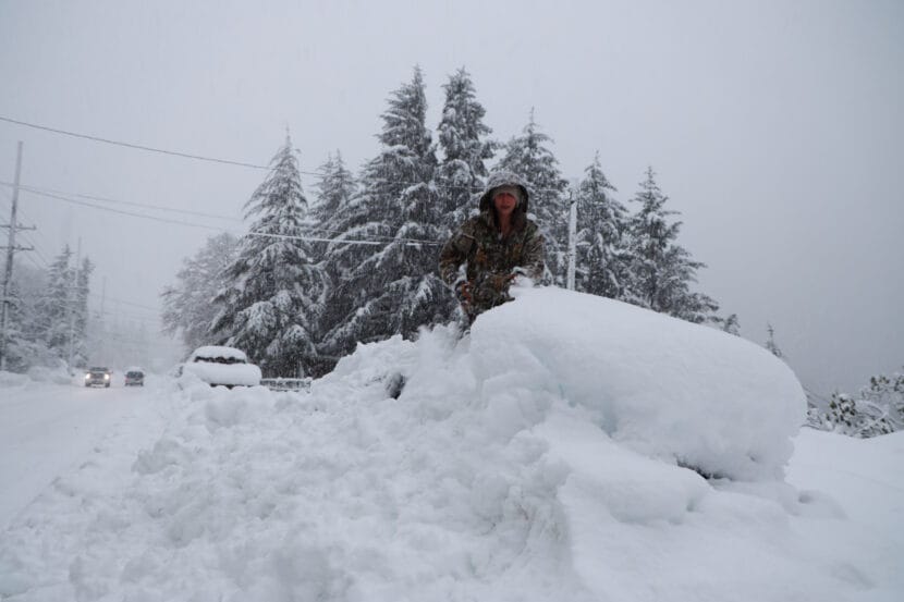
Thane Road is closed to all but emergency access after a number of slides came down on Monday afternoon and evening. Between 1.5 and 2 feet of snow are covering the road in the avalanche area, according to the city.

Alaska Department of Transportation spokesperson Sam Dapcevich said the department sent a plow truck through to create a lane for emergency access, but the rest of the road is closed through at least Monday night. 

“We don’t want our crews down there while the risk is still high and when we can’t see what’s going on up above,” Dapcevich said.

The department plans to do additional avalanche mitigation from noon to 2 p.m. on Tuesday. Thane Road’s avalanche gates will be closed during that time.

“If we feel like the risk is low enough, we would reopen the road until the mitigation work takes place,” Dapcevich said.

Original story

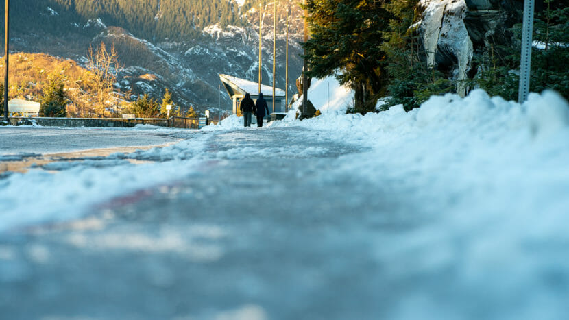
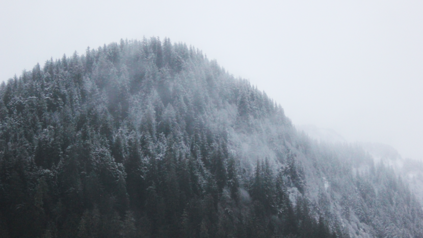
Juneau’s urban avalanche advisory is “high” on Monday, as a winter storm that dumped more than 20 inches of snow over the weekend is expected to continue through the evening.

The advisory says that avalanche activity is likely, with the potential for large snow slides. Avalanche country should be avoided for the next several days. But Tom Mattice, the city’s emergency programs manager, says avalanches are not likely to hit houses for now. 

“It could get into the urban perimeter. We could see powder clouds come through the neighborhood, we could see a random avalanche get out,” Mattice said. “But in general, I think that we’re still safe in the urban environment.”

According to the advisory, the snowfall came with warming temperatures. That created an “upside down” snowpack, with very cold, light snow on the bottom and heavier snow on top. And that snowfall came after a cold snap that created icy crusts on the existing snowpack.

Light, cold snow typically doesn’t bond well with the existing snowpack, which means it could give way and trigger an avalanche. 

“Right now, we have a couple of icy layers down deep in the snowpack — just really weak snow crystals,” Mattice said. “Now we’ve loaded them to a tremendous degree over the last couple of days. And the question is, how much can they take?”

The advisory said avalanche danger will likely decrease after the storm wraps up, and colder temperatures should help stabilize the mountain snowpack — but that people living in avalanche zones should keep checking the urban avalanche advisory web page for updates.

Katie Anastas contributed reporting.

This post has been updated.

Freezing temperatures, wind chill coming to Southeast this week

Ice covers roads and trails as temperatures drop to potential record breaking lows, December 16th 2022, Mendenhall Glacier, Juneau Alaska. (Photo by Paige Sparks/KTOO)

People in Southeast should brace for high winds and extreme low temperatures through the end of the week.

The National Weather Service issued a high wind warning for downtown Juneau and Douglas through tomorrow Thursday afternoon, and a special weather advisory warns of extreme low temperatures and wind chill across the region.

Temperatures are expected to start dropping rapidly Wednesday night and will continue to get colder through at least Friday morning.

Lows will be in the teens for most of the Panhandle. At higher elevations along the Haines and Klondike Highways, temperatures could reach 10 degrees below zero.

The strong winds will push temperatures even lower, especially in downtown Juneau and Douglas, where wind speeds could reach 25-30 mph with gusts of up to 60 mph.

Boats or loose property that might blow around should be secured. And residents should take precautions to prevent pipes from freezing or bursting.

2 bodies recovered from vehicle found snowbound on Steese Highway

The Steese Highway on Oct. 15, 2014. (Ian Dickson/KTOO)

Alaska State Troopers and state Department of Transportation workers recovered the bodies of two people Friday found dead in a snowbound vehicle on the Steese Highway at Eagle Summit. According to a trooper dispatch, the two were reported to have left Fairbanks on Tuesday headed for Circle.

DOT spokesperson John Perreault says a road crew from an area maintenance station headed up Eagle Summit in stormy conditions Wednesday morning and found three vehicles. Two of the vehicles were still running, but a third was buried in the snow, and the crew got no response when they knocked on the windows or tried the doors.

Perreault says the crew left to help the two other vehicles off the summit and then returned to check the third again.

“They couldn’t see inside,” he said. “The windows were frosted and tinted, and so they cleared the passenger doors. They even tried to pry them open.”

Perreault says the crew came off the mountain about six hours after first locating the vehicle Wednesday morning.

A State Trooper dispatch says they responded that evening and broke a window to get in and found two people dead inside.

“Because the weather I’m told at that time was 60 mile an hour winds, the Trooper and the DOT personnel came down off the summit and had to wait for the weather to clear up. And the vehicle was recovered with the occupants Friday morning,” Perreault said.

The Trooper dispatch says the bodies were transported to Fairbanks for identification and would then go to the state medical examiner for autopsy, adding that no foul play is suspected.

Strong winds are common in the Eagle Summit area, and the DOT has gates to close the highway when conditions warrant. Perreault says a road crew did not lower the gates after completing work around 4:30 PM Tuesday.

“They were open Tuesday night because the pass was clear when our guys came off shift,” he said.

Perreault says the DOT closed the gates Wednesday morning, as conditions had significantly worsened.

“And so traffic had gone over Tuesday night before they had come back on shift to make a determination,” he said.

Perreault says the incident and response will undergo review.

“Anytime tragedies like this happen, we want to make sure that we did everything we could, and we’ll be sure to put those sort of decisions through a process of review and to make sure we’re enabling our staff to protect the public as best they can,” he said.

Perreault encourages drivers to check weather reports and Alaska 511 for conditions, and to let someone know where they’re headed and be prepared with sufficient fuel, emergency supplies and equipment.

Murkowski visits Wrangell in wake of deadly landslide

Sen. Lisa Murkowski visits Wrangell on Wed. Dec. 20, 2023, one month after its deadly landslide. From left: Police Chief Tom Radke, Sen. Lisa Murkowski, Mayor Patty Gilbert and Amber Al Haddad. (Photo courtesy by Kara Hollatz)

Sen. Lisa Murkowski traveled to Wrangell last week to see the site of its recent deadly landslide.

While Murkowski was in town last Wednesday, she met with the fire department’s search and rescue team to talk about the town’s response to the Nov. 20 landslide and how Wrangell can stay safe moving forward. She also met with relatives of the five Keller family members killed in the slide and with Christina Florschutz, the sole survivor who lost her husband Otto that evening.

Murkowski said she was impressed by the dedication of the Wrangell Search and Rescue team as they described their teamwork after the fatal Nov. 20.

“It was actually quite inspirational to be listening to those who were on the ground, literally hours after this slide in the dark, in very, very tentative conditions,” Murkowski said.

Murkowski was born in Ketchikan and grew up in several Southeast Alaska towns, including Wrangell. She said she considers Wrangell home and she feels grief for the Wrangell community.

“It just hurt to look up the first glimpse of that scar on the mountain,” she said. “It was like just a cut through the body, to see that and to know the devastating impact and the loss.”

She said although the search may be over, the community will continue to face challenges like anxiety together. She said it’s important for her to continue to connect with people in Wrangell after they’ve been through so much.

“I just left Washington last night after votes and purposefully said I’m stopping here because I want the people of this community to know that they are not alone,” Murkowski said.

She said people in Wrangell are resilient and they’re used to doing it on their own, but people are stronger when they work together. She also said that she will continue to work with the people of Wrangell as they heal from their loss.

Update: Weather Service issues high wind warning for Juneau

Cars drive through mud and high water in downtown, on Sunday, Oct. 6, 2019, in Juneau, Alaska. (Photo by Rashah McChesney/KTOO)

Update — Dec. 12, 2:20 p.m.

On Tuesday, the National Weather Service issued a high wind warning for Juneau, effective through the early morning hours on Wednesday. 

The warning says Juneau could see winds from 25-35 mph and gusts up to 60 mph.

Alaska Electric Light and Power reported several outages out the road in Juneau on Tuesday.  One downed tree cut off power to homes near Tee Harbor and Amalga Harbor, and another caused an outage on Stephens Spur Road.

The power company says that more outages are likely as winds continue.

Damage to boats and other property is also possible as the storms continue. Juneau Docks and Harbors put out a reminder for boat owners to secure their mooring lines and ensure their balayage pumps are working as the rain and wind continue through the evening. 

Original story

The National Weather Service has issued high wind and flood watches from Juneau down to Ketchikan.

Meteorologist Grant Smith said several storms will pass over Southeast Alaska early in the week, bringing heavy rain and strong wind to the region. 

“What we’re looking at is just a series of strong low pressure systems moving into the Gulf that are going to be swinging in from the south over the panhandle,” he said.  

A flood watch is in effect from Monday evening through Wednesday morning for nearly every community in the region, including Juneau, Gustavus, Sitka, Wrangell, Petersburg, Ketchikan and Prince of Wales Island. 

In Haines and Skagway, some of that precipitation will come down as snow first — a winter storm warning is in effect for Monday. But by Monday night, rain is expected to pick up across the whole panhandle, bringing two to four inches by Wednesday.

The storms will also bring warmer temperatures, which could melt the snow that has accumulated across the region. Together, rain and snowmelt could cause flooding in low-lying areas, but Smith said water levels are generally pretty low across the region. That means lakes, rivers and streams will rise but may not break their banks. 

Rainfall will come with high winds in some places. A high wind watch is in effect Tuesday and Wednesday for Skagway, Juneau, Ketchikan and Prince of Wales Island. Sustained winds between 20 and 30 mph are expected, along with gusts up to 60 mph, which could bring tree falls, power outages and other wind damage. 

The combination of rainfall and strong winds means that isolated landslides are also possible on steep hillsides. 

“Do we expect them to happen? Are we forecasting them? No, we’re not,” Smith said. “It’s just that with the atmospheric conditions that we are forecasting, we have seen them in the past. So that’s a red flag.” 

The forecast will be updated weather.gov as the storms make landfall.

Lack of snow delays opening for Juneau’s Eaglecrest Ski Area

Snow dusts trees on a mountain in Juneau on Nov. 30, 2023. This week’s forecast doesn’t call for enough snow to open Eaglecrest Ski Area. (Katie Anastas/KTOO)

Juneau skiers will have to wait at least one more week to ski Eaglecrest. The city-owned ski area’s opening date has been tentatively pushed back to Dec. 9.

Eaglecrest had planned to open on Saturday. But at a Juneau Chamber of Commerce luncheon on Thursday, Manager Dave Scanlan said there isn’t enough snow in this week’s forecast. 

“Unfortunately, Mother Nature has been playing her way with us this past week,” he said. “We’re pushing off our opening day for one more weekend, hopefully.”

Scanlan said Eaglecrest’s high-efficiency snowmaking machines can be up and running as soon as temperatures drop to 28 degrees. And they have seven more of them this year, bringing the total to 22.

Scanlan says that investment has helped bolster sales. Last year saw record purchases of season passes, and nearly as many have already been sold this year.

“People now can trust and have faith that we’re going to be able to deliver a good product,” Scanlan said.

But Scanlan said that as winter temperatures rise and the cruise season extends, the ski area is also looking at new ways to attract visitors.

Scanlan told luncheon attendees that warming winters are one of the reasons the gondola, which the city bought last year, will be such an important addition to Eaglecrest. 

“It’s all about the sustainability of Eaglecrest, both from a climate sustainability and a financial sustainability standpoint,” he said. “As we have warm winter weather, the gondola is going to give us a lot of ability to not be so reliant on all our revenue coming in in the winter season.”

In an interview, he said the snow-making equipment runs best at 25 degrees or below. 

In the summer, Scanlan said, the gondola could help people get to hiking and mountain biking trails from a stop partway up the mountain. In winter, they could snowshoe or Nordic ski. And he said longer cruise seasons could even give some tourists a chance to ski.

“I think as we’re having boats arrive earlier in the spring, there’s going to be some great learn-to-ski packages being sold as some tour opportunities,” Scanlan said.

Scanlan said he thinks Eaglecrest could comfortably handle about 500 summer visitors per day. A traffic analysis is still underway. He said the goal is to open the gondola during the 2025-2026 ski season.

Site notifications
Update notification options
Subscribe to notifications