
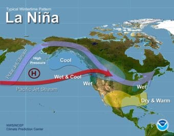
According to the National Weather Service Climate Prediction Center, there’s a 71 percent chance of a La Niña setting in by October.
Weather

Juneau and other Southeast communities broke high temperature records Monday
The National Weather Service reported that Juneau, Yakutat, Haines, Gustavus and Klawock all broke or matched previous record highs.
Juneau get its first-ever heat advisory
The National Weather Service issued the advisory for Juneau, the Upper Lynn Canal, Gustavus, Hoonah, Tenakee Springs and Yakutat – where temperatures were expected to reach 80 degrees.

Juneau Animal Control shares how to prepare pets for emergencies
Juneau Animal Rescue has a list of things all pet owners should know and have on hand to make sure their pets are safe in an emergency or crisis.
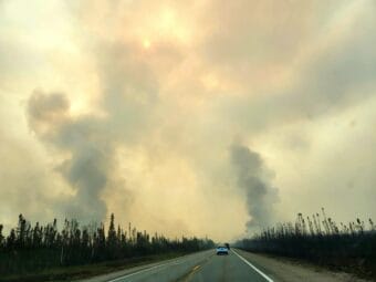
‘We all made it’: Residents recount their escape from the Bear Creek Fire
Officials are still assessing the damage, but the Denali Borough mayor says he knows for certain that people have lost their primary residences.
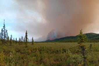
Homes lost, hundreds evacuated as wildfires explode across Interior Alaska
Some homes and other structures have burned, but it is not clear yet how many.