Breakup has wrapped up on the Kuskokwim River, a week after a series of massive ice floes began wreaking havoc on multiple lower-river communities. Now, individuals affected by flooding have the opportunity to apply for disaster relief funding.
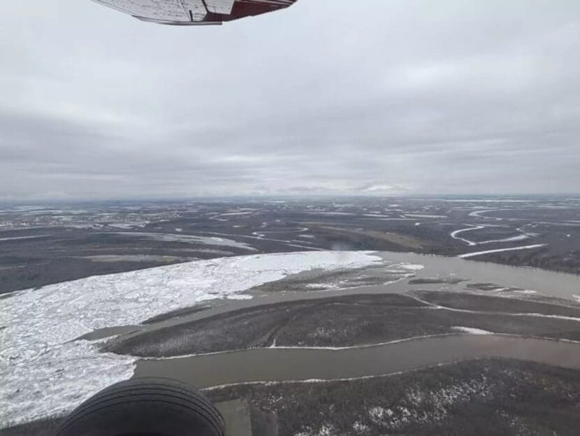
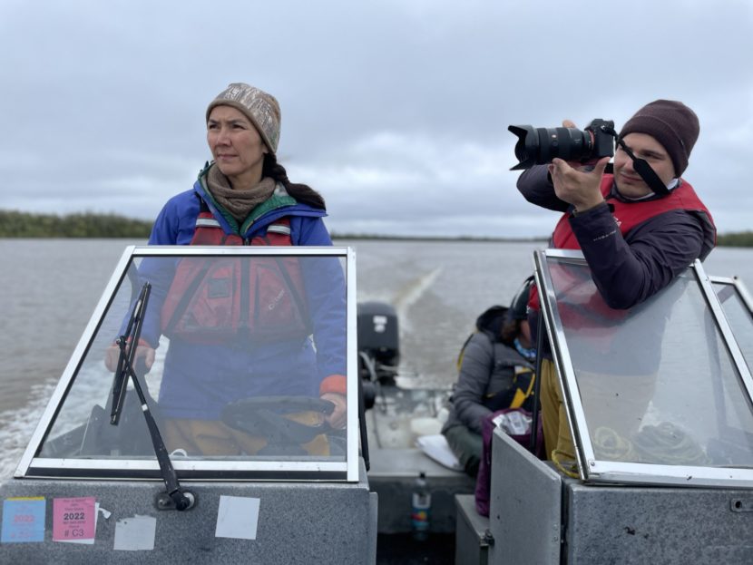
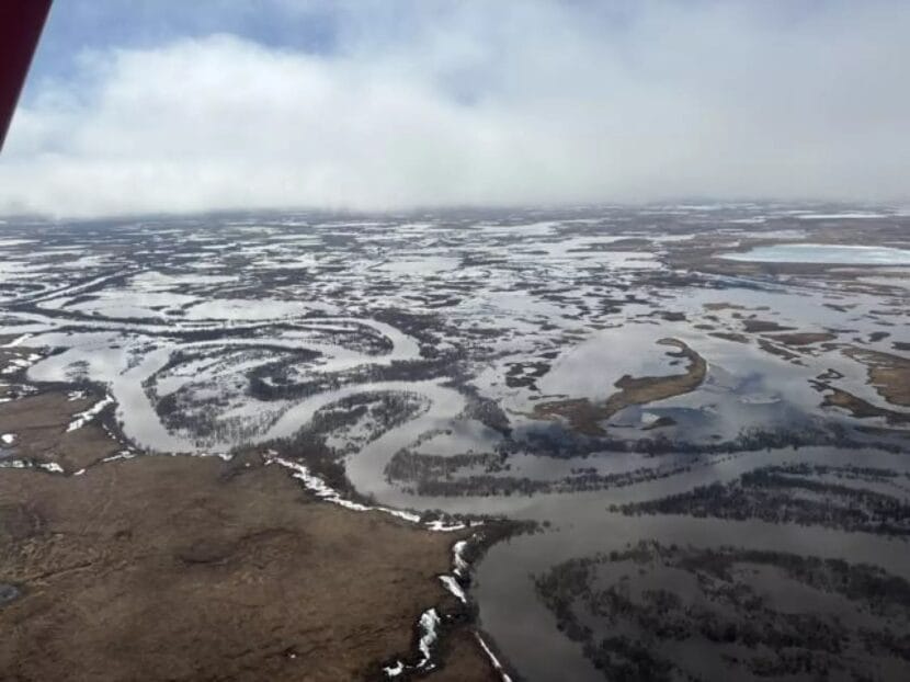
Early this week, the RiverWatch team flew far downriver from Bethel in search of the breakup front. But National Weather Service hydrometeorologist Kyle Van Peursem said that they found that it had basically disappeared.
“There’s usually just a lot of chunk ice pushing up against that strong ice, and that’s what we call the breakup front. There was no chunk ice there. It went from open water to spotty, in-place, rotten ice,” Van Peursem said. “We really have about 30 miles of intact ice left on the Kuskokwim, and it doesn’t look like it’s gonna jam. It’s just melting in place.”
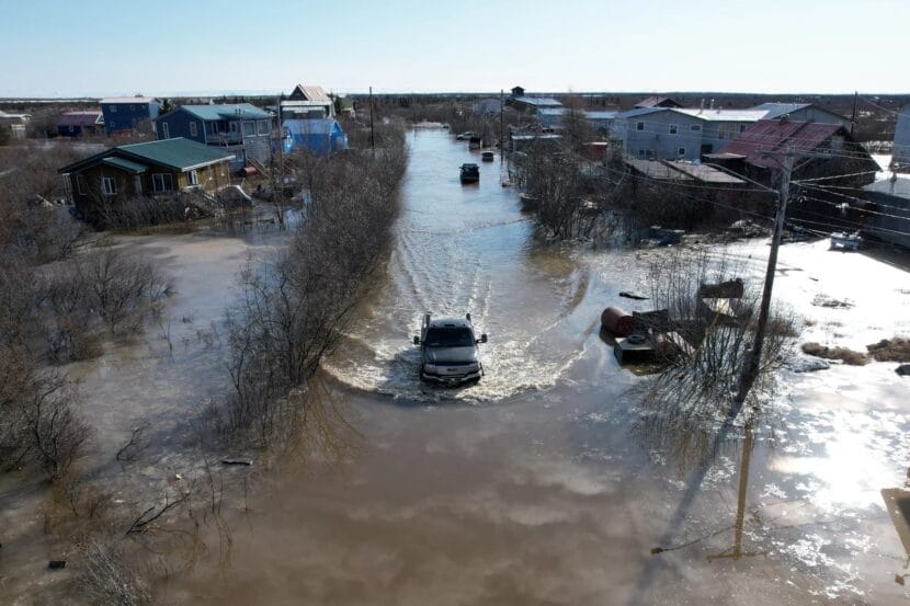
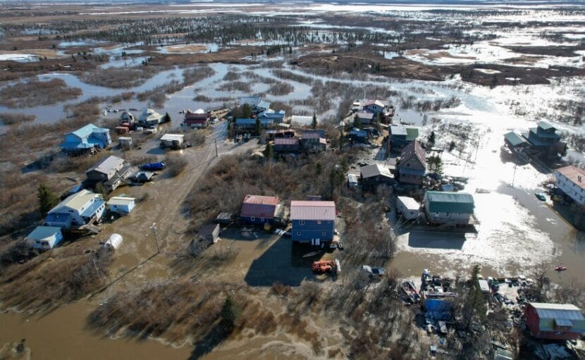
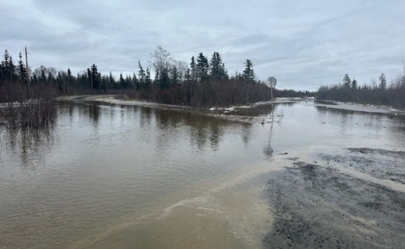
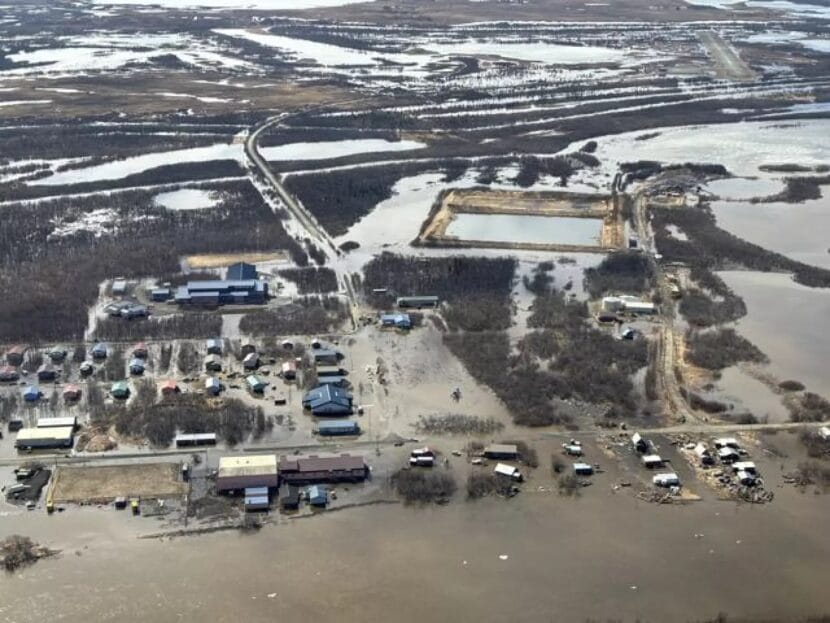
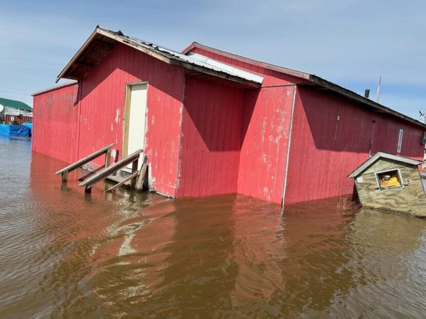
While the breakup front is gone, flooding in some areas is slower to disappear. Due to a combination of multiple ice jams and high meltwater, Kwethluk saw some of the worst of this year’s breakup flooding.
“We were kind of scratching our heads because everyone else around them was receding pretty fast and not even flooding anymore. But Kwethluk still had pretty significant impacts with high water,” Van Peursem said.
As of Monday, low-lying areas remained heavily inundated, though Van Peursem said that the water was down roughly a foot and a half from its peak days earlier.
“The tundra up there is just completely saturated still in spots. You can’t even see where the river is because it’s just completely full of water,” Van Peursem said.
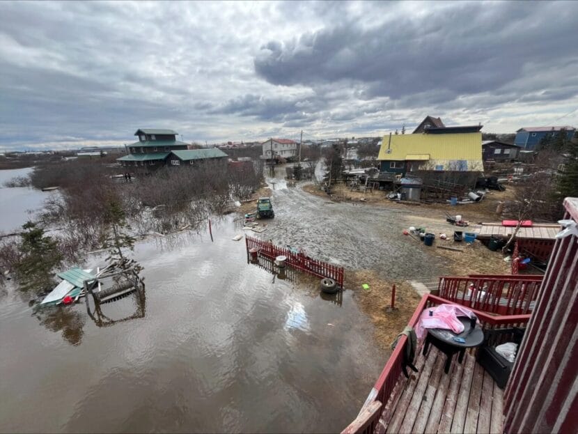
On Sunday, Vanessa Epchook, a spokesperson for the City of Kwethluk, said that the community was still in the process of getting piped water back and running following damage to a water pump early on in the flooding. She also said that the city was waiting to assess potential damage to the foundations of homes subjected to multiple days of standing water.
“All of these homes, they’re probably going to experience some unleveling because of the saturation,” Epchook said. “Some of these houses, their foundation is already bad from last year.”
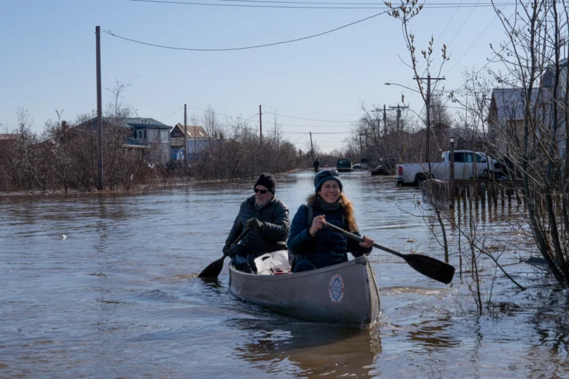
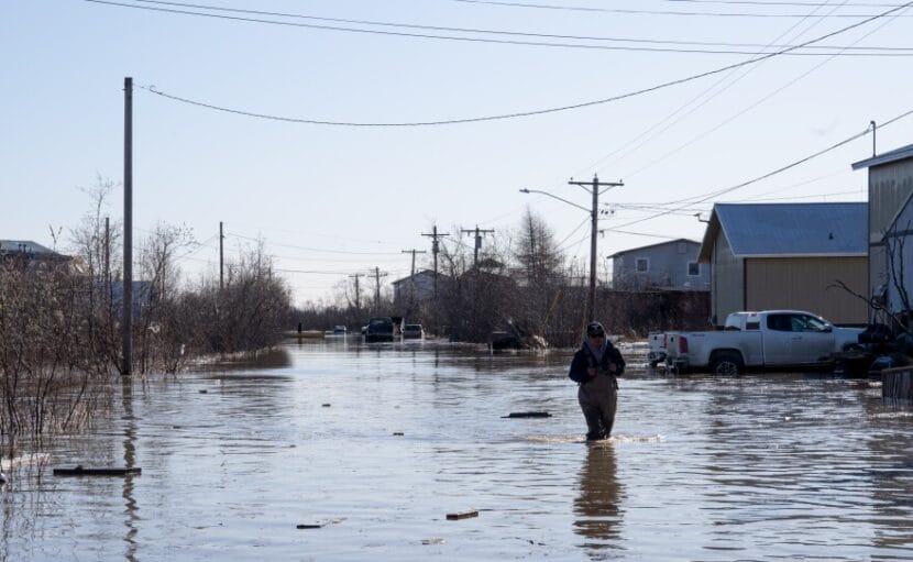
Downriver in Bethel, water levels were down more than three feet from their Friday peak as of Monday. One resident of the heavily affected Alligator Acres neighborhood took to social media to proclaim: “Land ho.” Others thanked the City of Bethel for making Sunday water deliveries to homes that had been cut off for days by floodwaters.
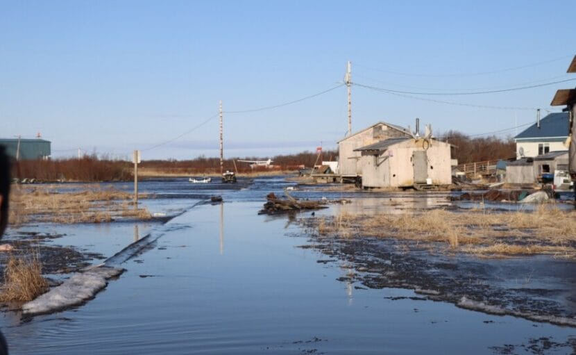
As of Monday, residents of communities downriver of Bethel were no longer grappling with high water, but some, like Napaskiak resident Earl Samuelson, were tallying up the damage.
“Did a little assessment through town this morning, a lot of boardwalk damage: uneven, some washed out, some boards gone,” Samuelson said. “One home I could see the insulation was starting to fall down. And I also noticed a lot of erosion where the river came up so fast and formed its own channel.”