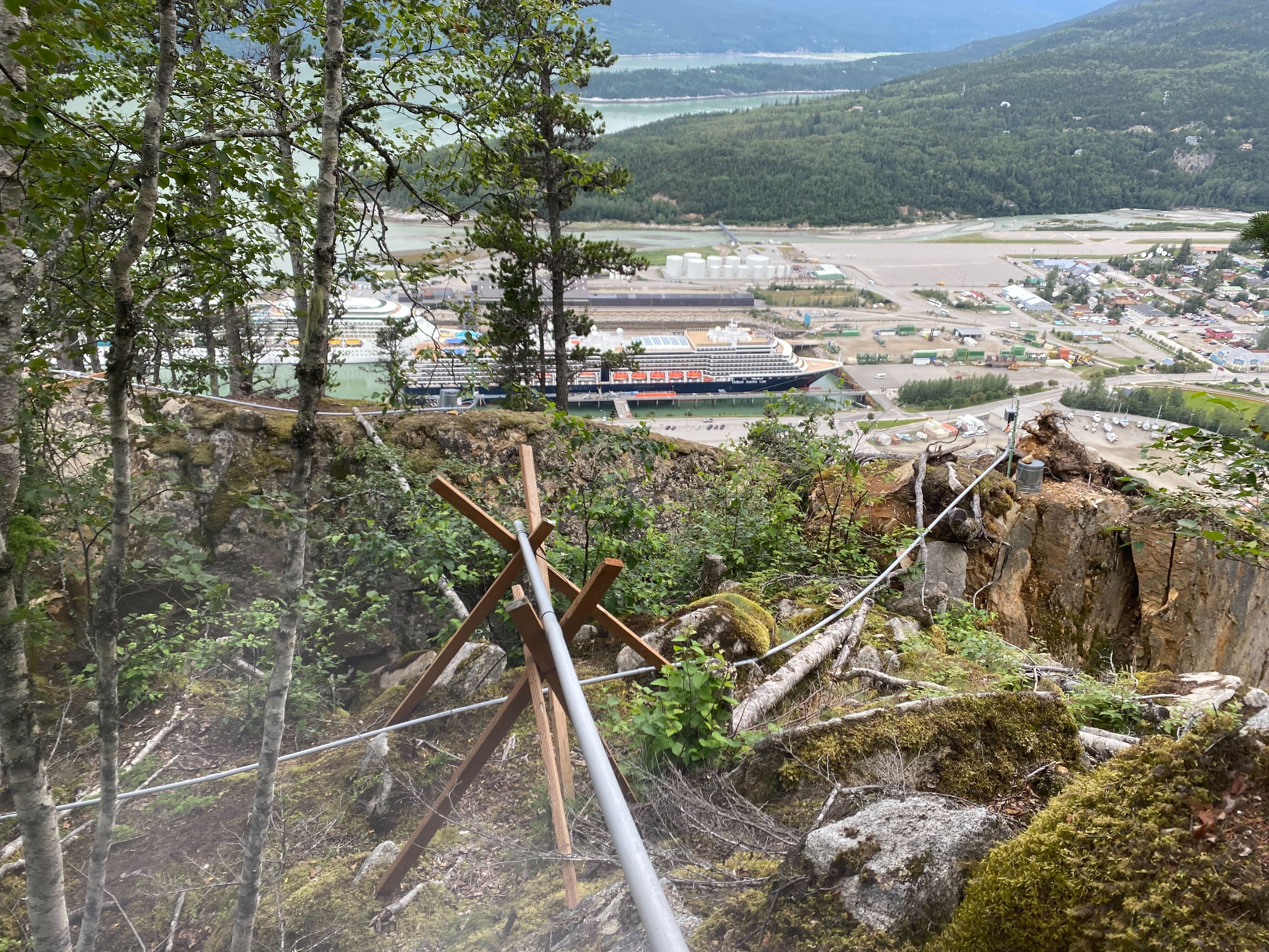
City-hired geologists say there’s risk of catastrophic failure at this rockslide zone above Skagway’s Railroad Dock. August 2, 2022. (Photo by Claire Stremple/KTOO)
In an effort to reduce the hazard from rockslides that barraged Skagway’s busiest cruise ship dock during the 2022 cruise season, the city has contracted with a design firm to develop mitigation strategies that could allow at least partial use of the dock next season.
This year’s slides caused partial shutdowns of the dock, resulting in a loss of more than 100,000 visitors to the community. The vast majority of the town’s economy relies on cruise ship traffic.
Seattle-based geotechnical engineering firm Shannon and Wilson have developed two different mitigation proposals for Skagway’s large rockslide chute officials are calling the South Slide area. It’s located above the north end of the Railroad Dock and clearly visible from the waterfront.
One plan is a large-scale, long-term effort costing nearly $40 million. A smaller short-term effort would cost a little over $3 million. The municipality is seeking grant funding for the long-term project but is moving ahead with the short-term project in the meantime.
Municipal officials hope that the short-term project can be done prior to next year’s cruise season. That project will include the installation of two attenuator nets. One of those, at the bottom of the slide area, was destroyed during a slide late last month, it was the large netting designed to guide falling rocks into the water below the dock. It will need to be replaced.
Another attenuator net will be installed in the mid-slope area.
“I’d say a third of the way down or maybe just over a third of the way down, there’s a bump on the hillside, and that kicks rocks off and launches them outward,” Borough Manager Brad Ryan explained during last Thursday’s assembly meeting,.
Those launched rocks can gain speed and miss the attenuator net at the bottom of the slope causing damage to the dock below. The plan also calls for a draped mesh at the top of the slope much like what is used along stretches of the South Klondike Highway between Skagway and Carcross in Canada’s Yukon Territory. The concept is that if you can slow the speed at which the rocks fall, the impact won’t be as damaging.
Heavy scaling will also be done to the top of the slide area. That will theoretically bring down any loose rock or vegetation that’s in danger of falling now. The scaling will be done with hand tools such as pry bars and airbags.
But Ryan doesn’t expect that the Railroad Dock will be used at full capacity upon completion of the mitigation effort.
“I think we have to be prepared that we’re going to try to limit as many people on that dock as possible,” he said.
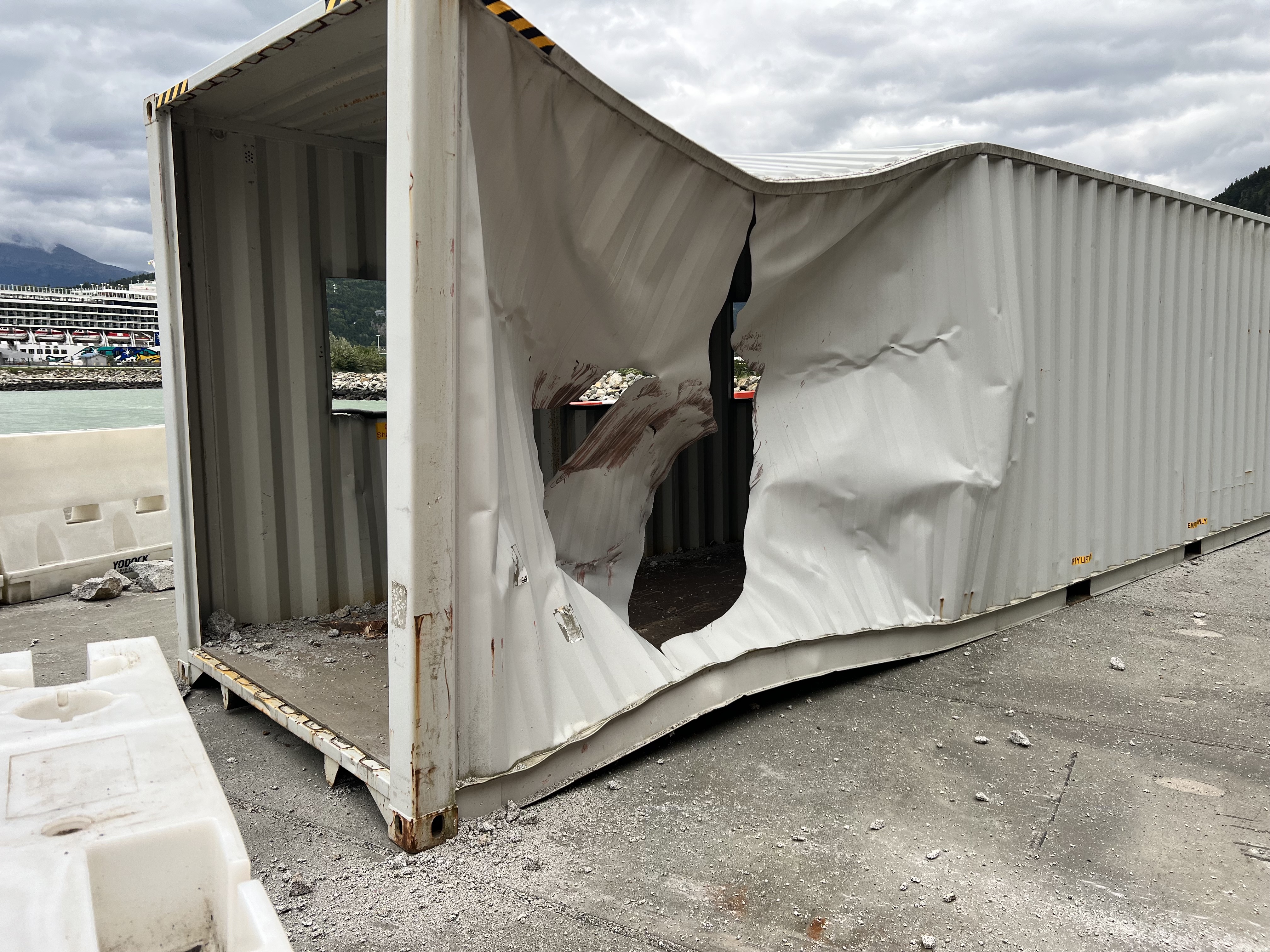
White Pass and Yukon Route Railroad used shipping containers as safety walkways for cruise ship passengers until rockslide activity in August damaged them. Now cruisers take small boats to shore to avoid the hazard zone. (Image courtesy of the city of Skagway.)
That means most likely cruise passengers will continue to be tendered from the ships that are able to berth on the Railroad Dock south of the slide area next season.
Ryan said funding for the project will likely come from a variety of sources. Alaska Gov. Mike Dunleavy declared a disaster emergency in Skagway last month, and the state made at least $1 million available for Skagway in the wake of the declaration. There could be more funds available but those aren’t guaranteed.
Another potential source of funding could come from the per-passenger fees collected by the State of Alaska and then distributed back to communities that host cruise ships.
“Can we cover it? I believe we can,” Ryan said. “The revenue bond has to go through and the expenses that would go to the development of the (Ore) dock would have to all go through that revenue bond, which we intend to do anyway. And then we’d have to cover it with our other municipal funds.”
A $65 million revenue bond was approved by voters last Tuesday. Those funds are supposed to be used for port development and are expected to be available early next year. The use of that money to reconfigure the Ore Dock to allow large-class cruise ships next year would allow other money to be available to help pay for the rockslide mitigation plan instead of the emergency Ore Dock redesign project.
Shannon and Wilson expect the hand scaling to take two weeks, with building the attenuator taking eight weeks and system tests taking one week. Ryan named Oregon-based contractor Rock Supremacy as the firm that will execute the plan. The White Pass and Yukon Route Railroad will continue to share geotechnical data and remove debris from the bottom of the slide area as needed.
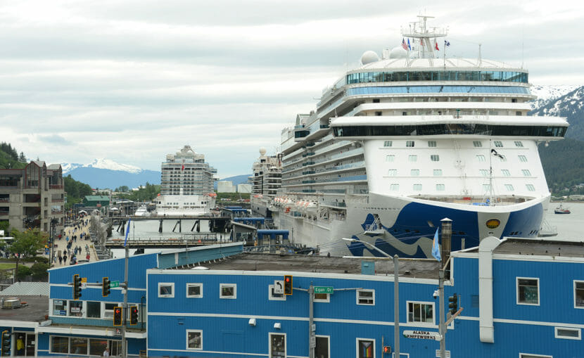
Cruise ships line the Juneau waterfront on Wednesday, June 8, 2022. (Photo by James Brooks/Alaska Beacon)
Southeast Alaska, home to the core of Alaska’s tourism industry, has largely recovered from the economic disaster caused by COVID-19, but the region still has fewer jobs than it did before the start of the pandemic.
Complete recovery may happen in 2023, attendees of Southeast Conference, a regional economic and local government conference, were told Tuesday in Ketchikan.
“We’re building back, but we’re not entirely there yet,” said Meilani Schijvens of Rain Coast Data, an economic firm that focuses on Southeast Alaska.
Scott Habberstad, chair of the Alaska Travel Industry Association Board of Directors, was cautiously optimistic.
“There’s a lot of opportunity for complete recovery and growth. But are we at the beginning of a recession and are we going to go into a recession?” he said, referring to the possibility of Federal Reserve interest rate increases.
“If we’re going into a recession, are people going to put their money into their pocket, or are they going to travel?” he said.
Southeast Alaska is heavily reliant on the tourism industry, and tourists who arrive in Southeast Alaska by cruise ship frequently travel to other parts of the state. The summer seasonal tourism industry employs thousands of Alaskans, some of whom rely on summer earnings to support themselves for the rest of the year.
Between 2019 and 2020, the number of tourists coming to Alaska fell by 82%. The number of cruise ship passengers arriving in the state dropped from more than 1.3 million to 48.
Southeast Alaska was among the hardest-hit places in the country by the resulting economic recession, Schjivens said. Businesses had spent millions of dollars preparing for the 2020 tourism season only to see it evaporate.
The regional fishing industry — another economic mainstay — also suffered in 2020 from poor salmon returns and low prices.
As a result, employment in Southeast Alaska dropped by 9,800 jobs — 24% of all jobs in the region — between June 2019 and June 2020.
Federal aid prevented many businesses from permanently closing, Schijvens said.
“The significant federal investments into the region in the form of COVID relief dollars worked as intended. Businesses, workers, and communities were able to continue in a stasis-like existence throughout the economically-impoverished early pandemic period, giving Southeast Alaska an economy to come back to in 2022,” she wrote in Southeast by the Numbers, an annual economic report card for the region.
As of June 2022, employment in Southeast Alaska remains 12% lower — down by 5,200 — than it was in June 2019.
Statewide, employment is down by 6%. For context, national employment was higher in June 2022 than it was in June 2019.
Business owners say conditions are better
Though the region hasn’t fully recovered, surveys conducted by Schijvens found business owners more optimistic about the future than at any point since the COVID-19 pandemic began.
Of 440 surveyed in 2021, 80% said the business climate was “poor” or “very poor,” and that was an improvement from 2020. This year, that proportion has dropped to 36%.
More than three-quarters of the businesses surveyed said they expect conditions to be better next year than this year.
Some of that optimism has been driven by the cruise ship industry’s rebound from COVID-19.
After the 48 passengers recorded in 2020, Southeast Alaska counted 124,600 cruise ship passengers in 2021. This year, Schijvens forecasts about 1 million tourists by cruise ship.
Optimism for 2023 but unknowns remain
Next year, based on the number of sailings and projected interest, she expects about 1.3 million — roughly the same amount that sailed to Alaska in 2019, the last year before the pandemic.
Air travel has also rebounded, with the number of passengers this year running only slightly below what it was in 2019.
“Tourism is back, and it is thriving,” she said.
Habberstad, who also works for Alaska Airlines, is more cautious. He said there’s several unanswered questions when looking ahead to 2023.
During the pandemic, Alaska was a convenient destination for Americans who couldn’t vacation internationally. Will that change? Will economic pressures force people to curtail spending? Will the war in Ukraine, COVID lockdowns in Asia and a strong dollar discourage international visitors from coming to Alaska?
Fall and winter are traditionally the times when tourists book trips for the next season. There’s a lot of opportunity but a lot of uncertainty, Habberstad said.
“I think we’ll have a better idea in December,” he said.
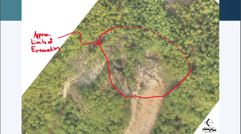
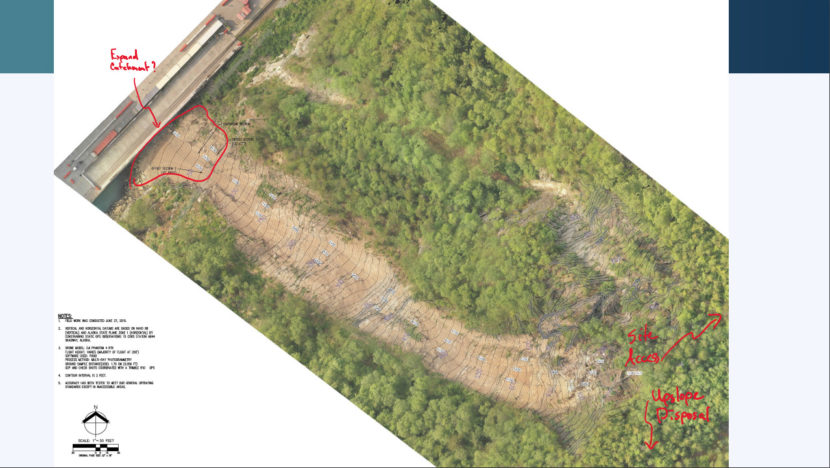
A slide from Shannon and Wilson’s presentation showing approximate excavation area.
The busy cruise ship town of Skagway is looking for a solution to the rockslides that continue to pepper its largest cruise ship dock. It also hopes to prevent a major rockslide that experts are calling inevitable. And as winter approaches, the window to execute a workable solution gets smaller and smaller.
The forward berth of the town’s largest cruise ship dock was shut down earlier this summer, about a week before a large slide hit the area. The town has been operating only three out of four berths ever since. That’s resulted in the loss of about 125,000 passengers this season.
If the community wants to return to hosting four ships at a time in 2023, it has less than seven months to fix the problem.
National geotechnical engineering firm Shannon and Wilson made its initial pitch to address the slides at the borough assembly’s Sept. 1 meeting. Anchorage-based Geotechnical Engineer, Kyle Brennan’s tone was hopeful but realistic.
“It’s a complicated issue, and time is not helping,” he said.
He said there are about 40,000 – 60,000 yards of rock that need to be moved off the mountainside to prevent both major and minor rockslides. The process would involve mechanically removing the rock, lifting it up over the top of the hillside and depositing the material out of the way of the view shed of Lower Dewey Lake, then repeating the process down the slope until it is completed.
Brennan says there are two problems. One is the ongoing smaller rockslides, of which there have been several over the past few weeks. The other is the large unstable mass at the top of the slope that he says will eventually release and destroy the area below the slide zone — and potentially much more if left untouched.
“What we’re trying to do is twofold. One, remove this very large hazard. But also, by doing so, we should greatly reduce the amount of rock fall that’s produced along the slope because we no longer have that moving rock mass,” Brennan said. “The rock fall hazard will never go away completely because you have a steep rock slope, and steep rock slopes over time generate rock fall occasionally, but the frequency of those rockfalls should be reduced dramatically.”
Another slide from Shannon and Wilson’s presentation showing the disposal area and site access area.
The most recent calculations say that the large rock mass is separating from the mountainside at a rate of 2.5 inches per year, up from between 1 and 1.5 inches just a few years ago.
Brennan said his firm will have preliminary design plans for mitigation completed by Sept. 16. Without those, permits can’t be applied for, grant proposals can’t be made and a contractor can’t be hired. But even if those plans are ready by mid-September, it’s not likely that permits would be approved before mid-winter.
“If we can get that contractor on early, you know, there are certain components of the project that maybe they can start that don’t really rely so much on the permitting: staging equipment, establishing access, maybe doing some work to prep the upslope disposal site for the rock,” he said.
That may include improving road access to Lower Dewey Lake to get large excavators and dump trucks to the construction site.
Assemblymember Orion Hanson suggested progress needs to start on those developments immediately.
“Any suggestion of a helicopter getting a 70,000-(pound) excavator up that mountain seems completely impossible to me,” Hanson said.
And without helicopter-assisted access, road work would need to begin before the winter freeze.
“You’re saying we can’t really do any excavation until sometime in the winter. We have to mobilize well before that if we have any chance of pulling this off before next year,” Hanson said.
For now, the company is only focusing on the north slide area above the railroad dock. Project cost estimates and funding options were not discussed in detail.
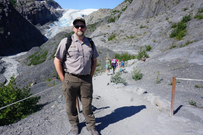
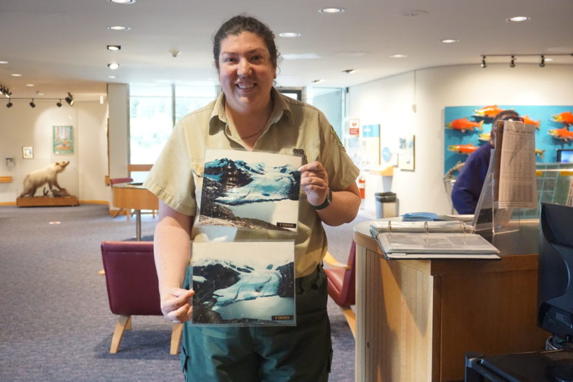
Benjamin Pister, director of resource management at Kenai Fjords National Park, stands on July 5 at a spot where the trail was extended to allow visitors to get as close as possible to rapidly retreating Exit Glacier. The park is trying to plan for a long-term future when the walk-up glacier, currently a prime tourist attraction, is no longer easily visible. (Photo by Yereth Rosen/Alaska Beacon)
On the route to one of Alaska’s most-viewed glaciers, there is little doubt about the destination. Visitors drive on Exit Glacier Road to get to the Exit Glacier trailhead of the 1-mile Exit Glacier trail that takes them to the face of Exit Glacier in Kenai Fjords National Park.
Now, with the climate continuing to warm, park managers are faced with a question: What will visitors do in that section of the park when rapidly shrinking Exit Glacier finally disappears from view?
“There’s going to be some big changes in how we think about this area,” said Benjamin Pister, leader of the park’s resource management team. “It’s not going to be about Exit Glacier in the future.”
Fister is coordinating a project at Kenai Fjords that is envisioning and planning for visitor services in the decades to come. The Kenai Fjords Frontcountry Management Plan seeks to guide operations to 2040 and perhaps longer.
There is an obvious need for such planning.
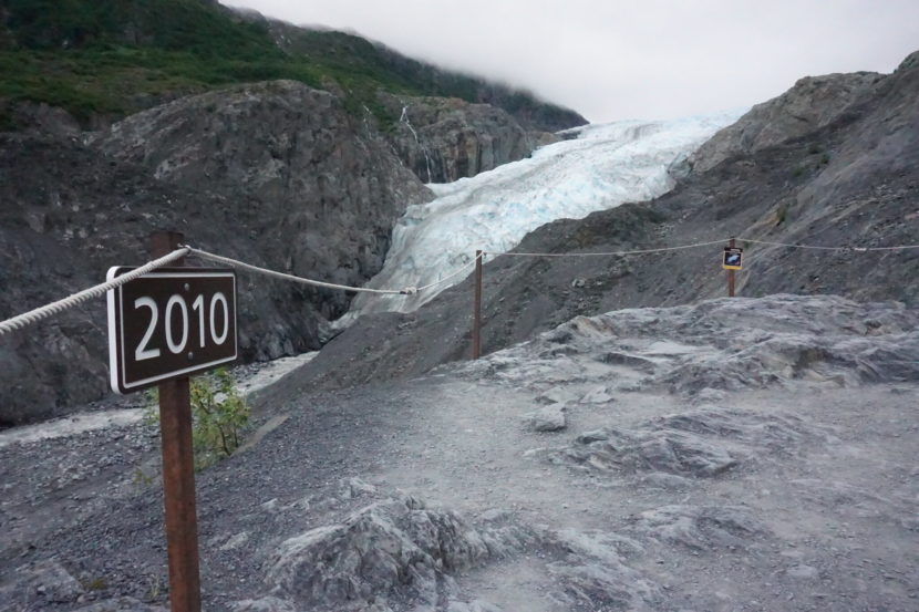
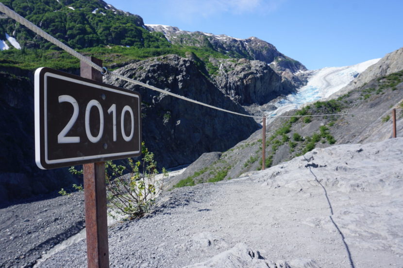
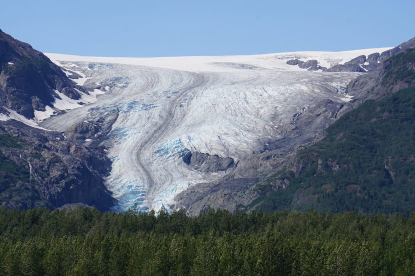
As of 2015, Exit Glacier had retreated a little over 1.5 miles in two centuries. The loss is accelerating; from the early 2000s to now, the retreat has been close to half a mile. And. It is not just the terminus that is shriveling; the glacier is becoming narrower, exposing large areas of rock.
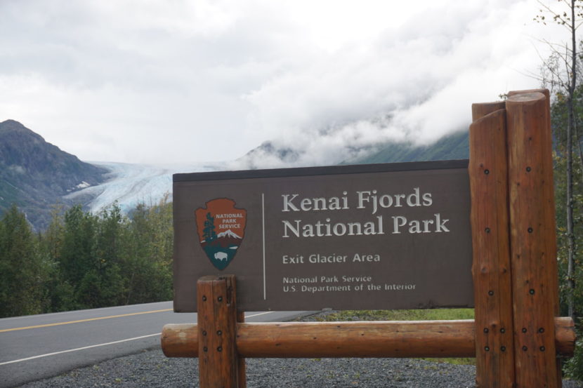
A sign, seen Aug. 27, 2022, marks the entrance of the Exit Glacier area of Kenai Fjords National Park. The car-accessible frontcountry is due for some big changes as its main attraction, walk-up Exit Glacier, shrings from view in Alaska’s warming climate. (Photo by Yereth Rosen/Alaska Beacon)
What’s happening at Exit Glacier is being repeated across Alaska as warming temperatures hasten glaciers’ retreat. That is forcing managers of some of the state’s most popular tourism and recreation destinations to make changes now and plan for more in the future.
As Exit Glacier is shrinking, visitation to the Exit Glacier area of the park is steadily increasing, from about 120,000 in the summer of 2000 to more than 200,000 last summer, according to Park Service statistics.
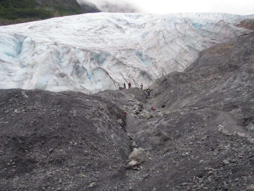
The mile-long trail used by throngs of visitors, from elderly cruise ship passengers to young children to President Barack Obama in 2015, has been extended twice and now ends at a steep slope. Further extensions are impossible without some complicated and time-consuming blasting that would probably be futile, Pister said.
“By the time we built a new trail up to the glacier, the glacier won’t be there anymore,” he said.
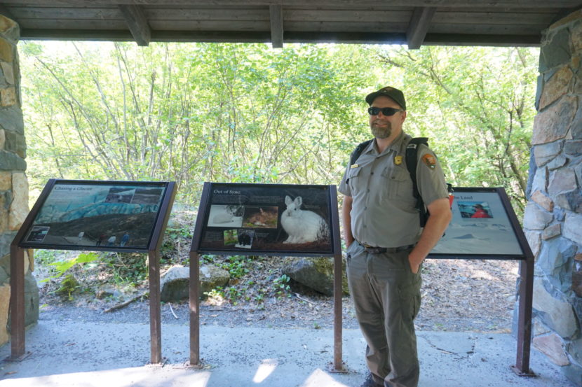
Similarly, a stone pavilion along the trail that is now hemmed in by alder trees and other greenery. “This was built to have a nice view of the glacier. Obviously, it doesn’t anymore,” said Pister, stopping at the site. It has been repurposed to provide a natural history lesson about ecological changes that happen when glaciers disappear.
Benjamin Pister, a natural resource manager at Kenai Fjords National Park, stops on July 5 at a stone pavilion that was intended to provide a sheltered view of the Exit Glacier. In the four decades since the park opened, the pavilion has become hemmed in by alders and other vegetation, and it has been repurposed to give lessons on what happens to lands after glaciers retreat. (Photo by Yereth Rosen/Alaska Beacon)
The park’s frontcountry management process is just in its early stages. So far, it has attracted some public comment, including suggestions from locals for more visitor amenities in a different site, nearby Paradise Valley, that gets snowmachine use in the winter.
Ultimately, the goal is to ensure that attractions for Kenai Fjords’ growing numbers of visitors do not disappear when Exit Glacier does.
There are some options, Pister said.
“Glaciers do some really amazing things to the landscape when they go away,” he said. Yosemite National Park, for example, is a big glacial valley, and the valley left by Exit Glacier could be something like that, he said. “I prefer to think of it as a new Turnagain Pass,” he said, referring to the mountainous area at the north end of the Kenai Peninsula.
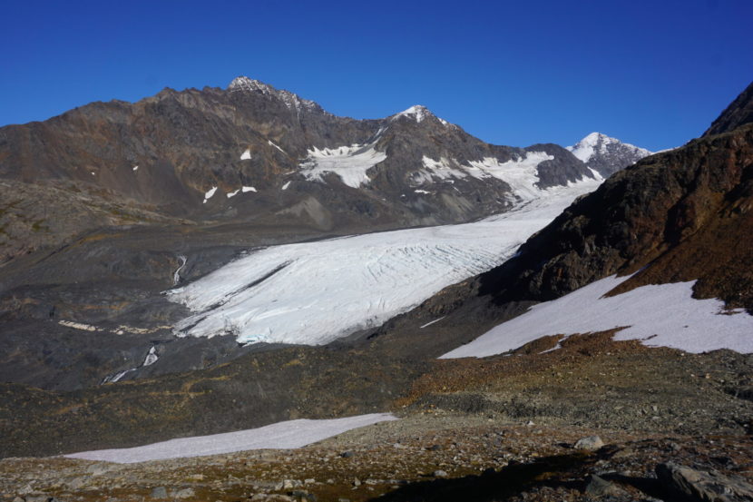
Though Exit Glacier gets much of the attention, ice losses in Kenai Fjords are widespread.
The terminus of Exit Glacier, seen on Aug. 5, 2018, is shown upslope from a sign marking the glacier’s reach in 2010. Retreat in the years since has been dramatic. (Photo by Yereth Rosen/Alaska Beacon)Exit Glacier’s terminus, seen on July 5, 2022, has retreated upslope and is getting farther away from the mile-long hiking trail. (Photo by Yereth Rosen/Alaska Beacon)
A newly published study of 19 other glaciers in the park – a selection among the approximately three dozen that spill off the 700-square-mile Harding Icefield – found that 14 have lost “substantial area” since the mid-1980s. Between 1984 and 2021, the glaciers in the study showed a cumulative loss of about 16 square miles of ice area, about 57% of that at the terminus, or end, points and 43% along the sides. And the 2021 measurements may be already out of date, given how fast the losses are happening, said the study, by University of Washington and National Park Service scientists and published Aug. 5 in the Journal of Glaciology.
“Most obviously, the Kenai Fjords viewscape is changing dramatically as tidewater glaciers retreat onto land and land-terminating glaciers retreat into the alpine or out of sight around a bend,” said the study, which recommends annual updates. “Our measurements indicate that most of the glaciers in Kenai Fjords National Park are shrinking rapidly, leading to measurable annual landscape change.”
lacial ice looms over workers building a spur to extend the Exit Glacier trail in 2010. (Photo provided by the National Park Service)
Like Kenai Fjords, other Alaska park or recreation sites with glaciers are undergoing rapid change – and some management adjustments.
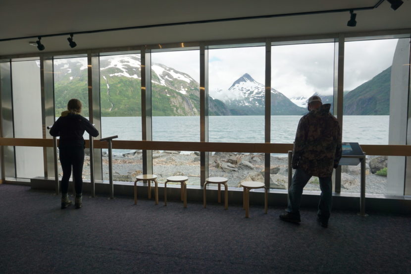
At Portage Glacier, a popular Chugach National Forest destination about an hour’s drive south of Anchorage, the visitor center no longer offers views of the glacier face. The center, built at the edge of Portage Lake with big picture windows facing the glacier, opened to the public in 1986; within a decade Portage Glacier had retreated out of sight, grounding on land on the opposite side of the lake. “Of course, the design was so you could see the glacier, and everything was sitting right here,” said Adrienne McGill, the Begich, Boggs Visitor Center’s director.
Now seeing Portage Glacier up close requires a trip across the lake, which many visitors do by motorized tour boat. Exhibits at the visitor center, which typically serves hundreds of people a day during the summer season, place a lot of emphasis on glacial retreat and the landscape changes that follow. Some leaf through the scrapbook of photographs at the front desk that shows Portage Glacier’s face from years past, and some are return visitors who are shocked by the changes, McGill said. “They reminisce a lot when they come here,” she said.
At Mendenhall Glacier in Juneau, a Tongass National Forest site that gets over 600,000 visitors annually, the Forest Service is going through its own process to upgrade facilities for what is expected to be an even bigger crush of tourists in a less-icy future. The situation is not as extreme as at Exit or Portage glaciers, but changes are coming, said Monique Nelson, a land management planner at the Tongass working on the project. “In the next 20 to 40 years, you probably won’t be able to see it from the visitor center,” she said of the glacier.
Visitors gaze out at Portage Lake from the large picture windows at the Begich, Boggs Visitor Center on July 18. The center, a popular attraction in the Chugach National Forest, used to provide a clear view of Portage Glacier. Since the mid-1990s, that glacier has been out of view, and exhibits in the center emphasize the landscape and ecological changes that occur when glaciers retreat. (Photo by Yereth Rosen/Alaska Beacon)
The Forest Service has a master plan to expand facilities, adding another visitor center closer to the glacier, and to transform footpaths into designated trails to take walkers to the ice edge. The plan also contemplates motorized boat tours, such as that at Portage. Some of that is controversial with Juneau locals, who have expressed concerns about overdevelopment of a well-loved recreational site, Nelson said.
At Denali National Park, where the sole park road is plagued with thaw-induced landslide dangers, most critically at the midpoint, glacial loss at higher elevations is affecting the mountain-climbing season. On Kahiltna Glacier, which is used as base camp for most Denali mountaineering expeditions, conditions are starting to get marginal for ski-equipped planes that ferry climbers on and off the mountain, said Mike Loso, a National Park Service geologist and glacier expert who works out of Wrangell-St. Elias National Park.
Because of melt dangers, in the latter part of the season, plane operations have to shift to a Kahiltna Glacier site about half a mile uphill, Loso said. That is as far as the planes can move, he said; crevasses and rock faces preclude any shifts farther uphill.
At Glacier Bay National Park in Southeast Alaska, 250 years of glacial retreat has been so dramatic that the land is actually rising. Through a phenomenon known as “isostatic rebound,” uncovered land that was previously compacted by heavy glacial ice has now sprung up, expanding the onshore territory.
Adrienne McGill, manager of the Begich, Boggs Visitor Center in the Chugach National Forest, holds up photos of Portage Glacier that show the changes from 1998 to 2003. The visitor center, seen here on July 18, has scrapbooks at the front desk with photographs of retreating Portage Glacier that were taken over the years. McGill said many return visitors comment on the drastic changes they’ve noticed. (Photo by Yereth Rosen/Alaska Beacon)
For Glacier Bay’s visitors, the ice losses are a prime attraction.
Most Glacier Bay visitors come on cruise ships, and those cruise passengers want to see tidewater glaciers calving ice chunks into the sea, Loso said. There are about six or seven tidewater glaciers remaining in the park, but as they crumble and melt, they will “ground themselves out” and no longer extend to marine waters, he said. “The trend overall is clear, and I can say with confidence that there are going to be fewer tidewater glaciers for cruise ship passengers to look at over there,” he said.
That might mean a shift to Wrangell-St. Elias to the west, where Hubbard Glacier, currently the destination for only a few cruise ships, “is still huge and going to be calving ice for a long time,” he said.
Wrangell-St. Elias has its own trail problem linked to glacial retreat. The trail to Root Glacier, like the more heavily trod Exit Glacier trail, has been extended about 0.4 miles. That might seem like a minor distance, but it has made for some tougher travel to the park’s most accessible glacier, Loso said.
“You have to drop further down the hillside and go further up the valley every year to get to the ice,” he said. “In 30 years, what used to be an easy day hike for all of our visitors might be a much more challenging and difficult trip to make.”
Melt along the sides of Exit Glacier exposes large sections of rock, as seen on July 5, 2022. The glacier is narrowing as well as receding uphill. (Photo by Yereth Rosen/Alaska Beacon)
There is potentially a side benefit of glacial melt: a big and expanding proglacial lake that didn’t exist 30 year ago at the base of Kennicott Glacier. “It’s a new thing. McCarthy is sort of a lakefront town,” Loso said.
But glacial melt also creates dangers. An ominous trend in all the world’s mountainous and glaciated areas is the increasing risks for landslides and the localized tsunamis they cause as glaciers that buttress mountain slopes shrink. Glacier Bay and Wrangell-St. Elias, with their combination of glacial ice, steep mountainsides, coastlines and locations at latitudes where glacial conditions have become marginal, are considered global hotspots for such slides. At Glacier Bay, there were at least 24 large rockslides or rock avalanches that occurred between 1986 and 2016 that were tied to warming conditions, according to the U.S. Geological Survey. Wrangell-St. Elias in 2015 had North America’s largest non-volcanic landslide on record, a huge slope collapse caused by the combination of glacial retreat and upper-elevation thaw. The resulting tsunami in Taan Fjord that rose as high as 633 feet up the opposite slope, ripping out trees. No injuries or effects on people in Alaska parks, but a similar landslide and tsunami in Greenland in 2017 killed four people.
Continued sweeping changes in Alaska’s glacial landscapes are considered inevitable.
Raven Glacier is seen on Sept. 13, 2020 from the summit of the Crow Pass trail in the Chugach National Forest. In the decades to come, glacier views like this will be increasingly rare in Alaska, scientists say. (Photo by Yereth Rosen/Alaska Beacon)
Loso is working on a project to predict the rate of retreat in all of Alaska’s national parks. So far, results show that the outlook over the next few decades is grim for glaciers at parks across Alaska, he said.
“Wrangell-St. Elias is the only park that retains anything close to its glacial coverage,” he said. “Wrangell is the glacier heavyweight.”
Future generations of Alaskans and Alaska visitors present at the end of the century will likely catch only faraway glimpses of the glacial ice that is currently a fixture in the Alaska scenery, he said.
“When you look at the year 2100, the stuff we’re talking about, it’s going to be distant,” he said. “It’s going to be hard for the public to see glaciers anywhere.”
A picture captured by a passenger onboard the fatal flight at 10:48 a.m. That’s two minutes before the last-received signal from the plane that crashed in early August 2021. (Image courtesy of the NTSB report).
A National Transportation Safety Board report released Thursday shows that weather was deteriorating in the hours before a floatplane crash that killed six people in Misty Fjords National Monument near Ketchikan last August.
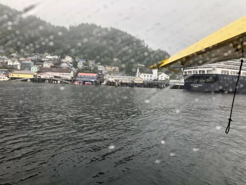
The Southeast Aviation sightseeing plane crashed against a steep, densely forested mountainside about 18 miles from Ketchikan.
A passenger on an earlier flight described the pilot, Rolf Lanzendorfer, “ducking” under clouds during their trip. The report also says that the pilot advised the owner of the airline to cancel that day’s trip to Hyder. The owner is quoted as saying “he didn’t have the ceiling back there for it.”
A photo of the plane’s left side taken by a passenger onboard the fatal crash. (Photo courtesy of NTSB)
But Lanzendorfer said the weather at that moment was good. The plane took off with five passengers aboard, all guests on a Holland America Line ship calling on Ketchikan that day.
Tracking devices from the plane showed a landing on a nearby lake around 10:30 a.m., less than 20 minutes before the crash. Lanzendorfer then took off in the direction of Ketchikan, flying near the Behm Canal. Visibility was low. Photos taken by passengers show thick clouds throughout the area.
An AIRMET Sierra weather advisory was in place when the crash happened, meaning visibility was poor. A Sierra advisory means there is “extensive mountain obscuration” and visibility of three miles or less for more than 50% of the advisory’s time window.
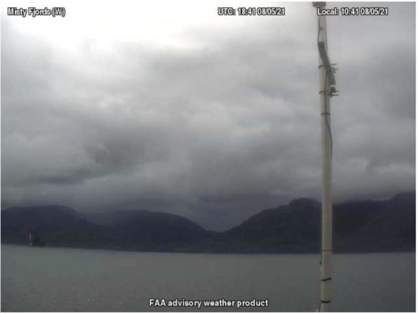
An image from a FAA weather camera in west Misty Fjords at 10:41 a.m. the morning of the crash. That would have been soon after the floatplane moved over the Behm Canal. (Image courtesy of the NTSB report).
Other pilots who had been flying that morning reported low clouds in the area. Conditions were similar at weather cameras in Ketchikan, as well as on Minx and Twin islands.
Emergency signals reached responders at 10:50 a.m. The wreckage was found by 11:20 a.m., with no survivors.
The transportation safety board reported that the crash was at 1,750 feet above sea level. That’s where part of the left wing was found — the other part of the wing was found in a tree along the debris path, where other pieces also were scattered.
The new report also details the pilot’s autopsy, which turned up no evidence of alcohol, drugs or carbon monoxide poisoning. His cause of death was listed as blunt force injuries. Lanzendorfer had not indicated taking any medications on his most current paperwork.
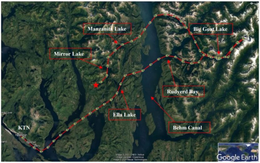
A map showing the plane’s route before crashing. The crash happened where the red star is on the map. (Image courtesy of the NTSB report).
The pilot was involved in an accident the month before the fatal crash. He hit a buoy and flipped over near Prince of Wales Island, damaging the plane. There was no formal discipline or additional training from Southeast Aviation after the incident.
Families of four of the passengers are suing Holland America and Southeast Aviation. The lawsuit against the cruise line argues that it didn’t do enough to warn guests about the risks of the tours. The suit against the tour company alleges that it didn’t properly vet the pilot before allowing him back after the July accident.
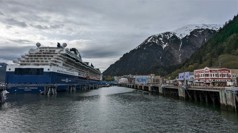
The Celebrity Millennium cruise ship docked at one of Juneau’s two city-owned cruise ship berths on May 17, 2022. (Photo by Jeremy Hsieh/KTOO)
All of the major cruise lines that visit Juneau have signed an agreement with the city — the first of its kind in Alaska — committing to nine actions. The parties announced the agreement on Monday.
“This was kind of the grab bag of issues that came out of the task force that we wanted to get down on paper early, or first,” said Juneau Tourism Manager Alexandra Pierce.
She was referring to the city’s Visitor Industry Task Force, which recommended many of the commitments in this agreement back in March of 2020, just as the COVID-19 pandemic began shutting everything down.
The industry’s commitments include giving advance notice to the city of ship schedules and capacity numbers and keeping big, outdoor screens turned off while in port. They also agree to maximize support for local businesses and support the use of up to $10 million in cruise ship passenger taxes to expand Centennial Hall.
Renée Limoge Reeve is the vice president of government and community relations for Cruise Lines International Association in Alaska. She said there’s no enforcement mechanism — it’s just an agreement made in good faith. But she said the cruise lines do get something back, even if the text doesn’t really capture it.
“I wouldn’t say that we give up a lot,” Reeve said. “What I would say is that we are able to have a welcoming environment when we come to Juneau. … And it’s important, again, that we are good partners in the communities that we visit … so that we are welcomed. Because that improves the experience for the visitors that we’re bringing. You want to be welcomed in the community.”
Both Reeve and Pierce say this collaborative agreement is a big deal. It’s a huge shift from the adversarial relationship that came to a head in 2016 when CLIA Alaska sued the city over its collection and use of cruise passenger taxes.
“We have a relationship with CLIA that we built through a very, very painful lawsuit process where we’re pretty open and honest and able to communicate our community’s needs and concerns,” Pierce said. “And I think that this represents an effort to capitalize on that relationship and use it for good.”
“And then people just got around the table and just started talking more,” Reeve said. “I would far rather have conversations and come to collaborative solutions this way than through anything like a lawsuit or a regulation or a law. I’d rather just have a conversation and make sure that we are following the will of the community.”
The city also has some leverage. It owns two of the four cruise ship docks in town, but it hasn’t historically taken an active role in how they’re scheduled.
“In the past, the city’s been a little bit more reactive to that information,” Pierce said. “And now we just want a bit more of a say in the process — we want to be a little bit more engaged with how our assets are being scheduled.”
Pierce said this agreement complements other longstanding relationships and programs in Juneau. For example, she said Cruise Line Agencies of Alaska will still handle logistics and scheduling for the cruise lines. And Tourism Best Management Practices, the industry’s voluntary program for fielding and responding to community complaints, will continue.
“You know, all of these different organizations and programs work together in concert to manage tourism in our community,” Pierce said. “And this is just another effort and another tool … and direct with the cruise lines as opposed to through a third party of some sort.”
Pierce said this may be the first of several agreements of this sort to come.
Close
Update notification options
Subscribe to notifications
Subscribe
Get notifications about news related to the topics you care about. You can unsubscribe anytime.