Weather

Meteorologist: It’s probably going to snow on Christmas

The view from Pittman's Ridge on Douglas Island looking southwest toward Admiralty Island on Dec. 23, 2016. (Photo by Mikko Wilson)
The view from Pittman’s Ridge on Douglas Island looking southwest toward Admiralty Island on Dec. 23, 2016. (Photo by Mikko Wilson)

A storm system is expected to reach Juneau on Christmas, with snow beginning that afternoon. Through Monday morning, Juneau could see up to 7 inches.

“Probably the greatest snowfall totals will be Christmas evening,” National Weather Service meteorologist Wes Adkins said.

Adkins said the storm system is over the eastern Aleutians moving east and it could affect travel plans this weekend.

“So we’re looking for snowfall to spread eastward and northward through Christmas afternoon and we’re looking at the potential for a significant snow event at the tail end of (the) holiday weekend,” Adkins said.

He said he’s very confident it will snow, he just isn’t sure how much. There’s also a possibility the snow could give way to rain, which could make surfaces even more slippery.
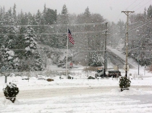
He said this season seems to be much more typical for Juneau.

“So at this point, we’re in a La Niña pattern, which promotes normal snowfall conditions with maybe cooler and somewhat drier climate for us through about February and then things start to change for us and go the other direction,” he said.

Adkins said the weather service releases a new climate forecast every month. So long-term predictions could change, but he says it looks like after winter Juneau will see a warmer than normal summer and then another warm winter next season.

He stressed that people should keep a sharp eye on this weekend’s weather. The National Weather Service will release more information on the storm as it comes in.
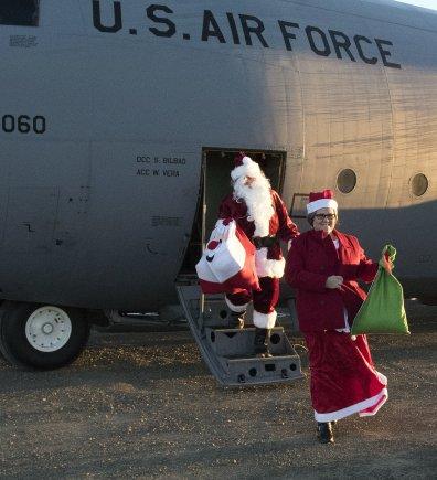
White Christmas in the forecast for much of Southeast

A city snow plow tries to keep up with the heavy snowfall in this photo from a few winters ago. (File photo by KRBD)

Area residents who love a white Christmas will be happy to hear they’ll probably get one – but not until the afternoon.

Wes Adkins from the National Weather Service in Juneau said forecasters there are watching a system that should be bringing warm, moist air on top of a cold break, which generally leads to snow.

“We’re looking for the front to arrive just offshore of the panhandle Christmas Day and steadily move eastward,” he said. “So, potentially, Christmas afternoon into that evening, we’re looking at a potential snow event.”

That event would affect most of southern Southeast, including Ketchikan, Metlakatla and Prince of Wales Island.

The snow could last through midnight Sunday, and Adkins said it then should switch to rain.

It’s still a little early to give an accurate prediction, he says, but he wants people to know before the holiday weekend that potential bad weather is on the way.

He said the total snowfall could be anywhere between 1 and 4 inches. While that’s not a lot by some standards, the upper end of that is more than Ketchikan usually gets in one storm.

“Our winter storm watches and winter storm warnings are derived from known impacts, and we have lower thresholds for the southern panhandle, with the exception of Hyder, than the rest of the panhandle, because we don’t get as much snow down there,” he said.

The National Weather Service has not as of Friday issued a winter storm watch or warning for the area.

They’ve instead issued a cautionary statement that significant snow is “possible” Sunday.

Operation Santa Claus rescheduled for Slavic delivery

Santa is going to be a little late to a few villages this year.

Freezing fog in Bethel this week, and the week before, prevented the Army National Guard from flying their UH-60 Black Hawk to Akiak, Tuluksak, and Grayling to deliver toys and food for Alaska’s 60th Operation Santa Claus.

Since 1956, the tradition has brought together the Alaska National Guard, local businesses, and community groups to collect and deliver gifts to a few villages each year.

“We asked the schools when we got weathered out this time, we said, ‘Would you like to distribute everything before Christmas, or would you like us to reschedule, knowing that we could not make it until the 4th, 5th, or 6th?'” said April Gettys, who organizes the event for the Guard. “So the villages all agreed they’d rather have us come out with Santa Claus and some of the military members and give the kids the attention that we’re able to give to all the other villages.”

Santa Claus and Mrs. Claus deliver gifts to Togiak in 2016 as part of Alaska’s 60th Operation Santa Claus. (Photo by Alaska Army National Guard)
Santa Claus and Mrs. Claus deliver gifts to Togiak in 2016 as part of Alaska’s 60th Operation Santa Claus. (Photo by
Alaska Army National Guard)

The trip is rescheduled for the first week of January, after school gets back in session.

“It’s post Christmas, but it’s pre-Russian Orthodox (Slavic),” Gettys said.

Slavic is Jan. 7. The holiday is celebrated in Akiak and Tuluksak, but not Grayling. Logistics mean that gifts to all three villages have to be delivered the same day.

And what do the kids get?

“Well it depends on what Santa’s elves make,” Gettys said. “It could be anything from models to Legos, basketballs, soccer balls, paint supplies, art supplies.”

Every child up to age 18 receives a gift.

School-age kids receive a backpack of school supplies and a personal hygiene bag.

“Which consists of toothbrush, toothpaste, soap, shampoo, conditioner.”

And it doesn’t stop there.

The operation also brings out fresh fruit — bananas, apples, and oranges — and 1 ton of non-perishable food for the village.

“It’s flour, sugar, rice, powdered milk, cereal, canned veggies, pasta, soup,” Gettys said. “We reached out to the villages and asked them what they could utilize most, and that was the list that they gave us.”

If weather doesn’t cooperate in January, then the village schools will distribute the food and presents, which are already sitting there, waiting for Santa to hand them out.

Operation Santa Claus already made deliveries to Akiachak and Togiak earlier this season.

Volcano in Aleutian Islands erupts again

A volcano in the eastern Aleutian Islands has erupted for the second time in two days prompting the Alaska Volcano Observatory to issue its highest alert level for aviation.

Both eruptions threw ash about 35,000 feet into the air.

Bogoslof volcano is on an uninhabited island, 60 miles from America’s largest fishing port, Unalaska.

Alaska Volcano Observatory scientist Michelle Coombs says the area is very dynamic with Bogoslof erupting eight times since the 18th century.

“People have seen that the shape of the island has changed,” Coombs said. “New little side islands have grown up and then are sometimes destroyed either by explosions or wave action and erosion.”

There is no monitoring equipment on Bogoslof so experts cannot predict how long the eruption might last. If it continues, then it could force airlines to divert flights.

The last time Bogoslof erupted was in 1992.

Ask a Climatologist: Tallying daylight on the darkest day of the year

Graphic courtesy of Brian Brettschneider
Above the Arctic circle, there’s no daylight on the solstice. Fairbanks has about 3.5 hours. Anchorage, 5.5 hours and Juneau a bit more than six hours. (Graphic courtesy of Brian Brettschneider)

Alaska marked the solstice early Wednesday morning at 1:44. So what does that mean for the amount of daylight across the state?

To answer that question, we checked in with Brian Brettschneider , a climatologist in Anchorage who closely tracks Alaska climate data and trends.

He regularly talks with editor Annie Feidt, from Alaska’s Energy Desk as part of the segment, Ask a Climatologist.

Interview transcript:

Brian: If you’re north of the Arctic Circle, north of Kotzebue, there’s no daylight, so no sunrise and sunset. And then once you get south of there, in Fairbanks, you’re at about 3.5 hours. When you get to Anchorage it’s somewhere in the 5.5 hour range and then in Juneau, it’s about six hours, 20 minutes.

Annie: Compare that to a few major cities in the lower 48.

Brian: Places in the northern part of the lower 48, like Seattle or Chicago, you’re looking at 8.5 to 9 hours of daylight. As you get farther south, like say Los Angeles- ten hours; in Miami- 10.5 hours.

Annie: How does the amount of daylight, especially in a place like Utqiagvik (formerly Barrow), affect the climate.

Brian: When the sun is about five degrees above the horizon, it provides essentially no solar energy. And so even though the sun is out and on your skin, you may feel a little warmth, but it provides almost no atmospheric heating. It’s just as likely in Fairbanks, for example, that the high temperature of the day would occur at 2:00 a.m., and the low at 2:00 p.m. There’s really no correlation like you would find in the summer when the sun is high in the sky and the afternoon high temperature is going to be just after that peak solar angle. It could be any time of the day or night once you get a little bit north of Anchorage.

Annie: Does the amount of daylight balance out around the globe over the course of a year?

Brian: That’s a really interesting question because we assume that long days in the summer, short days in the winter and they all average out. It’s actually not entirely true because of the elliptical nature of our orbit and the tilt of our axis, we actually get more daylight in the summer here in Alaska than we have darkness in the winter. So for example in Utqiagvik, formerly Barrow, in the summer they have 82 days where there is no sunset, so 24 hours of daylight, but in the winter they have 64 days with no sunrise, so that’s an 18 day difference. So it’s not fully in balance and that solar equation is actually more heavily weighted toward light than dark here in Alaska.

Alaska Volcano Observatory lowers Bogoslof volcano aviation alert

Update | 3:24 p.m. Wednesday

A volcano in the eastern Aleutians erupted suddenly Tuesday afternoon prompting the Alaska Volcano Observatory to issue its highest alert level for aviation.

The alert has since been downgraded.

Bogoslof volcano is on an uninhabited island 60 miles northwest of Unalaska.

Observatory scientist Michelle Coombs said several pilots reported seeing an ash cloud about 34,000 feet.

She said satellite data show a short-lived explosion occurred about 4 p.m., but the activity has since died down.

Coombs says the volcano seems to have erupted because it was “gassy.”

“It looked like it had a lot of gas in it — a lot of sulfur gas and probably water gas,” Coombs said. “(The eruption) might have been the opening event in possible the eruptive sequence.”

An eruptive sequence that might include new land forming.

“People have seen that the shape of the island has changed,” she said. “New little side islands have grown up and then are sometimes destroyed, by explosions or wave action and erosion.”

The area is very dynamic. Coombs said over the years the shape, height and number of islands have changed.

Since the 1700s, Bogoslof has erupted eight times and Coombs said it’s hard to know how long this eruption will last.

Eruptions are like personalities.

“Some volcanoes tend to erupt have a big explosive eruption and then go back to sleep,” she said. “A lot of volcanos have more longer-lasting, low-level activity.”

She said long eruptions — lasting weeks or months — are common in Alaska.

Because there is no-ground based monitoring equipment on Bogoslof volcano, the observatory cannot predict future eruptive activity. Instead, they are monitoring from afar — using satellite images and other data for indications of significant seismic activity.

If this eruption continues, then it could impact aviators, mariners and drop ash on nearby communities.

Prior to this, the last recorded eruption of Bogoslof was in 1992 and lasted nearly a month.


Original story | 8 a.m. Wednesday

Volcano in the eastern Aleutians erupted suddenly Tuesday

A volcano in the eastern Aleutians erupted suddenly Tuesday afternoon.

The Alaska Volcano Observatory says several pilots reported seeing an ash cloud about 34,000 feet above Bogoslof volcano.

Bogoslof volcano is on an uninhabited island 60 miles northwest of Unalaska.

The observatory says a short-lived explosion occurred at 4 p.m. Tuesday, but the activity has died down.

For now, the observatory and U.S. Geological Survey has raised the aviation code to “red” and the alert level to “warning.”

Because there is no-ground based monitoring equipment on Bogoslof volcano, the observatory cannot predict future eruptive activity. Instead, they will monitor from afar — using satellite images and other data for indications of significant seismic activity.

Prior to this, the last recorded eruption of Bogoslof was in 1992.

Site notifications
Update notification options
Subscribe to notifications