
The city is no longer using a five-point scale to communicate avalanche risk. Instead, it has switched to a ‘ready, set, go’ strategy.
Weather
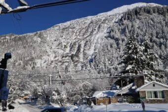
Avalanche alert issued for downtown, Thane residents
The alert is not an evacuation advisory, but the city advises residents in the affected areas to prepare for an evacuation if conditions continue to worsen.
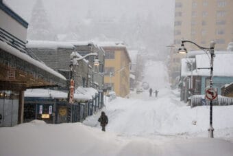
City, state and businesses continue closures in Juneau amid record-breaking snowfall
The National Weather Service Juneau has extended the winter storm warning until noon on Wednesday.
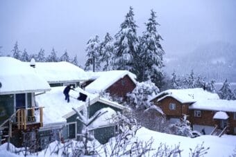
Heavy snow and freezing rain buries Juneau ahead of the new year
The National Weather Service recorded just shy of 27 inches of snow that had fallen during this storm as of Monday afternoon at its office in the Mendenhall Valley.

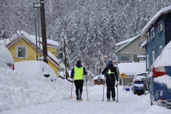
Another winter storm could dump more than a foot of snow in Juneau this weekend
The forecasted heavy snow comes after the capital city broke multiple record-low daily temperatures earlier this week.

What goes into keeping Juneau’s streets clear of snow all winter long?
Morning Edition Host Mike Lane recently sat down with CBJ Streets & Fleet Superintendent Scott Gray to learn more about local snow removal operations.