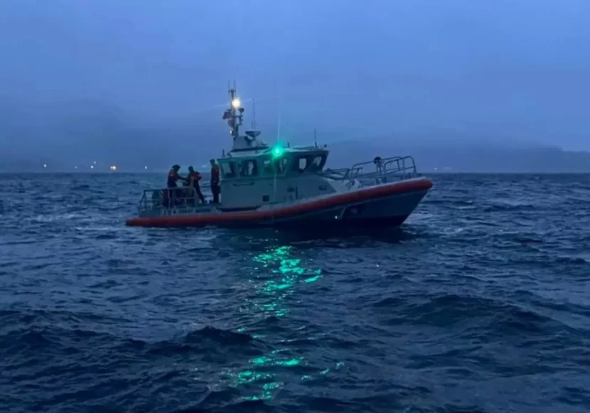
A Coast Guard Station Ketchikan 45-foot fast response vessel is seen in Nichols Passage in February 2022. (U.S. Coast Guard)
A fishing boat with one person believed to be aboard remains lost in Southeast Alaska waters near Ketchikan, a week after it was reported missing.
The 43-foot commercial geoduck clam dive boat Canis Majoris was last heard from Feb. 20 just north of Thorne Bay on Prince of Wales Island. The U.S. Coast Guard picked up an emergency radio transmission from the vessel at about 6:30 p.m. that evening.
Coast Guard Petty Officer John Hightower said Guardsmen responded aboard the cutter John McCormick, a 45-foot fast response boat dispatched from Ketchikan and a Jayhawk helicopter from Air Station Sitka. According to Hightower, crews sought the Canis Majoris for about 25 hours before suspending the search.
“They have a large number of factors that they take into account to determine the survivability of the person that’s being searched for,” Hightower said. “So they use all those factors to determine the optimal survivability of the missing person and how long it would be reasonable to search for them before shifting into a recovery position.”
Hightower said the Coast Guard has no word that anyone else was aboard the boat when it disappeared.
“It’s estimated that it was only the owner/operator,” he said. “Next of kin were contacted, and all the possible or suggested crew members and deckhands for the vessel were all contacted and they were confirmed to not be on the vessel.”
Canis Majoris is registered in the Commercial Fisheries Entry Commission database to a Ketchikan man named David Klein. Alaska State Troopers listed Klein as a missing person on Saturday.
Hightower said when watchstanders received the distress signal they alerted the Alaska Marine Highway System ferry Hubbard, which was nearby in Clarence Strait en route to Juneau.
AMHS spokesman Sam Dapcevich told the Ketchikan Daily News that the Hubbard didn’t have passengers aboard at the time. She was headed to Juneau to resume service after an overhaul at Ketchikan’s Vigor shipyard. Dapcevich told the paper that the ferry sent crew on a speedboat to the site of the distress call. They found a life raft and floating debris but no survivors. The weather got worse and the ferry crew had to return to safety.
The Coast Guard asks anyone with information on Klein or the Canis Majoris to contact Ketchikan troopers at 907-225-5118, or the Coast Guard Southeast Alaska Command Center at 907-463-2980.
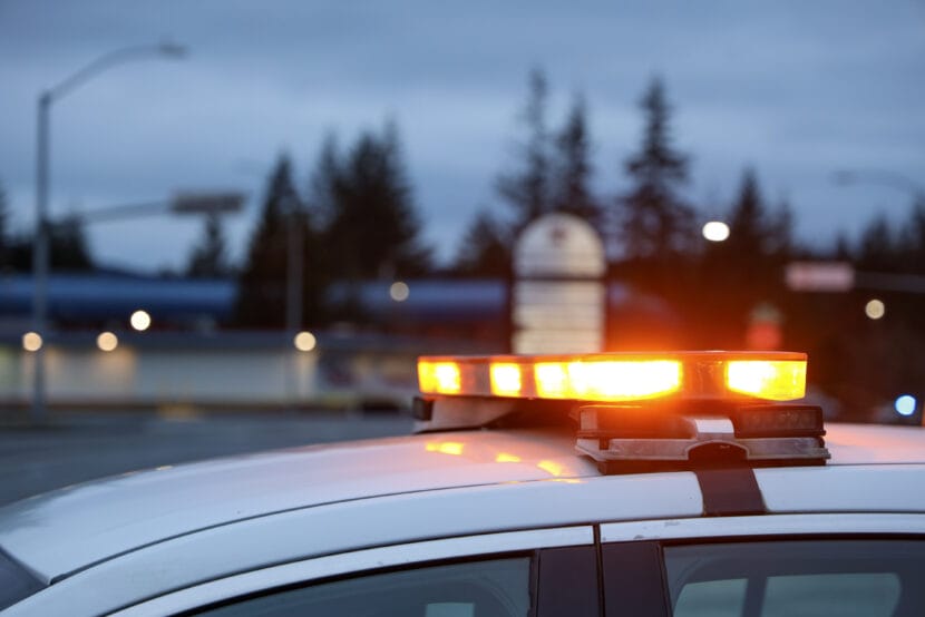
Juneau Police block traffic as officers investigate the death of a woman involving a police officer on Christmas morning on Wednesday, Dec. 25, 2024. (Photo by Clarise Larson/KTOO)
The Juneau Police officer who shot and killed a resident wielding a hatchet last year will not face criminal charges.
The state’s Office of Special Prosecutions released a statement Wednesday that cleared Officer Jonah Hennings-Booth in the Christmas morning shooting of 30-year-old Raye Johnston.
Two other officers were present during the incident but did not fire their weapons.
The fatal shooting took place in the parking lot of the Mendenhall Valley Breeze In convenience store. According to the Juneau Police Department, the officers were responding to an emergency call because Johnston was allegedly yelling and threatening people with a hatchet.
The statement from the Office of Special Prosecutions says Johnston did not comply with officers when ordered to put down the weapon and continued to advance toward the officers even after officers used their tasers. Hennings-Booth then shot Johnston, who was pronounced dead at the scene.
In its review of the incident, the state found Hennings-Booth was “legally justified in his use of deadly force” against Johnston.
Johnston’s death was the second shooting fatality involving police in Juneau last year. In July, police shot and killed 35-year-old Steven Kissack downtown. Months later, the Office of Special Prosecutions ruled the shooting was justified and cleared all officers involved of any criminal charges.
Since 2009, there have been more than 150 police shootings in Alaska. No officers involved have been charged with a crime.
In the days after the shooting, Deputy Police Chief Krag Campbell said the department planned to release police body camera footage to the public, but did not say at the time when that would happen. Campbell said in a text message Wednesday that they plan to release body camera footage on Thursday evening.
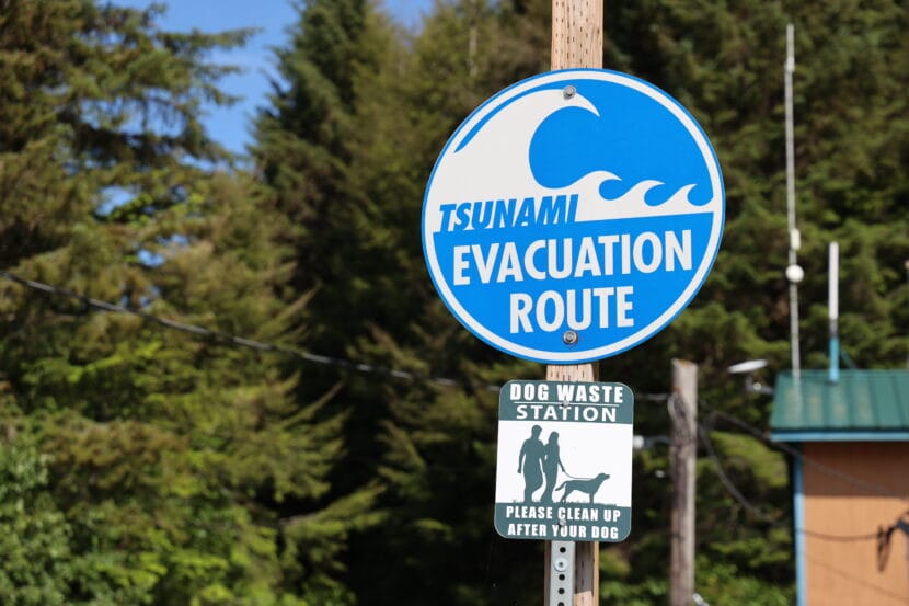
A sign points out a tsunami evacuation route in Pelican, Alaska in July, 2023. (Clarise Larson/KTOO)
Alaska’s Emergency Operations Center has cancelled an annual test of the system responsible for alerting Alaskans about potential tsunamis.
Each month, the National Tsunami Warning Center tests the system that alerts the coast guard, Federal Emergency Management Agency and other entities to tsunami activity. But once a year, the test goes further – and the warning is broadcast on public radio and television stations and sent to residents’ cell phones.
That usually happens in late March, around the anniversary of the 1964 Great Alaska earthquake. But the test has been canceled for this year. According to an email the Emergency Operations Center sent earlier this week, the test would not happen “due to a few factors beyond our control.”
Jeremy Zidek, a spokesperson for the state emergency operations center, said the system has been activated two times since July of 2023, when it was triggered by real warnings.
“Based on that information and the data that was gathered, it just looked like the test wasn’t going to be necessary to gauge if the system worked or not,” he said.
The tsunami warning system was activated in December by an earthquake in California and again in July of 2023 after an earthquake near the Aleutian islands. Zidek said the tests are crucial to ensure the system is working as intended, but that it’s also important not to do them too frequently.
“We want to make sure that the system is fully working, and we believe it is,” Zidek said. “But we don’t want to overtest it and then people become a little bit desensitized to the warnings when they’re real.”
Both the tests and real warnings have malfunctioned before, highlighting issues with the system. That includes after the 2023 earthquake near the Aleutians. The system sent out emergency alerts to people in communities that were not actually at risk.
Also in 2023, the annual test did not reach a handful of communities it should have, including Ketchikan and Sitka. Dave Snider, the Tsunami Warning Coordinator with the National Tsunami Warning Center, said that was largely due to confusion over which test was happening. Another factor was a coding failure, which he said has since been ironed out.
The Tsunami Warning Center, the National Weather Service headquarters in Alaska and the state all agreed the warning wasn’t needed this year, Snider said. Still, he emphasized the importance of regularly testing the system to be sure it – and the communities who rely on it – are ready if a tsunami does happen.
“We haven’t had a big one, or, you know, one that’s locally impactful in a really long time. That doesn’t mean that they don’t exist,” Snider said. “So just reminding folks there in your community that you know they do need to have a plan.”
He added that natural warning signs in coastal communities can be just as crucial as alert systems. Think: hearing a deep rumble, feeling the earth shake or observing unusual ocean behavior.
“In places like Haines, those natural warning signs will save their lives,” Snider said.
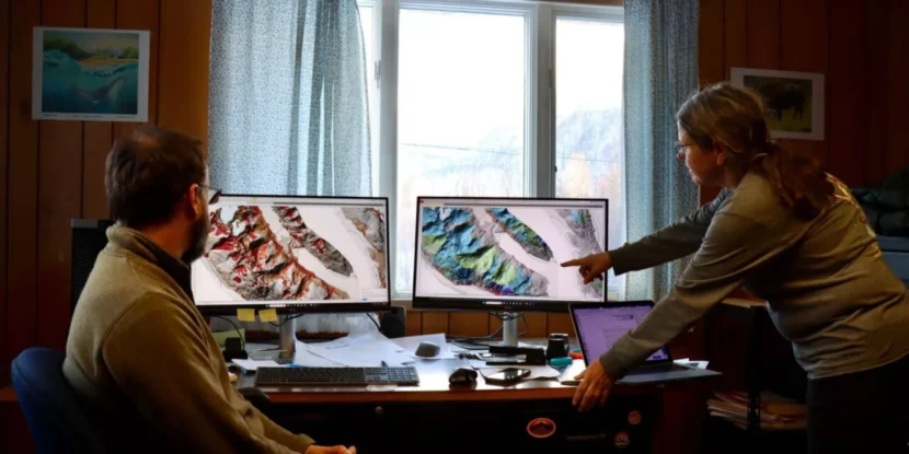
Members of the Haines Planning Commission examine new maps that illustrate landslide risk in the area. The maps are meant to inform future development and planning decisions. (Avery Ellfeldt/KHNS)
If you drive north on Lutak Road in Haines, you’ll see snow-covered peaks towering over the ocean below. If you look closer, you might notice something else: vertical gashes running down the mountain face. They mark places where landslides – or maybe avalanches – have struck, taking trees, soil and rocks down with them.
Patty Brown chairs the Haines Planning Commision. She pointed to one of the slide paths while out for a drive on a cold, clear day back in January.
“There’s probably been a history of different slides reshaping what that whole face even looks like,” Brown said. “All this is slide, slide, slide.”
A new report aims to address that reality by mapping the local landscape and pinpointing areas that might be more prone to slides down the line. The goal: providing homeowners and the local government with a science-backed tool that can be used to gauge landslide susceptibility, and to plan accordingly.
The multi-year effort, which was paid for with federal funding, began after an atmospheric river dumped record levels of rain on Haines in 2020. The storm washed out roads and triggered landslides, including one that killed two beloved community members.
“It was associated with such a radical weather event,” Brown said. “Those are going to keep getting more dramatic and be beyond what we predicted. So we better have some kind of an inventory of what to expect.”
The 2020 event and resulting maps are part of a bigger story about intensifying natural disasters – and how communities across Alaska and the U.S. are responding. As climate change and development fuel more destructive disasters including floods, slides and wildfires, local governments are trying to get ahead of the problem without also threatening homes and livelihoods.
Mapping efforts – and pushback – across Southeast
The Haines report is composed of three different maps, which were published in January by the Alaska Department of Natural Resources. The maps were made using light detection and ranging technology, also known as lidar, which researchers attach to planes, drones or helicopters to fly over a study area. The lidar sends down light pulses that bounce off the trees, buildings and the ground. The time it takes for the pulses to return provides detailed data about the landscape and what’s on it.
“So you can think of it kind of like a flashlight that’s shining down. Where does that light hit? Where does it pass through?” said report co-author Jillian Nicolazzo, a geologist with the Landslide Hazards program at the Department of Natural Resources.
The data is then used to create the maps, which local governments, communities and homeowners can reference when making crucial decisions about where to build housing, roads, schools and more.
“If we’ve identified an area that might be susceptible to landsliding, and in 15 years someone wants to put a subdivision in that area, well, hopefully they’ll see that we’ve identified it as a higher hazard area, and they’ll take a closer look,” Nicolazzo said.
Haines is not the only community interested in mapping the risk. Similar projects have been completed or are underway in more than half a dozen other communities in Southeast, in part due to four fatal landslides in the last decade. Those disasters happened in Sitka, Ketchikan, Haines and Wrangell.
But the efforts aren’t without controversy. Efforts to map physical hazards have sparked opposition in Alaska, but also in other places, like New Orleans and Oregon. The pushback has typically come from homeowners who don’t want the state or local government to label their properties as high risk out of fear it will drive down their property values and make it more difficult to get insurance.
Ron Heintz is a senior researcher at the Sitka Sound Science Center, a nonprofit that’s played a key role in confronting landslide risk in Southeast. He said the issue routinely comes up during conversations about landslide risk in Alaska.
“Everybody wants to see a hazard map, and they want to see if they’re exposed to any sort of hazard. But they don’t want any sort of official acceptance or understanding of these hazard maps,” Heintz said.
Take Juneau. In 2020, the local assembly commissioned new hazard maps, which placed some neighborhoods in landslide zones for the first time. The move drew widespread concerns that the maps would drive down property values or impact insurance. Later, in 2023, the assembly decided against formally adopting the maps and eliminated landslide restrictions from the city’s land use code.
Todd Winkel is a Haines resident who owns property right next to the fatal 2020 slide. He said people in Sitka warned Haines residents to push back against potential risk mapping after the disaster.
That was partially due to worries over real estate. But Winkel said it was also because people felt the mapping would only be beneficial if the local government focused on helping landowners mitigate the risk. Winkel agrees. He said Haines should focus instead on reducing the threat in areas that are clearly landslide-prone.
“If you’re not going to do anything, don’t risk assess it,” Winkel said.
Risks can hide in plain sight
The Haines Planning Commission, for its part, hopes the maps will help the community better gauge and respond to the risk, both during future extreme weather events and when making long-term planning decisions.
That could include encouraging people to consult an engineer before developing somewhere that’s landslide prone, said Derek Poinsette, the planning commission’s vice chair.
Poinsette emphasized that the commission does not currently plan to use the maps for regulatory purposes, such as vetting building permits – and that the maps have a few important limitations.
Key among them is that they do not predict where slides will happen in the future. Instead, they identify areas that may be more susceptible to slides due to the slope angle, vegetation and more. Another caveat, he said, is that the maps rely heavily on lidar, which provides important information but is not the same as verifying the risk in the field.
“This isn’t the last word on any specific area,” Poinsette said. “Getting out there on the ground and actually taking soil samples and drilling cores and things like that is what ultimately needs to happen to do a final engineering type assessment for any location.”
Back in the car, Brown, the commission chair, said there is a long history of landslides in Haines, and that the community is highly attuned to that reality. Still, she said, the deadly landslide in 2020 made at least one thing clear: the risk can hide in plain sight.
“It was a forested slope, and we like to be confident – ‘Oh, it’s got plenty of vegetation holding the soil.’ But it’s steep. Once something’s really forested, I think you lose track of how steep it actually is under there,” Brown said.
“Part of what we have to pay to live in such a beautiful, dramatic landscape is sometimes, the drama looks like this,” she added.
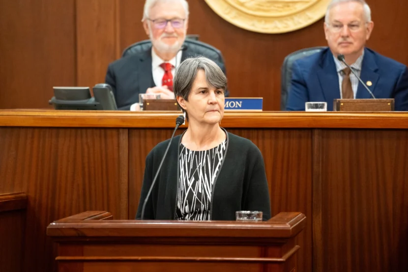
Alaska Supreme Court Chief Justice Susan Carney delivers the State of the Judiciary address on Feb. 12, 2025. (Eric Stone/Alaska Public Media)
Alaska Supreme Court Chief Justice Susan Carney defended the court system’s work and laid out plans for the future in a speech to state lawmakers on Wednesday.
Carney spent a significant part of her first State of the Judiciary address responding to concerns raised in recent news stories from the Anchorage Daily News and ProPublica highlighting yearslong delays in court proceedings.
In one case, it took seven years for a sexual assault witnessed by a police officer to go to trial. Another sexual assault case has gone more than a decade without a trial. The reports highlighted the growing time it takes to resolve unclassified felonies, like rape and murder.
Carney said the court system is working to be more efficient. She said courts are now closing more cases than they open every year, and the number of open cases is down by a third over the past year.
“But we know that we have more work to do,” she said. “Reducing the number of open criminal cases and the time it takes to get them done is our No. 1 priority at all levels of the court.”
Yearslong delays are “not typical,” she said. The average misdemeanor is resolved in six months or less, and felonies short of the most serious charges typically are closed in roughly a year, according to figures she outlined to lawmakers. Unclassified felonies, including rape and murder, take an average of three years — triple what they took a decade ago.
Carney highlighted a few efforts aimed at making courts more efficient — things like rules limiting delays, calling retired judges in to hear cases, and training aimed at speeding the process. But Carney told lawmakers that there’s only so much the court system can do.
“Three years is a long time for victims and for other people involved in those cases,” she said. “But those are the most serious cases. The facts tend to be more complicated. The number of people tend to be larger. The evidence issues that can arise can be very complex, and there’s always constitutional concerns. It’s very hard to shorten the time that those cases get.”
Carney also discussed efforts to expand restorative justice, mediation and collaboration with tribes. And she said the court system plans to release a “cutting edge chatbot” powered by artificial intelligence to deal with the complexities of the legal system when a loved one dies.
Carney also asked lawmakers to support the court system’s budget requests, including the next phase of a project that would add new courtrooms in Palmer to support the fastest-growing area of the state.
Carney presides over the state’s first majority-female Supreme Court and delivered the speech to a Legislature that also includes the state’s first majority-female House of Representatives.
“This has been a long time coming,” she said. “But what an example for Alaska’s children — that they can aspire to these kind of positions and know that they can achieve them.”
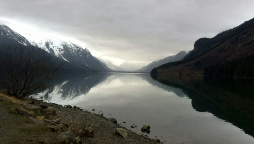
Authorities in Haines have suspended their search for a man who reportedly fell into Chilkoot Lake while ice skating on Thursday. In a dispatch, state troopers said local author Thomas McGuire, 79, had gone skating alone and failed to return, and that his vehicle was found in a parking lot near the lake. The dispatch said McGuire’s next of kin had been notified.
Late on Thursday afternoon, the Haines Volunteer Fire Department received a report that a skater had fallen through the ice at Chilkoot Lake. The call came from another skater, who used a Garmin inReach device to alert authorities. That person reported hearing – but not seeing – someone fall through the ice.
Jacques Turcotte, the Haines district park ranger, was the first person on the scene, at around 4:15 pm. He said he ran the search-and-rescue operation because Haines doesn’t currently have a local trooper, and the accident happened around a state park.
When the search-and-rescue team arrived, Turcotte said they found the person who called in the accident and ensured they got off the ice safely. Turcotte said the team made it more than a mile across the lake, but it became clear that it wouldn’t be safe to go any further to look for the missing skater.
“The ice was cracking, and water was bubbling up beneath my feet. So we turned back. At that point, with darkness coming in and unsafe ice conditions, we were unable to locate the victim,” Turcotte said.
Turcotte went up in a plane at first light Friday morning to scour the area. He saw pockets of open water near the far end of the lake, and he thinks that was where the skater fell in. But he said the search is no longer active, and authorities are focusing on recovering the victim.
“At this point, with no signs of life and no signs of a body and with ice conditions being what they are being, it’s too unstable and unsafe to send rescuers out onto the ice,” Turcotte said.
McGuire is a long-time Alaska resident. His most recent book, The Curve of Equal Time, tells the story of a woman who returns to Alaska from Seattle to work on a salmon fishing boat. He also published a book called Steller’s Orchid in 2019.
McGuire and his wife, Sally McGuire, built their home on the Chilkoot River, where they raised four children.
Haines residents have been skating at Chilkoot all week during a long spell of clear weather. But authorities are advising against that now due to unstable ice created by warmer temperatures, which Turcotte said can rapidly change conditions.
“Lake ice is inherently dangerous and unpredictable, and it can change quickly. You know, we’ve had cold temperatures,” he said. “We’ve also been getting warmer temperatures throughout the days, and it’s been sunny out too, and that affects everything as well.”
He advises people to skate with a partner, to wear life jackets when they skate, to continuously check ice thickness, and to bring rescue supplies. Among them: ropes, throw bags and ice picks that can be used to climb out of the water or help someone else do the same.
Close
Update notification options
Subscribe to notifications
Subscribe
Get notifications about news related to the topics you care about. You can unsubscribe anytime.