
In the past, climate models have struggled to connect ocean conditions with what happens in the atmosphere. But two new studies do a much better job describing that link.
Annie Feidt, Alaska’s Energy Desk
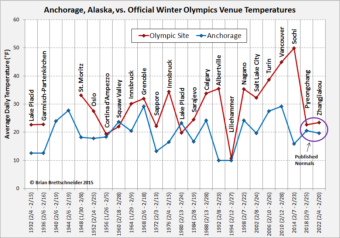
Ask a Climatologist: Winter weather makes a comeback at the winter Olympics
You have to go back over twenty years to find a colder winter Olympics.
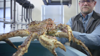
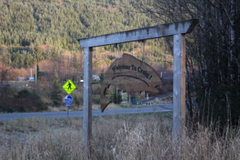
Video: The oceans are changing. Can crabs adapt?
At a lab in Kodiak, researchers are working to understand whether crabs can adapt to ocean acidification.
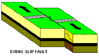
Magnitude 7.9 earthquake was an intriguing one for seismologists
A magnitude 7.9 earthquake early Tuesday is what is known as a strike-slip, or when two large blocks move side-to-side instead of up-and-down. That, and it’s distance from shore may explain why tsunami waves were so small.
Ask a Climatologist: “Astounding” new state temperature record for January
66 degrees at the Annette Island Airport on Sunday, January 14 is the state record for a high temperature anywhere in Alaska in the month of January.
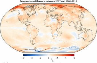
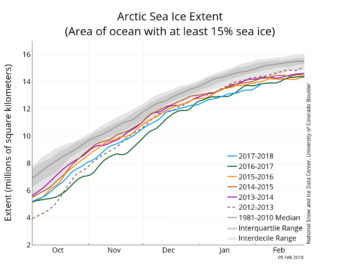
Ask a Climatologist: What is polar amplification?
As snow and sea ice melt in the Arctic it creates a feedback loop that enhances global warming called polar amplification.