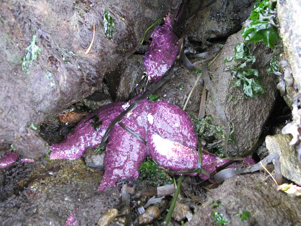
Sea star wasting disease is affecting starfish populations throughout the Pacific, from Baja California to Mexico. (Photo by Kit Harma, pacificrockyintertidal.org)
Droves of baby starfish are returning to Oregon and Northern California’s shores after a wasting disease decimated whole populations of the creatures over the past two years along the West Coast.
Data collected by Oregon State University researchers shows an unprecedented number of baby starfish, or sea stars, survived the summer and winter of 2015, the Eureka Times Standard reported Saturday.
“When we looked at the settlement of the larval sea stars on rocks in 2014 during the epidemic, it was the same or maybe even a bit lower than previous years,” Oregon State University marine biology professor Bruce Menge said in a statement.
“But a few months later, the number of juveniles was off the charts — higher than we’d ever seen — as much as 300 times normal.”
A similar increase was found at sites just north of Trinidad, California, near Patrick’s Point State Park. A baby starfish boom also was noted in the summer of 2014 near Santa Cruz.
A virus killed millions of starfish on the Pacific Coast from Southern California to Alaska by causing them to lose their limbs and eventually disintegrate into slime and piles of tiny bones.
The cause of the massive outbreak remains unclear. Some have hypothesized it to be abnormally warm waters in the Pacific Ocean, which have wreaked havoc on marine ecosystems for the past two years.
Humboldt State University Marine Lab Director Brian Tissot disagrees with that hypothesis since the virus spread during colder months and didn’t expand as much during the abnormally warm 2015.
“There is no clear environmental cue,” Tissot said, adding the deadly wasting disease has declined in intensity but remains present.
Experts say that while it’s encouraging to see the abundance of baby starfish, the disease, competition and environmental factors make their survival difficult.
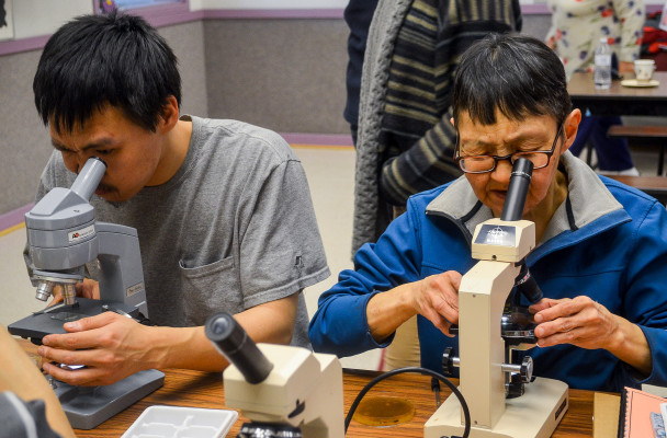
Last summer, residents of Gambell and Savoonga tested water samples for contaminants as part of an environmental health course led by Alaska Community Action on Toxics. (Photo by Kristin Leffler/KNOM)
That’s why representatives from Alaska Community Action on Toxics were in Nome last week. The nonprofit works to educate the public on environmental health and advocate for communities affected by contamination. This visit focused on one of the biggest toxic impacts in the Bering Strait: cancer.
On St. Lawrence Island, there has been cancer crisis for decades, according to Vi Waghiyi, an ACAT program director originally from Savoonga.
“We have come to learn that our people have six to 10 times higher PCB levels in the blood than the average American in the Lower 48,” she said.
PCBs are cancer-causing chemicals, also known as carcinogens, that were banned in the U.S. in the 1970s. Waghiyi said they’ve lingered in the environment on St. Lawrence Island because two former air force bases at Gambell and Northeast Cape have never been decontaminated.
Waghiyi said the proof is there. ACAT has tested local food staples, everything from fish and berries to crab and greens.
“We found out that our main foods — bowhead whale, walrus and seal, particularly the blubber and rendered oil — were so loaded with PCBs at levels we should not be eating,” she said.
And it’s not just PCBs from the former bases. Waghiyi said there are also high levels of pesticides and heavy metals, with contaminants coming from chemical-laden household products and air and water currents from around the world.
“We’re being exposed from so many sources,” she said. “It’s like a toxic stew.”
That has led to higher rates of cancer, miscarriages, and low birth weight for babies — not just on St. Lawrence Island, but in communities across the Bering Strait Region.
As part of continued efforts to help people learn about the toxins present in everyday life, ACAT brought Dr. Ted Schettler to Nome to visit the Norton Sound Regional Hospital and give a public talk.
“My latest project has been on breast cancer and the environment,” said Schettler, the science director of the nonprofit Science and Environmental Health Network.
Schettler’s research has found that many environmental factors play a role in breast cancer risk: diet and nutrition, physical activity, local emissions, and the chemicals people encounter daily.
“There’s no single thing we can point to that influences breast cancer risk nearly as strongly as cigarette smoking influences lung cancer risk,” he said. “Rather, there’s a collection of so-called risk factors that together create the conditions out of which breast cancer patterns evolve in our communities.”
But in educating the public on how to reduce environmental risk factors for cancer, Schettler and Waghiyi said they face difficult questions: Should people stop eating traditional foods to avoid contaminants? How can people stay healthy in their home communities without sacrificing their way of life?
Waghiyi said there’s no easy answer.
“It’s our identity. It’s our culture. We don’t have a choice,” she said. “So it’s important that we provide this data so that our people can make their own informed decisions.”
In the future, she said ACAT will continue raising awareness about toxins with the general public and health care providers as well as advocating for chemical cleanup. She said the organization will also continue collaborating with researchers like Schettler.
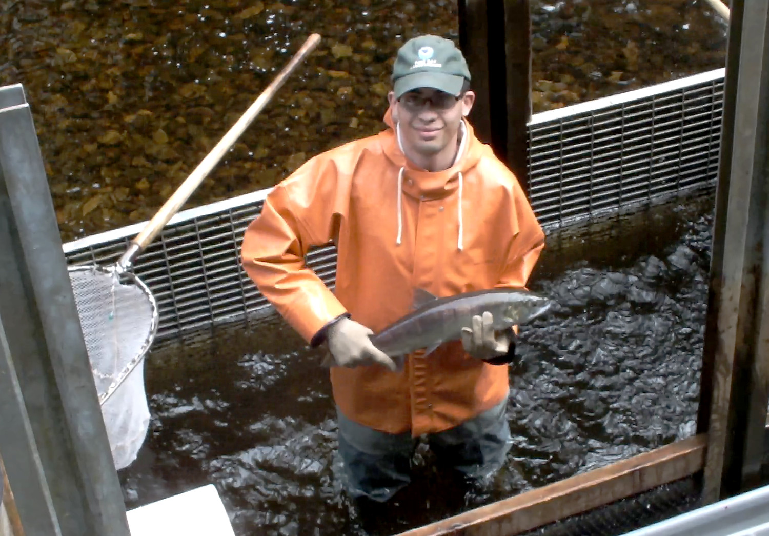
University of Alaska Southeast intern Joshua Russell holds up a squirming adult red or sockeye salmon before pitching it back into the water so that it can continue up Auke Creek to spawn. (Photo by Matt Miller/KTOO)
Fisheries researchers are investigating why pink salmon, a staple of Southeast Alaska’s commercial fisheries, seem to be growing bigger every year while other, longer-lived salmon species are getting smaller in size.
Listen to the audio version of this story:
“These pink salmon that we got in early this year are some of the largest I’ve seen in quite a long time,” said John Joyce, fisheries research biologist at National Oceanic and Atmospheric Administration’s Ted Stevens Marine Research Institute, in an interview last summer.
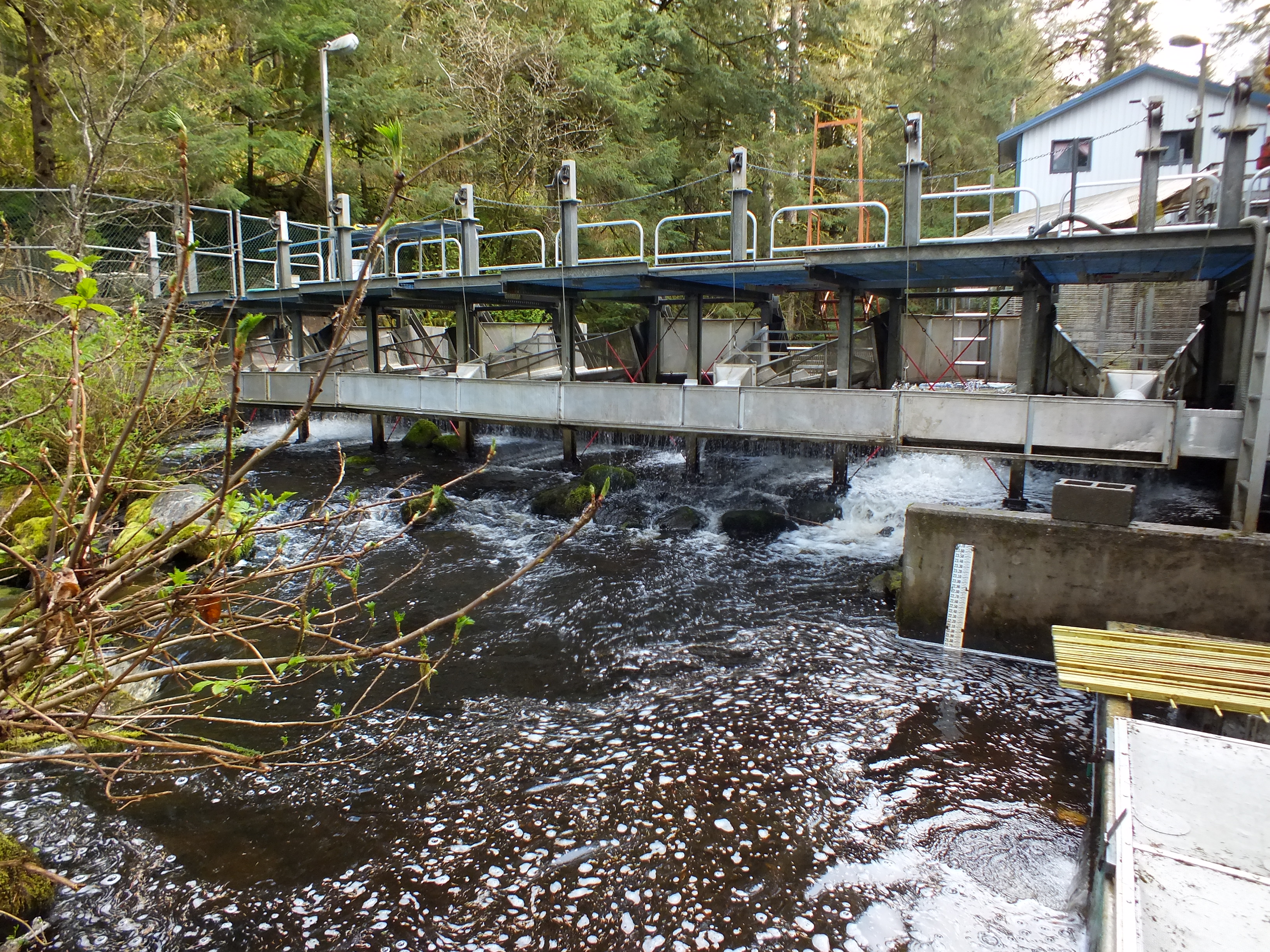
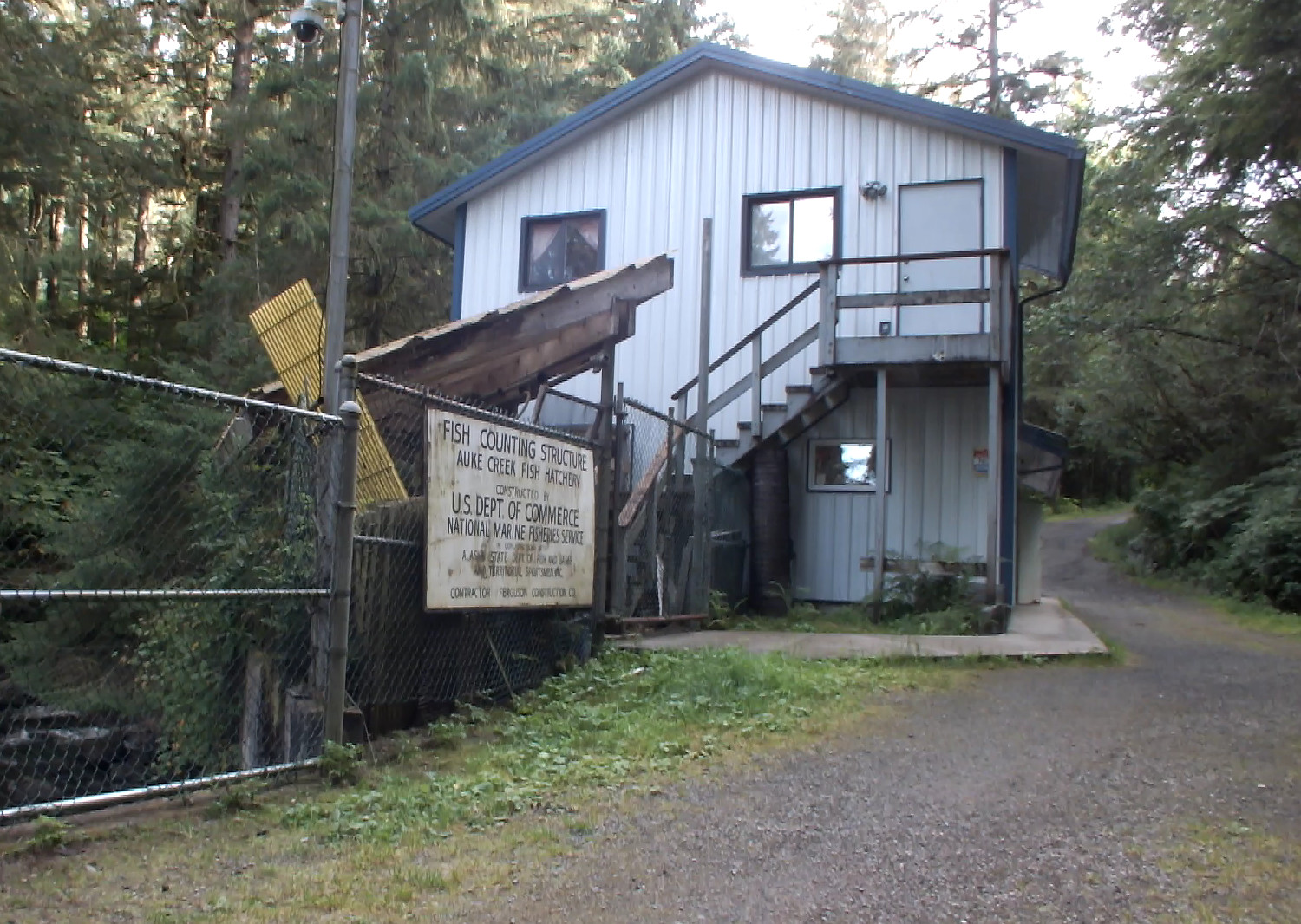
As Auke Creek flowed over rocks and returning salmon lingered in a nearby pool, Joyce explained how the creek’s weir provided more than 35 years of continuous data that is valuable for climate change research.
“We had a real warm event,” said Joyce. “It would be logical to assume that it’s creating a pretty good growth regime for these fish and we’re seeing evidence of that with these fish coming back.”
Downstream view of the fish counting weir at Auke Creek that is located north of downtown Juneau. (Photo by Matt Miller/KTOO News)
During the Salmon Ocean Ecology Meeting held in Juneau in March, research biologists presented their findings suggesting pink salmon runs may be affecting the growth and abundance of other salmon species in the north Pacific.
Leon Shaul, coho research project leader for Southeast Alaska for the Alaska Department of Fish and Game, said they’ve noticed a trend develop in the Gulf of Alaska and Southeast Alaska over the last several decades. Older chinook and coho are getting smaller while young reds and pinks are getting bigger.
“The size of salmon the region have shown a pattern of convergence with everything that was smaller 30, 35 years ago trending larger and the larger fish trending smaller,” Shaul said.
Shaul wonders if the salmon’s forage base is being altered by the recent swings in water temperature. When ocean temperatures are cool, young pink salmon usually grow by feeding on the bigger and fattier zooplankton. It just so happens that squid like zooplankton, too.
“Pink salmon may be changing the whole forage base similar to the phenomenon of fishing down the marine food web or taking out the squid which is a direct competitor with them for zooplankton,” Shaul said. “Pink salmon is an intraguild predator that both eats its competitor and eats the prey of its competitor.”
It’s possible that when pink salmon bulk up by consuming squid, they’re also depriving offshore coho and chinook of their primary food source.
Shaul acknowledges they still haven’t pinned down whether young pinks are benefiting from more zooplankton because those older pinks are scooping up all the squid. And since less fatty zooplankton are prevalent during warm conditions, they’re not sure how pinks are still getting bigger with the recent warm water Blob in the northeast Pacific.
“If it’s driven by climate, then you would expect – going back into a warm period – that they would’ve been smaller in size. And, yet, pink salmon have continued to grow larger in 2015,” Shaul said. “And, so they’ve followed this recent trend which suggests that there’s something more than just the change in climate. That there is plenty of food out there and somehow they are benefiting.”
Biologists at the Auke Creek Hatchery and Weir have been counting fish for the last 35 years. (Photo by Matt Miller/KTOO)
Elsewhere in the north Pacific, researchers have already documented what they believe is one salmon species possibly crowding out another.
During the Juneau conference, Greg Ruggerone of Seattle-based Natural Resources Consultants reviewed earlier research on how eastern Kamchatka pink salmon runs may be affecting Bristol Bay red salmon abundance. Pinks usually take two years to mature while reds usually take three years. Since both stocks intermingle in the north Pacific, huge pink runs compete for food with the young reds during their second year at sea.
“Basically, what you see is a very strong alternating year pattern,” Ruggerone said. “Pink salmon are about 40 percent more abundant in odd numbered years. When you see lots of pink salmon, you see the reduction in growth (in red salmon). It’s fairly consistent over time.”
As well as less growth for red salmon, Ruggerone said there are fewer of them in alternating years.
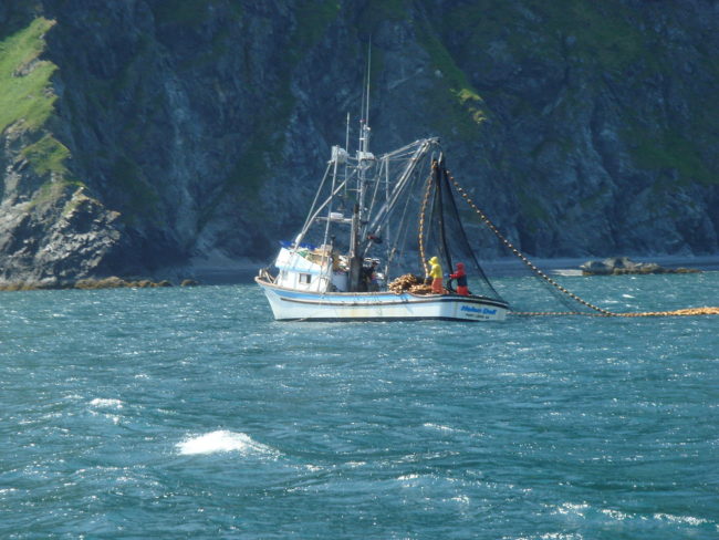
A seiner fishing for salmon off the coast of Raspberry Island in July 2009. (Public domain photo by NancyHeise)
Fisheries researchers say the appearance of a warm water anomaly in the northeast Pacific Ocean likely added a new wrinkle into recent predictions of Alaska salmon runs that are used by commercial fishing industry for the upcoming season’s planning. Because of the variability of West Coast salmon populations, a simple cause and effect may be impossible to pin down.
Listen to the audio version of the story:
Biologists admit they’re still not sure exactly how the warm water Blob is affecting salmon up and down the West Coast.
“The thing that we need to think about is that warm water in Alaska is really different than warm water in California,” said Brian Beckman, a research fishery biologist at National Oceanic and Atmospheric Administration’s Northwest Fisheries Science Center in Seattle.
“Warm water in California can be so warm that it is actually injuring the fish, whereas warm water in Alaska just means that it is abnormally different and maybe the ecosystem is different. But it’s still a comfortable place for fish to be,” said Beckman.
Beckman was one of the organizers of March’s Salmon Ocean Ecology Meeting in Juneau, which featured biologists and researchers from California to Alaska.
Because of differences in the life cycles and migration patterns of the five Pacific Ocean salmon species, Beckman said it’s impossible to immediately determine how The Blob is affecting salmon abundance, run timing, growth, forage habits and complicated predator-prey relationships.
“It’s really hard to talk about salmon runs all across the coast in any one single focus because they all kind of do different things,” Beckman said. “The Blob does not have one specific effect across all salmon stocks.”
Why would any of that information be important? The $414 million answer to that question comes from the Alaska Department of Fish and Game. That’s the dock price paid for all salmon harvested last year. In addition, the McDowell Group of Juneau says Alaska’s salmon fisheries generate $845 million in income for 18,400 direct jobs.
Joe Orsi, fisheries research biologist at NOAA’s Ted Stevens Marine Research Institute at Auke Bay, explained why they research salmon biology, and do modeling or run simulations to predict Alaska salmon abundance, run timing and even size of the fish.
“Basically, you confront the stakeholders and say this is what we think is going to happen, and you interact with the industry people,” said Orsi. “This is when the decisions are made.”
They include decisions by state fisheries managers who plan the timing and length of the openings, the processors which dispatch tenders and hire outside help to work in the plants, and the fisherman who must budget his or her expenses and figure out how many deckhands to hire.
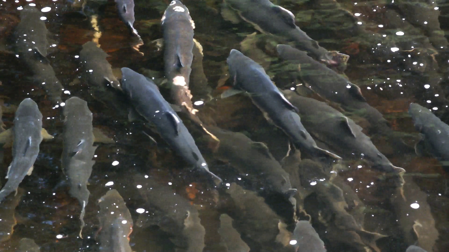
Pink salmon, plus an occasional silver and red, congregate in a pool above the Auke Creek weir before spawning. The males will put on displays and fight with other males as part of the competition for mating females which have already started a nest. (Photo by Matt Miller/KTOO)
Orsi said they’re not sure if it was The Blob’s presence in the northeast Pacific that upended their modeling for last year’s salmon runs. Overall, last year’s pink harvest in Southeast Alaska fell well short of predictions with runs in the southern part of the Panhandle doing poorly.
Another big question is whether El Niño or equatorial warming has encouraged other species to wander north.
“Of course, we have unknown ecological impacts of the subtropical fish species that were occurring in the Gulf of Alaska: tuna, sunfish, thresher sharks,” Orsi said. “We don’t know if there’s going to be increased competition or predation as a result of those.”
In order to get a better handle on what is happening, researchers have created a coast wide database that is intended to show how The Blob is affecting various salmon runs. Bryan Burke, research fishery biologist at the Northwest Fisheries Science Center in Seattle, helped design it.
“This could be a good way to summarize when and where did The Blob impact salmon,” Burke said. “The fact is that we don’t know yet because a lot of the salmon that were in The Blob have not returned yet.”
Some of those fish that have not returned yet are mature Copper River reds. Those fish are usually harvested during the very first commercial fishery of the year. It could kick off as soon as mid-May.
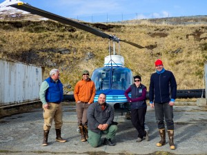
The ShoreZone flight crew. (Photo courtesy Pipa Escanlante)
How many photos do you figure you shoot out the window when you take a trip? Five? Ten? Twenty? How many of you take a picture every three seconds?
I caught up with a helicopter crew of modern mapmakers who shoot 3,000 to 5,000 photos a day.
Imagine looking out a helicopter window taking pictures as you’re traveling 60 mph and you’re only 300 feet over the Eastern Aleutian Islands.
That’s a typical day for the four-person ShoreZone flight crew. But why spend so much time when there are satellites?
“People have said, ‘Well, why don’t you just use satellite imagery so you can get one picture of everything?’ But of course the satellite picture is also limited in resolution,” said oceanographer Carl Schoch. “If we’re trying to resolve objects on shore that are on the scale of centimeters. That’s actually very hard to do unless you get this kind of imagery.”
Schoch added that there actually are no maps like this.
“There are lots of other coastal maps out there — navigation charts, topographic maps — there are even other maps of shoreline habitats but none that matches the imagery up with the map,” Schoch said.
The team can map the shoreline biology because the photographs are shot at an angle, which makes it easier to see cliffs and overhanging vegetation.
Over a week, they are documenting more than 1,300 miles of shoreline through video and still imagery. But there is a short window each year for photographing the shore. It can only be done during extreme low tides in the spring and summer when the intertidal flora is blooming.
To get everything done, the team is on a tight schedule with every five minutes mapped out. Any delay can ruin the entire day.
“All it takes is one flat tire or if anything was to happen here and all of a sudden the whole day is shot. We couldn’t go out,” said Schoch. “That one event would just destroy the whole project. We don’t have an extra day at the end of the tide to make it up. Coming back for 400 kilometers of shoreline isn’t worth it.”
Back in the lab in Victoria, British Columbia, the thousands of still images are stitched together using a technique called structure form motion. Every single pixel gets a latitude, longitude and elevation creating a 3-D model of the shoreline. And that step takes a long time. It will be at least six months before this project is completed.
Online everyone can access ShoreZone’s maps and video. When the program began in the 1980s, it was intended for oil spill responses. But over the years that has changed. Schoch said people can use the data in many ways.
“From beach walkers to people who are planning for making development plans on the coast or very large ecological questions that have to do with the entire gulf of Alaska, this project has relevance to all of them,” Schoch said.
In the winter months, Archaeologist Martin Stanford scrolls through the still photographs and video. The photos help him plan summer trips to explore old village sites where he can document stonefish traps and canoe ramps built nearly 600 years ago.
This trip to the Eastern Aleutians is part of a larger project mapping the entire coast of the Pacific Northwest. Alaska is 90 percent done while the coasts of Washington, Oregon and British Columbia are completed.
Certain areas of Alaska’s coast have been mapped more than once. With the ShoreZone project nearly finished, Schoch thinks people will be interested in seeing how fast their shoreline is changing.
“Now that we are thinking about remapping this becomes relevant because we can compare old 3D models to new 3D models and we can measure the change on a shoreline due to wave erosion or sea level rise,” said Schoch.
Full disclosure: The Nature Conservancy has contracted KTOO’s television production team to produce a documentary on the ShoreZone project.
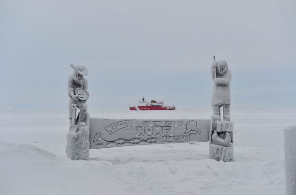
The Coast Guard Cutter Healy breaks ice near the city of Nome. (Public Domain photo by Chief Petty Officer Kip Wadlow/U.S. Coast Guard)
The U.S. Coast Guard is gearing up for a busy summer in the Arctic.
In preparation for the flagship voyage of the Crystal Serenity, a thousand passenger cruise ship set to sail through the Northwest Passage this summer, the Coast Guard has been hosting search and rescue drills, tabletop exercises, and meeting with communities along Alaska’s coast.
A contingent of Coast Guard officials visited Nome Monday. Rear Admiral Dan Abel led yesterday’s meeting at Old St. Joe’s community hall.
“Clearly Nome is a hub and we need to make sure we enfranchise what’s important to Nome with a plan,” Abel said.
The Coast Guard contingent heard comments from Nome’s Mayor Richard Beneville, City Manager Tom Moran, along with business and nonprofit representatives.
Both sides agreed that activity in the Arctic isn’t slowing down.
“What is happening here in the far north is the opening of the Arctic,” said Mayor Beneville. He and others at the meeting continually referred to the Arctic as a ‘new ocean.’
Nome and others along Alaska’s coast will see a bump in visitors and summer revenue from ships like the Crystal Serenity, but there is concern about the region’s ability to deal with a potential disaster at sea.
Tom Vayden chairs the Local Emergency Planning Committee.
“I think it’s very important that the major players remember that Nome is here with a lot of resources and that we can be on the ground first and help,” Vayden said.
He urged better communication between the Coast Guard and coastal communities like Nome.
The Coast Guard and the Department of Defense are scheduled to host the Arctic Chinook Drill in late August, just days after the Crystal Serenity passes through Nome’s port.
Close
Update notification options
Subscribe to notifications
Subscribe
Get notifications about news related to the topics you care about. You can unsubscribe anytime.

#/media/File:Seiner_off_the_coast_of_the_Kodiak_Archipelago,_Alaska_2009_218.jpg)