Families hanging out in the sunshine at Auke Rec, June 1, 2022 in Juneau, AK. (Photo by Paige Sparks/KTOO)
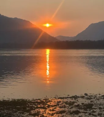
Temperatures in Juneau could climb to highs near 80 degrees on Friday, as a weekend heat wave brings clear skies and intense sun to Southeast Alaska.
National Weather Service meteorologist Kimberly Vaughn said a ridge of high pressure is bringing the heat by getting rid of Southeast’s typical cloud cover.
“The high pressure is pushing things down and away,” she said. “That’s why a lot of times, you’ll see the clear skies.”
Normal temperatures for the first week of July have generally hovered in the low 60s. Of course, there are always exceptions. The heat wave is forecast for the anniversary of Juneau’s hottest recorded day, when thermometers hit 90 degrees on July 7, 1975.
Despite a week of record-breaking heat across the nation and the globe, local meteorologists don’t expect any records in Southeast.
But the term heat wave is relative.
“Our heat wave is in the 80s,” Vaughn said. “You know, places like Texas, that’s not going to be as exciting for them.”
Meteorologists will keep an eye on the marine layer, which could bring in cloud cover and sea breezes to keep extreme temperatures at bay, especially for the outer coast.
Last month, the National Oceanic and Atmospheric Administration declared the arrival of El Niño, a period of warmer-than-average ocean temperatures in the Pacific, which happens naturally every 2 to 7 years.
El Niño sets the stage for higher-than-average temperatures, but it is just one of the many factors that forecasters consider. And El Niños reach their full strength in the winter, which means that warmer weather is more likely to come next summer.
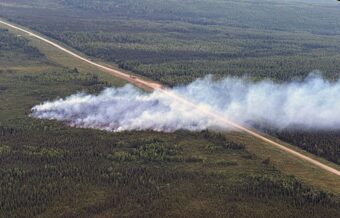
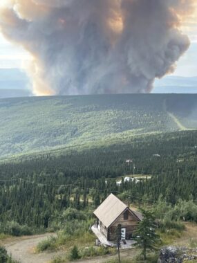
This weekend, the high temperatures and dry conditions will increase the risk of fire.
And heat-related injuries are possible, especially for pets, children and older adults. People should be sure to drink plenty of water and take breaks after long periods outdoors.
Outdoor workers are vulnerable to prolonged heat waves like the one hitting Texas, which climate scientist warn are becoming more common. (David J. Phillip/AP)
If there’s one kind of weather extreme that scientists clearly link to climate change, it’s worsening heat waves.
“They are getting hotter,” says Kai Kornhuber, adjunct scientist at Columbia University and scientist at Climate Analytics, a climate think tank. “They are occurring at a higher frequency, so that also increases the likelihood of sequential heat waves.”
In Texas, the Southern U.S. and Mexico, a three-week heat wave has gripped the region with temperature records falling for days in a row. Extreme heat has also hit India, China and Canada, where widespread wildfires are burning.
“Most of the world’s population has experienced record-breaking heat in recent days,” says Daniel Swain, climate scientist at the University of California-Los Angeles.
This year, something else is adding fuel to the fire: the El Niño climate pattern. That seasonal shift makes global temperatures warmer, which could make 2023 the hottest year ever recorded.
Temperatures in the weather report also don’t tell the whole story about the danger. With higher humidity, the toll that heat takes on the human body is much more taxing. Weather forecasters try to capture that with a heat index warning, which shows what the temperature actually feels like. But that’s only calculated for someone sitting in the shade, underestimating the risk for outdoor workers and others in the sun.
In recent years, scientists have done rapid assessments to determine how heat waves are being influenced by climate change. In several, they found the extreme temperatures were nearly impossible without climate change, like in the Mediterranean in April, in the Pacific Northwest in 2021, and in the United Kingdom in 2022.
El Niño is the exclamation point
This year, the planet also made a seasonal shift to an El Niño pattern. It starts when the ocean in the central and eastern Pacific warms up. That extra heat alters weather patterns, raising the temperatures globally.
“That’s its role in the global climate system – is moving some of the energy up from depth and dumping it into the atmosphere,” Swain says.
With El Niño just getting started this year, it’s likely the full effect isn’t being felt yet in heat waves or rainfall patterns. Typically, the Southern U.S. gets wetter and the Northern U.S. gets drier.
“That lag is because it takes some time for that extra heat near the surface of the ocean to actually make it into the atmosphere and be moved around by wind currents,” Swain says.
Climate experts say signs point to a strong El Niño this year, which could break global temperature records. The past 8 years have already been the hottest since record-keeping began, and 2016, the hottest ever recorded, was also a year with a powerful El Niño.
“Even if it’s not going to be the hottest on record, we’re certainly seeing the warmest decade so far,” Kornhuber says. “That alone should already be worrying enough.”
If the world continues emitting fossil fuels, these kinds of heat events are expected to become far more likely. Even if the world can meet its goal of limiting warming to 1.5 degrees Celsius (2.7 Fahrenheit), extreme heat waves still are likely to be more than eight times more common than they once were.
“The long-term driver is human-caused climate change where we’re sort of stair-stepping up along that inexorable upward trend,” Swain says. “El Nino represents the exclamation point on that trend.”
Copyright 2023 NPR. To see more, visit https://www.npr.org.
A jumble of fallen trees at Auke Nu Cove caught the attention of a Curious Juneau listener (Photo by Anna Canny/KTOO)
If you look across Auke Nu Cove from the parking lot at the Juneau ferry terminal, there’s a strange patch of fallen trees — about a dozen — that are splayed out in all directions.
Jesse Escamilla drives by on his evening commute every day. He’s used to seeing the occasional downed tree around his Lena Point home, but the fallen trees at Auke Nu Cove seemed mysterious and distinct.
“It looked odd, like it was isolated,” he said. “I remember it almost looking like someone with a bulldozer went and purposefully flattened that whole area.”
Escamilla grew up in Texas, and the pattern reminded him of the mark tornados leave. That became one of his two working theories.
“Option one would be Godzilla, and option two would be a tornado,” he said. “Both of those are viable, in my opinion.”
National Weather Service Meteorologist Rick Fritsch says the fan of fallen trees could be evidence of one of Juneau’s weirdest wind phenomena.
“To me, that sounds a whole lot like a microburst,” Fristch said.
The Southeast Alaska Land Trust manages the wetlands by the trees. Their conservation staff said the trees came down during a major wind storm that happened in October 2021.
That storm blew down dozens of trees across town. They hit houses and crushed cars, and in some neighborhoods they caused days-long power outages. It took days to clean up the mess of scattered trunks and branches.
The strong winds spread across all of Juneau. But in the small area around Auke Nu Cove, the wind may have generated a microburst, which can cause distinctive damage.
Fritsch says a microburst starts with a really strong gust of wind that blows straight down from the sky.
“And it comes down on the ground and it hits and goes out in every direction,” Fristch said.
As the winds gush outwards, they can exceed 100 mph — typically causing a lot of damage in a very small area. Just like what Escamilla noticed at Auke Nu Cove.
Elsewhere, microbursts are often associated with thunderstorms. When a thunderstorm forms, a swell of warm air rises to create clouds, which get heavy as they fill with rain or hail. If they get too heavy, they can release a strong gust of air that speeds toward the ground. That’s a microburst.
But thunderstorms are rare in Juneau, and that’s not what happened in the October storm. The alternative is even more interesting. It has to do with how wind interacts with Juneau’s coastal mountains.
“We in the business talk about straight-line winds, microburst winds and cyclonic winds, which are more associated with tornadoes. Basically circular,” Fritsch said.
Wind has basic, somewhat predictable directions, too. During a high pressure system — the kind that’s associated with clear skies — winds spiral clockwise and outwards to form gentle breezes. When a stormy, low-pressure system forms, winds spiral counterclockwise and inwards, building speed as they turn.
Those are the basics, but they’re not enough to predict exactly how the wind will behave.
“How do you get these winds flowing the way they do?” Fritsch said. “The topography on the inside is everything.”
Wind — like all weather in Southeast Alaska — is heavily influenced by topography.
Take straight-line winds. They’re strong storm winds that blow in just one direction. In stormy weather, they race down Gastineau Channel.
“So there’s sea level there. And then we got 3,000 feet on this side and 2,500 feet on this side,” Fristch said, pointing to downtown Juneau and Douglas on a map. “And that just acts like a natural funnel.”
That funnel directs strong gusts across Mendenhall Peninsula and up the runway at Juneau International Airport — in the case of that October storm, for nearly 24 hours. It kept planes on the ground, and it pushed many of the trees at the end of the runway to their breaking point.
Straight-line winds caused most of the tree falls during the storm, but the mystery treefall at Auke Nue Cove can probably be linked to what’s called the mountain wave phenomenon.
When wind hits a mountain, it’s forced upward. Then it hits a mass of stable air high in the sky, which pushes it back down. Those opposing forces make the wind move in an up-and-down wave motion.
When there are really strong winds and a stable air mass around Gastineau Channel, that wave action creates the famed Taku Winds in downtown Juneau.
But mountain waves can also cause microbursts. In some cases, clouds form under the mountain waves. When the windy waves pass over the top of a cloud, the friction can cause the cloud to start turning.
“You can’t necessarily see it spinning, like a sideways tornado,” Fritsch said. “But it is rotating. That’s the rotor cloud.”
On the side of the rotor cloud by the mountain, there are strong updrafts; on the far side, strong downdrafts. As gusts come over the mountains, they can get caught in those rotor clouds, spiraling and speeding up into the downdraft side of the cloud. And that downdraft can break away and come down as a microburst.
When that happens, it has the potential to cause Godzilla-sized damage. Fritsch isn’t sure that’s what took down the trees at Auke Nu Cove, but he says it’s the natural explanation.
“It may have been that you had this air that hit the Mendenhall Peninsula, and it rose, and it got trapped in a rotor,” Fritsch said. “And on the far side of the rotor, it went straight down.”
Fritsch said the wind is leaving its mark on Alaska’s landscape every day.
“Somewhere, there will be some kind of wind anomaly in the great, huge, awesome state of Alaska that will probably go unnoticed,” he said. “Because there’s nobody there to see it.”
Curious Juneau
Are you curious about Juneau, its history, places and people? Or if you just like to ask questions, then ask away!
A dog named Theo, who is oblivious to the existential threat posed by climate warming, chews a stick near Eagle River, where snow lingered at the end of April. (Casey Grove/Alaska Public Media)
Well, if you’ve been grumbling about it feeling cooler than usual in Alaska this spring, you’re right.
Lingering snow and cloudy days resulted in temperatures about 3.5 degrees below average, statewide, from March through May.
National Weather Service climate researcher Brian Brettschneider — back for our Ask a Climatologist segment — says that ranged from about 1 degree below average in Juneau, to 2 or 3 degrees in Anchorage, and 4 or 5 degrees in Fairbanks.
And Brettschneider says April was a particularly chilly month statewide.
Listen:
Brian Brettschneider: It was the month where, normally, April is where we transition to spring. But April really was a continuation of winter. So statewide, it was either the fourth or fifth coldest April on record, about 10 degrees below normal. But in much of the central and western Interior, it was, you know, 14 to even like 18, 19 degrees below normal for the entire month, which is really remarkable. And even places like Nome set an all-time lowest temperature record for the month of April. A lot of records were set in (the) western part of the state.
Casey Grove: Interesting, yeah. So a lot of people were complaining about that, obviously. Maybe this is a dumb question, but is that just because of cloud cover, like it just happened to be cloudy, more of the time?
Brian Brettschneider: You know, spring is tough, because as we get the sun getting much higher in the sky, particularly from mid-April onward, the temperature can be highly dependent on if there’s still snow on the ground. So snow, in many ways, acts like a mirror, it reflects a lot of the solar energy back into space. So if there is snow in the ground, it’ll be cooler than the airmass would otherwise let it get to. So because we had a deep snowpack in many parts of the state, it becomes what’s called a “positive feedback cycle.” We get some below-normal weather, and then that prevents the snow from melting, and the fact that the snow didn’t melt means that it keeps the weather cooler than it would ordinarily be. So from an atmospheric point of view, we just had a big area of very persistent low pressure that was really stuck over the state and the Bering Sea area, and that just prevented any kind of any warm air from moving over the state.
Casey Grove: Gotcha. Well, so how does this spring compare to years past? I mean, some of those numbers sound pretty significant, but in the grand scheme of things, are they?
Brian Brettschneider: Yeah, so, you know, when we compare March, April, May 2023 versus other years, we’re going to look back and say, “Yeah, this was cooler than the normal for the current normal period,” which is 1991 to 2020. But historically, this would be actually pretty typical spring conditions. So we do have some recency bias to overcome. But we’ve certainly had some much colder springs in years past.
Casey Grove: Yeah, no kidding. I feel like we talk about this a lot, too, where what’s going on right now, or even this past spring, doesn’t really mean a whole lot, you know, in the long-term summer forecast. And I should say, I feel like we talk about that in regards to wildfires, too, because it doesn’t take a whole lot of hot, sunny, dry days to really ramp up that wildfire danger. So just to like, make that point.
Brian Brettschneider: And to follow up on that, as many people in, say, the Fairbanks area remember, 2004 was kind of the wildfire season of record. Well, May of 2004 was the wettest May that Fairbanks had. Anchorage people remember the hot summer of 2019 and that we were just choked in smoke basically that entire summer. May 2019 was the wettest May on record in Anchorage. So we can get lulled into thinking, “Oh, well, boy, it’s really wet and cool,” and kind of try to extrapolate that as to what the summer conditions will be, only to be completely wrong.
Casey Grove: So is that forecast for June to be warmer than normal, is that based on shifting into an El Niño pattern?
Brian Brettschneider: So there’s a couple of things that they look at when making these monthly and seasonal outlooks. And one is they do look at what are called “dynamic models.” That’s kind of, “Here’s the initial conditions, and where do we expect it to evolve over the next number of several weeks to several months.” So that’s one aspect. Another is they do look at trends, and trends and temperatures, and trends and, say, sea ice, and trends and ocean temperatures and how that would affect (the outlook). And then they also do look at El Niño or La Niña conditions. Typically in an El Niño summer, Alaska is a little bit warmer than normal. And particularly the western part of the state has a stronger signal for warmer-than-normal conditions. So all those things go into the pot when they generate a monthly and a seasonal outlook.
Casey Grove: OK, well Brian, now I want to play the part of the, you know, cranky Alaskan who felt like their spring was really, really cold and maybe, you know, just to understand that I’m just trying to play a character here. But doesn’t that mean, since it was, in some places, significantly colder than normal, doesn’t that mean that global warming is not actually happening?
Brian Brettschneider: Well, it can be tempting to look outside and, you know, while you have your jacket on and are maybe even looking at snowflakes falling in summer to say, “Well, what happened to global warming?” But we have to remember that we are, even though we’re a big state — the biggest, of course — we are a small part of the globe. And most of the globe is really on fire, in many cases literally, especially in Canada. And right now, all the buzz in the climate community is how the oceans are basically just on fire. How Antarctic sea ice is, even though they’re in 24 hours of darkness, is decreasing, day after day, not increasing. It’s really uncharted territory. So we’re a little area of cool nirvana compared to everyone else.
A burnt landscape caused by wildfires is pictured near Entrance, Wild Hay area, Alberta, Canada on May 10, 2023. Canada struggled on May 8, 2023, to control wildfires that have forced thousands to flee, halted oil production and razed towns, with the western province of Alberta calling for federal help. (MEGAN ALBU/AFP via Getty Images)
Copyright 2023 NPR. To see more, visit https://www.npr.org.
Transcript :
MARY LOUISE KELLY, HOST:
Early and record-breaking wildfires are burning across multiple Canadian provinces from the east coast to the west coast. They’ve forced more than 50,000 people to evacuate this month. Some fires have been so huge smoke has drifted as far south as Philadelphia. Emma Jacobs reports.
JANINE MUISE: I can see the smoke billowing in the sky.
EMMA JACOBS, BYLINE: Volunteer Janine Muise steps outside the rec center in rural Shelburne County, Nova Scotia, to speak on the phone.
MUISE: When we first came here, we could – you know, you could smell it. There’s been a lot of calls that have been dropped. I think there may be some towers down.
JACOBS: Many of the 5,000 evacuees in this area have been stopping at the Red Cross shelter here to register – some with children and many with pets. Most plan to stay with friends and family, but others will sleep on cots set up in the hockey rink.
MUISE: Anxiety is the main thing, around their home. I mean, people have worked for years to build what they have. And then, all of a sudden, it’s just gone.
JACOBS: This fire, known as the Barrington Lake fire, has grown quickly, becoming the largest in the history of the province. Another wildfire on the outskirts of Halifax has destroyed around 200 structures – mostly houses – and forced another 16,000 evacuations. It’s unknown when they will be allowed to return home.
DAVE STEEVES: This is a very dangerous situation.
JACOBS: Dave Steeves with Canada’s Department of Natural Resources and Renewables said dry, windy weather today would create treacherous conditions for firefighting.
STEEVES: It’s changing every moment with wind, with fuels, with the lay of the land, how the sun is heating the fuels. Everything is constantly evolving.
JACOBS: Nova Scotia Premier Tim Houston has banned all travel and activity in the woods and pleaded with people to stop any behavior that could ignite more fires.
TIM HOUSTON: For God’s sake, stop burning – stop flicking your cigarette butts out your car window. Just stop it. Our resources are stretched incredibly thin right now fighting existing fires.
JACOBS: Halifax Deputy Fire Chief Dave Meldrum said the wildfire had hopscotched through neighborhoods, destroying some homes while leaving others nearby untouched.
DAVE MELDRUM: It’s terrible to see. There’s – you know, these are people’s homes. This is a community.
JACOBS: But it’s not just been a bad spring for fires in Nova Scotia. The area burned this year in the western province of Alberta is about half the size of Massachusetts.
MIKE FLANNIGAN: And this is the highest amount of area burned for May.
JACOBS: Mike Flannigan studies wildfires. He’s a professor at Thompson Rivers University in British Columbia.
FLANNIGAN: Things are still burning actively in British Columbia, Alberta, Saskatchewan, Northwest Territories and now Ontario.
JACOBS: He says climate change is exacerbating conditions that make for bigger, more destructive fires – more hot, windy weather and more dry vegetation.
FLANNIGAN: The warmer we get, the longer our fire seasons are. And we’re seeing that pretty well across much of Canada. Fire season starts earlier in the spring, goes later in the fall.
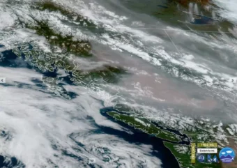
JACOBS: And these wildfires can have impacts far outside the fire line. Heavy smoke led to health warnings in Nova Scotia this week. And plumes of smoke from wildfires in western Canada led to air quality alerts in U.S. states from Colorado to Montana and Minnesota.
For NPR News, I’m Emma Jacobs in Montreal. Transcript provided by NPR, Copyright NPR.
Rainbow near the Wrangell Narrows. (Photo by Angela Denning/CoastAlaska)
Imagine the sound of wind chimes. It’s pretty — but it’s more than that.
“The wind chime is a really interesting translation, and musicification or a sonification of an unseen environmental phenomenon,” said Oregon State University researcher Chet Udell. “It’s giving me information that could be useful if I’m curious about how windy it is outside. And it also is aesthetically pleasing.”
Udell’s lab unites engineers and environmental researchers to design environmental sensors. Wind chimes were the inspiration for one of the newest instruments, called WeatherChimes, which collects weather data and turns it into music. Now the technology will get used for projects across Southeast Alaska, starting in Sitka and Hoonah.
Scientists often express changes in the environment with things like graphs and charts — but what does that mean to a non-scientist?
“They show you the data and wiggles on a graph, but they don’t usually go too deep into having the person, like, translate that into meaning,” Udell said. “How do you get those people to empathize with environmental data?”
The WeatherChimes sensor collects real-time environmental data and transmits it via Wi-Fi. That data can then be used to compose music (Photo courtesy of the OPEnS Lab at University of Oregon).
Udell and his team tried to build an environmental sensor that would be intuitive, emotional and creative. Like wind chimes, the WeatherChimes hardware is installed outside. It gathers data on things like light, temperature, humidity and soil moisture. Then it uses Wi-Fi to send that data into a program where it can be set to different keys, scales and instruments.
Humidity, for instance, could be a marimba playing a C major scale. By listening to those musical translations, you can hear weather patterns. Around sunrise and sunset, there’s a symphony of the world warming up and drying out. And throughout the day, there are melodies and countermelodies.
“There’s this thing in composition — Beethoven uses a lot, Bach uses a lot — called contrary motion,” Udell said. “Like, when one voice goes in one direction and another voice goes in a different direction.”
The WeatherChimes show the same thing happening in nature. Temperature and humidity, for instance, have an inverse relationship.
“And there’s a certain satisfaction in putting those kinds of natural things together, and seeing how patterns that exist naturally are the same ones that make this music fun,” Udell said.
Fun is one of the major goals. But as an educational tool, WeatherChimes could also help students think more deeply and personally about weather.
When there’s a particularly rainy period, is that good news or bad news? Udell hopes students can ponder questions like that through music.
“Should I make a happy melody or a sad melody? Should I make something that goes fast or slow?” he said. “Like, what does this mean to me?”
Educators at the Sitka Sound Science Center and Sitka High School’s Traditional Ecological Knowledge program will use WeatherChimes in classrooms and educational workshops over the coming year.
And Udell and his lab will work with the Sitka Sound Science Center, the Hoonah Indian Association and Alaska Youth Stewards to install more WeatherChimes for community-designed projects, including yellow cedar monitoring in Sitka and salmon stream monitoring in Hoonah.
Close
Update notification options
Subscribe to notifications
Subscribe
Get notifications about news related to the topics you care about. You can unsubscribe anytime.