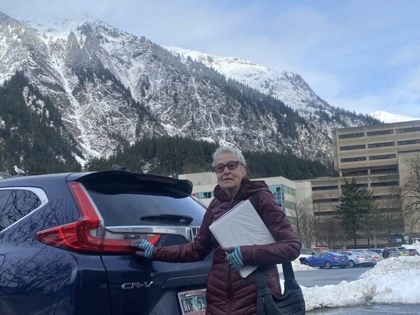
Malin Babcock, 84, poses outside of KTOO in February, 2024. (Photo by Anna Canny/KTOO)
This is Tongass Voices, a series from KTOO sharing weekly perspectives from the homelands of the Áak’w Kwáan and beyond.
Malin Babcock, treasurer of the Gastineau Historical Society, has lived in Juneau for more than 80 years. Her personal history is deeply intertwined with the history of the city and the state.
From the traumatic loss of her grandparents in Juneau’s 1936 landslide, to her long career studying salmon across the state, Babcock reflects on her life in Southeast Alaska.
This transcript has been edited for length and clarity.
Malin Babcock: Well, my name is Malin Babcock, and my grandparents Hugo and Hilja Malin Peterson were both killed in the building. And my mother who was Lillian Peterson Babcock survived.
She was probably one of the first ones that was rescued, because she was on the south end of the slide and right at the very edge when she was hit by the mudslide coming down. And it was the worst disaster that has ever occurred within the City and Borough of Juneau.
My mother was in the hospital for two weeks and then released from the hospital. She talked about it very rarely.
My grandparents were Finnish immigrants. There’s a lot of stoicism that goes throughout that culture. So they emigrated to Juneau late in 1913. My uncle Elmer, and my grandfather were miners, and they both worked for the AJ Mine.
My mother was born on November 9th of 1914, and grew up here, went through high school here. And she obtained a secretarial job with a fella by the name of Frank DuFresne, who was the head of the Alaska Fish Commission at that time. And he did all the arrangement for the funeral and everything else for her parents, which was absolutely amazing.
She later married of fella by the name of Doug Babcock, my dad, who was an early member of the Territorial Sportsmen, plus being one of the first Taku River Rats. And he notably helped in some of the early experimentation for salmon and salmon eggs that led to DIPAC.
Years later – years later – when I went to school at Oregon State and then up to Fairbanks for my master’s degree, where I took ichthyology and fisheries courses, our textbook was by Frank DuFresne. And it was called Alaska Fishes. I mean, it’s absolutely amazing, the webs that we turn that we find out later, you know, and that end up surprising you.
So I went to work at the Auke Bay Lab in 1969. There were not many women biologists, I think there were two when I started to work there. And I spent many, many a summer up in King Salmon in Bristol Bay. And I spent seven years walking the beaches of Prince William Sound working with with the effects of hydrocarbons after the Exxon Valdez oil spill. Anyway, it was just kind of a neat career and I’m very proud of myself.
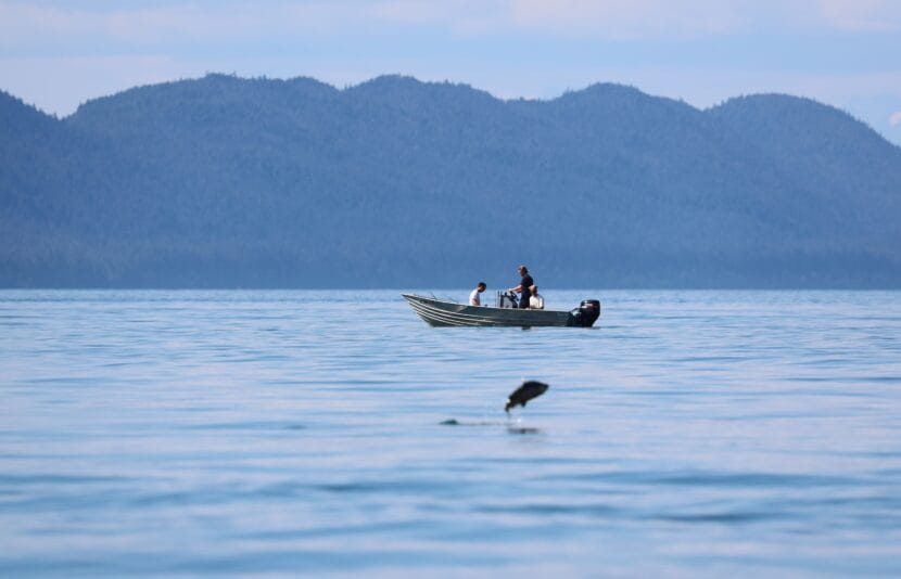
People fish off North Douglas in July 2023. (Clarise Larson/KTOO)
A new University of Alaska research project will look at how human-caused climate change affects fishing, farming and harvesting in the Gulf of Alaska to build resilience for communities that rely on the ocean.
$20 million dollars of funding from the National Science Foundation will support the work of 23 researchers at all three University of Alaska campuses in Fairbanks, Juneau and Anchorage.
Jason Fellman of the Alaska Coastal Rainforest Center is one of the principal investigators on the Interface of Change project. He says warming from the burning of fossil fuels is changing the weather across Southeast Alaska, bringing more extreme rainfall and less winter snow.
It’s also rapidly accelerating glacial melt, which creates a steady trickle of freshwater, sediment and nutrients.
“What’s running off the landscape potentially ends up in the nearshore marine,” Fellman said. “So these connections — land ocean connections — could be changing quite rapidly.”
Understanding those changing connections is important because the Gulf of Alaska supports vital commercial and subsistence harvests.
The five-year project will examine important marine foods like red seaweeds, kelp, oysters, clams, mussels and salmon to see how they might be responding to the changing environment.
It will also focus on questions about mariculture. The industry is booming in Alaska, but it’s still young.
“There’s still a lot to learn about this type of farming in the Gulf of Alaska,” Fellman said. “Maybe glacial runoff is driving places that are more suitable, or less, to growing seaweeds or kelps or something like that. Those are the types of questions we don’t know.”
Davin Holen, a coastal community resilience specialist with Alaska Sea Grant and one of the project’s five principal investigators, says the research will support the harvesting of traditional foods, too.
The goal is to create tools that people can use to adapt the timing and location of their subsistence harvests to keep up with a changing climate. There will also be projects focused on diversifying which species are gathered, and reconnecting younger generations to traditional foods.
“You can kind of build resilience, so that when the environment impacts one species, you still have lots of other species and the knowledge of how to harvest all those other species as part of your toolkit,” Holen said.
The researchers will work closely with industry partners, local science centers, and tribes in Juneau, Haines, Klukwan, Seldovia, Halibut Cove, Homer, Cordova and Valdez.
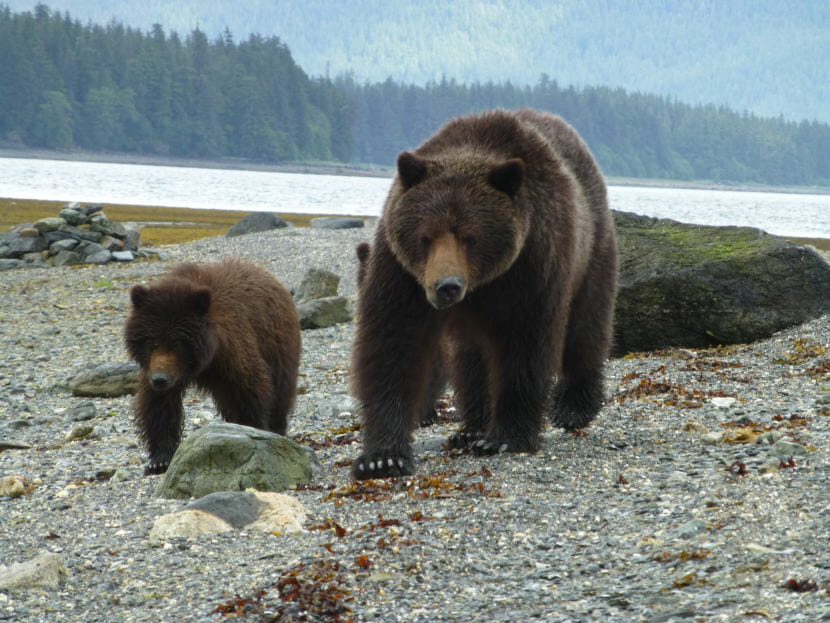
Two brown bears on July 10, 2012 in the Kootznoowoo Wilderness on Admiralty Island in the Tongass National Forest. (Photo courtesy (Don MacDougall/U.S. Forest Service)
The vast Tongass National Forest just grew a little bit larger, with the addition of five acres to the Kootznoowoo Wilderness on Admiralty Island.
The property, known as Wheeler Creek, was privately owned until the Southeast Alaska Land Trust and the Wilderness Land Trust teamed up to buy it. Then they transferred ownership to the Forest Service.
The swath of land is tiny compared to the 17 million acres that make up the Tongass. But Margosia Jadkowski, director of marketing and communications for the Wilderness Trust, said protecting it is still important.
“It has some important habitat contained on the property itself, on those five acres,” she said. “It has an abundant pink salmon run, its important king spawning habitat as well. And its habitat for a number of important land species including brown bears.”
Jadkowski said Wheeler Creek has boat access, which made it a prime target for building cabins or even a commercial lodge. But with the new wilderness designation, it can’t be developed for building projects, mining claims or timber sales.
More than 35% of the Tongass is protected as wilderness, but across the forest there are still a lot of small private properties leftover from the mining camps. Groups like the Wilderness Land Trust have been working to purchase them for conservation.
“When you have these private inholdings within wilderness, they sort of act as tears in the fabric of wilderness protection,” Jadkowski said. “They’re kind of weak spots, because they don’t carry any of the protections of the surrounding wilderness.”
The trust works with willing sellers to buy up those private properties and transform them into public lands. Their efforts have also added more than 180 acres of land to the Chuck River Wilderness, which sits about 70 miles south of Juneau at the head of Windham Bay.
And their partners at the Juneau-based Southeast Alaska Land Trust have purchased and conserved an addition 3,600 acres of wetland, wildlife habitat and open spaces, both in and outside of wildness areas.
Jadkowski said the Wilderness Trust is working to acquire another property in Chuck River. And they’re researching other properties they might want to protect.
“We’re also developing a data-driven analysis tool where we can look at things like biodiversity, climate resilience and wildlife migration corridors,” Jadkowski said.
Once finished, Jadkowski said, the tool will help to showcase the many benefits of growing conservation areas in Southeast Alaska.
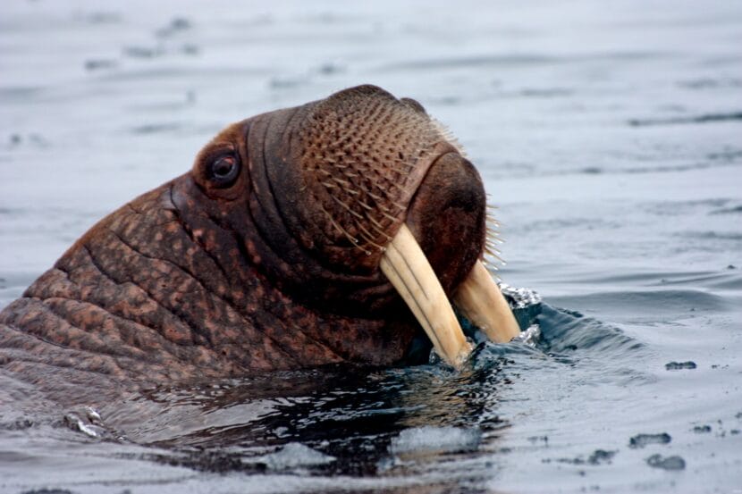
A walrus is seen in Alaska’s Chukchi Sea in June of 2010. Research by a University of Alaska Fairbanks student found microplastics, mostly tiny fibers, were lodged in muscle tissue, blubber and livers of walruses harvested by hunters from St. Lawrence Island and Wainwright. (Sarah Sonsthagen/U.S. Geological Survey)
Vi Waghiyi grew up in the village of Savoonga on St. Lawrence Island, where meat from walrus, seal and bowhead whale sustained her family through long winters.
“My people continue to live off the land and ocean like we have for millenia,” Waghiyi said. “Our elders call the Bering Sea our farm.”
Today, as an elder herself, Waghiyi wants her grandson to have access to the same traditional foods. But food security in the Arctic is increasingly threatened.
The burning of fossil fuels is heating the region four times faster than anywhere else on the planet. Warming waters are disrupting the food chain, and melting sea ice is erasing animal habitat and making hunting more dangerous.
“And we are some of the most highly contaminated people on the planet because of our reliance on our subsistence foods,” Waghiyi said.
Because plastic waste piling up across the planet is making its way up to the Arctic. Plastics contain toxins that have been linked to long-term health problems like cancer, hormone disruption and damage to the heart, liver and kidney, which threaten Alaska Native communities. That’s according to a new report from Alaska Community Action on Toxics and the International Pollutants Elimination Network.
Waghiyi, who is the director of environmental health and justice for Alaska Community Action on Toxics, is a co-author on the report, along with other scientists and Alaska Native leaders who are calling for an end to new plastic production worldwide. They’ll represent Alaska’s Arctic communities at a meeting of the United Nations later this month.
Pamela Miller, a long-time Alaska scientist who works with both organization, is also a co-author. She said strong currents in the ocean and the atmosphere naturally move from lower latitudes to the poles, carrying plastic and other pollutants along with them.
“We now know that there are microplastics in fish, in walrus, in ring seal, bearded seal, spotted seal, and many different whale species,” Miller said. “These are the animals that have been relied on for centuries for sustenance.”
The accumulation of plastics in the Arctic is made worse by climate change.
“We also know that with climate warming happening so rapidly that the highest concentrations of microplastics are found in those areas where there’s the most rapid melting of sea ice,” Miller said.
The melting of sea ice, permafrost and glaciers also release plastics and chemicals that have long been bound in ice.
In 2022, the United Nations set out to write a treaty on how to deal with growing plastic waste. They’ve held several meetings to hash out the terms, including one happening later this month in Ottawa, Canada. There, the authors of the new report will join representatives from more than 170 other countries.
Miller says there’s only one real solution to the plastics problem.
“The first thing is to curb the production of chemicals and plastics,” she said. “Since they’re reliant on fossil fuel production, that also means curbing fossil fuel production.”
But not everyone agrees with her.
Most plastic is created with chemicals derived from fossil fuels. And as demand for oil and gas in transportation or home heating drops with the switch to cleaner energy, many in the fossil fuel industry see plastics as a way to support their future business.
Waghiyi says she hopes that Arctic Indigenous communities are able to push back against those industry interests.
“Our people have done all we could to make sure our land, airs and waters are protected,” Waghiyi said. “These multinational corporations do not take human health into account.”
She says she’s headed to Ottawa to fight to protect the health and food of her grandson.
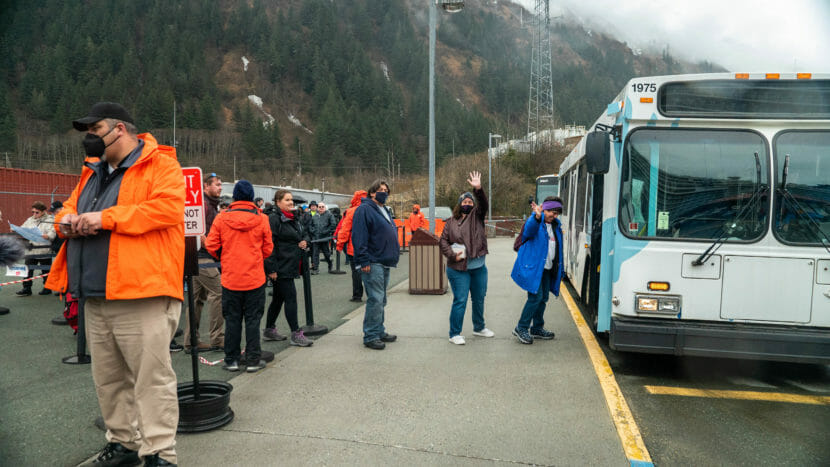
Passengers from the Natural Bliss Norwegian Cruise board a tour bus in April 2022. (Photo by Paige Sparks/KTOO)
Juneau may soon establish a new fund to help the city’s tourism businesses swap out polluting fossil fuel for cleaner forms of energy in their planes, buses and boats.
The proposal would set aside $1 million collected via marine passenger fees to fund a new clean energy loan and incentive program. It’s a small fraction of the $21.5 million in revenue expected from 1.6 million cruise ship visitors this summer.
According to city tourism manager Alix Pierce, the visitor industry generates a lot of Juneau’s greenhouse gas emissions, which contribute to human-caused climate change. She’s heard from residents and business owners who want to cut down on pollution, but she says they still need incentives to speed the transition to cleaner power.
“What I keep hearing consistently is that operators are interested, and that it’s just cost prohibitive,” Pierce said.
Public businesses or governments are often eligible for money that helps them to cut down on fossil fuels. Juneau, for instance, received funding from the Federal Transit Administration to buy electric buses.
But private tourism businesses are usually excluded from those grant programs. Bob Janes, owner of the whale watching and hiking company Gastineau Guiding, has about 30 diesel buses he’d like to replace. But he says it’s hard for small tourism companies to scale up.
“We can dabble here and there in the market, but until we really go into it full speed ahead, the impact is not much,” Janes said. “Well, full speed ahead is a lot of money. But this grant program would hopefully make that possible for us.”
Pierce says there’s a precedent for a loan and incentive program like this. In the early 2000s, the city established a fund that helped companies buy quieter engines for their float planes. The new clean energy program uses that as a model.
At this stage, what qualifies as clean energy is unclear. But Pierce says the bottom line is, it’s something that would cut down on greenhouse gas emissions. She says that could extend to hybrid power or even things like biodiesel.
Holland America and Princess Cruises in Juneau have used biodiesel developed from cooking oil to supplement the fossil fuel that powers some of their tour buses. They claim that it can cut emissions by 10%.
Even energy efficiency projects may qualify under the definitions of clean energy.
“I don’t want to unnecessarily limit operators,” Pierce said. “Maybe a smaller operator that wants to replace a dirty old school bus with just a brand new clean diesel bus — that’s a really big move in terms of emissions reduction.”
But Janes hopes the program will eventually push the local tourism industry toward net-zero emissions through electrification, which would tap into the city’s renewable hydropower supply.
“If I live long enough to see our fleet converted to electric, both on our boats, and with our buses, I will be the happiest person in the world,” he said.
The city is also considering using $5 million dollars of marine passenger fees for electrification of cruise ship docks. Renewable shore power is already available at the South Franklin Dock, which is privately owned by Princess Cruises. But Juneau has long-considered the installation of similar technology at two city-owned docks.
Though both funding proposals are in their preliminary stages, they’ll be up for debate as city budget discussions begin this weekend.
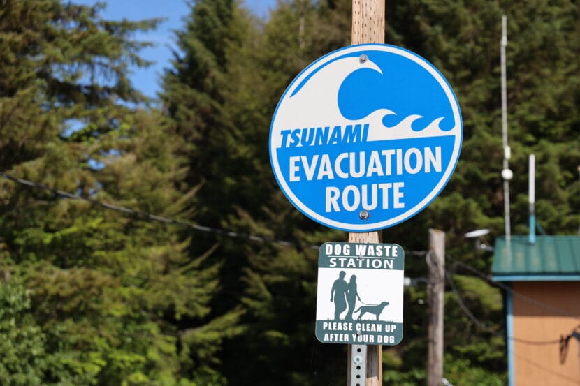
A sign points out a tsunami evacuation route in Pelican, Alaska, in July, 2023. (Clarise Larson/KTOO)
Alaska is home to breathtaking fjords, massive glaciers and a lot of mountainous nooks and crannies where nobody lives.
According to Mike West, director of the Alaska Earthquake Center, that rugged terrain is moving all the time in ways people might never see.
“Alaska is one of the few places where you can have a really massive landslide and nobody knows about it,” he said.
That happened 2015, when one of those remote landslides sent 180 million tons of rock tumbling into the Taan Fjord in Icy Bay. The force created a wave that crashed more than 620 feet up the shoreline.
And back in 1958, a massive earthquake triggered the tallest tsunami in recorded history in Lituya Bay. The wave killed five people, and stripped land, rocks and trees up to an elevation of 1,720 feet. At first, researchers couldn’t figure out how it reached that high, until they discovered that a landslide from the head of the bay created a wave of massive proportions.
Research seismologist Ezgi Karasözen with the University of Alaska Fairbanks said megatsunamis like that have the potential to be devastating for Alaska’s coastal communities.
“But we haven’t been monitoring these landslides routinely,” Karasözen said.
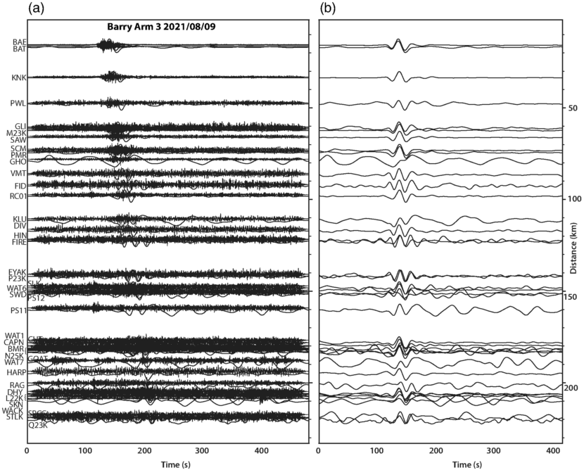
Until now. West and Karasözen have teamed up to develop a prototype method that can detect wave-generating landslides within minutes. They explain the new method in an article published in the journal The Seismic Record last month.
Seismic records from a landslide at Barry Arm. The left depicts both short-period and long period waves. On the right, long-period waves only. (Image courtesy of West and Karasözen)
Luckily, they didn’t have to start from scratch. Since the Good Friday Earthquake wreaked havoc 60 years ago this week, the state and other agencies have installed hundreds of seismometers that detect earthquakes and all kinds of geologic movement. The prototype taps into that existing network.
“So we have the infrastructure in place already,” West said. “It’s the same dang data – just analyzed in a different way.”
But the analysis is where things get tricky — because earthquakes, calving glaciers and all kinds of human noise create their own vibrations that can muddle the seismic records.
“When you only search for the landslide signal, the other signals become like noise to you, and you want to get rid of them,” Karasözen said.
Seismic signals can be read on a graph of vibrations over time. Most earthquakes happen briefly, just a few seconds. That motion creates what’s known as a short-period wave.
A lot of things create short-period waves, so the seismic record gets really busy. But landslides routinely last a minute or more, which means they create more distinct long-period waves, too.
The new detection method routinely scans the seismic record for those distinct, long-period landslide signals. Once it finds one, it runs that reading through an algorithm that calculates the rough size and location of the slide.
Karasözen says a detection system like this is more important now than ever because the risk of megatsunamis is growing as human-caused climate change melts glaciers.
“Once they retreat, these steep fjords we have all over coastal Alaska are losing their support,” Karasözen said. “If they were to fail — these slopes — they would fall into the water body and could trigger a tsunami that we wouldn’t know about.”
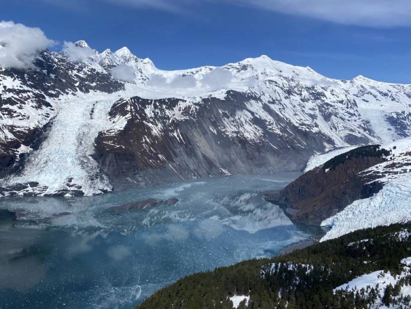
The Barry Arm fjord in May 2021. (Photo courtesy of the Alaska Division of Geological and Geophysical Surveys)
Barry’s Arm in Prince William Sound is probably the most well known example of this phenomenon. The steep face of the fjord, which was once buttressed by the retreating Barry Glacier, slumped hundreds of meters over the past few decades.
Scientists say a large tsunami there could hit nearby communities like Whittier within 20 minutes. Obviously that hasn’t happened yet. But West said that doesn’t mean it won’t happen in the future. He used the analogy of a dart board.
“I’m a really lousy darts player,” West said. “If I’m shooting for bullseyes, the vast majority of my darts are going all over the place, they’re missing,” West said.
Like in Barry’s Arm, where there have been at least three landslides in the last five years, but no big tsunami.
“But every once in a while, that dart, by coincidence, happens to line up with a bullseye,” West said. “And kind of the same thing is true for these landslides, which are happening all over the place, but most of the time don’t intersect with population centers.”
West and Karasözen say it’s their job to prepare before the day a landslide-triggered tsunami hits the bullseye. Their detection prototype has been collecting slide data in Barry’s Arm since last summer.
Every landslide they detect helps train the technology to get more precise. At the same time, they need more scientists who know how to interpret the data. That means it could be a long time before the method can be used as a practical warning system.
While monitoring of traditional earthquake-triggered tsunamis in the state has been honed over the last 60 years since the Good Friday earthquake, West points out that the science for detecting landslide-triggered tsunamis is still very young — but the new method is still a major step for tsunami preparedness.
“I’ve been humbled enough times on the earthquake side of things to appreciate that we still have a ways to go,” he said. “But this is research that has the potential to protect people.”
Close
Update notification options
Subscribe to notifications
Subscribe
Get notifications about news related to the topics you care about. You can unsubscribe anytime.