Anna Canny

Local News Reporter

New Tongass forest plan will focus on climate change, tourism boom in Southeast

Campers arrive at the Shakes Slough U.S. Forest Service cabin on the Tongass National Forest. (Photo by Katarina Sostaric/KSTK)

It’s been nearly three decades since the U.S. Forest Service released their first management plan for the Tongass National Forest. 

During a presentation at the Juneau Economic Development Council’s Innovation Summit last week, Southeast Alaska’s Deputy Forester Chad VanOrmer said it’s time for an update. The development of a new Tongass forest plan will inform the agency’s management decisions for the next 15 to 20 years. 

“The Forest Plan is really kind of a compass, is how I like to look at it,” VanOrmer said. “It gives a direction on our desired future outcomes.”

The existing management plan was developed in 1997. Since then, there have been some amendments concerning timber management and the transition from old growth to young growth logging. But otherwise, the original plan has remained largely untouched.

In many ways, it fails to keep up with the modern-day opportunities and challenges in the Tongass.

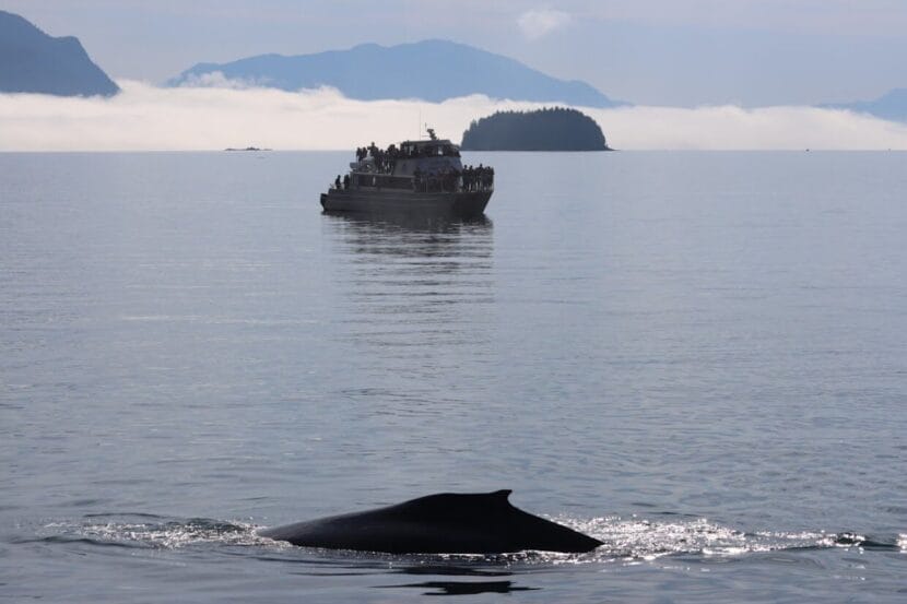
For instance, when VanOrmer started his Forest Service career on Prince of Wales Island — just a few years after the original 1997 plan came out — there were only about 500,000 cruise ship passengers visiting the Tongass region annually. 

“I call it the ‘Field of Dreams,’ because we were doing a lot of ‘build it and they will come,’” he said. “So we were investing a lot of money in building trails and cabins and all sorts of recreation infrastructure for a tourism and recreation industry that was yet to actually arrive.” 

Now the tourism boom has arrived in full force, with 1.7 million cruise ship visitors last year. And the number of tour guiding businesses in the forest has more than doubled, from 68 in 2000 to at least 177 today.

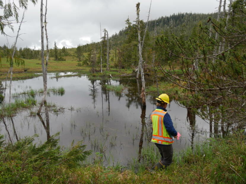
Time has also revealed new threats that will shape the Tongass and the communities that rely on it. VanOrmer said climate resilience planning will be a priority in the new plan.

“In 1997, climate change wasn’t even a thought in the  forest plan – it wasn’t even really contemplated,” he said. “And here we are today where it’s really frontline, headline news and we have a forest plan currently that doesn’t really prepare ourselves for it.”

To make a plan that works for the present day, the agency wants to strengthen relationships with community organizers and tribal governments.

VanOrmer said the introduction of the Southeast Sustainability Strategy in 2021 set a precedent for that by sending millions in funding to tribal and Indigenous organizations for sustainable development projects — things like forest restoration, trail work and Indigenous cultural education projects.

A lot of that work has already begun. 

“We have multiple crews that are working, doing stewardship on the landscape. But they aren’t Forest Service crews,” VanOrmer said. “They’re local tribal crews, they’re other youth crews, they are other scientists coming to the table and really wanting to roll up their sleeves and expand the capacity and scope and breadth of the work here on the National Forest. “

VanOrmer said the new Tongass Forest Management Plan will set the foundation up for more projects like that. 

The Forest Service will spend the next year hosting workshops around Southeast Alaska to gather input on the next version of the plan. It will likely take two to three more years to develop a final version.

Forest Service boasts dozens of new staff positions in the Tongass

U.S. Forest Service worker Sam Wynsma walks around a pond during a visual survey. (Photo by Katie Anastas/KFSK)

The workforce in the Tongass National Forest has grown a lot over the last couple of years, thanks to some major infusions of federal money. 

In a presentation at the Juneau Economic Development Council’s Innovation Summit in Juneau this week, U.S. Forest Service recreation specialist Jason Anderson said new staff will help the agency catch up on a backlog of maintenance projects and keep up with the tourism boom in Southeast Alaska. 

Anderson said that since the early 2000s, federal funding to support recreation in national forests had been shrinking.

“We were losing our spending power, we were seeing very diminished budgets and the inability to do work,” Anderson said. “It also translated in the inability to hire people to do that work, whether you’re hiring contractors, Forest Service workforce or partnering. That decline is significant.”

But recent federal legislation has reversed that trend. The Great American Outdoors Act in 2020 brought $62 million to the region for long-deferred maintenance of things like trails, cabins and roads.

And the Bipartisan Infrastructure Law in 2021 added another $36 million for other recreation projects, like the construction of 25 new public use cabins across the Tongass. 

“It’s huge. It’s time to celebrate,” Anderson said. 

Since 2020, the new funding has supported a boom in workforce development for the Tongass. In his presentation, Anderson said the U.S. Forest Service has doubled the number of jobs for recreation operations, which includes a range of positions from custodial staff to people focused on trail and cabin maintenance.

The agency has also nearly doubled the number of positions for their Heritage Program, which focuses on preserving historic and cultural resources on public lands.

And they’ve introduced 8 new staff positions for the special uses program, which mainly does permitting. 

“There are a variety of activities that we permit in the national forests,” Anderson said. “Research, guided recreation, things that are incredibly important to our communities and our economy.”

Lately, there’s been a major permitting backlog, and that’s been especially frustrating for people trying to start new recreation businesses to take advantage of the growing number of tourists. 

Anderson said that traditionally, the small staff in district offices had to process dozens of permit requests on their own, which caused major delays. 

“They might have an administrator, right? A single permit administrator, doing all of the permit activities,” Anderson said. “If that person became overloaded, if they retired, if they went on maternity leave – whatever the reasons are — we might have a hard time meeting expectations.”

Now, they’re introducing a Tongass region-wide team of permit administrators dedicated to working through the backlog and keeping up with new permit requests.

The team will include people with specific expertise on some of the particularly complex types of special use permits, like the ones needed for large hydropower installations. 

It will also include a staff member who works directly with the Juneau Economic Development Council’s visitor products cluster working group. That group, formed with federal funding from the Southeast Alaska Sustainability Strategy, focuses on boosting regenerative tourism opportunities and integrating Alaska Native heritage into tourist attractions, among other things.

According to Anderson, filling and maintaining all the Forest Service new positions will be the next challenge. Thirty percent of the jobs on the new permitting team are still vacant, and the Forest Service has struggled with up to 20% staff turnover in recent years.

Correction: A previous version of this article misstated the number of new positions for the special uses program. 

Juneau lawmakers want more state aid for Alaskans hit by disasters

Workers removed debris and added rock fill along the bank at Riverside Condominiums on Aug. 8, 2023. Residents paid more than $1 million in repair costs without the help of state or federal aid. (Photo by Andres Javier Camacho/KTOO)

Sen. Jesse Kiehl and Rep. Andi Story have introduced a pair of bills that would more than double the amount of aid Alaska can give out to people affected by disasters. 

Kiehl, a Juneau Democrat, introduced his proposal last week. He said he believes state aid fell short during recent natural disasters, like the 2020 Beach Road landslide in Haines and last summer’s glacial outburst flood in Juneau.

“I’ve seen now a couple of disasters in my district and looked at others around the state,” Kiehl said. “And I’ve seen just how much more we need to do to help Alaskans get back on their feet — or at least back towards their feet.”

When the state issues a disaster declaration, people with homes that were damaged or destroyed are eligible for grants to rebuild or repair their homes or replace their essential belongings.

For now, those grants max out at $21,500 each. Both the Senate and House versions of the new bill would bump that up to $50,000. 

“We’ll never be able to afford, as a state, to cover it all,” Kiehl said. “And this doesn’t replace insurance. But so many of these disasters aren’t actually things you can get insurance to protect yourself from.”

Landslide insurance isn’t available in Alaska. And residents affected by Juneau’s glacial outburst flood struggled to get insurance payouts. The flood affected areas that were not in an official flood zone, so many affected homeowners didn’t have flood insurance. 

Kiehl said the outburst flood also showed how some homeowners were excluded from state aid. Under state law, homeowners associations have to share the cost of disaster repairs, but their individual members don’t qualify for aid. 

When the floodwaters eroded the river bank and swept away the foundation of a building at the Riverside Condominiums, residents had to pay for a million dollars of repair work out of pocket.

“And so the bill fixes that,” Kiehl said. “It says that if the damage was because of the disaster, you can use your disaster assistance for your share of that shared responsibility.”

Last year Alaska had three declared state disasters — the Juneau outburst flood, spring flooding around the Yukon and Kuskokwim Rivers and the deadly landslide in Wrangell. 

And human-caused climate change is making destructive disasters more common. Last year was a record year for billion dollar disasters across the country. That’s increasing demand for federal aid. 

Story, a Juneau Democrat, said that makes it even more important for the state to step up. 

“It’s important to me that citizens of Alaska have some resources to get them through the disaster, to give them hope that financially they’re going to get through this and the state is behind them,” she said.

Both lawmakers said they hope at least one version of the bill will pass this session.

Climate change is making it harder to survey pollock in the Gulf of Alaska

Pollock are transferred from a fishing boat into a processing plant in Dutch Harbor, in the Aleutian Islands, in January 2019. (Photo by Berett Wilber)

Right about now, millions of walleye pollock are gathering in the Shelikof Strait, near Kodiak Island. They mass there every year towards the end of winter to prepare for spawning. 

And soon, scientists will follow them to do their annual winter trawl survey. 

“It’s timed to be there and survey the pollock just prior to the peak of spawning,” said fisheries biologist Lauren Rogers, with the National Oceanic and Atmospheric Administration. “So that timing of when pollock are going to be migrating to the spawning grounds or away from the spawning grounds is then going to be particularly important for that survey.”

But the timing of pollock spawning is becoming more unreliable, as human-caused climate change warms the ocean. That means the scientific surveys that are used for fisheries management could become unreliable too.

Between 2017 and 2019, surveys done by the Alaska Fisheries Science Center across the Gulf of Alaska produced wildly different estimates of pollock biomass. Summer surveys across the feeding grounds showed near-record lows, while the winter survey in Shelikof Strait showed record highs.

To understand the mismatch, Rogers and her collaborators worked backwards using surveys of larval pollock. 

“We have the offspring’s information and then we can go back to what the parents must have been doing in order to put them in the world when they were put in the world,” Rogers said. 

Rogers’ previous research on pollock showed that spawning can occur earlier when ocean temperatures are warmer. And according to a new paper, published this month, earlier spawning times account for much of the discrepancy in the Shelikof Strait survey. 

In 2017 and in 2019, peak pollock spawning happened more than 2 weeks earlier than the long-term average. That was likely shaped, in part, by marine heat waves that hit the Gulf around that time. The new paper offers a tool that can be used to account for changes in spawning timing when building stock assessments. 

But Rogers says spawning time isn’t the only thing fisheries surveys need to pay attention to — warming oceans may be changing fish in all kinds of ways. Recent studies in the Bering Sea, for instance, showed that as sea ice melts, populations of pollack are moving further north, out of the typical survey areas.

But Rogers says fisheries managers can try to adjust for these changes. 

“If we have an understanding of the links between changes in the climate and changes in spawn timing, or migration timing, or distribution shifts or growth rates, then we can start to use that information when we’re interpreting our biomass estimates or when we’re doing our stock assessments,” Rogers said. 

It’s not just a simple matter of doing the Shelikof survey earlier or moving the Bering Sea surveys north. Rogers said there are logistical challenges that come with doing that, and climate-driven changes will be unpredictable from year to year. 

“We need to be monitoring to track changes as they’re happening,” Rogers said. “Planning for a continual shift is not going to allow us to respond as proactively as we need to.”

So to keep up, she says fisheries managers need to consider the latest climate science. It’s the only way to follow the fish in a rapidly changing ocean.

Cruise ship passenger fee proposals include study of Juneau’s humpback whales

Two whales surfaces near Juneau in early September 2023. (Clarise Larson/KTOO)

By some estimates, Juneau is the world’s largest and most lucrative whale watching port. 

“We are about double the size of some of the other busy whale watching ports worldwide,” said Heidi Pearson, a professor of marine biology at the University of Alaska Southeast. “And it’s because of the cruise ship industry.”

Each year, hundreds of thousands of visitors — including at least 367,000 cruise ship passengers — take a boat tour hoping to catch a glimpse of a fin or a fluke of humpbacks that come to Juneau to feed every summer. 

The resident whales are beloved by visitors and locals alike. Many are even known by name, but scientists say there’s a lot we don’t know about their health. 

A research team led by Pearson and her collaborators at the National Oceanic and Atmospheric Administration and University of Alaska Fairbanks hopes to change that with a proposed whale monitoring project, which would be funded by money from cruise ship passengers. 

Whales in Juneau face all kinds of health stressors, but overcrowding from cruise ships tourists may be one of them. There are at least 72 active whale watching tour boats operating out of Juneau, and the fleet has been growing steadily over the past three decades.

But the population of humpbacks remains relatively small. Pearson says there are usually fewer than a dozen feeding in the area at any given time. All those tour boats could stress them out. 

“We know that in the presence of whale watching vessels, they travel more quickly. They have shorter dives, and they have a faster respiration rate,” Pearson said. “We know there’s behavioral impacts, but what we don’t know is, you know, are they just short term impacts? Does it have any effect on the physiology or health of the whale?”

A whale surfaces near an Alaska Tales Whale Watching boat in early September 2023. (Clarise Larson/KTOO)

The proposed monitoring project will build on previous studies of whale stress and health, which took blubber samples from local whales to measure levels of the stress hormone cortisol. More long-term monitoring could shed some light on how whales are reacting to tourism pressure.

The project proposed budget is $160,000 to sustain regular blubber sampling and photographic surveys and to hire an additional researcher to analyze the data. 

The funding would be generated by cruise ship passengers. The city of Juneau takes a $5 tax per person. But city Tourism Manager Alexandra Pierce said that money can’t be used for just anything. 

“Passenger fee projects are pretty highly restricted,” Pierce said.

Back in 2016, the city was sued by Cruise Lines International Association Alaska, or CLIAA, the trade association for the cruise industry, for using passenger fees to construct the park that houses “Tahku,” Juneau’s iconic life-sized humpback whale sculpture. 

The lawsuit was settled in 2019. But according to the settlement agreement, CLIAA has more of a say in how the city spends cruise passenger fees. Often, approved projects are concentrated in the downtown waterfront area. 

The money can hypothetically be used for other things. But the cruise industry would have to approve it.

Pierce says that whale monitoring makes sense, because whale watching is one of the city’s most popular and lucrative tourist attractions, bringing in at least $60 million dollars annually. But she also says that Juneau’s whales are more than just money-makers. 

“They hold a really important emotional place in the community,” Pierce said. “Both for visitors who were thrilled to be able to see them, and for residents who want to see them protected and not feel like they’re being harassed or bothered.”

In recent years, the health and happiness of the local whales has been the subject of public scrutiny. Some local whale watching companies have been looking for ways to minimize their potential disturbance to whales, but there’s not a lot of science to help them figure out the best way to do that. 

With the monitoring project, researchers could learn more about disease, reproductive health, pregnancy, diet and other factors that affect whale’s health. Pearson says taking that holistic approach is important, because tourism is not the only stressor for Juneau’s whales. 

Climate change threatens their food sources. Noise pollution can disrupt their communication. And entanglement in fishing gear or vessel strikes can injure or even kill them.

This summer for instance, the calf of one of Juneau’s most well-known resident whales died after he was hit by a boat. 

“It’s hard to look at one factor in isolation because they all work together to impact a whale’s health,” Pearson said. 

Juneau’s whale health monitoring project, along with all the other proposed passenger fee projects, will be up for public comment starting next week.

New wetland habitat maps will help capture Juneau’s ‘wildlife and fish factory’

Mendenhall Wetlands State Game Refuge on Wednesday, Feb. 7, 2024. (Clarise Larson/KTOO)

The Mendenhall Wetlands State Game Refuge has protected Juneau’s tidelands since the late 70s. Maps from that time show an abundance of high meadows where black bears roam, marshes where waterfowl roost and seaweed beds that are home to mussels, barnacles and young fish. 

Juneau’s tidal wetlands refuge lines both sides of the Gastineau Channel from Lemon Creek to Fritz Cove. And it’s changed rapidly since first mapped, with ongoing development pressures and land that’s rising nearly an inch a year as Juneau’s glacier retreats. 

Though these changes are happening fast, many of Juneau’s wetlands management policies are based on maps that are more than 40 years old. The Southeast Alaska Land Trust is hoping to change that by creating brand new maps. 

“We decided to go out there and really do a survey of the whole 5,200 acres or so in order to get a handle on what the habitats are now. And really importantly, what are the functional aspects of those habitats,” said Matt Robus, a retired wildlife biologist who chairs the trust’s lands committee. 

This fall, a team of scientists led by the land trust and wetlands specialists from Bosworth Botanical Consulting did more than 50 drone flights and took more than 4,000 photos on the ground. They’ll pair that data with LiDAR elevation models to create digital maps of the wetlands.

The team also did fieldwork to document the vegetation, soil types and hydrology of the many tidal habitats — including uplift meadows, grass high-marsh, sedge low marsh, succulent low-mars — and they did assessments to determine their health. 

The hope is that the maps will document the many beneficial functions of the wetlands. 

Wetlands clean water and sequester carbon. And in Juneau, the Mendenhall Wetlands — known as Taashuyee Chookan.aani, or “river/tide-flats”  in Lingít — are a critically important habitat for migratory birds and marine life. 

Many of the krill that feed Juneau’s resident humpback whales and the fish that populate rivers from here to the Chilkat Valley are born in Juneau’s tidelands. 

“The Mendenhall flats is this wildlife and fish factory that is sitting there cranking out resources without us having to do anything other than kind of leave it alone,” Robus said.

Leaving the wetlands alone is one of the main goals of the land trust. They own and manage nearly 22 other wetland properties around town, which are set away for conservation. 

The trust hopes a new map will help to push back against development pressures, which have been growing since the original map was created in 1979. 

“Anyone who marches out into the flats or walks their dog on the Airport Dike Trail can look around and see how many more private properties have been developed right down against the edge of the refuge,” Robus said. “They’re all the way around the perimeter, pretty much.”

The biggest proposed development is the Juneau-Douglas second crossing. The project aims to construct a new route that would supplement the existing Douglas Bridge. Though it’s still in the planning phase, four of the five proposed routes cut through the Mendenhall State Game Refuge. 

The Alaska Department of Fish and Game, which manages the refuge, was a partner on the mapping project.

Robus says new maps will better capture what’s at stake if the second crossing moves forward. 

“We’ve already over the years affected or removed at least 40% of what used to be the Mendenhall Wetlands. And so what we’ve got left is a, somewhat of a remnant, although it’s a healthy remnant,” Robus said. “And we just, in my opinion, need to be extremely careful with what we do from here on out.”

Though they’re still in draft form, the maps are expected to be done by spring — ahead of the next planning phase for the second crossing.

Site notifications
Update notification options
Subscribe to notifications