Anna Canny

Local News Reporter

Southeast and Southcentral Alaska awarded $38M to launch heat pump incentive program

An air-to-air heat pump can provide a more efficient alternative for heating a home, particularly in regions of Alaska with less dramatic temperature swings like Southeast. Because they run off of electricity, they can also reduce greenhouse gas emissions in communities that use renewable alternatives like hydropower or solar. (Erin McKinstry/KCAW)

Southeast Conference and the Juneau-based nonprofit Alaska Heat Smart have received a $38.6 million federal grant to help homeowners in Southeast and Southcentral coastal Alaska buy electric heat pumps to replace traditional fossil-fuel based heating systems.

AK Heat Smart has already helped to get heat pumps in 1,000 households across the region. This new infusion of money, which came in an announcement from the Environmental Protection Agency last week, will “supercharge” those efforts.

“It was, you know, definitely a feeling of shock,” said Andy Romanoff, Alaska Heat Smart’s executive director. “Then a little little bit of terror at the same time, which soon translated into excitement.”

Romanoff says the region is poised for more heat pump installations.

“We like to say coastal Alaska, from Ketchikan to Kodiak, is sort of the Goldilocks zone for heat pumps,” he said.

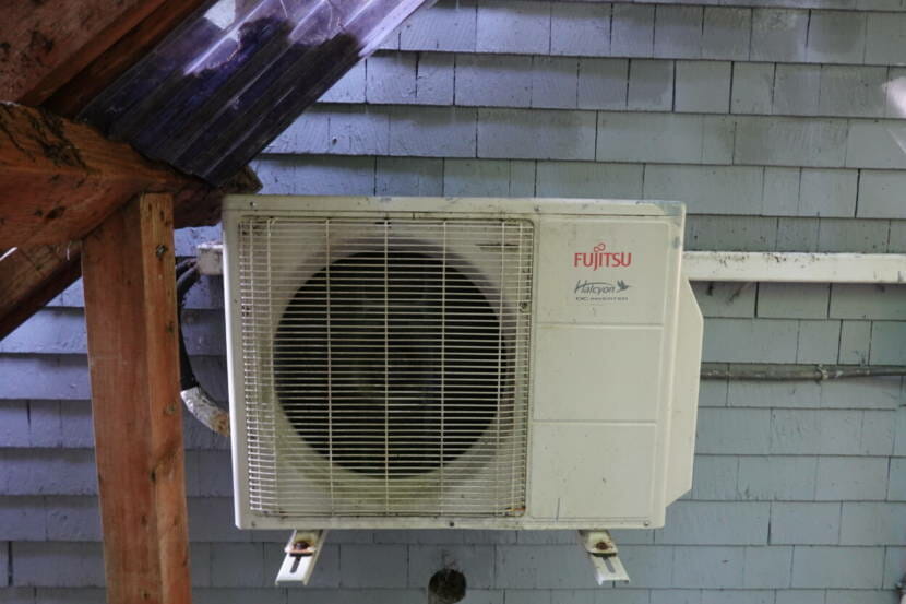
On Alaska’s southern coast, winters are not too cold and summers aren’t too hot, so heat pumps can easily maintain comfortable temperatures. And communities like Juneau, Sitka and Ketchikan have clean, renewable electricity in the form of hydropower, while Kodiak combines hydropower with wind energy. When heat pumps tap into those grids, they’re essentially emissions-free.

But even when they run on diesel-generated electricity, heat pumps can save homeowners up between 25% to 50% on heating bills when compared to traditional oil-based heating systems.

“That’s a really big lift, especially in our rural communities,” said Robert Venables, executive director of Southeast Conference. “And that is one of the primary focuses of this project, where over half the funds are really intended to those small rural villages that struggle with heating costs.”

The new funding will establish the Accelerating Clean Energy Savings in Alaska’s Coastal Communities Program, administered by Southeast Conference and AK Heat Smart, with help from Alaska Municipal League. The program will dole out financial incentives for heat pumps in communities from Ketchikan to Kodiak. Homeowners will be eligible for between $4,000 up to $8,500, depending on household income, to put towards a heat pump.

The program proposal was selected from more than 300 applicants nationwide who submitted bids under the EPA’s Climate Pollution Reduction Grant program, which ultimately divvied up $4.3 billion dollars total to states, local governments and a tribe for 25 projects that will cut down on the nation’s greenhouse gas emissions.

The biggest potential hurdle to this program’s success, Romanoff says, may be the workforce. There’s money for heat pumps, but there’s not really enough people to install them. He hopes more HVAC professionals, plumbers, electricians and even companies that have traditionally serviced oil boilers will go all-in on heat pumps, following this funding announcement.

“This is a chance to either grow a business, start a business, move into the space and recognize that this is where things are going, especially with this kind of infusion of money,” he said. “Now is a great time to get on the train and go for the ride with us, because we’re leaving the station.”

The program is expected to be officially up and running sometime next spring.

Correction: A previous version of this story characterized the new program as a rebate program, which would give refunds for heat pumps after purchase. Instead, homeowners will receive direct financial incentives ahead of purchase.

As Suicide Basin fills up, this scientist is keeping an eye on it

A research team led by hydrologist Eran Hood at the University of Alaska Southeast did a drone survey to map Suicide Basin shortly after it drained in August 2023, causing catastrophic flooding along the Mendenhall River (Photo by Anna Canny/KTOO)

Suicide Basin, a glacial lake tucked behind the Mendenhall Glacier, is a looming flood threat for Juneau residents this time of year.

Glacial outburst floods or jökulhlaups have happened in the Mendenhall River every year for the last decade. The basin fills up with rain and meltwater throughout the summer until it drains downstream.

Last year’s flooding was catastrophic. As the basin fills again, scientists at the University of Alaska Southeast are keeping a close eye on it. KTOO’s Anna Canny sat down with one of them.

This interview has been edited for length and clarity.

Anna Canny: I guess maybe you could start by introducing yourself and telling me a little bit about your background and what brought you to Juneau this summer.

David Polashenski: Absolutely. My name is David Polashenski, and I’m a postdoctoral researcher here at the University of Alaska Southeast. Just started the position a couple of months ago after finishing my PhD up in Fairbanks at University of Alaska. And yeah, my background is in ice dynamics and glaciology. So Eran Hood here hired me on to try to help with the Suicide Basin monitoring project this summer.  I would say mostly I’ve kind of continued the monitoring work that UAS, the USGS and the National Weather Service do together as a partnership for the past several years. So this summer, we’ve gone up to the basin now three times and conducted three drone surveys. So when we go up there, we just have a small little quadcopter drone with a camera on it. And we have it fly a regular flight path, so it’s basically just like mowing the lawn back and forth on the glacier, taking pictures looking down. And each picture has overlap with the previous, so that allows you to stitch all 2,000 or so pictures from any given survey into one big image of the entire basin. And then using digital image processing, you can turn that into an elevation map so you can keep track of how the basin’s shape is changing through time, and how the water level is rising up and down.

Anna Canny: So you talked about you’re basically figuring out the shape of the basin. How much is that changing from survey to survey? 

David Polashenski: Yeah, so like for this summer, it’s not changing a ton, but year to year, it’s changing slowly but surely. Kind of there’s these two competing feedbacks for how much water the basin can hold. The Mendenhall Glacier itself acts as a dam, and over time as the Mendenhall lowers, the dam’s elevation gets lower, and so that means you can hold less water behind the dam as the ice melts away, essentially. But then there’s the competing feedback of as the Mendenhall Glacier pulls back out further into its main branch, then the surface area of this basin increases over time. So I was looking at it this morning, I believe that  the basin has dropped on the order of tens of feet over the past couple of years, as far as the ice dam elevation, but it’s also expanding out into the main branch so that you have these competing feedbacks. And it’s not clear which one’s winning at the moment.

Anna Canny: Right, it’s getting shallower in some ways, but also wider?

David Polashenski: Exactly. 

Anna Canny: And then figuring out those competing factors helps you narrow in basically on how much water it can hold and therefore how much water it could release?

David Polashenski: Right. So are the monitoring efforts that we’re trying to keep track of is there’s basically two things we’re concerned about is how much water is in the basin? And then the million dollar question, that’s actually much harder is, how quickly is it going to drain? So how big is your bathtub and what size pipe is coming out the bottom of it, essentially,  control the dynamics of this flood event. And we’re getting better estimates of total volume over the years, especially after the big flood event last, we were able to do a drone survey when the water level was very, very low. So that gave us the baseline topography of the basin, which we just hadn’t seen before, because the water level had never dropped that low before. The two really big time periods that’s really important to get an elevation map is kind of right now when we’re approaching the maximum water level. And then after the flood event, as soon as we can get it back up there, we want to resurvey the whole basin to get again, this highest water level to the lowest water level survey allows us to estimate the total volume.

Anna Canny: Well, you mentioned we’re getting close to that maximum volume. When’s the last time you were up there and what did you see?

David Polashenski: Yeah, we were up there exactly a week ago, last Thursday. And I would have to look to double-check, but I believe the water level was about 402 meters. And so it is lower water elevation than then last summer, but still rapidly filling. As of this morning when I checked the monitoring website, it was about 410 meters. So we have got about, you know, 10 or 15 meters more to go to be at a similar water elevation to last summer.

Anna Canny:  Okay. And I mean, it’s not always that it fills up and then it drains like clockwork. There’s been some years where it’s drained before it’s all the way full, right? 

David Polashenski: Yes, exactly. So, this has been going on now since 2011. And sometimes, like last year, it drains catastrophically and almost fully, but then another year it only drains you know, a partial release. So 20%, 40% of the basin. And so that’s really the million dollar question: how much of the total volume is going to come out when it begins to drain? Weather and helicopter logistics willing, we’re hoping to go up again sometime in the next few days. And then once the basin drains later, you know, days or weeks from now, I would encourage everyone to keep an eye on the website for if and when the drainage does start occurring. The National Weather Service will publish a flood forecast.

New statue at Tee Harbor commemorates mythical sole survivor of the SS Princess Sophia

The Tommy statue at Tee Harbor was paid for and installed by an anonymous Juneau family (Photo by Anna Canny/KTOO)

A new guardian is watching over the treacherous waters of Lynn Canal, where several historic shipwrecks happened. Tommy, the mythical sole survivor of the sinking of the SS Princess Sophia, is now cast in bronze atop a boulder at Tee Harbor.

The Sophia — pronounced “so-FYE-ah” — set sail out of Skagway on October 23, 1918, carrying gold prospectors and others on the way to Vancouver and Victoria, Canada. But before the passenger liner could reach her final port, she ran aground on Vanderbilt Reef and, despite rescue efforts, sank almost two days later, on Oct. 25.

The disaster is sometimes called the “Titanic of the Pacific.”

“But like, people survived on the Titanic,” said Brian Weed, an amateur Juneau historian. “Nobody survived on this.”

More than 350 people went down with the ship, but as the story goes, Tommy the dog was able to swim through the frigid waters to reach the shore close to where the new statue now stands.

The steamship Princess Sophia grounded on Vanderbilt Reef. Photo courtesy of the Alaska State Library Historical Collections, Winter and Pond. Photographs, 1893-1943. ASL-PCA-87 ASL-P87-1702

The statue was funded by an anonymous Juneau family, and quietly installed on city land earlier this month. Then Weed, who was not involved, unveiled it on his popular Facebook page, Juneau’s Hidden History.

It’s accessible via the North Tee Harbor trail, which is a short hike down to the rocky shoreline. Weed led the way recently, accompanied by his own dog, Doug, a tiny Yorkshire terrier mix.

On the day the SS Princess Sophia ran aground, rain was pouring and wind was howling as a violent storm bore down on the ship. But on the morning Weed visited the statue, it was just drizzling. Doug was wearing a blue and gray raincoat to stay dry.

On the boulder where the statue stands, a small plaque identifies Tommy as a Chesapeake Bay retriever, though the actual likeness to the breed is vague. The metal is sculpted into wispy fur, and the dog’s strangely long neck is craned towards the rocky surface of the distant reef, which just barely breaks the surface of the water.

The Tommy statue is at least the third canine monument in Juneau. On the cruise ship docks there’s a sculpture of Patsy Ann, the bull terrier who greeted ships coming into port back in the 1930s. And near the Mendenhall Glacier there’s a plaque for Romeo, a wild black wolf who sometimes struck up friendly relationships with pet dogs.

“Juneau has always been a huge dog town,” Weed said.

But our dogs have not always walked on leashes, or slept in beds or worn raincoats, for that matter.

That’s why local scuba diver Annette Smith is skeptical about the miraculous story of the dog who survived. Smith has visited the wreck of the Sophia dozens of times and has done countless hours of research on the ship’s story.

She says there was a fish cannery at Tee Harbor in the early 1900s.

“The people that worked there had dogs. And they were not groomed, right? They did not sleep in the house. They were oily and greasy,” Smith said. “That’s where I think the dog from the dog story came from – (it) was probably one of those.”

In a story published in the Alaska Daily Empire in March 1919, a few months after the shipwreck, cannery workers described the arrival of a half-starved dog, whose white and brown spotted coat was covered in oil.

Unnamed at the time, it was believed to be a thoroughbred English Setter belonging to Captain James Alexander, who went down with the ship.

Setters are decent swimmers, but to make it to Tee Harbor, Tommy would have had to paddle nearly 15 miles.

“Let’s say yes, a dog survived. Let’s say yes, it managed to fight against five plus foot seas, 50 mile an hour winds that were pushing it,” Smith said. “Where’s it gonna come ashore? Well, the first place it’s going to come ashore is Amalga, not Tee Harbor.

To Smith, the story seems unlikely.

Then, a few years ago, researchers at the British Maritime Museum examined the dog’s survival story again, and they found a letter written by the administrator of the late Alexander’s estate, which instead described the dog that had been found in Juneau as a Chesapeake Bay Retriever.

Chesapeake Bay Retrievers have thick, water-resistant coats and strong paddle-like tails. It is believed that the breed descended from two puppies that survived a Newfoundland shipwreck in 1807.

That makes Tommy’s feat seem slightly more plausible. But we’ll probably never really know for sure.

Stories of dogs surviving shipwrecks are common. Three small dogs actually did survive the Titanic, when their owners carried them onto the lifeboats. But an enduring story of Rigel, a heroic black Newfoundland who supposedly helped save people when the Titanic went down, has been proven false.

Whether they’re real or fake, these stories often get passed down. Tommy’s survival was even featured as the climax of the Princess Sophia opera, a theater production that commemorated the 100th anniversary of the tragedy in 2018. Smith understands why.

“There’s people trying to make sense of this horrible tragedy and having a dog or something survive provides some hope. Right? And gives a little bit of meaning,” she said.

But to her, the tragic human side of the Princess Sophia story is more compelling.

Two black bears euthanized in downtown Juneau

A screenshot from drone footage shows a black bear going through trash in the Bear Valley neighborhood of Anchorage on Sunday, April 25, 2021. (Vern Poraning)

The Alaska Department of Fish and Game euthanized two black bears in downtown Juneau on Wednesday evening after they displayed aggressive behavior around garbage cans.

Wildlife management biologist Carl Koch said he initially responded to reports of a yearling that was entering shops, including a jewelry store on South Franklin Street.

“As we were looking for the little bear, we encountered two other bears that were uncooperative, you know, somewhat aggressive,” Koch said. “We were dealing with lots of tourists getting close to them, and so we did end up removing two bears for safety reasons.”

Those bears were more mature males. According to Koch, they were shot with tranquilizer darts and later put down. The yearling is still at large.

Bear sightings are common in the neighborhood.

“There’s a great habitat just above Franklin Street surrounding a bunch of houses, stairwells, that will lead down to garbage cans,” Koch said. “There were a lot of full cans that the bears could get after.”

Koch said he found many cans that were easy to get into on Wednesday, with extra garbage that was placed on top of them, out in the open.

Unsecured trash draws hungry bears. If a bear is easily shooed away, it doesn’t pose a threat. But when bears get used to trash as an easy food source, they get used to people, too, which makes them more bold and confrontational.

Bear sightings in the busy downtown tourist areas can draw large crowds. Curious onlookers plus confrontational bears means big concerns for public safety.

“You tell people to back off and they say, I paid all this money, I’m gonna get my picture,” Koch said.

Koch says the Juneau Police Department has been responding to more bear-related calls this summer than usual, and wildlife biologists are not sure why they’re especially active this year.

Fortunately, no other bears have been euthanized in the area.

Still, Koch says the best way to avoid that outcome in the future is to do a better job of securing and cleaning up trash. According to city law, residents and business owners can be subject to fines if their garbage attracts bears

Rainfall will intensify Monday night after a wet weekend in Southeast Alaska

A man attempts to clear a drain in the parking lot of the Four Points by Sheraton Juneau on Monday, July 15, 2024. (Clarise Larson/KTOO)

The wet weather that drenched much of Southeast Alaska over the weekend is expected to persist through tomorrow morning. Rainfall will be especially intense this evening in Juneau, Skagway, Haines Gustavus, Hoonah and Tenakee Springs.

“That is when we’re expecting the last batch of heaviest rain to really push through the area,” said meteorologist Sean Jones, with the National Weather Service Office in Juneau.

Heavy rainfall has saturated the ground, elevating the risk of landslides, and rivers and creeks are rising, especially in the northern panhandle. 

The National Weather Service has issued a flood advisory for the Mendenhall Valley in Juneau, especially Auke Lake and Jordan Creek, effective through 10 am Tuesday morning. 

A flood advisory is also in effect for the Chilkat River, as snowmelt and runoff push water levels in the basin higher. 

Jones says this amount of rainfall is pretty typical during Southeast Alaska’s rainy season, which usually begins in the fall. But it comes after a stretch of rain last week, when multiple single day rainfall records were broken across the region.

“Also, this was a long duration event, where we had significant rain totals over multiple days,” Jones said. “So that is part of the reason that it’s more impactful.”

Between 3 and 8 inches of rain has already fallen, and the forecast calls for 1 to 2 more inches before the storm lightens up  on Tuesday morning.

By Tuesday evening, moderate to heavy rainfall may start up again, when an incoming wet front stalls over the central panhandle between Wrangell and Juneau. That could drop an additional 2 to 4 inches of rain on soil that’s already saturated, especially around Juneau and Petersburg.  

Melting glaciers in the Juneau Icefield may be approaching “irreversible tipping point,” new study says

A Juneau Icefield Research Program expedition in 2018. (Photo courtesy of JIRP)

The Mendenhall Glacier is a beautiful sight. To Bethan Davies, a glaciologist at Newcastle University in the United Kingdom, it’s also a reminder.

“It’s the most visible, iconic evidence of climate change,” she said.

It’s no secret that Alaska’s glaciers are shrinking as the burning of fossil fuels warms the planet. But in the Juneau Icefield, home to the Mendenhall and more than a thousand other glaciers, ice has melted especially fast over the last decade — twice as quickly as it did before 2010. 

Davies worries that glaciers in the Juneau Icefield and elsewhere are approaching an irreversible tipping point.

“That means that we would continue to lose ice from Juneau Icefield, even if climate change stops. Even if temperatures stop rising,” she said. “At the moment, we can retain our icefields, but if we cross that tipping point it’s too late.”

The icefield stretches across 1,5000 square miles of mountain terrain between Juneau and British Columbia. It reached its peak volume back in the late 18th century, during a period of cooler temperatures known as the Little Ice Age. 

Since then, almost a quarter of it’s ice volume has melted away. Davies and her colleagues  from universities in the United Kingdom, United State and Europe used satellite imagery, historical photos and decades of glacial measurements to track that decline in a study published in the journal Nature Communications.

They found that glacier volume decreased at a pretty steady pace between 1770 and 1979. Through the tail of the 20th century and the early 2000s, things started to melt a little bit faster. Then, between 2010 and 2020, ice loss accelerated sharply.

And across the icefield, glaciers shrank five times faster from 2015 to 2019 as compared to the mid-20th century.

Every single glacier in the Juneau Icefield is smaller than it was 250 years ago. At least 108 of them have disappeared completely. Those that remain are thinning, receding and breaking into smaller and smaller fragments.

The consequence of all that melting, is more melting. Because the Juneau Icefield is a broad, top-heavy plateau, with ice stretching skyward. When it start to melt, the surface of the icefield slumps down to a lower elevation, where air temperatures are higher.

“And because it’s warmer, it melts more,” Davies said.

The icefield also is at risk of dipping below the snow elevation line. It’s the boundary between seasonal snow and snow that persists year-round, like the white caps on some of Juneau peaks. And it’s moving higher and higher. 

“That means you’re suddenly losing snow, losing nourishment over a really big area of the icefield,” Davies said. “That’s not a healthy thing for a glacier.”

As snowfall decreases and ice breaks apart, the icefield loses some of the reflective, bright white quality that protects it too. 

“You’re left with rock that dark, you’re left with glacier ice that’s maybe a bit gray and a bit dusty,” Davies said. “That absorbs more of the sun’s energy,”

These melt-accelerating processes could be happening to other plateau icefields in Norway, Canada and other parts of the Arctic. The fate of all that ice matters for the whole world.

Glaciers only cover about 1% of the planet.

“But they are currently responsible for about a quarter of sea level rise,” Davies said. “So all the world’s glaciers together are contributing more to sea level rise than the Greenland ice sheet, and more to sea level rise than the Antarctic ice sheet. And the area that’s contributing most from glaciers is Alaska.”

The only way to prevent that sea level rise is to keep water locked in glacial ice. And the only way to do that is to slow the rate of global climate change.

“Every 10th of a degree matters,” Davies said. “If we stick to 1.5 degrees of warming which is now very close we’ll retain most of the world’s ice.”

Site notifications
Update notification options
Subscribe to notifications