Northwest

2 Russian nationals request asylum after crossing to Gambell by boat

""
An aerial view of St. Lawrence Island, circa 2015. (Photo by Laura Kraegel/KNOM)

Two foreign nationals coming from Russia were detained on Alaska’s St. Lawrence Island earlier this week before being taken to Anchorage.

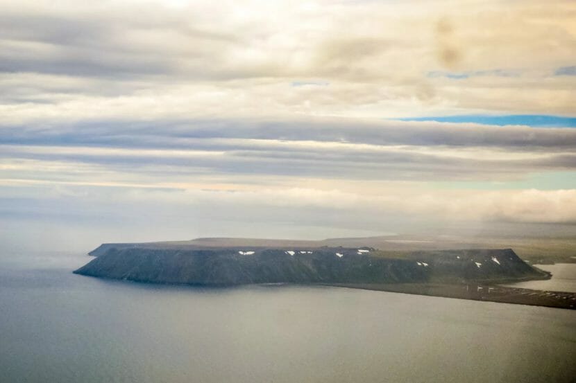
The two unidentified men arrived by boat on Tuesday in Gambell, a Siberian Yupik community of roughly 600 people on the western edge of St. Lawrence Island in the Bering Sea. Gambell is about 200 miles southwest of Nome and just a few dozen miles from the coast of Russia. By Wednesday morning the two men were transferred to Anchorage, according to U.S. Coast Guard officials.

The Department of Homeland Security and the office of Customs and Border Protection in Alaska are taking the lead on this case.

“The individuals were transported to Anchorage for inspection, which includes a screening and vetting process, and then subsequently processed in accordance with applicable U.S. immigration laws under the Immigration and Nationality Act,” a Homeland Security spokesperson said in an email.

According to Alaska’s News Source, officials in Gambell said the men told locals they were fleeing the Russian military.

Russian President Vladimir Putin declared a limited mobilization last month, drafting up to 300,000 men for Russia’s failing invasion of Ukraine – a move which has made many potential draftees, particularly in outlying areas of Russia, try to leave.

Sens. Lisa Murkowski and Dan Sullivan identified the two people who boated to Gambell as “Russian nationals” in a Thursday statement, saying both had requested asylum in the United States.

“This incident makes two things clear: First, the Russian people don’t want to fight Putin’s war of aggression against Ukraine. Second, given Alaska’s proximity to Russia, our state has a vital role to play in securing America’s national security,” Sullivan said.

Murkowski noted that the federal response was “lacking,” calling for additional federal resources to be sent to Alaska.

“Only local officials and state law enforcement had the capability to immediately respond to the asylum seekers, while Customs and Border Protection had to dispatch a Coast Guard aircraft from over 750 miles away to get on scene,” Murkowski said. “This situation underscores the need for a stronger security posture in America’s Arctic, which I have championed throughout my time in the Senate.”

A spokesman for Sullivan declined further comment on the incident Thursday.

This is a developing story and will be updated as more information becomes available.

Alaska Public Media reporter Chris Klint contributed information to this story.

Alaska’s next big storm forecast to hit farther north, as some communities still recover from September flooding

A forecast map shows the storm expected to hit Alaska on Wednesday. (National Weather Service)

A storm is forecast to hit Alaska’s northwest coast with high winds and coastal flooding, starting Wednesday night and continuing into Friday.

That’s as many Western Alaska communities are still trying to recover from last month’s major storm, the remnants of Typhoon Merbok, which impacted nearly 1,000 miles of coastline.

While the current storm’s track appears to be farther north, National Weather Service meteorologist Ryan Metzger said the communities impacted by the previous storm are now more vulnerable than they were a month ago.

“You know, the worst impacts with this storm will be north of the Bering Strait,” Metzger said. “But areas south of the Bering Strait that were impacted by the previous storm, they have more susceptibility to smaller events, so that’s why we’re kind of keeping an eye out for those areas.”

The most serious impacts are expected from Shishmaref to Kotzebue and up the coast to Utqiagvik.

The Weather Service has issued warnings for high winds, flooding or both for those areas, as well as the community of Gambell on St. Lawrence Island in the Bering Sea.

Wind gusts are expected as high as 70 mph in some locations by Thursday.

To the south, in places like Nome, Unalakleet and down to Hooper Bay, there are less serious weather advisories in effect.

State officials say assessment resources and local contractors are already on hand in communities that might be affected by the coming storm.

The Alaska National Guard’s adjutant general, Maj. Gen. Torrence Saxe, said guardsmen and helicopters are pre-positioned at armories in Nome, Kotzebue and Utqiagvik.

“This could be a different storm, as we’ve heard, so we’re getting people ready now,” Saxe said. “What we call the ‘warning order’ has already gone out to my forces, and we will be ready to go.”

Gov. Mike Dunleavy urged residents in the region to prepare. He emphasized the importance of protecting human life, after no deaths or serious injuries were reported from last month’s storm.

Most locations within the National Weather Service’s warning zone are expected to see the high wind tapering off by Friday.

Alaska Public Media’s Chris Klint contributed reporting to this story.

A new storm could hit parts of Western Alaska pummeled by last month’s typhoon remnants

A small, square building, some skiffs, and fishing gear jumbled together onshore
Nearly 90 of the 100 boats people use for hunting and fishing out of Chevak were damaged or destroyed after a powerful storm hit Alaska’s west coast in September 2022. Nearly all of the sheds that store the tools for subsistence harvest in the community were also destroyed. (Emily Schwing for Alaska Public Media & KYUK)

A storm is on track to hit a portion of the area pummeled last month by the remnants of Typhoon Merbok. National Weather Service meteorologist Scott Berg said the new storm developing in Russia is anticipated to move north of the Siberian Peninsula toward Alaska midweek.

“And as it does that, it’s going to bring some strong southwesterly, south winds into areas —basically areas from Norton Sound north to Point Barrow,” he said.

Berg said as the front makes it inland, winds will turn more westerly, and some storm surge is expected.

“We’re looking right now at it being basically minor coastal flooding, but there could be quite a bit of erosion with the wind waves on top of the surge that may occur,” he said.

Berg said erosion could be worse due to damage done by last month’s major storm.

“Their defenses are down,” he said. “The berms that were built up over the years, have all been damaged, so any minor coastal flooding or high surf in those areas could cause erosion issues that will be a bigger impact than what they normally would be.”

special statement from the National Weather Service says strong winds are expected to move into the Eastern Bering Sea and Chukchi Sea Wednesday afternoon with an elevated risk of coastal flooding from the Bering Strait to Point Hope Wednesday night into Friday. It says high surf is possible on south and west facing shores of Norton Sound.

Many of Hooper Bay’s dunes were washed away by the storm. Without them, residents feel exposed.

On the beach in Hooper Bay, Daniel Cernek, a middle school science teacher, is working to wrangle a few dozen of his students. It’s been less than a week since a powerful storm brought flooding and severe winds to the town of 1,300.

As part of his science class, Cernek wants his students to observe the coast and learn about erosion.

“You need to think back before the storm,” Cernek said. “When you drove down the beach, what was different between then and now?”

The students are on the beach south of the village where the storm surge was the strongest. In parts of this area, what was once a stretch of rolling sand dunes is now a flat floodplain. There used to be five rows of dunes. Now, there’s only one row here. In other places, they remain intact. The beach itself has also shrunk. Those dunes form a natural sea wall for the town. Without them, it’s left the town exposed.

Before the storm, Cernek took measurements of how far the water was from the dunes. On this field trip, he’s trying to gauge how things have changed.

“We’re going to get the GPS. They’ll record it on their paper, and we’ll use that to build a map that has the old coastline and the new coastline overlaid on each other,” Cernek said.

According to Cernek’s calculations, the storm eroded about 300 feet of coastline, bringing the water that much closer to town. The loss of Hooper Bay’s dunes has potentially serious consequences.

Emma Smith, a longtime Hooper Bay resident, drove her four-wheeler down to the beach after the storm to get a sense of the impact.

“That was traumatizing just by seeing how much our coastline has eroded,” Smith said. “There is not going to be enough protection for the village if water should be coming in from the Bering Sea. That’s really scary.”

Hooper Bay has minimal ground above sea level. The dunes have protected the village from high water. A 2014 assessment by the Alaska Division of Geological and Geophysical Surveys estimated that the coastline near Hooper Bay erodes about 5 feet every year. Floods like this accelerate that timeline.

The airport, which is only about a quarter mile from the shoreline, is the infrastructure that is most at risk of erosion over the next few decades. But more immediately, storm surges threaten the safety of the whole village. Although no one was injured or killed in the storm, the flood caused serious property damage and destroyed the homes of multiple families. Experts say that these storms are becoming more frequent due to climate change.

Tom Ravens, a professor at the University of Alaska Anchorage and an expert in coastal erosion, said that oceans can be an extremely destructive force.

“If you think about a wave building over, you know, hundreds or thousands of miles, those waves encapsulate just a ton of energy,” Ravens said.

Ravens said that Hooper Bay’s dunes likely made the flooding less severe than it otherwise could have been.

“The dunes can be considered like sacrificial elements, so there is value in rebuilding the dunes even if the next storm is going to take them out,” Ravens said. “The value is that they’re preventing the water from flowing from the ocean into the community.”

Mary Hoeschler, another lifelong resident of Hooper Bay, said that she was already concerned about what erosion along the coastline meant for the village. With the loss of the dunes, it’s hard for her to feel safe planning for her future in Hooper Bay.

“I wanted my kids to live here. I wanted to build them a house and live in Hooper Bay,” Hoeschler said. “But it feels like we have to move.”

On the beach, students were laughing and enjoying being outside of the classroom, rushing in and out of the waves. For them, at least right now, this moment is a learning experience and a chance to process the trauma of the past week. But for adults, it’s hard not to wonder what the loss of Hooper Bay’s dunes will mean for these students’ futures, and for the future of the town.

“I have no idea,” Hoeschler said. “This is just crazy and scary.”

Storm of the decade forecast for Bering Strait region

Front street in Nome, soaked and covered with debris
The aftermath of the infamous storm that ravaged Nome and environs in October 2004. Here is the east end of Nome’s Front Street just after the storm had passed, littered with driftwood and large rocks. KNOM provided live coverage and emergency advisories throughout the event. (Photo from KNOM file, 2004).

The National Weather Service is forecasting coastal flooding in Nome and across Western Alaska this weekend, with potential storm surge reaching up to 14 feet above normal levels. If this multi-day fall storm hits Western Alaska as predicted, storm surge would reach levels rarely seen over the last 50 years.

Based on the latest forecast from the Weather Service office in Fairbanks, significant storm surge and high wind will affect the coast of Western Alaska from Point Hope south to Hooper Bay starting tomorrow.

The Weather Service currently estimates water levels will rise between eight and 11 feet above normal high tides in the Nome area, with the likelihood of the Council Road being completely covered in water.

The forecast also calls for powerful winds along the Bering Sea coast, with gusts as high as 90 mph possible in some places.

The storm could be just as damaging as the November, 2011 Bering Sea superstorm and have similar coastal flood impacts, according to the Weather Service. The City of Nome announced on social media that the residents in Belmont Point area should be prepared to evacuate if necessary.

Climatologist Rick Thoman with the Alaska Center for Climate Assessment and Policy at the University of Alaska Fairbanks told KNOM via email that the latest information suggests Nome will see some of the highest ocean levels ever recorded since the local sea wall was constructed. Nome’s seawall was completed in June of 1951, according to the U.S. Army Corps of Engineers, but updated to something similar to its current form in the mid-1970s.

https://twitter.com/AlaskaWx/status/1570481928813551616


Thoman said that the timing of tides and the highest storm surges will determine where coastal flooding will be the most severe.

“Coastal flooding is certain this weekend, the only question is how bad,” he said.

Even the UAF research vessel Sikuliaq, which was docked in Nome the afternoon of Sept. 14, left town and headed north ahead of schedule to avoid the worst of the storm.

This post has been updated.

Alaska-based pilots intercepted Russian aircraft 3 times in a week

A four-propellor Russian military plane climbing and trailing black exhaust
JBER-based F-22s intercepted a Russian Ilyushin Il-20 like this one on Monday, Tuesday and Wednesday of last week. (Creative Commons photo by Kirill Naumenko)

Fighter jets from Joint Base Elmendorf Richardson intercepted Russian reconnaissance planes three times last week in airspace around Alaska. That’s happened often in recent years, but a Fairbanks-based military analyst says it’s noteworthy because this time, it happened while the United States is helping Ukraine defend itself from Russian invaders.

JBER-based F-22 fighters scrambled on Monday, Tuesday and Wednesday last week to intercept a Russian IL-20 that had entered the Alaskan Air Defense Identification Zone, or ADIZ. That’s international airspace, but it’s not unusual for a nation to send fighters out to meet foreign aircraft that enter their ADIZ and often to accompany them until they leave it.

“On average, we conduct about six to seven intercepts a year,” says Capt. Lauren Ott, a spokesperson for the North American Aerospace Defense Command’s Alaskan Region based at JBER. Ott says the number of intercepts has varied annually since Russia resumed its so-called out-of-area long-range aviation activity 15 years ago.

“Some years, as high as 14, and some years, as low as zero,” she said in an interview Monday.

This year, however, the usual game of cat-and-mouse is playing out in an entirely different context — one where the United States and Russia aren’t at war but are certainly at odds because of the U.S’s leading role in supporting Ukraine.

But Ott says that didn’t affect last week’s otherwise routine interceptions of the Russian planes near Alaska.

“The recent activity by the Russian aircraft in the Alaskan ADIZ is not perceived as a threat, nor is the activity seen as provocative,” she said.

But a military analyst based at the University of Alaska Fairbanks says the intercepts are notable at the very least.

Troy Bouffard is a 22-year Army veteran who now directs UAF’s Center for Arctic Security and Resilience. He says the timing of the Russian sorties is notable because they likely were intended to send a message to the United States and its allies.

“Russia is trying to demonstrate that it can still project power in different areas, even being decisively engaged in Ukraine,” he said in an interview Monday.

Bouffard says it’s also no coincidence that the Russians decided now is a good time to resume the flights around Alaska because the Il-20 is equipped for intelligence, signals and reconnaissance missions. He suspects they were interested in radio communications between the U.S. and allied forces engaged in the latest round of Red Flag military training exercises that were going on around the state last week.

“It was definitely right in the middle of Red Flag,” he noted.

Bouffard said he thinks the Russians also were sending a message by conducting the sorties with only one Il-20 and not a Tu-95 Bear bomber, which often carries out the missions accompanied by a Russian jet fighter. He says the flights enable the Russians to gain useful intelligence, sometimes just by noting how the Americans respond.

“All the aircraft that they send into an ADIZ is meant to invoke a response and a reaction for the purposes of being able to monitor that and see if they can learn from it,” he said.

Ott said that there haven’t been any Russian aircraft sorties since last week. She declined to say whether there had been any others earlier this year, or to say exactly where the Il-20 entered the Alaska ADIZ.

Site notifications
Update notification options
Subscribe to notifications