Northwest

Pollutants from far distances found in Bering Sea animals hunted by Indigenous people

An adult whale and calf swimming among ice floes
A bowhead whale and calf are seen swimming in an open-water lead the Arctic Ocean in this undated photo. A new study appears to be the first to document the presence of PFAS compounds, known as “forever chemicals,” in body tissues of bowhead whales. (Photo provided by the National Oceanic and Atmospheric Administration)

Chemicals from fire retardants and other materials have accumulated in the bodies of seals, whales and other animals of the northern Bering Sea, showing that pollutants emitted thousands of miles away continue to contaminate animals on which Indigenous people depend for food, according to a newly published study.

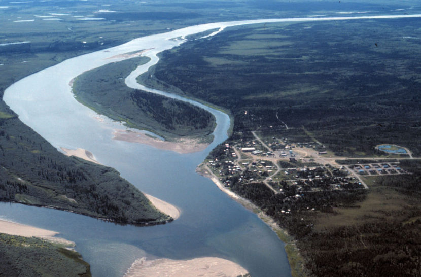
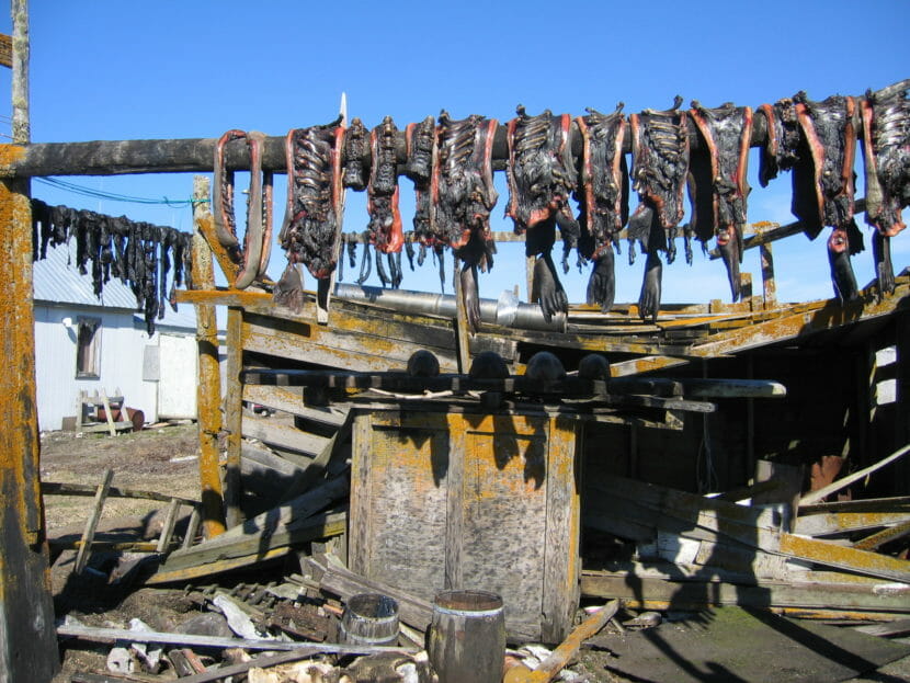
The study, published in the journal Environmental Science and Pollution Research, focuses on marine mammals and reindeer harvested by the Yup’ik residents of St. Lawrence Island, at the southern end of the Bering Strait.

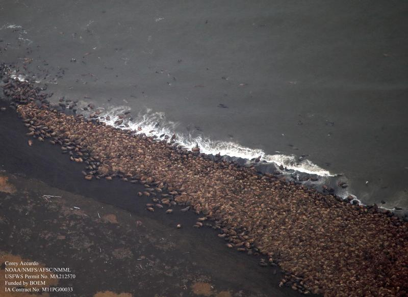
Through samples donated by hunters, researchers – who included island residents themselves – found varying levels of polybrominated diphenyl ethers (PBDEs) and per- and polyfuoroalkyl substances (PFAS) in marine mammals and reindeer on or around the island.

PBDEs are a class of compounds used as flame retardants. PFAS compounds are also used for that purpose but are found in a wide variety of consumer products such as cosmetics, clothing and cookware; they are known as “forever chemicals” because they do not break down in the environment. PBDEs have been phased out in the United States since 2004, but there is no national PFAS ban.

The study of subsistence foods at St. Lawrence Island shows how contaminants carried to the far north by atmospheric and ocean currents persist for years and sometimes decades, burdening the region’s Indigenous people.

Two women, standing outside, hold a large photo of another woman
Pam Miller, executive director of Alaska Community Action on Toxics, and Vi Waghiyi, the organization’s environmental health and justice program director, hold up a photo of the late Annie Alowi, a health aide from the St. Lawrence Island community of Savoonga who spurred studies of contaminants from local and long-range pollutants. Miller and Waghiyi are co-authors of a study that examined contaminants found in marine mammals and reindeer that the Yup’ik people of St. Lawrence Island hunt for traditional foods. Waghiyi is also from Savoonga. (Photo by Yereth Rosen/Alaska Beacon)

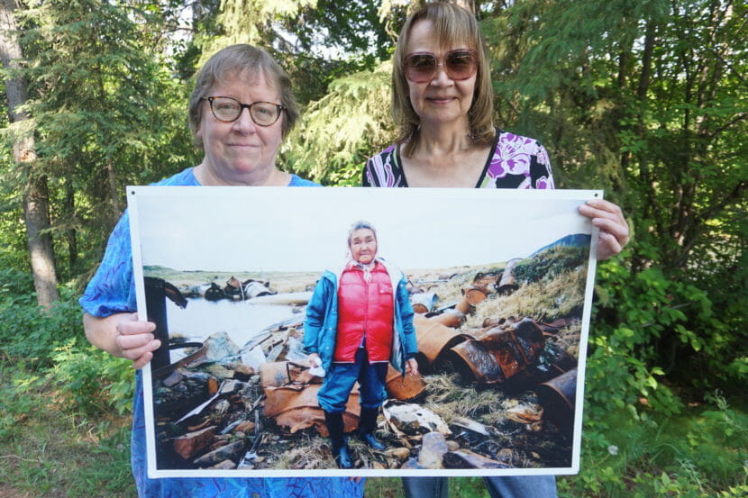
“We are being contaminated against our will,” said study co-author Vi Waghiyi, who is from Savoonga, one of the two villages on the island.

Still, the findings should not deter people from conducting their harvests of negepik, or traditional foods, said Waghiyi, the environmental health and justice program director at Alaska Community Action on Toxics, a nonprofit environmental health organization based in Anchorage.

“Our people still feel the benefits outweigh the risks. It is our identity,” she said. “We’re intricately tied to our lands and waters and wildlife that have sustained our people since time immemorial.”

The St. Lawrence Island findings are, in some ways, similar to those of other studies of contaminants in animals around the Arctic.

There were some new discoveries, however. The study appears to be the first to document PFAS compounds in bowhead whales, with traces showing up in mangtak – the name for skin-attached blubber – and blubber alone and muscle.

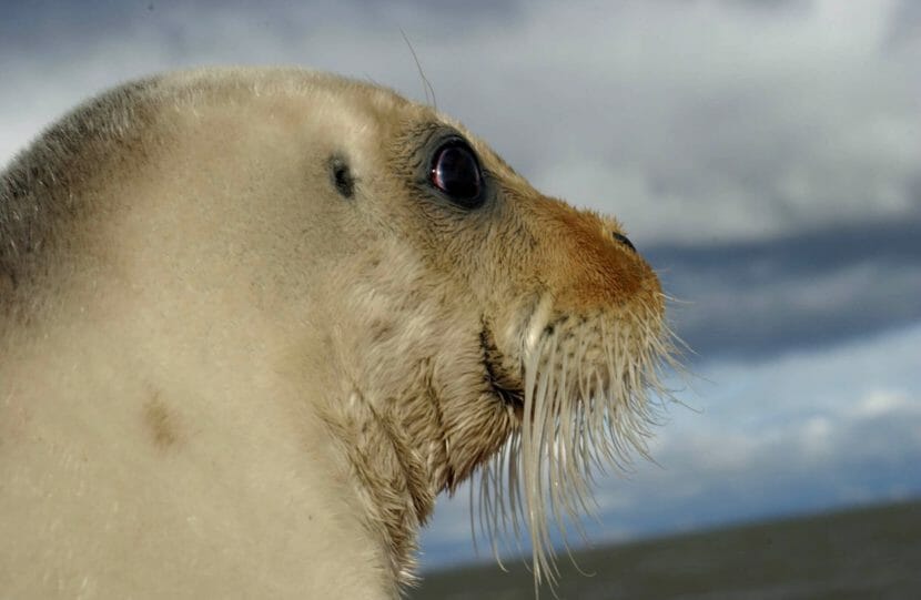
It also found that of all tested species, seals generally had the highest levels of PBDEs. That shows how persistent those chemicals are in the environment, said Pam Miller, ACAT’s executive director.

“Even though they’ve been subject to some global regulation and regulation in the U.S., they’re still very ubiquitous in the Arctic and still prevalent in people and wildlife that people depend on for traditional foods,” said Miller, another co-author.

The study, which used tissue samples provided by local hunters, is the latest in a series in a research program conducted by ACAT and its partners. The program traces back to the advocacy of Annie Alowa, a former health aide in Savoonga, who pushed for cleanup of military pollution on the island after watching so many villagers get cancer and other health problems. Much of the inspiration for ACAT’s founding and its continued work; she died of cancer herself in 1999.

Strips of meat drying on horizontal poles
Walrus meat dries on a rack in Gambell, one of the two communities on St. Lawrence Island, in 2005. Walruses were among the animals tested in a study that traced persistent pollutants in the Bering Sea environment. (Photo provided by the Alaska Division of Community and Regional Affairs)

The research program is notable for its community focus and reliance on local leadership and knowledge, said Waghiyi, who was named last year to a White House advisory council on environmental justice. “It’s one of the few where we’re not just research subjects,” she said.

While this newly published study focuses on pollutants that are carried long distances in the air and in the ocean, other work in the program is continuing to examine the effects of pollution from Northeast Cape, a military site closed in the 1970s, and other on-island sites.

St. Lawrence Island gets pollution from both faraway and local sources, and it is possible to distinguish between the two, said study lead author Sam Byrne, an assistant professor of biological and global health at Middlebury College.

Proximity to military sites and places like landfills is one distinguishing factor, he said. The types of chemicals discovered is another factor, as lighter compounds are more volatile and can be more easily carried by the winds, while heavier compounds such as some of the PCBs found near Northeast Cape, tend to not travel far.

The face of a white seal, in profile
A Bering Sea bearded seal displays its distinctive whiskers. A study of animals hunted by St. Lawrence Island’s Indigenous people found that the highest levels of flame-retardant chemicals were generally in seals. (Photo provided by NOAA)

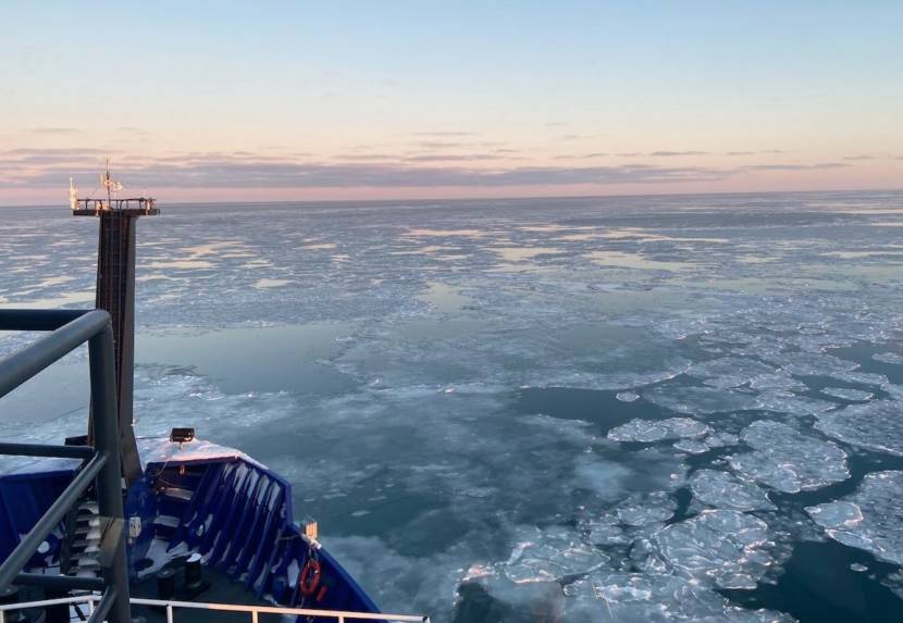
The problems go beyond emissions of dangerous chemicals, Waghiyi and Miller said. Melt of sea ice and glacier ice, thaw of permafrost and the proliferation of microplastics in the ocean is also spreading contamination, some of what had previously been sequestered in frozen states, they said.

“The convergence of climate, chemicals and plastics has not been fully appreciated by the scientific community or climate-justice activists,” Miller said.

The eight-nation Arctic Council is one organization that has made the connection between climate change and persistent organic pollutants, known as POPs.

report issued at a meeting last year of high-level officials from council nations showed how climate change has eroded some of the progress made since the mid-1990s by international bans and phaseouts of dangerous chemicals. In some places of the Arctic, the report said, POPs are even increasing in concentration after earlier declines.

Biden administration deals setback to Ambler road

Aerial view of Ambler and the Kobuk River in the summer. (Photo courtesy of the National Park Service via UAF Gates of the Arctic Research Portal)

The Biden administration is reeling back federal permission for the proposed Ambler road, a project that would support large-scale mining in Northwest Alaska.

In a court filing Tuesday, the administration agreed with road opponents that the environmental analysis of the project is flawed. The Interior Department wants to reconsider the federal right-of-way permits that the Trump administration granted.

Alaska’s congressional delegation blasted the decision. Sen. Lisa Murkowski called the move a setback for the project but said the fight is not over.

“This project is too important to us in the state, to the people in the region, and really to the country for the resource,” said Murkowski.

The Ambler mining district is believed to contain large amounts of good-quality copper and other minerals that proponents say will be important to an economy based on renewable resources. The proposed access road would stretch 211 miles in the Brooks Range, with 26 of those miles in the Gates of the Arctic National Park.

State Sen. Donny Olson, a Democrat who represents the region, said his constituents need the road and the mining it will support.

The project, though, is controversial. Tanana Chiefs Conference President Brian Ridley calls it a threat to cultural resources and the subsistence way of life.

Scientists use drones to count Chukchi Sea walruses without disturbing them

An aerial photo of many walruses hauled out on a beach
Thousands of Pacific walrus gather on shore near Point Lay in this aerial image captured during a NOAA survey of the Chukchi Sea. The arctic surveys serve to document the distribution and relative abundance of bowhead, gray, right, and fin whales, belugas, and other marine mammals in areas of potential oil and natural gas exploration, development, and production activities in the Alaskan Beaufort and northeastern Chukchi Seas. (Photo by Corey Accardo/NOAA)

Scientists from both the U.S. and Russia are using less invasive technology to get a more complete survey of the walrus population in the Bering Strait region. Their updated methods of surveying could lead to better management and protection of the subsistence marine mammal.

Tony Fischbach is a wildlife biologist with the U.S. Geological Survey Alaska Science Center. He’s been collaborating with scientists from the Russian side of the Bering Strait to test newer methods of surveying walrus on both sides of the Strait.

“With the help of Anatoly Kochnev and a team of biologists working there (in Chukotka), they were able to monitor five different sites using drones, and they also did controlled experiments in places where there weren’t too many walruses to determine what altitude the walruses will tolerate,” Fishbach stated.

The partnership helped scientists determine that if they flew a drone less than 50 meters above the head of a walrus, the walrus would be disturbed and flee, Fischbach said during a Strait Science presentation hosted by the University of Alaska Fairbanks Northwest Campus in Nome. But if the drone was flown higher than that height, then they would be able to safely conduct their surveys.

Fishbach says his team now flies drones about 100 meters above walruses, to be doubly sure they don’t disturb them. Overall, he thinks relying on drones rather than aerial surveys in small planes flown by private pilots is the better option.

“It’s much, much safer, not only for humans, but much safer for walruses. The best thing for us, is you can get more data. Whenever the weather breaks, the rain stops, and lays down, we can get out of our tents, launch this thing, get the survey done, and do it safely,” Fischbach said. “And the data is better too.”

Fischbach’s research team was able to fly 26 drone surveys in a span of two years to count walruses. That’s compared to the old method of flying planes for aerial surveys a few times a year, which was limited by costs, weather, and seasonal challenges.

Thanks to drone surveys, they were able to release “defensible numbers” from their annual walrus count at a previous Point Lay haul out, Fischbach said. The team estimated almost 60,000 walruses were on the beach during surveys taken at Point Lay in the fall of 2018 and 2019.

Once Fischbach and his team combine the survey data with information gathered from radio telemetry tags they placed on a number of walruses, then he says they will have a fuller picture of the regional population.

“And now that we have this methodology worked out, we can collaborate with partners in Northern Chukotka,” Fischbach said. “If they are interested, we can build a team, and we can do an estimate for the entire Chukchi Sea during that open water period.”

Anatoly Kochnev is one of the scientists who has been doing similar drone surveys on the Chukotka side of the Strait since 2017 and studying walruses for decades. Kochnev has also conducted aerial surveys of walrus, as well as focused on the local polar bear population in Chukotka for 30 to 35 years.

“The Pacific walrus is our shared resource, and Russia and the US need to work together to effectively manage and conserve the population,” Kochnev told KNOM via email. “Therefore, I really hope for continued cooperation. I think we need to focus on developing a simple and reliable method for regularly estimating population size – for example, using satellites is exactly what Tony [Fischbach] is doing right now. I would also like to continue monitoring the land walrus haulouts. In addition, we need to focus on tracking changes in the population associated with climate change.”

Kochnev’s and other Russian scientists’ involvement hinges on the 1994 re-negotiation of the U.S.-Russia Environmental Agreement to cooperate on environmental issues of mutual interest and concern.

As scientists from both sides of the Strait gather better survey data of walruses, this data could be used to inform management practices for U.S. and Russian agencies and to protect the animals from increasing vessel traffic.

Fischbach pointed to numerous ships transiting up and down the Chukotka side of the Bering Strait, mostly going in and out of the Sea of Okhotsk.

“The main thing is that we’re able to provide near-real-time management information and let people know ‘oh, take that different approach,’ so don’t fly over them [the walrus] for the aviators. And the same thing for mariners. That can be provided to authorities and they can give advice to people. It can also be used to support haul-out based estimates we were working on before,” Fischbach explained.

One of the next goals for Fischbach and his research team is to do future population estimates of walrus using satellite imagery counting the animals directly from space.

The U.S. Fish and Wildlife Service does not yet know when they will do an updated survey of the Chukchi Sea walrus population, according to Fischbach.

Alaska’s only Arctic deep draft port will get hundreds of millions of dollars from infrastructure bill

A model rendering for the design of a potential Arctic Deep Draft Port in Nome. (Courtesy PND Engineers)

Alaska’s congressional delegation announced on Jan. 19 that the Port of Nome will receive a quarter of a billion dollars for future construction. The significant financial boost for Alaska’s only Arctic deep draft port comes from the Infrastructure Act passed in 2021. There is a deep draft port in Dutch Harbor, but that is not located in Arctic waters.

This $250 million has been a long time coming, Senator Lisa Murkowski said.

“What it now means is that with money that is coming, now the real work begins,” Murkowski said. “This news about the port expansion is incredibly great, but we also know we’re going to have other projects coming our way, whether it’s the build out of broadband capacity, water and wastewater … So we’re going to be busy in Alaska.”

In the final infrastructure package signed into law in November, $250 million was earmarked for Alaska ports, specifically “remote and subsistence harbor construction.” Although this is the full amount the Port of Nome was awarded, it won’t necessarily take away money from other port projects in the state, Murkowski said.

“Because again if you look at that broader Infrastructure Bill, we did right by the port infrastructure. So it doesn’t necessarily mean it’s coming to remote and subsistence,” explained Murkowski. “And again as we look into more details, we’ll get some better definition there.”

For example, Senator Dan Sullivan mentioned in a similar announcement on Jan. 19 that the subsistence harbor project in Elim will receive $3,335,000 from the same funding source. That money will go towards planning engineering and the design for Elim’s harbor.

Alaska will receive a total of $925 million from recent appropriations announced by the U.S. Army Corps of Engineers, according to Sullivan.

More details on the timeline for the funding and next steps for the Port of Nome’s Deep Draft Port are forthcoming.

Ambler Metals says it’s nearly ready to apply for permit to mine in Northwest Alaska

A drill rig in a remote-looking mountain range
Drilling at Trilogy Metals Inc.’s copper-rich Arctic Deposit in Alaska’s Ambler Mining District. (Trilogy Metals)

A company doing exploratory drilling in the Ambler Mining District reports it’s preparing to apply for its main federal permit in “early 2022.”

Ambler Metals expects to submit an application early this year to the Army Corps of Engineers for a federal wetlands permit. That’s according to a report one of its parent companies, Trilogy Metals, made to the Security and Exchange Commission on Jan. 11. The application would be for extraction from what’s known as the Arctic Deposit, in Northwest Alaska. Copper is the prime target.

Trilogy says its budget for this year’s fieldwork is $28.5 million, a slight increase over last year.

A detailed plan isn’t available yet, but the mine will no doubt rely on the proposed 200 mile Ambler Road, which won federal approval during the Trump administration. Environmental groups, Alaska Native tribes and the Tanana Chiefs Conference have filed lawsuits challenging the adequacy of the federal review of the road.

Research cruise gets rare chance to study Bering and Chukchi seas

The Sikuliaq travels north in the Chukchi Sea in November 2021. (Photo courtesy of Seth Danielson)

The final research cruise of 2021 in the Bering and Chukchi seas came through the region in November. Scientists on board observed a variety of marine mammals, saw sea ice growth in real-time and found evidence of a healthy ecosystem despite warmer water temperatures from the summer.

Seth Danielson, a professor with the University of Alaska Fairbanks College of Fisheries and Ocean Science, led as chief scientist. The first time measurements were recorded from the Bering Strait in November was in 1960, according to Danielson.

“After 1960 there weren’t any other cruises that I’m aware of, in the month of November, until 2011. And that was a cruise that Karen Ashton led. Since Karen’s cruise in 2011, there have been a couple more that have gone north in November,” Danielson said. “A couple of them did manage to sample some stations on the shelf (of the Chukchi Sea), the way we did. They did that in pretty warm years.”

This cruise saw a much colder November in much of the Bering Strait and better sea ice conditions than in recent years.

Danielson presented his initial findings during a Strait Science presentation on Dec. 2 hosted by UAF’s Northwest campus. He was joined on board the Sikuliaq by many other researchers, including Catherine Berchok of the Alaska Fisheries Science Center Marine Mammal Lab.

“I was surprised by how few bowheads and how many gray whales and humpbacks there were out there,” Berchok said.

Alaska Sea Grant’s Gay Sheffield remarked that local observations from across the region supported Berchok’s assessment too.

Berchok was observing marine mammals from the bridge of the ship on a regular basis throughout the nine-day voyage. The research team headed north from Seward on Nov. 7 and stopped through Nome on their return around Nov. 16.

Various measurements from the Sikuliaq organized in color-coded graphs by Seth Danielson and research team from their November research cruise. (Screenshot from Strait Science presentation/YouTube)

They witnessed roughly a 20% or more increase in sea ice extent while in the Chukchi Sea during their trip, according to Danielson.

“Why we ever got a situation like this where it’s near freezing at the surface and warm near the bottom (of the sea). And the only thing I can think of is that it was the advection, the currents carrying ice over this region. And so ice did not form in place, but it must have been carried in,” Danielson said.

Other scientists on board the Sikuliaq were taking measurements from the Bering and Chukchi Seas to study water temperature, salinity and oxygen levels.

Southwest of St. Lawrence Island, there was a healthy amount of productivity for this late in the season happening in the Bering Sea ecosystem, according to Jackie Grebmeier, a researcher with the University of Maryland Center for Environmental Sciences.

“So there is still Chlorophyll,” Grebmeier said. “This is viable Chlorophyll on the bottom (of the seafloor) that can provide both food for consumption as well for microbial and carbon cycling. So it’s still going on into November although the values are about 50% less than what we have during the real productive times in July.”

Four DBO mooring sites were monitored by the research team on board the Sikuliaq during their November 2021 cruise. (Screenshot from Strait Science presentation/YouTube)

Grebmeier, Danielson and other scientists from the Sikuliaq are still compiling their final observations. The research team will publish more formal findings sometime in the next couple of years.

Site notifications
Update notification options
Subscribe to notifications