Southeast

Communities in Southeast Alaska are mapping their landslide risk. It’s complicated.

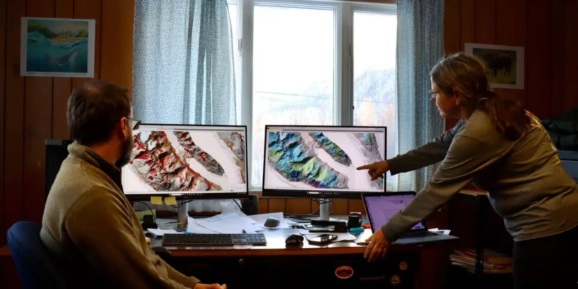
Members of the Haines Planning Commission examine new maps that illustrate landslide risk in the area. The maps are meant to inform future development and planning decisions. (Avery Ellfeldt/KHNS)

If you drive north on Lutak Road in Haines, you’ll see snow-covered peaks towering over the ocean below. If you look closer, you might notice something else: vertical gashes running down the mountain face. They mark places where landslides – or maybe avalanches – have struck, taking trees, soil and rocks down with them.

Patty Brown chairs the Haines Planning Commision. She pointed to one of the slide paths while out for a drive on a cold, clear day back in January.

“There’s probably been a history of different slides reshaping what that whole face even looks like,” Brown said. “All this is slide, slide, slide.”

new report aims to address that reality by mapping the local landscape and pinpointing areas that might be more prone to slides down the line. The goal: providing homeowners and the local government with a science-backed tool that can be used to gauge landslide susceptibility, and to plan accordingly.

The multi-year effort, which was paid for with federal funding, began after an atmospheric river dumped record levels of rain on Haines in 2020. The storm washed out roads and triggered landslides, including one that killed two beloved community members.

“It was associated with such a radical weather event,” Brown said. “Those are going to keep getting more dramatic and be beyond what we predicted. So we better have some kind of an inventory of what to expect.”

The 2020 event and resulting maps are part of a bigger story about intensifying natural disasters – and how communities across Alaska and the U.S. are responding. As climate change and development fuel more destructive disasters including floods, slides and wildfires, local governments are trying to get ahead of the problem without also threatening homes and livelihoods.

Mapping efforts  and pushback  across Southeast

The Haines report is composed of three different maps, which were published in January by the Alaska Department of Natural Resources. The maps were made using light detection and ranging technology, also known as lidar, which researchers attach to planes, drones or helicopters to fly over a study area. The lidar sends down light pulses that bounce off the trees, buildings and the ground. The time it takes for the pulses to return provides detailed data about the landscape and what’s on it.

“So you can think of it kind of like a flashlight that’s shining down. Where does that light hit? Where does it pass through?” said report co-author Jillian Nicolazzo, a geologist with the Landslide Hazards program at the Department of Natural Resources.

The data is then used to create the maps, which local governments, communities and homeowners can reference when making crucial decisions about where to build housing, roads, schools and more.

“If we’ve identified an area that might be susceptible to landsliding, and in 15 years someone wants to put a subdivision in that area, well, hopefully they’ll see that we’ve identified it as a higher hazard area, and they’ll take a closer look,” Nicolazzo said.

Haines is not the only community interested in mapping the risk. Similar projects have been completed or are underway in more than half a dozen other communities in Southeast, in part due to four fatal landslides in the last decade. Those disasters happened in SitkaKetchikan, Haines and Wrangell.

But the efforts aren’t without controversy. Efforts to map physical hazards have sparked opposition in Alaska, but also in other places, like New Orleans and Oregon. The pushback has typically come from homeowners who don’t want the state or local government to label their properties as high risk out of fear it will drive down their property values and make it more difficult to get insurance.

Ron Heintz is a senior researcher at the Sitka Sound Science Center, a nonprofit that’s played a key role in confronting landslide risk in Southeast. He said the issue routinely comes up during conversations about landslide risk in Alaska.

“Everybody wants to see a hazard map, and they want to see if they’re exposed to any sort of hazard. But they don’t want any sort of official acceptance or understanding of these hazard maps,” Heintz said.

Take Juneau. In 2020, the local assembly commissioned new hazard maps, which placed some neighborhoods in landslide zones for the first time. The move drew widespread concerns that the maps would drive down property values or impact insurance. Later, in 2023, the assembly decided against formally adopting the maps and eliminated landslide restrictions from the city’s land use code.

Todd Winkel is a Haines resident who owns property right next to the fatal 2020 slide. He said people in Sitka warned Haines residents to push back against potential risk mapping after the disaster.

That was partially due to worries over real estate. But Winkel said it was also because people felt the mapping would only be beneficial if the local government focused on helping landowners mitigate the risk. Winkel agrees. He said Haines should focus instead on reducing the threat in areas that are clearly landslide-prone.

“If you’re not going to do anything, don’t risk assess it,” Winkel said.

Risks can hide in plain sight

The Haines Planning Commission, for its part, hopes the maps will help the community better gauge and respond to the risk, both during future extreme weather events and when making long-term planning decisions.

That could include encouraging people to consult an engineer before developing somewhere that’s landslide prone, said Derek Poinsette, the planning commission’s vice chair.

Poinsette emphasized that the commission does not currently plan to use the maps for regulatory purposes, such as vetting building permits – and that the maps have a few important limitations.

Key among them is that they do not predict where slides will happen in the future. Instead, they identify areas that may be more susceptible to slides due to the slope angle, vegetation and more. Another caveat, he said, is that the maps rely heavily on lidar, which provides important information but is not the same as verifying the risk in the field.

“This isn’t the last word on any specific area,” Poinsette said. “Getting out there on the ground and actually taking soil samples and drilling cores and things like that is what ultimately needs to happen to do a final engineering type assessment for any location.”

Back in the car, Brown, the commission chair, said there is a long history of landslides in Haines, and that the community is highly attuned to that reality. Still, she said, the deadly landslide in 2020 made at least one thing clear: the risk can hide in plain sight.

“It was a forested slope, and we like to be confident – ‘Oh, it’s got plenty of vegetation holding the soil.’ But it’s steep. Once something’s really forested, I think you lose track of how steep it actually is under there,” Brown said.

“Part of what we have to pay to live in such a beautiful, dramatic landscape is sometimes, the drama looks like this,” she added.

The threat is only growing as temperatures rise – and weather grows more extreme – with climate change.
Forest Service seeks feedback on Tongass National Forest assessments

The Tongass National Forest is the largest temperate rainforest in the country. With exceptions, the Clinton-era Roadless Rule restricted road building and industrial activity in around 55% of the national forest. Advocates for its repeal said it posed unnecessary hurdles to development projects, like logging, mining, and renewable energy (Erin McKinstry/KCAW)

The U.S. Forest Service has completed assessment reports on over 20 topics that will inform how the Tongass National Forest will be managed in decades to come.

The last comprehensive plan for the Tongass was done in 1997. There have been a few amendments since then, but the plan is still missing a lot about the way the forest is today. 

Barb Miranda is a spokesperson for the U.S. Forest Service. 

“Our economic fabric has shifted from timber to tourism,” she said. “The reason why we are doing a plan is not just because we’re required to, but everything’s changed in the last 25 years.”

The assessments are a comprehensive look at what the federal agency knows about the Tongass now and will help inform the new plan. They cover timber, energy and minerals to subsistence and the status and uses of the land. Nearly all assessments mention climate change as a future challenge. For example, the assessment on subsistence cites salmon as an “integral part” of both salt and freshwater ecosystems, but their population can be affected by numerous climate-related factors.

Another new topic in the plan is carbon stocks. It’s the measurement of how much the trees and soil can store carbon dioxide, which is a greenhouse gas that contributes to climate change. Human activities produce a lot, but the 17-million-acre Tongass can store a lot. 

The assessment says carbon and carbon stewardship must be part of Tongass land management.

“It’s not going to be easy, there’s a lot of competing interests on the Tongass,” Mirada said. “It’s a vast forest and, of course, a lot of people have, you know, really particular interests in a particular area, because it’s our backyard, and we’re so fortunate to have it as our backyard. But you know, we’re looking for those sweet spots where we can all agree.”

Another area that the old plan didn’t detail was Indigenous knowledge. The Forest Service wants the new one to have more input from the Tlingit, Haida and Tsimshian, who have been living in the region for thousands of years. The new assessment says every part of the Tongass is associated with Native Alaskan tribes.

To prepare the new plan, the Forest Service met with a few dozen communities in the region, sharing their latest reports on the status of the Tongass. Altseen Esther Reese is the tribal administrator for Wrangell. She said the Forest Service has done “a wonderful job” with outreach this past year.

“They brought a tribal liaison to town and just really went into depth on what the tribal priorities are for our specific community and the lands of the Shtax’heen Kwaan [Stikine River People] and what we want to see included in that 25-year plan because as the original stewards of this land, it’s very important that our voice be heard,” Reese said.

She said there are many issues the tribe wants to collaborate with the federal government on, including addressing climate change and transboundary mining. 

Wrangell suffered a landslide that killed six people in 2023. Reese said they’d like to create an early warning system for landslides and other natural disasters.  They’re also concerned about upriver mining across the border in Canada.

“So we talked about transboundary mining issues,” Reese said. “We talked about fisheries restoration. We talked about stream monitoring, we talked about mapping plans. So it’s been a good collaborative relationship.”

The Forest Service expects the overall comprehensive plan revision to take three to five years. This spring, they plan to revisit Southeast communities to hear the details of what the new plan should include. 

They want feedback on the new batch of assessments, which can be found on the Forest Service’s website. Comments on those are due Feb. 24. 

Authorities suspend search for skater who fell through ice in Haines

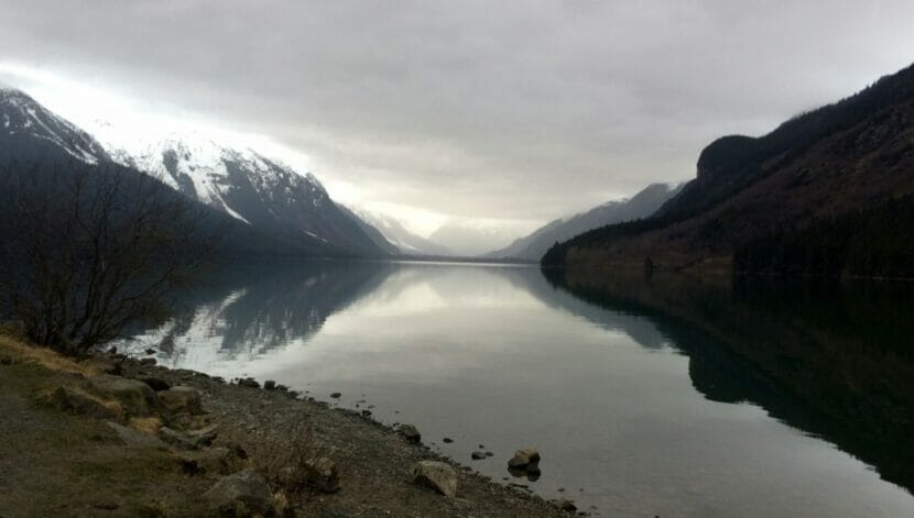
Chilkoot Lake (Alain d’Epremesnil/KHNS)

Authorities in Haines have suspended their search for a man who reportedly fell into Chilkoot Lake while ice skating on Thursday. In a dispatch, state troopers said local author Thomas McGuire, 79, had gone skating alone and failed to return, and that his vehicle was found in a parking lot near the lake. The dispatch said McGuire’s next of kin had been notified.

Late on Thursday afternoon, the Haines Volunteer Fire Department received a report that a skater had fallen through the ice at Chilkoot Lake. The call came from another skater, who used a Garmin inReach device to alert authorities. That person reported hearing – but not seeing – someone fall through the ice.

Jacques Turcotte, the Haines district park ranger, was the first person on the scene, at around 4:15 pm. He said he ran the search-and-rescue operation because Haines doesn’t currently have a local trooper, and the accident happened around a state park.

When the search-and-rescue team arrived, Turcotte said they found the person who called in the accident and ensured they got off the ice safely. Turcotte said the team made it more than a mile across the lake, but it became clear that it wouldn’t be safe to go any further to look for the missing skater.

“The ice was cracking, and water was bubbling up beneath my feet. So we turned back. At that point, with darkness coming in and unsafe ice conditions, we were unable to locate the victim,” Turcotte said.

Turcotte went up in a plane at first light Friday morning to scour the area. He saw pockets of open water near the far end of the lake, and he thinks that was where the skater fell in. But he said the search is no longer active, and authorities are focusing on recovering the victim.

“At this point, with no signs of life and no signs of a body and with ice conditions being what they are being, it’s too unstable and unsafe to send rescuers out onto the ice,” Turcotte said.

McGuire is a long-time Alaska resident. His most recent book, The Curve of Equal Time, tells the story of a woman who returns to Alaska from Seattle to work on a salmon fishing boat. He also published a book called Steller’s Orchid in 2019.

McGuire and his wife, Sally McGuire, built their home on the Chilkoot River, where they raised four children.

Haines residents have been skating at Chilkoot all week during a long spell of clear weather. But authorities are advising against that now due to unstable ice created by warmer temperatures, which Turcotte said can rapidly change conditions.

“Lake ice is inherently dangerous and unpredictable, and it can change quickly. You know, we’ve had cold temperatures,” he said. “We’ve also been getting warmer temperatures throughout the days, and it’s been sunny out too, and that affects everything as well.”

He advises people to skate with a partner, to wear life jackets when they skate, to continuously check ice thickness, and to bring rescue supplies. Among them: ropes, throw bags and ice picks that can be used to climb out of the water or help someone else do the same.

Dancing to rebuild a clan house: two sold out shows raise money for revitalization in Sitka

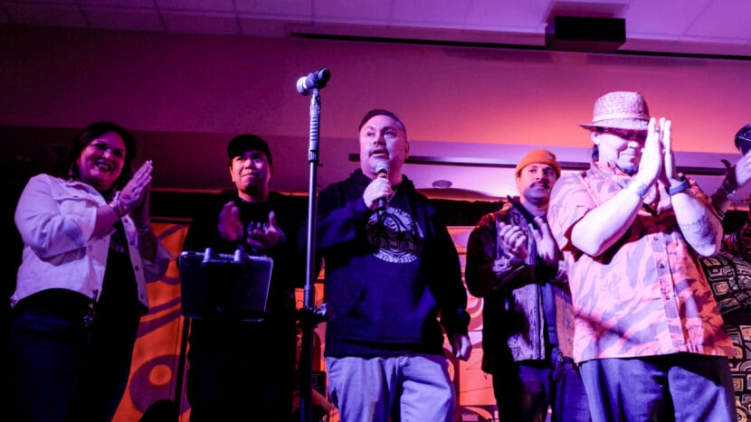
Lgeik’i Heather Powell Mills (left) and Lduteen Jerrick Hope-Lang (center, with microphone) at the Hít Wóoshdei Yadukícht, “Dancing Our House Together” on Feb. 1, 2025 in Sitka. (Photo by J. Joshua Diltz)

One of Alaska’s most famous bands, Portugal. The Man, joined Native American Music Awards winner Samantha Crain and Lingít artist Ya Tseen for two sold out shows in Juneau and Sitka last weekend. They were raising money and community awareness for an effort to rebuild a Kiks.ádi clan house in Sitka.

The event was called Hít Wóoshdei Yadukícht, which means “Dancing Our House Together.” Each ticket was a donation toward the goal of rebuilding a Sitka clan house, called the Point House. 

After the music faded, the lights dimmed and the hall cleared out, Kiks.ádi clan member and organizer Lduteen Jerrick Hope-Lang said the event was a success. 

“By broadening the audience with music as the vessel, you are able to bring a large, mixed group of people into a room and say, ‘This is worth fighting for, and you can be an ally,’” he said. 

Lgeik’i Heather Powell Mills is a member of the X̱aay Hít clan house in Hoonah. She helped organize the fundraiser, and for her, it’s personal. She grew up with a clan house — a community home that unites all generations of a clan, and holds their stories — and she wants others in her community to have that resource. 

“The benefit of that is the strength of identity, the strength of community, the strength of family,” she said. “And being able to have a place that you can walk into and feel like it’s a safe place to be who you are.”

Powell Mills said clan houses hold clan history, and allow members like her – and ones yet to come – to understand their identity and know that they belong. 

“They carry the names of our ancestors within their walls. They hold our most precious objects: our at.oo,” she said. “The stories and the names and the spirit that’s  put into these places is such a powerful, immensely knowledgeable way of being.” 

Point House originally sat along the water in downtown Sitka. Hope-Lang said Sitka had 43 clan houses at one point, and few remain standing and in tribal hands. Colonialism and the attempted eradication of Lingít communities left generations of children with only bread crumbs, he said — pieces of language, arts traditions and family history. 

“Those bread crumbs were the pieces that we had to pick up and put back together for ourselves, nourish ourselves with,” he said.

Now, he said he’s seeing those crumbs turn into full loaves through language and cultural revitalization efforts across Southeast Alaska, but he wants to go further. He wants future generations to have the tools to make their own nourishment, and rebuilding the Point House offers that chance. 

“My ultimate goal for this whole project is that we don’t just give them bread, that we give them the whole kitchen. That we give them all the opportunity to be who they are, not bits and pieces,” Hope-Lang said. “You don’t have to go here to get language. You don’t have to go here to get art. You don’t have to go here to get your stories. That they become centralized.”

Hope-Lang said they don’t know the final amount last weekend’s shows raised yet, but he’s still working to raise everything they need to start construction. Point House is just the beginning, he said. 

The show also benefited a fundraiser for researching rare disease, made on behalf of the daughter of two Portugal. The Man members, Frances. Hope-Lang says this was an act of reciprocity, as a “thank you” to the band for donating their time. 

Learn more about the Point House project at pointhouse.org

Sitka High ‘Barkadas’ Club celebrates Filipino heritage

Members and advisors of Sitka High School’s Barkadas Club smile for a picture during a January 2025 meeting. (Meredith Redick/KCAW)

On a rainy Wednesday around lunchtime, the students in Room 211 at Sitka High are passing around Styrofoam takeout containers of egg rolls. They’re here for the weekly meeting of the Barkadas Club.

The word “barkadas” translates to “group of friends” in Tagalog. Senior Julia Nabua started the club in 2023 after attending a camp for young Filipino Americans in Washington State.

“All my friends all talked about a Filipino club and it sounded really interesting, so I wanted to start one here too,” she said.

She said she wanted a space where Filipino American students could take pride in their culture – and for some, learn more about their own heritage.

“Usually we don’t really learn much about it in school or at home, because, you know, we’re in the U.S.,” she said.

A little over six percent of Sitkans identify as Filipino or Filipino American, according to the most recent data. Julia’s mother, Bennie Grace Nabua, is an advisor for the club. In 2022, she helped develop a scholarship for Filipino students in Sitka and drafted a municipal resolution declaring October to be Filipino American History Month. She said she was eager to support Julia’s idea to start a club.

“Julia, you know, finding herself and and having a better and deeper appreciation of her identity as a Filipino teenager in the US, I was kind of like, ‘Oh, I think it will be super great, you know, to have that space,’” she said.

The Barkadas have extended their reach far beyond the walls of Room 211. The club partners with the Tulong Aral scholarship fund, which provides scholarships for graduating Filipino American students to pursue higher education. The club has also coordinated two “Salo-Salos,” or community gatherings, to celebrate Filipino American History Month.

Last year’s Salo-Salo brought in more than a hundred people. Bennie Grace said the students did most of the work to organize the event.

“The Salo-Salo gatherings that we have been having for the past two years are big projects — fundraisers, connecting with businesses, asking for solicitations,” she said. “Most of them are done by the students, and — how should I say it? They have really been independent about doing a lot of the work.”

Sitka High teacher Jarred Rivera is a faculty advisor for the Barkadas and a Filipino-American. He said growing up, Sitka’s Filipino American community hosted a lot of community events.

“I remember when I was young, we had huge potlucks,” Rivera said. “The whole community was invited, and it was a big thing. It was huge, and, and then, you know, that went away but now, since the Barkadas club started, you know, we’re getting a lot of buy-in from the community and stuff.”

The club has attracted a diverse group of students, including many who aren’t Filipino American. Senior Desirae Hutton said she initially joined to support Julia, her friend since sixth grade.

“When she told me she was starting this group, she was like, ‘Can you come for this first meeting? I’m nervous,’” Hutton said. “And I was like, ‘I got you. I’ll be there.’”

Hutton has been a member since that first meeting. She’s now the club treasurer.

“I’ve never been a part of a heritage-type of club, so being here and learning about this different stuff has been really interesting,” she said. “And it’s also been cool, though I’m not Filipino, being able to still be involved how I am, that’s just fun and cool, getting to learn something new.”

Julia said she hopes the club continues to grow, even in her absence. She’s already mentoring younger students to take over club leadership after she, Hutton, and vice president Rex Adres graduate this spring – and she said even after graduation, she hopes to serve as a resource for future members.

Landslide researchers have more clues about what caused Wrangell’s devastating 2023 slide

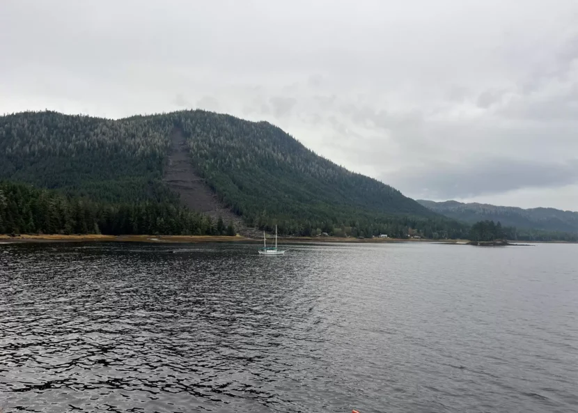
Wrangell’s landslide 11 months after on Oct. 13, 2024. (Colette Czarnecki/KSTK)

It’s been over a year since a landslide devastated the Wrangell community, killing six people. Last month, geologists presented their work from a visit to the slide over the summer.

Margaret Darrow, a professor of geological engineering at the University of Alaska Fairbanks, has been studying the landslide with her colleagues. She said their research is still in the works, but they’re inching closer to answers.

“My greatest hope is that whatever we find from this work will be able to tell the community of Wrangell why this slide might have happened, where it happened, where other slides could happen, so that you could use it in community planning,” Darrow said.

So far, they’ve found that the slope held an unusual amount of loose material waiting to be set in motion – and that the muskegs on top of the ridge may have played a role in doing that.

A surprisingly large volume of loose material

Their soil and rock samples are still being processed, but so far the researchers can say that the soil where the landslide happened is unusually loose. It sits on top of glacial sediment, which acts like a barrier against water. That could have been a huge contributor to the slide.

Annette Patton, a geologist at Oregon State University, said there was a surprisingly large volume of the loose material.

“A lot of the hill slopes around Southeast Alaska have really thin soils because it’s just so steep and material can kind of slide right down,” she said. “But part of why this landslide was so large is because there was actually a very anomalously thick layer of very loose material.”

She said the team looked at records of old landslides in the area. They think the 2023 landslide — which took out about 200 trees — happened right below what they think was an older slide.

“We just wanted to show this as an example of the fact that there is a lot of movement and activity that’s happened on this hill slope since the last glacial maximum,” Patton said. “And there’s a lot that we don’t understand about exactly how that might play out.”

She said there was a large storm the day of the landslide of a type known as an atmospheric river, but it wasn’t out of the ordinary for Southeast Alaska.

“Something notable here is that it wasn’t a really extreme storm,” Patton said. “It had a return period of about one year. So it’s like a big winter storm, but the kind of storm that maybe happens at least once a year.”

But the rainfall monitoring was done only at the airport, 11 miles away from the landslide and at sea level. That monitoring system recorded a little over an inch of rain during the six hours before the slide. Some Wrangell residents said they recorded three inches of rain that day, closer to the slide.

“These are really common types of storms,” Patton said. “Most landslides are triggered by atmospheric rivers here in Southeast Alaska. But not all atmospheric rivers trigger landslides.”

But Patton said there was a lot of water on the slope — and it mobilized all of that loose material.

More than twice as big as any known Wrangell slide

Her colleague, Josh Roering, a professor at the University of Oregon, said that the U.S. Forest Service started paying attention to landslides in the 70s, and a lot of their research came out of Wrangell and Prince of Wales.

“You’re really in the epicenter of a lot of amazing discoveries that have continued to affect how we think about these processes that led to the Forest Service mapping landslides every year across the region,” he said. “The map for Wrangell includes 256 landslides.”

He said it’s helpful to look at all the surrounding landslides in order to contextualize the massive one from 2023.

“It was more than twice as big as the next biggest slide that’s happened on Wrangell,” he said. “This was truly an extreme, anomalous event in terms of size, compared to what has happened here before. So this really led us to ask the question, ‘What is so different about that setting that allowed it to behave so differently?’”

He said they were also able to use the LIDAR data from the State Division of Geological and Geophysical Science. The department surveyed the area months before the landslide happened. The department also surveyed the area after the slide.

Roering said the first thing they noticed was some large ledges, or steps, exposing the bedrock.

“These are really big steps,” he said. “Looking at it from the road does not prepare you for how big they are in person.”

He said the erosion wasn’t consistent throughout the slide — most of it happened at the steep bedrock steps. And they even found living blueberry bushes right below some of those cliffs.

Roering said that implies the slide came down and almost launched from one ledge down to the next — which would only be possible if the soil was liquefied. And that would take an enormous amount of water .

“This field work occurred in August of 2024 so about six, seven months ago, and it was still really, really wet,” he said. “It hadn’t rained in a while, weeks before we were there. Yet there’s still what we call seepage – a lot of drainage from the landscape above the scarp that was coming into this side.”

The muskegs on the ridgetop

Roering said they wanted to know where the water came from, so they used previous LIDAR data to find the path from the top of the ridge to the beginning of the slide.

“As we follow these flow paths, they go up another set of bedrock ledges, and then they get up on top of the ridge,” he said. “We spent a lot of time up here on this ridgetop muskeg, trying to imagine the plumbing system for how this works, how the water goes up and down, how it spills out in some places and not others.”

He said they put in hydrologic sensors that test water levels that will help them understand when and how much water gets channeled down from the ridgetop muskegs. The researchers will get the sensors 14 months after installing them. They’ll see if the water levels remain constant or fluctuate a lot during the time period.

Roering said the muskegs only form here in areas of flat land — not where the ridge is too steep. And they can hold a lot of water and channel it downhill.

“In some ways, having channels to take that water out is a good thing, but in a lot of cases, having channels funnel water to one location where there’s a lot of loose material is obviously a really bad thing,” he said.

Roering wrote in an email that the likelihood of another landslide happening in the same area is low because the scar left behind doesn’t have much material left to be mobilized.

The researchers also gave tips for recognizing when a landslide might be about to happen — like sudden changes in water flow or color. Another indicator would be sound — some have compared it to a falling jet or a tornado. The researchers said that once people hear a landslide, they only have moments to get out of the way.

They also encouraged people to pay attention to weather forecasts, as landslides usually happen during intense rainfall. People can report a landslide on Alaska Landslide Reporter, an app that the state of Alaska recently released.

Site notifications
Update notification options
Subscribe to notifications