Elizabeth Jenkins, Alaska's Energy Desk - Juneau

NASA keeps watch of shrinking Arctic ice

The future of monitoring Arctic ice begins in space.

NASA scientist Thomas Wagner said to think of the IceSat-2 like a giant laser pointer.

Rather than entertaining your cat, these lasers can measure the height of ice above the water. A total of six of them will be beamed down to Earth.

“The point being that we’re going to get our most accurate maps ever of the thickness of the Arctic sea ice,” Wagner said. “And that’s one of the most important things that we put into our models.”

Those models could influence conservation and planning decisions in the Arctic, Wagner said.

NASA launched a prototype of IceSat in the early 2000s, but it was decommissioned in 2010.

This new and improved satellite — along with additional measurements collected by NASA — will help determine what the future could look like in the Arctic.

And it’s happening at an important time.

“A lot of ice experts, including myself, thought we were headed for a record year minimum,” said Hajo Eicken, a professor at the International Arctic Research Center at the University of Alaska Fairbanks.

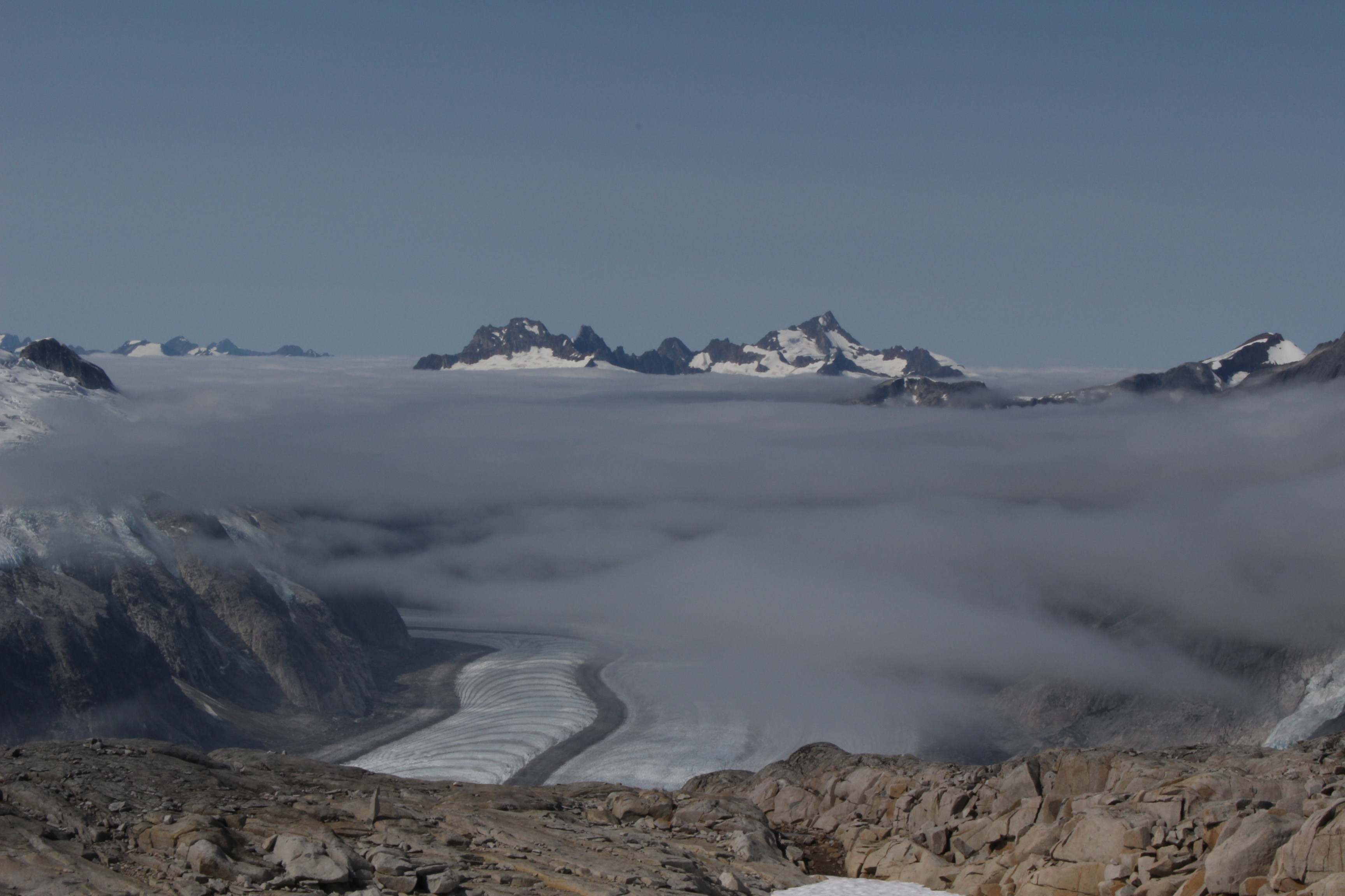
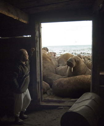
Arctic sea ice is important because it acts like a giant air conditioner for our planet, he said.

This year, a combination of events, such as a major ice retreat near Russia, left scientists wondering if the summer would beat a previous low. The last recorded minimum in the Arctic was in 2012.

But wind patterns offset the loss of sea ice and things cooled down a little.

“So now it looks like we’ll have well below normal ice extent, but we won’t have that record minimum,” Eicken said.

Still, Eicken said scientists are trying to figure out how the blob — a large pool of warm water in the Pacific Ocean — could be affecting the Arctic.

Sunlight is the most effective way to melt ice.

“However, the heat that comes up from below, some of it actually survives the winter,” Eicken said. “So in part, what we’re seeing now is that we have years where some of the heat that’s put into the ocean, upper ocean, from the sun and the atmosphere in the summer survives well into the winter.”

That could mean melt episodes even in the colder months.

Eicken is excited about the NASA satellite, which can help document these changes.

Even though what it finds might appear alarming, Wagner said people should be concerned, not afraid.

Look, I have kids, too, and I’m not hopeless at all,” Wagner said. “All the time I see things that are going on in society that make me think that we are generating the social will to deal with this. And I think we’re getting a better handle on the challenges that we face today, and I think we are going to be able to deal with them.”

IceSat-2 is set to launch in 2018.

As wildfires blaze, Southeast glaciers could be feeling the melt

Shad O'Neel releases an ice core onto a work station. (Photo by Elizabeth Jenkins/KTOO)
Shad O’Neel releases an ice core onto a make-shift “work station,” during scientific research on the Juneau ice field. (Photo by Elizabeth Jenkins/KTOO)

Out on the glimmering white expanse of the Juneau ice field, a group of students and scientists work an assembly line of sorts.

It begins with Shad O’Neel, a glaciologist with the United States Geological Survey, who twists a metal tube into the snow and ice to take a core sample.

So you spin it down, it drills its way in, you turn it backwards, catch the snow, you pull it out and hope there’s something inside,” he said.

Scientists are wondering whether the carbon released from interior fires is traveling all the way to Juneau — potentially speeding up glacial melt.

Wildfires are increasing in Alaska, a trend which has largely been attributed to climate change, e.g. less snow cover can mean a longer wildfire season.

The Southeast part of the state typically doesn’t have to worry about fires. It’s a rainforest afterall, but smoke can travel.

Glaciers will document that journey and more, said Natalie Kehrwald, a USGS research geologist from Colorado.

“So it will tell you if it was colder, it will tell you if it was windier, if there was a lot of pollution during that time,” she said.

And it will  reveal whether carbon from wildfires winds up on the ice.

“The glacier surface itself is basically layer upon layer of those snapshots in time,” she said.

Kehrwald wonders whether an increase in interior wildfires is spreading fine amounts of carbon on the Juneau ice field — which could accelerate glacial melt.

That phenomenon has been documented on the ice in Greenland, she said, after smoke from wildfires in Western Canada swept across North America.

Kehrwald leads the team on the ice field to collect the coring samples to see if the same thing is happening in Juneau.

Shad O’Neel pulls up the metal tube:

“So, we’ll just sort of jiggle it a little bit and it get it to come out,” O’Neel said.

Natalie Kehrwald leads a group of Juneau Icefield Program students on how to saw an ice core. (Photo by Elizabeth Jenkins/KTOO)
Natalie Kehrwald leads a group of Juneau Icefield Research Program students on how to saw an ice core. (Photo by Elizabeth Jenkins/KTOO)

He releases a nearly perfect cylinder of snow and ice that’s a couple feet long.

From there, a group of students from the Juneau Icefield Research Program slice it into sections, weigh it and eventually smash it to pieces with a mallet.

They will write down what section the sample belongs to, the deepest part being the oldest. The melted pieces will be sent to Dartmouth College, South Dakota State University and the USGS in Colorado, among other places, to test what the temperature was when the snow fell and what traces of fire could be in the ice.

Sarah Fortner will take some of the samples back to Wittenberg University, where she teaches geology. In the science community, the trickle down consequences of climate change is on everyone’s mind, she said. Ice cores from glaciers around the world have been telling a sad story.

“That’s one of the ways that we know that climate change is happening and that it’s related to our greenhouse gas productions,” Fortner said. “Because ice cores have preserved that record of increased greenhouse gasses all around the world.”

Scientists hope to determine if fire is affecting Juneau’s ice later this year.

Why students and scientists spend summer on ice

Every year, dozens of 20-somethings forego a summer break to live on the Juneau ice field. They slog heavy packs and ski to camps — miles away from the closest cell phone signal or Wi-Fi hotspot. The Juneau Icefield Research Program has been around for 70 years. First, exploring the icy expanse. And later, tracking the rate Southeast glaciers are shrinking.

If you squint, you might think you’re in the desert. Flat, white terrain stretches out as far as the eye can see and rocky peaks dot the horizon. The people, too, appear to be dressed for warm weather. Most are wearing running shorts and t-shirts. Their eyes hidden behind sunglasses to block the glare from snow.

Olivia Truax — a recent graduate from Amherst College — says she can’t imagine her peers would be up for the Juneau ice field.

“Probably not,” she said. “One of my friends was dropping me off at the airport and she was like, ‘you’re off to spend your summer on the ice doing science and skiing and digging. That sounds like my personal hell. Have fun!’”

But Truax and the others are clearly having a good time. They’re digging a hole in the snow that’s so deep they had to develop a special strategy. Rather than dropping straight down, the pit resembles a Tetris piece. And working together, each person shovels the snow and ice onto the next platform. This isn’t boot camp. This is science.

By the end of the day, they’ll reach last year’s snow surface which will allow them to measure how much snow is above it and determine how much the ice field is gaining or losing.

“With some fancy math and weather data, we can figure out how much snow can be left,” said Annika Ord, a Southeast resident who’s on safety staff.

The program has the oldest mass balance record in North America. A record of how the Juneau icefield — which feeds more than 30 major glaciers — is changing.

Miles away from the snow pit is Camp 18. It’s a rustic collection of bunkhouses where students and scientists live during their stay. And it feels like it’s on the top of the world. On a clear day, you can see where glaciers meet and flow down the valley.

Like Olivia Truax, you would expect most of the people who attend this program to describe themselves as “outdoorsy” but not Joel Gonzalez-Santiago.

“No, not even a little bit,” he said.”I prefer to be indoors with my computer and maybe some nice music, in a controlled temperature.”

Gonzalez-Santiago is a junior at Elizabeth City State University in North Carolina and a business major. He learned about the program through an academic adviser and decided to give it a shot.

He’s logged a lot of firsts: First time camping overnight, first time seeing skis, first time traveling long distances on skis.

“Back at home, I walk a total of maybe a mile?” said Gonzalez-Santiago. “And that’s to get from my house to the car, to the car to the parking lot and to school. So, it’s different. I’ve never done anything like this before.”

Juneau icefield Research Project Photo by Elizabeth Jenkins/KTOO
At Camp 18, when the weather permits, the classroom is outdoors. (Photo by Elizabeth Jenkins/KTOO)

To get to the 1,500 square mile ice field, students take a trail behind Juneau’s Home Depot. The multi-day trek involves hiking up steep terrain, climbing and eventually skiing on top of glaciers. Gonzalez-Santiago says to get through it, he had to get out of his own head. But he doesn’t regret spending his summer on ice.

He’s excited to send photos of his goggle tan and the landscape back to his grandma in Puerto Rico. And explain to his family what climate change means. That some of the glaciers, where he just spent two months, are disappearing.

“Yeah, I can show them and say, ‘I’ve witnessed this. I see it. You can’t deny it.’” he said.

This summer, the youngest person on the icefield is fresh outta high school. And the oldest person?

“Well, I won’t tell you that,” said Alf Pinchak.

He’s been coming up here since the 1960s. He says when he was a research fellow with the National Science Foundation, it was glacial streams, not human-caused climate change that caught his attention. Pinchak now helps maintain a project that measures the year-round temperature at some of the camps. And he doesn’t think this will be his last trip.

If you read through the Robert Service poems about this kind of country, I think you’ll come to understand why people come back here: ‘it’s the great big broad land up yonder, it’s the forest where service has lease, it’s the beauty throws me with wonder, it’s the stillness that fills me with peace.’”

Back at the dig, the group has carved out a pit in the snow that’s at least as deep as a few flights of stairs. It’s hours of labor but Olivia Truax doesn’t seem to mind. She says it’s a cool feeling to contribute to such a long-running record.

“But also can be kind of sad when I think about the way our models say the Juneau ice field will be in another 70 years,” she says.

Truax imagines — for her own kids someday — the icefield will be a different and far more dangerous place.

Unlikely allies: U.S. and Russia work together on walrus

USGS Wildlife Biologist working at a haulout near Point Lay, Alaska. (Photo by Ryan Kingsbery/USGS)

What brought Soviet Russia and the U.S. together during the Cold War? Walruses.

Now a new federal database, created with over a century of information, shows where those animals haul out on both sides of the border. And that’s especially important as sea ice disappears and the animals spend more time on land. Read more at http://bit.ly/2amRxlR.

Unlikely allies: U.S. and Russia work together on walrus

(Photo taken during USGS research efforts permitted under US Fish and Wildlife Service Permit No. MA801652­3) Ryan Kingsbery, USGS Public domain
USGS Wildlife Biologist working at a haulout near Point Lay, Alaska. (Photo by Ryan Kingsbery/USGS)

What brought Soviet Russia and the U.S. together during the Cold War? Walruses.

Now a new federal database, created with over a century of information, shows where those animals haul out on both sides of the border. And that’s especially important as sea ice disappears and the animals spend more time on land.

Tony Fischbach says a cacophony of walruses has a lot of bass.

“There’s so many animals there. It really reverberates in your chest, especially when you’re laying in the sand,” he said.

Fischbach is a wildlife biologist with the U.S. Geological Survey. He’s describing listening to more than 10,000 walruses on the beach in Point Lay. When he’s in the field, Fischbach dresses up in an outfit that looks like beach debris to sneak up on the animals to radio tag them.

He says, not too long ago, this spot looked different.

“Well, prior to 2007, we’ve never had large numbers of walruses on the North Western Coast of Alaska,” Fischbach said.

That’s when the sea ice disappeared off the continental shelf of the Chukchi Sea. In the summer, female walruses and their babies spend time offshore hauling out. They float on sea ice to a walrus version of the grocery store, an area full of nutrient-dense food like clams.

But with the melt, they’ve had no choice but to come onshore.

When they’re onshore, if they get moving, they can develop into a panic, and there can be trampling, injuries and deaths,” he said.

Fischbach says he’s encountered over 100 walruses who died like this, mostly babies.

But this isn’t the only time in history biologists have been concerned about the Pacific walruses. In the 1960s, Fischbach says commercial overharvesting — not melting sea ice — was seen as a potential danger. And to get an idea about walrus population, the United States had to team up with an unlikely ally.

Photographer: Anatoly Kochnev, Senior Scientist, Mammals Ecology Lab Institute of Biological Problems of the North Far East Branch, Russian
Anatoly Kochnev observes a large walrus haulout near Cape SerdtseKamen’. (Photo by Anatoly Kochnev/Russian Academy of Sciences.)

“Even the Cold War was not able to stop this work from happening,” said Anatoly Kochnev in Russian.

Kochnev is the coauthor with Fischbach on the Pacific Walrus Coastal Haulout Database, which holds 160 years worth of information. It’s a historical treasure trove — from old ship logs to joint aerial surveys that happened before the fall of the Soviet Union. Our countries go way back on working together on walrus.

“Walruses are not political and do not respect any political boundaries,” he said.

Knowing that, Kochnev says Russian and American scientists agreed to work together. Our countries collected and shared information on walruses that could shape policy decisions today. All of this when Russia was still a ruled by a Community party.

“In the Soviet era, financing was provided to the scientists and that was provided to do the aerial surveys by plane, and the last one of those was in 1990, and that was the last year the Soviet Union funded the surveys,” Kochnev said.

Since then, Kochnev says Russia has been through some tight economic times, and the funding for projects like this has largely dried up. So, I ask, how is he able to spend months at a time in remote parts of Russia studying walruses? My translator, Elisabeth Kruger, responds to his answer with a laugh.

“He says I know myself how he finds money, and that I don’t need to ask him,” Kruger said.

She works for the World Wildlife Fund. The organization helps pay for Kochnev’s research.

Remember Point Lay — the spot where Tony Fischbach observed over 10,000 walruses hauling out? Just across the Bering Strait is Cape Serdtse­Kamen’. Kochnev has documented more than 100,000 walruses hauling out there.

And over the years, he says he’s witnessed the effects of climate change firsthand. Polar bears attacking and killing walruses. Something he says biologists hadn’t observed at the haulout before. Just recently, they’ve seen evidence of walruses eating birds.

“That could be an indication that they are finding it more difficult to find food,” Kochnev said. “And that their normal food source is not enough. The walruses predating on birds happened 30 years ago, but it was very rare. Now we’re starting to see it more often.”

Both Kochnev and Fischbach say they hope the haulout database can help illuminate what’s happening to the Pacific walrus. Next year, the feds will decide if the animal should be on the endangered species list. And the database has already received attention from a private company that advises the industry on oil and gas.

Fischbach says the database couldn’t have happened without decades of scientists working across the Bering Strait.

“Even down to the small details,” Fischbach said. “I was having trouble working with the Russian language, representing the Russian script in the database because it’s in Cyrillic. And I’m using Latin script, and the complexity of that on computer systems is really daunting.”

And a Russian scientist — who wasn’t even working on this project — put in the time to lend a hand.

Map showing Pacific walrus coastal haulout locations reported in the past four decades (1980s– 2010s), with a maximum aggregation size of greater than or equal to 1,000 walruses.
Map showing Pacific walrus coastal haulout locations reported in the past four decades. (Courtesy of USGS.)

Audio: U.S. and Russia work together on walruses

Site notifications
Update notification options
Subscribe to notifications