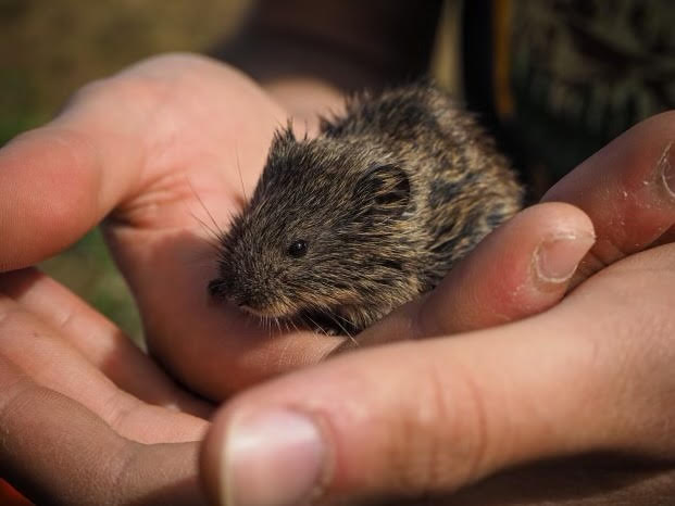
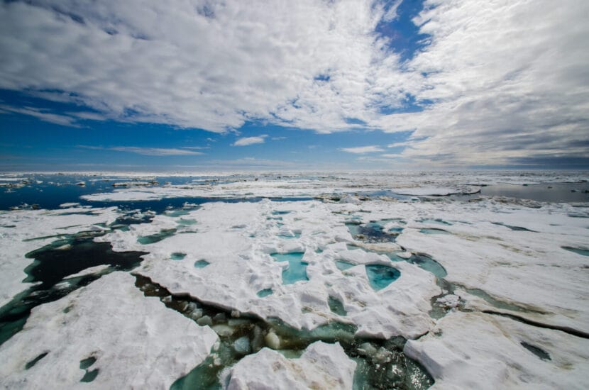
Tundra voles are among the small mammals Dr. Phil Manlick, with the U.S. Forest Service, studies to understand how warming is changing boreal and Arctic food webs.
Tiny organisms are making big moves in Alaska’s boreal and Arctic ecosystems, encouraged by climate change.
Underground fungi and bacteria are becoming more active as permafrost thaws in northern regions, breaking down dead plants and other organic matter that was previously frozen in the soil. Scientists call this new activity a “microbial awakening.”
A new study led by U.S. Forest Service research biologist Phil Manlick found that the microbial awakening is actually changing the structure of the Arctic and boreal food webs, that is, it’s changing the interconnected relationships between organisms and what they eat.
“What it means is that a food web that was in the past, supported by primary production in plants, is now supported by decomposition,” Manlick said.
Manlick and his team studied samples from small mammals collected at the Bonanza Creek Experimental Forest near Fairbanks over the last 30 years of warming. During that period, they determined that fungi were becoming a bigger part of the animals’ diets.
Manlick calls this a “browning” of the food web. In the past, most of the energy supporting small mammals like shrews and voles came from eating plants. Now, he said, for some species, most of that energy is derived from fungi.
“We can say, with very strong certainty, that fungi are becoming a really, really important player in terms of energy,” Manlick said. “If you look at a shrew in 1990, they were probably getting 40 to 50% of their energy from fungi. And now it’s like 90 to 100%.”
Manlick said there’s still a lot that scientists don’t understand about the ripple effects this new abundance of energy will have on northern ecosystems, which are rapidly transforming as a result of human-caused climate change.
Amanda Koltz, a University of Texas ecologist who co-authored the study, said it’s already understood that increased microbial activity as a result of permafrost thaw has global implications.
Decomposition in the soil releases carbon dioxide and methane into the atmosphere, which adds to the carbon emissions humans are already pumping out, speeding up global warming.
The world’s permafrost is estimated to hold twice as much carbon as is currently in the atmosphere.
“Even though these northern ecosystems — at least for folks down south — seem very far away and irrelevant, it’s not actually true, because what happens in the Arctic and in the boreal is really globally relevant,” Koltz said.
The Arctic is already warming four times faster than the rest of the planet due to climate change.
Manlick and his team have more research planned to study how the microbial awakening is impacting higher levels of the food web this summer.
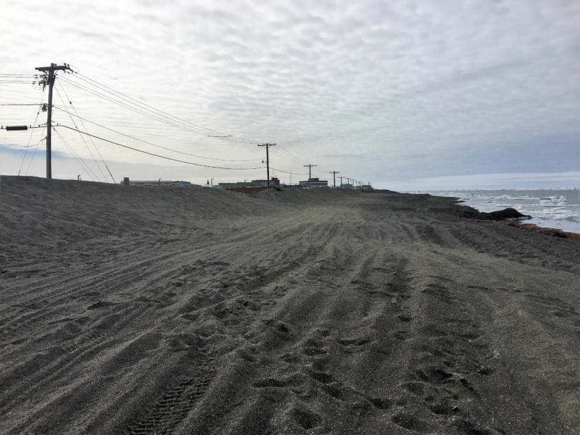
A gravel berm is one of the ways that the North Slope Borough protects infrastructure from storm damage.
Every year, millions of migratory birds flock to Arctic Alaska. Hundreds of thousands of caribou use the tundra, rich in plant life, as their calving grounds. Alaska’s North Slope is also rich in other natural resources: oil, gas, minerals. But one important thing is lacking: Rocks. “Yes, gravel is a precious commodity on the North Slope,” said Jeff Currey, an engineer with the state’s Department of Transportation and Public Facilities who works in the agency’s Northern Region Materials Section. For decades, Currey said, the state has been searching for gravel all over the North Slope, with limited success.
Gravel is essential for all kinds of long-term development: building projects, road construction, runways and other major infrastructure. “There’s a big need for gravel, and not a lot of it, is really what it comes down to,” said Trent Hubbard, a geologist with the Alaska Division of Geological and Geophysical Surveys.
“We need roads. We need housing developments,” said Pearl Brower, president and CEO of Ukpeaġvik Iñupiat Corporation (UIC), based in Utqiaġvik, during a panel discussion at last year’s Arctic Encounter Symposium, the largest annual Arctic policy symposium in the United States. Brower was among a handful of leaders from across the Arctic speaking on the region’s future.
“I definitely think it’s kind of a paramount necessity,” said Brower. UIC runs a construction company that has completed more than $1 billion in construction projects throughout the United States. The company’s website boasts that it specializes in remote locations. Brower said its projects over the last three decades have exhausted two gravel pits, and the corporation is now developing another. “You look all around (Utqiaġvik) and we’re very gravel-based,” Brower said. “You know, we don’t have pavement for the most part, and you wonder, ‘Wow, you know, where did all this gravel come from?’”
Ross Wilhelm — the project superintendent at UIC Sand and Gravel, which opened a new pit last year — said that if all the projects that currently require gravel from UIC’s pit are completed, it could be in operation for up to nine years.
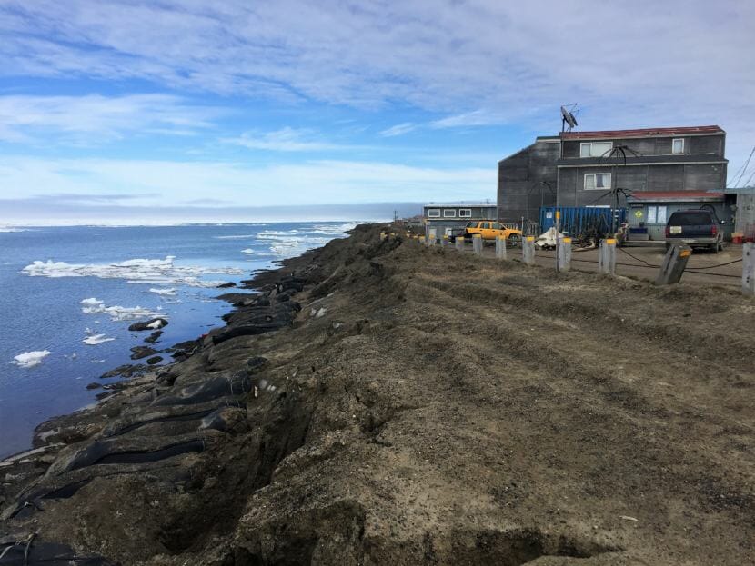
A piece of the Utqiagvik coastline in a residential area near downtown. Much of this bluff collapsed during the September 2017 sotrm. Visible to the left are “supersacks,” part of the North Slope Borough’s strategy at the time for protecting the coastline from storm damage. (Ravenna Koenig/ Alaska’s Energy Desk)
According to Wilhelm, climate change is increasing demand: Gravel is needed for stabilizing existing infrastructure as the frozen ground underneath it thaws, as well as for a seawall to protect Utqiaġvik from high rates of coastal erosion. “I think it’s a big factor,” he said. A five-mile-long sea wall was priced at nearly $330 million, according to a 2019 feasibility study by the U.S. Army Corp of Engineers.
Gravel may also be a means to a richer economic future for Alaska’s North Slope. “To keep the economy growing, it’s so vital,” said Wilhelm. Many of the region’s residents dream of connecting at least some of its eight main communities by road, but doing so would require lots of gravel. The state and the North Slope Borough are partnering on a project, the Arctic Strategic Transportation and Resources, or ASTAR, that could do exactly that. It’s been under evaluation by state geologists since 2018.
The issue isn’t just locating enough gravel for projects like ASTAR; the cost can also be exorbitant. Currey said he’s heard of other North Slope projects where the bids are as high as $800 a cubic yard for gravel, enough to cover about 50 square feet. In Anchorage, a cubic yard of aggregate gravel — the kind used for building projects — goes for about $15. “The DOT has paid on the order of a couple hundred dollars a cubic yard for material being barged in, because that’s the only way to do it,” Currey said. Some of those barges come all the way from Nome, traveling more than 700 sea miles north and east through the Bering Strait and up and into the Beaufort Sea to deliver gravel.
Gravel is also a prized commodity for the oil and gas industry. Last year, the Biden administration approved ConocoPhillips’ Willow Project, a decades-long oil-drilling project in the National Petroleum Reserve. The controversial endeavor will require 4.2 million cubic yards of gravel — more than 12,800 Olympic-size swimming pools’ worth of rocks — for its three oil drilling pads, as well as enough for more than 25 miles of new road. Much of that gravel will come from a 144-acre mine ConocoPhillips will dig itself.
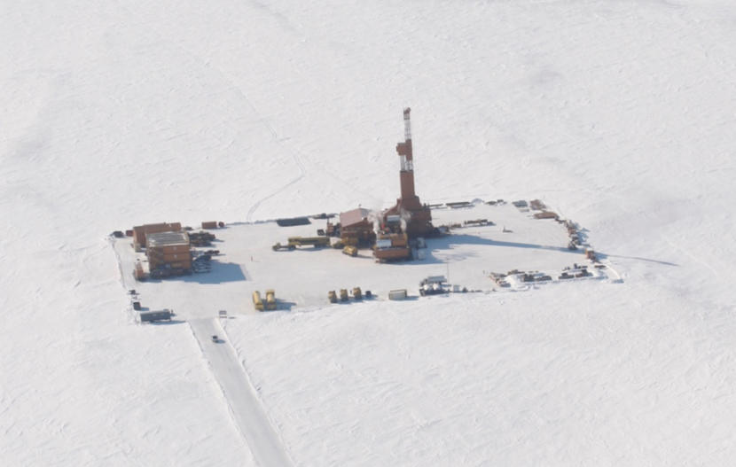
ConocoPhillips’ Willow prospect, pictured here, is still being explored. (Photo courtesy ConocoPhillips)
When it comes to gravel, the Willow Project may fare well, mainly due to its geography; it will be located just west of the village of Nuiqsut, where there’s actually plenty of gravel. Nuiqsit lies on the eastern side of Alaska’s North Slope, where the Brooks Range is closer to the coast. Streams that run northward down the mountains carry gravel with them, according to Hubbard.
But the North Slope is vast, spanning nearly 95,000 square miles, and further west, gravel resources dwindle: The mountains are farther from the coast, and gravel gets caught in the Colville River. “Much of the material north of the Colville River is largely silt and sand left over from historic sea-level rise and fall,” said Hubbard. It’s the kind of material that doesn’t work for projects like Willow or the roads and critical infrastructure that communities rely on. “Gravel,” said Hubbard, “is just a really hard resource to find.”
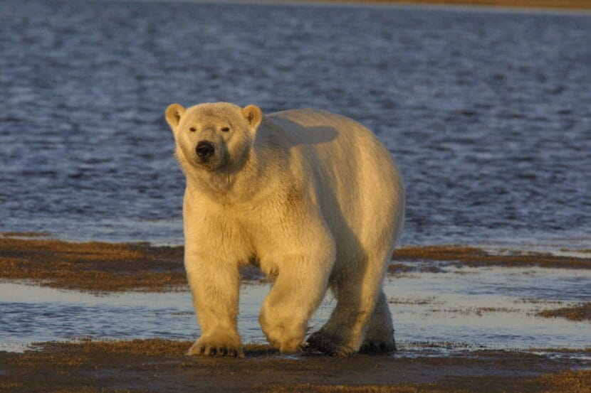
A polar bear walks along the shore in Alaska on Sept. 6, 2019. A different animal discovered dead in October near Utqiagvik is now confirmed to be the world’s first documented case of highly pathogenic avian influenza in a polar bear.(Photo provided by U.S. Fish and Wildlife Service)
A polar bear found dead on Alaska’s North Slope is the first of the species known to have been killed by the highly pathogenic avian influenza that is circulating among animal populations around the world.
The polar bear was found dead in October near Utqiagvik, the nation’s northernmost community, the Alaska Department of Environmental Conservation reported.
The discovery of the virus in the animal’s body tissue, a process that required sampling and study by the North Slope Borough Department of Wildlife Management and other agencies, confirmed earlier this month that highly pathogenic avian influenza was the cause of death, said Dr. Bob Gerlach, Alaska’s state veterinarian.
“This is the first polar bear case reported, for anywhere,” Gerlach said. As such, it was reported to the World Organisation for Animal Health and has gotten attention in other Arctic nations that have polar bears, he said.
This was also the first Endangered Species Act-listed animal in Alaska known to fall victim to the disease. Polar bears, dependent on sea ice that is diminishing because of climate change, were listed as threatened in 2008.
While polar bears normally eat seals they hunt from the sea ice, it appears likely that this bear was scavenging on dead birds and ingested the influenza virus that way, Gerlach said. Numerous birds on the North Slope of various species have died from this avian influenza, according to the Department of Environmental Conservation.
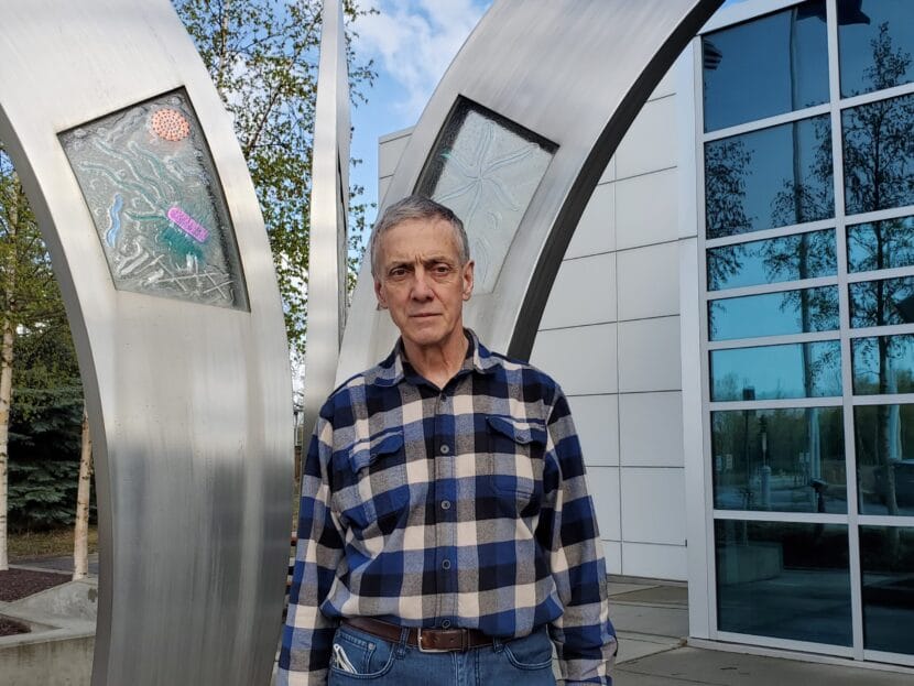
Dr. Bob Gerlach, Alaska’s state veterinarian, stands outside the Department of Environmental Conservation lab in Anchorage on May 13, 2022. (Photo by Yereth Rosen/Alaska Beacon)
However, the bear need not have directly eaten an infected bird to have become sick, Gerlach said.
“If a bird dies of this, especially if it’s kept in a cold environment, the virus can be maintained for a while in the environment,” he said.
The polar bear death is a sign of the unusually persistent and lethal hold that this strain of highly pathogenic avian influenza has on wild animal populations two years after it arrived in North America, officials said.
“What we’re dealing with now is a scenario that we haven’t dealt with in the past. And so there’s no manual,” said Andy Ramey, a U.S. Geological Survey wildlife geneticist and avian influenza expert.
No longer just a poultry problem
Highly pathogenic avian influenza is called that because it spreads rapidly in flocks of domestic poultry, often requiring massive culls to control the contagions. Such outbreaks have been of concern in the past because of their economic consequences for global agriculture. Until recently, wild birds were afterthoughts. Though they were known to carry the viruses, ferrying them between domestic poultry populations, they were largely unaffected.
That has changed dramatically. The prior U.S. outbreak of highly pathogenic avian influenza, in 2014-15, resulted in some wild bird infections, and some influenza-caused bird die-offs occurred in Europe shortly thereafter. But the current version is considered unprecedented in its effect on wild birds and other wildlife.
“Across North America, and really around the world, lots of wild birds these days – I mean, thousands of wild birds these days, tens of thousands in some cases — are dying because of these highly pathogenic avian influenza viruses,” Ramey said.
The deaths are of particular concern when they occur in populations that are already vulnerable, he said. An extreme example he cited is the highly endangered California condors, with a population of just a few hundred. After 21 influenza deaths were documented, federal wildlife officials launched what promises to be a challenging vaccination program in that population.
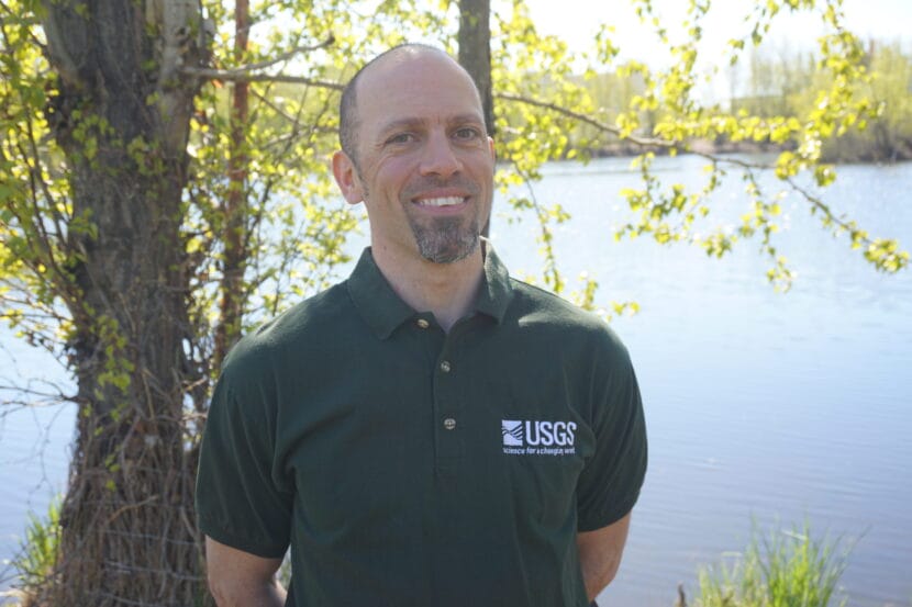
U.S. Geological Survey wildlife geneticist Andy Ramey, standing at University Lake in Anchorage on May 18, 2022, is a leading authority on avian influenza. (Photo by Yereth Rosen/Alaska Beacon)
The disease has also killed a variety of mammals around the world.
In Alaska, three foxes, a black bear and a brown bear have died from this avian influenza. Elsewhere, more bears have been found dead after being infected by the virus, along with skunks, raccoons, mountain lions and large numbers of seals in eastern Canada and off the coasts of Maine and Washington state, as well as outside of North America. The nation’s first detection of the disease in a squirrel was confirmed earlier this month in an animal found in Arizona.
To Gerlach, the polar bear case was not surprising, considering that black and brown bears have died. It is possible that more polar bears succumbed to the disease, but in remote places out of the view of people to record the events, he said.
“You’re really dependent on the public that’s out there, or the wildlife biologists that are doing surveillance,” he said. Documenting cases in any wild mammal population can be difficult, he added: “How long is a carcass going to be in the wild before it gets scavenged or eaten by something else?”
Aside from the large and wide-ranging death toll in the wild, the current outbreak has some other differences, particularly its durability, as seen in its persistence away from domestic flocks.
The virus that caused the 2014-15 outbreak spread in the wild bird populations for a while, but it “sort of fizzled out,” Ramey said, probably because it was eventually stamped out in poultry operations.
But this one continues to be maintained in the wild, as evidenced by monitoring in Western Alaska, a place far from any big farms raising chickens or turkeys, he said.
Gerlach gave the same assessment. “After the second year, that all of sudden disappeared,” he said of the 2014-15 version. “It didn’t stick around, where this virus seems like it’s sticking around.”
Rather than winding down, it is continuing to spread across the world, he noted, even into bird populations in Antarctica, as has been recently documented. There are signs that it is now endemic in the wild, a fixed feature into the foreseeable future, he said. If so, “it’s not going to go away. It’s going to be here, and we have to have some way to deal with it,” he said.
Alaska a disease crossroads
For Alaska, “a mixing area” for global bird migrations, spread of avian diseases is always an issue, Gerlach said. “Alaska is a catchall area for birds from North America or the Americas, as well as from Asia,” he said.
The highly pathogenic avian influenza of 2014 and 2015 was introduced from Asia to North America by wild birds migrating through Alaska. The current influenza is also crossing continents through Alaska, though from multiple directions, Ramey’s research has found.
In a newly published study, Ramey and his research partners found what is likely to have been three separate and independent introductions of highly pathogenic avian influenza into Alaska last year. His research, with colleagues from the USGS and other agencies, used genetic analysis to trace one form of influenza to North America and two to Asia.
“To have three introductions in Western Alaska, two from East Asia and one from the Lower 48, I mean, we haven’t seen anything like that before,” he said. “It really, I think, exemplifies how these viruses now are clearly able to be maintained.”
That study examined birds harvested in the fall of 2022 by hunters in the Izembek National Wildlife Refuge area at the southern tip of the Alaska Peninsula. Ramey and his colleagues found only a tiny number of hunted birds that were infected with the currently active highly pathogenic influenza virus: out of 811 swab samples taken directly from birds and another 199 samples from feces, the only harvested birds identified as infected were eight pintails, one cackling goose and one widgeon.
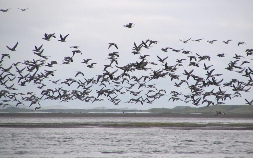
Pacific black brant fly above Izembek Lagoon at Izembek National Wildlife Refuge on Dec. 27, 2013. The refuge is used as a migratory stop for nearly the entire global population of Pacific black brant. Black brant are among the wild birds in Alaska found to have been infected with the highly pathogenic avian influenza virus, according to state records. (Photo by Kristine Sowl/U.S. Fish and Wildlfie Service)
It can take months to get test results from samples, so what happened to those harvested birds is unknown, he said. But their meat was safe to eat as long as it was properly cooked to the recommended 165 degrees, he said. “Heat is remarkably good at deactivating viruses,” he said. Along with the cooking advice, there are other longstanding recommendations about safely handling hunted birds, such as regular handwashing and avoidance of obviously sick animals.
There is little evidence that the current avian influenza wave poses an infection risk to humans. Only a few cases have been documented in the world, and those were general among people working with poultry.
For Alaskans dependent on wild game, this highly pathogenic influenza poses a different type of risk: possible food-security problems. If large numbers of birds wind up dying, that might mean less food on the table in rural Alaska, Ramey and Gerlach said.
“Obviously, less birds could equate to less availability, and also less resiliency in the population from things like disease, or climate change, or toxins, et cetera, that could in fact, impact these populations of birds,” Ramey said.
Plenty of stressors already exist in wild populations, he said, “so adding another threat to these populations isn’t doing them any favors.”
The ocean surface at the Chukchi Borderland is seen on Aug. 10, 2016, from the Coast Guard icebreaking Cutter Healy. (Photo provided by National Oceanic and Atmospheric Administration)
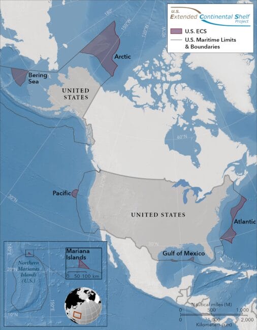
United States ocean territory could expand by an area more than twice the size of California, with most of that in ocean areas off Alaska, under a claim being prepared by the federal government.
The U.S. State Department this month announced results of a two-decade program to map the extended continental shelf areas beyond the nation’s 200-mile exclusive economic zone. Much of the focus was on the Arctic Ocean, where bathymetric and geologic surveys by federal agencies produced the first detailed maps of a complex seafloor with a series of canyons, ridges and deep-sea plateaus.
A map of North America and the oceans around it shows the extended continental shelf areas that the U.S. government is preparing to claim as its national territory. The Arctic Ocean holds the largest swath of extended continental shelf area to which the U.S. plans to make claims. (Map provided by U.S. State Department)
In all, the mapping reveals that the U.S. has rights to an additional 987,700 square kilometers, an area about twice the size of California, according to the State Department. Of that, more than half – 520,400 square kilometers – is in the Arctic Ocean beyond the 200-mile exclusive economic zone off Alaska’s North Slope. Another 176,330 square kilometers is contained in a triangular section in the Bering Sea that abuts the U.S.-Russia maritime border. There are also claims in the works to territory off the Atlantic and Pacific coasts, the Gulf of Mexico and the Mariana Islands area.
The decades-long project to map the extended continental shelf involved the National Oceanic and Atmospheric Administration, the U.S. Geological Survey and other agencies and, within the Arctic, numerous research voyages by the U.S. Coast Guard icebreaker Healy. It sets up a formal claim to be made to the international community, the State Department said.
“The continental shelf is the extension of a country’s land territory under the sea. Like other countries, the United States has rights under international law to conserve and manage the resources and vital habitats on and under its ECS,” the State Department said in its Dec. 19 announcement.
Under international law, countries have the right to claim sovereignty over areas of the ocean that lie beyond the 200-mile limit, as long as those areas are physically connected to underwater shelves that extend from continental masses. Sovereignty includes control over resource development.
Ratification requires a vote of two-thirds of the U.S. Senate, and key Republicans, starting with then-President Ronald Reagan, have rejected the idea for decades.
A bill she introduced in November, her third such attempt at passage, might be successful now that there are potentially tangible benefits to ratifying the treaty, she said at a Dec. 22 news conference.
“I’m really optimistic that things are different,” she said. Resistance has always been within her party, she noted. “But as I have talked with different colleagues, there has been a genuine interest in knowing and learning and understanding more.”
She noted that her bill has a Republican cosponsor, Sen. Bill Cassidy, R-Louisiana.
Murkowski said her understanding is that the U.S., without ratification, has the right to make claims, but it does not have the right to mount challenges. Without ratification, she said, “we’re limited in terms of our ability to not only defend our claim, but then to push back on others as well.”
Being part of the Law of the Sea treaty would help the U.S. assert more control in not only the Arctic, as climate warming opens up the waters to more activity, but in disputed areas like the South China Sea, Murkowski said.
Former Lt. Gov Mead Treadwell, who chaired the U.S. Arctic Research Commission from 2006 to 2010, has also argued in favor of ratification.
Without it, he said, the U.S. claim could run into some trouble. “It’s a problem if somebody challenges us who believes they’re got other rights to the same land,” he said.
In fact, the extended continental shelf mapped out by the U.S. in the Arctic does overlap a bit with the extended continental shelf claimed by Canada, a matter that the State Department said will have to be settled sometime in the future.
Nonetheless, the territory staked out by the national mapping project, at least in the Arctic and Bering areas off Alaska, appears to be within U.S. rights, Treadwell said. By skirting around well-recognized maritime borders, they largely avoid areas of contention, he said.
The newly mapped U.S. Arctic territory does not extend that far north. The most northern point is 680 nautical miles beyond the current 200-mile exclusive economic zone limit.
Within the Arctic territory that the U.S. is intending to claim as its extended continental shelf is a topographical feature called the Chukchi Borderland, located 600 miles north of the Bering Strait. There, underwater ridges and plateaus rise from the seafloor at a point where warmer, saltier water flowing in from the Atlantic meets the colder, fresher water flowing from the Pacific.
The Chukchi Borderland is clearly an extension of land in Arctic Alaska, according to the State Department’s documents.
“Extensive geophysical data and interpretation show that the Chukchi Borderland and the northern Chukchi elevation share a fundamental morphologic, structural, geochemical, geophysical, and tectonic connection with the Chukchi Shelf and northern Alaska,” said the department’s executive summary.
Treadwell said the U.S. extended continental shelf assertion could reap some valuable economic and regulatory benefits. He made those arguments in an essay published on Dec. 19 by the Washington, D.C.- based Wilson Center, where he serves as a Polar Institute advisory committee member.
Aside from potential resource extraction, the extended continental shelf – now that it is better understood – could be used to properly place long-distance fiber-optic connections, for example, he said. And if U.S. sovereignty in the area is affirmed, the U.S. will have the right to regulate and inspect other nations’ research vessels working in the area, an activity on the rise as China, Korea and Japan expand their icebreaker fleets, he said.
“Once we have it, we’ll figure out what we do with it,” he said.
The ConocoPhillips Alaska headquarters, seen here on April 8, 2020, looms over downtown Anchorage. An appeals court order denying environmentals’ request for an emergency injuction allows the company to proceed with its ongoing winter construction at its massive Willow project on the North Slope. (Photo by Yereth Rosen/Alaska Beacon)
A federal appeals court rejected a motion by environmental and Alaska Native groups that were seeking to block construction of the Willow oil field project, allowing ConocoPhillips to continue with its planned winter work on the huge development on the North Slope.
The 9th Circuit Court of Appeals, in a three-page order issued Monday, denied the motion for an emergency injunction that was filed two weeks ago by the groups that are seeking to overturn the Biden administration’s Willow approval.
The order was issued “without prejudice,” meaning that the larger legal case remains alive, with merits of the arguments for and against development to be evaluated later.
The Willow project, in line to become one of the most prolific oil fields on the North Slope, would tap into an estimated 600 million barrels of recoverable oil and produce up to 180,000 barrels a day, according to ConocoPhillips and federal regulators. That would be a significant boost to North Slope production that has dwindled since its 1988 peak of over 2 million barrels a day. Production in the last fiscal year, which ended June 30, averaged 479,400 barrels per day, according to state officials.
Willow has been the subject of intense controversy. Alaska political and business leaders are championing it as critical to the state’s economy and the North Slope’s future as a long-term oil producer, while environmentalists are blasting it as a polluting “carbon bomb” that threatens to derail U.S. efforts to combat climate change.
For ConocoPhillips, the court order affirmed ongoing plans.
“ConocoPhillips is pleased the Ninth Circuit Court of Appeals denied the plaintiffs’ request for an injunction pending appeal. ConocoPhillips is proceeding with Willow construction as we continue to review the court’s decision,” company spokesperson Rebecca Boys said by email on Tuesday.
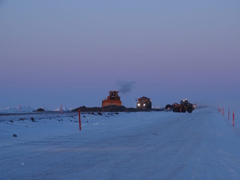
The company has 800 employees and contractors already assigned to the project, and this winter’s work includes building an ice road, mining and placement of gravel and pipeline construction, Boys said. Activities that do not disturb the surface, such as preparations for the ice road, have already started, as have deliveries of construction materials to a staging area, she said. The surface-disturbing activities like gravel mining and placement are expected to start this month, she said.
Road construction is seen on March 12, 2017, at ConocoPhillips’ Greater Mooses Tooth Unit in the National Petroleum Reserve in Alaska. ConocoPhillips plans similar construction work farther west at its huge Willow project. (Photo by Sarah LaMarr/U.S. Bureau of Land Management)
Willow opponents, in a statement issued Tuesday, said they will press on with their challenges despite the latest setback.
“It’s disappointing that the court has allowed ConocoPhillips to continue doing construction on the Willow project when there’s ongoing litigation charging the Biden administration with unlawfully approving the project in the first place,” said Bridget Pasrianos, senior staff attorney with the environmental law firm Trustees for Alaska, which is representing the plaintiffs.
“This project was approved despite known harms to the community of Nuiqsut and despite the fact that it will produce huge amounts of greenhouse gases in a region already suffering existential climate impacts like the collapse of fish populations and community infrastructure,” she continued, citing the Inupiat village that is closest to the Willow site. “We will do everything we can to protect the western Arctic and stop Willow in the weeks and months to come.”
The continuing legal fight dates back to 2020, when the plaintiffs successfully challenged the Trump administration’s project approvals. After President Joe Biden was sworn into office, agencies in his administration reevaluated the plan and ultimately approved a project that would be somewhat smaller in scope, winnowing it down to three drill sites rather than the five that were in the Trump-approved plan.
Critics of the project continued to press their legal challenge, but their arguments were ultimately rejected last month by U.S. District Court Judge Sharon Gleason. The plaintiffs appealed Gleason’s decision.
Backers of the project have amicus briefs supporting the Biden administration’s approvals. Briefs have been filed with the appeals court by the state of Alaska, the North Slope Borough and the Native-owned Arctic Slope Regional Corp., as well as by ConocoPhillips. The appeals court, in its latest order, also agreed to accept additional supportive briefs that the Alaska Congressional delegation and Alaska legislature plan to file.
The court set a series of deadlines later this month and in January for the parties to flesh out their arguments. On Tuesday, the court scheduled oral arguments on the matter to be held on Feb. 4 in San Francisco.
Willow, with production expected to start in 2029, would be the farthest-west producing oil field in Arctic Alaska.
Because it is located on federal land, within the National Petroleum Reserve in Alaska, the state would reap much less income from oil produced there than it does from most North Slope oil fields, which are located on state land. The extent to which state revenues would be negatively affected is being reviewed.
Purple areas show the regions the U.S. is claiming as its extended continental shelf. (U.S. State Department)
Tuesday, the United States grew by a million square kilometers — the equivalent of nearly 60% of Alaska’s land mass.
The State Department enlarged the country’s geography, citing international law, by defining how far under the sea the continental shelf extends. The new additions are spread across seven areas of ocean, and more than half of the claim is in the Arctic.
“America is larger than it was yesterday,” said Mead Treadwell, a former Alaska lieutenant governor and former chair of the U.S. Arctic Research Commission. Decades of scientific study, dozens of ice breaker missions and detailed seafloor mapping went into making the claim, he said.
“It’s not quite the Louisiana Purchase. It’s not quite the purchase of Alaska, but the new area of land and subsurface resources under the land controlled by the United States is two Californias larger,” he said.
The State Department didn’t make anyone available for an interview Tuesday, but said in documents that the extended continental shelf claim was made according to the provisions of the 1982 United Nations Convention on the Law of the Sea. The U.S. Senate has never ratified that treaty, but the Biden administration decided to make the claim anyway. It’s a move Treadwell has long urged, as have other past chairs of the Arctic Research Commission.
Other countries may raise an eyebrow at the unilateral action but “who’s going to challenge us?” Treadwell said. “Because nobody’s got an overlapping claim. If somebody came back and said, ‘Your science is bad,’ I think the United States would listen. But I don’t think science is bad. I think we’ve had very good science.”
The State Department’s recognition of its extended continental shelf in the Arctic doesn’t conflict with a 1990 agreement setting the maritime boundary with Russia.
“None of the fixed points delineating the outer limits of the continental shelf of the United States are located west of the agreed boundary with the Russian Federation,” the State Department said in a summary explaining its announcement.
The U.S. and other countries already claim 200 miles off their coasts as their exclusive economic zones. They exercise rights in these zones over the resources in the seabed and in the waters above.
Tuesday’s declaration of the extended continental shelf, beyond 200 miles from shore, doesn’t include jurisdiction over the water column or fishing rights. Treadwell said it’s still significant, because it gives the federal government control over the seafloor and any valuable resources that can be mined from it, as well as the right to say who can conduct research or lay pipelines across it.
Some of the areas of ocean the U.S. has claimed as extended continental shelf are in the Atlantic, the Pacific, the Gulf of Mexico and the Mariana Islands. The large section north of Alaska plus a smaller patch in the Bering Sea total nearly the acreage of Texas.
Close
Update notification options
Subscribe to notifications
Subscribe
Get notifications about news related to the topics you care about. You can unsubscribe anytime.