Western

Savoonga man marooned in Russia as friends, family rally to raise money for flight home

View of Provideniya from Komsomolskaya Bay. (Public Domain photo)

A man from the St. Lawrence Island community of Savoonga remains stranded in Russia after traveling there through a unique visa-free program for eligible Alaska Natives. Despite not needing a visa for the trip, Sivoy Miklahook now finds himself on the wrong side of the Strait as his Russian papers inch closer to expiration and residents in western Alaska rally to bring him home.

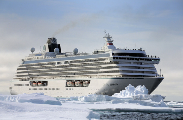
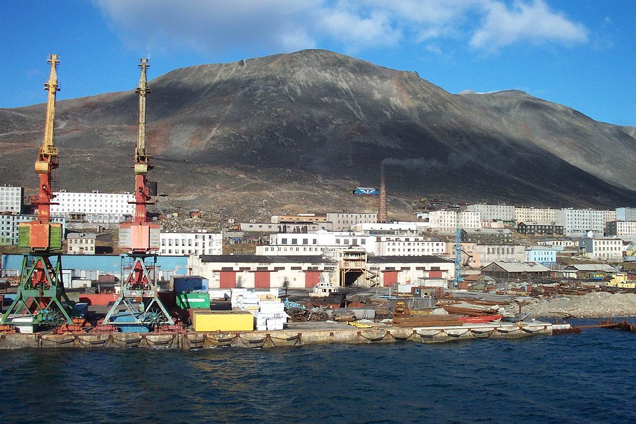
Miklahook flew just over 230 miles across the Bering Strait—from Nome, Alaska to Provideniya, Russia—in mid-August. He’s now in a small village called New Chaplino. His trip was following up with some Russian relatives after they visited his home in Savoonga back in May.

“This is what he wanted,” older sister Carol Miklahook said from Savoonga Monday. “He wanted to go over there for the experience … to visit friends and family.”

That “experience” includes a shared language and culture that dates back thousands of years. But it’s only in the last few decades that travel has become problematic. Political tensions make crossing the border—a couple hundred meager miles—no easy task. Since 1989, eligible Alaska Natives from the Bering Strait and Kobuk regions, as well as native Chukotkans, have been able to use a unique visa-free travel program to visit family on both sides of the Strait.

The program was unofficially mothballed for the past few years as political tensions between the U.S. and Russia became strained, but in August—with little explanation from either government—the program resumed.

Miklahook was the first visa-free U.S. citizen to travel to Chukotka since the program resumed. But even without visas, the travel is no easy task, requiring a Chukotka border pass as well as an invitation from a Russian host.

Vera Metcalf organizes Alaska-Chukotka travel for the Bering Straits Regional Commission. She said in an email Tuesday that approval has to come from commissioners on both sides of the Strait, and only authorizes a 90-day visit.

Bering Air is the only carrier in western Alaska with the clearance to make the flights across the international dateline to Russia. They have no regular trips to Russia. Every flight is a chartered plane and can take up to three weeks to prepare.

Pilot Ryan Woehler flies the charters and said visiting Russia is far from straightforward.

“I don’t even think they use fax, it’s usually telex,” he said with a laugh. “You have to get permission from Moscow, and somebody in Vladivostok has to sign off on it, and Petropavlovsk, and the military, and the customs and the border guard, and each of these different agencies have to be part of the permission process, and it’s a big deal.”

Complicating Miklahook’s trip is his uncertain return. Nina Wideman runs the Russian Travel Desk for Bering Air. She said he left Alaska with no return flight, knowing there were no other charters on the schedule. She said he was “optimistic” a charter would come up to take him home. Another group charter did get booked for Oct. 7, Wideman said, but it was for a trip to Anadyr, another 275 miles west of Provideniya.

Miklahook’s family nonetheless tried to book him a seat on that flight’s return to Nome, but the group ultimately canceled the trip for reasons unknown. Wideman said there are other pitfalls: border pass applications can take from 60 to 90 days, and can be rejected arbitrarily; combined with high costs, shifting timelines, and unpredictable weather, she said it’s not uncommon to see charters delayed or canceled.

The busy season for charters—and the time when solo travels can reasonably expect to buy a seat on someone else’s charter—is just a brief window during the summer months.

“Basically, at this time of year, we have no scheduled charters until next summer,” she said.

Miklahook’s sister Carol said his three-month window is rapidly closing. He has to leave Russia Nov. 14.

“There was a flight that was supposed to come beginning of this month that was supposed to bring him back,” she said, referring to the canceled October flight. “He needs to pay for his own charter now.”

But those charters are expensive—really expensive.

“From Nome to Provideniya it’s $5,450, one way,” Wideman said. Those costs have a lot to do with what Russia requires visitors pay for.

“We need air navigation permissions, we need our landing permissions …Russian customs for landing, the fuel that we have to buy over there … all of those things, they charge us for all of that stuff,” she said. “We get charged for all of it.”

Friends and family are doing what they can back on St. Lawrence Island to help, mostly with bake sales and small donations. Michelle Kubalack is from St. Lawrence Island but now lives in Kotzebue. She said, after seeing Miklahook reach out on Facebook for help raising money to charter a flight home, she got his permission to start a donation page on the popular crowdfunding website Go Fund Me, letting anyone with Internet access chip in toward the $4,000 goal.

“My concern was I don’t want him to get deported or get into any kind of trouble,” she said. “I think if anybody else had the opportunity to go visit relatives and family in Russia, they would take it, but not knowing that you would get yourself into this kind of circumstance and situation … I just hope that he can get home without getting in trouble.”

While efforts are underway to pay for a charter home, Metcalf with the Bering Straits Regional Commission is working with U.S. State Department officials and their Russian counterparts to formally extend Miklahook’s visa-free invitation. Metcalf did not say how likely that effort would be to succeed, or if it’s worked in the past.

Bering Air pilot Woehler said, despite the friendly and welcoming locals, he knows Russia’s not the kind of place you want to be with expired papers.

“The Russians don’t see a lot of opportunities around, ‘well, your visa expired, I’m sorry,’” he said with an ironic laugh. “They don’t see a lot of solutions. If it’s expired, it’s expired. You’re basically in trouble.”

Trouble is exactly what Miklahook’s family says he’s trying to avoid, as they scramble to raise money for a flight to bring him home.


Online map plots coastal erosion in 8 Western Alaska locations

A bluff crumbles in Port Heiden after a storm event in late September, 2015. (Photo by Scott Anderson)

Each year, coastal communities in Western Alaska watch feet – even yards – of shoreline disappear into the waves. Now, a new online mapping tool will let them look at past erosion and see where coastlines might be in future years.

In the next ten or twenty years, the waters of Bristol Bay will overtake much of Port Heiden’s old, abandoned village site. It’s a fate that’s long been obvious to residents of Port Heiden. And now anyone with an internet connection can see the water’s progress over time using the new Alaska Shoreline Change Tool.

“On the west side, that’s where the shoreline’s about 5 feet away from that building.”

Scott Anderson is the Mayor and Environmental Coordinator for the City of Port Heiden. I spoke to him over the phone as we both clicked our way around the interactive map.

The site of Port Heiden’s old tank farm and shorelines in 1983 (blue), 2009 (green), 2013 (pink) and projected location in 2035 (yellow). (Image courtesy of Alaska Division of Geological and Geophysical Surveys)

A satellite image shows a bird’s eye view of Port Heiden. It’s overlaid with a series of colored lines that you can toggle on and off to show exactly where the shoreline was during a given year — from 1957 to the present, with predictions up through 2035. Anderson tells me the satellite image is an old one. Some of the buildings are already gone, hauled away from the creeping coastline.

“You see where the two white tanks are?” asked Anderson. “The shoreline – it’s now about halfway through that tank closest to the west.”

A few years ago, Anderson called on the Alaska Division of Geological and Geophysical Surveys (DGGS) to study Port Heiden’s erosion. The village needed help to haul away old buildings before they crumbled into the bay. And they needed better information about how fast the erosion was going to keep happening.

“So, we did some fieldwork for Scott in 2013.”

Alex Gould is a geologist for DGGS who created the Alaska Shoreline Change Tool. He says the erosion survey that Anderson asked for in Port Heiden became a model for similar mapping efforts elsewhere;

“We then decided, oh, we can apply this across the state,” says Gould.

Over the last year, Gould created clickable shoreline maps for Unalakleet, Wales, Kivalina, and four other locations on the Beaufort and eastern Chukchi sea coasts. He says mapping the shoreline change over time required aerial photographs.

“A lot of the old ones are Air Force and Navy… So they’re taken with a plane that’s specially set up to have a camera pointed straight down,” explained Gould. “A lot of these photographs are housed by USGS and some by the UAF. They went and they scanned all these old photographs… we have to process the imagery first before we can actually map the shoreline.”

Gould says he chose to make an interactive web map because some shorelines are changing so quickly that his team couldn’t publish print maps often enough.

“So with an interactive interface, we can continually add data and allow it to be much more fluid, rather than printing out a solid map,” he said. “So that’ll be really important because the data we’re going to be getting in the near future – year two – will be incorporated right away into these maps.”

Back in Port Heiden, Mayor Anderson is on board with that plan. He took photos after an early fall storm to give the DGGS team an update. He says the maps have already helped Port Heiden catch the attention of state and federal agencies who can help fund backhaul efforts. And the online tool is an added benefit.

“Anybody now, I mean, just like you and I are sitting here talking about it, we can say – ‘You see exactly what I’m talking about. And I can give you a picture that proves it.’” says Anderson. “So it’s a pretty handy tool. It’s pretty awesome.”

The Shoreline Change Tool went live last month, but the DGGS has plenty more erosion data to work with. Gould says in the coming year he may add online maps for Shaktoolik, Nome, and Hooper Bay, among other communities.

The map project was funded by the U.S. Fish and Wildlife Service’s Coastal Impact Assistance Program. The DGGS also published a guide to accompany the interactive map tool.

Storm surge hits Toksook Bay

Storm surges against Toksook Bay on Oct. 1, 2015. (Photo courtesy of Jimmie Lincoln)

October opened with the season’s first fall storm, flooding communities across Western Alaska’s coast. In the Yukon-Kuskokwim Delta, strong surges hit Toksook Bay.

“There was some massive wave action going on, and the cliffs were scoured by waves and some of our gabions, our seawalls, got damaged,” said Toksook Bay City Administrator Paul Chimiugak.

Gabions are cages of rocks often used to reduce erosion. The ones forming the Toksook Bay seawall, Chimiugak said, are about 30 years old and falling apart. Last summer, the village reinforced the seawall with boulders, but Thursday’s storm scattered those supports.

“We tried everything to keep them in place, but it didn’t work too well. So now it’s back to square one with that area,” he said.

Cliffs about 20 feet high rise above the seawall with houses perched on top. With every storm, as the waves tear away at the cliffs, the homes are closer to the edge, threatening to one day take the houses with them.

With housing in the community limited, Chimiugak said the residents do not currently have plans to move.

Half a century ago, Chimiugak said, the cliffs stretched 40 feet from the houses. Now, they sit 10 feet away.

“We’ve lost that much to wave action, and it seems to be speeding up a little because of the high water,” he said.

Chimiugak said that water seems to rise higher every year, intensifying the damage.

“Every year we expect this storm to come in, but with the high water, it’s getting worse,” he said.

Water crested 30 feet in Thursday’s storm. Boats not brought inland far enough were damaged. Two boats sank. Others rammed fish racks, wrecking the frames.

The boats shelter behind a spit of land that acts as a protective harbor.

Chimiugak said the city has completed paperwork for a feasibility study to construct barriers to protect the spit. But the papers are useless until the city can secure funding.

Chimiugak said there are no current plans to rebuild the seawall.

Toksook Bay typically experiences two to three fall storms annually.

GCI to expand network in Western Alaska

A TERRA network radio tower. (Photo courtesy of GCI)

GCI recently announced plans to complete its TERRA network in rural Alaska by 2017. The expansion would offer a better and more reliable Internet connection throughout the YK Delta and much of Western Alaska.

GCI announced its plan this week during the Association of Village Council Presidents’ 51st Annual Convention.

David Morris, GCI’s vice president of corporate services, says it’s a plan the company has had for a while. He refers to it as “completing the ring.”

“The TERRA network is not a ring yet; it’s what we call single thread,” said Morris, “When it becomes a ring that traffic can automatically be rerouting in the opposite direction in the event of an outage,” said Morris.

The TERRA network is a crucial system of ground-based radio towers spread throughout Western Alaska communities from Nome to Iliamna. The towers relay phone service, wireless data and Internet services.

Right now if one of the towers goes offline the entire network stops working.

This was the case in late September when a microwave radio near Illiamna became damaged leaving nearly 18,000 residents without Internet or phone.

Morris says while Bethel may experience distribution outages, the outage that occurred was extremely abnormal.

“We believe this was due to software issues,” said Morris. “We don’t like outages at all. Where these outages occur, they’re on top of mountaintops, and they’re easy to get to in the first place.”

An expanded TERRA network would make connectivity more secure. If another radio tower is damaged it won’t take out the whole system.

Morris says the expansion will cost GCI an estimated $250 million but will not affect consumer prices.

The expansion will allow larger organizations, like schools and health providers, to develop and utilize services that require more reliability.

Nome hosts Arctic cruises, tourism expected to expand and diversify

The Crystal Serenity, carrying 1,000 passengers, will stopover in Nome next summer en-route to the Northwest Passage. (Photo courtesy of Crystal Cruises)

They’re hard to miss. Most of them wear matching red jackets. Many carry around identical ship-issued polyester backpacks, juxtaposed by their designer genuine leather rolling suitcases. They’re usually only in town for a few hours, half a day at most, enough time to walk the length of Front Street, get bused around the outskirts of town, and be back to the port by dinnertime.

Cruise ship passengers are an increasingly common sight during Nome’s summer. But unlike the tourists that flood the streets in March for the Iditarod, passengers aboard ships like the Bremen, a German cruise ship that passed through Nome earlier this month, a majority of them are European and know very little of what Nome has to offer. In fact, many only know the town for its role in the Last Great Race.

Waltraud, a passenger from Nuremberg, Germany was quick to admit that she only knew Nome for the Iditarod. While it’s her fourth time aboard the Bremen, it’s her first in Nome. Waltraud explained she and her husband like to travel to colder climates, visiting remotes places like the Norwegian Arctic island of Spitsbergen to see polar bears. They’ve also sailed all the way down to Antarctica to see penguins.

The Bremen will sail across the Bering Strait to the Russian port of Provideniya, where the ship’s itinerary suggests passengers could see whales, seabirds, walruses and seals. It will then sail down the Kamchatka Peninsula, through the Kuril Islands, and eventually dock at Japan’s western coast after more than three weeks at sea.

While Waltraud and over 100 other passengers are beginning their trip aboard the Bremen, many have reached Nome at the end of their journey and are crossing paths over lunch at Old St. Joe’s Church.

“We did, by ship, the Northeastern Passage from Tromsø to Nome and it was just great, it was just great,” said Susan, a Swiss passenger. She is also not a first timer aboard the Bremen though it was her first time in Nome.

Susan recounted her journey with a smile across her face, adding “we liked the tundra, the flowers and the animals. We saw icebergs and moose and a lot of fishes. It was great.”

So why are so many Europeans choosing to set sail through the Arctic?

Andrew Mew, a vessel agent for Cruise Line Agencies of Alaska, thinks history has a lot to do with the popularity of Arctic cruises among Europeans. “I think it’s a combination of, well the fact that wealthy Europeans have been trying to do the Northwest Passage for about the last six hundred years,” explained Mew.

He says that the emphasis of leave time and the value of travel in European society are other factors that account for the large numbers of European cruise ship passengers that come through Nome.

But, as Mew suggests, recent activity in Alaska may lead to more visits by American tourists.

“With the president’s visit up here, with America taking the Chairmanship of the Arctic Council there’s been more discussion of the Arctic, at least in the United States,” Mew said, adding “I would expect that might produce a slight jump in U.S. passenger interest in the Arctic.”

Next year might see more than just a slight jump in American passengers passing through Nome, as the English-speaking cruise ship the Crystal Serenity will make call to port here next August on its way up to the Northwest Passage. While most of the cruise ships that come through Nome carry about 150 passengers, the Crystal Serenity will have over 1,000, nearly tripling the number of cruise ship passengers that Nome is used to hosting in one summer.

While it will be the first passenger ship of its size the traverse the once fabled and elusive Northwest Passage, the Crystal Serenity is just another sign that tourism is expanding and diversifying in response to the rapidly melting Arctic.

Women’s traditional chin tattoos are making a comeback in Alaska


More and more Inuit women are getting face tattoos.

The traditional practice dates back centuries but was banned by 19th and 20th-century missionaries. Now it’s coming back. Though the techniques and customs were nearly lost, a new generation is using tattoos to reclaim what it means to be a Native woman in the 21st century.

In the backroom of a small Anchorage tattoo parlor, Maya Sialuk Jacobsen uses a thin needle to pull an inky thread through the skin on her friend’s wrist.

“I use the exit hole as the entrance for the next stitch,” Jacobsen explained, bent over her work as a small crowd observed.

The friend is Holly Mititquq Nordlum, organizer of a weeklong series of tattoo-related events called Tupik-Mi. Compared to the sting of a tattoo gun, the stitches hardly register, and Norldum looks unfazed, greeting and bantering with observers cycling in and out of the cramped room.

“It’s loose,” Nordlum said, nodding at the flesh on her arm. “I put on a few pounds so she’d have something to work with.”

“Her skin is so much better than my husband’s skin,” Jacobsen laughed. “She has really lovely skin to tattoo.”

Maya Sialuk Jacobsen of Greenland gives a henna tattoo to a friend’s chin during an event at the Anchorage Museum, part of the Polar Lab’s Tupik-Mi series on traditional tattoos. (Photo by Zachariah Hughes/KSKA)

Jacobsen is one of the few Inuit women who knows how to give tattoos through traditional methods like sewing and poking in dabs of dye. She’s candid about the fact that the equipment has changed. Instead of whale sinew, she uses cotton thread; rather than coloring with soot, she uses tattoo ink. But much like rifle hunting compared to harpooning, she sees her modern tools simply as superior means towards traditional ends: inscribing the skin with meaningful marks.

Jacobsen has spent years cobbling together a body of knowledge about what the practice meant before Danish colonization in her native Greenland almost three centuries ago.

“There is no short answer,” Jacobsen says, adding, “it’s also a very Western, academic way of thinking.”

Jacobsen’s son Benjamin came with her from Greenland, and shows off self-administered henna designs made of different traditional patterns, but reconfigured. (Photo by Zachariah Hughes/ KSKA)

Outsiders have looked at Inuit tattoos as having legible meanings embedded within stable rituals, like clear markers signifying marriage or adulthood. But not only did those cultural foreigners import concepts of their own–like marriage–but also a sense of fixity to a practice Jacobsen says was much more fluid and interpretive. “I can’t tell you a triangle means an iceberg,” she explained dryly. That’s partly because the historical record is unreliable, but also because symbols were not nearly so firm.”

You can’t understand tattooing, she believes, without understanding the lives of Inuit women.

While working as a tattoo artist in Europe, Jacobsen was diagnosed with fibromyalgia, which made it difficult to wield the heavy, vibrating drill that is the trade’s standard instrument. So she started poking, and from there stitching. But as she tried learning more about how Inuit women had traditionally been marked, the few historical accounts all came from European adventurers and missionaries.

“I assure you, they did not really know what tattooing was,” Jacobsen says with a wry smile.

But then came the mummies. A group of 15th century Inuit women discovered during 1972 at the Qilakitsoq (“little sky”) grave-site in Greenland, preserved tattoos and all. Jacobsen found a book about them, studied the designs, and realized the marks on their foreheads, cheeks, and chins were similar to the tight stitches she’d learned as a girl. It was her first primary source.

“I have, like, literature, and then I have, what I call ‘from the horse’s mouth,’” Jacobsen says, “and that is the mummies.”

Tupik-Mi, Jacobson and Norldum’s project, is part of an effort within the Urban Interventions series in the Anchorage Museum’s Polar Lab.

“Tupik means tattoo,” explained Nordlum, who is Inupiaq, “and then ‘mi’ is a shortened version of muit, which means ‘people.’ In Kotzebue, we say ‘Qikiqtaġrumuit’ which means, ‘We’re the people from Kotzebue.’”

Nordlum was introduced to Jacobsen over Facebook after she couldn’t find anyone to give her a traditional tattoo in Alaska. A friendship blossomed, and they arranged the first in what they hope will be yearly Tupik-Mi events.

In addition to a lecture and live tattooing demonstration, the women also hosted a light explanation of traditional tattoos for high schoolers before letting them apply tube after tube of henna to their appendages.

Nordlum squeezed a tight formation of dots and lines onto the back of an 11th grader’s wrist.

“She’s making my initials with the Inuit designs,” says Ben Hunter-Francis.

The West High junior says he has plenty of time to decide whether or not he’ll get a tattoo. But if he does, he’d like it to be attached to his Yup’ik roots in the Lower-Yukon community of Marshall.

“Just to make my heritage proud, and make my family proud,” Hunter-Francis says, “that I’m connected with my heritage in some way.”

Traditionally, tattooing was the province of women. They were the ones who wore them, and exclusively the ones to administer them. But as Nordlum finished Hunter-Francis’s wrist, she explained that the practice isn’t bound in place by history.

“In modern culture, men getting tattoos is not a rarity. We are contemporary people working in modern times, so although it was a rarity traditionally, now it isn’t,” Nordlum says, not letting up her hold on Hunter-Francis’s arm.

“Culture is not a set thing, it is a living breathing thing that changes as time goes, and we’re just adapting … like skin.”

Holly Mititquq Nordlum shows off her partially complete tattoo during a live demonstration at Anchorage’s Above The Rest studio. Each horizontal line is 40 individual stitch marks through the first layer of skin. Before starting the stitches, Jacobsen poked the basic design of three bird feet rising from the lines. Nordlum’s Inupiaq name, Mititquq, means ‘a place where birds land,’ and she celebrates big life goals with bird feet tattoos, like the two on her opposite wrist, done with a tattoo gun. (Photo by Zachariah Hughes/ KSKA)

If plans go ahead, Tupik-Mi will expand next year to train a handful of Alaskans in traditional tattooing methods. By the third year, the hope is to hold workshops in Canada and Greenland, growing tattooing capacity across the high north.

“The idea,” Nordlum explains, “is for Iñupiaq, Inuit, Yup’ik women to feel proud of who they are. To feel strong. To create a sisterhood. To belong to something bigger than yourself, so that you’re safe and you’re supported by all these other women.”

Nordlum was a few days away from getting lines tattooed on her chin, one of the most visible and common styles across a wide array of indigenous Arctic communities. She says more women in Alaska are opting for chin tattoos, to the point where she brushed off the suggestion it was a bold decision to get one

“I don’t feel very brave here because there’s so many of us,” Nordlum says.

Permanence is part of why tattoos carry so much weight, and Nordlum sees the resurgence in women’s chin tattoos as putting forward a permanent, proud Native identity for all to see.

Jacobsen had her own chin lines laid down by her partner just two months ago. Soon after the process began, she felt a visit from her late mother.

“My mind was just wrapped around all of these thousands of fore-mothers I must have had that had tattoos,” Jacobsen says, her words growing softer. “My heart was beating so hard, and I cried, and I was shaking.”

Four thin lines that would have normally taken a few minutes took hours. “It was definitely very, very emotional,” she says.

Jacobsen is sharing that intimate experience with Nordlum, dot-by-dot, as she pokes a tattoo into her friend’s chin.

Site notifications
Update notification options
Subscribe to notifications