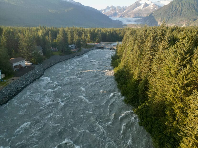
Water continues to rise along the Mendenhall River during Juneau’s annual glacial outburst flood on Monday, August 5, 2024. (Eric Stone/Alaska Public Media)
The Assembly approved an ordinance that will allow the city to work with the U.S. Army Corps of Engineers on the installation of flood protection barriers along the Mendenhall River.
The barriers are made by a company called HESCO. They’re Army Corps–recommended and relatively easy to install, according to City Manager Katie Koester. They’re essentially stackable heavy duty sandbags, which are about 4 feet tall and 3 feet square.
“Those HESCO barriers are what we would be lining the river with to protect life and property in the event of the next jökulhlaup,” Koester said.
The Corps will donate the barriers free-of-charge — enough to eventually line up to four miles of riverbank — along with 60,000 sandbags for individual homeowners. But the city will be responsible for distributing the sandbags and installing the HESCO barriers at key places along the river.
Phase one installation will focus on the stretch from Marion Drive to Killewich Drive to Meander Way. Those locations were selected because that’s roughly where the water first breached the bank in August. Later on, the makeshift levee might be extended along the remainder of the developed side of the river, as well as on River Road and View Drive. The city would take on responsibility for the maintenance of the flood barriers, which typically last for about five years.
It’s unclear what the total project budget will be, but the first phase may cost up to $2 million dollars. The Assembly will discuss ways to come up with that money at a regular meeting on October 21, 2024.
City leaders hope the barriers can be installed over the next few months. In previous meetings, they’ve discussed more long-term solutions to minimize or prevent flooding altogether, but those solutions will be time-consuming, costly and legally thorny. They’ll require a more in-depth study by the Corps. That study has not yet been approved, but Governor Dunleavy and the Central Council of the Tlingit and Haida Indian Tribes of Alaska have requested it and the City and Borough of Juneau have preemptively set local money aside to fund it.
The flood barriers are a more immediate solution, Koester said, though they’re not perfect.
“They’re ugly, they’re large. Again, they’re designed for a five year lifespan,” Koester said. “And while we will be expeditiously looking on long term solutions, we really don’t know what that looks like until, until that study has has been done.”
Most of the barriers will also have to be installed in people’s yards, and about 75 homes may be asked to put barriers on their private property. Koester said the city will start outreach to those homeowners this week, but members of the public who showed up to testify expressed support for the plan.
Some, like Clinton Singletary, who lives in the affected neighborhood of Center Court, also reiterated the need for long-term solutions.
“These events will continue happening as the glacier retreats, and from the research I’ve seen, they’ll likely only get worse each year until effective mitigation is in place,” Singletary said.
Suicide Basin, which is dammed by the Mendenhall Glacier, is bound to flood the valley again. And it’s already refilling, which raised concerns about the possibility of another major flood this fall.
But Aaron Jacobs, a hydrologist with the National Weather Service who attended the meeting, said the basin is only about halfway full and levels in the Mendenhall River are currently low. If Suicide Basin drained right now, it would cause a moderate flood, bringing the river to about 10.5 feet – much lower than record-breaking 15.99 feet during August’s flood.
As freezing temperatures kick in, Jacobs said the possibility of another release in 2024 will wane.
“We’ve never seen one over the wintertime — not saying that couldn’t take place — but just in the past, we have not seen one take place in November, December, January,” Jacobs said. “If it doesn’t release into the fall time, what that will tell us is that we could just see a fuller basin a lot earlier next year.”
The city also plans to welcome the Army Corps of Engineers for a public meeting this fall to provide technical advice for homeowners trying to protect their homes from flooding, but the Corps has not yet confirmed that plan and specific dates have not been announced.
Correction: A previous version of this story misspelled the word “levy.”
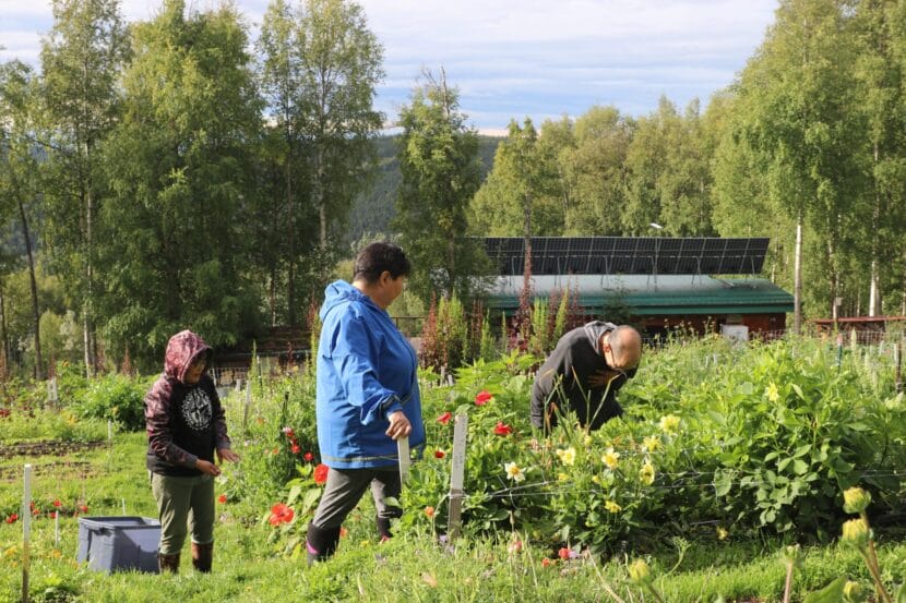
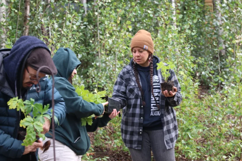
Cousins Viva Johnson (left) and Bernadette Pete harvest celery with instructor Leonardo Sugteng’aq Wassilie at Calypso Farm and Ecology Center, just outside Fairbanks, Alaska. Johnson and Pete can’t always get fresh produce in their village of Alakanuk, near the Bering Sea. In August, they participated in an Indigenous-led farmer training program at the farm. (Anna Canny/KTOO)
Growing up in rural Alaska, Eva Dawn Burk recalls hunting, trapping and going to fish camp every summer, gathering traditional foods with her family.
Burk is Alaska Native, Dene’ and Lower Tanana Athabascan. She grew up in the small villages of Nenana and Manley Hot Springs along the Tanana River in Interior Alaska, where her family and neighbors relied on the land to fill their pantries and freezers.
But that way of life is increasingly threatened. Alaska is warming faster than any other U.S. state as a result of human-caused climate change. Heat waves and other shifting weather patterns are causing chaos in ecosystems that Indigenous hunters and fishermen have long relied on, disrupting everything from the migration of caribou and reindeer to the abundance of wild-berryharvests.
“It doesn’t matter what part of the state that we look at,” says Burk, now a community food activist and a student of sustainable agriculture at the University of Alaska Fairbanks. “Climate change is wreaking havoc on the habitat and on our fish and wildlife.”
But the warmer temperatures and changing seasons have also had another impact: Climate change is making agriculture more possible in many parts of Alaska. That’s driving a new enthusiasm for farming across the state.
Few of the state’s rural villages have farms or even community gardens. So in 2020, Burk decided to start a training program to teach aspiring Alaska Native farmers how to grow their own food.
The goal, she says, is to help Alaska communities that are being most affected by climate change — and to shore up food security as traditional foods become more unpredictable.
“An Indigenous value is to be prepared for the future,” Burk says. “What our program is doing is working to prepare some of the most vulnerable communities.”
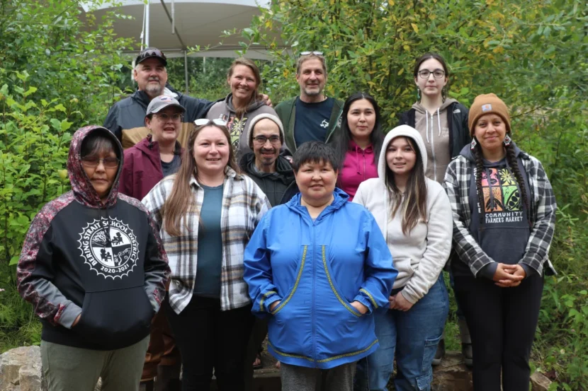
Trainers and participants with the Indigenous farmer training program at Calypso Farm and Ecology Center spent a weekend in August camping together and harvesting food for their meals. Susan Willsrud and Tom Zimmer (back row, center) founded Calypso Farm and Ecology Center with the hope of educating more beginner farmers. (Photo by Anna Canny/KTOO)
“You can’t farm in Alaska”
Alaska isn’t usually considered farm country. Much of the state has cool summers, harsh winters and a short growing season, which can make it challenging to grow anything other than hardy crops like cabbages and potatoes.
First frosts are already arriving later in some parts of the state, allowing growers to keep their crops in the field longer. Research done at the University of Alaska Fairbanks predicts the growing season could be weeks or even months longer by 2100.
Hotter summers could support larger yields, and milder winters could shift the state’s plant hardiness zones, which describe the crops most likely to thrive in a region. By 2100, the hardiness zones in Fairbanks may resemble those in modern-day Kansas or Kentucky, the UAF study found.
Even now, Alaska farmers and gardeners are experimenting with crops that have historically been extremely difficult to cultivate.
“We’re successfully able to grow things like artichokes and field-grown tomatoes, peppers and corn here in Fairbanks,” says Glenna Gannon, a professor of sustainable food systems who runs crop trials at UAF. “I don’t think 30 or even 10 years ago that would have been successful.”
The state’s tiny agriculture industry is growing fast. The number of farms in Alaska has nearly doubled over the last two decades — from just about 600 in 2002 to almost 1,200 by 2022.
But Alaska growers like Gatgyeda Haayk still encounter a lot of skepticism.
“I hear that a lot. Like, ‘You can’t farm in Alaska,’” says Haayk, an instructor at the Indigenous-led agriculture training program at Calypso Farm and Ecology Center, just outside Fairbanks. “Even when I first came here, I didn’t think of myself as a farmer.”
Haayk runs a community garden in Metlakatla, a Tsimshian village of about 1,500 people in Southeast Alaska.
She first came to Calypso as a student, learning skills like seed starting and garden planning. Now she’s eager to pass that knowledge along.
Alaska farmers will not be exempt from the downsides of agriculture in a hotter world, like increased risk of drought or pests.
But in Haayk’s eyes, farming is still one of the best ways for Alaska Native villages to adapt to climate change. Alaska Native people make up more than 20% of the state’s population. As Alaska’s agriculture industry grows, Haayk wants to see more Indigenous-led farms and gardens.
“I feel like it’s time for the Indigenous people to be the pioneers of this change,” Haayk says. “We know this land best.”
She also thinks Alaska communities need to be less dependent on the Lower 48. Alaska currently depends almost entirely on produce grown elsewhere: Almost 95% of the state’s food is imported. Most grocery supplies arrive in Anchorage on barges. From there, everything must be transported to the state’s far-flung communities, many of which are not connected to the road system. Supplies are delivered by smaller boats or planes.
Those are all issues Eva Dawn Burk hoped to combat when she founded Calypso’s Indigenous-led farmer training program a few years ago.
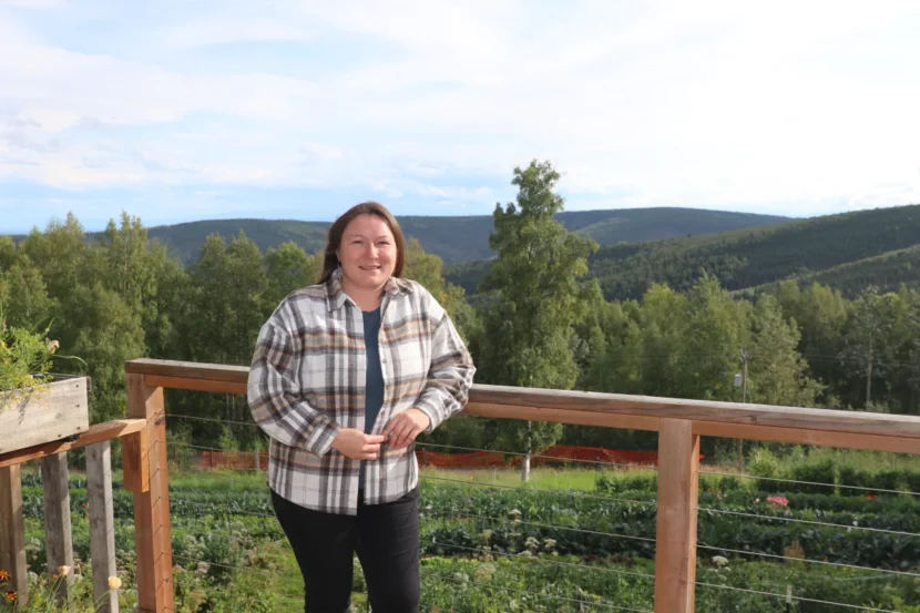
Eva Dawn Burk, a community food activist, visited Calypso’s farmer training program in August. Burk founded the program to grow a network of Alaska Native farmers. (Photo by Anna Canny/KTOO)
Fresh veggies for remote villages
The Calypso Farm and Ecology Center was founded in 2000, just as the current wave of interest in Alaska agriculture was starting. It’s a small farm, nestled on 3 acres of land in the boreal forest just outside Fairbanks. But it grows hundreds of varieties of fruits and vegetables, just a few hundred miles from the Arctic Circle.
Burk first visited Calypso in 2019.
“I was really in shock and awe,” Burk says. “I was like, ‘How come we haven’t ever built something like this in one of our villages?’”
By 2020, Burk had launched the Indigenous agriculture trainings, building on Calypso’s existing suite of educational programs.
Burk views growing food as a natural complement to hunting, fishing and gathering wild foods. She hopes the training program will spur more farms in rural communities, where growers will tend to crops on the same land where they smoke salmon and tan animal hides.
Burk and her partners at Calypso have already helped develop a small statewide network of Alaska Native farmers and teachers. Late last year, the nascent program received a boost with nearly $750,000 in funding from the U.S. Department of Agriculture’s Beginning Farmer and Rancher Development Program.
On a drizzly day in August, this year’s training was well underway.
Tom Zimmer, who owns Calypso Farm, dug a hole in the deep brown soil and held out a small apple sapling to a group of trainees from across the state.
“Whoever plants this, in four years you get to come back and have some apples,” Zimmer said.
Bernadette Pete raised her hand. Pete took three flights to get to Calypso Farm, traveling for 12 hours from her hometown in Western Alaska for a weekend of lessons.
She and the other trainees were learning about transplanting and seed starting, composting and soil health, and irrigation. Between lessons, they spent the weekend camping and harvesting food for meals they cooked together.
Pete stepped up, pulled the tree roots from their plastic covering, and plopped the sapling into the ground.
“Write my name on it!” she said, laughing, as she packed the soil with her heel.
Fresh apples are one food it can be hard to get back home, Pete said, along with many of the veggies she snacked on that weekend, like sugar snap peas off the vine and celery straight from the ground.
Mikkiah Goessel and Gatgyeda Haayk (right) prepare to transplant seedlings at Calypso Farm and Ecology Center. They’re instructors for the farm’s Indigenous farmer training program. (Photo by Anna Canny/KTOO)
Like almost all the students who come to Calypso, Pete has stories about how the environment around her home is changing. Her hometown, the Yup’ik village of Alakanuk, sits at the mouth of the Yukon River, near the Bering Sea.
The community of about 700 people relies on wild foods like seabird eggs, berries, moose and especially salmon, which have been hit hard by climate change.
“I notice fall flooding, a lot more rain, less fish,” Pete said.
Endless rainstorms last summer drenched the salmon on Pete’s drying rack, being preserved for winter. She had to throw much of it away.
Since salmon stocks have crashed, the region’s only commercial salmon-processing plant has started pivoting to agriculture, putting up greenhouses in Alakanuk and surrounding villages.
With the knowledge she gained at Calypso, Pete is eager to get planting.
“Everyone here is so eager to teach you. It’s like they know every plant and how it grows,” Pete said. “I want to grow lettuce, potatoes, sugar snap peas.”
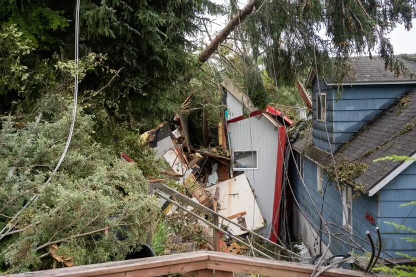
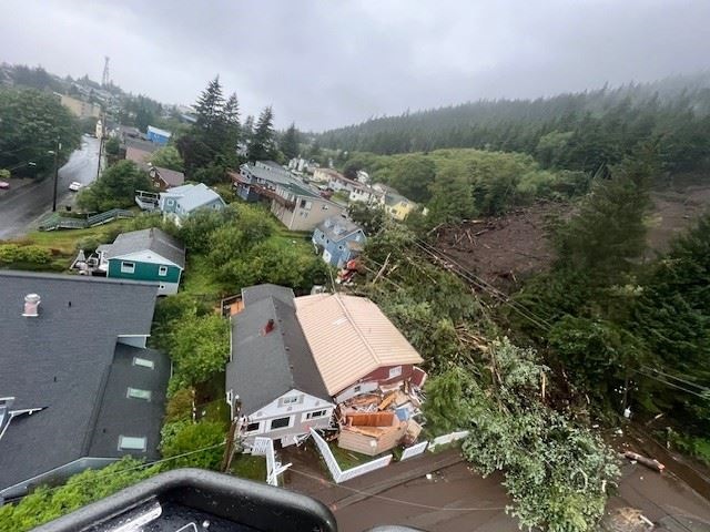
A house on Second Avenue in Ketchikan is flipped sideways and destroyed by the Aug. 25 landslide. (Jack Darrell/KRBD)
Ketchikan gets more rain than almost anywhere else in Alaska. It’s the kind of rain you have to dump out of your coat pockets before you come inside. Mountainsides across the channel on Gravina Island are streaked with scars from landslides in years past.
But even so, landslides never felt like a threat, said Ketchikan mayor and local historian Dave Kiffer.
“If you ask most people here, they’re going to say, ‘Well, if it was going to happen, it would have happened by now,’” Kiffer said in a recent phone interview. “That’s where the shock comes — all of a sudden, boom, this happens, and it really feels like it comes out of the blue.”
There had been some scattered rockslides and smaller landslides, often in areas where humans had disturbed the ground in some way. One took out a beloved downtown grocery store. Others temporarily closed roads on the outskirts of town.
But never before had a 250-foot wide section of hillside just up and given way. It crashed downhill nearly a quarter-mile in just 15 short seconds, the city and borough said. The slide killed a city maintenance technician who had come in on his day off to clear storm drains, and another man has a long road back after sustaining serious injuries, Kiffer said.
It simply had not happened in the 130-odd years since people started living on the banks of Ketchikan Creek year-round, and certainly not right in the city center. So, Kiffer said, this was a change.
“Now the biggest mindset change going forward is, yeah, they can happen here,” Kiffer said. “So how do we mitigate that?”
That’s a big question, and not one with easy answers.
Four fatal landslides have struck communities across Southeast Alaska since 2015, killing at least a dozen people. Landslides are nothing new in this region of steep mountainsides and heavy rain. But the idea that every few years, another Southeast Alaska community has to dig its way out after a fatal disaster — that is new. The string of recent deadly slides is changing the way people look at their surroundings and plan for the future as they reckon with their own risk in a changing climate.
Communities across the region are working to mitigate the risk, but their options are limited. Forecasting landslides is difficult. Home insurance doesn’t cover landslide damage. And some efforts to address landslide risk on a community-wide basis have run into pushback from residents.
It’s a question on the mind of another Southeast Alaska mayor, too — Tom Morphet, in Haines. In 2020, after an atmospheric river dumped heavy rain for days on top of a thick layer of snow, a landslide on Beach Road killed two people. Looking at photos of the Ketchikan slide, he said, is unsettling.
“There really was nothing in the area of the slide that you can say, ‘Oh, we cut too many trees there, or we cleared too much,’” Morphet said. “That’s, I guess, maybe the spookiest part of it of all — that a bunch of 300-year old trees and vegetation can just move on you and just collapse.”
Morphet said living with that risk, knowing the hillside could one day simply collapse, makes it hard for communities to plan for the future.
“It’s a whole new regimen of things we have to figure out because of these weather extremes,” he said.
It’s an issue that Sitka reckoned within 2015 after a series of slides, including one in town that killed three people. That led the then-director of the Sitka Sound Science Center, Lisa Busch, to convene a team of researchers to address the problem, said Ron Heintz, the center’s senior researcher.
“For a lot of people in the community, it really sort of made them aware, much more aware of the fact that these things can occur, and they can occur right in town,” he said.
Heintz said it’s hard to say whether landslides are becoming more frequent in Southeast Alaska. It’s an active area of research. But Heintz said 90-plus percent of them are associated with so-called atmospheric rivers, which bring most tropical air northward to the region.
“We’re getting more atmospheric rivers, and as the climate warms, the atmospheric rivers seem to be getting more intense,” he said.
So how can communities respond? For one thing, Heintz said, it’s important to create maps of what areas are the most risky. Those can help guide policymakers as they consider new areas for home and business development. But Heintz said that knowledge is both a blessing and a curse for homeowners.
“They’re sort of reluctant to know,” he said. “They don’t really want the municipality to know, or the insurance companies to know, because they’re afraid of what it would do to their property values or their insurance rates.”
And efforts to translate those risk maps into policy have indeed been controversial. City leaders in Sitka ultimately rolled back restrictions on development imposed after the 2015 slide. In Juneau, the assembly declined to adopt new landslide hazard maps and scrapped development restrictions last year after hearing pushback from homeowners who would have been placed in high-risk areas. And land is already at a premium in communities across the region struggling with housing shortages.
Regardless, Heintz said, it’s difficult or impossible to get insurance covering landslides in Alaska. Researchers with the RAND Corporation, a policy think tank working closely with the Sitka Sound Science Center, found that landslide insurance would likely require some sort of government intervention, maybe something akin to the existing National Flood Insurance Program.
“If you live in a flood zone, the federal government requires you to have flood insurance, and you pay into a pool for flood insurance,” Heintz said. “That would be the way landslide insurance would have to work .”
But that brings with it many of the same complications that have made hazard maps difficult for communities to act on.
One effort that’s less controversial is a warning system that lets people know when conditions are ripe for a landslide. The Sitka Sound Science Center developed a website that provides a 72-hour outlook for landslide risk based on recent rainfall data, and Heintz said researchers are working on integrating more data on things like soil moisture and pore pressure into the model in the future.
Kiffer, the Ketchikan mayor, said better weather data closer to town could help people in Ketchikan better prepare for landslides and look out for warning signs like dirty runoff and saturated soil.
Right now, Ketchikan’s primary source of weather data is a station at the airport, near sea level and across the channel from town. That station reported far less rainfall on the day of the August slide than city-run stations at higher elevations — 2.5 inches at the airport versus more than 10 inches measured at a city-run weather station at a higher-elevation hydropower station.
“They should have been publicly saying, ‘Ketchikan’s getting six or seven inches of rain downtown. That’s a big storm,’” Kiffer said.
Kiffer said he’d also like to see the federal flood insurance program extended to people who live with the risk of landslides.
For now, Kiffer said, Ketchikan is reckoning with what looks like it might be the new normal.
For some families, he said, life will never be the same. But even for those not in the path of the slide, Kiffer said, Ketchikan’s landslide risk will remain high on residents’ minds.
“Every time I drive on the Third Avenue Bypass, probably for the foreseeable future, I’ll be thinking about … the hillside that came down,” he said. “Could it come down again? It suddenly adds a bit of uncertainty into our lives that wasn’t there before.”
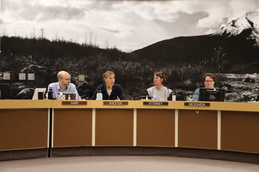
Deputy City Manager Robert Barr, City Manager Katie Koester, City Attorney Emily Wright and City Clerk Beth McEwen at a Juneau Assembly Committee of the Whole meeting on Monday, Sept. 9, 2024. (Photo by Anna Canny/KTOO)
City leaders say they’re working with federal partners on strategies to endure a future of flooding in the Mendenhall Valley, following a second year of record-breaking flooding.
At Monday’s Juneau Assembly Committee of the Whole meeting, City Manager Katie Koester said the last two years of catastrophic glacial outbursts have changed the community’s understanding of what can flood. Two years ago, only about two dozen homes were affected. This year, nearly 300 homes were damaged.
“Most communities that deal with flooding, they’re dealing with flooding over time, increased flooding — we have really gone from zero to 100 overnight,” Koester said. “All of those things just underscore the need for action, both in the near-term and the long-term.”
Juneau officials met with a number of state and federal agencies in Anchorage late last week to discuss ways to better understand — and possibly prevent — glacial outburst floods in the future.
The Alaska Department of Transportation, Central Council of the Tlingit and Haida Indian Tribes of Alaska, National Weather Service, U.S. Geological Survey, U.S. Forest Service, National Resources Conservation Service, U.S. Army Corps of Engineers and representatives from the offices of Senators Lisa Murkowski and Dan Sullivan were in attendance.
On Monday, the Assembly discussed short-term plans to set aside money for updated flood maps and a new hydrologic study of the Mendenhall River, which would help homeowners better understand risks in their neighborhood. They’re also considering hiring an additional staff member for the city’s emergency management department.
Many in the community are also hoping for a way to prevent severe flooding altogether. The Assembly discussed some possible ways to do that at a meeting last month. But Koester said the meeting in Anchorage underscored a need for more research to move forward, and she said no major flood prevention project would be feasible over the next year.
“No one solution is going to control flooding, right? It’s going to need to be a combination of levee, a combination of some channelizing, maybe some hardening to protect the bank,” Koester said. “It became pretty obvious that there’s no short-term construction solution — you know, trenching, building — that could be done successfully before next summer.”
Meanwhile, Suicide Basin is already filling again, which means another flood might be possible even sooner than that. Koester and city officials expressed concern about that possibility, saying they’re not prepared for another flood to happen this fall.
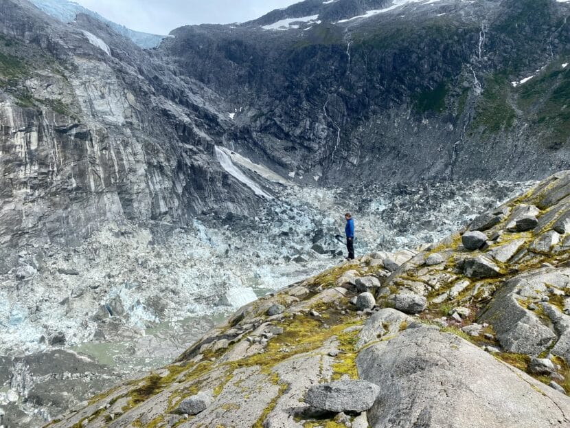
Researcher Eran Hood stands on the lip of an empty Suicide Basin just a few days after it drained to create a record-breaking glacial outburst flood in August 2023. (Photo by Anna Canny/KTOO)
Meteorologist Nicole Ferrin with the National Weather Service said it is not unheard of for the basin to release multiple times in one season. In fact, the basin drained last September, after August’s outburst flood. But it released relatively little water, which was largely unnoticed.
“But what is happening right now is unusual,” Ferrin said. “The basin always refills some in the fall time, but it doesn’t usually keep refilling to the level it’s at right now.”
Currently, water levels in the basin are similar to where they were in June of this year. If water were to drain right now, the Mendenhall River would only reach a minor flood stage, inundating portions of the Skater’s Cabin road.
Typically, as the summer turns to fall, the rate of water filling the basin slows down as rain in the mountains becomes snow, and cooler temperatures slow the melting of ice. Ferrin said the likelihood of another catastrophic flood this year is low.
“If we get multiple rain events back to back to back to back and then it releases, you know, I wouldn’t rule it out,” Ferrin said. “But I would rather alleviate people’s fears by saying it’s not imminent. Major flooding is not imminent, but we are monitoring it, and people should stay aware.”
Still, the filling of the basin is a reminder of the need for swift action. The city has already allocated $300,000 set aside from an emergency appropriation and this year’s capital improvement budget that can be put towards studying and mapping Mendenhall River flooding, which they hope to do this winter. They need a plan to allocate an additional $100,000 to cover the cost of that work, which they plan to introduce by their next regular Assembly meeting.
The city also hopes to create a plan for flood fighting and emergency response before water returns next year. Koester said Sen. Murkowski is working on a piece of national legislation on emergency response funding, which may eventually free up federal money to support that work.
And the salary of new emergency management personnel would be covered by money that was previously allocated for a city-sponsored finance position at the Juneau School District. That hiring decision does not fall to the Assembly, but member Christine Woll expressed support for the idea.
“Obviously disaster relief is front of mind given the last few years, and given the flood,” Woll said. “We also know it’s going to get worse in the future, and we need to be able to not only respond, but proactively plan — and landslides are on my mind too.”
Human-caused climate change is bringing warmer temperatures and more extreme weather events to Southeast Alaska, which could make disasters in Juneau more common.
When it comes to glacial outburst flooding, the bigger financial lift will be the study of major flood prevention projects, which might involve construction to alter Suicide Basin, Mendenhall Lake or the greater Mendenhall River flood plain.
Koester said the U.S. Army Corps of Engineers has a program to pursue projects like that, but it’s pricey. Koester says engaging the Corps will require the city to secure $3 million of local funding, and an additional $3 million in federal funding.
The Assembly said they’re committed to allocating that local funding by pulling from appropriations for other planned city projects. But they’ll discuss it further at their regular Assembly meeting next Monday, Sept. 16.
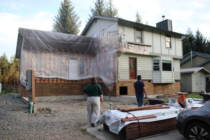
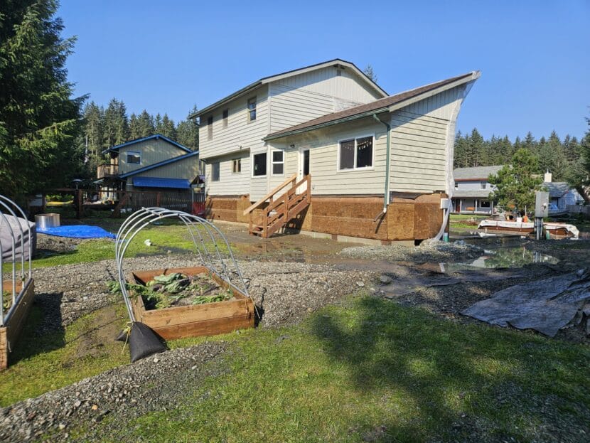
Sam and Amanda Hatch circle their house on Meander Way (Photo by Anna Canny/KTOO)
Sam and Amanda Hatch can’t reach the knob on their front door. It’s suspended in mid-air, along with the rest of their home, which towers above the others on Meander Way.
During last year’s glacial outburst flood, water filled the Hatch’s crawl space and saturated the silty land beneath their house until it was wiggly, like quick sand. The whole building sank back towards the river. The four corners drooped and the foundation folded down the middle.
“Our house is really screwed up,” Sam Hatch said. “We made this decision like ‘Okay, either we intervene now or we wait for the house to break and walk away.’”
Their frankensteined house is that intervention. The original building, with its light green siding, now sits four feet off the ground, vaulted on sheets of plywood. Beneath that, there’s a brand new foundation. The garage has not been rebuilt yet, and in the front yard, there’s some unused construction material, leftover from when they ran out of money to finish the job.
The high water threatened to breach Hatch’s house, even after it had been lifted, but they managed to stay dry while hundreds of others in the Mendenhall Valley took on water.
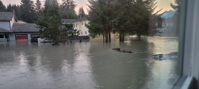
When flood waters surged into their neighborhood on Meander Way, the Hatches were spared because of their lift, but they watched many of their neighbors flood. (Photo courtesy of Amanda Hatch)
With the promise of more glacial outburst floods to come, Sam Hatch says he’s heard lots of people wondering about how they should fix up their homes, grappling with the same uncertainty he faced last year.
“It’s like what do I do? Do I just put it back the way that it was?” he said. “If we know the flood hazards, then people want to prepare for them. They can either harden structures, or mitigate or get away from the problem.”
It’s hard for homeowners to figure out what will make these annual floods tolerable. Staying completely dry might be difficult, if not impossible, but it’s also hard to make peace with letting the water in again and again. Both options are expensive.
“And you have to decide, is it worth selling? Is it worth walking away? Or is it worth paying to repair,” Amanda Hatch said.
The Hatches decided to lift their house, after consulting with a neighbor on View Drive who had done it after his house was damaged by a glacial outburst flood in 2015. Few contractors in the state do that kind of work. The Hatches had to fly someone in from out of town.
At first, they say, there was a small group of neighbors who were interested in lifting their houses too. That would have brought down the cost of the labor and materials, but in the end most people backed out. So the Hatches decided to go it alone.
They were able to get a small grant from state disaster assistance to fill in the land that the flood scoured from beneath their house. But they had to take out loans and open up their retirement account to scrape together the rest of the money they needed — $100,000 to fix the foundation, then another $150,000 for the lift.
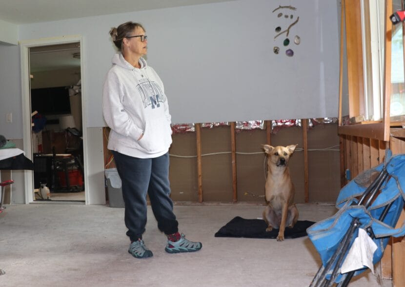
Lisa Wallace and her dog Stella just returned to their gutted house on Meander Way. Wallace plans to do bare bones repairs on the first floor, in anticipation of another flood next year. (Photo by Anna Canny/KTOO)
Compromising a dream home
Lisa Wallace, who lives a few blocks over on Emily Way, said she doesn’t have that kind of money. The bottom floor of her two-story house filled with two feet of water this year, even though it had never flooded before.
“To have this place that has been my safety and my security for all these years and now be told you’re going to get a 500-year-flood every year. It sucks,” Wallace said.
She says this place was her dream home, with a freshly remodeled kitchen that’s now completely gutted and a cozy living room that’s empty now, except for the dining room table and a couple foldable camping chairs. The place is drying out with box fans, and the exposed subfloor is still dusted in glacial silt.
Wallace knows it could flood again, so she’s making plans to live with the water. She’s been researching construction materials that are used in the Southeast U.S., where things like hurricanes and sea level rise driven by human-caused climate change cause frequent floods.
She said she’ll outfit her first floor with special waterproof drywall and vinyl flooring to replace the hardwood, so it will be easier to dry out next year. A lot of the things she loved about this place will not be replaced.
“Why the heck would I buy new furniture? Why would I put beautiful flooring down? Why would I do that,” she said. “I had my perfect home, and it isn’t perfect anymore. But I’m certainly not doing any of that until we find out how the next flood goes.”
Wallace had plans to move somewhere smaller in her retirement, which is fast approaching. But she says the investment she’s making to repair this house will make affording a new place challenging.
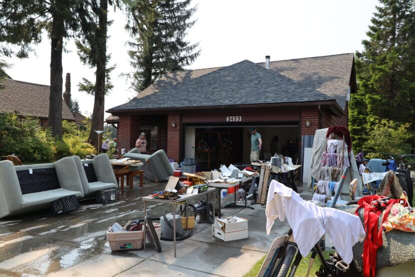
Susan and Nico Bus dry out their belongings following Juneau’s annual glacial outburst flood on Tuesday, Aug. 6, 2024. (Clarise Larson/KTOO)
“I wouldn’t buy here again”
Most people who flooded this year, including Wallace, never paid much attention to the glacial outburst floods before. But Nico Bus did, because the Mendenhall River runs right through his backyard on Meander Way. His efforts for flood mitigation have been both a success story and a cautionary tale.
Even before the annual floods began, the river had been eroding his property — and that of his neighbors — for years. Back in 1996, Bus made an investment of $25,000 to protect his home by armoring the riverbank with rock.
When the glacial outburst floods started, they accelerated the erosion, and back in 2018 Bus even campaigned to get the entire neighborhood to split the cost of a retention wall to stop it. At the time, many of his neighbors felt the costs were too high, and the risks were too low.
That is, until last year’s catastrophic flood, which ate away at the riverbank so quickly that it undermined foundations and caused two houses to collapse into the river. Bus made it out unscathed that time.
“Clearly, it was a smart move to reinforce the bank,” Bus said. “But I don’t think the riprap, as you call it, was designed to help with this high of water.”
The nature of the flooding continues to evolve. This year, the reinforced banks held again, but it didn’t matter. The water spilled over them and surged into Bus’ home from multiple directions, as it never had before.
Bus said he and his wife love their home, but he feels it isn’t worth the money it will take to protect it.
“I wouldn’t buy here again. We have been lucky to live here for 39 years,” he said. “We’re going to give it another year, but if it floods again I’d be silly to stay here.”
The force of the water during 2024’s glacial outburst flood soured land around the Hatch’s home, but the repairs they made last year spared them from a lot of additional damage. (Photo courtesy of Sam Hatch)
As much as they’re grateful for their homes, some also feel stuck with them after the flood. In the end, the Hatches did get some financial help via a loan from the U.S. Small Business Association, which they applied for last year. Ironically, that money finally came in on the day of this year’s flood. They say it will help them to pay back the higher interest loans they took out, but they won’t recover any of the personal savings they spent.
“That’s just gone.,” Sam Hatch said. “It’s in the house now. Yay! That’s one form of investment.”
For the Hatches, the investment to protect their house makes sense. Juneau has an enduring shortage of housing, and the homes that are available are extremely expensive. Amanda Hatch said they worried they’d have nowhere else to go, and they don’t want to leave this community.
“Is it worth it? Are we glad we did it? Absolutely, cause I think the house would have been a loss,” she said. “Juneau can’t absorb a family of five, let alone 300 houses worth of families.”
But she says there was no joy in being spared this year, while they watched their neighbors flood.
A deadly landslide in Ketchikan on Sunday, Aug. 25, 2024, seen on the Ketchikan Gateway Borough’s website. (Ketchikan Gateway Borough)
Landslides like the one that killed a man in Ketchikan on Sunday can strike with little warning, sending earth and trees crashing down a mountainside as fast as a car on a highway.
Scientists are still looking into what factors were at play in the deadly Ketchikan landslide, but rainfall saturating the ground, potentially triggered by wind, are common culprits in landslides in Southeast Alaska. There’s also the increased frequency and severity of weather events associated with climate change.
Dr. Gabriel Wolken is manager of the Climate and Cryosphere Hazards Program for the state Division of Geological and Geophysical Surveys. Wolken says landslides are often the result of a complicated series of events.
This interview has been lightly edited for length and clarity.
Gabriel Wolken: Several factors contribute to the development of a landslide, and then triggering is something else, too. Saturated ground can elevate landslide susceptibility, and this causes a reduction in the stresses that hold the soil particles together, the rock together, just inserting water in between different soil particles, and it causes those particles to separate, no longer interlock. And so that’s typically what happens during precipitation events, especially extreme precipitation events, when there is a lot of moisture falling to the ground. And this is especially the case when soils are already saturated.
And then several factors contribute to the development of landslides. You know, rainfall, snowfall, temperature changes, and of course, wind is one of those. Typically, wind’s influence on the development of landslides has to do with the wind’s impact on trees, and then how the tree acts as a lever on the soil,and the different physical interactions that happen at that point.
I just want to underscore that we really don’t know enough about the landslides in Ketchikan to make any sort of statements about the causes, the triggers, at this point, but we’re really investigating it right now. We have many of our folks, partners on the ground, investigating the landslide right now, assessing it, assessing the stability of the slope, and then later, you know, we’ll really dive into trying to understand what actually happened.
Casey Grove: Yeah, that makes sense. So I wanted to ask you about something that has come up. I think it’s been four fatal landslides in the last 10 years or so. And, you know, folks are talking about how it seems like these are happening more frequently. Is that true? And do we have any kind of sense of why that might be?
GW: Yeah, I mean, it does. It does seem that way. I agree, 12 fatalities in the last decade or so is a lot, and this is hard to deal with. And, you know, our thoughts go out to the people who are impacted by these disastrous events. But in terms of determining whether or not landslides in Alaska are occurring more frequently in recent decades or in recent time compared to those in the past, is really quite difficult, if not impossible, to answer at this time, really due to a few factors. And really the most influential, perhaps, is the inconsistencies in landslide reporting. And so it means that we really don’t have a detailed enough historical record in Alaska, the records really don’t go back far enough for us, to be able to fully assess whether or not there has been an increase in landslides in recent time.
CG: Hypothetically, I mean, seeing the effects of climate change on so many different parts of our lives and so many different parts of the terrain out there, would you expect that that could be something that would increase, maybe, the frequency of landslides?
GW: Right, yeah, so again, the caveat is always (that) Alaska is fairly data sparse, and so it’s really hard to answer this question directly. But what is clear is that as the world warms, climate change is making adverse and extreme weather events both more likely and worse.
And so while these areas, such as Southeast Alaska, are already quite damp and windy at times, increases in temperature, precipitation and wind likely will have noticeable effect on the landscape, and that could include a change to what we consider to be the frequency and magnitude of natural hazards right now. And so in other places in the world, there have been connections to increases in the frequency of landslides with increasing temperature and precipitation. That’s entirely likely for Alaska, but we cannot say definitively that that’s that’s indeed the case at this point.
CG: So I appreciate you being the one to step forward and talk to me about this today, and I don’t mean to put this huge question just on you alone, but what are we supposed to do about that? I mean, what can local, state, federal agencies do? What sort of things are underway, maybe already, to help people avoid the adverse impacts of of landslides?
GW: Right, well, I think what’s really important is that we have very good relationships going on right now between state, federal agencies, local government agencies, universities, all really good relationships. We have partnerships in play, and the goal really is to try to work together to make sure that we’re doing all we can with what we have to provide a resilient state, resilient communities, by increasing the knowledge of the conditions that create landslides and to try to just generally make things safer for people.
And what this ends up being is a very challenging area to work, and we cannot with absolute certainty, you know, provide predictions about landslides, or anything even remotely close to that. But what we can do is evaluate landslides that have happened. We can make sure that we’re recording landslides and specific events properly so that we can use that to increase our knowledge and hopefully predict how landslides might occur in the future.
Close
Update notification options
Subscribe to notifications
Subscribe
Get notifications about news related to the topics you care about. You can unsubscribe anytime.