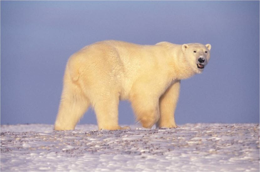
A polar bear in Arctic Alaska. (Photo Credit: Terry Debruyne/USFWS)
A polar bear killed a woman and boy Tuesday afternoon in the Northwest Alaska community of Wales, according to Alaska State Troopers.
Troopers received a report of a polar bear attack around 2:30 p.m., troopers said in an online report. According to initial accounts, a polar bear came to the village and chased several residents, troopers said.
The bear killed a woman and a boy, troopers said. Another Wales resident shot and killed the bear “as it attacked the pair,” troopers said.
The two people who were killed in the mauling weren’t identified in the report, and troopers said officials are working to notify their next of kin.
Austin McDaniel, a spokesman for the Alaska Department of Public Safety, said troopers are coordinating with the Alaska Department of Fish and Game as they try to send personnel to Wales as soon as the weather allows.
Wales — a predominantly Inupiaq village of fewer than 150 people — is located on the far western edge of the Seward Peninsula bordering the Bering Strait, just over 100 miles northwest of Nome.
In winter, polar bears can be found as far south as St. Lawrence Island, occasionally traveling even farther south, according to the Alaska Department of Fish and Game. Subsisting primarily on a diet of marine mammals, males can grow to be up to 1,200 pounds, females up to 700 pounds, with no natural predators beyond humans.
Fatal polar bear attacks are extremely rare in Alaska. In 1990, a polar bear killed a man in the North Slope village of Point Lay. Biologists later said the animal showed signs of starvation. In 1993, a polar bear burst through a window of an Air Force radar station on the North Slope, seriously mauling a 55-year-old mechanic. He survived the attack.
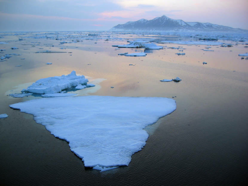
Sea ice floats in the Bering Strait off Cape Prince of Wales. (UAF photo by Gay Sheffield)
With the loss of sea ice and the ocean staying open later in the year, polar bears have been spending more time on land, which increases the chance of human encounters, said Joseph Jessup McDermott. He’s the executive director of the Alaska Nannut Co-Management Council, a tribally authorized organization consisting of the 15 Alaska tribes, including Wales, that have traditionally harvested polar bears for subsistence.
“Over the past few decades, it’s been very, very rare for those types of attacks to occur,” McDermott said. “It’s incredibly tragic it happened.”
While McDermott said the Chukchi Sea polar bear population is healthy, there were accounts of polar bears in Northwest Alaska seeking alternative food sources such as trash. About 10 years ago, residents as far inland as Noatak reported spotting animals, he said.
“While rare instances like a bear showing up in Noatak have occurred in recent years,” McDermott said, “the presence of bears around communities like Wales is a normal and regular occurrence.”
Some communities in Alaska — for example, several on the North Slope — have had polar bear patrols to keep residents safe. That’s not currently the case in Wales.
“Wales does not currently have an active Polar Bear Patrol Program due to lack of government funding, unlike the North Slope,” McDermott said, “but this is something that ANCC has sought to pursue with other (nongovernmental organizations).”
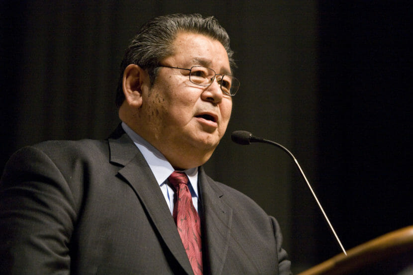
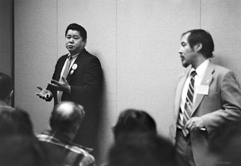
Oliver Aveogan Leavitt speaks at the 2007 Alaska Federation of Natives convention. (Courtesy ASRC)
Alaskans are mourning the loss of a North Slope leader who grew up running sled dog teams to collect firewood along the Arctic coast and came of age in the time of snowmachines, borough governments and Native corporations.
Oliver Aveogan Leavitt died Sunday at the age of 79.
Oliver Leavitt was a whaling captain and a cultural beacon for his people, fluent in Inupiaq and known for his ability to make skin whaling boats, or umiaks, without a blueprint.
Richard Glenn, an executive vice president at the Arctic Slope Regional Corp., called Leavitt his mentor. The two men served together on the board and in management roles.
“Without a piece of paper in your hand, to go from dimensional woods, hard woods, to end up with a whaling boat is a skill,” he said.
Glenn said he admired Leavitt for his ability to fight for his region — and to move comfortably from the boardroom to both the whaling camp and the halls of Washington, D.C.
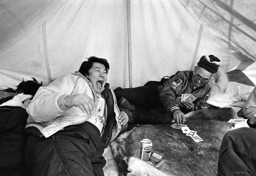
In a break from the Arctic Slope Regional Corp. boardroom, Oliver Leavitt plays cards and laughs. (Courtesy ASRC)
“He was adept at it. He made it effortless,” Glenn said. “He has a diplomat’s skill, but he also has a hard-won, nuts-and-bolts kind of education.”
Leavitt used that education to help turn ASRC into Alaska’s largest private company.
Former Democratic state Sen. Willie Hensley, a leader in Alaska Natives’ land claims fight, met Leavitt when he got out of the Army.
“I’ve known him for 50 years,” Hensley said.
After Leavitt’s military service, Hensley said, he dedicated himself to a life of public service — working to form a new borough, teaming up with other leaders to turn ASRC into a company that earns billions in revenues every year.
“He was persistent,” Hensley said. “And in order to do the things he had to do, he had to work hard and practically camped in Washington, D.C.”
Oliver Leavitt at an early Alaska Federation of Natives caucus. (Courtesy ASRC)
Hensley said one of Leavitt’s biggest accomplishments was his battle to help the North Slope Borough gain access to a gas field controlled by the U.S. Navy. That access enabled the borough to bring heat and power to homes in the region.
Although Hensley was from Kotzebue, a community on the northwest coast of Alaska, he said the two men bonded over their upbringing — growing up in a time when there were no modern amenities, just lots of hard work.
“The reason we are good friends: I understand exactly what he was saying,” Hensley said.
Hensley said Leavitt was passionate about improving life in the Arctic. Although they didn’t always agree about how to do this, their friendship endured. Hensley was at Leavitt’s side to offer comfort when he died in his home village of Utqiaġvik, surrounded by loved ones.
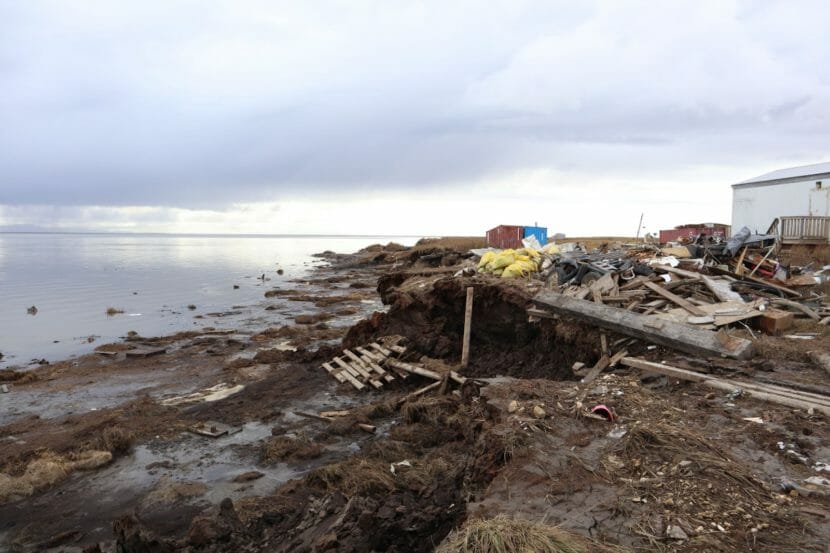
The remnants of Typhoon Merbok left Newtok’s coastline littered with storm debris in September 2022. The Federal Emergency Management Agency (FEMA) contracted with a company to translate disaster relief documents into Yugtun and Iñupiaq, but those translations were indecipherable. (Emily Schwing for KYUK)
A translation service company that contracted with the Federal Emergency Management Agency to offer disaster relief information to Alaska Native people will reimburse the federal agency for work that has been deemed indecipherable.
Accent on Languages was supposed to translate information for speakers of two Alaska Native languages: Yugtun, or Central Yup’ik, and Iñupiaq. Those documents could have helped Indigenous language speakers impacted by Typhoon Merbok apply for disaster relief.
The translation company has committed to reimbursing FEMA for the work. But that’s not enough for former Assistant Secretary of Indian Affairs Tara Sweeney.
“Fraud is fraud, in my opinion,” Sweeney said. “And you can’t put a price on the impact [of] denying services to vulnerable communities because of misinformation. When you look at the cost of living in rural Alaska it’s exorbitant and it’s challenging. There’s no dollar amount that can be refunded to the federal government to make that behavior and that business practice okay.”
Lee said that her company was paid just over $5,000. Of that, more than half, or about $3,400, covered the costs for the Yup’ik and Iñupiaq translations. That’s the money Lee said that she will give back to FEMA. Lee wrote that in taking on the translation work, her goal was “not only to just merely help these languages survive, but to help these languages and cultures thrive.”
The contract between Accent on Languages and FEMA falls under a much larger one that the company shares with the U.S. Department of Homeland Security. Accent on Languages has held contracts with various federal agencies since 2004, according to a federal spending database.
“Have we had this happen at FEMA before? The answer is no,” said FEMA’s Tribal Affairs Advocate Kelbie Kennedy. “We’ve never had this happen before. And this, in particular, is not a systemic issue.”
Kennedy is a citizen of the Choctaw Nation of Oklahoma. She also speaks her Indigenous language.
“We have a very hard working team within FEMA, and we want to make sure that they keep doing the work that they’re doing to improve and get more translations out to Indian Country,” Kennedy said. “It’s so important, I would say as a tribal citizen, to have FEMA speak in a language and speak in my native language in a way that makes sense for my community. You have to have that culturally competent element.”
Kennedy said that the agency has been contacted by members of Congress. She said that FEMA is willing to take part in any sort of investigation that may result from the mistranslations.
Sweeney is pushing for an investigation.
“My recommendation would be to members of Congress to exercise their fiduciary responsibility to American Indian and Alaska Native people across this country to look into whether or not this is common practice for the federal government,” Sweeney said.
Julia Jimmie is a life-long Yup’ik speaker who works as a translator for KYUK in Bethel. She said that there’s a silver lining to what is otherwise a deep disrespect for her language.
“They probably thought Yup’ik and Iñupiaq were going extinct, and they probably thought they wouldn’t be caught,” Jimmie said. “So this puts it out there that Yup’ik and Iñupiaq are still alive and used.”
It’s unclear how or why the work provided by Accent on Languages ended up as it did. The company said that it has provided FEMA with a list of corrective actions. Neither Accent on Languages or FEMA would share that list, but FEMA said that the agency is no longer doing business with the translation company.
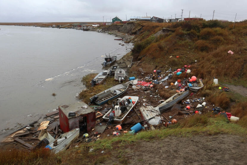
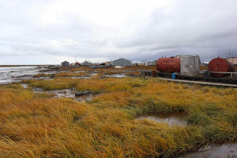
The storm surge from Typhoon Merbok brought high water 17 miles inland to Chevak from the Bering Sea coast, where boats parked on the Ninglikfak River were tossed around like bathtub toys. These boats aren’t just for recreation; they offer residents a way to access subsistence food resources, including fish and moose. (Emily Schwing/KYUK)
The translated documents were supposed to offer information on how to apply for financial assistance. On the Y-K Delta, at least half the population, about 10,000 people, learn Yugtun, or the Central Yup’ik dialect, before they learn English. Another 3,000 people speak Iñupiaq further north.
Julia Jimmie, a translator at KYUK, said that the Yugtun translations were incorrect. Other Indigenous language speakers also didn’t understand the translated documents. Two sources on Nelson Island agreed: they were not Central Yup’ik. Another source from Chevak said that it wasn’t Cup’ik. Siberian Yup’ik speakers also couldn’t make sense of the documents.
Tara Sweeney, the former Assistant Secretary of Indian Affairs under the Trump Administration, also said that the Iñupiaq translations were wrong; her great-grandfather helped develop the Iñupiaq alphabet.
“We don’t use characters like the letter ‘e’, or the way some of the words seem to be put together or structured,” Sweeney said.
To refer to the documents as translations would be wrong, said linguist Gary Holton.
“That is an amazing understatement,” Holton said after reviewing some of the documents. “The only thing you might gather from that is there are a couple of dates, but you wouldn’t know what those dates are for. I would say the only useful bit of information in there might be if there’s a reference to a website or something.”
Holton spent 20 years documenting Alaska Native languages at the University of Alaska Fairbanks’ Alaska Native Language Center. He said that whoever created the Yup’ik translations just lifted full phrases from a compilation of language and folklore from Far East Russia known as the Rubtsova texts. It was published in the Soviet Union in the 1940s.
According to Holton, in at least one of the documents where FEMA’s news release says “State News Desk,” the translated version reads, “when she said so, the dog ran farther off from the curtain.” In another section of the same document, what should be a translation of information about the Small Business Administration reads, “that one said that I should draw a line on the ice when he gets close.”
“I mean, imagine if someone, you know, took all of your folktales and then interviewed your great-grandmother about her experiences growing up. And had all of this information recorded, and wrote it down, and then scrambled it and stuck it in various different ways and made kind of a collage out of it,” Holton said. “It’s offensive.”
Sweeney agreed. She said that the work is not only a waste of federal funding, it’s insulting to Alaska’s Indigenous people.
“There’s a lot of that historical trauma of being beaten in schools because they were speaking their Indigenous languages, which is why there’s a generation of us in Alaska that struggle with fluency,” Sweeney said.
Accent on Languages touts work it has done in Alaska on its website. (Www.Accentonlanguages.Com)
The company contracted to do the work is Accent on Languages, whose website boasts a 100% customer satisfaction rate and touts its recent service in Alaska “after emergency flooding.” CEO Caroline Lee declined to answer questions about how or why the mistakes happened and what she plans to do to ensure that something like this doesn’t happen again.
The company’s Iñupiaq translations were meant to help language speakers in the Bering Strait Region who were impacted by Typhoon Merbok. But at least one of Accent on Languages’ Iñupiaq translations was actually done in the Inuktitut alphabet. Inuktitut is an Indigenous language spoken in Northeastern Canada. The mistake should have been an easy catch because the Inuktitut alphabet is made up of syllabic characters, unlike Iñupiaq where many of the letters are identical to the Latin alphabet.
A Federal Emergency Management brochure incorrectly presented as an Iñupiaq translation. It is written using the Inuktitut alphabet – a language spoken in the central and eastern Canadian Arctic – though speakers say it is garbled in that language as well.
At least two Inuktitut speakers in Canada said that a tri-fold glossy brochure created for FEMA by Accent on Languages is unintelligible.
FEMA spokesperson Sharon Sanders said that some of the translations were up to two weeks late. Her colleague, Tom Kempton, said that he had suspicions about the inaccuracies from the beginning. He said that the final products looked strange.
“I don’t speak, you know, Yup’ik. What we were seeing coming back, I mean, when I first saw the Iñupiat [sic] ones I was like, ‘What is this?’ It was all, like, hieroglyphic,” Kempton said.
According to FEMA, the agency paid $27,800 for the translations. The money comes out of a larger contract Accent on Languages holds with the U.S. Department of Homeland Security. There are at least half a dozen news releases and other documents that have been translated incorrectly.
“It’s a problem for underrepresented, minority communities if this is the type of information that’s being disseminated and people can’t even understand it,” Sweeney said. “Services to American citizens are being denied, especially in time of need. That is egregious.”
FEMA spokesperson Sharon Sanders said that the translations were not widely distributed, but they were sent to at least two radio stations and two newspapers in Western Alaska. And in October, a month after Typhoon Merbok hit the state, multiple staff members of Alaska’s Congressional delegation reported receiving the incorrect Iñupiaq translation at Alaska Federation of Natives (AFN), the largest annual gathering of Alaska Natives.
Staff from both Sen. Lisa Murkowski and Rep. Mary Peltola’s offices said that they informed the agency that the translations had many problems. In response, Sanders said that the mistranslated documents were removed from FEMA’s website. The agency also hired an Alaska-based company to continue the work.
High water from Typhoon Merbok caused a fuel spill and damaged Newtok’s diesel fuel tanks. The storm surge also shifted boardwalks across the community and further exacerbated coastal erosion. The Federal Emergency Management Agency contracted with a California-based company to provide documents for Yup’ik and Iñupiaq language speakers impacted by the storm, but the company’s produced “unintelligible” work, according to speakers of both languages. (Emily Schwing/KYUK)
In a December statement, FEMA said that it was “committed to enhancing [it’s] capacity to work with Tribal Nations … which includes providing culturally competent services and translating FEMA products into Native American languages… ” But whoever wrote that statement later misspelled both Yup’ik and Iñupiaq.
“All I can say is, you know, FEMA is a people-first agency,” Sanders said. “We’re people helping people who have been hurt, right? So when we don’t get it right, that really matters to us. And we work really hard then to make sure we do get it right.”
To date, the agency has paid roughly $7,600 per applicant to people whose applications for disaster relief were approved. To put that into perspective, the agency paid the original translation service, Accent on Languages, more than three times that amount, which is also more than the median annual income in the Yukon-Kuskokwim region.
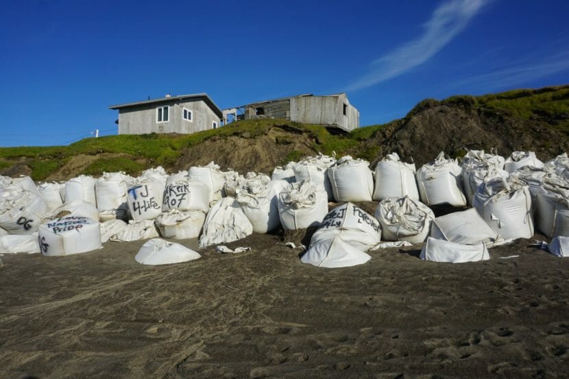
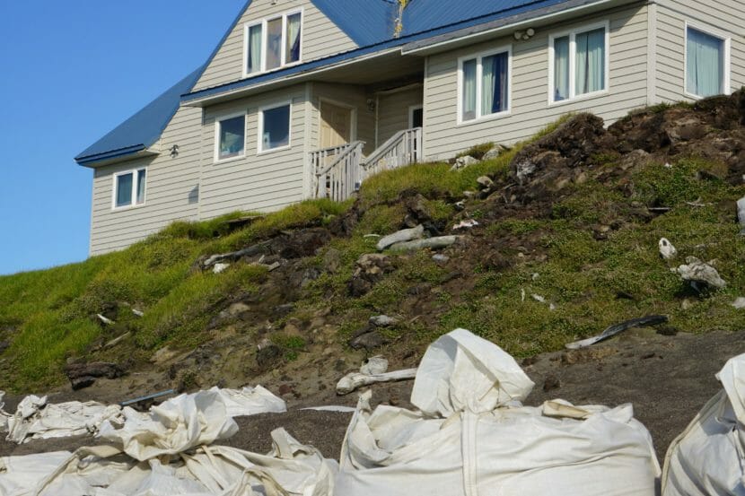
Houses, seen on Aug. 2, teeter on the edge of an Utqiagvik bluff that is being rapidly eroded by permafrost thaw. The house on the right has been abandoned. At the base of the bluff are SuperSacks filled with sand, placed there as part of the effort to hold back ocean waves and slow down erosion. (Photo by Yereth Rosen/Alaska Beacon)
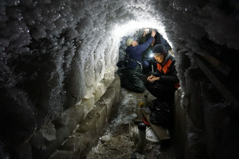
Nearly 20 feet below the ground of a field of open tundra in the nation’s northernmost community, an icy world gives a picture of the ancient past and the future of this part of the Arctic.
Embedded in the walls of a tunnel is frozen peat, its features perfectly preserved from 10,000 years ago.
“It’s quite fresh, and it keeps the shape of the moss,” said Go Iwahana, a University of Alaska Fairbanks scientist who descended down a metal ladder to reach a low, 10-meter (32-foot) long tunnel built into the permafrost in the 1960s.
Sloshing below the floor are mobile pools of super-salty and bacteria-packed brine, the remnants of an ancient lagoon that dates back at least 40,000 years and is completely cut off from the Arctic Ocean.
Go Iwahana, a scientist with the Unviersity of Alaska Fairbanks’ International Arctic Research Center, checks on conditions at a borehole in the permafrost research tunnel in Utqiagvik on Aug. 5. Behind him is Todd Sformo, a wildlife biologist with the North Slope Borough. Permafrost temperatures measured in the tunnel have increased by 3 degrees Celsius (5.4 degrees Fahrenheit) in the past decade. (Photo by Yereth Rosen/Alaska Beacon)
Within the soil, though, the modern world is making its mark. Iwahana, crawling around along the low tunnel, sent probes 1.5 to 2 meters down boreholes to see how the modern world has made its mark. “Three,” he called out after reading a thermometer.
The soil here has warmed over the past decade from minus-6 degrees Celsius to minus-3 , or from 21.6 degrees to 26.6 degrees Fahrenheit, said Iwahana, who works at UAF’s International Arctic Research Center.
“That’s a lot,” he said.
Findings at the tunnel are consistent with those elsewhere on the North Slope. As air temperatures rise, the soils as deep as 20 meters below the surface are warming at a rate of up to 4 degrees Celsius per decade, according to long-term measurements by UAF scientists.
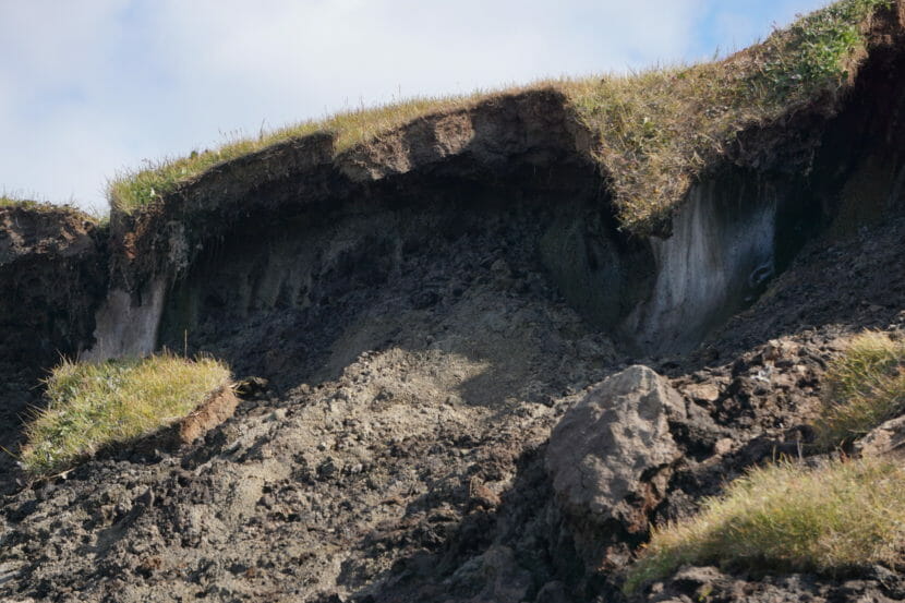
Wedges of ice, features of the ice-rich permafrost that underlies Utqiagvik, are exposed on Aug. 2 on an eroding beach bluff. A record rainfall the week before in the northernmost U.S. community helped speed up thaw, sending chunks of sod-topped soil downhill. (Photo by Yereth Rosen/Alaska Beacon)
For Utqiagvik, the North Slope’s biggest community and home to nearly half of the North Slope Borough’s residents, the unrelenting warming means trouble.
The most obvious is seen at the places where ice-rich permafrost is closest to the surface: the coastline at Utqiagvik’s downtown core, where a bluff has cleaved dangerously close to the edge of houses. Beneath one abandoned house is a gaping hole where the bluff has completely eroded away. Another house, owned by Doreen Fogg-Leavitt’s in-laws, is teetering on the edge.
“I remember 20 years ago, when her backyard to the edge was a good 30 feet, 40 feet. Now it’s about three,” said Fogg-Leavitt, natural resources manager for the Inupiat Community of the Arctic Slope, the local tribal government.
The North Slope has some of the fastest erosion measured in the nation, according to the U.S. Geological Survey, and rates have accelerated. The coastline is losing as much as 9.5 meters a month, according to findings by Williams College researchers presented in mid-December at the annual conference of the American Geophysical Union.
Erosion has brought the edge of a permafrost bluff to the back of Oliver and Annie Leavitt’s home in Utqiagivk. The house and the bluff it sits on are seen on Aug. 2. Protruding from the bluff are artifacts from Utqiagvik’s past, including whale bones used for sod homes. (Photo by Yereth Rosen/Alaska Beacon)
The long-term warming of frozen soil that Iwahana and his UAF colleagues are measuring in the tunnel is just one of the factors that work in combination to erode the coastline.
Another is sea ice loss. More open water – persisting this year into late November – means more opportunities throughout the year for waves to hit the beach and make contact with permafrost bluffs. That causes “niche-erosion block collapse,” said Tom Ravens, a University of Alaska Anchorage civil engineering professor.
There are more subtle factors, too, which Ravens listed at a permafrost workshop held in Anchorage in November. A change in precipitation patterns from snow to rain sends heat from the surface into the soil. The ocean water, aside from bringing soils in contact with heat, also contains salt, another thaw factor. Long-term thawing is causing vast stretches of land to sink, pulling down the coastline along with the rest of the landscape. Measured sinking across the North Slope from 2017 to 2022 averaged 3 centimeters to 5.8 centimeters, depending on location, according to UAF research to be presented at this month’s AGU annual meeting.
Sophisticated revetment to replace sand-filled bags and sand piles
At Utqiagvik, erosion is especially worrisome because of the large size of the community – about 4,500 people – and the large concentration of important infrastructure, including buildings, roads, utilities and, right next to the beach, a landfill.
The North Slope Borough in recent years has piled up masses of sand-filled Supersacks, delivered by barge each summer, to keep the sea’s water away from the most vulnerable resources. Beyond the walls of Supersacks, the borough uses heavy equipment to pile up beach sand into a makeshift barrier.
A more durable fix is on the way.
The U.S. Army Corps of Engineers is putting the final touches on the design for five miles of what’s known as a revetment, to protect the shoreline. It is a massive project that has been several years in the planning and is expected to take at least six years to complete, said Bruce Sexauer, chief of civil works project management for the Corps of Engineers’ Alaska district.
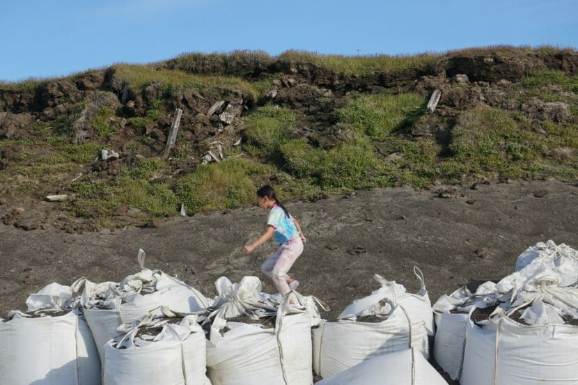
A girl plays on Aug. 2 on the sand-filled SuperSacks lined up at Utqiagvik’s beach. The sacks are used to try to protect the permafrost bluff from ocean waves that speed erosion. The thaw has exposed beams and artifacts from dwellings used in Utqiagvik’s past. (Photo by Yereth Rosen/Alaska Beacon)
In the past, Utiqagvik has been able to do a little mix of “managed retreat,” moving some buildings and property away from the disappearing shoreline. But the region is fairly flat, and those options are largely exhausted.
“Now they are at a place where the important infrastructure is right up next to the edge. Their water supply and sewage lagoon are right up against the edge,” Sexauer said. The revetment project is seen as the most practical long-term solution, and Utqiagvik’s position as a service and business hub gives all North Slope communities a stake in it.
“If Utqiagvik suddenly had a catastrophic issue, that would have an effect on the other communities in the area,” Sexauer said.
The full cost of the revetment project is yet to be determined. The 2022 Disaster Relief Supplemental Appropriations Act included a provision that puts $364.3 million into the project.
The Corps expects to formally seek bids this coming summer for the first phase of the project, the 0.75-mile section right at the central bluff, Sexauer said. A request for bids for the rest of the project is expected about a year later. The full project also incorporated a rebuild of Stevenson Street to raise the elevation of the oft-flooded roadway leading north of town toward Point Barrow.
Site-preparation work for the erosion-control project is expected to start in 2024, Sexauer said.
The revetment design plan is for multiple layers of different material with varying porosity, from industrial fabric to large boulders, to preserve the ground’s cold temperatures, Sexauer said. That type of multilayer technology has proved to be successful, so far, for a much-smaller revetment at the erosion-threatened village of Shishmaref farther south in the Bering Strait region, according to Corps of Engineers’ reports.
It is important that the revetment be more than a simple rock wall, said one expert.
“Even if you build a rock revetment very strong, the permafrost below can degrade,” said Ming Xiao, a Pennsylvania State University civil engineering professor. “You can’t just build on the existing permafrost.”
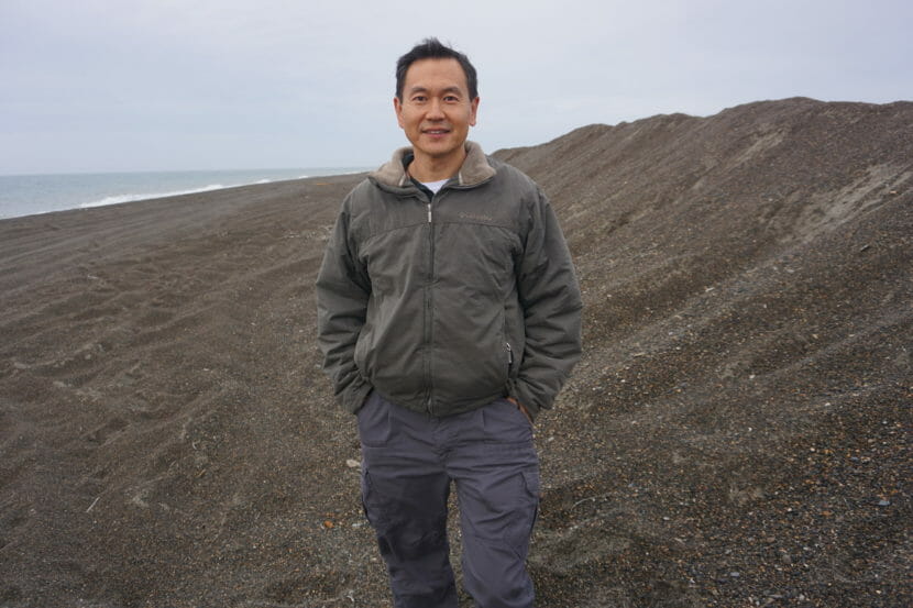
Ming Xiao, an engineering professor at Penn State University, stands on Aug. 3 by a piled-up sand berm used as a makeshift barrier to protect parts of Utqiagvik from storm-driven flooding. Xiao is leading a project that uses a fiber-optic cable to track the minute movements of warming and thawing permafrost. (Photo by Yereth Rosen/Alaska Beacon)
Xiao is leading a project, with collaborators from UAF and Virginia Tech University, that uses a buried fiber-optic cable to measure the minute movements within the soil of Utqiagvik’s warming permafrost. The hope is that the underground vibrations, when correlated with temperature measurements, can forecast conditions in decades to come. “Then we can predict in the future, say 50 years, what the ground temperature is going to be,” he said. And that, in turn, will give information about whether the ground is too weak to support any structures atop it, he said.
The Supersacks are certainly not up to the erosion-control task, Xiao said. For one thing, he said, they are made of material that degrades when exposed to the sun’s ultraviolet light, something that is unrelenting in summer. For another, the sacks can be punctured in rough weather, “and the wave is going to pick up the Supersasck and put it into the ocean,” he said.
Below-ground threats to pipelines and cellars
Beyond the eroding shoreline, a less-visible thaw problem lies beneath the surface: threats to underground pipes for water and utilities.
About a third of Utqiagvik’s water, wastewater and electrical lines run through a protected, temperature-controlled tunnel called the “Utilidor.” Built in the oil-money heyday of the 1980s, the Utilidor was too expensive to extend beyond its initial 3 miles. That leaves most of the rest of the system with underground piping, and thaw risks lurk even 12 feet below the ground’s surface.
That danger materialized in a different North Slope community in the spring of 2021. In Point Lay, 180 miles southwest of Utqiagvik, a sudden thaw collapse in the permafrost severed a main water line, temporarily cutting off flow of water to the village clinic and to several houses. It was a particularly ill-timed event, as it came during the COVID-19 pandemic, when clean water became a critical need.
Protected as it is, the Utilidor is not impenetrable. Storms in 2015 and 2017 came close to sending water flooding into it, according to the Corps of Engineers. With waves breaking up the seasonally maintained beach berms, seawater also came close to contaminating the freshwater lagoon, the Corps reported. In October, Utqiagvik was slammed by a storm that, though not as serious as the 2015 and 2017 events, pushed saltwater from the sea again over barriers to flood Stevenson Street and enter the lower lagoon; one more breach and seawater would have hit the city’s upper-lagoon drinking water supply.
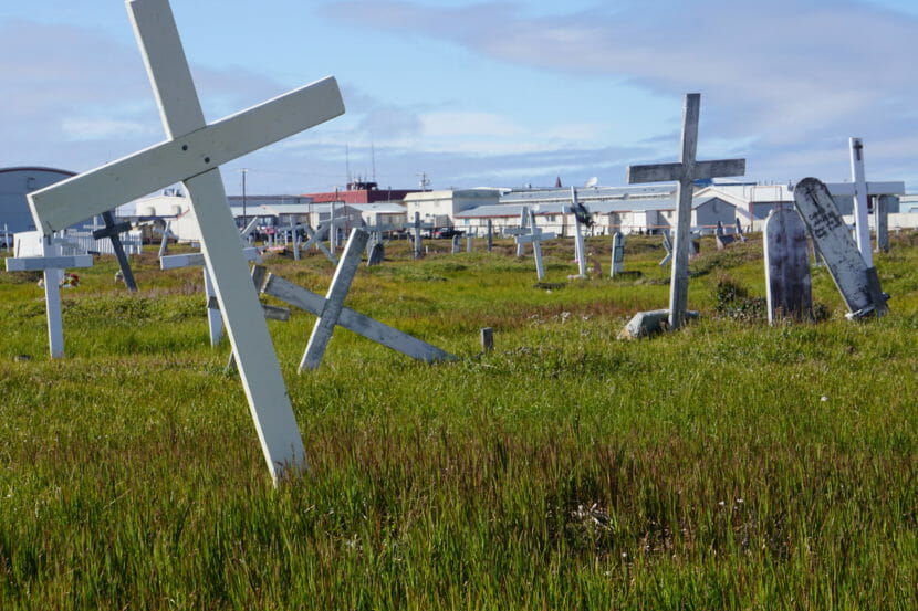
Grave markers in Utqiagvik’s cemetery, seen on Aug. 6, are tilted, a sign of thaw in the ground below. Permafrost thaw impacts extend to the dead. (Photo by Yereth Rosen/Alaska Beacon)
Permafrost thaw, in combination with storm flooding, is encroaching on some cultural practices, too.
Many of the community’s traditional Inupiat permafrost cellars, known as sigluaqs, have been damaged by flooding or other incursions.
That happened in 2015 to the sigluaq maintained by Fogg-Leavitt’s family. While there was no pooled water in it, the temperatures rose high enough to thaw the meat. It remained edible, she said, but the taste was compromised; the blood ran out during the thaw, meaning it was impossible to create the traditional fermented product.
The thaw threats have prompted some changes in practices, she said. “Some younger crews are using walk-in freezers exclusively,” she said. But others are passionate about keeping their sigluaqs intact and functional. To that end, ICAS is experimenting this winter with technology: installation of thermosyphons, devices that pull heat out of the ground passively. Only a few cellars are to be included in the first phase of the project, but it could be expanded in the future, she said.
“This is what we’re going to do to sustain our culture,” Fogg-Leavitt said. “We’ll see if it works.”
Gravesites and archaeological resources at risk
Thaw effects extend even to the dead.
That is seen at the modern cemetery, where grave markers have tilted as the ground below warmed. It is also seen at the central bluff in town, where remnants of historic homes made of sod and driftwood are crumbling away, and at more remote sites, to more remote coastal area, where sometimes-ancient artifacts and even gravesites are being lost.
Archaeologist Anne Jensen stands next to a display at the Barrow Arctic Research Center that explains her work rescuing eroding cultural sites in and around Utqiagvik. (Photo by Yereth Rosen/Alaska Beacon)
Rescuing those sites has been the mission of archaeologist Anne Jensen. Now with Bryn Mawr College, Jensen lived for decades in Utqiagvik and previously worked for the Ukpeaġvik Iñupiat Corp.’s science department.
When the 800-year-old remains of a young girl were uncovered by erosion in 1994, Jensen was on the case; the girl was determined to have been a victim of starvation and numerous chronic diseases. She was named Anaiyaaq, meaning “young girl,” and her body was reburied.
When accelerating erosion was exposing gravesites at Nuvuk, an ancient settlement at Point Barrow, Jensen was also at work to rescue remains; the sites were from a cemetery area with use stretching back about 1,000 years. She has done other work at a well-known archaeological site about 18 miles down the Chukchi Sea coast called Walakpa, which was thought to be stable until about a decade ago, when a fall storm began carving off the once-frozen bluff.
The vulnerable archaeological sites are not just about culture, Jensen said. “Sites are not just culture. They are a frozen tissue archive. Everything in it is preserved.” That includes ancient DNA in both tissues and sediments, stable isotopes and other pieces of information that can be used to reconstruct past conditions, she said.
The places where Jensen has worked represent only a small fraction of the archaeological and cultural sites packed along the coastlines at Utqiagvik and elsewhere on the North Slope. Several have already been lost, such as the 100-year-old Esook Trading Post that was swallowed by the Beaufort Sea in the early 2000s. Many more are likely to wash away before anyone knows what they held, Jensen said.
“There’s not enough money on the planet. It’s either excavate them or write them off,” she said.
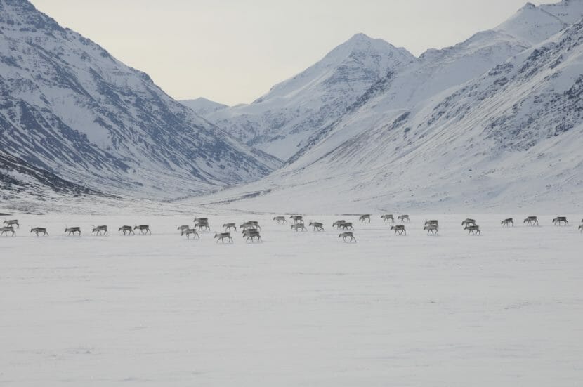
Caribou cross through Gates of the Arctic National Park and Preserve in their 2012 spring migration. The Western Arctic Caribou Herd, long one of the largest in North America, has declined precipitiously and is now at the lowest size since the early 1980s. The herd’s range includes Gates of the Arctic. (Photo by Zak Richter/National Park Service)
One of the biggest caribou herds in North America has taken a nosedive, and climate change is a likely culprit in the population decline.
Alaska’s Western Arctic Caribou Herd population is lower than at any time in over four decades, with numbers put at 164,000, down from a high of nearly 500,000 in 2003, according to the Alaska Department of Fish and Game.
In a meeting room in a downtown Anchorage hotel earlier this month, representatives of Indigenous villages and other organizations dependent on the caribou spent three days discussing the bad news and how to respond to it.
“Right now, our caribou is very, very critical,” said Vernon Cleveland, chairman of the Western Arctic Caribou Herd Working Group, an advisory panel representing people of the region. The herd went from 188,000 in 2021 to 164,000 in the past year, “and it’s going down. We have to do something about it,” he said.
For a short-term response, the working group, which advises policy makers on wildlife management, agreed on recommendations for new cuts in hunting limits, which had already been reduced. There should be more avoidance of cows, as adult female survival was shown to be on an especially bad trend, the group also concluded. Additionally, members of the working group urged better reporting from villages of their hunting experiences and successes. For now, it is estimated that only about a tenth of the region’s hunts are reported to Fish and Game, said Alex Hansen, the department’s Kotzebue-based regional biologist.
But neither hunting nor predation by bears or wolves is implicated in the long-term decline. Instead, several signs point to climate change as having a big effect on the herd.
There is a continued pattern of later fall migration, as recorded by biologists. At the Kobuk River, a key landmark in Gates of the Arctic National Park that the caribou pass in their annual southward trek, the first crossings are about a month later in the year than they were just a decade ago, according to biologists’ information.
“Back in the day, we had animals crossing over in late August,” Kyle Joly, a National Park Service biologist who studies the herd, told the working group. In contrast, in 2020 the first crossing was in early November, the earliest in the record going back to 2010,
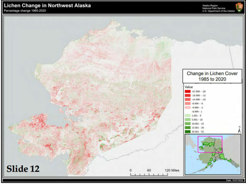
Another possible factor is the change to vegetation on which caribou depend. As the climate warms, woody plants are growing farther north, displacing many of the tundra plants that caribou eat. New research that is underway has shown a transformation in part of the western Arctic herd’s range since 1985. The changes are particularly drastic on the Seward Peninsula, in the more southern area of the herd’s range, according to preliminary results of the research, being led by Fairbanks scientist Matthew Macander, who has done similar research in other parts of Alaska.
A map shows the changes in lichen cover in northwest Alaska from 1985 to 2020. The darkest red areas have lost the most lichen coverage, and the Seward Peninsula is notable for such losses. Green areas show increased lichen cover. The map, from research led by Fairbanks scientist Matthew Macander, were presented at the 2022 annual meeting of the Western Arctic Caribou Herd Working Group. (Graph provided by National Park Service)
“Basically, you’re going from great to not-very-good caribou habitat,” Joly told the working group.
Macander’s preliminary findings are consistent with Seward Peninsula residents’ reports of scarce caribou sightings in their region. And they are consistent with data produced by radio tracking of caribou. Of the 33 caribou fitted with radio collars during the fall 2021 migration, none spent the following winter in the Seward Peninsula’s Bering Land Bridge National Monument, according to information presented by Joly to the working group.
Caribou and reindeer herds shrinking across the cirumpolar north
Caribou populations are famously volatile, so the Western Arctic herd’s losses could be reversed in the future. Still, around the north, most caribou and wild reindeer populations are on the decline, and many key populations have crashed.
Only two of the 23 herds monitored in an international network – the Porcupine herd that straddles northeastern Alaska and northwestern Canada and the Lena-Olynek herd in Siberia — were at historic highs, according to the 2018 Arctic Report Card issued by the National Oceanic and Atmospheric Administration. Globally, populations declined by about 40% over three generations, according to scientists with the CircumArctic Rangifer Monitoring and Assessment Network. Some of the most stunning declines have been in Arctic Canada, where the George River herd fell from over 800,000 in the 1990s to about 8,000 now and the Bathurst herd fell from 470,000 in the mid-1980s to 6,240 in 2021.
A litany of climate-change impacts are affecting migration of caribou and wild reindeer, according to a recent study led by Joly. They include changes in snow and ice, along with the vegetation transformations being seen in places like the Seward Peninsula. Other impacts of warming are increased rain-on-snow events, which cause hardships for all tundra grazers, and increase in disease-carrying parasites. Permafrost thaw that leads to abrupt changes in lakes, with some draining and others forming, has mixed impacts on caribou migration, according to the study.
Caribou and reindeer around the north are also affected by human development, which fragments habitat, Joly’s research said.
Even for the Western Arctic herd, which has a largely intact habitat, development has made a mark.
The major site of development in the caribou range is northwest Alaska’s Red Dog Mine, one of the world’s biggest producers of zinc. Years of research have found that migrating caribou are affected by the 53-mile road that connects the inland mine with its Chukchi Sea port used to export ore.
For reasons that have yet to be fully understood, a large percentage of migrating caribou refuse to cross the road, altering their migration patterns to avoid it.
The latest piece of evidence of that behavior comes from the past year’s radio tracking. Of the 33 animals collared in the fall of 2021, 10 wound up roaming the area near the Red Dog road. Two of those crossed the road and survived for the full year afterward. Of the eight that did not cross, only five survived for the full year after. It is a tiny sample size, Joly told the working group, but hints at something important. “Sixty-two-and-a-half percent versus 100 percent survival, it’s potentially a big deal.”
Dust deposited by ore-hauling trucks could be affecting caribou and other wildlife, scientists have said.
A newly published study found that tundra plants on either side of the road were thinned out by years of dust deposits. Particles of zinc, lead, cadmium and metal sulfides reduced plant quantity and diversity up to a kilometer away from the road, according to the National Park Service-led study, published in June in the journal PLOS One.
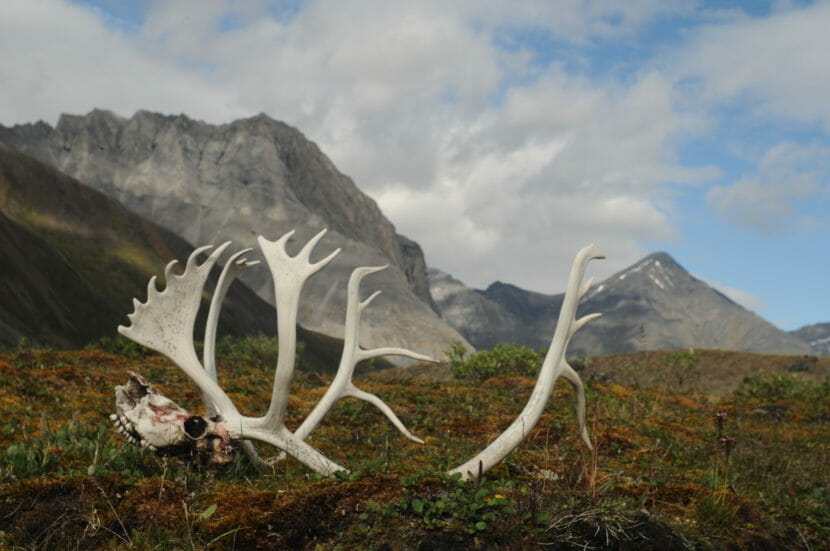
Antlers and a skull from a dead caribou are seen on Aug. 1, 2014 on the ground in the Oolah Valley of Gates of the Arctic National Park and Preserve. (Photo by Cadence Cook/National Park Service)
In recent years, the mine’s operator, Teck Resources Ltd., has taken steps to reduce dust from truck traffic along the road. But even with those improvements in dust management, the tundra plants grow so slowly the damage will take a long time to repair, the Park Service-led study said. “Due to the slow growth rates of these nonvascular plants … it is likely that long-term recovery would take many decades after contaminants decrease additionally following mine closure or more intensive fugitive dust control,” the study concluded.
Existing road impacts cited in arguments against Ambler road project
The experience with the Red Dog road contributes to wariness in the region about another mining-related development: the proposed 211-mile road that would cut through the Brooks Range foothills to the isolated Ambler Mining District in northwestern Alaska. The project, which is proposed by the Alaska Industrial Development and Export Authority, is seen as crucial in enabling development of large copper mines.
So does experience with the Dalton Highway, the now-public highway that was originally built as an industrial-use-only supply route along the Trans Alaska Pipeline corridor to the Prudhoe Bay oil field. It was opened to full public access in 1994.
The Ambler project is controversial because of its potential impacts on caribou and other resources. It has been the subject of lawsuits that prompted the Biden administration to reconsider an approval granted in 2020 by the Trump administration. Numerous tribal governments along the proposed route of the Ambler road have passed resolutions in opposition to it.
At the annual working group meeting, members also expressed their misgivings.
“If the road opens up, we’re going to have a lot of people up in that area. No fish, no caribou, no animals, just like the Dalton Highway,” said Cleveland, who is from the Inupiat village of Noorvik. The development represents a threat to traditional Indigenous lifestyles, he said. “We live off the land. We live off tuttu,” he said, using the Inupiaq word for caribou. “We live off caribou, moose, geese, beaver.”
Tom Gray, a working group member from Nome, asked U.S. Bureau of Land Management officials attending the meeting to consider rejecting the current road proposal.
“If this road goes in place, our way of life is going to change,” Gray said. “If it’s hard for our culture and our caribou, you could turn the switch off and say, too bad, figure another way.”