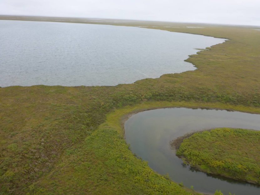
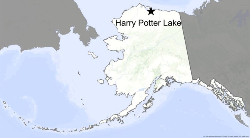
Harry Potter Lake, at the top of this drone photo, after most of its water drained into a nearby creek on Alaska’s North Slope in early July 2022. (Photo by Allen Bondurant)
“Lakes seem, on the scale of years or of human life spans, permanent features of landscapes, but they are geologically transitory, usually born of catastrophes, to mature and die quietly.” — George Evelyn Hutchinson, “A Treatise on Limnology,” 1957.
Harry Potter Lake did not die quietly. Water in the basin on Alaska’s North Slope cut through a 30-foot strip of tundra in early July 2022. The lake then roared into a creek. The creek swelled like a python for a day, robbing Harry Potter Lake of the majority of its water.
Scientists know this because they were watching the lake with game cameras and satellite images.
Chris Arp of the University of Alaska Fairbanks Water and Environmental Research Center named Harry Potter Lake because his daughter was enjoying the book series when he first encountered the lake. It also somewhat resembled a wizard’s hat when seen from above.
Arp and other scientists were monitoring the lake because it’s in an area oil companies are considering for development. The lake was large enough that while standing on one side of the water-filled oval in that flat, buggy landscape, you could not see the far shore.
Harry Potter Lake, at the top of this photo, as it looked four years ago, perched 10 feet above and 30 feet away from the creek that in 2022 received most of its water. (Photo by Chris Arp)
During field work four years ago, Arp noticed that the lake basin was perched 10 feet above the creek level. If gravity had its way, lake water would some day make it into the creek.
Arp noticed a trickle of water between the lake and the river in summer 2021. When he returned this summer, the water was doing its thing.
“By late June that water had begun to cut a major niche, which increased the flow and caused it to erode even faster,” Arp said from Deadhorse after returning from the lake basin in mid-August. “We realized then it was going to go soon.”
Judy Kayaak Creek — the nearby stream that received all that water — flows into larger drainages that empty into the Arctic Ocean northwest of the village of Nuiqsut.
On July 7, 2022, the erosive power of the water cut a new channel, sending a torrent of lake water flooding into the creek.
Judy Kayaak Creek pirated almost the entire volume of Harry Potter Lake in about 24 hours. The creek raged with 100 times its normal volume during the peak flow.
“It was probably strong north winds in early July that ultimately pushed enough water over that outlet to trigger the failure,” Arp said.
Alaska’s treeless North Slope is peppered with lakes that have formed because of surface water that thaws frozen ground. Those lakes have emptied themselves for at least 10,000 years or so, leaving behind scars on the landscape and fertile places for new plants.
Drained lake basins make up more than half of the Arctic coastal plain, the part of the Alaska map that most resembles Swiss cheese.
The disappearance of Harry Potter Lake is “kind of a tree falling in the forest type of thing,” according to Arp. Rarely do people get to see it.
Meteorologists at the National Weather Service warned the residents of the village of Nuiqsut, who might have fish camps along the creek, to be watchful for the sudden pulse of water (which did no reported damage).
Other living things have noticed the absence of Harry Potter Lake. Arp flew over the basin one last time on Aug. 15. He noticed it was full of ducks, shorebirds and other waterbirds attracted for some reason to the ponded, muddy lake bed.
“It was kind of amazing how fast they moved in,” he said.
A truck makes its way south on the Dalton Highway near Coldfoot, Alaska. (Photo by Rashah McChesney/Alaska’s Energy Desk)
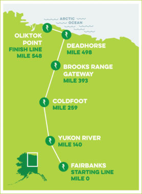
Ten electric vehicles set out Friday from Fairbanks on a thousand-mile journey up the Dalton Highway and back. The Arctic Road Rally is intended to demonstrate the ability of electric vehicles to operate in the far north.
Organizers say the rally also will showcase EV technology and promote efforts to enable the vehicles to drive anywhere on the state’s road system.
“With this event, we’re showing that it’s possible to electrify even the most remote parts of Alaska very quickly and cost-effectively,” says Dimitri Shein, the executive director of the Alaska Electric Vehicle Association. AKEVA is one of the main supporters of the rally, along with Launch Alaska, an Anchorage-based startup-business accelerator.
Shein, one of the organizers of the rally, says he’ll be one of those traversing the remote stretch of the Dalton between Fairbanks and Oliktok Point — the farthest-north point in North America accessible by road.
“I’ll be driving my wife’s Tesla, and I hope she forgives me for driving her car down this stretch of road,” he said.
The 2022 Arctic Road Rally course and charging station locations. (Alaska Electric Vehicle Association)
The federal Department of Energy also is supporting the event, along with the Alaska Energy Authority, Sandia National Laboratories and the Center for Technology and the Environment, a Georgia-based nonprofit that promotes electrifying the nation’s transportation system.
The state Department of Transportation is providing power for an electric-vehicle fast charger at the Yukon River crossing, the first of four charging stations on the route. The others are at Coldfoot Camp, Trans-Alaska Pipeline Pump Station 4 and Deadhorse.
“This will the most advanced charging network and highway in Alaska,” he said in a recent interview.
Shein says the arrangement is only temporary, but he says the infrastructure that’ll be built-out at the four sites will remain after the rally ends. He says that would enable charging stations to be permanently set up those locations, once the state gets around to the Dalton as part of its plan to enable EVs to travel throughout the road system.
“We’re pro-charging anywhere in Alaska,” he said. “So, I mean, that would be a great outcome.”
That’s one of the objectives of the rally, says Tim Leach, who heads up Launch Alaska’s transportation program.
“We’re interested in increasing the awareness and adoption of electric vehicles here in the state of Alaska,” he said. “We want to make sure that electric vehicle savings and emissions benefits are accessible to all folks who are interested in electric vehicles.”
Leach says the rally will bring together manufacturers of EVs and charging-station suppliers, and startups that will use the lessons learned from the rally to understand how to make more EVs and the facilities needed to power them available to Alaskans, wherever they live in the state.
“Some of this technology demonstration that we’re undertaking here at the Arctic Road Rally will help us identify what technology solutions are suitable both on the vehicle and the charging side for some of these communities that have different sets of infrastructure,” he said.
Electric vehicle owner and advocate Phil Wight says he hopes the rally also will help Alaskan’s understand the benefits of converting to an electric vehicle.
“The electrification of transportation can save Alaskans ultimately billions of dollars,” he said.
Wight is an assistant professor of history and Arctic and Northern Studies at the University of Alaska Fairbanks, and he’s a policy analyst with the Alaska Public Interest Research Group. He says wasn’t able to sign up in time to enter his Chevy Bolt in this year’s rally, but hopes to next year.
Wight hopes Alaskans will pay attention to the event because it will demonstrate the billions in savings for would come in the form of keeping money Alaskans keeping the money they pay local utilities for transportation here, instead of the corporate offices of oil companies Outside.
“We spend, I think, one billion dollars every year paying for oil. We do not get a hometown discount for our oil.”
Wight says the other savings come in the form of health benefits that come from breathing cleaner air — an especially important consideration for people who live in the Fairbanks area.
“Local air pollution — right? There is a significant chunk of air pollution which emanates from light- and heavy-duty vehicles,” he said.
The 2022 Arctic Road Rally got under way at 11 a.m. Friday, Aug. 12. The starting line was at the Golden Valley Electric Association’s headquarters on Illinois Street in Fairbanks. The 1,096-mile rally isexpected to wrap up on Tuesday.
Temperatures in Longyearbyen, Norway above the Arctic Circle hit a new record above 70 degrees Fahrenheit in July 2020. The Arctic has warmed nearly four times faster than the planet as a whole since 1979, a new study finds. (Photo by Sean Gallup/Getty Images)
The Arctic is heating up nearly four times faster than the Earth as a whole, according to new research. The findings are a reminder that the people, plants and animals in polar regions are experiencing rapid, and disastrous, climate change.
Scientists previously estimated that the Arctic is heating up about twice as fast as the globe overall. The new study finds that is a significant underestimate of recent warming. In the last 43 years, the region has warmed 3.8 times faster than the planet as a whole, the authors find.
The study focuses on the period between 1979, when reliable satellite measurements of global temperatures began, and 2021.
“The Arctic is more sensitive to global warming than previously thought,” says Mika Rantanen of the Finnish Meteorological Institute, who is one of the authors of the study published in the journal Communications Earth & Environment.
There have been hints in recent years that the Arctic is heating up even more quickly than computer models predicted. Heat waves in the far North have driven wildfires and jaw-dropping ice melt in the circumpolar region that includes Alaska, Arctic Canada, Greenland, Scandinavia and Siberia.
“This will probably be a bit of a surprise, but also kind of extra motivation perhaps,” says Richard Davy, a climate scientist at Nansen Environmental and Remote Sensing Center in Norway, who was not involved in the new study. “Things are moving faster than we could have expected from the model projections.”
There are many reasons why the Arctic is heating up more quickly than other parts of the Earth. Changes in the amount of air pollution coming from Europe and natural multi-decade climate variations likely play a role. But human-caused global warming is the underlying reason that the Arctic, and the planet as a whole, are heating up.
Loss of sea ice is one of the clearest drivers of Arctic warming. The Arctic Circle is mostly ocean, which used to be frozen for most or all of the year. But permanent sea ice is steadily shrinking, and seasonal ice is melting earlier in the year and re-forming later.
That means more open water. But while ice is bright and reflects heat from the sun, water is darker and absorbs it. That heat helps melt more ice, which means more water to trap more heat – the loop feeds on itself, accelerating warming in the Arctic.
“That’s why the temperature trends are the highest [in] those areas where the sea ice has declined most,” explains Rantanen. There are hotspots in the Bering Sea over Northern Europe and Siberia, which are heating up about seven times faster than the global average, the study estimates.
Rapid Arctic warming affects people living far from the Arctic circle. For example, there is evidence that weather patterns are shifting across the U.S. and Europe as sea ice melts, and many marine species migrate between the tropics and the Arctic each year. “What happens in the Arctic doesn’t just stay in the Arctic,” says Davy.
The new research also finds that the advanced computer models that scientists use to understand how the global climate is changing now, and will change in the future, struggle to capture the relative speed of Arctic warming. That suggests that future models may need to be adjusted to better capture the realities of global warming in polar regions, although this study did not tease apart what exactly is missing from current models.
“The paper’s finding that climate models tend to underestimate the warming ratio [between the Arctic and the Earth as a whole] is really interesting,” says Kyle Armour, a climate scientist at the University of Washington who was not involved in the new study.
Previous studies have found that computer models actually do a good job estimating how much the Arctic has heated up, but that they tend to overestimate how much hotter the whole planet is, Armour explains. That means the models’ comparison between Arctic warming and overall warming ends up being incorrect.
“We have more work to do to figure out the source of this model bias,” says Armour. And that work is increasingly important, because world leaders use climate models to understand what the future holds and how to avoid even more catastrophic warming.
Copyright 2022 NPR. To see more, visit https://www.npr.org.
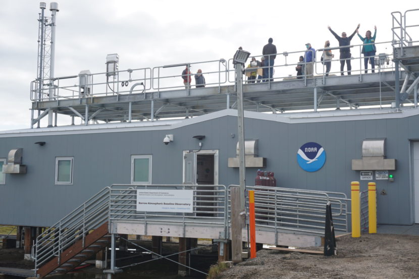
Visitors take in the view on Aug.4 from the roof of the newly upgraded Barrow Atmospheric Baseline Observatory. The roof, with its unobstructed views of usually snow-covered tundra, is the site where technicians can track albedo, the measurement of solar heat reflection. As snow and ice diminish, so does albedo, and more heat is absorbed in the Arctic, feeding into a self-reinforcing warming cycle. (Photo by Yereth Rosen/Alaska Beacon)
For nearly 50 years, the National Oceanic and Atmospheric Administration laboratory on the outskirts of the nation’s northernmost community has tracked a steady rise of carbon dioxide in the atmosphere, the byproduct of fossil-fuel burning that is enveloping the Earth and trapping its heat.
Now the NOAA Barrow Atmospheric Baseline Observatory has a new, expanded, state-of-the art facility, with space for more research and experimentation and — finally — some creature comforts like flush toilets. Though the 2,730-square-foot building was completed in late 2020, NOAA hosted an official opening ceremony Friday, an event postponed by the COVID-19 pandemic.
While expansion to new and improved space that allows more science work to be conducted is good news, what is happening in the air it measures is less happy.
Now carbon dioxide levels here, as measured in parts per million, veer between the high 300s and close to 430, varying by season with the cycles of summer tundra plant growth and winter dormancy. Those seasonal changes shift the tundra landscape from being a temporary carbon sink to being a temporary carbon source.
That compares to conditions in 1973, when the Barrow observatory was just a rustic 960-square-foot structure and when carbon dioxide levels in the air ranged between about 325 and 336 parts per million, varying by season.
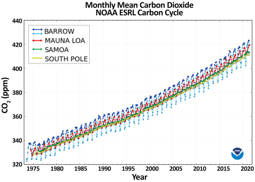
Carbon dioxide levels measured at NOAA’s four observatories have risen steadily since the 1970s. Readings at the Barrow Atmospheric Baseline Observatory at Utqiagvik show the widest seasonal variations, the product of tundra plant growth and dormancy. (Graph provided by NOAA)
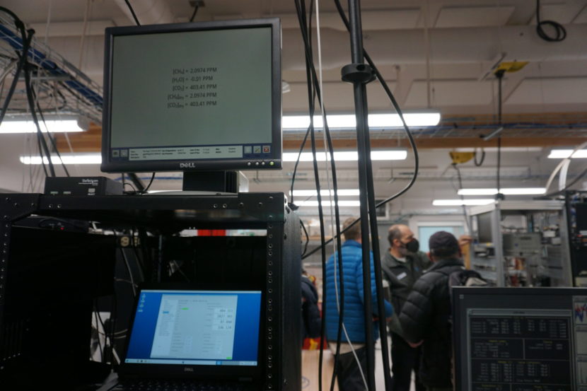
Even on that early August day with sunny skies and green plants on the tundra still photosynthesizing and thus absorbing carbon from the air, the atmospheric CO2 levels at this Arctic location measured 402.57 parts per million.
“We’re over 400 and it’s not going back,” said Bryan Thomas, the station chief at the observatory. He remembers when 400 parts per million — a level first hit in 2012 — was considered the threshold that might shock people into climate action. Readings well above 400 have now become routine.
“When I stop and think about it, it makes me sad. We could have done more sooner. But now is a better time than never,” he said.
The Barrow Atmospheric Baseline Observatory is one of four such NOAA remote baseline observatories that measure the global atmosphere from the Arctic to the Antarctic. The three others are at Mauna Loa in Hawaii, in American Samoa and at the South Pole.
Last year, the global average for atmospheric carbon as measured by all four observatories set a record for the annual average, 414 parts per million. That compares to about 280 parts per million prior to the Industrial Age, according to NOAA.
“It keeps going up,” said Brian Vasel, director of operations at NOAA’s Global Monitoring Laboratory in Boulder, Colorado, who was in Utqiagvik for the opening celebration.
As station manager Bryan Thomas talks to visitors, a screen shows the carbon dioxide levels of 402.57 parts per million measured on Aug. 4 in the air outside the Barrow Atmospheric Baseline Observatory. (Photo by Yereth Rosen/Alaska Beacon)
Gases, particulates, solar reflection and permafrost are monitored
Much more than carbon dioxide gets monitored at the Barrow observatory and at its three sister observatories. There are constant readings for methane and water vapor, which are also greenhouse gases.
For the Barrow observatory, an important task is measuring particulates in the air, like black carbon and similar brown carbon, varieties of soot that darken snow and ice and reduce their ability to reflect solar heat. Dark colors absorb solar heat, and darker snow and ice melts more quickly. From the rooftop, NOAA technicians measure the degree to which the white landscape reflects the sun rather than absorbs it, a phenomenon called albedo.
The more expansive space at the new Barrow lab accommodates equipment to track permafrost temperatures and the movements within permafrost that are enabled by warming. And air sampling is enhanced by a new sensor-equipped tower outside the building that is 100 feet high, replacing the old 60-foot tower.
The observatories also measure chlorofluorocarbons, chemicals that eat away at the high-stratospheric ozone layer that protects the Earth and its inhabitants against solar radiation. A treaty signed in 1987, the Montreal Protocol, phased out and ultimately banned the ozone-depleting chemicals, and readings at the Barrow observatory and elsewhere tracked their decrease in the following years. But progress has not always been smooth.
The Alaska site caught a disturbing trend that started in about 2013. The level of a chlorofluorocarbon known as CFC-11 in the atmosphere unexpectedly slowed what had been a steep and steady decline that started with the treaty. That pointed to loopholes or outright violations of the Montreal Protocol.
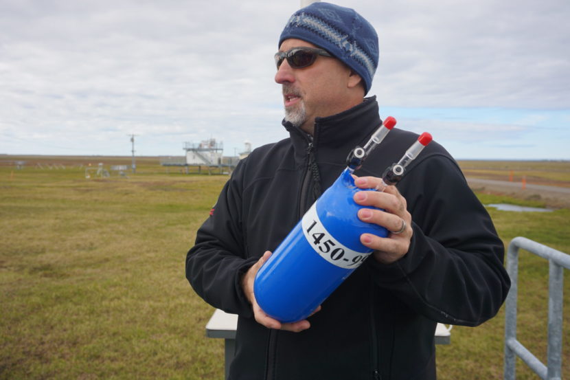
Brian Vasel, director of operations at NOAA’s Global Monitoring Laboratory, holds a flask of the type that is used to ship air samples between the Barrow Atmospheric Baseline Observatory and the organization’s main lab in Boulder, Colorado. Behind Vasel, at the Barrow site on Aug. 4, is a neighboring environmental lab operated by the U.S. Department of Energy. (Photo by Yereth Rosen/Alaska Beacon)
The Barrow observatory was the first of the four to record the flattening trend that was later picked up worldwide. That wave-like pattern helped scientists pinpoint the source of the CFCs: east Asia. Corrective actions followed, and by 2018 CFC levels were back on their expected rate of decline.
“If we hadn’t been able to monitor that, we wouldn’t have been able to recover and get back on the trajectory,” Thomas said.
Aside from sampling on premises, the Barrow observatory sends samples to NOAA’s laboratory in Boulder, and the Boulder laboratory sends sealed air samples by barge to be used as controls. The Barrow observatory samples analyzed in Boulder are part of a worldwide system that ships to the site. “We are the world’s center for measuring CO2,” Vasel said.
High-latitude location in fast-warming Arctic is critical
The location of the Barrow Atmospheric Baseline Observatory is deliberate.
It lies about five miles north of the main part of Utqiagvik, on a strip of tundra between the Chukchi Sea and Elson Lagoon, far away from any significant development in existence or likely to happen in the future. Prevailing winds that come over the ocean from the west make the air there some of the purest on Earth and best for sampling and for giving a picture of how conditions at that high latitude affect the rest of the planet. Its Arctic location is critical, as the Arctic is warming at four times the global rate, according to the most recent calculations.
“We appreciate that we’re a very small part of the Arctic. But we have to pay attention to the whole Arctic and the whole world,” Thomas said.
As for the North Slope oil fields to the east, they are generally too far away to skew the readings, Thomas said. There are occasional shifts in wind that bring in dust and potentially other materials from Utqiagvik in the south, he said, but NOAA staffers know when that happens and adjust accordingly.
A new 100-foot tower equipped with a variety of sensors to record weather and atmospheric conditions rises from the tundra at the Barrow Atmospheric Baseline Observatory. The tower, seen on Aug. 4, replaces a smaller version used for decades. Next to it is one of the round satellite downlinks. (Photo by Yereth Rosen/Alaska Beacon)
One factor that is affecting the carbon dioxide readings is the greening of the tundra. Of the four key NOAA observatories, the Barrow observatory has the biggest seasonal swings, and those are getting wider as tundra vegetation becomes more plentiful.
More plant growth means more photosynthesis and more carbon absorption in the sunny summer, but it also means more release of carbon into the atmosphere from plants that decay or die as winter darkness arrives. Warmer permafrost has an effect, too, allowing long-trapped carbon gases to stream up from the ground. There is growing scientific evidence that the release of carbon in the winter is outstripping the seasonal carbon absorption in the summer. A landmark 2019 study found that the warmer winters have already turned the world’s northern permafrost regions from being a net carbon sink into a new carbon source.
A more recent study, led by Donatella Zona of San Diego State University, presents a pessimistic outlook for the ability of tundra plants, like the lichen and sedges outside the Barrow Atmospheric Baseline Observatory, to work harder through absorbing carbon dioxide in the summer.
There is no major development near NOAA’s Barrow Atmospheric Baseline Observatory, but on the distant horizon, seen here on Aug. 4, are camps used by Utqiagvik residents for gathering of traditional wild foods. Beyond the cabin and campsites is the Chukchi Sea. (Photo by Yereth Rosen/Alaska Beacon)
While there are more plants growing on the ground and they are emerging and photosynthesizing earlier, they are also losing their ability to photosynthesize and grow later in the summer, indicating that the growing season is not really longer but only shifting in time, according to the study.
Zona likened the plants’ energy to human energy. “When you wake up earlier in the morning, you are tired earlier in the evening,” she said in an online presentation to a science conference held last week in Utqiagvik to mark the 75th anniversary of the Naval Arctic Research Laboratory established north of town.
The impetus for the study, Zona said, was a puzzling finding about the “breathing” of the tundra – the lack of any significant increase in carbon uptake that would be expected to be tied to earlier snowmelt and earlier plant emergence. But there has been a marked increase in carbon respiration from the tundra, she said.
Something that is not contributing to local carbon emissions in any significant way is the new observatory laboratory itself. It was designed and built by UIC Nappairit LLC, a unit of the Native-owned Ukpeaġvik Iñupiat Corporation, as a LEED-certified building. The certification comes from the U.S. Green Building Council and is a widely used ranking system for structures with minimal carbon footprints and other environmental impacts.
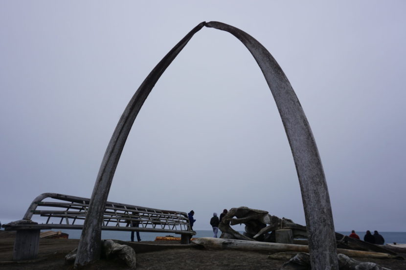
Scientists attending a conference marking the 75th anniversary of the Naval Arctic Research Laboratory walk on the beach at Utqiagvik’s iconic whalebone arch during an Aug. 2 tour of the city. (Photo by Yereth Rosen/Alaska Beacon)
In the nation’s northernmost community, about 100 scientists, engineers and other Arctic experts are gathered this week to celebrate a cutting-edge research program that started in the 1940s.
The event in Utqiaġvik, also known by its former name of Barrow, is a conference marking the 75th anniversary of the Naval Arctic Research Laboratory, or NARL. The institution was originally created to support oil and gas exploration on the North Slope, but in short order became a world-class center for Arctic science.
Beyond establishing Utqiaġvik as an Arctic research heavyweight, NARL has another legacy: respect for Indigenous knowledge and partnership, a characteristic missing in much of the scientific world.
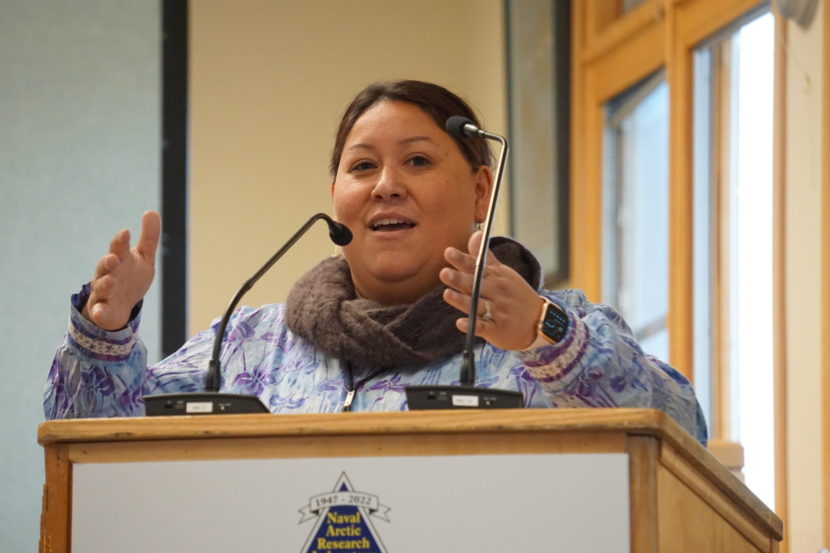
“The NARL facility has been a huge part of our North Slope Iñupiat community for 75 years,” said Pearl Brower, president of the Ukpeaġvik Iñupiat, or UIC, the local Native corporation. It is a mutually beneficial relationship, she said in a welcoming address.
“Indigenous people are the first ecologists, the first scientists of our lands. When we entwine generations with firsthand knowledge of place with western scientific models, we are stronger and more informed,” she said.
Pearl Brower, president of the Ukpeaġvik Iñupiat Corporation, speaks to visiting scientists at an Aug. 1 welcoming event kicking off a week-long conference marking the 75th anniversary of the Naval Arctic Research Laboratory. (Photo by Yereth Rosen/Alaska Beacon)
Brower calls herself a third-generation NARL associate. Her grandfather, Harry Brower Sr., worked as both a carpenter and a local science adviser at the facility, and her father, Price Brower, contributed with a similar combination of facility support and science advice. Brower remembers being a little girl hanging around the NARL cafeteria, wandering the buildings and looking at the animal samples, mostly fetuses of marine mammals like seals, that were preserved in jars. “It was a little bit morbid, but it was so cool to see,” said Brower, who was president of Iḷisaġvik College, a tribal college in Utqiaġvik, prior to her appointment this spring as UIC president and chief executive officer.
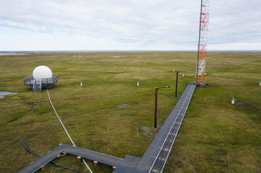
Officially, NARL no longer exists as a formal entity – even though the site, about five miles north of the town’s center, continues to be called “NARL” by locals. The Naval operation officially disbanded about 40 years ago, and it has spun off into a collection of modern research and academic institutions. UIC owns the property and buildings, and its science department operates the modern Barrow Arctic Research Center in the general NARL area. UIC rents space to Iḷisaġvik College, which operates on the grounds. Other facilities in the general area include the National Oceanic and Atmospheric Administration’s Barrow Observatory, which has measured atmospheric carbon for nearly 50 years, and U.S. Geological and U.S. Department of Energy research sites. Structures range from old Quonset huts to gleaming modern lab buildings to high-tech towers and domes supporting atmospheric testing equipment.
The long-term nature of work at the NARL site is appropriate, because knowing the Arctic is a long-term commitment, local leaders told visiting scientists attending the anniversary conference.
“The lessons that we learned growing up make us the experts in the Arctic that we are today,” Nagruk Harcharek, UIC vice president of Arctic development, said in a Tuesday session. “Remember that there is a database of knowledge stored in the minds of the people in the villages in which you operate.”
The partnership produced some tangible results. Some of the earliest published research papers resulting from NARL research, for example, credited a local Indigenous partner as a formal co-author. Simon Paneak, a North Slope cultural leader, is listed as co-author of papers on bird migrations, general ecology of the region and ptarmigans.
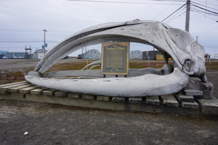
A bowhead whale skull, seen on Aug. 3, is displayed at the entrance of Iḷisaġvik College in Utqiaġvik. The tribal college is located on grounds previously occupied by the Naval Arctic Research Laboratory. Iḷisaġvik College is one of several academic and research instiutions now operating at the site about 5 miles north of downtown Utqiagvik. NARL helped lay the groundwork for the various science-focused organizations now operating at the site. (Photo by Yereth Rosen/Alaska Beacon)
Decades later, other science organizations and projects have now concluded that they need to create similar partnerships. Some have established programs that strive for what is referred to as “co-production of knowledge.”
One program ties university researchers with Kotzebue residents. Called Ikaaġvik Sikukun, or Ice Bridges, it gives research leadership to the local elders. The National Science Foundation is operating a program called “Navigating the New Arctic” that seeks to incorporate Indigenous science and give Indigenous people more control over research undertaken in their area.
But the need for such relationships and long-term commitments clashes with what Utqiaġvik-raised geologist Richard Glenn called a “built-in defect in the system that funds research. To get that funding, scientists have to compete against each other for grants, which are usually doled out in short-term increments, he said.
“Science in America is cowboy science,” said Glenn, a longtime Iñupiat leader who recently retired from a senior vice president position at the Iñupiat-owned Arctic Slope Regional Corp. Often, he said, a winning project that seems attractive to funders ”is not likely to be the research priority of the community.”
Glenn has been working to bridge that gap, serving as a volunteer bringing together Western scientists and Inupiat experts. Such efforts are part of the “NARL effect,” he said, the mingling and cooperation among different people, “all of whom are focusing on our Arctic environment.”
A lot of NARL and its legacy is the product of chance, Glenn said. It’s chance that even brought the NARL facility to Barrow in the first place.
The genesis was the 1923 action by the administration of U.S. President Warren G. Harding to designate the surrounding region as Naval Petroleum Reserve 4, one in a series of land units set aside as possible sources of energy for the nation’s military forces.
“So they drew this big boundary around the traditional homeland of many, many families and called it the petroleum reserve,” Glenn said.
It wasn’t until the 1940s that the Navy solidified plans for actual oil and gas exploration. The original intent was for an exploration camp to be established at Cape Simpson, a site with natural oil seeps that lies east of Point Barrow along the Beaufort Sea coast, Glenn said. But bad weather there forced a retreat to the Chukchi Side and ultimate settlement near Utqiaġvik, he said.
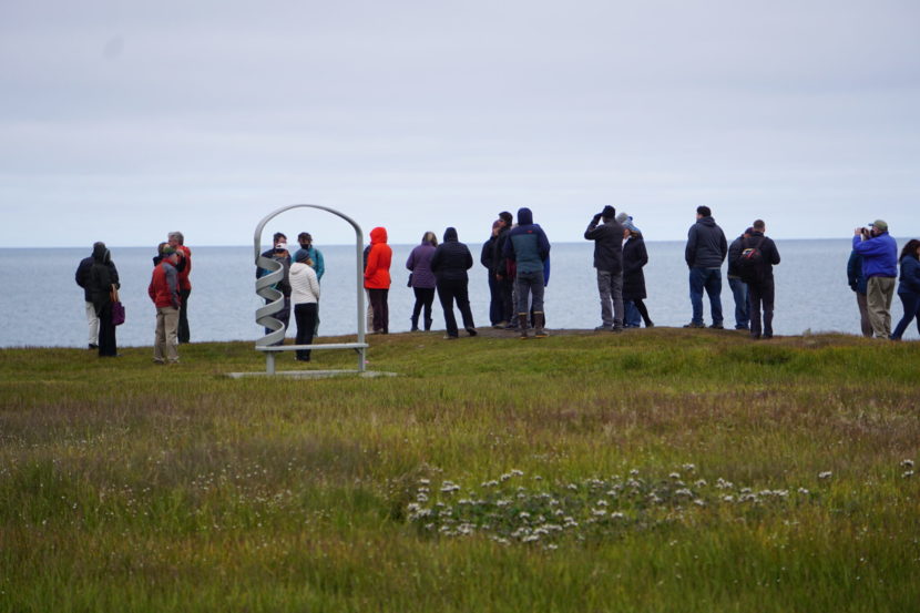
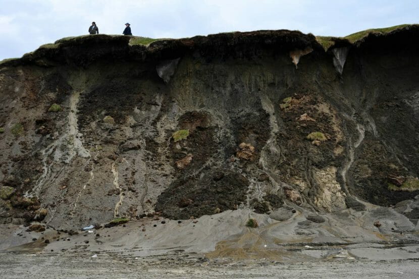
Scientists visiting Utqiagvik for a weeklong conference marking the 75th anniversary ot the Naval Arctic Research Center look out at the Chukchi Sea on Aug. 2 from the top of a coastal bluff that is crumbling because of permafrost thaw. (Photo by Yereth Rosen/Alaska Beacon)
The mission quickly expanded beyond oil and gas exploration.
Study at NARL of freeze-tolerant creatures – research initially done with the idea of finding better ways to prepare Navy aviators for Arctic conditions – led to examination of below-ice gas contents. And that led to a conclusion about a new way to quantify ancient atmospheres by studying gas bubbles trapped in glacier ice.
Since then, analysis of gases in polar ice has become a foundation of research that reconstructs ancient atmospheres and environments. It has also become critical to the study of climate change, which is accentuated in the Arctic and is driving much of the Arctic research.
Climate change, in turn, is driving world events and makes the NARL legacy and the work of its successor organization even more important, said Michael Sfraga, chair of the U.S. Arctic Research Commission and moderator of one of the anniversary event’s opening sessions. The commission advises the president and Congress on Arctic research.
“We are probably gathered at the most consequential time for the Arctic,” Sfraga said.
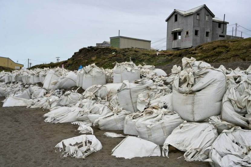
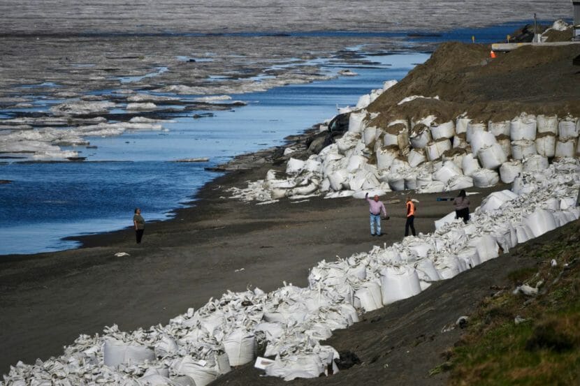
Giant bags along the shoreline in Utqiagvik are intended to buffer against big waves and slow erosion. Construction of a rock revetment is planned (Photo by Marc Lester/ADN)
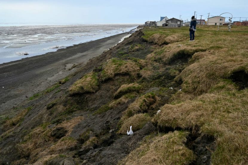
UTQIAĠVIK — Miranda Rexford-Brown walked atop the slowly disappearing sandy bluff between the Arctic Ocean and the house her father built. The late-June wind frazzled her hair as she looked out at the shore-fast ice and the approaching coastline.
“It gets our window wet,” Rexford-Brown said about the ocean. “And then the mist, it sprays our house.”
In Utqiaġvik, where the coast is eroding at some of the fastest rates in the nation, storms, flooding and thawing permafrost damage houses, roads and cultural sites. Ice forms later each year and storms are becoming longer and more severe.
To protect residents — as well as more than $1 billion worth of critical infrastructure, access to subsistence areas and historical resources — the U.S. Army Corps of Engineers is designing a 5-mile-long rock revetment along the coast and raising a road that follows the coast at the city’s northeast. The design for the first 0.75 miles of revetment is nearly complete and going through final internal reviews, said John Budnik, the Corps’ public affairs specialist for the Alaska District. A construction contract will likely be awarded before the end of the calendar year.
North Slope Borough Mayor Harry Brower said that building a seawall will help protect the city from coastal erosion.
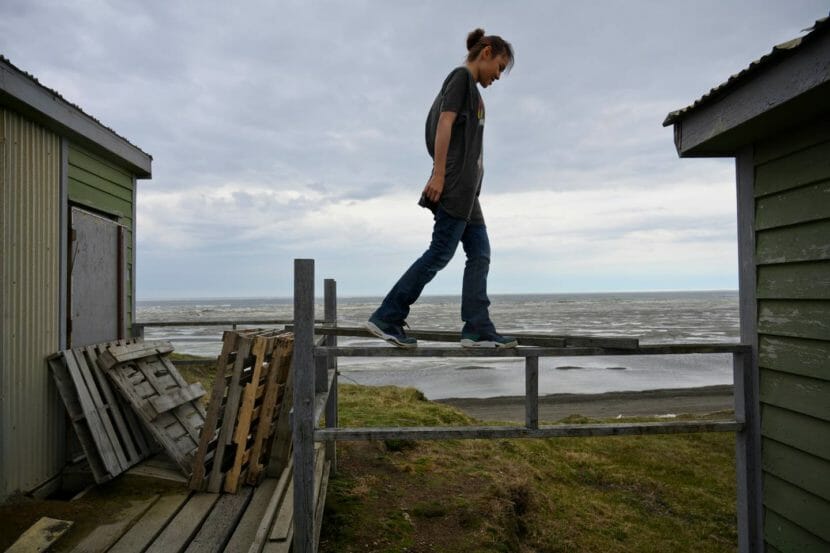
Miranda Brown, 15, daughter of Miranda Rexford-Brown, balances on a railing outside her home near an eroding bluff in Utqiagvik. (Photo by Marc Lester/ADN)North Slope Bororough Mayor Harry Brower speaks with U.S. Sen. Lisa Murkowski about the coastal erosion situation in Utqiagvik on June 26 (Photo by Marc Lester/ADN)
“In a matter of years, we’ve lost a number of ice cellars, sod houses, we had to move homes that were aligned to the bank before,” Brower said, pointing to five houses on top of the bluffs at the south end of town. “All of these homes had to be moved.”
Rexford-Brown’s house was among those moved inland in the 1980s. Back then, the house was occupied by Rexford-Brown’s father, George Leavitt. During one storm, the ocean took out a big chunk of land beneath the house, and Leavitt needed to stay in Rexford-Brown’s apartment.
“Our back bedroom, there was nothing under there. The house was going,” Rexford-Brown said. “Pretty soon people were walking under our house.”
After waiting a few days for the storm to calm down, the borough and city employees came to move the house inland, equipped with a crane, tractor and two wide, flat tow ropes — “the kind (the community) uses to pull up the whale,” Rexford-Brown said. The city offered the family a piece of land near the Fred Ipalook Elementary School, to move their house even further inland, but Leavitt refused to relocate. He built this house from the floor up near the ocean where he could stay close to his family and the water.
“He said, ‘No way, I’m not leaving the beach,’” Rexford-Brown said. “We’ve already been here 60 years already. This is where we live. We were happy at home.”
After several houses on bluffs were moved away from the cliff, they are now located right against the road, which limits the amount of parking space available and leaves no place to relocate them farther inland.
“This is too close,” Rexford-Brown said, looking at her neighbors’ house near the edge of a cliff. “They don’t even got a walkway no more.”
Miranda Rexford-Brown lives in a home atop an eroding bluff in Utqiagvik. Her home, built by her father, as been moved away from the bluff once before, she said. (Photo by Marc Lester/ADN)
Just a few steps in front of Rexford-Brown’s house, she pointed out the slowly sinking ice cellar her neighbors still use to store meat and fish. The land around the cellar has been falling off, exposing its walls, and parts of the bluff seemingly hang above the beach.
The bluffs are not the only place affected by coastal erosion in Utqiaġvik. The storms — which are becoming stronger and more prolonged — also regularly damage Stevenson Street, which runs along the beach and connects the main part of the village to the residential area close to the Naval Arctic Research Laboratory and Iḷisaġvik College. The street can be washed out and “completely cut off everybody who lives out there,” as it almost did during a storm in 2017, said Scott Evans, deputy director of capital improvement program management at the borough.
If the storm waves reach the lagoon area, they could contaminate the only freshwater source in the community, according to the 2019 Barrow Alaska Coastal Erosion Feasibility Study by the Corps. Sewer infrastructure and an old military landfill are also close to the coast, and if they are damaged, engineers said, contaminants could harm people as well as birds and marine animals.
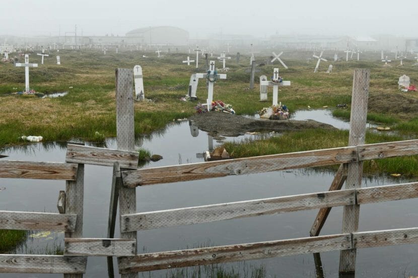
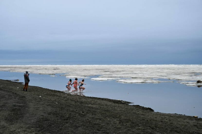
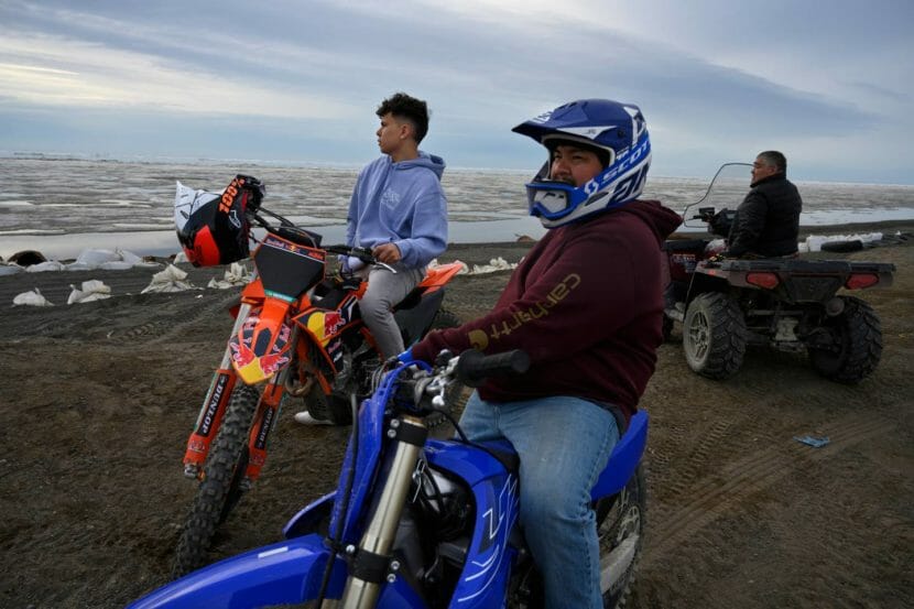
Utqiagvik no longer permits burials in its older cemetery, due in part to erosion and the inability to use heavy equipment. (Photo by Marc Lester/ADN)Visitors from Seward Hannah Ortiz, Samantha Roth and Megan McGrath take a brief dip in the Arctic Ocean from the beach in Utqiagvik on June 24. (Photo by Marc Lester/ADN)Justin Kanayurak, left, and Leroy Adams-Kanayurak ride their dirtbikes in Utqiagvik (Photo by Marc Lester/ADN)
The graveyards inland have been affected by permafrost thaw, and historically important sites along the coast have been washing away, said archaeologist Anne Jensen. Eroding ground in Utqiaġvik holds sod houses, meat cellars and human and animal bones, she said.
“There’s literally everything people used,” she said. “Lots and lots of bones that tell all kinds of information about what people were eating and about those animal populations. … There’s a lot of stuff there, particularly deeper earlier stuff, that hasn’t necessarily been looked at at all.”
Archaeological discoveries suggest that the bluffs, where houses are now facing the cliff, used to be the burial sites, usually placed on higher ground inland — a sign of the coastline eroding for hundreds of years, Jensen said. Until the early 1910s, a larger community was located at Nuvuk, the tip of Point Barrow, before the site was completely abandoned.
A bluff on the southwest end of Utqiagvik shows the ongoing effects of erosion. (Photo by Marc Lester/ADN)
The borough works to minimize the risk of flooding and erosion and yearly bulldozes up beach materials into temporary beach berms, Evans said. Every year the borough spends approximately $8.3 million on emergency response and uses most of the local gravel for obstructing and maintaining the temporary berm along the coastline. They also work to make sure the larger sacks with gravel are at the base of these bluffs to reinforce the shore and stop wave action, Evans said.
Rexford-Brown looked down from the cliff to the shore at the row of white sandbags, placed for protection from the waves.
“They can help for a few days, I guess. But September 26, it’s bad, the waves are big,” Rexford-Brown said. “Sandbags, they are trying to help, and I can see they are. But easily, they can be taken overnight.”
Sen. Lisa Murkowski, at right in orange, talks with North Slope Borough Mayor Harry Brower about the coastal erosion situation in Utqiagvik on June 26, 2022. (Photo by Marc Lester/ADN)
On the beach in Utqiaġvik in late June, Brower spoke to Sen. Lisa Murkowski about how the bluffs had collapsed since her last visit, and why moving forward with the construction of the wall is more urgent than ever.
“We’ve been communicating with Army Corps, we’ve been patiently waiting,” he said.
Over the course of the last decade, Corps engineers have been planning a two-layer rock revetment at the bluff area and the lagoon, stretching from the airport past Browerville and to the Naval Arctic Research Facility. In their design, they have been taking into account the behavior of the waves, melting ice, eroding land — and the need of whalers, fishermen and other residents to access the ocean. Budnik said that the seawall will maintain all access points to the water residents now have.
“The Corps of Engineers will work with project stakeholders when designing these features to ensure whalers and fishermen have access to the ocean,” he said.
ATVs kick up dust along a road on the southwestern coast of Utqiagvik. Roads along the town’s coast are prone to flooding and erosion. (Photo by Marc Lester/ADN)Nancy Kagak Grant looks at the eroding bluff along the coast in Utqiagvik (Photo by Marc Lester/ADN)
In January, the construction of the Barrow Alaska Coastal Erosion Project in Utqiaġvik was fully funded with about $364.3 million from the Infrastructure Investment and Jobs Act.
“I’m looking at these guys and they’re probably thinking ‘I don’t have two years,’ not when you see how much has already crumbled away,” Murkowski said, looking at the houses on the bluffs.
“If you want to save the community, you want to save all this infrastructure, everything from the homes to the airstrip to your businesses, the utilities, everything that we’re going to be putting money into with this infrastructure bill. We can’t throw good money after bad by not making sure that this community isn’t literally washing away year over year over year.”
Utqiaġvik resident Robin Mongoyak said that the construction of the seawall is important to avoid the need to move coastal residents inland and to protect the city from strong ocean storms that sometimes surge inland.
“These past storms are little compared to what can happen suddenly overnight. A strong storm can take up to a week to subside, and by that time, a lot of infrastructure and land would be destroyed or underwater,” he said. “We may depend on our ocean for sustenance, but we must respect its nature.”
William and Isiah Aveoganna paddle around the open water on the Utqiagvik coast (Photo by Marc Lester/ADN)

 The disappearance of Harry Potter Lake is “kind of a tree falling in the forest type of thing,” according to Arp. Rarely do people get to see it.
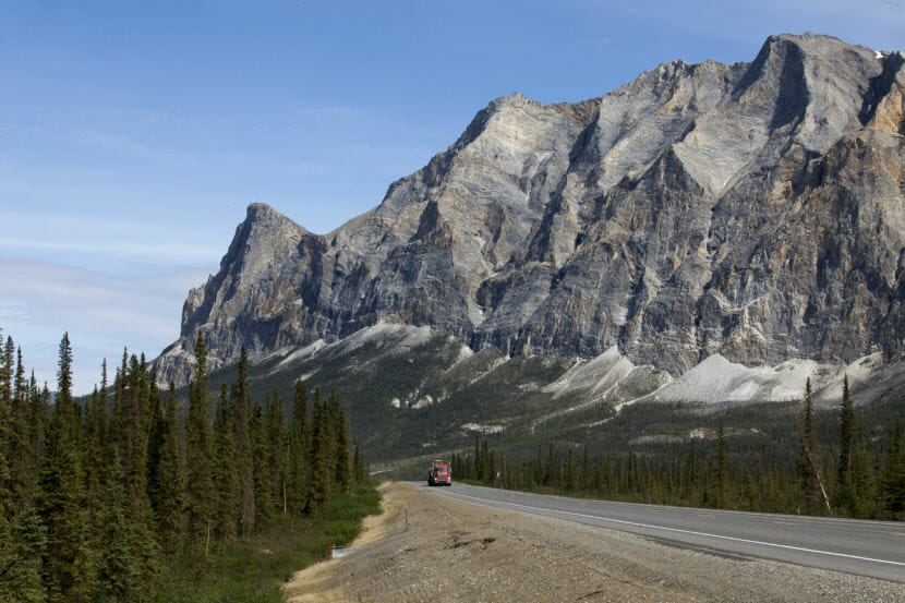
9(MDEwMjQ0ODM1MDEzNDk4MTEzNjU3NTRhYg004))