Climate Change

Communities must adapt as climate change transforms Alaska, federal report says

The Nunalleq dig site located just off the coast of the Bering Sea, close to Quinhagak. A portion of the site already eroded into the sea.  (Photo by Katie Basile/KYUK)

Declining sea ice, thinning snowpack, thawing permafrost and other climate-driven changes are threatening the health, livelihoods and cultural practices of Alaskans across the state, according to a major new federal report.

“Choose any societal issue you want — climate change is having an effect,” said Henry Huntington, Arctic Science Director at the Ocean Conservancy and lead author for the report’s Alaska chapter. “And I would bet not a good one.”

The National Climate Assessment, produced every four years, is the federal government’s most exhaustive account of how climate change is affecting the U.S.

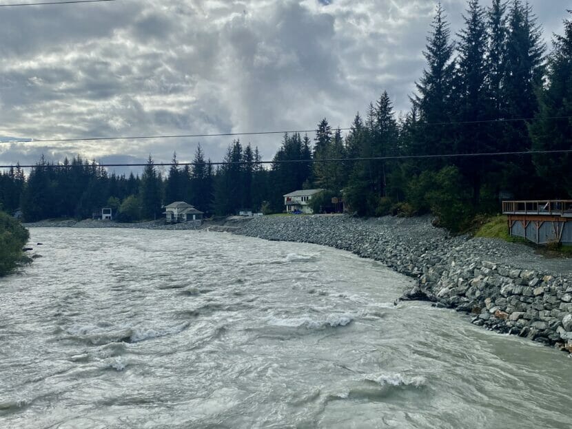
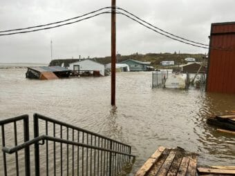
It finds that human-caused climate change, driven primarily by the burning of fossil fuels, is already affecting Alaska communities. The state is warming two to three times faster than the rest of the world, and many places across the state have already experienced climate-driven catastrophes like storms, floods and wildfires.

While plans to adapt and build climate resilience are already underway across the state, the report finds these efforts will need significantly more funding, support and coordination to be effective. 

“Climate change continues to be a serious problem,” Huntington said. “We’ve got to act. But there are things that we can do.”

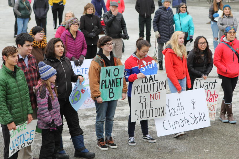
Here are three key takeaways for Alaska:

1. More public health challenges, especially in rural communities. 

Two buildings at a fish camp, one badly damaged and the other knocked over
A fish camp in the Nome area, seen on Sept. 24, shows damages wreaked by the remnants of Typhoon Merbok. (Photo by Jeremy Edwards/FEMA)

Villages across the state already face public health challenges like inadequate sanitation and overcrowded homes amid a severe housing shortage. Climate change will make those problems worse, the report finds. 

An estimated 3,300 households across the state lack access to running water and sewer systems, and according to the report a lack of indoor plumbing can contribute to the spread of disease, like the high incidence of COVID-19 cases among tribal communities nationwide. 

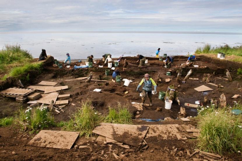
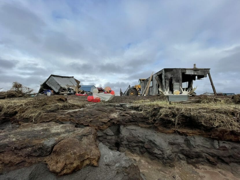
Eighty percent of the state sits on permafrost, which is thawing rapidly. Along with erosion, stronger storms and flooding linked to climate change, melting permafrost can undermine existing infrastructure. It can warp fragile water lines or compromise drinking water sources and sewage lagoons. Those same hazards can make it difficult to build new sanitation systems.

A photo of a coastal area showing several flooded buildings
A massive storm battering Western Alaska brought floodwaters to the steps of the local school in Golovin on Saturday. (Photo courtesy of Josephine Daniels)

The report highlights some innovative temporary solutions, like the Portable Arctic Sanitation System, a modular unit developed by the Alaska Native Tribal Health Consortium that includes treated drinking water, a handwashing sink and a waterless toilet. This system, which has been piloted in five rural communities so far, can stop-gap when existing systems are damaged by climate hazards. But the authors highlight the need for more permanent solutions. 

Many rural communities also have severely limited housing stocks, which are being squeezed by climate hazards. Structural damage from floods or storms like ex-Typhoon Merbok can displace families, who face enormous repair costs and few alternative housing options in their villages. And more slow-moving disasters, like collapsing land caused by permafrost thaw or erosion, can further damage housing. In the worst cases, that’s forcing communities to relocate major infrastructure or even, as in the case of Newtok, more permanently.

Altogether, the report finds that Alaska Native communities face nearly $5 billion in climate-related infrastructure costs over the next 50 years. But the loss is not just monetary. 

“These effects, including a profound loss of connection to a landscape altered by climate change, can increase instances of mental illness and spiritual grief in affected populations,” the report says.

2. Threats to traditional foods and cultural practices. 

Daren Jennings loads up his skiff to deliver Bristol Bay salmon to Lower Yukon River communities. (Photo by Olivia Ebertz/KYUK)

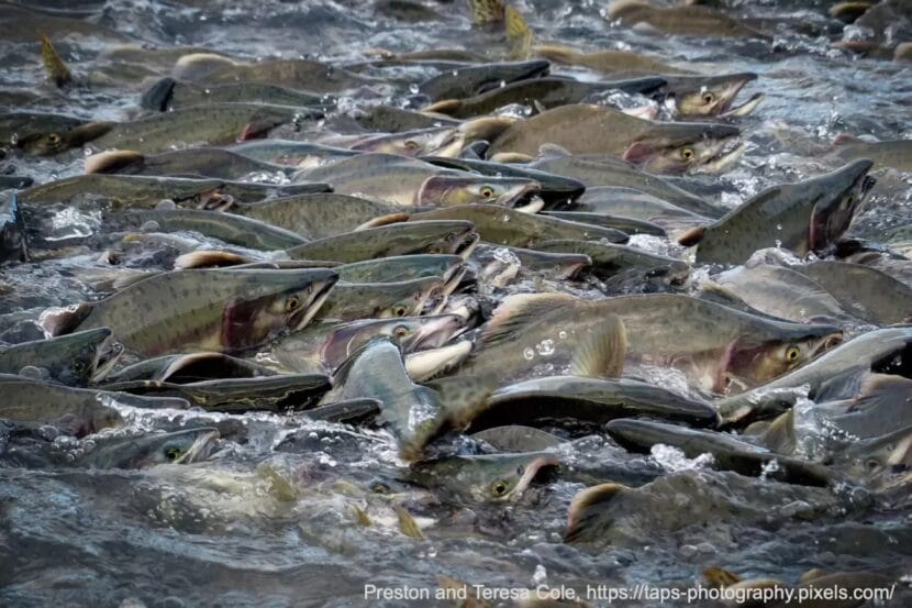
As climate change transforms ecosystems across the state, it is also disrupting Alaskans’ food security. The report catalogs numerous ways in which warming temperatures are threatening subsistence hunting and fishing and livelihoods statewide.

Stronger storms and the decline of sea ice in Arctic and sub-Arctic communities are making hunting more dangerous, the report notes. Warming is disrupting food webs for sea birds and shifting habitats or migration patterns for species like moose and caribou.

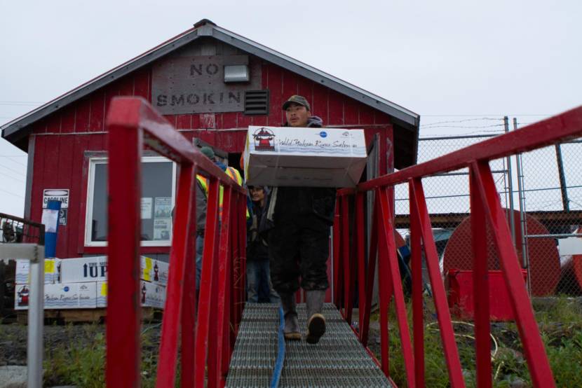
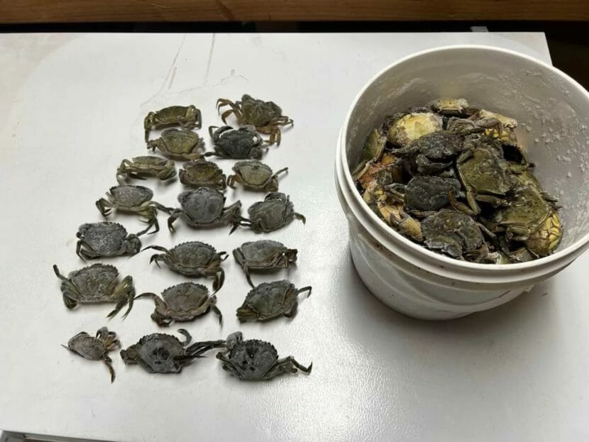
Changing weather conditions have made subsistence foods like wild berry harvests more unreliable. Both commercial and subsistence fisheries have faced collapse and closures in recent years linked to climate change. Warming waters have contributed to declines in king salmon on the Yukon and Kuskokwim Rivers and snow crab in the Bering Sea. 

""
More than 10 billion Bering Sea snow crabs disappeared in Alaska between 2018 and 2022 (Photo courtesy of Corey Arnold/Alaska Bering Sea Crabbers)

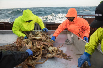
For commercial harvesters, those changes threaten thousands of jobs and billions of dollars in revenue, the report finds.

For the state’s rural, predominantly Alaska Native communities, the threat is even more serious. Grocery prices in the state’s villages may already be more than twice as high as in its cities, and the report notes that 95% of rural residents rely at least in part on subsistence hunting and fishing for their food supply.

It’s becoming harder to harvest food, as thinning Arctic sea ice makes whale and seal hunting seasons shorter and more dangerous, and warming waters, especially around the Chukchi Sea, trigger harmful algal blooms that can make shellfish toxic. 

Even after harvest, climate change is threatening traditional ways of processing and storing food, as wetter weather makes it more difficult to dry fish and meats, and flood and melting permafrost compromise the traditional ice cellars in which many Alaskans store food

These changes to traditional foods and subsistence practices represent an especially profound cultural loss for many Alaska Native communities. 

3. Communities are planning for adaptation. Indigenous leadership, more funding and support can help put those plans into action.

Students in Anchorage rally in solidarity with the global climate strike.
Students in Anchorage rally in solidarity with the global climate strike, March 15, 2019. (Photo by Wesley Early/Alaska Public Media)

But the report doesn’t just list climate impacts – it also highlights examples where Alaskans are taking action. Many municipal and tribal governments are already making plans to deal with Alaska’s changing climate, the authors write, and communities could make significant progress with more funding and support. 

At least four municipalities — Anchorage, Homer, Sitka and Juneau — and seven tribal governments, from the Nome Eskimo Community to the Central Council of the Tlingit and Haida Indian Tribes of Alaska, have developed local climate adaptation plans. More rural communities across the state are developing their own plans.

The climate assessment is meant, in part, to be a resource for people developing or improving upon those plans.

But putting those plans into action can be challenging, the report says, especially for smaller communities. In rural Alaska villages, local governments often lack the funding, expertise or staff to plan for climate impacts. And the same societal challenges that are made worse by climate change — things like food and water insecurity, substandard housing and limited health care — can often limit a community’s ability to pursue climate adaptation. 

“But these aren’t in isolation. It’s not that we have to choose climate change or something else,”  Huntington said. “A lot of the things that we want to do can have many benefits in addition to helping make us more climate ready.”

Successful adaptation planning, the report emphasizes, involves a holistic approach, one that takes a includes collaboration between Western scientific approaches and Indigenous traditional knowledge holders. The authors highlight the Alaska Arctic Observatory and Knowledge Hub, which includes Inupiaq experts in climate research and environmental monitoring, as an example of how to do this. 

Still, political will can be a limitation for climate adaptation. “Support for climate adaptation varies among communities,” the report says. “And adaptation has not been a consistent priority for the state government.” 

Gov. Mike Dunleavy has long questioned the scientific consensus that human-caused carbon emissions are driving climate change, and disbanded a climate change task force convened by his predecessor. 

And while the federal government is dedicating more and more funding toward addressing climate change, the report finds that Alaska communities struggle to access that money, in part because they often compete with bigger communities across the nation.

But the report says securing more money and increasing collaboration and coordination between many different governments and agencies is the only way to create a brighter future for the state. 

“Together, these efforts address climate change and intersecting societal challenges in ways that begin to lay a foundation for a just and prosperous Alaska,” the report reads. 

Sitka workshop discusses the future of invasive crabs in Alaska

Twenty green crabs laid out in rows on a table, with a bucket full of green crabs next to them
European green crabs collected from Metlakatla’s Tamgas Harbor this week. The crabs were trapped in shrimp pots. (Photo courtesy of Dustin Winter)

Tammy Davis is the invasive species program coordinator for the Alaska Department of Fish & Game. During the Alaska Invasive Species Partnership workshop in Sitka on Thursday, she was teaching a roomful of people how to identify invasive green crabs – which, surprisingly, are not always green.

“They can be brown, they can be orangish, reddish, yellowish,” Davis continues. “They’re four inches — an adult is four inches across the back of the carapace.”

European green crabs first reached the Pacific coast in 1989, but it wasn’t until 2022 that they showed up in Alaska. Davis remembers the moment she learned that green crabs had been found in Metlakatla last summer.

“And I think we were all really close to tears, because we should have known they were coming,” Davis said. “But we didn’t think they would come this soon, I guess.”

Genelle Winter is the Climate & Energy Grant Coordinator for Metlakatla Indian Community.  While Metlakatla is the only place in Alaska where green crabs have been positively identified, Winter said it’s likely that they’ve already spread.

“The numbers that we’re finding them in — we’re pretty sure that there are other places, we just haven’t found them yet,” Winter said. “And with that, right now, we’re just under 3000 crabs total that have been caught since discovering them in 2022.”

She said that aggressive trapping in Metlakatla, combined with early detection, has made it easier to reduce their spread.

“The first thing that was found was the first shell,” Winter said. “And that triggered that response to really start intensifying our trapping and then modifying how and where to make sure that we were really actually putting the traps where the crab were. And now those guys, they have it dialed in something fierce.”

These crabs tend to decimate eelgrass beds, which are critical habitat for juvenile salmon and other critters. They are also voracious eaters of clams and other small crabs. They reproduce quickly, and can survive in a wide range of environments.

Davis said communities like Sitka should be on the lookout.

“It seems so frightening and negative to say it’s inevitable, but based on ocean currents, it’s likely,” Davis said. “We don’t actually have good oceanographic information about currents in the Alexander Archipelago, so some of our Southeast communities may be slightly more protected if currents tend to go out along the coast. Unfortunately, that puts Sitka more likely.”

Davis said that Alaskans can help by learning how to identify green crabs and looking out for them on beach walks. While collecting some invasive species requires a permit, Alaska beachcombers can collect potential green crabs for the purposes of reporting – but they should keep the crab in a container and report the find immediately. You can report invasive species online through the Alaska Department of Fish & Game website or by calling the invasive species hotline at 1-877-INVASIV.

3 cities face a climate dilemma: to build or not to build homes in risky places

New homes are under construction in June at a housing development near Buckeye, Ariz. A growing number of local governments are considering limits on homebuilding in the face of floods, droughts and wildfires driven by climate change. (Mario Tama/Getty Images)

With climate-fueled disasters killing hundreds of Americans annually and costing communities billions of dollars, a growing number of local governments are asking a basic question: Are there some places where people shouldn’t build homes?

It’s one of the most difficult choices a community can make. Local governments typically want more housing, not less, because budgets are generally funded by the property taxes from those homes. At the same time, a nationwide housing shortage is creating even more pressure to build.

“[If] you’re a local government, of course you want to develop,” says Katharine Mach, who studies climate change and housing at the University of Miami. “You’re building a community. You’re supporting livelihoods. You’re supporting tourism oftentimes. [And] there’s the pragmatic dimension of, you need the property taxes.”

As a result, putting limits on homebuilding can feel like a non-starter for the local officials who generally control land-use decisions.

But with often deadly extreme-weather disasters on the rise, the problem can no longer be ignored. In the last five years, floods, wildfires, severe storms and droughts have caused more than $580 billion in damage and killed hundreds of people. And some states are passing laws that put conditions on future growth.

NPR visited three places that are grappling with the question of how to stop building homes in harm’s way — with varying degrees of success. Whether it’s flooding, wildfires or drought that threatens a community, similar conversations are now playing out across the United States.

California: Building homes in places that could burn

Two things are painfully apparent for many California cities: the massive statewide housing shortage and a growing danger from wildfires.

With some of the most expensive housing in the U.S., California’s cities face requirements to build more housing to boost supply. But where to put it is tricky. About one-quarter of California is at high risk of burning, according to state wildfire authorities. And as the climate gets hotter, tens of thousands of homes have been lost in destructive wildfires in the last five years alone.

With few statewide regulations, navigating housing needs and wildfire risk falls to local governments, like Santee, Calif., a largely suburban town on the outskirts of San Diego.

Santee is nestled next to miles of open space, and at the edge of town, a major new development of almost 3,000 homes, known as Fanita Ranch, is being planned. For years, residents like Van Collinsworth have fought the project, which would be tucked away in the golden, shrubby hills. As a wildfire inspector by day who examines flammable brush, he knows the city is at risk. It barely escaped the 2003 Cedar Fire, which destroyed more than 2,000 homes.

“I don’t think the project should be built — that’s the bottom line,” he says. “I don’t think developers and decision-makers are willing to acknowledge that we are living in a new era of extreme weather and really grapple with what that means for the desire to build and build and build.”

Collinsworth directs Preserve Wild Santee, an environmental group that joined several others to file a lawsuit to stop the development after the city approved it in 2020. A judge agreed, finding that the developer didn’t adequately analyze how long it would take residents to evacuate during a fire or whether they could do so safely.

The developer, HomeFed Corp., proposed the project again in 2022, this time with a phased evacuation plan that works by zones, so neighborhoods could be cleared more efficiently. Houses would be built with fire-resistant materials and have fire sprinklers. Inspectors would check that flammable vegetation was cleared twice per year, something that would be paid for by homeowners association fees. Those funds would also ensure vegetation was cleared around the outskirts of the community, creating a buffer.

“Other parts of the country are in a hurricane zone, and they have codes and standards that say, if you build to these standards, you can go ahead and build a home,” says Kent Aden, senior vice president of HomeFed. “We have all these standards for building in wildfire zones, but there seems to be a resistance to allow projects to move forward that meet or exceed those standards.”

In 2023, the City Council approved the project again, with several members saying they were satisfied with the wildfire safety measures after local fire officials supported the plan.

“We tried to take everything we can learn from the fires plus even more, making it, in my opinion, the best example of what can be done to make a defensible community,” Aden says.

Collinsworth and environmental groups filed a second lawsuit to halt the project, and it will be heard in court next year. It’s one of several lawsuits aimed at stopping developments in California, and some of these suits were supported by state Attorney General Rob Bonta. He recently released guidance for cities about how to analyze wildfire risk.

Still, while California leads the nation in some wildfire policies, like building codes for individual homes, there are few statewide laws about making development decisions in high-risk zones. Those decisions fall to local governments alone. A bill now being considered from state Sen. Ben Allen would require developers to analyze fire behavior and create evacuation plans in cooperation with local fire authorities as part of their projects.

Previous legislative bills requiring local governments to create standards for approving housing in risky areas have failed amid pushback from the building industry.

“If we site houses and infrastructure in places better, safer, that makes it easier to keep people safe as climate change intensifies into the future,” Mach says. “But it’s not as if we have easy choices of just building in the safe places, because there are no places that are devoid of hazards right now.”

Arizona: Limiting growth where water is scarce, with a catch

Located in a desert, cities around Phoenix are constantly facing questions of water supply — not just at water management agencies but also at city councils considering where to develop. That’s because Arizona has one of the most powerful laws in the country linking water with the decision to build.

In Casa Grande, about an hour south of Phoenix, Mayor Craig McFarland knows his city’s future is linked to water. Housing is already in high demand. Industry is moving into the area, with both a battery and an electric car manufacturer offering thousands of jobs near town.

“We have this huge need for workforce housing, and that workforce housing needs a place to go,” McFarland says. “And so that’s why all of a sudden the rush is on.”

But whether that housing can be built is a question. A two-decade drought in the Southwest has triggered cutbacks to Arizona’s water supply, as climate change strains the Colorado River, one of the state’s biggest water sources. Underground aquifers are the state’s other major water source. But in Pinal County, where Casa Grande is located, overpumping of aquifers is a big concern.

So when it comes to development, McFarland consults a map that looks like a patchwork quilt. Some parcels of land are blue, which means a water supply would be ensured for new homes. But many other parcels are white. There, developers would have to find their own water supply in order to build. State law limits growth where water is in short supply, requiring new subdivisions to show they have 100 years of water for their customers.

“Arizona is the only state in the country that requires 100 years’ worth of water,” McFarland says. “It’s a consumer protection.”

This year, regulators announced they would not be guaranteeing water supplies for new subdivisions around Phoenix, limiting future construction. That has been the situation for several years in Casa Grande.

Still, McFarland isn’t discouraged. In the long term, the city is looking at water recycling and conservation. And in the short term, building hasn’t stopped.

That’s because developers have found a profitable workaround. Arizona’s water law applies only when lots are subdivided into smaller lots for six or more homes and those houses are either sold or made available for long-term rentals. Instead, developers have turned to building short-term rentals on a single large piece of land.

Not far from the center of town, construction workers are putting the finishing touches on new single-story homes in a 331-unit development. Water supply hasn’t been a barrier to building because these units will be part of one large rental project.

“We don’t need an assured water supply because it’s one lot,” says Greg Hancock of Hancock Builders, which is constructing the project. “Although it’s 331 units, it’s one lot.”

Casa Grande, like several other Arizona cities, has seen a boom in these “build to rent” projects. Hancock says after decades in the business, his company started building them only recently and has more than 10,000 units built or in development.

“It’s been one of the greatest housing markets forever,” he says. “People will not stop moving here.”

But with the growth, that unaccounted-for water demand is raising red flags. Already, Arizona water regulators say there won’t be enough groundwater to meet existing needs over the next 100 years.

“If you build houses and you rent them, there’s no way to go back and undo the fact that they’re there and people are living in them,” says Kathleen Ferris, senior research fellow at the Kyl Center for Water Policy at Arizona State University.

Ferris helped write Arizona’s 100-year water law four decades ago. She says its strength is that it tethers building decisions to water decisions. Back then, build-to-rent wasn’t common. Now, she says, the state is reaching a pivotal moment when all water use needs to be accounted for.

“Climate change and aridification have come on so much faster than most people thought,” she says. “Yes, there is still opportunity for growth, but there needs to be an understanding of the limits.”

This year, Arizona legislators drafted two state bills to close the loophole, which would require rental projects to have a water supply. Both failed to pass. Some cities pushed back, saying it would limit a key way to address the housing shortage. Now, a working group convened by Gov. Katie Hobbs is examining the issue.

Still, the overriding conversation is about growth. With droughts expected to worsen, Arizona’s water law is pushing cities to look at boosting their water supplies locally, whether that’s through building water-recycling projects or amping up conservation.

“I used to say, ‘Maybe we’re at our limit. Maybe we can’t build any more houses,'” says Pinal County Supervisor Stephen Miller, who works on water issues. “So now I say, ‘If we’re going to maintain any type of growth, we have to bring water in.'”

New Jersey: A little bit of everything adds up to a lot of flood protection

New Jersey may offer a blueprint for how to get people out of harm’s way while continuing to grow and prosper economically, according to climate experts.

The marshy coastal state is a decade into a systematic statewide effort to protect residents from floodwaters. And those efforts appear to be successfully limiting new construction of homes in flood-prone areas and better protecting people who live in flood zones or are considering moving into them.

“This is an area where New Jersey is very proactive,” says A.R. Siders, a climate researcher at the University of Delaware who studies climate risk and housing.

New Jersey has attacked its flooding problem from every angle. Since Superstorm Sandy devastated the region in 2012, New Jersey has passed regulations that make it harder to build new homes in flood zones. If you want to substantially renovate a home that already exists in a flood-prone area, the new rules require major upgrades to protect the house from water, such as putting the whole house on stilts or moving air conditioning units and other crucial utilities off the ground so they can survive a flood.

This year, New Jersey also passed some of the strongest flood disclosure laws in the country, which means that people who are buying homes in the state get information about whether their prospective new house has flooded in the past or is likely to flood in the future.

And the state has purchased more than 1,000 houses in the last decade through a permanent home-buyout program known as Blue Acres, which acquires homes that have flooded and knocks them down to provide more open space for floodwater.

As a result, New Jersey appears to be doing significantly better than the national average when it comes to the number of homes in flood zones, according to preliminary findings by a group of climate scientists including Siders and Mach.

That’s particularly notable since New Jersey is both the most densely populated state in the country and one of the most flood prone.

The town of Woodbridge, N.J., has been on the front lines of New Jersey’s strategy.

After Superstorm Sandy flooded the town, the local government decided to support home buyouts.

“[It’s] not something we wanted to do, but we had to do it,” says longtime Mayor John McCormac. “We didn’t want to lose residents.”

But it was equally unthinkable that homes would be rebuilt in places that had flooded, he says. And there were alternative ways for the town to grow economically.

Because home buyouts are voluntary, the town could move forward only if people agreed to move. McCormac remembers a town meeting he presided over in the high school auditorium.

“It was difficult. People were angry,” he says. “It wasn’t an easy process. You know, somebody’s talking to you about moving out of their home that they’ve been in for 60 years. And it’s their biggest investment in their life.”

Similar conversations have played out across the state in recent years, says New Jersey’s chief resilience officer, Nick Angarone. “These are very complicated and very difficult conversations to have,” he says. “You’re talking about some of the basic principles of the country, you know? Where and what you can do with your property.”

But unlike in other states, New Jersey residents who are considering a home buyout are assigned a case manager who can help navigate both the paperwork and the emotions that come along with such a momentous decision.

“Our case managers are sort of our secret sauce,” says Courtney Wald-Wittkop, who runs the Blue Acres program. “They’re very good about developing that rapport and relationship with the homeowners.”

One reason New Jersey is able to match people up with experienced case managers is that, unlike other state buyout programs, Blue Acres exists all the time, not just after major disasters. Because it’s permanent, it’s more accessible to both homeowners and local officials, without whose support buyouts cannot happen.

Ultimately, more than 180 homeowners in Woodbridge decided to accept buyouts and move away, says McCormac, the mayor.

The homes that remain in flood-prone areas of Woodbridge are subject to New Jersey’s new, tighter regulations that require them to be elevated. Instead of building new homes in marshy areas, Woodbridge is allowing more units to be built in denser parts of town near train stations and highways. The town’s population is stable, and its economy is growing.

The town’s flood plain manager, Tom Flynn, says the strategy is also paying off in the form of less flood damage. When the remnants of Hurricane Ida dropped 8 inches of rain in Woodbridge in 2021, Flynn says, it flooded dozens of homes instead of hundreds.

Copyright 2023 NPR. To see more, visit https://www.npr.org.

City seeks public testimony on flood mitigation along Mendenhall River

Property owners have already installed tons of rock to fortify the bank along River Road, just downstream the Brotherhood Bridge (Photo by Anna Canny/KTOO)

The Juneau Assembly will discuss flood mitigation along the Mendenhall River at a meeting of the committee of the whole on Monday. 

In August, a severe glacial outburst flood eroded large swaths of the riverbank, destroying two homes and damaging dozens more. It was the worst outburst flood in Juneau’s history. And scientists say future floods could be even more severe.  

Many residents have already set to work rebuilding eroded land and armoring the riverbank on their own. But now, the city will consider stepping in to help with bank stabilization.

The committee will present different federal funding opportunities that could help cover the cost of more bank stabilization work to protect riverside homes from future flooding. 

Residents are encouraged to attend to ask questions or offer public testimony. 

The meeting will take place at 6 p.m. Monday in person at City Hall and remotely via Zoom.

Pink salmon are thriving in warmer waters, affecting other species, scientists say

Pink salmon returning to Prince William Sound, Alaska, hatcheries contributed to record-setting abundances in recent years and to impacts on other marine species. (Photo by Preston and Teresa Cole)

A new scientific paper published this fall shows that the pink salmon population is booming in the North Pacific Ocean, and global warming is helping it happen. The new evidence suggests that pinks are not just outcompeting other salmon species but they’re affecting the whole ecosystem — from the microscopic to large marine whales.

“Pink salmon are one of the winners in terms of climate change,” said Greg Ruggerone, a salmon researcher and lead author of the new 40-page paper published Sept. 21 in the scientific journal, Marine Ecology Progress Series.

But for every winner, there is a loser — or in this case, several. The new research shows that the spike in pink salmon in recent decades is affecting the ocean’s fragile food chain. Pink salmon run on an every-other-year cycle. The population in the odd number years is 25% greater than even number years. And when pink numbers are up, other species are down.

“From phytoplankton, zooplankton, forage fishes, all five species of Pacific salmon, and so forth and marine birds. It all points to pink salmon,” Ruggerone said.

Scientists don’t know all the reasons that pink salmon are doing better in warmer waters. But they do know that pinks are better than other salmon species at finding prey and growing from their nutrients. In fact, they’re the fastest-growing salmon, ready to spawn in just two years, three times faster than kings.

Plus, hatcheries are bolstering their population — pumping roughly 5 billion salmon annually into the Pacific Ocean, mostly pink and chum.

The general assumption is that the ocean has sufficient capacity to support them all. But Ruggerone said his new paper proves that’s not the case.

“I think the evidence that we provided leads to the observation that the ocean has a limited carrying capacity to support both wild salmon plus massive numbers of hatchery, chum and pink salmon released into the North Pacific,” he said.

His new research shows that when pink salmon are especially abundant, that’s when other species suffer. Pinks eat a ton of prey from zooplankton to small fish. In turn, this creates:

  • Smaller and fewer other salmon species as well as steelhead trout
  • Less growth in Alaska’s herring population
  • A 33% lower birth rate in humpback whales in Southeast Alaska
  • And higher mortality and lower birth rates in endangered orcas in Puget Sound.

The study also connects the pink salmon cycle to nearly a dozen species of seabirds.

“They laid more eggs on even years, good years than they did on odd years, bad years,” said Alan Springer, co-author of the study and a seabird researcher with the University of Alaska Fairbanks.

Springer said they got data from scientists all over the world who had found biennial patterns.

“A variety of associated reproductive kinds of parameters all varied in lockstep with that even-odd year pattern in pink salmon,” he said.

Things like emaciated and starving shearwater birds on an every-other-year cycle.

The scientists say there is no evidence for other explanations for the biennial patterns that have been recorded.

“You know, sea surface temperature or wind speeds or these atmospheric indexes of, whatever, failed to show any kind of similar patterns,” said Springer. “So that’s kind of what for us is the bottom line.”

The Alaska Department of Fish and Game is skeptical of the paper’s findings. Commissioner Doug Vicent-Lang, in a written response, called the paper a “hypothesis” and said it’s “the subject of an ongoing debate among scientists.”

“The conclusions put forth are stated as more definitive than the strength of the evidence that backs them up,” he wrote.

The researchers agree that it’s a hypothesis — but a strong one. The data shows connections but doesn’t answer all the reasons why.

“More research is certainly needed,” Ruggerone said. “But again, with the synthesis paper, an important part of it is just the consistency in the relationships across all these different taxa.”

Taxa meaning a biological group.

The authors hope that other scientists take their findings and dig deeper into all the ways the large pink salmon population could be affecting other species in the North Pacific. And timing is of the essence as ocean temperatures are expected to rise.

Artist captures climate change in his brushstrokes for new Alaska State Museum showcase

Painter David Rosenthal stands before a series of paintings of Sheridan Glacier outside of Cordova. Each painting captures the glacier during different time periods. (Photo by Anna Canny/KTOO)

When painter David Rosenthal came to Alaska nearly 50 years ago, he was captivated by the expansive glory of the icy landscapes. Over his career he’s painted ice, snow and glaciers in Alaska, the North Pole, Greenland and even Antarctica, inadvertently capturing climate change in his brushstrokes.

The Cordova-based artist’s showcase, “Painting at the End of the Ice Age”, is a retrospective which places his paintings in the context of human-caused warming and glacial retreat, seamlessly blending science and art. It opens Friday, Nov. 3 at the Alaska State Museum, followed by a lecture from Rosenthal.

He sat down with KTOO’s Anna Canny to talk about his experiences capturing the last remnants of Alaska’s glaciers.

This interview has been edited for length and clarity.

Anna Canny:  So you’ve been a painter for decades, and you’ve always painted landscapes. But as this exhibit showcases, you have an affinity for icier landscapes. Can you kind of tell me how you found that focus? 

David Rosenthal: I grew up in Maine, the Ice Age was over.  But we used to always hear about it, because, you know, we’d be driving by a field with these boulders everywhere and my parents would go ‘Oh, the glacier left those,’ you know? And it was really something that I used to think about and was fascinated by. And, you know, I was in Maine, doodling and, you know, doing these paintings. And some of them were pretty good, but I barely sold anything. I had just graduated with an interdisciplinary degree, which doesn’t prepare you for anything. So just by chance, I got this job at a cannery up in Cordova, thinking oh I’ll just go up there for a job. Because, you know, compared to Maine it sounded like a lot of money. So, I go up to South central coast, Alaska, basically, which is surrounded by some of the remnants of the Ice Age. They’re all these glaciers and icefields, you know, some, this is some of the biggest glaciation in North America. And this is where basically, this is my playground for years. And so that’s how I, I mean, all during this time, I did other things, besides ice. But I just, ice, glaciers are just so, the colors and the way the light hits them. I mean, they’re just a beautiful subject for painting. 

Anna Canny: What were some of your earliest glacier paintings?

David Rosenthal: Well, in Cordova, we have these glaciers, Childs and Miles, about, oh, 52 miles out of town. And when I first saw it in ‘77, there was a little area in this brush and you could just kind of sit there and watch, the face of this, the active face, was about a mile long and it was about 300 feet high in places. And you just go out there for the afternoon and watch these calving chunks, you know, 300 feet high and 200 yards wide and it would actually throw waves across the river. You had to be careful, you had to run sometimes. It was just the wonder of the world. 

David Rosenthal’s showcase of oil paintings features glaciers and ice fields from across Alaska and the globe (Photo by Anna Canny/KTOO)

Anna Canny: So you’ve been painting these landscapes, obviously, for years, you’ve been painting ice for years. But when did you realize that taken altogether, these paintings say something about climate change?

David Rosenthal: It was funny because I’d see everywhere, these exhibits and journalists writing about climate change, you know? And a lot of them were ‘Oh yeah, I’m so and so, I have five years on the ice, you know, or studying this ice and, this one glacier has retreated 100 meters,’ you know, that sort of thing. And I’m thinking, wait a second, I’m living around for the last 40 years, glaciers that have retreated 15, 16 miles. And, so I’ve never been any kind of activist, but there was a lot of times that I would think about what I was doing, and, well, you know, you’ve spent your life making pretty pictures, you know? What good is that, you know? And so then it dawned on me, well, wait a second, this is my chance to give back something. 

Anna Canny: I mean, and one thing this exhibit really drives home is that we’re seeing change happening so fast, that in one painter’s lifetime you can catch all of this. 

David Rosenthal: Yeah,  yeah, you know this, uh in geological time my, well now it’s almost 47 years painting glaciers — in geologic time, that’s nothing. But with glaciers, you get significant changes. So it’s one of the best ways to illustrate these changes. And it’s sad like, uh for my first years in Cordova I used to just go up for the summer, but in ‘81 I moved there full time. And one winter day some friends invited me to go out to the Saddlebag Glacier. It’s a relatively small one. But that memory is etched in my head. Because you come around this corner in the stream and you just like, there was just this wall of ice. And it was around the solstice. So the yellow sun even at noon time made the ice look this incredible emerald green. And then in 2018, there’s not even ice, it’s just gravel in this canyon. And it’s so sad to see these young people, like, you used to just drive out and watch it calve or you could hike up for miles. And you can’t do it anymore. 

Site notifications
Update notification options
Subscribe to notifications