Climate Change

From rain-drenched mountains to Arctic permafrost, Alaska landslides pose hazards

A muddy landslide path crosses a road into the ocean
The deadly landslide that crashed through the outskirts of Wrangell on the night of Nov. 20, 2023, is seen from the air on the following day. The landslide killed six people and blocked a major road, the Zimovia Highway. (Photo provided by Alaska Department of Transportation and Public Facilities)

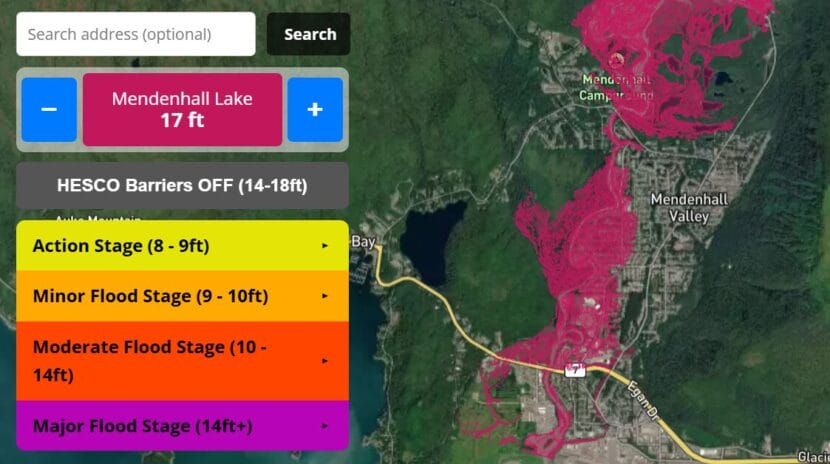
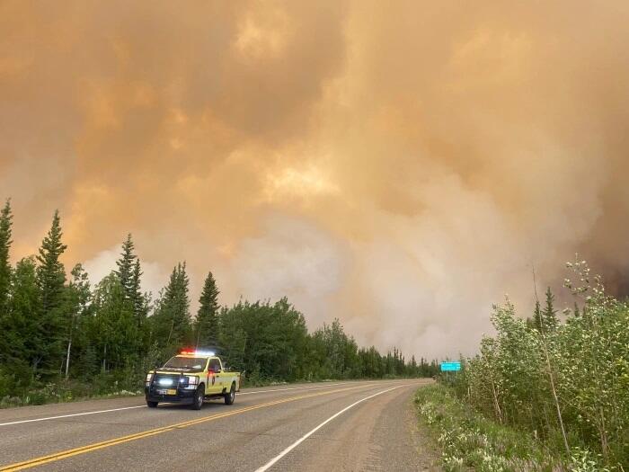
From the Southeast rainforest to the Arctic tundra, warming conditions are creating a variety of Alaska landslide hazards, some of them posing extreme hazards to human safety and others creating expensive problems for important infrastructure.

Just how many hazardous sites are out there? Bretwood “Hig” Higman, a geologist based in the Kenai Peninsula town of Seldovia, has done a basic inventory.

From 2012 to early this year, there have been more than 1,000 slow-moving slides of different varieties, with triggers that include receding glaciers, thawing permafrost, extreme weather or combinations of those factors, according to his calculations.

a landslide covers a highway
A Ketchikan landslide covers the Tongass Highway at a spot called Wolfe Point on March 20, 2025. The slide closed that part of the highway for days after, but there were no injuries that resulted from it. (Photo provided by the Alaska Department of Transportation and Public Facilities)

In a state where people contend with earthquakes, floods, wildfires and erupting volcanoes, it may be difficult to add another type of natural disaster to the public’s list of worries, Higman said. But elevating landslide awareness and preparedness is necessary as events increase, he said.

“It is vastly more risky than most things we deal with,” said Higman, a partner in an Alaska landslide science program created by the Massachusetts-based Woodwell Climate Research Center.

Shallow, sudden slides triggered by rain

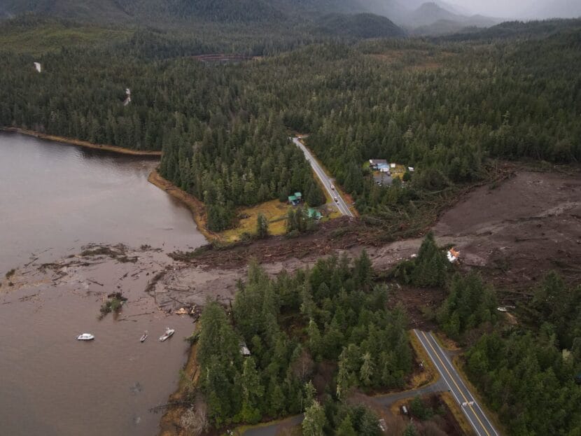
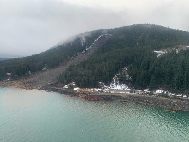
The lesson has been learned in Southeast Alaska, where catastrophic slope failures triggered by extreme rains have proved deadly. Since 2015, 12 people have been killed by landslides in Sitka, Haines, Wrangell and Ketchikan. Victims included an entire family of five killed by a sudden slide in Wrangell in late 2023.

In Southeast Alaska, steep mountains that were created through tectonic processes rise from the water’s edge, and rain is frequent. It is naturally susceptible to landslides.

a landslide-scarred hillside
A rainstorm-caused landslide in Haines is seen on Dec. 3, 2020. Extreme rainfall caused several slides in that Southeast Alaska town, including one that killed two people. (Photo by Lt. Erick Oredson/U.S. Coast Guard)

“One of the primary processes that sculps the landscape in southeast Alaska is landslides and glaciers and rivers,” said Dennis Staley, a U.S. Geological Survey scientist and Alaska landslide program leader. “When you combine rapid uplift with steep slopes with junky rock and lots of rainfall, you have all of the key ingredients for landslides.”

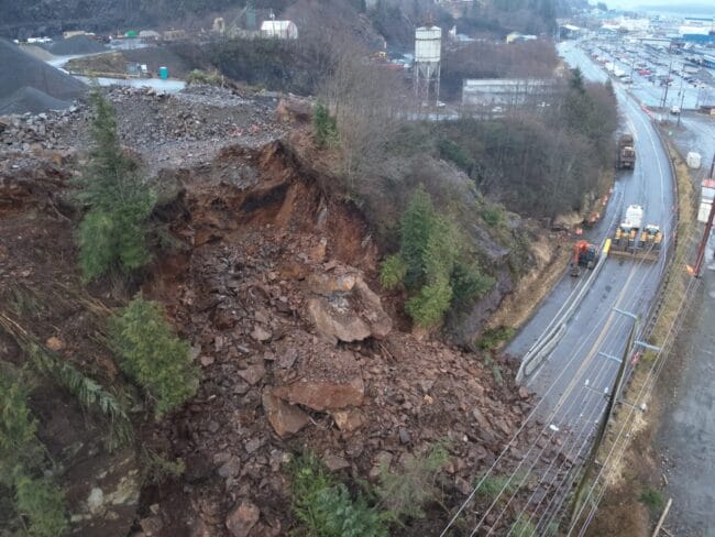
Southeast Alaska landslides are classified as shallow slides because they involve the soil, trees and other materials atop the bedrock rather than the rock itself. Those slides are numerous; the USGS recorded 162 news-reported slides in Southeast Alaska from 1990 to 2024. They are longstanding threats. A 1936 landslide in Juneau, for example, killed 15 people.

Now climate change is compounding the threat by creating more extreme rainfall events, driven by atmospheric rivers, as well as bringing more winter rain that, in other years, would be snowfall.

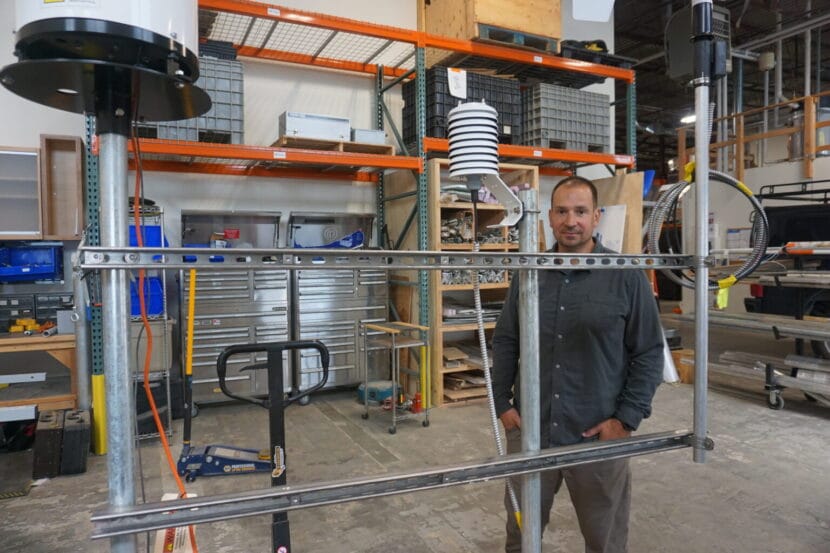
That means efforts to monitor landslide risks extend not just to topography studies but also the details about precipitation. Whether it is rain or snow – or rain-on-snow – has implications for slope stability, and the multiagency team studying landslide risks in Southeast Alaska has developed a prototype monitoring station to record precise qualities of the precipitation, as well as wind and temperature.

a man stands in a warehouse next to a landslide monitoring device
Dennis Staley, the U.S. Geological Survey’s Alaska landslide team leader, stands in the agency’s Anchorage warehouse on Aug. 20, 2025, by a prototype of a monitoring device that scientists hope to use in Southeast Alaska. The device has instruments to measure wind, precipitation and discern whether precipitation is rain or snow. (Photo by Yereth Rosen/Alaska Beacon)

Beyond federal and state agencies’ work and that of university organizations like the Alaska Earthquake Center at the University of Alaska Fairbanks, there is focused work by tribal governments and community organizations.

The Sitka Sound Science Center, previously known for its fisheries and ocean science work, now has one of the most well-developed landslide programs. The center’s landslide program was launched in 2015, after a slide there killed three. The center now maintains a local landslide hazards dashboard, and it participates in and coordinates a variety of research projects and educational programs.

One is the Kutí project, a partnership with the Central Council of the Tlingit & Haida Indian Tribes of Alaska and other tribal partners. Named for the Lingit word meaning “weather,” the program is funded by a National Science Foundation grant awarded in 2022. The purpose is development of a more regional Southeast Alaska monitoring, warning and educational system.

The Sitka center’s work has been hampered by Trump administration budget cuts and policies. A landslide conference that the center was set to host last spring was canceled because Trump administration policies prevented federal partners from attending.

A sign along a snowy hillside road warns of landslide risk
A sign seen on May 5, 2023, advises travelers that the road through Denali National Park is closed at about its midway point because of the landslide at Pretty Rocks. (Photo by Yereth Rosen/Alaska Beacon)

Permafrost thaw and frozen lobes

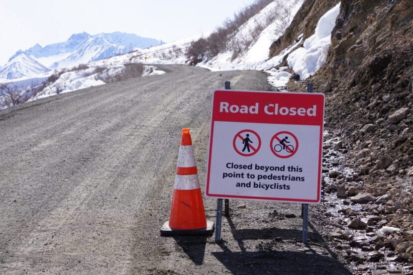
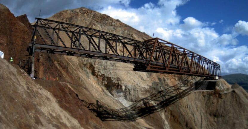
Farther north, slopes are shifting and creeping as permafrost thaws, creating hazards for infrastructure. The best-known case may be in Interior Alaska at Denali National Park and Preserve, where one of the more than 140 detected landslides along the park’s sole road interfered with travel.

That slide, at a site called Pretty Rocks at the midpoint of the 92-mile road, had been ongoing for years, creating maintenance headaches for park staffers trying to keep the road open. In 2021, it finally made the road impassable there.

project is underway to create a bridge over the slide area, but it is proving more complicated than originally envisioned. Early on, it was estimated to cost a bit under $100 million and expected to be completed by the 2025 tourist season. Since then, the completion date has been pushed back, with full road access expected to resume in 2027. The cost is now estimated at $150 million, a figure that does not include potential work at other landslide sites along the park’s road.

a debris flow on a hillside
A frozen debris lobe in Gates of the Arctic National Park and Preserve is seen in 2020. This lobe of frozen material was stable and nearly completely vegetated until about 2005, when it began to thaw and move downslope. (Photo provided by the National Park Service)

More than infrastructure at risk from Interior landslides. Last summer, when a guided rafting expedition encountered a landslide on the Nenana River just outside the park, a woman in the party was killed.

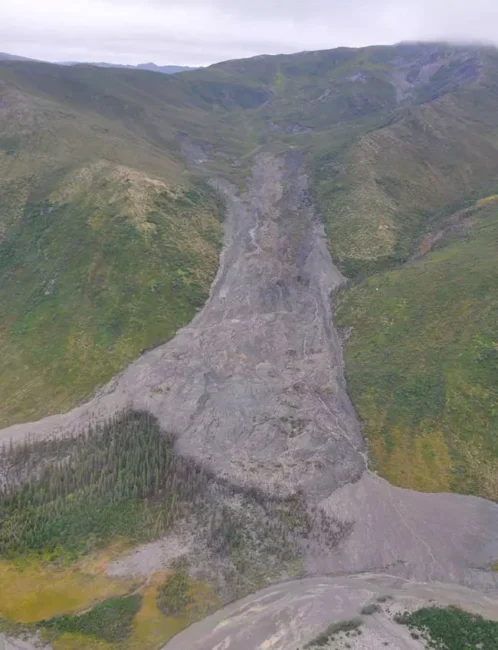
Yet farther north, masses of frozen material are working their way down to the corridor that holds the trans-Alaska pipeline. University of Alaska Fairbanks and state scientists have identified more than 200 of them in the Brooks Range. As of last year, said UAF’s Margaret Darrow, there were 99 identified along the Dalton Highway, the road that parallels the trans-Alaska pipeline and the sole land route to the Prudhoe Bay oil complex.

The conglomeration of moving ice, water, crumbling rock and vegetation have their own descriptive name: “frozen debris lobes.” Darrow, the principal investigator on various UAF projects, began studying them in 2011, when she drove up the Dalton Highway for a two-family camping trip with a colleague.

The lobes, which move more quickly than thawing permafrost but are not causing sudden collapse, proved enough of a threat to the highway that the Alaska Department of Transportation and Public Facilities rerouted a section in 2018, part of a $25 million project that addressed thaw problems along the highway.

The reconfiguration proved necessary. The leftover section of highway was left in place as a test site, and the frozen debris lobe continued to flow. By late 2023, it had shoved the leftover highway section about a foot to the side, according to research led by Darrow.

A woman sitting in an office holds a piece of slate
Margaret Darrow, in her University of Alaska Fairbanks office on Oct. 10, 2024, holds a piece of thin, brittle slate retrieved from a far-north site where thawing lobes of ice, rock, soil and vegetation are creeping down mountain slopes. The geology in those areas contributes to the slides. Darrow leads the UAF team studying the frozen debris lobes along the Dalton Highway and elsewhere in the Brooks Range. (Photo by Yereth Rosen/Alaska Beacon)

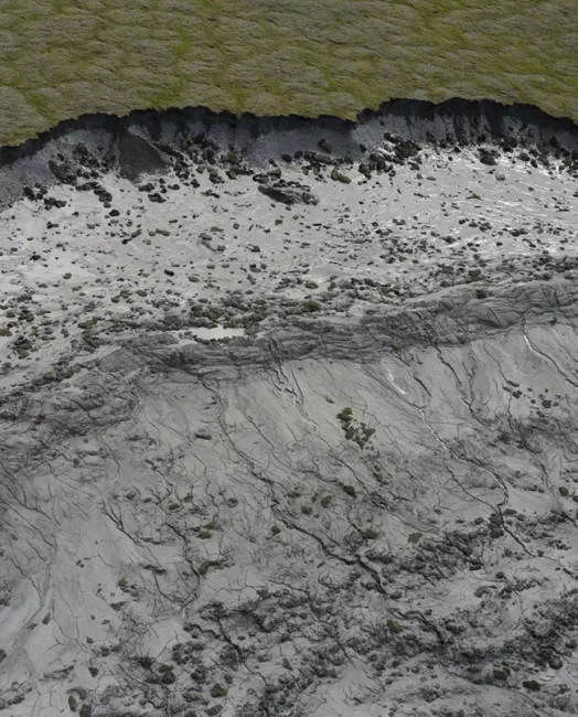
In the Arctic, in Alaska and elsewhere, permafrost thaw caused by warming temperatures has triggered widespread landslides known as retrogressive thaw slumps.

Among the affected sites is the Noatak Valley in mountainous Gates of the Arctic National Park and Preserve, considered a hotpot for such slides. In that remote region, the safety of people and property is not much of an issue, but water quality can be. Numerous retrogressive thaw slumps have dumped tens of thousands of cubic meters of sediment into a single creek, according to the National Park Service.

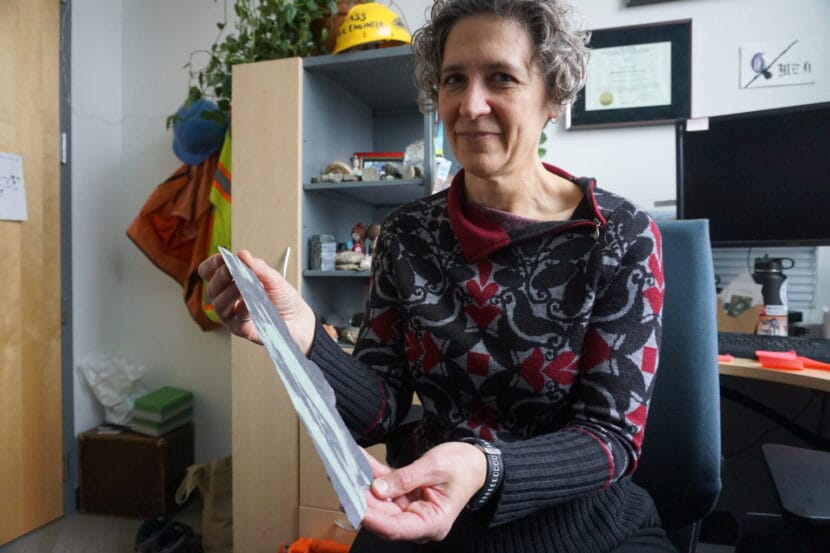
Keeping abreast of the hazards from all types of unstable slopes in Alaska requires coordination by agencies at all levels of government, universities and other entities, said Jillian Nicolazzo, a geologist who leads the state’s landslide hazards program.

“At the moment, we can’t do it all,” said Nicolazzo, a geologist who leads the landslide program at the Alaska Division of Geological and Geophysical Surveys. “Everyone pitches in a little bit, because it is just too much for any one agency.”

a permafrost thaw slump
A retrogressive thaw slump in the Noatak National Preserve is seen in this photograph. The escarpment on the top is about 10 feet tall. (Photo provided by the National Park Service)

Addressing federal uncertainty

The state program gets funding from the USGS, and a big boost for U.S. landslide monitoring has been provided by the National Landslide Preparedness Act signed into law in 2021. Through that act, Congress in 2021 appropriated $4 million specifically to landslide hazards in Prince William Sound.

But the law, which authorized federal funding for landslide programs, expired in 2024.

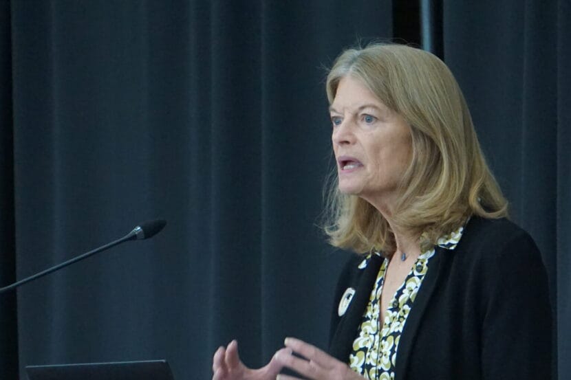
Legislation is pending in Congress to reauthorize it, with sponsors from Alaska and Washington, states with deadly slides in recent years. One bill is sponsored by U.S. Sen. Lisa Murkowski, R-Alaska, and U.S. Sen. Maria Cantwell, D-Washington. Another is sponsored by U.S. Rep. Suzan DelBene, D-Washington.

Without reauthorization, prospects for future funding are clouded.

The Trump administration’s proposed budget for the coming fiscal year would cut funding for USGS natural hazards work – which includes landslide hazards – by about a quarter, from $203 million to $157 million, according to a Congressional Research Service report.

As with the canceled Sitka conference, Trump administration policy interrupted landslide work last spring in Prince William Sound. Massive federal layoff and spending freezes prevented some planned maintenance work at the Barry Arm landslide site.

If federal support for Alaska landslide monitoring becomes spotty, there is a potential backstop: citizen science.

Sen. Lisa Murkowski, R-Alaska, speaks on April 22, 2025, at the Alaska Infrastructure Development Symposium in Anchorage. Murkowski and Sen. Maria Cantwell, D-Washington, are sponsoring a bill to reauthorize the National Landslide Preparedness Act. A similar bill is pending in the U.S. House. (Photo by Yereth Rosen/Alaska Beacon)

The Division of Geological and Geophysical Surveys earlier this year launched an online app through which members of the public can report the landslide risks they encounter. Those could be actual slides, small rockfalls, cracks or anything unusual, and the division encourages people to submit photographs.

The hope is that important information will be gathered “if people are out hunting and fishing and recreating, especially if they see a lot of landslides that we don’t,” Nicolazzo said.

Without help from the public, scientists like her have to rely a lot on things like satellite imagery, she said. “I mostly sit at a computer and look at Google Earth. The images can be years old,” she said.

So far, the Alaska Landslide Reporter app has not been promoted or used much. But Nidolazzo is hopeful about its eventual utility.

Public awareness is, for now, the prime solution to the landslide problem in a place as big, mountainous, wild and fast-changing as Alaska, Nicolazzo said.

“I think educating people about the risk is the best we can do at this point. Because the area is so large and people are everywhere,” she said.

a metal bridge sits in front of a slope
The bridge that will allow vehicles to pass over the Pretty Rocks landslide at Denali National Park is seen in early August 2025 as it was being slowly pulled into place. The ongoing thaw-induced landslide, which accelerated and made the road impassable late in the summer of 2021, prompted the bridge project. The bridge project is expected to be completed in 2026. (Photo provided by the National Park Service)

This story has been supported by the Solutions Journalism Network, a nonprofit organization dedicated to rigorous and compelling reporting about responses to social problems, solutionsjournalism.org.

Yup’ik climate advisor appointed by UN secretary general

Charitie Ropati, a young Alaska Native engineer with roots in Kongiganak, has been appointed as a youth climate advisor to the United Nations. (Photo courtesy of Charitie Ropati/KYUK Public Media)

Twenty-four-year-old Charitie Ropati is Yup’ik and Samoan, and has roots in the Bering Sea coastal village of Kongiganak. She said that the community has inspired her.

Following a flood event in 1966, many members relocated from the village of Kwigillingok to higher ground, a settlement which would become known as Kongiganak. Now, the permafrost under the village is thawing and Kongiganak is facing its own set of climate impacts.

“It really started with the story of my community,” Ropati explained. “And it’s because of that story of survival, I think, that brought me to where I’m at now.”

“Now” for Ropati means working in New York City as an engineer designing public housing infrastructure for Indigenous communities across the country. Ropati has also started her own nonprofit education organization called LilnativegirlinSTEM and was recently named to the Forbes 30 under 30 list.

Ropati said that she was back in Alaska, driving around Anchorage with her mom and her partner, when she got the news that she’d been selected as a youth climate advisor to the United Nations (U.N.)’s secretary general.

“It really meant a lot to be there, especially with my mom where these stories of survival really originated from her and specifically that story of relocation,” Ropati said. “Just our ability as Yup’ik people to do these type of things. Not only for survival, but for the love of each other and community.”

As a youth climate advisor, Ropati will be part of a cohort working with United Nations Secretary-General António Guterres to provide “practical and outcome-focused advice, diverse youth perspectives” around climate action, according to a press release from the U.N.

The youth advisor roles are pretty new to the U.N. In 2025, the number of selected advisors doubled from seven to 14. According to the press release, that’s to help support young people who don’t often have a seat at the table. Ropati is one of the first Alaska Native youth to be appointed as an advisor.

“I think this is a huge win, especially for youth in the Arctic,” Ropai said. “Because I don’t think we’ve ever been given this type of platform before.”

It’s a big year to be involved. The United Nations’ annual climate conference will take place this November in Brazil. Also this coming year, countries in the U.N. are required to submit new climate plans.

The plans will follow the Paris Agreement, a commitment to reduce greenhouse gas emissions to keep the global surface temperature below 1.5 degrees Celsius. It’s a figure the U.N. has emphasized as a tipping point for damaging climate impacts, a point Ropati said affects the human rights of Indigenous people in the Arctic.

“We know that if that happens, and if our world does do that, that’s going to have devastating impacts, not only on these nations or states, but it’s going to have devastating impacts on Indigenous peoples, and especially on us, on Yup’ik, on Inuit, on Inupiaq, on all of us in our state,” Ropati said.

Ropati said human rights form the foundation of her climate advocacy. She said that Indigenous people on the front lines of climate change are often left out of the discussion when it comes to climate solutions. But she said they’re a group well-equipped with answers.

“When we talk about the climate work we’ve been doing, this is work that has been carried on through generations,” Ropati said. “This is work that didn’t start with me. It started with my great grandfather, to my grandmother, to my mother, and now me.”

Ropati said that climate conversations in the Western world often involve looking for quick fixes. But in Yukon-Kuskokwim Delta villages facing relocation, Ropati said that it’s understood that climate solutions can take generations. The recent relocation of the village of Newtok to a new site, Mertarvik, was one that was decades of planning and discussions in the making.

“It’s not just up to our youth to do this, and it needs to be intergenerational,” Ropati said. “I think this is something we as Indigenous people have always understood and continue to do, especially in our communities.”

In her capacity as a U.N. youth climate advisor, Ropati will work for the next three years alongside appointees from around the world, including Kenya, Sweden, and Indonesia.

Ropati said that she’s looking forward to bringing Indigenous perspectives to the forefront of the international climate discussions.

While some evacuate, others hunker down ahead of Juneau’s glacial outburst flood

Malachi Thorington and Elizabeth Figus pack their truck as they evacuate their home on View Drive ahead of the Juneau’s glacial outburst flood on Tuesday, Aug. 12, 2025. (Photo by Clarise Larson/KTOO)

Listen to this story:

Juneau’s annual glacial outburst flood started Tuesday morning and is expected to peak Wednesday morning. Experts predict it could be the largest flood on record. 

This year, the flood will test a temporary levee that the city installed this spring. But not every street in the flood zone is protected by the barrier. 

As Malachi Thorington and Elizabeth Figus packed their blue chevy truck Tuesday afternoon to stay at a friend’s house, the sound of the rising river rushes behind their house. 

The first floor of their home flooded the past two years. Thorington said he knows the drill now.

“Just kind of dealing with the present, at the moment, basically going into damage mitigation mode. Try not to feel anything, just try to go as mechanical as possible,” he said. “There will be things that are lost, and I really hope that other people have taken this seriously.”

The City and Borough of Juneau issued an evacuation advisory Tuesday morning as glacial outburst floodwaters began to rise in Mendenhall River. Some residents are heeding the warning, but others are hunkering down at home. Everyone is waiting to see whether preparations made over the past year will protect their homes from a third catastrophic flood. 

Water rushes down the Mendenhall River on Tuesday, Aug. 12, 2025. (Photo by Clarise Larson/KTOO)

At the end of View Drive, a colossal man-made berm separates Carol and Don Habeger’s house from the cold rushing water. 

Walking along the berm, they see a young spruce on the other side of the river crash into the torrent. Along with a couple of neighbors, the Habegers spent the past month erecting the levee around their home of more than 20 years. The city constructed a separate temporary levee farther downriver. 

Don Habeger and Wayne Coogan walk on the top of a man-made berm built at the end of View Drive on Tuesday, Aug. 12, 2025. (Photo by Clarise Larson/KTOO)

“We are trying to save our property — we are trying to save our equity,” he said. 

Imagine 400 truckloads of boulders, rocks and fine sand stacked around 12 feet high. The couple plans to stay home, even as the river is projected to reach a record-breaking level of 16.6 feet.

“I was going to invite folks, but I don’t want the liability,” he said.

The Mendenhall River started flooding annually more than a decade ago, but for a while it was treated as more of a curiosity than a cause for concern. Then, in 2023, everything changed when a record-breaking 15-foot flood hit the Valley. A couple dozen homes flooded. 

The 2024 flood broke the record again, this time cresting at 16 feet, and it was catastrophic. Nearly 300 homes flooded. The federal government declared it a major disaster.

Glacial outburst floods are not uncommon in Alaska, or in other places with glaciers around the globe. But Juneau, Alaska is the only city in the U.S. that lives beneath their threat.

Suicide Basin is the source. It’s a slurry of water, icebergs and silver silt that swells with rain and meltwater in the spring and summer. 

Climate change has sharpened the risk of glacial outburst floods. In Juneau, their size has increased as the glacier has melted more rapidly. Scientists today are trying to figure out how big the floods can get.

Environmental Science Professor Eran Hood inspects a man-made berm built by residents at the end of View Drive on Tuesday, Aug. 12, 2025. (Photo by Clarise Larson/KTOO)

At a press briefing Tuesday morning, Warning Coordination Meteorologist for the National Weather Service Nicole Ferrin said the river was already unusually high because of rain from the past few days. 

“This will be a new record based on all of the information that we have,” she said. 

The city is encouraging residents to evacuate the area, but it’s not a mandatory order. On Monday, the city hung nearly 900 informational door flyers in Mendenhall Valley neighborhoods in the flood zone and launched a flood information hotline.

Residents can see whether their home is in the flood zone by visiting Juneauflood.com. Though city officials say they’re confident the barriers will hold, they don’t want people to test it with their lives. The area includes homes along the river, down Riverside Drive to Safeway, past Glacier Highway and near the Juneau International Airport.

Flood maps on juneauflood.com show residents what areas of the Mendenhall Valley are expected to be impacted at different flood stages with and without the HESCO barriers. (Courtesy of City and Borough of Juneau)

Capital City Fire/Rescue Assistant Chief Sam Russell said emergency responses will become more difficult as the river rises. He asked residents to stay away from the river and bridges as much as possible.

“As the flood goes up, our ability to navigate the waters goes down due to the debris that flows down through it makes navigating the river with a boat very, very difficult,” he said. 

At the Floyd Dryden campus, the American Red Cross is prepared to receive people who follow the evacuation advisory. 

Loren Jones with the Red Cross heads into Floyd Dryden Campus to open an emergency evacuation shelter on Tuesday, Aug. 12, 2025. (Photo by Clarise Larson/KTOO)

Michael Downs is the Juneau district ranger for Tongass National Forest. He closed down the Forest Service campground on Mendenhall Lake this morning. The few RVs that were there are now parked at the campus.

He said the Forest Service is also managing disaster tourism in the area – people wanting to get an in-person glimpse of the flooding. He said all lakeside trails and roads by the Visitor Center and near Skater’s Cabin are closed. Anyone who violates that could face consequences.

“This year, we just did a Forest Order that they can be fined up to like, $5,000 so [it’s] got a little bit more teeth this year,” he said. 

He said on top of being a safety concern, it’s to protect the employees. 

“Their homes are impacted, and they work there, and people are oohing and ahhing about their disaster and it’s yucky,” he said. “I prefer people don’t come in there.” 

Floodwaters are expected to peak Wednesday afternoon, and then drop through Thursday morning. 

This story has been updated to add more context about glacial flooding and reflect the latest National Weather Service forecast

Find the latest news on glacial outburst flooding and resources for how to prepare at ktoo.org/flood.

Cave sediments found on Prince of Wales Island could help scientists understand Earth’s climate history

Paul Wilcox descends into Devil's Canopy Cave on Prince of Wales Island. (Photo courtesy of Jessica Honkonen)
Paul Wilcox descends into Devil’s Canopy Cave on Prince of Wales Island. (Photo courtesy of Jessica Honkonen)

Listen to this story:

An unlikely discovery in a cave on Prince of Wales Island could help scientists understand Earth’s climate history. A small pile of sand and stones tells the story of formidable glacial meltwater floods that washed through Southeast Alaska during the last Ice Age. 

Paul Wilcox is a paleoclimate researcher at the University of Lapland in Finland. While looking for stalactites and stalagmites on Prince of Wales Island in 2022, he stumbled across something odd in Devil’s Canopy Cave. 

“I found this very impressive pile of sediment in one of the cave rooms,” he said.

The pile is made of rounded cobbles and pebbles on top of sand, which is unlike what he usually finds in most caves. 

“It often is either like a goopy mud or the rocks are very sharp-edged,” Wilcox said.

The rounded and weathered rocks looked like they traveled a vast distance over land, and the layers gave Wilcox a clue that the sediments could have been transported by multiple floods. 

He and his colleagues dated them using a method called optically stimulated luminescence that traces when quartz crystals were last exposed to sunlight. They found that the sediments were preserved in the cave like a time capsule between 17,000 and 20,000 years ago.

The researchers say the pile is evidence of enormous glacial meltwater floods coming from the Cordilleran Ice Sheet that covered much of British Columbia and parts of Alaska, including Southeast, South Central and the Aleutian Islands, during the last Ice Age. 

“These meltwater events were a common occurrence during the height of the last Ice Age,” Wilcox said. 

The finding could help researchers unravel the mystery of how Earth’s climate rapidly fluctuated thousands of years ago. 

Maureen Walczak, a researcher at the University of Washington, named these prehistoric floods Siku events, an Iñupiaq word for ice. 

She said this pile is significant because Siku sediments are a rare find on land. The glacial ice usually destroys everything in its path when it advances forward. 

Paul Wilcox samples Siku sediments inside Devil's Canopy Cave. (Photo courtesy of Jessica Honkonen).
Paul Wilcox samples Siku sediments inside Devil’s Canopy Cave. (Photo courtesy of Jessica Honkonen)

Walczak didn’t work on this cave study, but she and her team discovered evidence for Siku events in the Gulf of Alaska in 2020. 

“The ice basically picks up the rock, and it gets mixed up with the ice, and then the icebergs float out to the middle of the ocean and drop it,” she said.

Along with boulders at the bottom of the ocean, she found glacial silt fanned far out from the coast of Alaska. Radiocarbon dating revealed these floods started around 40,000 years ago. 

Walczak said that the timing is key. It could shift how scientists understand the chain reaction that led to prehistoric climate swings.

The same sort of glacial calving and flooding events happened on the other side of the globe, in the North Atlantic Ocean. They’re named Heinrich events after the scientist who discovered them in the late 1980s. 

The tremendous influx of cold freshwater into the North Atlantic is thought to have changed the ocean’s circulation. Ocean circulation affects climate, so many climate scientists think that Heinrich events could have played a big role in abrupt climate fluctuations during the last Ice Age. 

But Heinrich events started after the more recently discovered Siku events. 

Paul Wilcox explores another cave on Prince of Wales Island. (Photo courtesy of Jessica Honkonen)

Walczak suggests that Siku events may have even triggered Heinrich events, or they just responded to the same trigger earlier. What could have set them off is still a mystery. But once they were in motion, researchers say they could have created a feedback loop that further destabilized Earth’s climate. 

“We’re talking about shifting a paradigm here,” Walczak said. “This is right in the beginning of changing how we’re thinking about the role of the Cordilleran [Ice Sheet] in the global climate system.”

Historically, the Pacific Ocean was seen as a relatively passive entity in climate systems. When it came to driving global climate, the North Atlantic got the most research attention. 

“Probably because it’s the easiest thing to study, and it’s ringed by a bunch of big, illustrious academic institutions,” Walczak said. 

But she said that’s changing, especially since scientists understand the Pacific and Southern Oceans play important roles in shifting global patterns now. 

Walczak said that understanding climate changes in Earth’s history can help us prepare for the effects of future warming now.

“We don’t have in historic times any kind of analog. So we have to go back, you know, over 10,000 years ago to understand what this might look like,” she said.

Sometimes, to understand Earth’s history, digging around in Alaska’s caves can help. 

How is climate change impacting life in rural Alaska? Researchers are looking for answers.

An eroding bluff in Dillingham. (Erika Gavenus)

Researchers have been spreading across rural Alaska to conduct a long-term study on the regional effects of climate change, collecting evidence in parts of Bristol Bay.

The Polaris Project is a research initiative led by scientists from universities across the country, funded by the National Science Foundation. It’s in its fifth and final year of studying how climate change is impacting social well-being, subsistence lifestyles, and community infrastructure in Arctic communities.

“We know that the Arctic is one of the regions that has been studied the least,” said Dr. Guangqing Chi, professor of rural sociology, demography, and health sciences at Penn State, and lead researcher on the Polaris Project.

Chi’s team has been conducting research in Dillingham, Port Heiden, Kotzebue, and Chevak, focusing on three key areas: food, migration and erosion.

According to the National Climate Assessment, Alaska is warming at a rate twice the global average, leading to changes in habitat, receding sea ice, and thawing permafrost.

The assessment indicates that as permafrost thaws and sea ice retreats, coastal bluffs become increasingly vulnerable to erosion.

In Dillingham, Polaris Project researchers established erosion monitoring sites at community-selected locations throughout the city.

They found that in certain areas, the shoreline is eroding at a rate of 5.21 meters per year. In other areas, that number is 10.69 meters per year.

A map of coastal erosion in Dillingham. (Michael Letzring/The Polaris Project)

“We also heard that the cave in the hospital area has been falling off, kind of becoming dangerous,” Chi said.

Erica Gavenus is a postdoctoral scholar at Penn State and a researcher on the project. She says the data can help the community prepare for potential futures.

“There’s been work on the assessment of the rate of erosion and then projecting out how long it will be before it reaches certain points,” Gavenus said. “They’ve learned some of those findings, and have shared those back with the city of Dillingham to help with planning in those ways.”

Coastal erosion is already creating a need for community migration and mobility across Alaska.

For example, in Newtok, a Yup’ik village on the Ninglick River, coastal erosion has forced the entire community to relocate – a project that’s still underway.

But, Gavenus says moving is not always an option. In other cases, it may be a tough decision.

“I think one of the things that was coming out in some of the research is that, especially in rural Alaska, there’s a lot of reasons why people are very committed to staying,” Gavenus said. “Whether that’s staying in their physical location or staying with that family and broader community and the social networks they have.”

The researchers are also examining the impact of climate change on food security.

In partnership with the Alaska Department of Fish and Game, the Polaris Project conducted a subsistence study in 2021, finding that 97% of households in Dillingham utilized subsistence resources, either by harvesting them themselves or through community sharing.

Gavenus says they observed consistency in the resources being harvested, but the composition has changed, and the amount has decreased by roughly 18 percent over the last four decades.

The study found that harvesting certain wild resources, such as Chinook salmon and large land mammals, is becoming more challenging than in the past.

They also found that food security is higher in Dillingham than in both Alaska and the U.S. as a whole.

A 2021 comparison of food-security assessments from Dillingham, Alaska and the U.S. overall. (Graph courtesy of Alaska Department of Fish and Game- Division of Subsistence)

Chi says subsistence practices have an impact on migration.

He says a lack of access to food resources can force people to leave their communities, but food can also drive people back.

“There’s also the food and the culture driving people back,” Chi said. “You know, not necessarily just the food as food, but it’s the culture. You get together with your family, with your friends. So it’s really two directions for that.”

The Polaris Project will conclude on Aug. 31, with final reports available to the public on their website. But the researchers say their work in the study regions will continue, helping communities adapt as the Arctic continues to change.

Interior wildfires burn across Parks Highway, prompt evacuations

Smoke from the Bear Creek Fire near Mile 270 of the Parks Highway on Saturday, June 21, 2025.
Smoke from the Bear Creek Fire near Mile 270 of the Parks Highway on Saturday, June 21, 2025. (Photo courtesy of Alaska Interagency Coordination Center)

A surge in wildfire activity across Interior Alaska following the summer solstice has left crews facing several massive blazes, including major fires in the Interior that briefly closed the Parks Highway and prompted evacuations.

According to a situation report from the Alaska Interagency Coordination Center, 28 new wildfires were discovered statewide Saturday and Sunday, with a total of 181 active Sunday. The fires are burning on about 98,000 acres in total. About 350 firefighters are actively fighting 21 fires.

In an overview posted online Saturday night, staff with the federal Bureau of Land Management’s Alaska Fire Service said all Alaska crews have been assigned to fires, with assistance being requested from the Lower 48.

“With firefighting resources stretched thin, BLM AFS and the Alaska Division of Forestry & Fire Protection are working together to prioritize responses where firefighter and public safety are most at risk,” officials said. “The two agencies are coordinating closely to share resources.”

The division said on Facebook Sunday morning that the Bear Creek Fire near Anderson, along with two other fires in the area, had reached 20,000 acres. By 4 p.m. Saturday the blaze had burned across the Parks Highway, prompting its closure near Mile 270, but by 9 p.m. one lane was open to intermittent traffic.

An evacuation map for Parks Highway areas near the Bear Creek Fire as of 9 p.m. Saturday, June 21, 2025. (Denali Borough)

“The pilot car may have multiple hours between the north and south routes,” federal officials said. “Expect long delays.”

Evacuation orders were issued for several nearby residential areas, including the Bear Creek and June Creek subdivisions west of the highway.

Farther north along the Parks, the division said the Nenana Ridge complex of fires was burning about 15,000 acres between Mile 322 and 332. Along the Elliot Highway north of Fairbanks, the Himalaya Road complex was burning about 30,000 acres. Evacuation orders have been posted for parts of the region by the Fairbanks North Star Borough.

Division officials said more restrictions on Parks and Elliott Highway traffic were likely Sunday. They urged Alaskans in wildfire areas to sign up for wildfire alerts, prepare defensible spaces around their homes and be ready to evacuate.

In addition, they asked people not to fly drones in wildfire areas, which threatens air support from tanker aircraft and helicopters.

“Flying drones or UAS (unmanned aircraft systems) within or near wildfires could cause injury or death to firefighters and hamper their ability to protect lives, property, and resources,” state officials said. “If you fly, we can’t!”

Site notifications
Update notification options
Subscribe to notifications