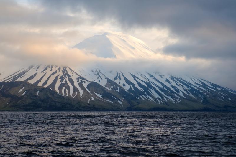
Tanaga Volcano from the northeast on May 23, 2021 (M.W. Loewen/Alaska Volcano Observatory)
Two western Aleutian volcanoes are showing signs of unrest, signaling the potential for an eruption in the coming days or weeks.
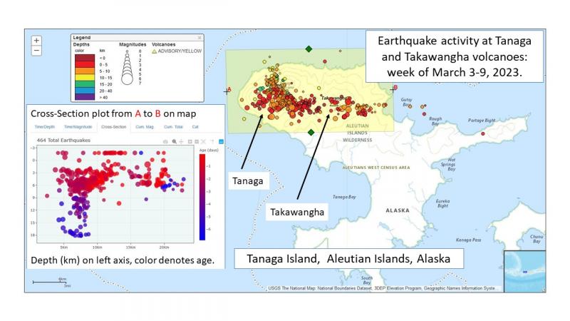
Tanaga and Takawangha Volcanoes are about 60 miles west of Adak. Earthquake activity started increasing near Tanaga on March 4, with Takawangha following on March 8, according to the Alaska Volcano Observatory.
“It certainly appears that there’s magma moving at a shallow level beneath the volcanoes,” said U.S. Geological Survey Geologist Tim Orr. “But it’s uncertain right now if they will erupt — or which one will erupt.”
Tanaga and Takawangha are 5 miles apart on uninhabited Tanaga Island.
Recent earthquake activity under Tanaga Island. (Max Kaufman/Alaska Volcano Observatory)
Due to the volcanoes’ remoteness and close proximity to one another, records of their historical eruptions aren’t perfectly clear. Tanaga’s last recorded eruption was in 1914. There are no recorded historical eruptions at Takawangha, but scientists say it’s possible some eruptions attributed to Tanaga may have actually come from Takawangha.
Orr said the observatory is monitoring the volcanoes’ current activity by satellite and through reports from people passing by.
“We don’t really have eyes on the volcano, except from space,” said Orr. “It’s possible that people in the area — mariners or pilots in the area — might spot something happening and report it to us. We rely on a lot of different sources to determine whether a volcano has erupted.”
If the volcanoes erupt, Orr said ashfall would certainly affect air travel in the area — just how much would depend on the wind.
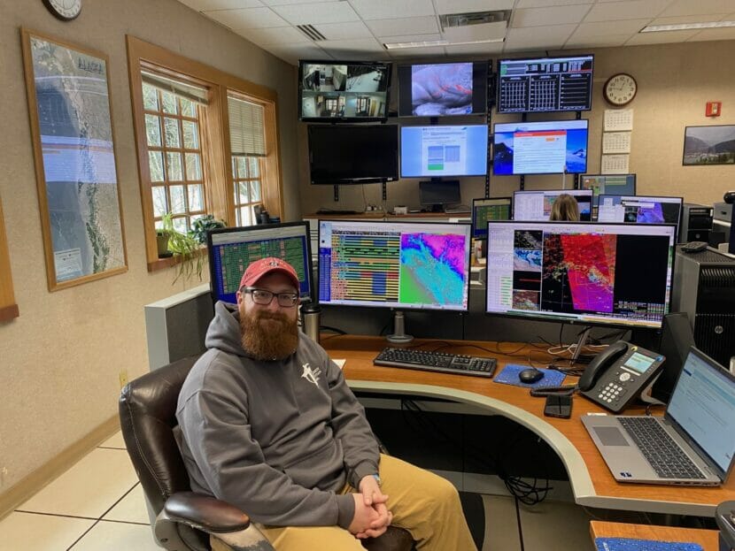
Meteorologist Grant Smith at the National Weather Service office in Juneau. (Photo by Anna Canny/KTOO)
Last week, a blizzard in Juneau forced schools to shut down in the middle of the day, touching off a scramble to pick up kids amid blowing snow and slippery roads.
School officials told parents they chose not to close ahead of time — despite forecasts that had called for up to 8 inches of snow — because “often the weather doesn’t hit as forecasted.”
It’s true. Weather forecasting is notoriously hard to get right, especially in Southeast Alaska. No one knows that better than National Weather Service meteorologist Grant Smith.
“One time I was standing at my house looking outside, just drinking my coffee, and it was 34 and raining. Later that afternoon it was 38 and snowing,” Smith said. “I was just like, ‘I give up.’ It’s a moving target.”
Smith moved to Juneau in 2020 after seven years working as a TV meteorologist in South Dakota. He says forecasting there was a little more straightforward.
“South Dakota, a lot of it is flat. So you can just take the models and go ‘eh, that sounds right’,” Smith said. “Because it’s flatter, the range of possibilities is much smaller.”
Models meet microclimates
Weather forecasts start with three basic components: satellites, radar and models.
Together, radar and satellite imagery show the basics of incoming weather systems. Meteorologists can look at them to see the direction of a storm or the intensity and location of precipitation.
Weather models are used to bring out the finer details. Smith and his colleagues at the NWS run more than a dozen models to build the forecast each day. They all use the same basic principle: running simple atmospheric data through complex equations that predict things like wind speed, dewpoint and temperature.
But what’s happening in the atmosphere doesn’t always give a clear picture of what’s happening on the ground. That means forecasters have to compare the weather systems to what they know about the terrain. And the mountains and waterways of Southeast Alaska make things complicated.
For instance, Hoonah and Gustavus are fairly close to each other, but the same wind pattern can cause very different weather in each.
“The north wind for Gustavus is coming off of land — probably going to be cold, probably going to be snow,” Smith said. “But a north wind over Hoonah is coming off the water. Rain, rain-snow mix, or rain.”
Juneau alone has a handful of distinct microclimates.
Downtown, right on the water, it’s usually rainier. When fronts come off the ocean, clouds hit Douglas Island before dumping rain downtown. Meanwhile, in the Valley — which lies in the shadow of Mendenhall Glacier — it’s often less rainy and colder and snowier in the winter.
And the area at the edge of the Mendenhall Wetlands is known for dense fog.
“So naturally, we put an airport there,” Smith said. “That’s what we always joke about.”
Meteorologists can adjust the forecast to account for those differences. Meteorologist Nicole Ferrin says the models predict weather conditions for areas that are three square kilometers. But even in that small grid, Juneau’s terrain can change from land to ocean to high mountain peaks.
By living and working in Juneau, Ferrin has learned to adjust the model forecast grid by grid to fit community needs.
“The majority of this box is a mountain, and the models think that that is a mountain point. They don’t know that Home Depot’s right there. Right? But I do,” she said, as she clicked to edit the temperature forecast by hand. “I know that there’s people that live there and might be clicking on that point to get the forecast. So I’m gonna adjust that to match.”
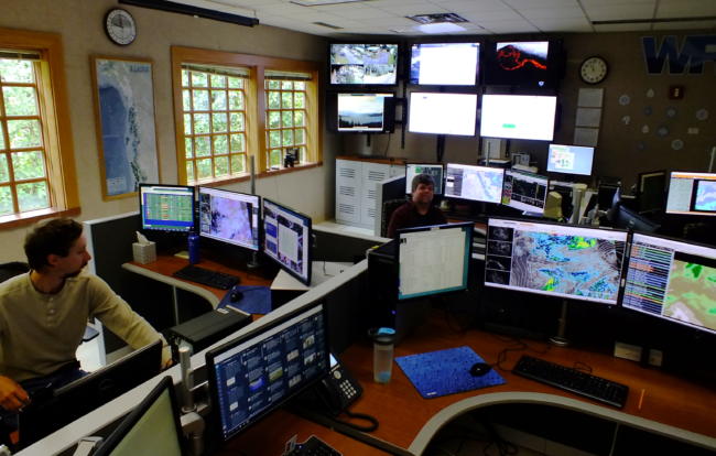
Forecasters in the Juneau office of the National Weather Service work 24 hours a a day to keep tabs on changing weather throughout Southeast Alaska. (Photo by Matt Miller/KTOO)
A Florida-sized chunk of Alaska
Southeast’s mountains and waterways are only part of the challenge. It’s also just a huge forecast area.
“Our area is about the size of Florida,” Smith said. “And Florida has six or seven offices. And we have one.”
After twelve years in Juneau, Ferrin has the benefit of local knowledge. But not all meteorologists stick around that long. And many of them haven’t visited all of the small communities they’re called on to forecast for.
So they turn to the people that live there.
The final component of the weather forecast comes from real-time observations, collected at weather stations scattered all over the Panhandle. They measure things like precipitation, wind speed and temperature.
But a lot of the data that forecasters rely on comes from volunteers.
“People that are weather nerds like the rest of us here in the building,” Smith said. “They like the weather, so they report on it.”
Spotters are trained on how to collect key pieces of weather data. When storms hit, they send information by email or over the phone from all across Southeast Alaska.
Sometimes they beat the weather system. If a front passes over Gustavus, for instance, those local observers can help meteorologists predict what’s going to happen in Juneau.
Still, over an area the size of Florida, there are bound to be some gaps. Some places lack weather stations and spotters, which makes forecasts less precise.
“We have a weather ob[servor] here, Tenakee Springs. We have one in Angoon. And then nothing between there,” Smith said. “So we may not know what’s going on there all the time.”
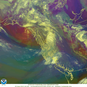
This satellite animation from the National Weather Service shows a weather system moving across Southeast Alaska on morning and afternoon of Aug. 2, 2022.
An abundance of caution
NWS forecasters often default to the more significant weather possibility, especially when making storm advisories or warnings. So if the conditions for heavy snow are there, they’ll include it in the forecast even if they can’t be sure it will happen everywhere.
“Sometimes when we issue a storm warning, you know, the range can be two to eight inches,” Smith said. “It’s not because we’re not sure. It’s because we think two inches down there and eight inches over there.”
If it does snow, the forecast gives the public time to prepare. If it doesn’t, it might be a pleasant surprise. But because their top priority is safety, they’re likely to over-predict sometimes.
Despite the challenges, Smith says assembling a forecast in Southeast Alaska is more satisfying than anywhere else he’s worked.
“It makes it kind of more of a challenge,” he said. “And more fun when you can nail it. When you get it right.”
Sunrise over Thomsen Harbor in Alaska. Mt. Edgecumbe, Sitka Ranger District, Tongass National Forest, Alaska. (Forest Service photo by Jeffrey Wickett)
The Alaska Volcano Observatory is planning to install a series of seismic instruments on Mount Edgecumbe near Sitka after preliminary measurements showed magma moving deep below the Mount Fuji-shaped volcano.
The movement doesn’t mean an eruption will happen soon — or even at all — from Southeast Alaska’s most prominent volcano, but it’s significant enough that the observatory has raised the volcano’s threat level.
“Internally, how we think about Edgecumbe has changed. It definitely has moved up,” said Cheryl Cameron, a state geologist who works at the volcano observatory.
Officials at the observatory have been paying greater attention to Edgecumbe since April last year, when a swarm of small earthquakes brought attention to the volcano, which had been considered dormant.
A new information update, released Friday, shows the earthquakes have continued, hikers have observed gas bubbling from the ground near the volcano, and satellite radar measurements show the ground around the volcano bulging upward.
“Our latest update is really just saying, ‘Hey, this unrest is still going on. We still think the magma is very deep. It might not erupt. If it does erupt, we expect a lot more activity before that happens,’” said Michelle Coombs, a USGS geologist and scientist-in-charge at the Alaska Volcano Observatory.
In an October paper published in the journal Geophysical Research Letters, scientist Ronni Grapenthin noted that the ground on the east side of the volcano was bulging outward at a rate faster than any other volcano in Alaska.
“Other volcanoes have had similar amounts of deformation without erupting,” Coombs said, noting that the ground around Laguna del Maule in Chile has been bulging outward even more quickly than Edgecumbe, and for a longer period, without an eruption.
Mount Edgecumbe is now considered a “high” risk volcano, one step below the state’s “very high risk” volcanoes: Augustine, Spurr, Redoubt, Akutan and Makushin.
Risk isn’t just the likelihood of an eruption, Coombs said. It’s also based on how close a volcano is to homes, businesses and structures.
Mount Rainier, in Washington state, hasn’t erupted in more than 500 years and shows no signs of doing so, but it’s the No. 3 risk in the nation because of its threat to the people living nearby.
There are no written accounts of eruptions from Mount Edgecumbe, but Tlingit oral tradition calls L’úx Shaa (the original name of Edgecumbe) “a mountain blinking, spouting fire and smoke” about 800-900 years ago.
Scientific core samples indicate eruptions about 4,000 and 4,300 years ago, with additional eruptions before that.
“To a geologist, erupting 4,000 years ago is pretty recent, you know?” Coombs said.
A series of eruptions about 14,000 years ago spread volcanic ash across Southeast Alaska that may have helped melt the glaciers that covered the region at the time.
Now, 73,000 people live in the region. Sitka, with a population of about 8,400 people, is 14 miles away.
Don Kluting and his wife, Denise Turley, are among those 8,400 people and frequently travel across Sitka Sound to Kruzof Island, home to Mount Edgecumbe, for hikes and birding.
In October, they found something new — gas bubbling through several ponds on the east side of the island.
Turley said their first thought was that the bubbles were from something decomposing in the ponds or from tidal action, but they’d never seen them before and thought the bubbles remarkable enough to report them to Cameron, who is Tlingit and from Sitka.
That report inspired the volcano observatory to plan a gas-sampling mission, which could take place as early as May. If the gas bubbling through the lakes is magmatic, she said, it’ll be another sign of activity at the volcano.
About the same time, the observatory will be placing three or four additional instrument stations on the volcano.
These stations will use GPS to track the volcano’s continued expansion, and their seismographs will allow scientists to triangulate the small earthquakes that take place within the volcano as magma moves around.
Cameron said the observatory is also planning a meeting with Sitka residents to explain what’s going on with the volcano.
Partially because of their experience, Kluting and Turley have been following events more closely than most. They said they’re not concerned by the volcano’s movement or the distant prospect of an eruption.
“I guess I trust the science on it,” Kluting said. “I have certainly heard from people that are very concerned and feel like they’re scared. After talking with Cheryl and crew, I think that the monitoring works. I think the science is behind it. I think they’re doing due diligence and following through and they believe there’s going to be lots of warning if we ever get to that point, and it may never happen.”
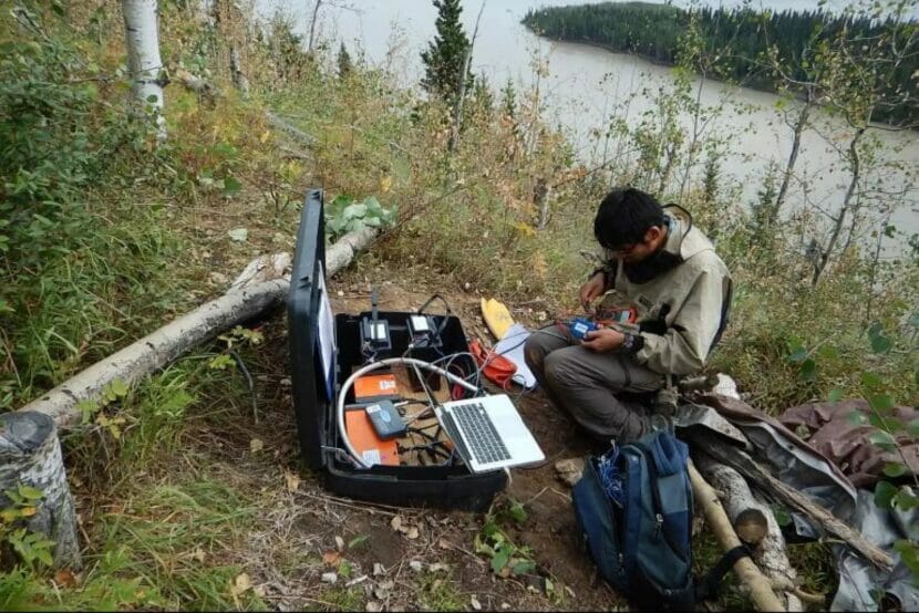
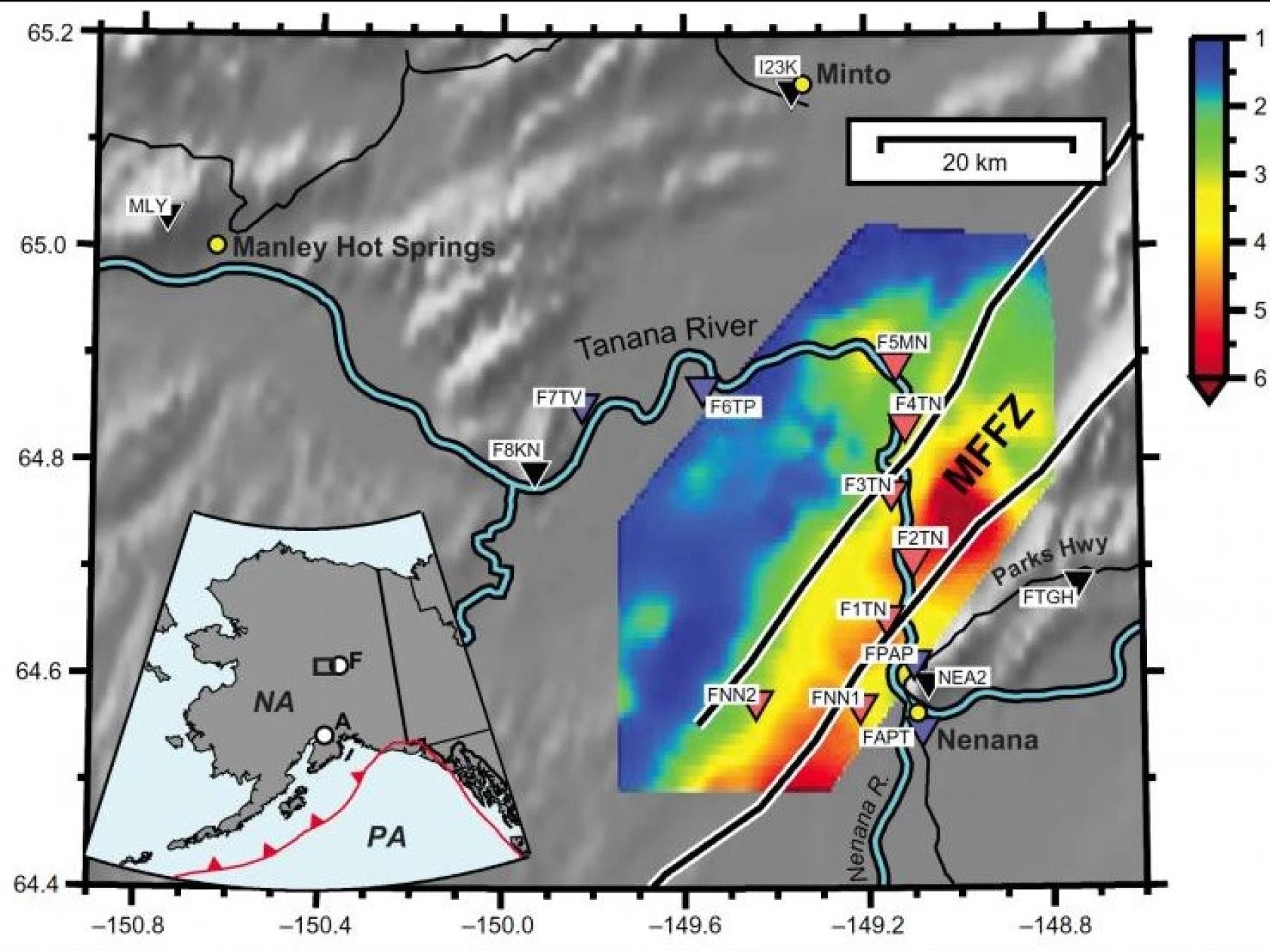
University of Alaska Fairbanks Ph. D. student Kyle Smith services a seismic sensor in 2018 on the bank of the Tanana River in the Minto Flats area. (Photo by Carl Tape/UAF Geophysical Institute)
Earthquakes in the Nenana Basin in Interior Alaska last longer and feel much stronger than quakes of comparable magnitude in other places.
University of Alaska Fairbanks scientists are studying why.
It’s all about the reverberation.
Below the beautiful lakes and swamps in the Minto Flats region is a giant bowl, and it’s filled with gravel. UAF Geophysical Institute seismology professor Carl Tape said to imagine the flat surface of the land like the surface of the ocean, and if you removed the water, you’d see interesting things revealed.
“If you remove all this dirt that’s been deposited, there’s a lot of interesting features,” he said. “These deep bowls, depression, exists west of the town of Nenana, where the Tanana River kind of takes a turn and flows north, toward the Minto Flats area before it goes west and eventually into the Yukon. So in that area of Minto Flats, what looks very flat and normal at the surface has a lot of really interesting features beneath.”
Tape worked with graduate student Kyle Smith, placing 13 seismic monitors across the area over four years, from 2015 to 2019. In that time, they collected data from 48 local and regional earthquakes. The monitors, the first seismic stations installed in Minto Flats, are part of the Fault Locations and Alaska Tectonics from Seismicity project funded by the National Science Foundation.
“That area has not been really studied that much,” said Smith. “And we wanted to know how the basin moved, because people want to do a lot of projects in that region. So it’s good to know what happens when there’s a big earthquake.”
They found that the seismic waves get amplified as they bounce back and forth off the sides and bottom of the sedimentary basin. So people in the flats perceive the earthquakes as bigger than they actually are. They also incorporated discussions with people who live and work in Minto into their research.
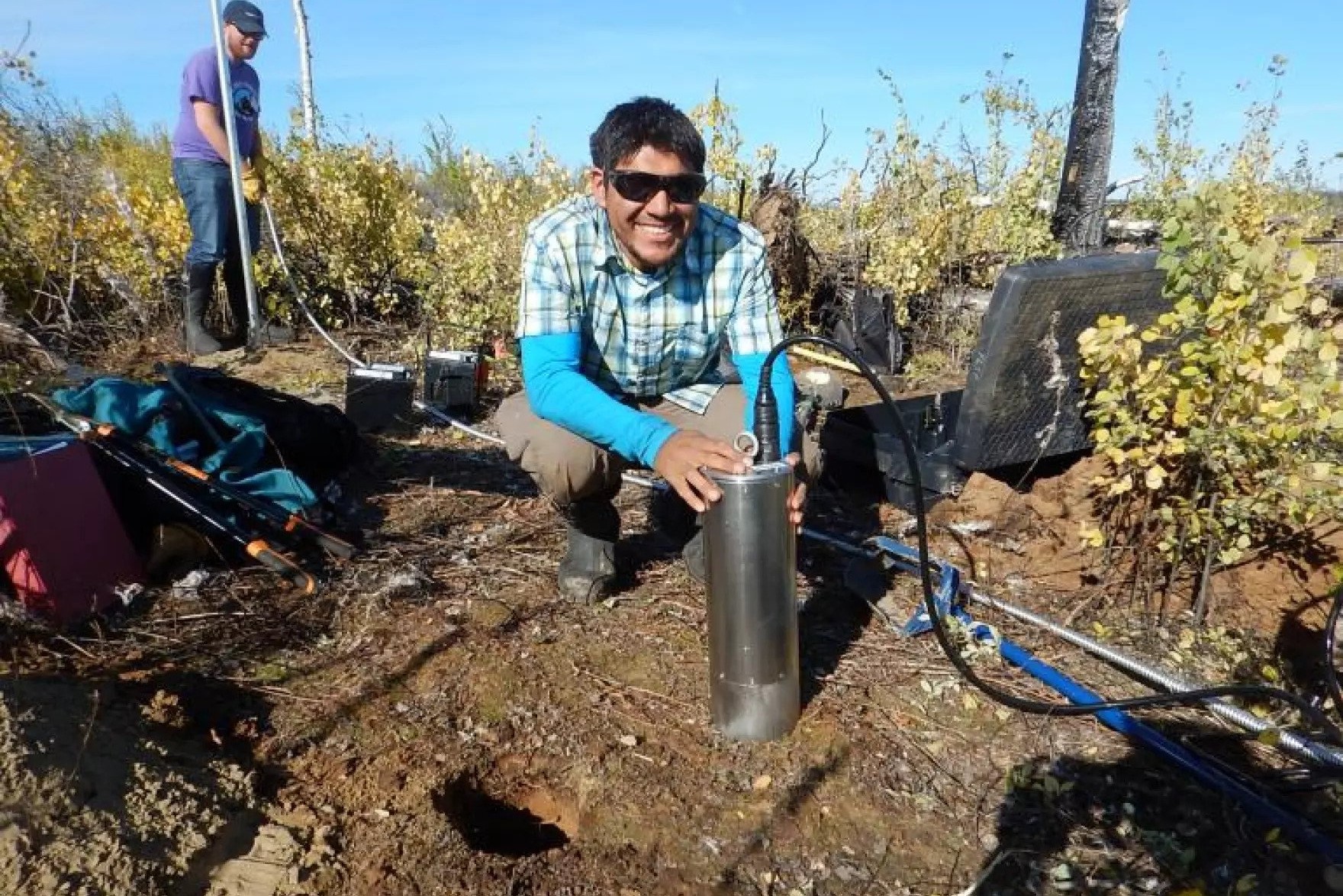
University of Alaska Fairbanks Ph. D. student Kyle Smith installs a seismic sensor in 2015 in the Minto Flats area. (Photo by Carl Tape/UAF Geophysical Institute)
The basin west of Nenana and south of Minto is 56 miles long and 7.5 miles wide. It was filled in over millions of years with sediment brought by the rivers from the Alaska Range. Smith said it could be the deepest such basin in Alaska.
“ It’s up to seven kilometers deep, so that maybe about four miles,” Smith said.
That is deeper than Denali is high.
Map of the Nenana Basin and Minto Flats fault zone. Triangles show seismic stations that operated from 2015 to 2019 in the Tape/Smith study. (UAF Geophysical Institute)
The seismic monitors recorded earthquakes lasting longer on the gravel-filled basin than on harder ground. Both Tape and Smith noted the measured difference between the Nenana Ridge under the Parks Highway, and the flats below.
“The ridge between Nenana and Fairbanks, when you drive along that, you’re high up on pretty close to rock. The ground moves very differently in that kind of material than it does down in Minto Flats.”
“There’s certain places that, because of the exceptional topography below ground in this case, is big basin Bowl amplifies the ground motion and makes it last longer. And we know that because we put the stations out there to record earthquakes,” Tape said.
“The shaking is like 10 times less compared to if you were just downhill from that. So it’s pretty amazing how stark the difference is caused by whatever the underlying geology is,” Smith said.
Smith was raised in the Navajo Nation, got his Ph. D. at UAF, and is on a new research assignment in Taiwan.
Tape said many UAF scientists are targeting the basin for research.
“But the same features are what led, you know, like Doyon, for example, to drill exploratory wells and acquire geophysical data because of the prospects for oil and gas,” Tape said.
Although the research shows how the ground would likely move during certain kinds of earthquakes, Smith cautions that actually predicting earthquakes is a long way off.
“ We will have a better idea of how much the ground will be shaking from some kind of earthquakes, but that doesn’t tell us when and where the earthquake is occurring,” Smith said.
Smith will give a talk on the research at Sandia National Laboratories in May.
Cape Serdtse-Kamen’, a headland on the northeastern coast of Chukotka, has been reported as a walrus haulout since the 1920s. (Anatoly Kochnev)
Last October, research biologist Tony Fischbach made a startling discovery. Using satellite imagery, Fischbach and his team counted 200,000 Pacific walruses on one Russian beach at Cape Serdtse-Kamen’, bordering the Chukchi Sea.
It suggests that the most recent population estimate, which measured about 260,000 Pacific walrus in the world, may have been an undercount.
A year ago, Fischbach would have been able to quickly confirm the finding with his Russian colleagues. But since the U.S. severed many research ties with Russia at the start of the Ukraine invasion, he doesn’t know when that will happen.
Fischbach studies walrus populations for the U.S. Geological Survey, a federal agency that studies natural resources and the hazards that threaten them.
For decades, stretching back to the Cold War, Russian and American scientists have been close partners on Pacific walrus research. U.S. and Soviet researchers began flying joint aerial surveys to count the animals in 1975.
“Even during my career — almost 30 years — there are people I’ve worked with the entire time,” said Fischbach. “They’ve been on ships with us shoulder to shoulder working closely together. We gathered data together, we published it together, that’s been our tradition.”
Walrus are an important subsistence animal for coastal Bering Sea communities. But as climate change speeds sea ice loss, the habitats and migration patterns of these massive marine mammals are changing in new and unpredictable ways.
But walrus don’t recognize international borders. And after Fischbach and his American colleagues made their exciting population discovery last year, it’s been hard to move the research forward without Russian input.
Since Russia invaded Ukraine last February, the U.S. imposed sanctions and began to cut off government funding and research relationships with Russian government-affiliated research institutions.
As a result, Fischbach, a federal employee, has had no communication with his colleagues across the Bering Strait.
“We don’t want them to be put in any danger for communicating with Americans. And due to our sanctions, we also need to step back and not have direct communication,” he said.
There is a caveat to the count that Fischbach needs his Russian colleagues to clear up. The 200,000 estimate relied on walrus density measurements made in Alaska — that is, how closely the walrus pack together when they haul out on shore.
Fischbach said they won’t know their measurement is correct until Russian scientists publish their own density data and confirm Fischbach’s team accurately interpreted the satellite images.
“Our approach is to continue doing what we can and hope that they can do what they can,” Fischbach said. “We’ll publish our findings and our data. They can access that, they can publish their findings and their data. And we can move our science forward.”
This new format for scientific progress is like playing a long-distance game of telephone through formally published findings.
The strained relationship between Russia and the U.S. has also slowed research at the university level.
Vladimir Romanovsky, a Russian-born permafrost scientist at the University of Alaska, Fairbanks, said increased tension with the outside world has made it riskier for Russian scientists to work with foreign agencies. It’s a tricky path to navigate, he said, because the government also wants international recognition for their science.
“On the one hand, they push [Russian scientists] to work with Western scientists and publish in Western literature. But on the other hand, if you’re doing it, you always have a chance to get in trouble,” Romanovsky said. “That’s Russia.”
Romanovsky said Russian scientists who accept funding from abroad also risk being labeled a “foreign agent” by their government.
“Which is very serious in Russia. You can go to jail for that,” Romanovsky said.
Universities aren’t subject to the same sanctions that federal agencies like USGS are, so Romanovsky can still communicate virtually with his Russian colleagues. But meeting in person has proved difficult as the international scientific community has moved to exclude Russia from conferences in the last year.
Romanovsky said while it’s still possible to continue ongoing projects with his Russian colleagues, starting any new collaborations will be difficult.
“It’s hurting, not immediate right now. But [in] the future, definitely, there is much more problems with the future,” he said.
Romanovsky wants to bring some of his colleagues to Alaska for a research visit in the fall, but he said getting them visas will be nearly impossible.
Meanwhile Fischbach is waiting to see if his Russian colleagues confirm the giant walrus count with their own scientific paper. There’s no way to know when the publication is coming, but he said he trusts they’re working on it.
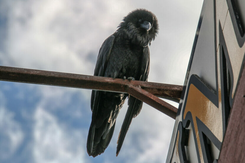
A Fairbanks raven looks down on an observer at the Shopper Forum Mall in May 2020. (Photo by Hannah Foss/UAF)
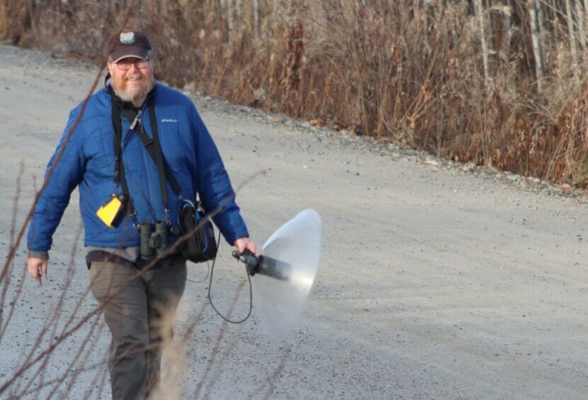
Be careful what you say, ravens. Doug Wacker is listening to you.
Wacker studies animal behavior at the University of Washington Bothell. Since August 2022, he has been in Fairbanks, following ravens. When he hears them vocalizing, Wacker points at the big, black birds with a microphone attached to a plastic dish that resembles a giant contact lens.
Wacker is recording as much raven talk as he can in Fairbanks. He wants to find meaning, if any, in the squawks, rattles and water-droplet/computer sounds that so often come from those black beaks.
Many of Wacker’s recordings are the voices of members of the greatest local congregation of ravens he has found so far — at the Fairbanks dump.
“I never thought I would go do an academic sabbatical in a landfill,” Wacker said during a recent presentation.
Wacker wonders if there is any pattern in the array of sounds that come from a raven’s mouth. Over the years, researchers have identified up to 116 different vocalizations from ravens.
Doug Wacker walks a Fairbanks road last fall while pursuing ravens, the voices of which he is recording. (Photo by Kim Wacker.)
Though scientists who study ravens have debated that number, William Boarman and Bernd Heinrich described a few types of specific calls in a raven description they wrote for the Cornell Lab of Ornithology’s Birds of North America. The distinct calls were begging, vocal play, predatory alarms, demonstrative calls, knocking, comfort sounds, chase calls and mimicry.
Wacker is now recording the sounds of ravens (and their present cohorts bald eagles) at the Fairbanks landfill 24 hours a day. He is also recording at many other places opportunistically.
Wacker wants to further decode raven calls using machine learning, which he describes as using a computer to look for patterns.
He said humans are biased in their descriptions of sounds, noting that scientists have described the same call ravens use to announce they have found food as an aw, a kow, a ky and as a yell.
“We’re all calling the same call something different,” Wacker said.
He looks at raven calls with spectrograms — visual displays with colored peaks and valleys that spill over his computer screen. These allow him to compare the sounds using his eyes as well as his ears. For example, he can measure with precision the length of a raven’s call and the time between syllables.
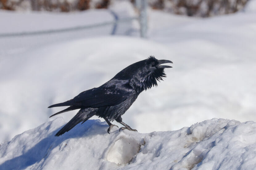
A raven vocalizes on the west side of Fairbanks in April 2021. (Photo by Hannah Foss/UAF)
He hopes that as he uploads snippets of Fairbanks raven chatter, the machine-learning computer will separate raven calls into categories he would not have come up with himself.
For now, Wacker taps his brake and steps outside his car near Wendy’s, where he records ravens talking over the traffic on Airport Way.
With the help of artificial intelligence, he might gather enough raven talk during his sabbatical year to help us humans come up with a better idea of how our dumpster companions are communicating.
Which raises a question: Do we really want to know what ravens are saying about us?
Close
Update notification options
Subscribe to notifications
Subscribe
Get notifications about news related to the topics you care about. You can unsubscribe anytime.