Science & Tech

What history’s hidden grandmother of climate science teaches us today

There are no lasting photos of Eunice Foote. Her experiments set the foundation for climate science. (Carlyn Iverson/NOAA Climate.gov)

Today, most climate science is done with satellites, sensors and complicated computer models. But it all started with two glass tubes.
“A woman, about 170 years ago, used a very simple experimental setup – two glass tubes, two thermometers, an air pump – and was able to demonstrate that if you add carbon dioxide to the atmosphere, you warm it up. It’s basic physics,” says Annarita Mariotti, a climate scientist and program director of Modeling, Analysis, Predictions, and Projections at the National Oceanographic and Atmospheric Administration.

Eunice Foote, the woman behind that glass tube experiment, has largely been left out of the history books. Until about 10 years ago, John Tyndall was seen as the grandfather of climate science for setting the foundation for the understanding of the greenhouse gas effect. But Foote’s experiment, done three years prior, showed that air with more “carbonic acid,” or carbon dioxide, both heated up faster and cooled down slower than regular air.

“She actually did some really important work before John Tyndall even got going. So why was there this grandmother of climate science that had essentially been written out of the history books?” asks Katharine Wilkinson, a climate scientist and the executive director of The All We Can Save Project. “Some of the frustration is that her story is still all too relevant today, that there are still far too many women doing really important work that either flies under the radar or gets shoved under the radar.”

Foote’s study was relatively straightforward. In a series of experiments, she took two glass containers full of air and would pump different gasses – including carbon dioxide and water vapor – into one of the containers. She would then leave those containers in the sun and monitor how quickly they heated up and cooled down in the shade.

Her work was presented in 1856, at the annual meeting of the American Association for the Advancement of Science. It was the first work done by a woman to be presented at the conference – though she did not give the presentation herself. Rather, it was done by physicist and first secretary of the Smithsonian, Joseph Henry.

But Foote didn’t just pioneer the field of climate science. Mariotti says, “She opened doors for women in science and in general broader representation in sciences … She did not have a Ph.D. and she did not have sophisticated experimental set up. And still she did it.”

Foote was a pioneer in more ways than one. She was the first woman in the United States to publish papers on physics; she also advocated for women’s rights outside of academia. Foote helped organize the Seneca Falls Convention, which launched the women’s suffrage movement in the U.S. “There was something sort of intersectional, perhaps, in her thinking in her life,” Wilkinson says. “If we are not bringing critical lenses to understand the root causes of the climate crisis, if we’re not bringing critical lenses to understanding the need to embed equality and justice in the solutions to the climate crisis, we’re not going to get to a good outcome … There’s early seeds of that in Eunice’s story as well.”

Listen to Short Wave on Spotify, Apple Podcasts and Google Podcasts.

This episode was produced by Liz Metzger, edited by Rebecca Ramirez and fact-checked by Anil Oza. The audio engineer was Robert Rodriguez.

Copyright 2023 NPR. To see more, visit https://www.npr.org.

Annual test of Alaska’s tsunami warning system scheduled for Wednesday

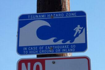
A Tsunami hazard zone warning sign.
A Tsunami hazard zone warning sign. (Photo by Derin/Flickr Creative Commons)

Many Alaskans will get a tsunami warning on Wednesday at 10:15 a.m. It’s a test, but the people sending it out are worried that not everyone will know that.
Dave Snider of the National Tsunami Warning Center says that’s because the system used to send out tsunami alerts is outdated and overly complicated.

“We’re operating on a system that is probably closer to where meteorology and weather science was 20, 30 years ago,” he said.

Real tsunami warnings get broadcast on local radio and TV stations and relayed through warning sirens, in places that have them. They also go out through wireless emergency alerts — the kind that can show up on your cell phone’s lock screen, sometimes with an irritating siren noise. 

For Wednesday’s test, the cell phone alerts won’t be activated. But Snider says it’s possible that some mobile apps might spread the warning anyway. And due to incompatible software, those third party apps could misread the code that communicates the warning and leave out the part that says it’s a test. 

Tsunami push notification sent out through the wireless emergency alert system on Jan. 23 via IPAWS. (Screenshot by Aaron Bolton, KBBI)
Tsunami warnings sent out through the wireless emergency alert system look like this. Those alerts shouldn’t go out on Wednesday, but similar third-party messages could appear on your lock screen (Screenshot by Aaron Bolton, KBBI)

“We do rely on our third party, private industry and enterprise to make sure that they’re keeping up with the changes that we’re making, and making sure that they understand the code that we’re using,” Snider said.

It’s also possible that the warning will reach people outside of the testing zone. That’s because tsunami warnings are issued using weather forecasting boundary zones —  the same ones used to issue alerts for weather hazards like winter storm warnings.

Most of the zones cover large areas, and they’re not designed for tsunami warnings. Snider says feedback from tests — like hearing from people outside tsunami zones — is vital to designing a better warning system. 

“One of the results of this will be to see, are there places that are getting this alert that shouldn’t get the alert? And we may find a couple of those places,” Snider said. “Because we know in the past, there have been some areas that have been over-warned or over-alerted.”

The warning center runs the annual test each March as part of Tsunami Preparedness Week. It falls around the anniversary of the devastating tsunamis of the Great Alaska Earthquake of 1964. 

Those tsunamis are why the center exists in the first place. Decades later, the technology for sending out precise warnings is very much a work in progress. In a report last year, the NOAA science advisory board called for “urgent action” to update the tsunami warning system. 

Snider says perfecting that technology could take decades longer — and in the meantime, he expects some errors.

“​​Twenty years from now, when we’ve redesigned the alert system, it won’t happen,” he said.  “It’s a technology thing, and we’re constantly working to refine that and keep people safe.”

Feedback from this week’s test will help to improve things along the way. People in the southern Alaska tsunami zones are encouraged to submit their comments at www.ready.alaska.gov.

Eruption risk down for 2 Aleutian volcanoes

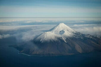
Tanaga in November 2012. (Roger Clifford/Alaska Volcano Observatory/U.S. Geological Survey)

Scientists last week warned that two Aleutian volcanoes were at a heightened risk to erupt following an intense series of earthquakes nearby.

Since then, they’ve lowered the risk levels on Tanaga and Takawangha. But they’re continuing to watch for any signs the volcanoes could still erupt in the future.

John Lyons is a research geophysicist with the Alaska Volcano Observatory, which studies volcanoes like the ones on Tanaga Island and watches out for potential hazards. They keep an eye on the volcanoes on the island with satellites and six remote monitoring sites.

“We had seen seismic unrest going back into the fall of 2022 at Takawangha Volcano,” Lyons said.

Swarms of earthquakes, like the one at Takawangha, can be precursors to volcanic eruptions.

Two weeks ago, Lyons said the unrest started underneath its neighbor, at the Tanaga Volcano.

“At the same time, the earthquakes got shallower — they moved up toward the surface,” he said.

That’s when the observatory upped the risk to color-code orange, which means a volcano is showing signs of unrest with an increased potential to erupt. Activity peaked between March 9 and 11.

But Lyons said after that, the rate, intensity and magnitude of the earthquakes happening there all began to drop — plus, observers weren’t noticing other signs of volcanic activity, like steaming.

“This was last Thursday,” he said. “At that point, we felt pretty good lowering the color code from orange to yellow.”

That means the observatory is seeing signs of unrest of the volcano but doesn’t think those signs are going to lead to what Lyons calls “imminent eruptive activity.”

“Yellow is like an advisory level,” Lyons said. “It’s kind of like, heads up, this isn’t background activity — there are still earthquakes ongoing. I think in the last week, we’ve had maybe 15 or so magnitude 2-plus earthquakes, which are pretty big for volcanoes.”

Still, he said those are a step down from the magnitude 3-plus earthquakes the observatory was picking up earlier in the month.

Lyons said his office is continuing to keep an eye on activities at Tanaga and Takawanga and that they’ll be ready to raise the alert level again, if needed. You can find daily updates on the volcanoes here. Lyons said there isn’t much of a concern about the human impacts of the volcanoes, since Tanaga Island is uninhabited and the closest community to the volcanoes is Adak, 60 miles away.

As coastal erosion pulls rural Alaska communities into the sea, new research seeks solutions

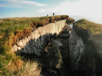
Coastal erosion reveals the extent of ice-rich permafrost underlying active layer on the Arctic Coastal Plain in the Teshekpuk Lake Special Area of the National Petroleum Reserve – Alaska. (Brandt Meixell/USGS)

For years, coastal Alaska communities, a majority of them Alaska Native villages, have contended with erosion, eating away at the land and pulling more and more of the coast into the sea. It’s led to a growing field of research into what can be done to address the problem.

new article from nonprofit environmental news outlet Grist takes a look at what’s at stake in these communities and what residents are doing to combat the loss of land. Author Saima Sidik discussed her story with Alaska Public Media.

Listen:

This interview has been edited for length and clarity.

Wesley Early: So can you set the scene for us in these communities? What are community members in Dillingham and other coastal communities having to contend with due to erosion?

Saima Sidik: Yeah, it’s really striking. If you walk down the beach in a lot of these places, you can just see the earth crumbling away. Huge bluffs are just not where you left them the day before. Rocks and trees fall over the edge. Landmarks are disappearing in some cases. These points that people used to use to navigate are just not there anymore to guide them. So definitely a big problem threatening a lot of infrastructure, a lot of people’s livelihoods and just overall causing a lot of havoc and hardship.

Wesley Early: Your story lays out a lot of local proposals to mitigate the impact of erosion. One of them has to do with reinforcing melting permafrost with something called thermosiphons. Can you explain what those are and how they address erosion?

Saima Sidik: Yeah, this is really interesting. So, this is something that Tom Ravens at the University of Alaska Anchorage is looking into. So thermosiphons are these large tubes that stick partly into the ground and partly out of the ground. And in them, there is a substance that alternates between being a gas and being a liquid. So when the substance gets cold, it condenses and it falls to the bottom of the tube, which is in the ground. And if the ground is warm, then that substance then heats up and turns back into a gas and goes up to the top of the tube where it’s colder. And in doing that, it delivers heat out of the ground and into the air. And so it sort of keeps the ground frozen. These have been used in some inland sites and there are some people who are suggesting that maybe they could be more widely used and maybe they could be part of a solution for erosion along coastlines.

Wesley Early: I know that scientists made another observation that has to do with this correlation between where subsistence hunters process marine mammals and the rate of erosion. Can you talk about that a little bit?

Saima Sidik: Yeah, for sure. So subsistence hunters have noticed that places on beaches where they process marine mammals after they catch them, those places tend to be resistant to erosion. And some scientists are wondering if there are oils that leak out of the mammals that might be responsible for that. And they’re wondering if similar compounds could be found in other oils, like maybe even waste cooking oil. So this could be a way to possibly, you know, repurpose your French fry oil. After you eat your fast food, you could isolate these compounds from the leftover oil. And maybe that could be a way to stabilize the beaches.

Wesley Early: In response to erosion, several Alaska villages in recent years have already begun the process of relocating their communities. Can you talk a little bit about discussions researchers are having around portable housing?

Saima Sidik: Well, my understanding — and I must say I’m not in Alaska, I’m not a Native person myself — but my understanding is that back in the history of a lot of these groups, they used to move from one place to another, depending on the season to keep themselves synced up with where natural resources were available. And some researchers are wondering, is it worth considering a move back to that sort of mobile lifestyle. And so there’s another researcher I talked to who is currently applying for funding to have conversations with Indigenous communities and ask them if they think living in structures that are meant to be moved when conditions necessitate that, if that could be a viable strategy.

Wesley Early: In addition to coastal villages losing physical land, you mentioned there is a historical component to what’s being lost in primarily Alaska Native communities. What did locals tell you about what’s at stake if the erosion continues to eat away at the coast?

Saima Sidik: Well, you know, it just really changes their, the way of life that they’ve had for a long time. These are people who have a really long and deep relationship with the coastline and for whom the resources that they get from the ocean are deeply important. And so having to change their whole lifestyle and their whole communities, having to rearrange their whole communities in response to this problem, it’s not as simple as it might be in some parts of the world. You know, if you buy all your food at the grocery store, then it might not be such a problem to just start going to another grocery store, but it’s not that simple when you’re used to relying on the land a bit more.

UAF scientist finds evidence of recent volcanic activity on Venus

This computer-generated 3D model of Venus’ surface shows the summit of Maat Mons, the volcano that is exhibiting signs of activity. A new study found one of Maat Mons’ vents became enlarged and changed shape over an eight-month period in 1991, indicating an eruptive event occurred. (NASA/JPL-Caltech)

A University of Alaska Fairbanks scientist has found evidence of relatively recent volcanic activity on Venus. UAF Geophysical Institute professor Robert Herrick reviewed radar imagery of the surface of Venus collected over eight months in 1991 by NASA’s Magellan spacecraft and found evidence of lava flow at a vent on Venus’s largest volcano: Maat Mons. 

“Not only is it 9 kilometers high, it covers an area that is over a thousand kilometers across, so we’re looking at a very small part of a gigantic volcano,” Herrick said.  

A paper outlining the discovery was presented at the Lunar and Planetary Science Conference happening this week in Texas. Speaking during a press conference Wednesday, Herrick explained the time lag between collection of Venus imagery by Magellan and the identification of active lava flow on Maat Mons. He said the ability to screen the vast amount of imagery gathered by Magellan was initially limited by technology.

“The type of analysis that resulted in this discovery, really required the ability to pan around few hundred gigabyte data sets and zoom in and out,” he said.

Herrick’s co-author, NASA’a Scott Hensley, emphasized that there’s no algorithm to search out the geographic changes caused by lava flow.

“This is still a manual task,” he said. “So you do need that new technology for displaying things because we can’t write mathematical code that can search through all the data to find that.” 

Herrick and Hensley’s research, which was published Wednesday in the journal Science, adds Venus to a short list of bodies in our solar system known to be volcanically active. Herrick says future Venus observation missions will likely document volcanic flows that have happened since those seen in the images captured by Magellan over 30 years ago.  

First Native woman in space is home

NASA astronaut Nicole Mann, Wailacki of Round Valley Tribes, taken out of the Dragon capsule on a stretcher as part of the recovery activities from space. SpaceX Crew-5 splashed down off the coast of Florida at 9:02 p.m. Eastern Time on March 11, 2023, after five months on the International Space Station. (NASA photo)

The first Native woman in space and Crew-5 returned to Earth Saturday evening after five months on the International Space Station. 

The SpaceX Dragon capsule splashed down off the coast of Florida near Tampa after nearly a 19-hour journey. 

“That was one heck of a ride,” Commander Nicole Mann, Wailacki of Round Valley Tribes, radioed after splashing into the Gulf of Mexico at 16mph. “Looking forward to next time.”

She logged 157 days in space, her first spaceflight. 

Mann and the crew — NASA astronaut John Cassada, astronaut Koichi Wakata of the Japan Aerospace Exploration Agency, and Roscosmos cosmonaut Anna Kikina — made the space station their home since October where they conducted scientific research for future space exploration and life on Earth. 

Besides dodging space junk, the astronauts had to deal with a pair of leaking Russian capsules docked to the orbiting outpost and the urgent delivery of a replacement craft for the station’s other crew members.

After splashing down in the ocean, Crew-5 was taken out of the capsule on a stretcher, one of the many recovery activities they will have to undergo, due to the change in gravity. 

Crew-5 was flown to Houston to reunite with their families after six months. 

Earlier in the week, high wind and waves in the splashdown zones kept them at the station a few extra days. Their replacements, Crew-6, arrived more than a week ago.

Remaining behind at the space station are three Americans, three Russians and one from the United Arab Emirates.

Wakata, Japan’s spaceflight champion, now has logged more than 500 days in space over five missions dating back to NASA’s shuttle era.

This story originally appeared in Indian Country today and is republished here with permission.

Site notifications
Update notification options
Subscribe to notifications