Science & Tech

Landslide-triggered tsunamis can strike without warning. Alaska researchers are trying to change that

A sign points out a tsunami evacuation route in Pelican, Alaska, in July, 2023. (Clarise Larson/KTOO)

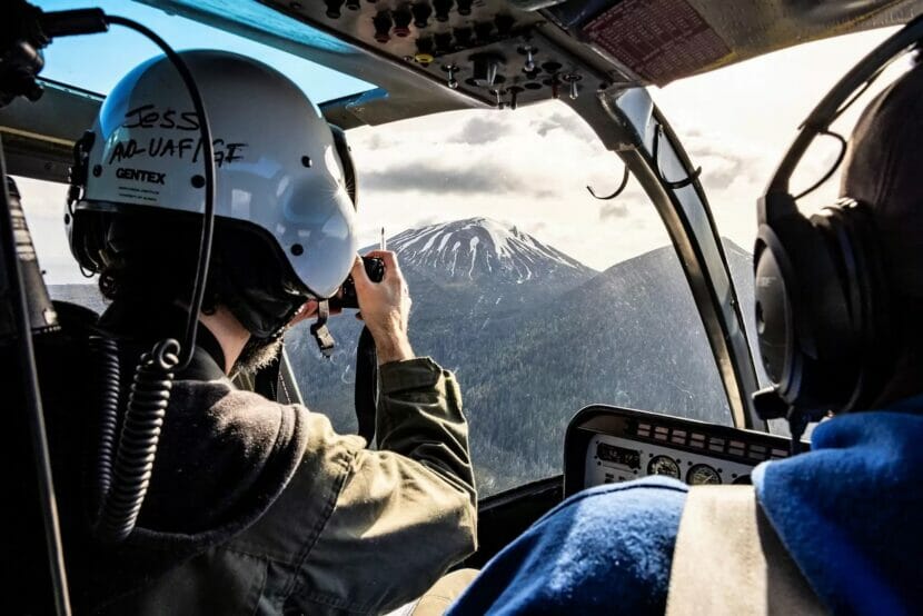
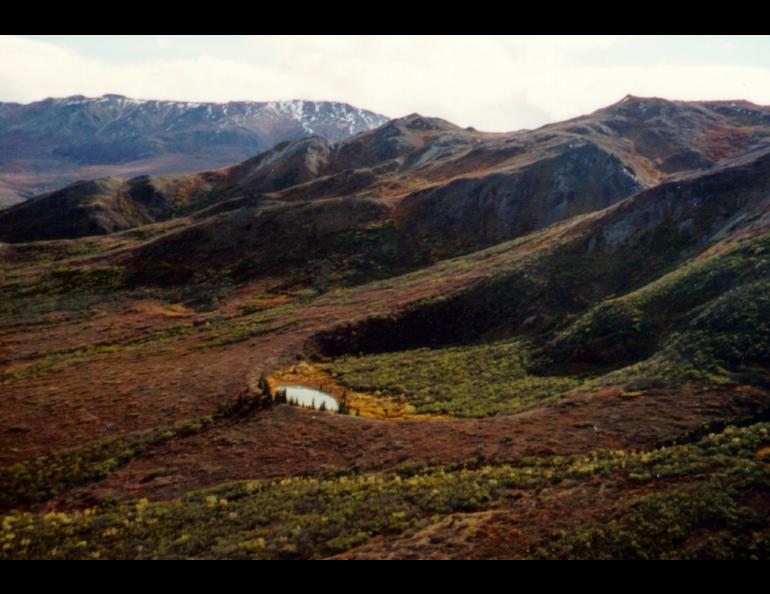
Alaska is home to breathtaking fjords, massive glaciers and a lot of mountainous nooks and crannies where nobody lives.

According to Mike West, director of the Alaska Earthquake Center, that rugged terrain is moving all the time in ways people might never see. 

“Alaska is one of the few places where you can have a really massive landslide and nobody knows about it,” he said.

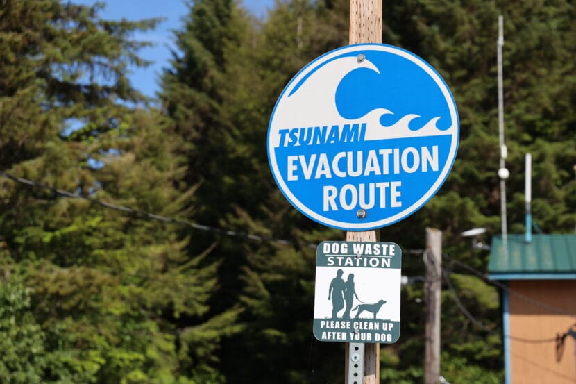
That happened 2015, when one of those remote landslides sent 180 million tons of rock tumbling into the Taan Fjord in Icy Bay. The force created a wave that crashed more than 620 feet up the shoreline. 

And back in 1958, a massive earthquake triggered the tallest tsunami in recorded history in Lituya Bay. The wave killed five people, and stripped land, rocks and trees up to an elevation of 1,720 feet. At first, researchers couldn’t figure out how it reached that high, until they discovered that a landslide from the head of the bay created a wave of massive proportions. 

Research seismologist Ezgi Karasözen with the University of Alaska Fairbanks said megatsunamis like that have the potential to be devastating for Alaska’s coastal communities.

“But we haven’t been monitoring these landslides routinely,” Karasözen said.

Until now. West and Karasözen have teamed up to develop a prototype method that can detect wave-generating landslides within minutes. They explain the new method in an article published in the journal The Seismic Record last month. 

Seismic records from a landslide at Barry Arm. The left depicts both short-period and long period waves. On the right, long-period waves only. (Image courtesy of West and Karasözen)

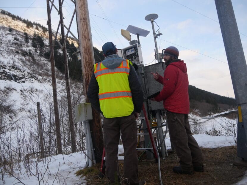
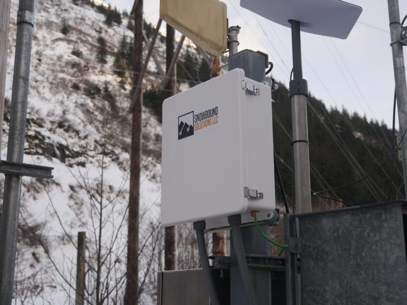
Luckily, they didn’t have to start from scratch. Since the Good Friday Earthquake wreaked havoc 60 years ago this week, the state and other agencies have installed hundreds of seismometers that detect earthquakes and all kinds of geologic movement. The prototype taps into that existing network.

“So we have the infrastructure in place already,” West said.  “It’s the same dang data – just analyzed in a different way.”

But the analysis is where things get tricky — because earthquakes, calving glaciers and all kinds of human noise create their own vibrations that can muddle the seismic records.

“When you only search for the landslide signal, the other signals become like noise to you, and you want to get rid of them,” Karasözen said.

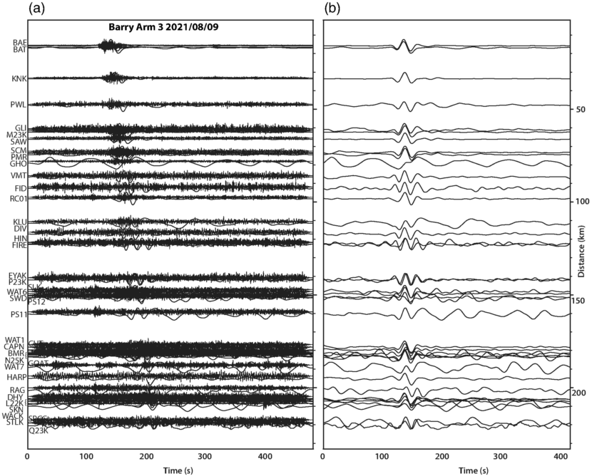
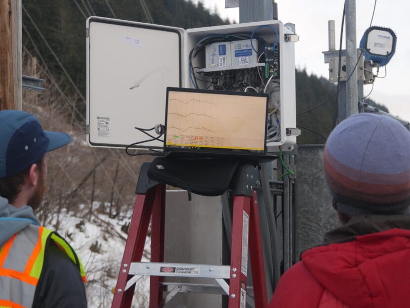
Seismic signals can be read on a graph of vibrations over time. Most earthquakes happen briefly, just a few seconds. That motion creates what’s known as a short-period wave.

A lot of things create short-period waves, so the seismic record gets really busy. But landslides routinely last a minute or more, which means they create more distinct long-period waves, too.

The new detection method routinely scans the seismic record for those distinct, long-period landslide signals. Once it finds one, it runs that reading through an algorithm that calculates the rough size and location of the slide. 

Karasözen says a detection system like this is more important now than ever because the risk of megatsunamis is growing as human-caused climate change melts glaciers.

“Once they retreat, these steep fjords we have all over coastal Alaska are losing their support,” Karasözen said. “If they were to fail — these slopes — they would fall into the water body and could trigger a tsunami that we wouldn’t know about.”

The Barry Arm fjord in May 2021. (Photo courtesy of the Alaska Division of Geological and Geophysical Surveys)

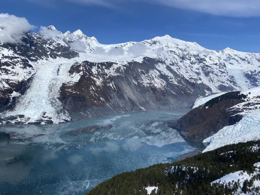
Barry’s Arm in Prince William Sound is probably the most well known example of this phenomenon. The steep face of the fjord, which was once buttressed by the retreating Barry Glacier, slumped hundreds of meters over the past few decades.

Scientists say a large tsunami there could hit nearby communities like Whittier within 20 minutes. Obviously that hasn’t happened yet. But West said that doesn’t mean it won’t happen in the future. He used the analogy of a dart board.  

“I’m a really lousy darts player,” West said. “If I’m shooting for bullseyes, the vast majority of my darts are going all over the place, they’re missing,” West said.

Like in Barry’s Arm, where there have been at least three landslides in the last five years, but no big tsunami.

“But every once in a while, that dart, by coincidence, happens to line up with a bullseye,” West said. “And kind of the same thing is true for these landslides, which are happening all over the place, but most of the time don’t intersect with population centers.”

West and Karasözen say it’s their job to prepare before the day a landslide-triggered tsunami hits the bullseye. Their detection prototype has been collecting slide data in Barry’s Arm since last summer.

Every landslide they detect helps train the technology to get more precise. At the same time, they need more scientists who know how to interpret the data. That means it could be a long time before the method can be used as a practical warning system. 

While monitoring of traditional earthquake-triggered tsunamis in the state has been honed over the last 60 years since the Good Friday earthquake, West points out that the science for detecting landslide-triggered tsunamis is still very young — but the new method is still a major step for tsunami preparedness. 

“I’ve been humbled enough times on the earthquake side of things to appreciate that we still have a ways to go,” he said. “But this is research that has the potential to protect people.”

New development center will connect Alaska businesses with AI tools

Jon Bittner is the Director of the Alaska Small Business Development Center in Anchorage. (Courtesy Jon Bittner)

Artificial Intelligence or AI technology is advancing faster than most people can keep up. That includes small business owners in Alaska. The Alaska Small Business Development Center has a new resource center aimed at familiarizing businesses with AI tools.

Jon Bittner is the director of the new center.

Listen:

Ava White: Jon, what prompted you to start this center?

Jon Bittner: A lot of things. Artificial intelligence technology has been around for a while, but recent changes in its accessibility really meant that it was being implemented by a lot of different people really rapidly. We had several people on our staff that were very interested in trying to explore some of those opportunities and we decided to run with it.

Ava White: What do you see as the potential for AI use for small businesses in Alaska?

Jon Bittner: It’s helpful for people to contextualize this as something similar to the creation of the personal computer or the home printer or cellular technology. It doesn’t solve any one simple problem. It solves a host of problems. So you can use it for marketing, you can use it for business development, you can use it for data, generating new images and things like it really is pretty ubiquitous at this point.

Ava White: What kind of challenges do Alaskan small businesses face specifically that you think AI technology can help with?

Jon Bittner: Absolutely. I’ve been doing business and economic development in Alaska for a long time. What you realize pretty quickly is that a lot of the barriers to business have been around for even longer, decades. It’s a lack of workforce, high operating cost, lack of access to technical skill sets, things like that, particularly in rural communities. I think AI has the potential to help with all of these. You can really up your efficiency, you can get access to certain levels of technology and professional services that you couldn’t get otherwise. I think it’s going to be a real game changer, honestly. The big thing is how you interact with it, you don’t need to be a coder, you can just talk to it, like we’re talking right now. And you can generate really advanced responses.

Ava White: What do you think small businesses need to be thinking about in terms of balancing the use of AI while maintaining human interaction with customers?

Jon Bittner: I think that it’s good to look at AI as sort of a supplement to what you do. I wouldn’t recommend just letting AI handle all your customer interactions, I don’t think that’s a good idea. But it can help when you’re dealing with customers on the front end, it can help drive them to the right place. You can embed AI driven bots on your website to make sure that they’re not wasting a lot of time and insights that they don’t need. It can help you develop better management for your social media platforms and your outreach and your marketing, identifying who your market is. As technology is changing so fast, I think it’s really important to just try and be open to understanding what’s happening there and being ready to take advantage of it when something comes along that you can use.

Ava White: The state has seen a drop in the working-aged population and it’s expected to continue declining through 2030. You touched on it a little bit, but can you talk more about how the AI resource center might help businesses deal with the employee shortage?

Jon Bittner: I think that one of the easiest ways that it’s going to address that is through greater efficiency. We use it a lot in our own offices for helping to generate emails, helping to generate online content, we let it write one of our newsletters one month, that was a lot of fun. Really, where we’re seeing the most implementation is in letting AI do the things that none of us have ever liked to do, the repetitive grindy time consuming tasks so that we can focus on the things that we do like to do, figuring out the broader picture, actually implementing things that come out launching businesses, deploying capital, as opposed to writing endless proposals or writing, all sorts of things that just take a lot of time. And nobody really reads anymore. It’s like the terms and conditions on new software. I mean, somebody had to write that, but maybe three people on the planet ever read it.

Ava White: AI can be intimidating. What’s your pitch to small business owners in terms of overcoming any fears they might have?

Jon Bittner: Our recommendation is to start small. The good news is, there are no special skills required here. I mean, you can train yourself to get better results, but anybody can jump into numerous AI platforms that are free. The more you use it, I think, the more you’ll realize, ‘oh, this isn’t a scary technology, but it is a technology that is going to deeply impact a lot of aspects of our lives.’

Advisors are free, and can help entrepreneurs with financial planning, feasibility studies and marketing.

Technology that detects volcanoes and nuclear explosions will listen for avalanches in Juneau

Pat Dryer (left) and Scott Havens (right) install the finishing touches to bring an infrasound avalanche detection system online (Photo by Anna Canny/KTOO)

On a sunny February afternoon by the roadside of Thane Road, Scott Havens opened the door of a nondescript, white metal box to reveal a jumble of sensors and computer cables. Then he pointed to the steep slope of Mt. Roberts across the road.

“As the avalanche is coming down, it’s going to create that rumble that we’re picking up,” Havens said.

Humans can’t hear most of the rumbling generated by snow coming down the mountain because it’s infrasound — a kind of sound that’s too low-frequency for our ears to pick up.

Picking up infrasound could help Alaska Department of Transportation track high mountain avalanches that often go undetected. That in turn could improve their avalanche mitigation strategies and shorten the closures along Thane Road every winter.

All kinds of things generate infrasound. Similar detection systems have been used to keep track of volcanic eruptions and illegal nuclear weapons tests across the world. Havens’ company, Snowbound Solutions, is pioneering infrasound for avalanche monitoring using sensors developed with researchers at Boise State University.

The sensors measure the subtle changes in atmospheric pressure that are generated by every sound. On Thane Road, the challenge is distinguishing between noises like helicopters, cruise ships or the humming of the power lines.

“Like, we’re picking up this car that’s coming by us,” Havens said. “As it’s moving through the atmosphere, it’s emitting infrasound. And so with the array, we can basically track where that’s coming from.”

This white metal box houses sensors and communication equipment that will alert Alaska Department of Transportation when an avalanche occurs on the slopes above Thane Rd. (Photo by Anna Canny/KTOO)

The infrasound detection boxes are arranged in triangles at the bases of different avalanche paths along Thane Road. Each triangle is called an array.

“The array works a lot like your ears. As the sound moves across the array, you can differentiate where the sound is coming from because it’ll arrive at each of those sensors at a different time,” Havens said.

And when the sound can be traced to somewhere up the slope, in an avalanche start zone, they’ll know it was an avalanche.

Snowbound Solutions has already deployed similar systems in Utah, California, Colorado and New Zealand. The system in Juneau, funded by a grant from the Alaska Department of Transportation, will be the first in Alaska.

Pat Dryer is the avalanche program specialist for the Alaska Department of Transportation on Thane Road. He says infrasound is part of the department’s larger effort to develop an avalanche monitoring and warning system on Thane road.

According to Dryer, “hearing” avalanches with infrasound is crucial because it’s often impossible to see them. Most don’t make it all the way down to the road. They happen high up the mountain, where storms can cloud visibility, or they happen at night.

“We’re assuming that avalanches are occurring, or we’re predicting that they are occurring, but not having that positive feedback loop that something is happening,” Dryer said.

Dryer said that over time, the record they’ll build of when avalanches happen and in what weather conditions will help improve their avalanche forecasting.

“We can start to make some assumptions or even predictions of when they’ll occur in the future,” he said. “So that we can better refine our methods of managing that hazard or closing the roadway.”

Dryer and Havens read infrasound signals (Photo by Anna Canny/KTOO)

More data will also help Havens refine the technology so it may be possible to identify avalanches not just by their location, but by their distinct soundwaves. Avalanche infrasound does have a kind of recognizable rumble, but the signal still varies a lot based on the type of avalanche and its size.

“So yeah, we’re hoping to figure out what an avalanche sounds like? Like, what is the kind of characteristic signal,” Havens said. “If we can apply some fancy machine learning or AI algorithms, can we start picking out and classifying these better?”

And in the future, Havens said, infrasound detection could be used to monitor hazards like rockfalls and landslides too.

NASA is looking for people to test out its Mars simulator for a year

In this April 30, 2021, file image taken by the Mars Perseverance rover and made available by NASA, the Mars Ingenuity helicopter, right, flies over the surface of the planet. (NASA via AP)

NASA is looking for four people to join its yearlong mission in a Mars simulator, as the agency continues research for human exploration of the planet.

The agency is already halfway through the first of three of its planned CHAPEA, or Crew Health and Performance Exploration Analog, missions. As the agency continues to collect data from it, applications are live for its next four-person cohort to live and work from a 3D-printed, 1,700-square-foot facility at NASA’s Johnson Space Center in Houston.

Starting in spring 2025, participants will undergo some of the trials and tribulations of life on the Red Planet, “including resource limitations, equipment failures, communication delays, and other environmental stressors,” NASA said.

Crew members will additionally have to do spacewalks, operate robots, exercise, grow crops and maintain the facility, known as the Mars Dune Alpha.

Details about pay will be discussed during the screening process, NASA said.

To qualify, applicants must be U.S. citizens or permanent residents, be between 30 and 55 years old, nonsmokers and speak English proficiently. Additionally, the agency is primarily looking for those with experience in science, technology, engineering or mathematics, known as STEM.

You can have at least four years of professional STEM experience, but must also either have a bachelor’s degree in STEM or have completed military officer training. If you have a master’s degree in STEM, you must have at least two years of professional STEM experience or at least 1,000 pilot hours. You may also be considered if you’ve gotten through two years of a STEM doctoral program.

Applicants who have a medical degree or have done a test pilot program also have a chance.

To apply, click here. The deadline is April 2.

Copyright 2024 NPR. To see more, visit https://www.npr.org.

Alaska Volcano Observatory fully activates monitoring network for Sitka’s Mount Edgecumbe

Geophysical Institute research assistant professor Társilo Girona takes video footage while graduate student assistant, Claire Puleio, takes a forward-looking infrared camera video during a reconnaissance flight around Mt. Edgecumbe volcano on Kruzof Island. (UAF/GI photo by JR Ancheta)

Sitka’s Mount Edgecumbe volcano is wired.

On Friday, the Alaska Volcano Observatory announced the completion of a new instrument network intended to measure the activity of a volcano that could be awakening after a period of dormancy.

The network includes four seismic stations and four sites that measure the way the ground is deforming as magma moves deep below the volcano. Since April 2022, the movement of that liquefied rock has caused hundreds of small earthquakes and raised concerns that Sitka, 15 miles away, could soon be near an eruption.

That’s still an unlikely scenario, and the new instruments — many installed last summer and evaluated over the winter — will keep track of the risk.

“It does have some signs of unrest — there’s signs that there is magma that’s come into the system very deep. We’re talking 6 miles below the volcano. And so we want to be sure to be monitoring it as best we can,” said Hannah Dietterich, a research geophysicist for the U.S. Geological Survey at the Alaska Volcano Observatory.

Mount Edgecumbe, a scenic, Mount Fuji-like volcano visible from Alaska’s first capital city, hasn’t erupted within written history, but Tlingit oral tradition notes some eruptions about 800 years ago, and the original name of the peak is L’úx Shaa, or “blinking mountain.”

2010 research paper noted evidence of an ash eruption about 1,150 years ago, including deposits in Sitka Sound. A similar eruption “may pose significant risk to local population centers,” the authors noted.

After a series of small earthquakes in 2022 drew attention to the volcano, experts reviewed satellite radar measurements from as far back as 2014 and concluded that ground near the mountain was bulging outward at a rate faster than seen at any other volcano in Alaska.

That growth has since slowed.

“The deformation rate has slowed in the last year, especially in the second half of 2023,” Dietterich said.

The new instruments will help track any future changes in the volcano. Precise ground sensors mean that scientists can get hourly changes in the shape of the ground near the volcano instead of waiting days or weeks for less-accurate satellite measurements.

Seismic instruments installed near the volcano will give precise recordings of earthquakes — even quakes smaller than magnitude 1. Before the new installation, the nearest instruments were in Sitka, and precise calculations were difficult.

“Often, the earthquakes you get at a volcano aren’t usually the ones that anyone feels,” Dietterich said. “When we have more seismometers on a volcano, we’re able to see any movement of fluid or magma, or even faulting — structural things that can produce very, very small earthquakes.”

That sensitivity means “we’re much more able to essentially detect eruption precursors,” she said.

Last summer, scientists also investigated reports of gas bubbling from the ground near the volcano. They took samples and submitted them for review, looking for signs that the gas was associated with magma deep underground.

“They just got the helium results this week,” she said on Friday, “so hot off the presses. And it looks like there’s no strong evidence for a volcanic signature to any of the gasses.”

If there had been a signature, that could have been a sign of a path between the surface and magma deep underground, increasing the likelihood of an eruption.

In addition to providing early warning for Sitka, the new instruments will offer some research opportunities as well. Alaska’s active volcanoes are generally located west of Anchorage, where the Pacific tectonic plate is sliding beneath the North American plate in what’s known as a subduction zone. Edgecumbe, now the easternmost monitored volcano in Alaska, is near a transform fault, where the plates are sliding past one another. Less is known about volcanoes along transform faults, Dietterich said.

Some field maintenance is scheduled in May 2024 to improve the sensors and radio communications as needed, Dietterich said, and there is the possibility of later season geology work, but that hasn’t yet been scheduled.

This story originally appeared in the Alaska Beacon and is republished here with permission.

Scientists may have found a reservoir of magma in Interior Alaska

A volcanic crater northeast of Healy, Alaska that is part of the Buzzard Creek maars. (photo by Chris Nye)

For years, scientists have wondered why North America’s highest mountain is not a volcano. All the ingredients for volcanic activity lurk deep beneath Denali, which sits above where one planetary plate grinds past another.

Recently, while looking for something else, researchers found a reservoir of what might be magma, seven miles beneath the muskeg of middle Alaska.

The spot intrigues Carl Tape because above it, at the ground surface, are ancient volcanic features.

Tape is a seismologist with the University of Alaska Fairbanks Geophysical Institute. A few years ago, he headed a team that peppered seismic instruments along the Parks Highway and on the Denali seismic fault. They installed hundreds of seismometers at spots along the road and dozens more right on the fault.

While looking at the seismometer data, which revealed ground motions large and small, Tape and his colleagues noticed a spot where earthen waves slowed down as they passed through.

“Sometimes a slowdown is due to sediments, such as those in the Tanana (River) valley,” he said. “Sometimes it’s due to magma. This one is beneath the Buzzard Creek maars.”

The Buzzard Creek maars are two vegetated craters northeast of Healy. They formed when molten rock rose to the water table and blew up about 3,000 years ago. Geologists have found rocks around Buzzard Creek with the same chemical signature as Aleutian volcanoes.

Those volcanic features near Healy are within a region scientists have named the Denali Volcanic Gap. The gap is a puzzling absence of volcanoes from Mount Spurr (across Cook Inlet from Anchorage) to the Wrangell Mountains in eastern Alaska.

Volcanic activity of the Aleutian Islands seems to end at Mount Spurr. But if the curve of the Aleutian Arc were to extend north, it would intersect the Alaska Range.

Other conditions there are favorable for volcanoes, too: Most of the Aleutians are located about 60 miles above where the slab of the Pacific plate plunges beneath the North American plate. The Buzzard Creek craters and the mountains of the Alaska Range (including Denali) are located about 60 miles above the interface of the giant plates.

University of Utah student Santiago Rabade pored over subtle signals picked up by the dense network temporary seismometers Tape and his team had set up quickly in February 2019. Then they performed rare winter fieldwork to detect aftershocks from the magnitude 7.1 Anchorage earthquake on Nov. 30, 2018.

The earthen hum generated by ocean waves disturbing the sea floor is a constant source of noise we can’t feel but seismometers can; that signal allowed the scientists to detect the patch of magma beneath the Buzzard Creek craters.

“We had zero plan to look for what we found,” Tape said. “It’s fun to find results when you don’t seek them. And it’s generally better science.”

A next logical step to discover more about the mystery magma spot would be to cluster seismic instruments directly above it. Tape is hoping his team’s recent paper will inspire someone to take a closer look at the red blob that might help solve the riddle of the Denali Volcanic Gap.

Site notifications
Update notification options
Subscribe to notifications