Science & Tech

A 1783 eruption in Iceland may have been catastrophic for northwest Alaska, scientists say

Trees living at their environmental limits in Alaska, such as these burned black spruce, often preserve past climate clues in their growth rings. (Ned Rozell)

Two-hundred and forty-one years ago, when General George Washington marched back into New York City as British troops were walking out, a volcano erupted in Iceland.

For eight months in 1783, Laki volcano spewed lava and belched noxious fumes into the atmosphere. One-quarter of Iceland’s population died, and the sulfur-rich gases that spread worldwide reflected the sun’s rays, making many places on Earth cooler.

Using evidence held in white spruce trees, researchers think the Laki eruption was a catastrophe for northwest Alaska residents, who had no idea why their July turned into November that year.

Rosanne D’Arrigo of the tree-ring lab at Lamont-Doherty Earth Observatory in New York once told the story of Alaska’s year without a summer.

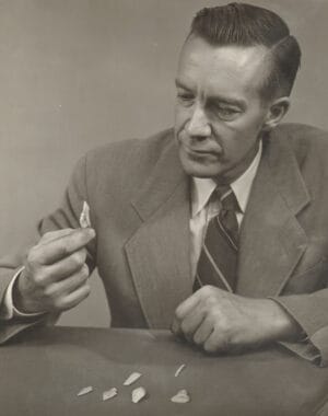
On a poster in a cavernous meeting hall in Washington, D.C., a few years ago, she displayed a photo of tree rings from a white spruce tree from Alaska. Amid a series of dark lines is a faint one that lines up with the year 1783.

Tree rings are thick-walled cells that form in conifers late in the growing season. The hard-to-see tree ring in D’Arrigo’s example shows a most unusual year — 1783 — amid centuries of normal spruce growth.

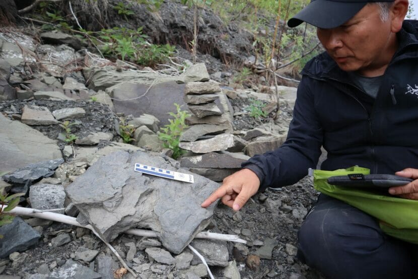
D’Arrigo, Alaska archaeologist Karen Workman and the late Gordon Jacoby once wrote of a “disaster for northwest Alaska Inuit” caused by the Laki eruption and the cold temperatures that followed. The scientists based their conclusion in large part on cores of wood pulled from white spruce trees at the northern treeline.

Archaeologist and Alaska adventurer James Louis Giddings examines some artifacts. (Photo courtesy of John Christeson)

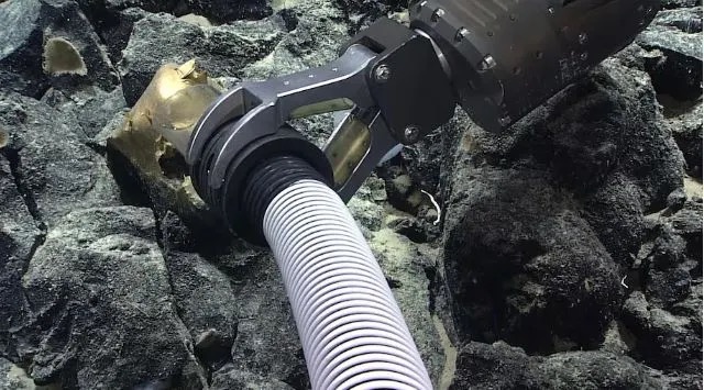
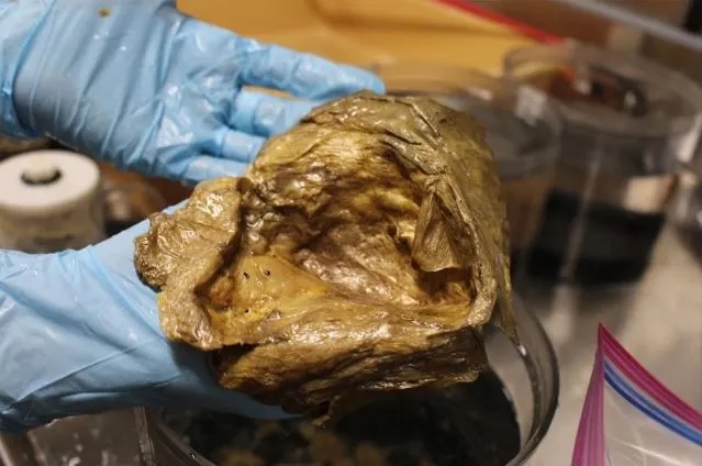
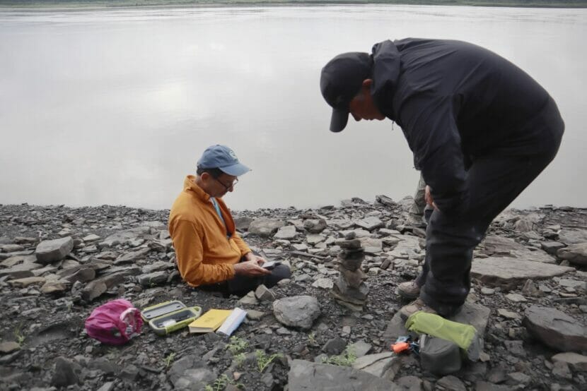
James Louis Giddings gathered many of those plugs.

In June of 1940, Giddings, an archaeologist and mining engineer educated at UAF, flew from Fairbanks to Allakaket. Once in that small village, he aimed his compass at a mountain pass across the Koyukuk River that would lead him to the headwaters of the Kobuk River.

Giddings then started walking. He carried a 40-pound pack and a .22 rifle, along with “a change of heavy underclothes one must wear as mosquito protection.”

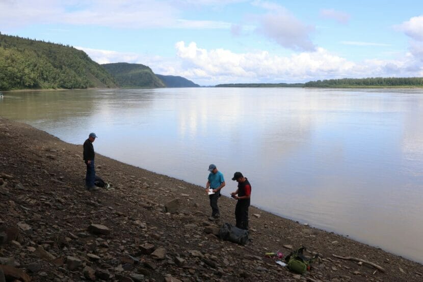
He lashed together a log raft when he reached the Kobuk River. He floated its length, taking tree cores along the way and stopping at known and possible archaeological sites.

At the mouth of the Kobuk, he turned right and traveled up the Noatak River. When Giddings was finished there, he went on to the Seward Peninsula, not finishing his scientific journey until he walked into the town of Haycock, not far from today’s village of Koyuk.

In fall of 1940, Giddings wrote his master’s thesis, detailing his remarkable season of fieldwork and the hundreds of tree cores he acquired.

Half a century later, scientists at Lamont-Doherty used some of Giddings’ samples. With tree-ring records from Giddings and others in Alaska and the real weather station data gathered at the University of Alaska and other places, the researchers reconstructed Alaska summer temperatures from the late 1600s to the present.

They figured average Alaska temperatures from May to August were about 53 degrees Fahrenheit for most of that time. In 1783, the May to August average temperature was about 44 degrees.

“You have this anomaly that’s off the charts,” D’Arrigo said.

To further show the weirdness of 1783, the Lamont-Doherty scientists also cited a book of oral traditions from Natives of northwest Alaska, written by William Oquilluk.

In the book, Oquilluk describes four ancient legends, each linked to the near-extinction of everyone living in northwest Alaska. The first two events were too far back for the researchers to imagine what they might have been. The fourth and most recent disaster was the influenza epidemic of 1918 that hit Alaska and the rest of the world so hard.

The researchers argued that the third calamity in northwest Alaska was linked to the Iceland eruption. Oquilluk wrote of it as “The Time Summer Time Did Not Come.”

That year — perhaps 1783 — migratory birds had returned to Alaska in the spring and all seemed normal, until after June passed. Then, “suddenly it turned into cold weather” and people “could not go out hunting and fishing,” Oquilluk wrote.

“In a few days, the lakes and rivers, recently thawed, froze over. Warm weather didn’t not return until spring (early April) of the next year,” the Lamont-Doherty scientists wrote.

A pair of earthquakes near Glacier Bay shook Southeast Alaska on Friday

A pair of earthquakes on Friday, Oct. 27, 2023 originated from a strip of land between the Denali Fault to the northeast and the Fairweather Fault to the southwest (Alaska Earthquake Center map)

Southeast communities felt the shudder of two earthquakes on Friday evening. 

A pair of quakes — first a magnitude 5.1 and then a magnitude 5.3 — happened about 45 minutes apart near Glacier Bay National Park. They were felt lightly in communities as far away as Juneau and Whitehorse. Smaller aftershocks continued through the weekend — about 40 so far. 

Senior scientist Natalia Ruppert with the Alaska Earthquake Center said moderately sized quakes like these are not surprising for the region. 

“These are common, although they are infrequent,” Ruppert said. “Maybe once every three or four years. So it kind of fades away from people’s minds.” 

Smaller aftershocks continued through the weekend, following the initial magnitude 5-plus quakes on the evening on Friday, Oct. 27, 2023 (Alaska Earthquake Center graph)

Over the past decade, a few significant quakes have shaken Southeast Alaska. In 2017, a pair of magnitude 6-plus quakes near Haines caused some damage in Whitehorse. And in 2013, a magnitude 7.5 earthquake near Craig was felt as far away as Seattle.

Back in 1958, a magnitude 7.8 quake damaged docks and bridges in Yakutat and triggered a landslide that generated a deadly tsunami in Lituya Bay — the highest ever recorded. 

Quakes in Southeast Alaska often happen near two faults — the Denali Fault, which extends south from the Alaska Range through Southeast Alaska, and the Fairweather Fault, which runs along the coast. In this case, the quakes originated from a strip of land between the two. 

Both are strike-slip faults, which are fractures between two different pieces of earth that move horizontally. The earth on either side of the fault moves at different rates. Ruppert said it’s like two cars driving at slightly different speeds in parallel lanes on the highway.

“If you put a rubber band around those two cars, it would keep stretching, stretching,” Ruppert said. “And that’s how the pressure builds up.” 

When the rubber band breaks, pressure is released. That’s when a quake happens. 

Strike-slip faults are typically pretty close to the surface, so even small or moderate quakes are easier to notice. Residents who felt the earthquakes are encouraged to fill out the “Did you feel it?” form from the U.S. Geologic Survey, to help scientists with their follow-up analysis. 

Thanks, Neanderthals: How our ancient relatives could help find new antibiotics

With an antimicrobial resistance epidemic looming, some researchers are looking to solutions in molecular de-extinction. (altmodern/Getty Images)

Antibiotics have changed the world.

They’ve made it possible to treat diseases that used to mean anything from discomfort to death. But no new classes of antibiotics have made it to the market since the 1980s.

What if humans’ closest, ancient relatives held the answer to antibiotic resistance?

Some scientists like University of Pennsylvania bioengineering professor César de la Fuente want to discover new antibiotics using machine learning … and some very, very old relatives.

Machines and molecular innovation

Antibiotics have changed the world, making it possible to treat diseases that used to mean anything from discomfort to death.

But now, society faces a new problem.

“We’re facing a silent pandemic where more and more bacteria are becoming resistant to available antibiotics,” de la Fuente says.

As a post-doctorate student at MIT, de la Fuente had an idea: What if machine learning could teach a computer how to innovate at a molecular level?

He and his team did just that — trained a computer to execute Darwin’s algorithm of evolution. In 2018, they published, to their knowledge, the first study to use AI to find a new antibiotic.

“It took initial antibiotics that were not very effective and it was capable of evolving them to become much more effective,” he says. These new antibiotics killed bacteria in mice.

Mining proteins from our ancestors

Next, de la Fuente and his collaborators used these computer models to dig through the proteins in the human body – the proteome – in search of tiny proteins called peptides that might play a role in the immune system.

They discovered over 2,500 peptides with anti-infective traits, and wondered: What if they turned their attention to extinct species in this hunt for new potentially antibiotic molecules?

De la Fuente says organismal de-extinction, the conceit of Jurassic Park, kept coming up in brainstorming sessions. But instead of dinosaurs, they set their eyes on humans’ closest ancestors: Neanderthals and Denisovans.

“Instead of bringing back entire organisms, why not just bring back molecules from the past to solve present day problems?” de la Fuente says.

De la Fuente says he and his team did just that – developed a machine learning model that could mine proteomic and genomic data from Neanderthals and Denisovans. The model finds sequences from archaic humans and predicts which ones would be good antibiotic candidates.

The next step? Resurrection.

“We use a technique called solid phase chemical synthesis, which essentially is like little robots that allow us to make the peptides and they make one amino acid at the time and then they link them in a chain to essentially get your final peptide, which again is a tiny protein,” de la Fuente explains. “And then we expose them to bacteria that we grow in the laboratory and we see whether they’re able to kill clinically relevant bacteria or not.”

They found several peptides that effectively killed bacteria in petri dishes, and tested them in animal models.

“In one of the mouse models, which was a skin infection model, one of the Neanderthal peptides was able to reduce the infection to levels comparable to a standard of care antibiotic called Polymyxin B,” de la Fuente says.

They called it “neanderthalin-1” and, while the peptide itself is not potent enough to be an antibiotic on its own, de la Fuente says he and his team hope to use it and other peptides as templates for further study of anti-microbials.

Want more on de-extinction? We’ve got you! Listen to our episode on the de-extinction of entire animals, like the dodo and woolly mammoth.

Have a question? Email us at shortwave@npr.org.

Listen to Short Wave on Spotify, Apple Podcasts and Google Podcasts.

This episode was produced by Rachel Carlson. It was edited by Rebecca Ramirez. The fact checker was Anil Oza, and the audio engineer was Patrick Murray.

Copyright 2023 NPR. To see more, visit https://www.npr.org.

Scientists baffled by golden orb found in Gulf of Alaska

The Okeanos Explorer live streams a lot of their expeditions. (Courtesy of Okeanos Explorer crew)

The Okeanos Explorer, an exploratory vessel operated by the National Oceanic and Atmospheric Administration, discovered an unidentifiable golden orb deep in the Gulf of Alaska late last month. The orb ended up making national headlines for stumping the ship’s scientists.

The attention came as a surprise, said expedition coordinator Sam Candio.

“I’m not even sure that that was the most interesting thing on that dive,” he said. “We, aboard, pretty much forgot about it. And then once it started getting all the media attention, it was just like, ‘Oh, that’s what everybody’s focused on.’”

Researchers still haven’t been able to identify the golden orb.

“We don’t know what it is, and I haven’t gotten any compelling ideas from people ashore. But a lot of theories right now are kind of the same ones that we had when we first came across it,” he said. “It could be some sort of sponge, maybe a coral, I’m kind of on the egg-case train.”

It was found about about 2 miles under the ocean’s surface during the ship’s work along Alaska’s coastline.

Underwater, the orb was a bit more circular and had kind of a golden shine, but when their drone brought a sample to the surface, it was a matte brown and had a flaky texture with a hard center.

Scientists used an aquatic drone to bring it to the surface for testing. (Courtesy of Okeanos Explorer crew)

Scientists aboard the ship took several photos and ran tests. Candio said the crew will have to send the orb along with a myriad of other potential new species to the Smithsonian National Museum of Natural History in Washington, D.C., for further analysis.

“We got a lot of things that are new to science, which is really exciting,” he said. We’re processing them, making sure that we get them all packed away safely.”

He said while the orb intrigued the crew, they were more fascinated on this particular dive by seeing octopi tending to eggs – that’s previously been a rare sight. In their time in Alaska, the scientists found several octopi tending to eggs, with 10 mothers off the coast of Kodiak Island.

The Okeanos Explorer is about to complete its work in Alaska. The ship’s last stop is in Seward, and then the crew will head to San Francisco for the winter. Candio said he was glad to visit so many places around the state.

“Just seeing how incredible all the life and the landscapes and the geology and how diverse and beautiful it was with crazy coral forests and chemosynthetic communities, and pretty much everything you could hope to see,” he said. “It’s amazing to see that both on land and at sea.”

The boat is scheduled to begin mapping waters around Hawaii next year.

100 million years ago, dinosaurs left clues about how they lived in Interior Alaska

A three-man research team spent three weeks exploring more than 100 miles of Yukon riverbanks this summer to find out more about how dinosaurs lived in the region during the Early Cretaceous. (Emily Schwing/KYUK)

Over the course of three weeks, scientists documented more than 90 sites where dinosaurs left their footprints along the middle section of the Yukon River. It’s the first time researchers have dug so deep into the region’s ancient history.

Paleontologists Tony Fiorillo and Yoshitsugu Kobayashi spent many hours considering the details of footprints left behind by at least half a dozen ancient species.

The most common footprints this team found here along the Yukon River this summer were plant-eating dinosaurs that made three-toed prints. Fiorillo and Kobayashi also found footprints left behind by a four-toed, armored ankylosaur.

Yoshitsugu Kobaysahi, a paleontology professor from Hokkaido University in Japan, points to a dinosaur footprint, left behind 100 million years ago along the bank of the Yukon River. (Emily Schwing/KYUK)

For his part in the research, Kobayashi, who is a professor at Japan’s Hokkaido University, brought a lot of tools. He uses a technique called photogrammetry to create a 3D image of the fossils. This kind of imagery can help parse out finer details human eyes could miss. He also used a drone to fly over sections of the riverbanks that hold clues about the ancient landscape.

This kind of research is kind of like reading a book and filling in the details. The various dinosaur footprints indicate who the characters in the story are, but at least one of those characters also raised some questions. Nearly 100 million years ago, a species Fiorillo couldn’t immediately identify left a large print with three long, slender toes behind.

Once he returns to his office at the New Mexico Museum of Natural History and Science, Fiorillo will dig through literature and other museum archives to figure out what kind of ancient species left its mark here.

Halfway through the trip, the team stumbled upon a stretch of riverbank about the length of a football field. It was littered with large sandstone blocks that were covered in footprints left by at least two shorebird-like species. Fiorillo was floored by the find: at least 16 blocks covered in the same footprints.

“This must have been a place that they found something to do, like lots of food,” Fiorillo said.

The next day brought another interesting find: a series of small, knobby bumps on a dark gray siltstone that gave Fiorillo and Kobayashi pause. It was a dinosaur skin imprint. They said that the imprint indicates that this environment is also ripe for the preservation of bones.

Tony Fiorillo (in orange) and Yoshitsugu Kobayashi puzzle over the imprint of dinosaur skin, preserved in a chunk of gray siltstone. The two wonder if the rock isn’t also a preserved dinosaur footprint. (Emily Schwing/KYUK)

In all, the team recorded more than 90 track sites left behind by at least half a dozen different ancient species — so many discoveries that both Fiorillo and Kobayashi nearly ran out of pages in their hard-backed yellow field notebooks.

“I was starting to wonder, what am I going to do if I run out of pages? But I never had a field notebook this full,” Fiorillo said.

Kobayashi laughed. He said that he was also running out of space. “So my figures, drawings, and letters are getting smaller and smaller.”

This summer’s work informs a larger body of research, nearly a quarter century’s worth, on how large reptiles survived this far north. Kobayashi said that the story isn’t yet fully told.

“So once we get back and we get the data together, then we will have another question to ask. More than one, probably,” Kobayashi said. “This stretch of river, just one chapter of the book. We know there are more outcrops down the river. So we try to understand this chapter, and if there’s any holes left unsaid, we’re going to come back.”

Local stories mean Yukon River ‘treasure trove’ is more than just a lot of dinosaur footprints

Rita Painter (right) and husband Dean Painter (center) tell paleontologist Tony Fiorillo (left) about a footprint they saw along the Yukon River more than 30 years ago. (Emily Schwing/KYUK)

It has been more than a decade since researchers first announced that they’d found dinosaur footprints along the middle section of the Yukon River. And when that team did make their discovery public, they also said that it was unlikely that people who live along the river even knew dinosaur footprints littered the riverbanks near them.
But Nulato resident Rita Painter can prove them wrong.

“It was maybe about 30 to 35 years ago, and that’s when they had a fish wheel right down here,” Painter said.

Painter stands in her family’s long, aluminum boat near the riverbank at Halfway Camp, a fish camp about 12 miles downriver from Nulato. She tells the story of a large fossilized dinosaur footprint that had been found nearby.

“We were coming up from Grayling; they invited us to have some tea,” Painter said. “And while we were visiting with them, they showed us this rock. It was huge, and there was, like, a footprint on the rock.”

Painter said that the rock was maybe a foot or so wide and about 8 inches long.

“It was clearly a foot, but the toes looked different. And it was embedded in a rock,” Painter said.

Her husband, Dean Painter, said that the footprint had three toes.

The Painters told their story to three scientists who spent 16 days on the Yukon River in August. The team was hoping to find out more about the ancient reptiles and birds that once lived in this area.

The Painters’ description pretty accurately describes the footprint made by a bipedal, plant-eating dinosaur known as an ornithopod. And it’s helping the researchers meet their goal to better understand what locals know about the footprints.

A large dinosaur footprint lies along the banks of the Yukon River downriver from Kaltag. The three toes are a signature sign that plant-eating ornithopods, which walked on two feet, once lived in abundance in this region of Alaska’s Interior. (Emily Schwing/KYUK)

Martha Turner grew up fishing along the span of riverbank where the Painters told the story of their dinosaur footprint encounter. It’s also a place where researchers found dozens of similar footprints. “Oh wow. That’s so cool. Like, our camp has all these dinosaur tracks,” said Turner when she heard Painter’s story.

Turner, who is Nulato’s tribal administrator, said that her grandmother, who was born at Halfway Camp, never mentioned any large, three-toed footprints to her before. Now she’s eager to ask about it.

In Kaltag, a village just over 30 miles downriver from Nulato, news that a research team was finding dinosaur tracks there this summer came as no surprise.

“Ever since we were this big, ever since we were 3-foot high we knew,” said Patrick “Paddy Bun” Madros Jr.

Madros Jr. said that he’s been finding ancient footprints left by giant reptiles along the riverbank his entire life. He grew up at a fish camp even further downriver.

“When we flip over rocks on the bluffs and we’re making a deadman, we put a stick down and we bury it and we see the footprints,” Madros Jr. said.

A deadman is a pile of wood buried deep in the sand and silt. It helps anchor a fish wheel in place.

Patrick “Paddy Bun” Madros Jr. grew up at a fish camp downriver from Kaltag. He said that he’s been finding prehistoric footprints left by dinosaurs along the Yukon River’s banks all of his life. (Emily Schwing/KYUK)

Madros Jr. said that he was always finding preserved footprints in the rocks, but he was too busy subsistence fishing with his family to pay much attention to them.

“You would never think twice about it. It’s just another rock. Throw it on the pile,” Madros Jr. said.

“I don’t think it’s something that people would stop and say ‘we need to dig here and look around here,’” said Kaltag Mayor Violet Burnham. She added that the science is interesting, but not her community’s focus. “Because there’s so many other things that we face as a community that are just more important.”

Burnham was born in Kaltag. She said that things have changed drastically, and it’s been hard on her community where jobs are limited and where, in recent years, the salmon populations people rely on heavily for food have crashed.

Kaltag Mayor Violet Burnham’s husband has been finding dinosaur footprints along the Yukon River’s banks for years. While she says that the Yukon River’s paleontological story is interesting, her community’s main priority is survival. (Emily Schwing/KYUK)

“In my lifetime we went from no phone to phones, to internet, to 24-hours-a-day news. From a subsistence lifestyle to a cash-based economy,” Burnham said.

Paleontologist Tony Fiorillo said that he is pleased to hear people’s memories and stories of footprints. Fiorillo is the Executive Director of New Mexico’s Museum of Natural History and Science and he has studied Alaska’s dinosaurs for 24 years.

“I think that’s fascinating to me because if you go back, what did they say? Thirty to 35 years? You’re starting to get to when dinosaurs were first recognized in this state,” Fiorillo said.

Fiorillo and his colleague, paleontologist Yoshitsugu Kobayashi, spent time traveling on the Yukon River this year. They spent much of the field season collecting data to create 3D images of every track they found. Instead of removing the footprints themselves as specimens to be housed in a museum archive, they also made numerous molds of the footprints. Kobayashi said that he believes the footprints should stay where the locals can see them.

“It’s not ours,” Kobayashi said. “The specimens belong to this place.”

Site notifications
Update notification options
Subscribe to notifications