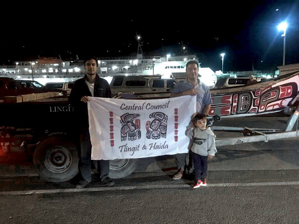
Doug Chilton and DeAndre King in front of the canoe they’ll take to North Dakota. (Photo courtesy of Central Council of Tlingit and Haida Indian Tribes of Alaska)
Members of the One People Canoe Society will travel this week from Alaska to North Dakota to paddle in protest over a controversial pipeline.
The Standing Rock Sioux Tribe has asked paddlers from around the country to show support with a float down the Missouri River.
Doug Chilton and DeAndre King left Wednesday night on the ferry from Juneau, said Richard Peterson, president of Central Council of Tlingit and Haida Indian Tribes of Alaska.
“It was kind of a last minute deal because a lot of folks with the One People Canoe Society are actually canoeing here to Kasaan tomorrow,” Peterson said. “So they got together what they could. They got their raven canoe together and they just needed some financial support.”
There’s a ceremony in the village of Kasaan for the restoration of the Chief Son-I-Hat Whale House Naay I’waans on Saturday, but Chilton and King decided to go to North Dakota after the chairman of the Standing Rock Tribe put out a call asking for help, Peterson said.
They’ll be displaying a Central Council flag, and he thinks it’s an important time to show support, Peterson said.
He sees similarities with British Columbia mining and Southeast waterways.
“You know, we’re fighting here on transboundary issues, and we don’t know what turn that’s going to take and we may need people to stand with us as well,” Peterson said.
If the pipeline is built, then a half-million barrels of crude could flow daily from North Dakota to Illinois.
For it to get there, it would have to cross under the Missouri River — Standing Rock Reservation’s water source.
Peterson thinks it could take two days for Chilton and King to reach North Dakota.
Prudhoe Bay. The Department of Natural Resources has refused to approve the oil field’s 2016 Plan of Development until operator BP includes detailed marketing information for its massive gas reserves. (Photo courtesy BP)
The clock is ticking on a dispute between Gov. Bill Walker’s administration and the state’s largest oil producers.
The Department of Natural Resources has rejected the annual plan for Prudhoe Bay, demanding detailed new information on how North Slope companies plan to market the field’s natural gas reserves.
But companies have resisted, arguing the information the state wants either does not exist or would be illegal to hand over.
Thursday, Sept. 1, was the deadline for the field’s main operator, BP, to submit a new plan. The state now has 60 days to respond.
This fight started back in January, with a letter from former Natural Resources Commissioner Mark Myers. The letter asked BP to include detailed information on its efforts to market the field’s oil and — more to the point — natural gas reserves.
That request was new because right now there isn’t a clear path for major gas sales from Prudhoe Bay. The state and North Slope producers have been trying to build a pipeline to bring that gas to market for decades. At the time of the letter, the state was in a four-way partnership with the main Prudhoe Bay leaseholders — BP, ExxonMobil and ConocoPhillips — though that partnership is now dissolving, as the state takes control of the project.
When BP submitted its plan in March, the Division of Oil and Gas responded with a bullet-point list of details it still required — including potential customers, volumes and pricing terms for natural gas sales.
BP refused, calling the state’s request “extraordinary,” “unprecedented,” and “unlawful.” The company argued, in part, that sharing marketing information with competitors — including the state — would violate antitrust laws.
BP also said much of the information the state wants simply doesn’t exist, because nobody is currently selling gas from the North Slope. And it pointed out the state was well aware of its major efforts to monetize its gas, through the Alaska LNG project.
The state wasn’t satisfied. On June 30, Division of Oil and Gas Director Corri Feige sent a letter declaring the Prudhoe Bay 2016 Plan of Development incomplete. The division extended the previous year’s plan and gave BP two months to try again.
With the new plan submitted, the state has until Nov. 1 to respond. (BP’s most recent letter and updated plan have not been released publicly; the division said it will release the plan once it has been reviewed for confidential information.)
It’s unclear what will happen if the state rejects the plan again. A company can’t operate a field without an accepted plan of development — so in theory, at least, the dispute could disrupt production at Alaska’s largest oil field.
But a Division of Oil and Gas spokesperson insisted that’s not in the cards, saying the state is confident it will get the information it wants, and the division can issue another extension — or more — if needed.
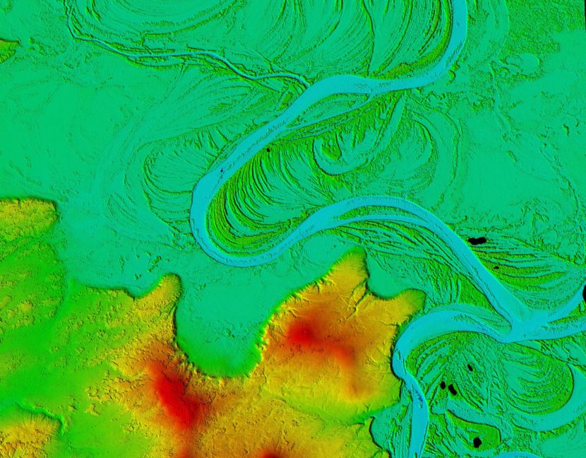
The digital elevation models show the unique boreal forest vegetation patterns alongside Western Alaska’s Koyukuk river. (NSF/NGA)
In Kotzebue a year ago, President Barack Obama called for a publicly available, high-resolution elevation map of Alaska, a map that will help Alaskans monitor the effects of climate change. Now, it’s here.
There are many satellites that orbit the Earth. Typical satellites — like NASA’s Landsat — capture really large images, more than 100 miles across. For this project, the images are much smaller.
“You can tell when things are close and far away because you have two eyes and they’re separated,” Morin said. “That’s pretty much the same principle, and instead of having two satellites, you have one satellite and it takes two pictures.”
Once there are two good images, those pictures are fed through a super computer. Software is used to find the same objects in both images. From that, the elevation is calculated.
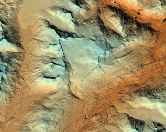
Wolverine Glacier is on the Kenai Peninsula. (NSF/NGA)
Morin says the elevation maps are available online and can document landscape changes.
“It can be used to look at the gain and loss of ice on a glacier,” he said. “It can be used to calculate the extent of watersheds for a lake or for a river.”
Topography on this scale is so detailed it can measure individual trees.
“We have such resolution in this data that people can go in, look at an elevation data set from two years ago and compare it with a data set from today,” Morin said. “And you can see individual trees being cut down.”
Collecting the imagery for this project has taken three years. Now that Alaska is completed, up next is the entire Arctic. Those maps are expected to be finished by the end of 2017.
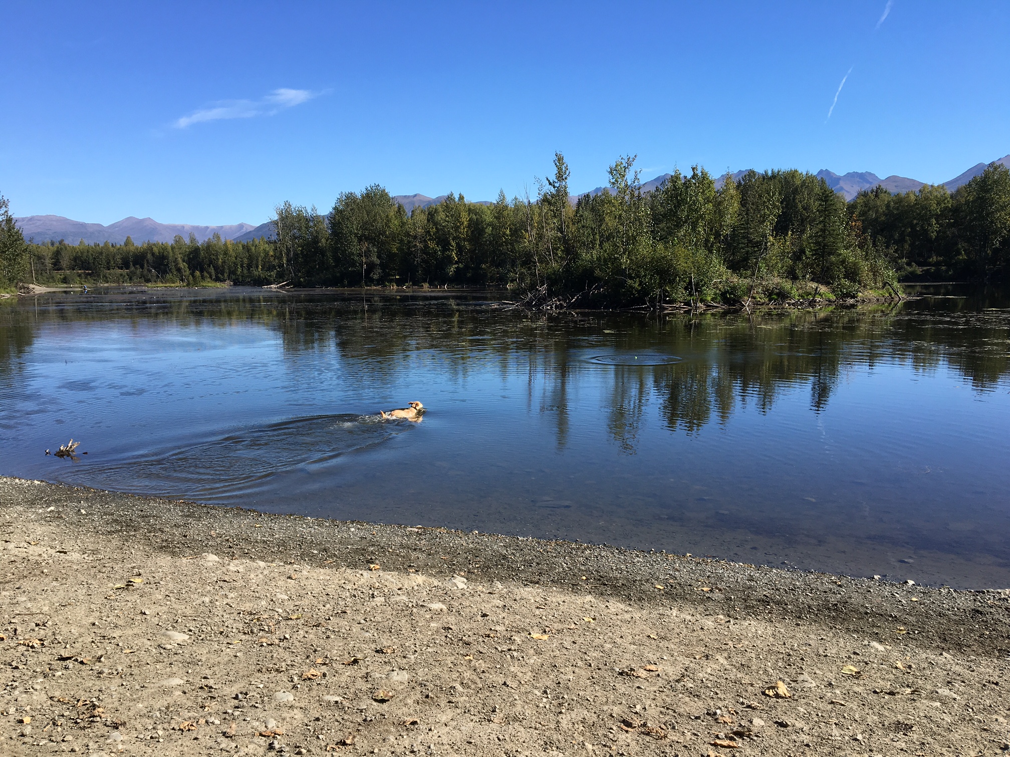
A dog swims in University Lake in Anchorage on Aug. 31, 2016. (Photo By Annie Feidt/Alaska’s Energy Desk)
In climate terms, Wednesday marks the official end of summer. That’s because June, July and August are the hottest months of the year. And in Alaska, it was really hot this summer.
Nine communities around the state broke daily high temperature records Tuesday, including Kenai at 71 degrees, Bethel at 72 degrees and Anchorage at 74 degrees.
Brian Brettschneider is a climatologist in Anchorage who closely tracks Alaska climate data and trends. Alaska’s Energy Desk is checking in with him regularly as part of the segment, Ask A Climatologist.
Brettschneider told Energy Desk editor Annie Feidt that this summer is the warmest on record for the city of Anchorage.
Interview transcript
Brian: For most stations in Alaska it’s been a top five warmest (summer). In a few places, like Fairbanks, it’s the tenth warmest. But very warm from north to south, from east to west.
Annie: Has Anchorage been the warmest, in terms of records?
Brian: Well, not so much in terms of absolute temperature, because we are on the coast and it’s always going to be warmer than the interior. But as far as why we’ve been warmer than anyone else, it’s really because of our proximity to the Gulf of Alaska and the much above normal water temperatures. And also, our low temperatures have been very, very warm compared to normal. We’ve had extended periods of time with low temperatures well above normal.
Annie: And talk about the last week, or the last few days. What daily records have we seen here, especially in Anchorage?
Brian: So here in Anchorage for Saturday, Sunday and Monday, we had high temperatures that were all records. It was 73, 77 and then 72. And that’s the latest we’ve gone into a season with three consecutive days at that temperature, so it really is quite unusual.
Annie: And what about the rest of the state?
Brian: There were a number of places in the state that actually set their warmest temperature for so late in the season. So up on the north slope at Barrow, and Nuiqsut and a couple of other places, they were well into the 60’s, mid to upper 60’s — again, never so warm this late in the season — they had a south wind, an offshore wind. And then along the Gulf of Alaska coast, places like Anchorage and Cordova and Yakutat and a few others, they also set their highest temperature ever measured for so late in the season.
Do you have a climate question for Brian? Email akenergydesk@alaskapublic.org
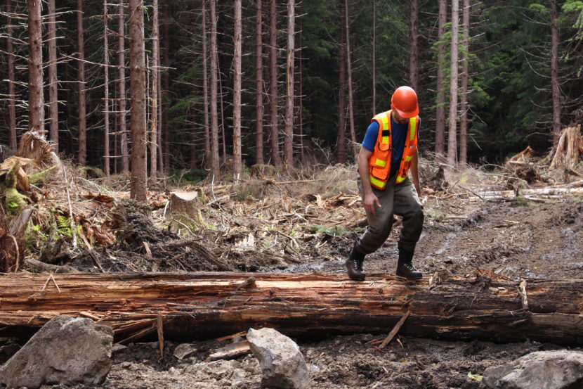
Kuiu Island in 2014. At the time, the U.S. Forest Service was repairing streams on the island damaged by logging from the 1970s. Now, 23 million board feet could be harvested on the north part of the island. (Photo by Elizabeth Jenkins/KTOO)
An old growth timber sale recently announced in a Ketchikan newspaper has one conservation group scratching its head.
That’s because this type of harvest — near valuable salmon streams — won’t be allowed in the future.
The U.S. forest service is working on a new timber plan in the Tongass National Forest, which is expected to be finalized by winter.
In the meantime, forest managers are moving ahead with timber sales under the old rules.
Recently, in the Ketchikan Daily News an ad appeared along with advertisements of cars for sale and apartments for rent. The forest service was looking for a buyer for 866 acres of old growth trees on north Kuiu Island.
“You know, no one would know about it unless you’re reading the back pages of the Ketchikan paper,” Austin Williams said.
He learned about it from a Trout Unlimited member in Ketchikan. Williams is the director of law and policy for the organization.
What troubles Williams about the timber sale is where it’s slated to happen.
“Right in the middle of some of the most valuable and important fish and wildlife habitat in the region,” he said.
It’s one of a group of watersheds, known as the Tongass 77, that environmental groups want protected.
Logging can cause erosion, creating problems for spawning salmon, Williams said.
Just a few years ago, the Forest Service repaired streams on Kuiu damaged by timber harvests from the 1970s, back when there were no regulated buffers along salmon streams.
That’s changed and this particular sale went through an environmental assessment and a public comment period before becoming final eight years ago.
“There’s been no opportunity for public involvement since the decision came out in 2008,” Williams said. “And you know, a lot has changed since then.”
One major change: soon sales like this won’t be possible.
The Forest Service is about to come out with an amended timber plan for the Tongass. Old growth logging in these watershed areas won’t be allowed.
Jason Anderson, a deputy forest supervisor, said sales that have already been approved — like the one on Kuiu — can move forward.
“We would not have necessarily crafted this sale under the new plan,” Anderson said. “But we’re also operating in that change-over period.”
Anderson said the Kuiu sale is happening now because the “market conditions” are right.
He’s not sure how many outstanding timber sales exist like this.
He thinks — compared with the overall size of the Kuiu sale — the trees in the watershed area represent a relatively “small percentage.”
“While I can recognize the concerns that are out there. I think on the whole, the transition spells out how a lot of this will occur in terms of bringing forward more young growth over time,” Anderson said. “Being very deliberate about what old growth is offered. And again, considering and protecting those watersheds that have the highest fisheries value in the region.”
The Forest Service approved the Kuiu timber for export, which means the trees aren’t likely to go to local mills.
That’s OK with Owen Graham, the executive director of the Alaska Forest Association, a timber industry group.
The Kuiu sale is made up of a lot hemlock, a low value timber, he said.
“Those chips used to go to the pulp mills and now they have to be barged 800 miles south,” Graham said. “The economics of trying to harvest timber and manufacture on a remote island like Kuiu is pretty difficult.”
There are no pulp mills left in Southeast Alaska. The Forest Service’s red tape doesn’t make it any more cost effective for domestic buyers, Graham said.
Still, he thinks the Kuiu Island timber sale is significant for the logging jobs it does keep in the region.
The public should have another say before old growth trees are cut down in a watershed, Williams said.
“You know, one of the things about Southeast Alaska is that largely our fisheries are intact and our watersheds and streams are healthy,” Williams said. “But if we don’t take care of it, we risk losing those.”
The objection period on the amended Tongass plan ends this week.
The Forest Service is accepting bids for the Kuiu island timber sale until September 13.
Editor’s Note: We’ve updated the story to clarify the definition of the Tongass 77.
Coastal erosion reveals the extent of ice-rich permafrost underlying the active layer in the Teshekpuk Lake special area of Alaska’s National Petroleum Reserve. (Photo: Brandt Meixell/USGS)
Russian officials say warming permafrost could be linked to a deadly anthrax outbreak in Siberia this month.
Permafrost can be found almost everywhere in Alaska — from the Arctic coast to Anchorage.
But at least one expert isn’t alarmed about the potential for thawing ground to bring old diseases back to life.
After a Siberian heat wave, anthrax hit the Yamal Peninsula in early August.
The bacterial disease has claimed the life of a child and thousands of reindeer.
Permafrost expert Vladimir Romanovsky of the University of Alaska Fairbanks said melting permafrost and erosion may have worked together to spread anthrax into the water supply.
“Thawing of permafrost can release microorganisms first into the active layer, then into water and air,” Romanovsky said. “They were sequestered there for many, many years — tens of years, even thousands and tens of thousands of years.”
Scientists have talked about the possibility of epidemics caused by thawing permafrost, but until now, it’s only been a theory, Romanovsky said.
If the Siberian anthrax outbreak is traced back to spores in the permafrost, then it would be a troubling development.
“This release of these dangerous microorganisms could actually be spread very easily from the north, because we have lots of birds who are migrating all kind of places in the world,” he said. “So this problem could be not just local problem. It could be global problem.”
More research is needed to tie this anthrax outbreak to warming permafrost, Romanovsky said.
Infectious disease specialist Dr. David Morens, with the National Institutes of Health, isn’t worried about anthrax — or any other disease — surfacing from the ground.
Anthrax is hardy and virtually everywhere, he said.
“Anthrax is sitting in the grass in farms in Texas,” Morens said. “It’s in Asia. It’s in Africa. It’s everywhere. And so the fact that some might be in the permafrost doesn’t really add to whatever the risk is.”
Although anthrax is widespread, the chance of getting sick from it is really small.
The likelihood of contracting anthrax from spores exhumed from the permafrost, is even tinier.
Morens has studied the 1918 Spanish influenza pandemic that decimated rural villages in Alaska. Brevig Mission was hit especially hard.
Spanish flu killed 90 percent of the village over the course of six days.
The remains of victims were buried together.
Researchers have used samples from that mass grave to reconstruct the genetic code of the virus.
But Alaskans shouldn’t be afraid of getting sick as the ground in Brevig Mission thaws, Morens said. Unlike anthrax, Spanish flu is very fragile.
“What came out of the so-called permafrost was just broken pieces of RNA,” Morens said. “Nucleic acid. There was nothing infectious. A ton of it swallowed would have been harmless.”
Freezing and thawing breaks up viruses like Spanish flu, killing them.
“So if we are talking about viruses and deadly things, I would say whatever might be there in the permafrost is not going to be contagious,” he said.
Morens doesn’t fear viruses or bacteria emerging from their cryogenic slumber, but he is concerned about the threat of new diseases.
“All these emerging viruses that are coming on — Zika, chikungunya, severe acute respiratory syndrome (SARS), and all that,” Morens said. “It’s not that they’re being created. It’s not that they’re being dug up from the permafrost. They’re already there. And we human beings do things that invite them to come in, infect us, and cause epidemics.”
Officials in Russia are trying to stop the anthrax outbreak from spreading further. They are incinerating all infected reindeer carcasses and have banned hunting in the region.
Close
Update notification options
Subscribe to notifications
Subscribe
Get notifications about news related to the topics you care about. You can unsubscribe anytime.