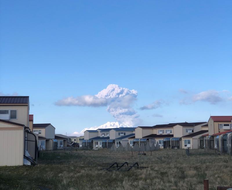
Great Sitkin eruption column, as seen from Adak on May 25, 2021. (Photo courtesy of Finn Spitler)
Scientists have downgraded the alert level at Great Sitkin Volcano near the Aleutian Island of Adak following an eruption Tuesday night.
The event took place at around 9 p.m. and produced an ash cloud up to 15,000 feet above sea level and impacted flights.
“The eruption itself occurred for over about a minute,” said David Fee, coordinating scientist for the Alaska Volcano Observatory. “It had a very loud, audible and low frequency sound to it. I guess a good analogy would be if you shake up a bottle and then you pop the cork and get an explosion out the top. That’s kind of what happened here.”
Following the eruption, Fee said, they issued a red alert warning for planes in the area, because there was likely a high emission of volcanic ash in the atmosphere.
Since then, activity has decreased at the volcano.
Steaming at Great Sitkin, seen from White Alice seismic station on May 20, 2021. (Photo courtesy of Malcolm Herstand/Alaska Volcano Observatory, Division of Geological & Geophysical Surveys)
“We lowered the advisory back down to orange this morning,” Fee told KUCB Wednesday morning. “And there hasn’t been much activity — I think it’s mainly just steaming since the eruption last night.”
According to Fee, the activity at Great Sitkin isn’t “normal,” but it’s also not unexpected, given some small explosions that have happened there over the past few years.
He said the AVO will continue to watch closely for increased seismic activity or gas emissions that could indicate another eruption, but for now, it’s pretty quiet.
“We haven’t seen an eruption like this from Great Sitkin at least as long as I’ve been around here,” he said. “So it could quiet down or we could expect continued activity. We’ll just have to wait and see.”
This is the first significant explosion at Great Sitkin since 1974.
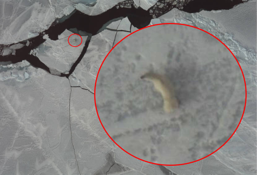
Polar bear image captured during aerial survey of the Chukchi Sea. (Photo courtesy of NOAA Fisheries)
Sea ice in the Arctic serves as a habitat for polar bears and their prey, ice seals. The ice doesn’t follow international boundaries, and monitoring the migration of these species requires access to both American and Russian waters.
Irina Trukhanova is a wildlife biologist with North Pacific Wildlife Consulting. The group contracts with the National Oceanic and Atmospheric Administration and U.S. Fish and Wildlife Service.
She says that polar bears and ice seals are loosely spread out across the vast Arctic, and it can be difficult to keep track of their movements and populations.
“The only time that you can actually look at those species in their natural habitat is springtime,” Trukhanova said.
That’s when the species travel on the sea ice in the Chukchi Sea.
However, U.S. researchers are normally restricted to U.S. boundaries. Researcher Paul Conn with NOAA says that the process can be limiting since the polar bears travel between sea ice in both Russia and the United States.
“The only ones that they collar are the ones that end up over near Kotzebue, so that is a knowledge gap,” Conn said.
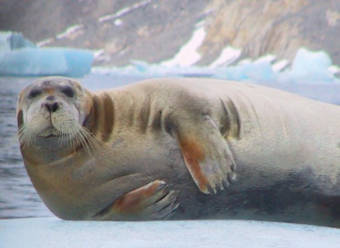
Bearded and other ice-associated seals are the primary prey of Chukchi Sea polar bears. (Photo courtesy of NOAA Fisheries)
In order to survey polar bears and ice seals across the entire Chukchi Sea, U.S. researchers with NOAA and Fish and Wildlife partnered with Russian scientists. The result was a 2016 aerial survey that observed the species populations and movements.
Using a combination of infrared technology with photography and visual observations, the researchers were able to track the distribution and abundance of the seals and polar bears. Conn says the results from the research give a more complete view of the mammals in the wider Arctic.
“It does give us a sense for where bears are in the spring in April, and having done surveys for seals at the same, we can see how important the distribution of prey is for the distribution of bears,” Conn said.
Moving forward, Trukhanova says that global warming will necessitate continuous research, as the Arctic warms faster than any other part of the world. That has led to diminishing sea ice for polar bears, and the ice seals they prey on.
“If it melts earlier, if the ice cover isn’t stable enough, then the survival rates for the pups, specifically for the ringed seal pups, become lower,” Trukhanova said.
The Alaska Nannut Co-Management Council, an organization of tribes that subsist on polar bears, praised the collaboration. In a statement, Nannut Executive Director Katya Gray said “… this effort is significant for its use of non-invasive methods to study polar bears, the importance of which our tribes and hunters are consistently raising.”
Trukhanova, who grew up in Russia and attended the University of St. Petersburg, said the data could not have been collected without collaboration.
“We were working together,” Trukhanova said. “We were planning the survey together, trying to make the methods compatible and make the results compatible so we could join forces and bring all the data to the table and get the robust joint results that we could use on both sides of the border.”
While the governments of both countries have had a sometimes tense relationship in recent years, Conn says he was impressed with the scientific community’s good-natured approach.
“You hear about Russia and us, and this antagonistic relationship, but when you actually get to the people it’s just amazing the amount of love they have for their science,” Conn said.
Gustavus residents are asking the state to stop work on an upgrade to the city’s airport, where there are toxic chemicals. (Claire Stremple/KTOO)
Gustavus is getting a multi-million dollar airport upgrade, but city officials and some residents are calling on Alaska’s Department of Transportation to stop work on the project. That’s because toxic chemicals called PFAS are known to be present at the site.
So far, the state hasn’t stopped work, but it did hold a Zoom meeting last week to explain its plan to residents.
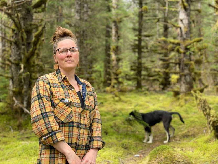
From her coffee shop and gallery on Gustavus’ main road, it’s just a short walk through the forest to owner Kelly McLaughlin’s place.
“So this is my house, my new muddy yard,” she said, stepping out of the trees.
McLaughlin grew up here. All her neighbors are relatives.
“This is sort of the back edge of the land that my grandparents bought when they moved here in the 60s.”
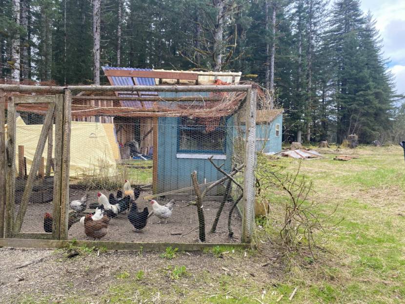
There’s a two-story house, a big chicken coop full of hens, a garden, and, now, an 8,000-gallon cistern that catches the rainwater her family drinks and bathes in.
They need the cistern because the state found toxic “forever chemicals” called PFAS in McLaughlin’s well. PFAS don’t break down in the environment and accumulate in the human body. They’ve been linked to serious health effects, like cancer and immune system problems.
The PFAS came from the state-run airport where contaminant-laden firefighting foams ran into the groundwater and spread. More than a dozen wells were affected, and the state has supplied bottled water to those households since 2018.
PFAS are in McLaughlin’s chickens, in her garden, and in her blood.
“I used to take the chicken eggs to the gallery and serve, you know, fresh local eggs. But I had to stop doing that because I didn’t want to, you know, poison people,” she said. “I didn’t eat anything from my property for a couple years. And then sort of started back just because I figured it’s, I’m, this is already in my body.”
Kelly McLaughlin organized the Gustavus PFAS Action Coalition advocating for people affected by the toxic chemicals from the state-run Gustavus airport. (Claire Stremple/KTOO)
McLaughlin says her blood has tested at 10,000 and 7,000 thousand parts per trillion — a number that makes PFAS experts squirm. She says her young son’s blood is double that. She hasn’t tested her daughter, who was an infant when the contaminants were found.
The experience pushed the cafe and gallery owner into another full-time job: advocacy. McLaughlin organized GPAC, Gustavus PFAS Action Coalition, to represent her family and neighbors affected by the chemicals.
“At least some of us have been through this now. So if the airport project does contaminate further, there’s recourse. There’s people to rely on, people to ask questions,” she said. “I had nobody.”
There was a close call this spring when the state began work on the airport. Its original plan was to move asphalt from the airport to a previously uncontaminated site near houses. Residents pushed to get the asphalt tested for PFAS, something the state isn’t required to do. The project managers listened. They tested the asphalt and they found contaminants. And they did change the plan.
But it didn’t feel exactly like a win for the community. It shook their trust in the state’s planning for the project.
And so GPAC asked the state to stop work at the site until the extent of PFAS contamination is fully understood. The city council, other concerned citizens, and EarthJustice joined them.
Kelly McLaughlin’s chicken coop. McLaughlin says she once gave other residents fresh eggs from her coup but stopped when she and her property had become affected by PFAS. (Claire Stremple/KTOO)
The Department of Transportation didn’t stop its work, but it did schedule a Zoom meeting.
Representatives from multiple state agencies and the Federal Aviation Authority joined the virtual meeting.
“I want you to know that Gustavus community members’ health and safety are of utmost importance to us while we deliver the needed airport improvement project,” said Christopher Goins, the construction engineer for DOT.
He pledged a full evaluation of PFAS contamination to the roughly 70 people who logged on, but was clear in his presentation that the scope of the project is to improve the runway, not to characterize or clean up contaminants.
Because the state doesn’t have a plan to clean up the chemicals at the airport yet. What it has is $20 million in federal funds to upgrade a runway that the community really needs.
“Due to FAA funding limitations, the airport reconstruction project cannot address ongoing PFAS site characterization, cleanup and replacement water efforts. Those efforts are covered in a separate project funded by state funds,” Goins said.
He also pledged to safely handle more than 7,000 cubic yards of PFAS contaminated materials. It will be stored in already contaminated areas or on thick plastic liners. And it plans to re-use some contaminated asphalt in the project. That didn’t sit well with residents on the call.
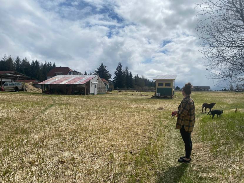
Kelly McLaughlin looks out toward her uncle’s property. PFAS came from the state-run airport where contaminated firefighting foams ran into the groundwater and spread, affecting McLaughlin’s well and dozens of other wells in the community. (Claire Stremple/KTOO)
In the end, the state gave a lot of information to residents during the meeting, but nothing in the state’s plan for the project changed.
John Buchheit is a city council member and a longtime resident of Gustavus. He’s at the airport the day after the Zoom call, under a dripping awning as a spring storm finishes up.
“We’re on the edge of a 3.3 million-acre world class wilderness park and there’s an expectation that this environment is fairly pristine,” he said, referring to Glacier Bay National Park and Preserve. Gustavus is basically the gateway to the park.
“And then to discover that there is an industrial chemical that’s polluting the groundwater really shakes people’s faith and what they feel is special about this place.”
He said he’s grateful for the meeting and the agencies’ candor, but he’s disappointed that this conversation is happening now, at the 11th hour. He’s also concerned that the small town of Gustavus— a population of roughly 450 — has to be the watchdog for contaminated materials.
Buchheit says the city council’s role has been to support those residents and GPAC.
“It really took a handful of concerned citizens to pull the fire alarm and say, ‘hey, you’re gonna do what? And you’re starting it when? Hold on now,” he said.
He stands at the chain-link fence that separates the parking lot from the runways where more than a dozen yellow machines sit. On aerial view maps, this place is dotted with red, yellow and green markers that indicate levels of a contaminant whose full effects have yet to be seen.
Correction: An earlier version of this story said Christopher Goins was the project engineer for the Department of Transportation. Goins is the construction engineer. A photo caption has been corrected to state Kelly McLaughlin is looking out toward her uncle’s property.
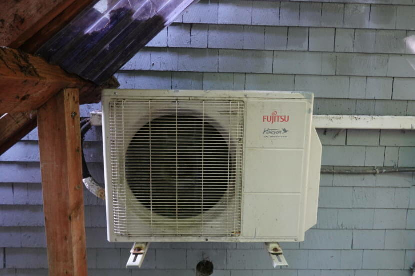
An air-to-air heat pump can provide a more efficient alternative for heating a home, particularly in regions of Alaska with less dramatic temperature swings like Southeast. Because they run off of electricity, they can also reduce greenhouse gas emissions in communities that use renewable alternatives like hydropower or solar. (Erin McKinstry/KCAW)
Kake resident Adam Davis decided to convert to a heat pump about four years ago. Before that, he was using a pellet stove, but barging in fuel was getting expensive.
When Tlingit-Haida Regional Housing Authority offered to install a heat pump for free as part of a pilot program, it piqued his curiosity.
“I was willing to be a guinea pig to see whether or not they were viable here,” he said.
Davis doesn’t have any complaints about his air source heat pump. The devices can work like an air conditioner, using electricity to move hot air outside during the summer. But unlike an air conditioner, they can also move warm air into the home to provide heat in the winter. They also provide added benefits like air filtration, compared to wood and oil heating, which can reduce indoor and outdoor air quality.
Davis said maintaining and operating the heat pump is also a lot easier than the pellet stove, and he’s only seen a slight increase in his electricity bill. Even with that increase, he thinks he’s saved money not having to buy the pellets for his stove.
But that wouldn’t be the case if it was his only source of heat, especially when temperatures drop below freezing. He also has propane and oil heaters for his nearly 2000-square-foot home.
“I see them as a great, you know, complementary type of heat source. Not as a primary heat source just because of the wide swings in our temperature here,” he said. “I don’t think you can rely on them in the coldest of months.”
Davis is one of six Kake residents to benefit from the program so far, including a few of his neighbors. He said they installed heat pumps as their only source of heat and their electric bills skyrocketed, minimizing or eliminating savings from not having to buy heating fuel.
Like many rural Alaska communities, the cost of electricity in Kake is high: 1.5 times the state average and 2.5 times the national. And that’s when you factor in something called Power Cost Equalization, a state program that subsidizes rural energy costs. In Kake, any usage over 500 kilowatt hours a month is about double the cost because it isn’t covered by the program. And the added electrical demand of heat pumps can easily push a household over that threshold.
“I do understand that people are having a hard time, you know, those who have heat pumps are having a hard time paying the extra amount on their electric bill every month,” IPEC CEO Jodi Mitchell said. “And so some of them are really struggling with that.”
“People always say IPEC has to be more efficient, and IPEC’s customers need to be more efficient. It doesn’t work that way because of the economies of scale factor,” Mitchell said. “The more we sell the cheaper it is for everybody. That’s it in a nutshell.”
Introducing a special rate for heat pumps could encourage more customers to use them, and the money they’d normally spend on imported fuels would go toward electricity instead. And even though IPEC would absorb the cost of the special rate, the study shows that it’s still worth it financially because it would help them sell more power.
The study also shows that, with the special rate, consumers would save money on heating in the long run, even if they have to cover the cost of the heat pump and installation. But with the program Davis benefited from, that could come for free.
And finally, in places like Kake where renewable hydropower is in play, heat pumps are a win for the environment because they replace non-renewable fossil fuels with clean energy.
Mitchell is excited about the findings, but also recognizes their limitations. IPEC doesn’t want to overload their microgrids either. They’ll likely have to limit the number of residents who can benefit from the special rate, which would apply to any usage over 500 kWh a month.
“So we’re trying to find this sweet spot: how many can we allow, assuming that our system was using a peak demand from like January? If we added this much more burden on our electric system, would we have to start up another generator? And that’s what we want to avoid,” Mitchell said.
The study put that sweet spot at about a quarter of Kake households installing heat pumps.
Gary Williams is a former executive director of Kake’s tribal government, the Organized Village of Kake. He’s been working on a grant-funded project to study heat pumps and electric vehicles to help Kake address energy issues, and hopes IPEC will implement the special rate.
“Because without that rate for heat pumps and EVs, it quite frankly, probably wouldn’t be practical,” he said.
He said looking to alternative solutions to address the high cost of energy in Kake is imperative. It doesn’t just impact households; it has a broader effect on the entire economic development of the town.
“Time after time, we’re faced with the high cost of electricity just making it impractical and unfeasible for anyone to develop new businesses,” Williams said.
IPEC plans to hold a meeting with its members in early June to discuss the special rate for heat pump users. If implemented, customers would apply on a first-come, first-served basis.
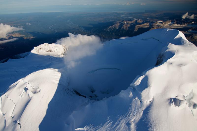
Mount Spurr is an active volcano in the Aleutian Arc of Alaska. (Cyrus Reed/Alaska Volcano Observatory & U.S. Geological Survey)
Two companies are looking at the geothermal energy potential of Mount Spurr, an active volcano across Cook Inlet from Anchorage.
Once they have the final go-ahead from the state, GeoAlaska and Raser Power Systems can explore adjacent leases on Mount Spurr’s south side.
It’s the latest push to harness and develop geothermal energy from the 11,100-foot volcano, a feat no company has accomplished — at least not yet. The state has held geothermal lease sales for Mount Spurr since the 1980s.
Part of the challenge has been just locating the resource, said Steve Masterman, director of the state’s Division of Geological and Geophysical Surveys.
“Understanding the geology is really a key part to that,” Masterman said.
The basic idea of geothermal is to harness heat contained below the earth’s surface in the form of steam and water. Geothermal is a renewable resource, and like other renewables, can be used to heat homes or generate electricity.
But Mount Spurr poses a challenge for developers, according to Gwen Holdmann, director of the Alaska Center for Energy and Power in Fairbanks.
While it’s an active volcano, with a lot of trapped, simmering heat, “that system doesn’t have a lot of clear surface expression in terms of where you might want to drill, for example, to confirm a resource,” she said.
Gov. Mike Dunleavy’s administration wants to make geothermal exploration in Alaska easier for interested companies, whether it’s at Mount Spurr or elsewhere.
He’s proposed legislation that would, in part, allow companies to lease and explore nearly double the acreage they’re currently allowed.
Masterman said that would be helpful because surface hot springs often indicate the presence of reservoirs. But the hottest water isn’t always right beneath those springs.
“That might be a number of miles away from the place where it comes out of the ground,” he said.
Dunleavy’s legislation would also extend the maximum exploration period, from two years to five.
“It might take a number of summers in order to do the background work, the geology, the geophysics before you do the drawing,” Masterman said. “And then it might take a number of rounds of drilling before you’re successful with finding a viable resource.”
There are other geothermal projects in motion in the state. Chena Hot Springs has its own geothermal plant. And in Unalaska, two companies plan to start constructing a geothermal energy plant this summer for the city’s power grid.
Those plans, and the ones for Mount Spurr, are subject to the state’s current regulations, since Dunleavy’s legislation hasn’t yet passed, and may not before the Legislature adjourns next week.
According to Petroleum News, GeoAlaska, one of the companies looking for a permit, started in 2020 and is based in Anchorage. The other, Raser Power, is based in Utah. Raser Power filed for bankruptcy in 2011 in relation to a geothermal plant there.
Surveyors tried and failed to find hot water reservoirs at Mount Spurr a decade ago. Ormat Technologies did surveys and some exploratory drilling there between 2008 and 2011 but later relinquished their leases when it couldn’t locate the resource.
“They took a little bit of a conservative approach from the standpoint of drilling in a location that would be more optimal to develop a power plant, and staying a little bit away from any areas that might be close to hazards,” Holdmann said.
But she said there is much more land to explore on the volcano. And data from the prior surveys are publicly available and could still be helpful for GeoAlaska and Raser.
“I am certain that they have looked closely at that data and are using that to rethink the program that they’re developing,” she said.
The up-front costs are expensive. But Holdmann said there are also regulatory hurdles to development, including restrictions from the Alaska Oil and Gas Conservation Commission.
“I think one that one thing that we want to be thinking about in addition to encouraging and promoting exploration is really thinking about what development might look like,” she said.
Then, there’s the question of a market, and whether a geothermal project at Mount Spurr is cost-competitive with existing energy sources.
But that’s all years down the road. First, the interested companies need to prove the resource is there — and that they can find it.
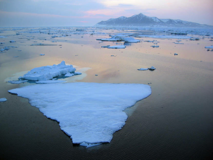
Sea ice floats in the Bering Strait off Cape Prince of Wales. (UAF photo by Gay Sheffield)
For the past decade, scientists have observed several years of abnormally low sea ice extent. While most of the cause has been attributed to a warming Arctic climate, a new study from the University of Alaska Fairbanks has found evidence that warming waters outside of the Arctic are impacting sea ice as well.
In the summer, there is a warm water mass that flows up from the Pacific Ocean through the Bering Strait across the Chukchi Sea. UAF marine science professor Harper Simmons says this transfer of warm water up into colder seas is normal.
“That flow is a natural state of the system,” Simmons said. “Unless things were really rearranged in the distant past.”
The water ends up resting in a layer just below the surface of the Arctic Ocean. Simmons says it stays there until the fall when colder water starts to form ice on the surface.
“That warm water makes its way slowly out of that layer and affects the ultimate amount of sea ice that forms in the Arctic,” Simmons said.
While that flow is normal, Simmons says there is emerging evidence that the warm water coming up from the Pacific is getting even warmer.
“Since the 90s, the temperature of that water has been observed to have a pretty significant warming trend,” Simmons said.
That trend translates to about half a degree Fahrenheit per decade. While that may not seem like a lot, Simmons says because it’s such a sudden change from years of stable sea ice conditions, it can be jarring to the system.
“If there was, in the past, kind of an expected sea ice formation of two meters of sea ice over the Beaufort,” Simmons said. “And this heat becomes part of that, then you would expect that instead of getting two meters of sea ice, you would only get a meter and a half of sea ice.”
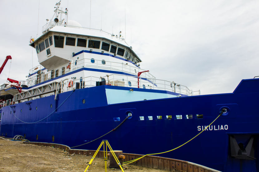
The UAF-University of California San Diego study on warming Pacific waters was conducted on the R/V Sikuliaq, seen here docked in Nome. (Emily Russell/KNOM)
These observations were made as part of a study conducted by the University of Alaska Fairbanks and the University of California San Diego’s Scripps Institute of Oceanography. Simmons says the major change between this study and studies in the past was the introduction of new CTD, or conductivity, temperature and depth, technology.
The process works the same as how scientists had done it in the past. Basically, researchers lower a package into the ocean to monitor conditions in the water.
However, Simmons says the new custom-made CTD technology from the Scripps Institute exponentially increases the amount of data that researchers can gather.
“In a traditional cruise, you could make hundreds of profiles, and with a package like this, you could make thousands,” Simmons said.
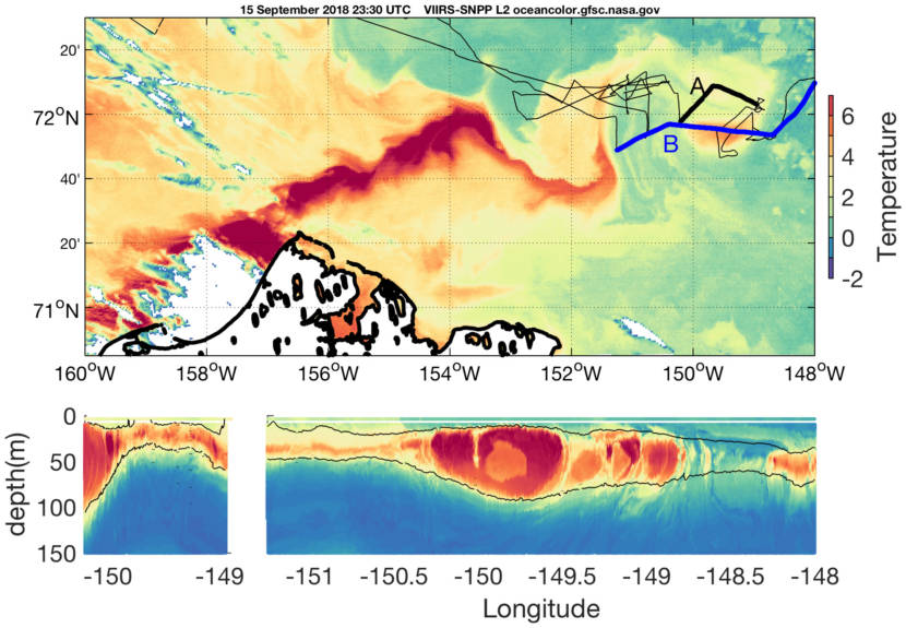
Satellite imagery (upper figure) shows a warm jet of salty water flowing past Point Barrow then disappearing. Ship-based measurements (lower figures) show that the warm water subducts and continues below the surface. Lines A and B in the upper figure correlate with the ship-based data in the lower left and right figures, respectively. (Harper Simmons/UAF)
As scientists continue to monitor changes in sea ice, the impacts to the region continue to grow.
Diminishing ice has the potential to disrupt everything from marine mammal migration to the travel patterns of people who use the sea ice. Additionally, it could make travel across the Northwest Passage easier for shipping companies. Simmons says the diminishing sea ice could also impact the rate of coastal erosion.
“The more open water that you have for longer periods of time gives you more opportunities for storms to create large waves that increase coastal erosion.”
In the end, Simmons says that the findings of the study show that it isn’t just a warming Arctic that is leading to less sea ice.
“It’s not warmer temperatures locally,” Simmons said. “There’s this kind of global connection where warm water in the Pacific makes a difference.”