Science & Tech

Scientists say they can explain the giant, glowing orb seen over Interior Alaska last week

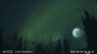
A whitish globe in the sky above spruce forest, with green aurora above it
Still video image of an orb of light, as seen from Fairbanks, moving across the sky before 5 AM March 29th. (Courtesy of Leslie Smallwood)

A week after a large orb of light was seen moving across the early morning Alaska sky, scientists have offered an explanation.

Fairbanks photographer Leslie Smallwood captured video of the luminous sphere on automated aurora cameras before 5 a.m. on March 29.

“It seemed like it had something that was spinning inside it when I zoomed in on it,” he said. “And it’s a small tail — whitish tail.”    

Smallwood says the foggy ball of light was far larger than a full moon and moved through the sky from the northeast to the southwest over a few minutes.

“It’s not like it shot across the sky,” he said. “It was like, taking its time.”

University of Alaska Fairbanks physics professor Mark Conde says the orb was also recorded by a UAF all-sky camera in Gakona. Speaking last week, Conde said he wasn’t sure what to attribute the phenomenon to, but he noted that the orb appeared gaseous.

“A glowing cloud of gas that was sunlit would look like that,” he said.  

Jonathan McDowell, an astronomer at the Harvard Smithsonian Center for Astrophysics in Boston, Massachusetts, says sightings of the orb in Alaska correspond with the flight of a Chinese satellite deployment rocket.

“I am very confident that what people saw was the dumping of fuel from a Chinese rocket stage,” he said. “This rocket — the Longmarch 6A or Chang Zheng 6A — was launched early on March 29 from China, placed 2 satellites in orbit and, calculating its orbital path, it passed over the Yukon area about 350 miles up at exactly the time that this glow was seen in the Alaskan sky.”  

McDowell says leftover rocket fuel was likely released into space where it froze, spread out and reflected sunlight.

“This cloud is probably hundreds of miles across, that’s why it looks so big,” he said.

As to why rotating movement and a tail were observed, McDowell says that to maintain a rocket’s orbit during the release of fuel, the space craft is put into a tumble. 

“End over end while spewing out this fuel like a garden hose, and so you’ll get this sort of moving pattern,” he said.  

McDowell says rocket fuel dumps resulting in visible spheres of light occur fairly regularly in the lower 48 and elsewhere in the world. He says a similar glowing orb viewed over a large area of northern Siberia in 2017 was attributed to exhaust from ballistic missiles during test firings.

Alaska Native Science and Engineering Program to expand its high school program to Juneau

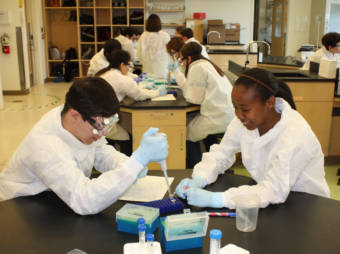
Students in lab coats seated around tables
Acceleration Academy allows students to earn both a high school diploma and a bachelor’s degree in five years. (Photo courtesy of the Alaska Native Science and Engineering Program)
The Alaska Native Science and Engineering Program at the University of Alaska has received $5 million to expand its high school component to Dillingham, Kotzebue and Juneau.

The program’s Acceleration Academy allows students to earn both a high school diploma and a bachelor’s degree in five years. It’s currently offered at the university’s Anchorage, Bethel and Matanuska-Susitna campuses.

Program founder and vice provost Herb Schroeder said it helps the state and families save money.

“The cost to government for a graduate from our university is around $300,000, and the cost to government for students to graduate from Acceleration is $88,000,” he said. “We want to make this opportunity available for every single student in the state.”

Schroeder started ANSEP after seeing how many students from rural communities were unprepared for college math and science classes. The first Acceleration Academy started in the Mat-Su in 2015.

Acceleration Academy students spend about half of their day in traditional classes, and the other half working together on projects or in study groups. Schroeder said about 70% of ANSEP’s students are Alaska Native.

“This whole idea of collaboration came out of Alaska Native culture, where everyone works together to be successful,” he said. “If you live in the village, everybody depends upon each other.”

Some student housing is available at the Bethel location. The funding will also allow the university to offer student housing at the Anchorage campus, which, Schroeder said, will make it more accessible.

“There’s a lot of students who live in communities that don’t have access to those rural campuses that the university has,” he said. “And they can come in starting in 9th grade and live in our residence halls and attend the Acceleration Academy we have on our campus here.”

The Dillingham, Kotzebue and Juneau programs will begin this fall. Next, Schroeder hopes to expand even further — to Kodiak, Nome and Fairbanks. Schroeder’s goal is to offer the program in every community with a University of Alaska campus, which also includes Soldotna, Homer, Palmer, Valdez, Ketchikan and Sitka.

Volunteers help monitor Cook Inlet’s endangered belugas

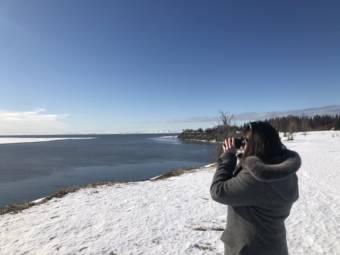
A woman on a snowy shore looks out on the water with binoculars
Kelly Hild says she’s hooked on beluga observing. Her go-to spots are Bridge Access Road and the bluff near Vintage Pointe in Kenai. (Photo by Sabine Poux/KDLL)

To the untrained eye, any flash of movement or ripple of water at the mouth of the Kenai River could be a beluga.

Not to Kelly Hild of Kasilof. She’s a trained beluga monitor, and she knows what to look for when she’s watching for belugas and reporting those sightings back to researchers.

“We do a lot of scanning,” she said, pointing toward the inlet. “From this spot you can see south. So if the whales were coming up from the south, you could see them there.”

Each spring, trained volunteers with the Alaska Beluga Monitoring Partnership perch on the Kenai and Kasilof bluffs and along Turnagain Arm. They’re trying to spot the critically endangered whales and record observations for researchers with NOAA Fisheries, so they can learn more about what the population is doing and why it isn’t rebounding.

Tuesday was the official first day of beluga monitoring on the Kenai. And Tuesday afternoon, visibility was great, minus a streak of sun glare on the river.

Hild, peering through a pair of binoculars, didn’t spot any belugas or seals from the park next to the Kenai Senior Center.

But she’s seen them many times before. This is her third season tracking belugas.

“It’s kind of addicting once you get out here and you start to kind of see the patterns and the times that they’re showing up,” Hild said. “And you think you have it, and I’m like, ‘OK, I know who’s gonna show up today.’ And then they trick you, and they don’t show up, or they show up and it’s a completely different group, or it’s half of the group. It’s very mysterious.”

Researchers know belugas are in the rivers in the spring and that they feed on fish there, including hooligan.

But beyond that, there’s a lot they don’t know about why the population goes upriver, says Deborah Boege-Tobin, a biology professor with Kenai Peninsula College who’s working on a beluga research project on the Kenai River.

“That’s part of the reason we’re monitoring,” Boege-Tobin said. “We think they’re going in the river to look for prey, but we don’t really know exactly.”

This year, volunteers are making observations even earlier than they usually do, said Teresa Becher, a coordinator for the Alaska Beluga Monitoring Partnership. Although the official start of the two-hour daily monitoring sessions was Tuesday, there have already been several sightings this month, including on a few occasions on the Kenai.

“The Kenai River broke up much earlier than it did last year than it did last year and the year before that,” Becher said. “And so the river is open now. The belugas have access and so they can come in and start looking to see what’s in the river, what’s coming down the river and what food is available right now.”

The first observation this year was March 10 — a mom and a calf on the river. Last year, the first sighting was March 25.
Becher tries to look for belugas most days on the Kenai River.

This week, she was traveling back into town just in time to start spring monitoring.

“I’m very very excited and assessing to see how they fared over the winter,” Becher said. “They’re a critically endangered group and so we want to make sure that they survived and that they thrive this season.”

The official observation season for Turnagain Arm starts a little later than the river season — April 1. Suzanne Steinert, who runs the nonprofit Beluga Whale Alliance, said that’s because the whales show up a bit earlier in the middle part of the inlet.

“So it’s not really known exactly why they hit that area first,” she said. “But in Turnagain Arm anyway, the hooligan run starts in April, and that’s when we really see them come into the upper inlet.”

But this year, monitors have already spotted whales on the arm, including an observation Saturday. On Tuesday, Steinert was heading out to the arm to take a look.

Hild, the beluga observer in Kenai, studied animal science in school. She finds watching the animals in their natural habitat fascinating.

And she’s hardly the only one. The Beluga Monitoring Partnership had nearly 30 volunteers last year, between March and May. While Hild was out on the Kenai bluff by herself on Tuesday, she’ll be joined later this week by other volunteers.

“Everybody comes from really cool backgrounds, and it’s not a group of people that I would’ve met any other way,” Hild said. “And it’s just kind of a little beluga family that comes together. And if you want to come out and volunteer, definitely reach out and meet us. The more eyes the better out here. It’s a really special experience that you cant really get anywhere else.”

The Aleutians have a rat problem. Scientists are trying to solve it.

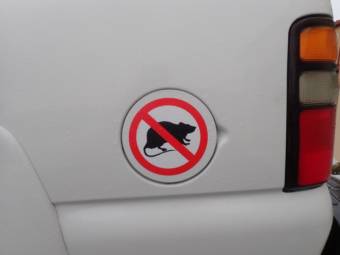
A "no rats" sticker on the gas cap cover of a white vehicle
A U.S. Fish and Wildlife vehicle on Adak Island promoting rat eradication. (Photo by Jennifer Pemberton/KTOO)

For millions of years, birds lived nearly predator-free on the Aleutian Islands. The volcanic archipelago stretches westward for 1,200 miles from the Alaska Peninsula, dotting a border between the North Pacific Ocean and Bering Sea. Hundreds of bird species thrived here.

Then came the rats.

When a Japanese boat sank in the Western Aleutians around 1780, stowaway rats jumped ship and made it to one of the islands, wreaking havoc on the ecosystem.

The rodents proliferated during World War II, when American Navy ships traveled along the chain, expanding the rats’ domain.

“The rats are like an oil spill that keeps on spilling year after year,” said Steve Delehanty, the refuge manager for the Alaska Maritime National Wildlife Refuge. “We would never allow an oil spill to go on for decades or centuries, nor should we allow rats to be a forever-presence on these islands.”

Rats bring a list of challenges to the islands. One: They’re a threat to birds.

The federal refuge that Delehanty manages consists of nearly five million acres of land and thousands of islands, where more seabirds breed than all of the rest of the United States and Canada combined.

But those birds are in trouble. Massive seabird die-offs in recent years have conservationists scrambling for solutions. And while there are many reasons for the decline in bird populations — rising ocean temperatures, algal blooms, and changing food sources — rats certainly play a role.

“You can have a colony that contains thousands, or hundreds of thousands, or sometimes even millions of birds,” he said. “Sadly, rats can just absolutely devastate bird populations. Seabirds, but also waterfowl and songbirds, and really the whole ecosystem.”

A couple years ago, Delehanty met with representatives from a wide range of groups, including the U.S. Department of Agriculture and the Aleutian Pribilof Islands Association, to figure out a plan to manage the Aleutians’ rat problem.

And they arrived at a fairly straightforward solution: kill the rats. All of them.

“That group collectively developed a vision of a rat-free Aleutian Islands someday, recognizing that that’s really an aspiration,” Delehanty said. “There’s no current plan to eliminate rats from every single Aleutian island. But wouldn’t that be a wonderful thing to achieve in the coming decades?”

Already, federal agencies and conservancy groups have taken steps to at least have fewer rats.

Back in 2008, before the group decided to end the rats’ Aleutian vacation once and for all, a team of scientists traveled to Hawadax Island, formerly known as Rat Island. They dropped poison pellets out of a helicopter all over the island. And they killed the entire rat population on that island.

Unfortunately, that’s not all they killed.

“We killed a considerable number of bald eagles,” Delehanty said. “They’re not out there consuming the bait, but what they are doing is consuming a rat that died that consumed the bait. Or consuming a gull, perhaps … and you can end up with this second or third order of killing that you don’t want to have happen.”

But the bird populations rebounded and thrived. A 2021 study published in Scientific Reports found that killing the rats led the island to rebound to its natural state. And now, Hawadax is touted as a success story for ecosystem recovery.

To be clear, the recent seabird die-offs have nothing to do with the Hawadax rat extermination. The rats were the main threat to birds on that island, and eradicating them is what led the ecosystem on that island to rebound.

Still, Delehanty and the team want to minimize collateral damage as much as possible. In August, around half a dozen scientists are planning to visit Great Sitkin Island in the Western Aleutians. Their plan is to put a small number of nonpoisonous pellets in strategic locations around the island. They’ll deposit the pellets by hand, then study how the pellets interact with the ecosystem.

“They are taking the same style of grain pellet that someday would include rat poison. But this year they’re using it without any rat poison in it, just to see how it breaks down in the environment,” Delehanty said. “Does a fish eat it? Does it last in the stream for hours, or days, or weeks? That sort of thing we want to learn.”

Delehanty said they’ll report their findings to see how feasible it will really be to eradicate rats from the Aleutians. He expects to complete the study by winter 2023.

Scientists are studying what extreme drought looks like in Alaska’s temperate rainforest

A fire burns through dry vegetation with snow-covered peaks in the background
A wildfire near Juneau in May 2018. Tongass National Forest responded to 32 wildfires in 2018. 15–20 fires/year is normal in the forest. (U.S. Forest Service photo)

A multi-year drought that hit Southeast Alaska before the pandemic had such wide-ranging effects that a group of scientists has just finished studying it.

In 2019, extreme drought was recorded for the first time in Southeast Alaska. But it’s hard to gauge drought in one of the wettest places in North America.

“Drought is relative. At no point did Southeast look like what people often think of as drought — you know, a dried up Kansas cornfield,” said Rick Thoman, a climate specialist for the Alaska Center for Climate Assessment and Policy at the University of Alaska Fairbanks.

Much of Southeast Alaska is a temperate rainforest. Ketchikan has about five times the average rainfall as the rest of the state — up to 160 inches per year.

“Southeast Alaska is built for lots of precipitation,” Thoman said. “And so even though 100 inches of precipitation in a year in most places in the United States would be an immense amount of precipitation, in southern Southeast it isn’t. And so it had impacts to people, to the whole ecosystem.”

Muddy waterlines and reservoir infrastructure exposed by low water levels in a reservoir.
Low water exposes the banks of a reservoir near Ketchikan during the drought. (Photo by Jeremy Bynum)

For example, many southeast communities rely on hydropower for electricity. In 2019, Ketchikan had to run on backup diesel generators for months. By one estimate, it cost more than a million dollars. Petersburg and Wrangell burned diesel, too.

Thoman said warmer temperatures from climate change made this drought more severe. Heat threatened salmon hatcheries in Juneau. The berry season was sparse. An insect called the Hemlock sawfly took advantage of dry summers to eat the needles off of half a million acres of trees in the Tongass.

So a group of scientists called the Southeast Alaska Drought Project, a partnership between Alaska scientists and the National Oceanic and Atmospheric Association, documented and analyzed what happened. He says their work on the 2016-2019 drought will be an important one-stop resource for Southeast communities when the next one hits.

They’re releasing their findings on a characteristically wet year.

“Right now, no one in Southeast is thinking about drought. But we know it’s going to happen again. And we know, we just have lived through how impactful it can be,” said Thoman.

He says it’s also important to put this particular drought in context.

An aerial view of a conifer forest with many of the trees brown
A sawfly outbreak hit the southern Panhandle in summer 2018, spreading to the central Panhandle in 2019. (Photo by Elizabeth Graham/U.S. Forest Service)

Andrew Hoell studies hydro climates across the globe for the National Oceanic and Atmospheric Administration.

“Droughts of this kind have happened in the past. It’s just a drought like this hadn’t happened in our society as we see it today,” Hoell said. “The population had grown accustomed to getting that normal delivery of precip, and then it got dry, and then the impacts were pretty profound.”

So profound, in fact, that the United States Department of Agriculture redefined drought metrics for the region in 2019.

The researchers say more droughts are coming, but maybe fewer and further between. Climate trends indicate the region will warm and get wetter overall.

US and Russian scientists are still working together to solve salmon mysteries

A side view of a white research ship at sea.
The Russian R/V Tinro at sea. (Photo courtesy North Pacific Anadromous Fish Commission)

Tensions continue to simmer between Moscow and Washington in the wake of Russia’s invasion of Ukraine.

Oil companies are canceling partnerships with Russian firms. State legislators are calling for the state’s sovereign wealth fund to dump Russian investments. President Joe Biden announced Tuesday the U.S. would close its airspace to Russian aircraft.

But the United States and Russia are still working together on at least one issue: salmon.

There’s a map scattered with orange, green, blue and red dots spanning most of the North Pacific above 46 degrees latitude.

On the map are three flags of Arctic nations: the U.S., Canada and the Russian Federation.

“This interaction between the countries in this is really something that has never happened to this scale before,” said Mark Saunders, the executive director of the five-country North Pacific Anadromous Fish Commission.

He’s talking about the 2022 Pan-Pacific Winter High Seas Expedition.

Vessels from both sides of the Pacific are braving gale-force winds and 13-foot seas as they crisscross the ocean from the edge of the Aleutian Chain to the Strait of Juan de Fuca.

A map showing the current expedition along with past surveys conducted in the western Pacific and Gulf of Alaska. (North Pacific Anadromous Fish Commission)

All in the name of research into the challenges to wild salmon runs that are important to people on all sides of the north Pacific Rim.

A historic shortfall

Last year, the chum salmon run on the Yukon River collapsed.

“This past summer, the Yukon River did not fish for food. Zero,” said Mike Williams Sr. He’s the chair of the Kuskokwim Inter-Tribal Fish Commission, an organization that manages and researches fisheries using a combination of traditional knowledge and Western scientific methods.

Never before had so few fish swum up the nearly 2,000-mile river. Regulators closed all fishing on the Yukon to preserve what little of the run remained.

Williams says in recent years, he’s watched runs on the Kuskokwim dwindle, too. In the past, he says fishing was relatively unrestricted. Residents would return to their fish camps shortly after the ice on the river broke up in the spring.

But in recent years, he says residents have had to wait until June — long after breakup — to start stockpiling fish.

“We depend on the salmon to sustain us through the winter, and we’re very concerned about the returns of our salmon in all of the rivers in Western Alaska” Williams said in a phone interview Wednesday.

It’s not clear what was behind the collapse. The Inter-Tribal Commission — and the Alaska Department of Fish and Game, for that matter — spend most of their effort studying what happens in freshwater. But that’s just a small part of a salmon’s life.

‘Something happens in the ocean’

“The salmon spawn in our headwaters, they go down to the ocean, and something happens in the ocean,” Williams said.

And it’s not just Western Alaska that’s struggled with salmon runs in recent years — in Southeast, chinook runs from Haines to Ketchikan are listed as stocks of concern. Salmon fishing on the Unuk River has been banned outright for years.

Some, including Williams, say too many salmon in the Bering Sea and the North Pacific are pulled out of the ocean as bycatch from trawlers that scrape the seabed for sole and flounder. Others say fish from hatcheries all over the north Pacific Rim are outcompeting native fish. Some say climate change is affecting the food web — or that it’s a combination of all these factors.

But one thing is clear: something is happening to chum and chinook salmon in the open ocean.

“We know that a lot of the poor survival for chum and other salmon is related to the marine environment,” Saunders, of the North Pacific Anadromous Fish Commission, said Tuesday from his home office on Vancouver Island.

There’s quite a bit known about how the ocean is changing, “but you need to know where the fish are and have actually had your hands on them, and understand how they’re interacting with the environment,” Saunders said.

“I think a lot of that is a large black box — in particular, this winter period we know very little about,” he added.

He says the goal of the survey, the largest ever conducted, is to shine some light in that black box.

Scientists are hoping to map out the distribution of salmon across the North Pacific using new DNA techniques developed over the past decade or so to understand where salmon interact with predators, prey and each other — not to mention a generally warmer, more acidic ocean.

“And the big question is, how is the changing North Pacific Ocean affecting our salmon? And improving our ability to understand how that change is going to impact people and fish and fisheries into the future,” he said.

That brings us back to the map.

A map of the North Pacific showing the present locations of research vessels
A screenshot of a live map tracking vessels from the U.S., Canada and Russia during the 2022 Pan-Pacific Winter High Seas Expedition on March 2, 2022. (YearOfTheSalmon.org)

A long-planned voyage meets geopolitical realities

Earlier this winter, ships from the U.S., Canada and Russia set sail for the North Pacific. Each is assigned its own area to sample: The U.S. and Canada are tackling areas in the Gulf of Alaska and west of British Columbia, and a vessel from Russia is surveying an immense swath of ocean spanning areas south of the Alaska Peninsula all the way out the Aleutian Chain southwest of Adak.

The Russian vessel’s survey work started late last month  — it actually tied up in Dutch Harbor a day after Russian troops started their assault on Ukraine’s capital, Kyiv. Unalaska’s port director told KRBD the visit was tightly scrutinized by U.S. border agents.

Alaska’s chief salmon scientist, Bill Templin, says a few thoughts crossed his mind as he watched the invasion unfold.

“My first concerns were for the people of Ukraine,” Templin said by phone Wednesday. “But then when I walked into my office and I sat down, I was thinking, Oh, OK, so what does this mean?”

He says it’s not the first time international tensions have come up in his work with the five-country commission. He recalls Russian scientists including islands disputed with Japan on maps of salmon stocks — all in good fun, as he recalls it.

“The first two years, they got it past me, and the Japanese had to come over and correct me very politely,” he said.

But this is more tension than usual.

Saunders, the head of the anadromous fish commission, says an American scientist was scheduled to board the Russian vessel to allow it to survey within the 230-mile U.S exclusive economic zone.

That didn’t happen. And that means the Russian research vessel can’t work close to the Aleutian Chain, where some salmon are thought to spend the winter. Templin says that means salmon activity within that zone will remain a blank spot for now.

“It doesn’t ruin the results. It’s not a failure — but it is going to limit what we get,” he said. “And it’s taken years to get this winter coordinated, so it’s a little disappointing.”

But Templin says scientists from Japan, Canada, South Korea, Russia and the United States have always put their work first, and their political leaders’ policies second. And he says that’ll continue.

“The salmon all go to the same place. So they’re all grazing in the same field, so to speak. For all of us to work together to understand what’s happening out there, and the way it affects our nations, is — I think it’s a pretty huge deal,” he said. “And I’d hate to see it go away.”

Site notifications
Update notification options
Subscribe to notifications