Oceans

Environmental group clashes with energy company over fracking in Cook Inlet

LGL Alaska Research Associates documented beluga whales in Cook Inlet as part of a photo identification project. The whales are listed as endangered. (Photo courtesy of LGL Alaska Research Associates)

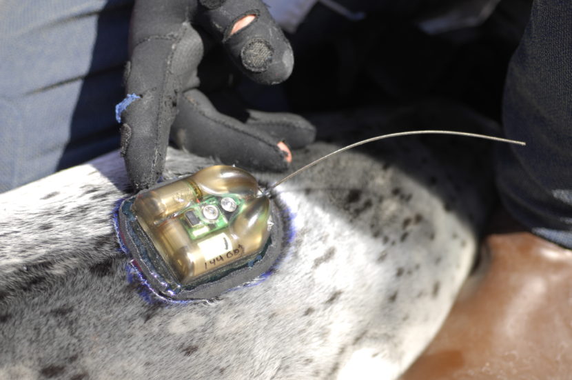
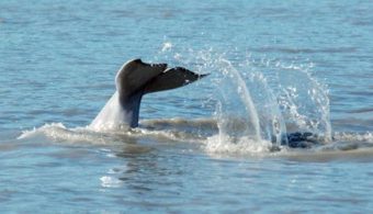
The Center for Biological Diversity is calling for the National Marine Fisheries Service to stop BlueCrest Energy’s plans to conduct hydraulic fracturing of oil wells in Cook Inlet, citing concern for beluga whales.

Kristen Monsell, staff attorney, sent a letter to NMFS on June 22. She says fracking could hurt beluga habitat.

“Fracking blasts mass volumes of water mixed with toxic chemicals at incredibly high pressures, which is just very dangerous and doesn’t belong anywhere, certainly not in the habitat for one of most endangered whales in the entire world,” Monsell said.

BlueCrest, an independent energy company headquartered in Texas, says its plans to extract oil from the Cosmopolitan Unit pose no threat to whales.

“To us, as far as the fracking process is concerned, it’s all a moot point. We can’t impact the belugas in any way. It’s just not possible,” said Larry Burgess, health, safety and environment manager for BlueCrest.

He said he’s scratching his head over the letter, in part because NFMS has no jurisdiction over the company’s plans to use hydraulic fracturing on 10 oil wells below Cook Inlet this winter.

BlueCrest plans to drill from its pad onshore, about seven miles north of Anchor Point. The well bore would extend down and diagonally out to the wells, 3.5 miles offshore and almost a mile and a half below the inlet. Burgess says no drilling or producing activity will take place in the inlet.

“The fractures only go out about 150 to a maximum 200 feet from the pipe. And that’s as far as the frac will go. We’re almost 7,000 feet below the surface, so it’s virtually impossible for us to impact Cook Inlet at all, in any form or fashion. There’s just no way,” Burgess said.

BlueCrest does have a permit application pending with NMFS, called an incidental harassment authorization. It’s required for activities in marine waters that could disturb marine mammals. In it, the company outlines the mitigation measures it would undertake — including using marine mammal observers and possibly a separate vessel to keep an eye out for belugas. But the permit was for using a jack-up rig in the inlet to drill for natural gas. Given market conditions, BlueCrest has since shelved that idea.

“That’s just not on the table. We’re not doing anything offshore. NMFS has no bearing on this whatsoever,” Burgess said.

BlueCrest saying that it won’t be operating in Cook Inlet waters doesn’t quell Monsell’s concerns, though, particularly where fracking is involved.

“The fracking component is incredibly concerning to us, given how fracking increases the risk of oil spills and increases the risk of earthquakes, which could lead to a toxic spill in Cook Inlet beluga habitat, and they’re already critically endangered and threatened by pollutants, and they need to eat fish that are also threatened by fracking chemicals,” she said.

Monsell says that some of the chemicals used in fracking fluid can be extremely toxic to marine life.

“We don’t know yet what chemicals these companies will use but we do know chemicals routinely used in offshore fracking in other states can kill or harm a wide variety of marine species, including fish and sea otters,” Monsell said.

BlueCrest is still working on its engineering plan and hasn’t yet submitted an application to the Alaska Oil and Gas Conservation Commission for its proposed fracking operation. The company is required to disclose in advance a list of the chemicals it plans to use. In public presentations, Burgess has said that the fluid will be 99.5 percent water and sand. Of the 0.5 percent of chemicals, Burgess said that most are benign, with two or three being listed as toxic.

He says that drilling from onshore, over a mile below the surface, poses little risk of spills. He also says that seismic activity is not a threat since the fault line in Cook Inlet is 10 times the depth of their oil wells.

Monsell says she wants federal officials to study the potential impacts of fracking in Cook Inlet and wants to see the practice banned immediately.

“We think fracking is inherently dangerous and does not belong in fragile marine ecosystems, and the only way to truly protect Cook Inlet belugas is to prohibit the practice altogether,” Monsell said.

Burgess says he expects a decision on the incidental harassment application within a month. At that point, it could sit on a shelf, then the garbage can since the gas-drilling program has been suspended and the permit is only good for a year.

BlueCrest officials say they plan to drill more wells by the end of summer and hope to be fracking by the end of the year.

Japanese kayakers paddle Aleutian Chain without GPS, rescue radio

Two Japanese kayakers are traversing the Aleutian Chain without the use of GPS, satellite phones or rescue radio. (Photo courtesy of Takao Araiba)
A group of Japanese kayakers are traversing the Aleutian Chain without the use of GPS, satellite phones or rescue radio. (Photo courtesy of Takao Araiba)

Cold Bay to Unalaska is nearly 200 miles. By plane, it takes about an hour. By kayak, it’s nearly a month. Akio Shinya made the trip — with three others — in 24 days.

“I am an old man — 69 years old,” Akio Shinya said. “So very hard, but now I am happy.”

Over the past 16 years, he has taken six kayak trips to the Aleutian Islands. A place he considers special.

“Kayak was born here,” Shinya said. “Aleutian Island chain. They have big history, so I am interested in the ancient people and Aleutians.”

Shinya lives on Japan’s northern island — Hokkaido — in the village of Niseko where he runs a ski lodge. In the summers, he operates a kayak tour business and occasionally he takes people on expeditions to the Aleutians.

The kayakers are completely self-sufficient. They carry all their own food and camping supplies. They paddle collapsible kayaks designed to be easily transported and assembled without tools. The Japanese prefer these boats because they have an outer skin stretched over an aluminum frame similar to the skin-on-frame kayaks designed and used in the Aleutians for thousands of years. Shinya and his co-leader, Takao Araiba, even use traditional Aleut paddles made by a friend in Japan.

“Every time, always, I use Aleut paddles in Japan and here,” Shinya said. “This paddle is good for Aleutians. Paddling is very smooth.”

They’re wooden with a narrow bridge. Shinya calls himself a student of ancient people. On his trips, he does not use a GPS, satellite phone, or rescue radio because ancient people did not have them.

Although this trip is over, he hopes one day to return to the Aleutians.

“I know, I old man,” Shinya said. “If possible more paddling. My experience of Aleutian is very small”

Necropsy planned for dead whale found in Glacier Bay

Dead humpback whale under tow June 26, 2016 in Glacier Bay National Park and Preserve.
Dead humpback whale under tow June 26, 2016 in Glacier Bay National Park and Preserve. (Photo courtesy of National Park Service)

National Park Service officials say a dead humpback whale was found floating off of Point Carolus, and it has been identified as a whale that was first observed in Lynn Canal more than 40 years ago.

According to a statement issued Monday by Glacier Bay National Park and Preserve officials, the charter vessel M/V Yakobi reported the dead whale on Sunday morning. The whale was towed to shore Sunday afternoon and prepared for a necropsy that’s expected to start Tuesday.

The whale was an adult male about 40 feet long.

Based on fluke markings, the whale was identified as #441, nicknamed “Festus,” who was first documented in 1972 in Lynn Canal by researcher Charles Jurasz.

At 44 years, Festus was the longest-sighted humpback whale recorded in Southeast Alaska.

Festus was last seen in Glacier Bay in June 2015.

Park Superintendent Philip Hooge said in a release “We would like to hear from anyone who was in the area in the past several days and may have observed anything unusual so that we can better understand causes of humpback whale mortality.”

Anyone who has seen a sick or injured whale in the area recently is requested to contact the park at 907-697-2230.

Hunting baby seals for science near Yakutat’s glacial fjords

Capture_mode: Researchers move slowly through the ice in Disenchantment Bay hoping to get close enough to net a seal so as to measure and weigh it, collect samples, and attach a satellite tag to monitor behavior. Photo collected under the authority of MMPA permit No. 19309. Photo credit: Jamie Womble (NPS)
Researchers move slowly through the ice in Disenchantment Bay hoping to get close
enough to net a seal. (Photo by Jamie Womble/National Park Service)

Summer is an important time for seal pup development. So the federal government is asking vessels — like cruise ships — to stay farther away from harbor seals in glacial fjords. Biologists are tracking the population in Disenchantment Bay near Yakutat to see how the new guidelines are working. 

Tagging 45 precocious baby seals is no easy task. That’s the number John Jansen, a federal biologist, has in mind. His crew is preparing to float through the water near the face of Hubbard Glacier.

The plan: Catch the pups as they drift by on hunks of glacial ice.

“Our first attempt is going to be using a small dip net and trying to approach them in a stealthy way,” Jansen said.

Of course, mama seals can make this difficult. It’s easier if they scoop up a pup before she notices they’re around. Once Jansen and his crew catch a seal, they’ll glue a satellite transmitter to its fur, either on its back or head.

“Because that’s the only part that typically comes out of the water when they’re at sea. Those have been equated with party hats,” he said with a laugh.

Back in his Seattle office, Jansen will be able to see the pup — just a small dot — on his computer screen. It sounds like a seal version of Big Brother, but the National Oceanic and Atmospheric Administration wants to know how much time pups spend hauling out on the ice. It’s an important time for seals to rest. And for baby seals, it’s a chance to fatten up.

A netted pup: a harbor seal pup just captured in Disenchantment Bay, Alaska. The pup will provide hair, skin, and whisker samples just before having a satellite tag glued to the hair on its back. Pups were reunited with their moms in 20-30 minutes. Photo collected under the authority of MMPA permit No. 19309. Photo credit: John Jansen (NOAA)
A netted pup: a harbor seal pup just captured in Disenchantment Bay near Yakutat. (Photo by John Jansen/NOAA)

“There is a really critical function of hauling out, and if that period of hauling out is disturbed by humans, it has a consequence,” Jansen said.

As many as four cruise ships can be in Disenchantment Bay a day. It’s popular spot to see massive hunks of the Hubbard Glacier fall into the water. Seals are rest on icebergs nearby.

But the ships sometimes scare seals into the water.

“In Yakutat, we harvest seals so the seal population has to stay healthy,” said Victoria Demmert, the president of the Yakutat tribe.

She said local hunters became concerned in the late ’90s when they noticed fewer seals in Disenchantment Bay. And they wondered if an increase in tourism was affecting the population. So NOAA started monitoring the seals. Over the years, the federal agency has observed large vessels are causing the seals to spend less time on the ice.

Demmert said that’s a growing concern for the tribe.

“We understand they want to show off the area for their passengers but we need them to be considerate,” Demmert said.

The old marine viewing guidelines advised vessels to stay 100 yards away from seals. They were created before the boom of tourism. Aleria Jensen, a NOAA stranding coordinator, said that’s no longer adequate in glacial fjords. So the agency came up with new guidelines and public comment was taken.

NOAA had two options: Make it voluntary or require it through regulation.

“The agency decided to go with a voluntary approach. So there are some measures that are meant to apply to glacial fjords across Alaska,” Jensen said.

Vessels are now being asked to stay 500 yards away from seals. Jensen said NOAA realizes the tour industry offers the state a significant economic boost.

“And the goal here is to protect seals without compromising opportunities for high quality glacial viewing and wildlife viewing experiences but finding the balance,” Jensen said.

Satellite technology: A closeup view of a satellite tag attached to a harbor seal pup. The tag will transmit information about haulout and diving behavior of pups during the period they are dependent on mom for nutrition, and during their first year of independence. Photo collected under the authority of MMPA permit No. 19309. Photo credit: Jamie Womble (NPS)
A closeup view of a satellite tag attached to a harbor seal pup. (Photo by Jamie Womble/National Park Service)

Soon, NOAA and the National Park Service will be closer to figuring out what that balance is. They’ll use this summer’s research to determine exactly how the vessels impact the growing seals. For example, how much time are they really spending on the ice?

Back in Disenchantment Bay, John Jansen and his team are giving a seal pup a haircut. Actually, they’re taking hair and whisker samples to bring back to the lab. Then they glue on the tracking device.

“We just want to make sure that the rise and presence of humans is not putting those populations at risk,” Jansen said. “We want to make sure they’re there for everyone to enjoy in the long term.”

After awhile, the seal mom swims around to check on her baby.

“That’s frickin’ awesome!” Jansen said.

When the biologists are finished, they’ll dip the pup back into the water — with new haircut and new hardware.

Study participant: A study animal resting on ice in a group near Hubbard Glacier in Disenchantment Bay some days after having a satellite tag attached (see tag on pup’s back). Photo collected under the authority of MMPA permit No. 19309. Photo credit: John Jansen (NOAA)
A study animal resting on ice in a group near Hubbard Glacier in Disenchantment Bay. (Photo by John Jansen/NOAA)

Correction: An earlier version of this story overstated how many cruise ships are in Disenchantment Bay at once. This summer, as many as four cruise ships are scheduled to pass through the bay in a single day, but not at the same time. 

Northwest Passage cruise marks turning point in Arctic tourism

Crystal Serenity at North Cape in Norway
The Crystal Serenity at North Cape in Norway. (Photo courtesy Crystal Cruises)

On Aug. 16, the Crystal Serenity will steam out of Seward on a historic trip. The vessel will be the first big luxury liner to chart a course through the Northwest Passage, stopping in Kodiak, Unalaska and Nome before cruising through Canada’s far north to Greenland and then south to New York. The unprecedented voyage is generating excitement — and trepidation.

Cruise ships have been plying Arctic waters for years, but the Crystal Serenity will be the largest by far to chart a course through the Northwest Passage. The luxury ship will carry more than 1,000 travelers and 620 crew members on a journey that will take an estimated 32 days, and comes at a cost of $21,000 per passenger.

It marks a turning point for tourism in the Arctic, which has seen a steady increase in ship traffic as a warming planet yields more and more ice-free water in summer.

For some, it’s an exciting shift. In Nome, Harbormaster Lucas Stotts said there’s a lot of enthusiasm for the arrival of the ship, which will actually have to moor offshore, as it’s too big for the harbor.

“For us, 800 to 1,000 passengers is an awful lot of folks coming ashore when we’re used to seeing the pocket-sized cruise ships or the expeditionary cruises that have anywhere between 100 and 200 people on board only,” Stotts said.

Others are looking on the unprecedented trip with some caution.

David Aplin with the World Wildlife Fund’s Arctic Field Program said the region has opened up to traffic so rapidly that he’s concerned our reach there is outstripping our understanding of the place.

“As the ice recedes and we create a new ocean at the top of the world, what we’re finding worldwide is that we’re unprepared for that increase in shipping traffic,” he said.

Aplin and others say safety is the biggest concern when it comes to Arctic travel. Insurance company Allianz Global keeps tabs on international shipping, and its latest report shows that Arctic travel is relatively risky. Losses at sea dropped overall last year, but because of new traffic, the number of incidents in the Arctic jumped to 71 —  a nearly 30 percent increase. It’s a decade high.

And mounting a mass rescue operation thousands of miles from the nearest deepwater port is difficult. Same goes for containing oil spills. The Coast Guard has been planning for a potential mass casualty event in the Arctic for years and is planning a drill near Nome, though it won’t happen until after the Crystal Serenity departs.

There are other concerns about impacts to a fragile and stressed Arctic environment, and to the Native communities who rely on it.

Andrew Hartsig is the director of the Ocean Conservancy’s Arctic Program. He said cargo ships are usually looking for the shortest, easiest routes, but that’s not necessarily the case for cruise ships.

“A tourism company is often seeking out the very places that are kind of most dramatic or seeking out congregations of animals, because that’s what the passengers want to see,” Hartsig said.

John Stoll, the Crystal vice president in charge of managing the Northwest Passage voyage, said the company has been carefully planning this trip for three years. The ship has been outfitted with new ice-detecting equipment, including forward-looking sonar and thermal imaging technology. And once it’s in Canadian waters, an icebreaker on loan from Great Britain will act as a support ship, sending up helicopters for real-time ice recon. The RRS Ernest Shackleton will also carry emergency rations and a team of experts guides who will run special Zodiac expeditions for guests.

“We want to be the cruise line that sets the example for how to do this and how to do it right,” Stoll said.

He said Crystal has also planned carefully to minimize impacts. They’ll be exceeding international guidelines on wastewater discharge, he said, and they’ve been working with the tiny Arctic towns they’ll visit to make sure they won’t overwhelm the communities.

“I think Crystal from this standpoint has an obligation to do what we can to introduce the world to this part of the world,” Stoll said. “It’s phenomenal and it’s something that people shouldn’t miss.”

Still, some are concerned about what Crystal’s trip heralds. Austin Ahmasuk is with the Kawerak Corporation’s Marine Program, which aims to give a voice to Native villages as the world continues to talk about increasing Arctic traffic. He said there’s reason to worry about tourism’s impacts on subsistence resources.

“People in northwestern Alaska, on the coast, we’ve been mariners for a very long time and we make substantial use of the marine environment for subsistence food items, for culture, for living,” Ahmasuk said. “And it is very important to us..”

Despite that, Ahmasuk said, it’s easy for Native communities to be left out of the conversation about the opening of the Arctic.

“We want to make sure that the environment is not damaged, we want to make sure that our communities are able to sustain themselves, and we want to be able to participate in some decision making,” Ahmasuk said.

When it comes to this trip, Hartsig and others said Crystal Cruises has done a solid job of planning. They said they worry about other operators who’ll come along later.

It’s a mixed bag, Hartsig said. The only reason tourism can happen so far north is because of a warming climate, but maybe that fact will inspire visitors to care more about the environment.

“For a lot of people, the Arctic is out of sight and out of mind, and if you have vessels like this taking people up to the Arctic to see firsthand this environment that maybe being an optimist about it, maybe that will be the thing that really registers with people,” Hartsig said.

There is, at least, a lot of interest. According to Crystal, the Serenity is sold out for this sailing and is filling up for another trip in 2017.

Walrus prompt Ugashik boundary change for Bristol Bay fishery

Walrus hauled out at Cape Greig, north of Ugashik Bay. Photo taken May 19th by the U.S. Fish and Wildlife Service. CREDIT BRETT NIGUS
Walrus hauled out at Cape Greig, north of Ugashik Bay. Thursday May 19, 2016.
(Public Domain photo by Brett Nigus/USFWS)

The Department of Fish and Game said Friday that it will be moving the north boundary of the Ugashik commercial fishing district approximately one mile south on account of the walrus hauled out at Cape Greig.

“Well the reasoning is that the animals are there, and there are lots of federal regulations that require certain distances be kept from endangering threatened species. That’s the short story,” said area management biologist Paul Salomone Friday morning. “We have to maintain some distance between us and them.”

The walrus showed up at Cape Greig, 8 miles north of Ugashik Bay, this spring. Bristol Bay has several other main haulouts used by male Pacific walrus during the summer, including the iconic spot at Round Island. Residents and pilots flying the Peninsula coast this spring noticed the walrus, and US Fish and Wildlife Service staff at the nearby refuge office in King Salmon documented them by aerial survey.

Cape Greig walrus, on Thursday May 19, 2016 Public Domain photo by Brett Nigus/USFWS
Cape Greig walrus, on Thursday May 19, 2016
Public Domain photo by Brett Nigus/USFWS

Their location is about a half mile north of the Ugashik district boundary’s north line, which quickly prompted concern about the proximity to the fishery and its many vessels and nets.

According to an ADF&G release Friday, starting Monday at 9:00 a.m. the new northern line of the Ugashik District will be defined by the following points:

  • The northeastern (onshore) corner will be located at 57o 42.69’ N by 157o 42.30’ W.
  • The northwestern (offshore) corner will be located at 57o 42.69’ N by 157o 44.47’ W.

“All vessels transiting the area are asked to maintain one nautical- mile of distance from the haul out when traveling to or from the Ugashik District,” the agency wrote.

Salomone said he expects to hear from the Ugashik and Egegik fleet this weekend, which is why the Department put the announcement out Friday ahead the change going into effect Monday.

Site notifications
Update notification options
Subscribe to notifications